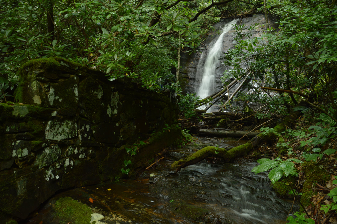
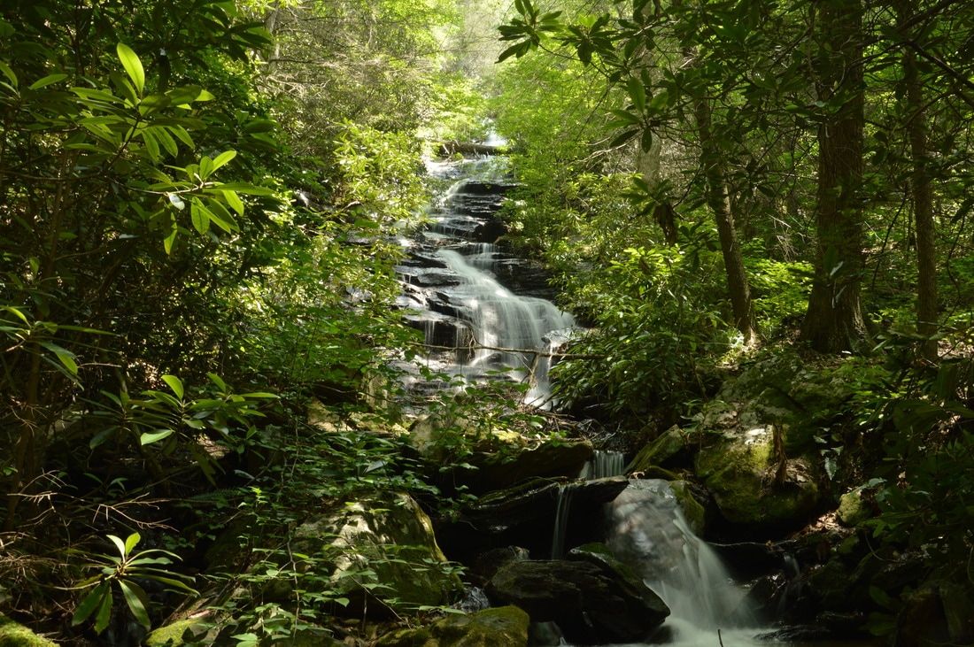
A tributary of Soapstone Creek, Sorrels Branch sports a pair of scenic waterfalls near Georgia Highway 180 and the former location of CCC Camp Soapstone. Access to both waterfalls is not difficult thanks to an unofficial trail along an old logging road that passes by them. The 50-foot sheer lower falls is more scenic than the small 25-foot upper slide, but the historical aspect of the Sorrels Branch waterfalls may be the most fascinating part of this hike. Perched precariously in the middle of the creek at the brink of the lower falls and near the base of the upper falls is a mysterious stone structure. The forest service, history books, and even the internet provide little clue to the origin of these ancient ruins, but you'll have fun coming up with your own guesses when you visit. This hike occurred on Saturday, July 1st, 2017. My plan was to hike out and back to Lower and Upper Sorrels Branch Falls from Highway 180.
1 Comment
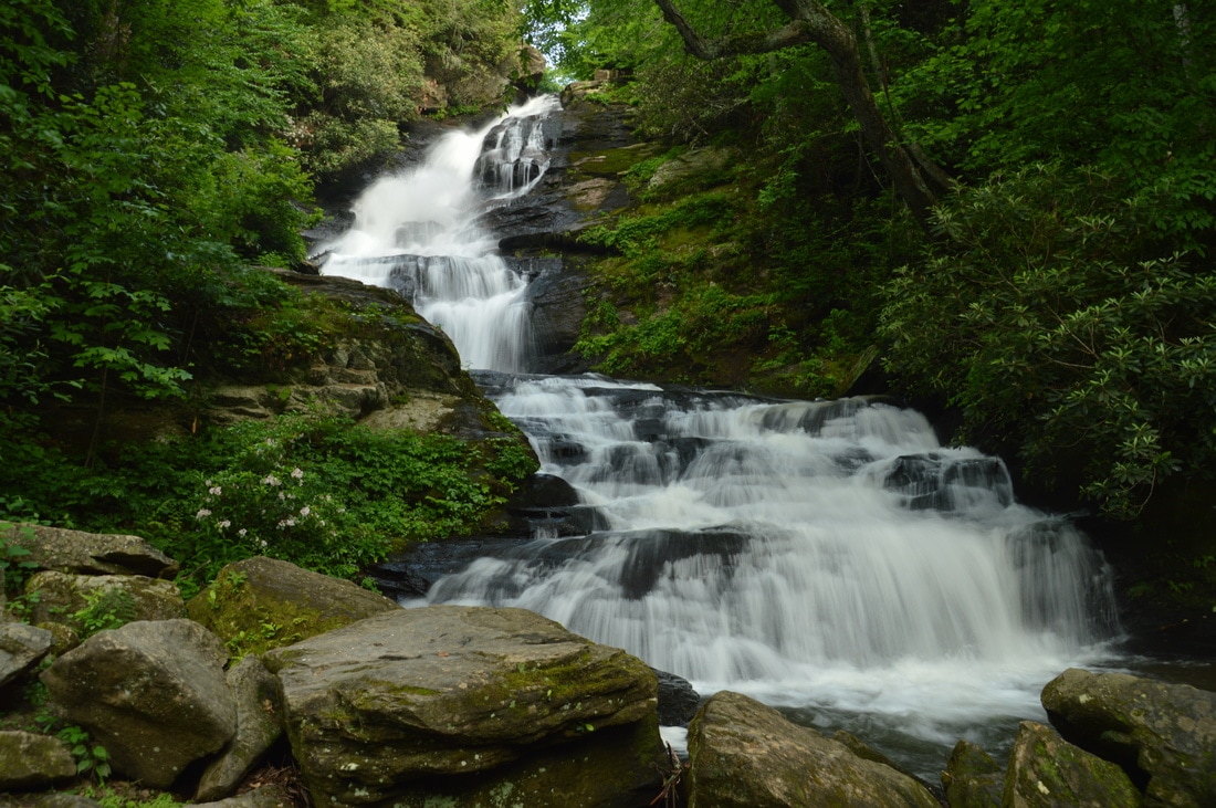
High Shoals Creek is home to two of Georgia's most popular waterfalls: High Shoals Falls and Blue Hole Falls. Very few people who hike to those waterfalls know that the same watershed is home to a remote waterfall no less impressive. Rogers Branch Falls is a tiered 80-foot waterfall on a tributary of High Shoals Creek, with additional small waterfalls above and below the main drop. Even though local residents are aware of the waterfall as evidenced by the well-used path to it, it is not publicized well at all and clearly off the radar for most hikers and waterfall hunters. The routes to the base of Rogers Branch Falls are not quite for everyone due to their steepness, but those who reach the viewing area at the base will be rewarded by a breathtaking sight. This hike occurred on Saturday, July 1st, 2017. My plan was to hike out and back to the base of Rogers Branch Falls from a popular camping area off Indian Grave Gap Road.

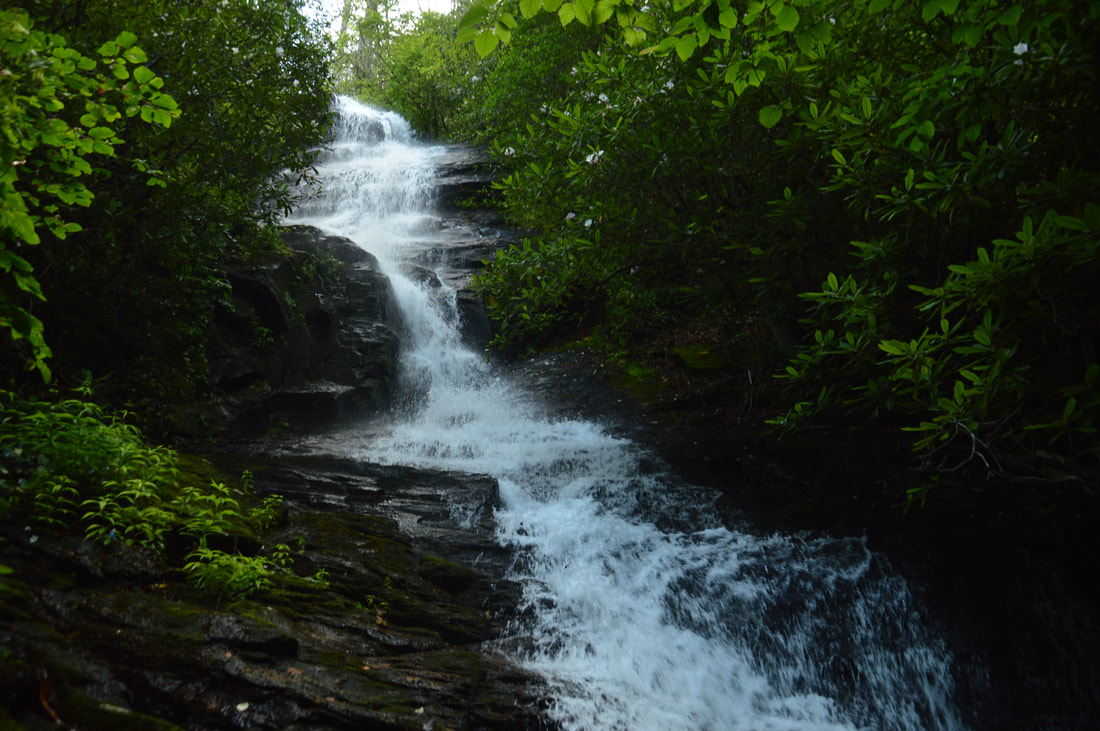
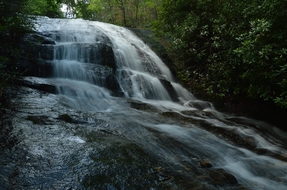
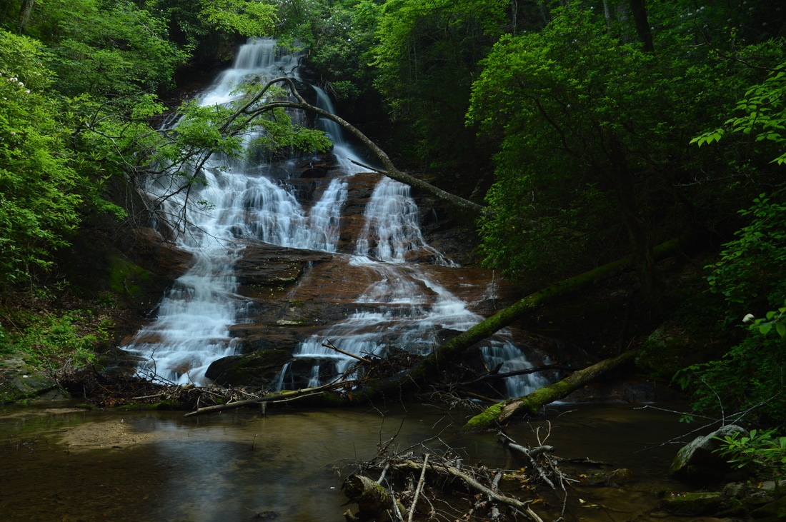
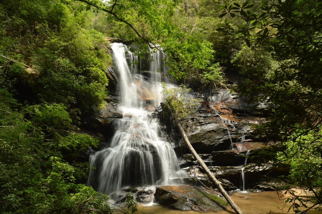
Buckeye Cove Falls is one of a handful of waterfalls in the Swallow Creek Wildlife Management Area near Hiawassee. About 80 feet high, this picturesque stairstep waterfall is easy to reach via a short hike, but it is located far enough in the middle of nowhere that you're not likely to find someone else at the waterfall. The lush green setting of Buckeye Cove Falls makes it appealing to waterfall enthusiasts and photographers during the warmer months. The falls is located in a very small watershed though, so it is best to visit during late spring or early summer. This hike occurred on Saturday, June 24th, 2017. My plan was to hike the unofficial path from the end of Swallow Creek Road out and back to Buckeye Cove Falls.
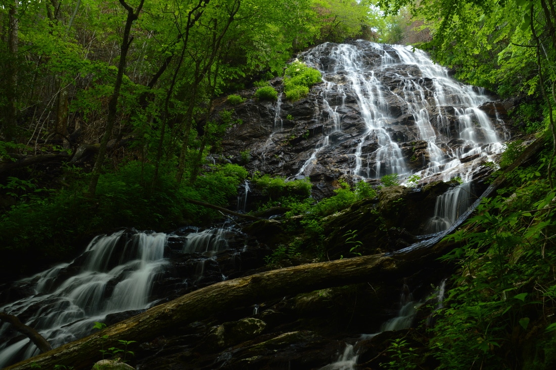
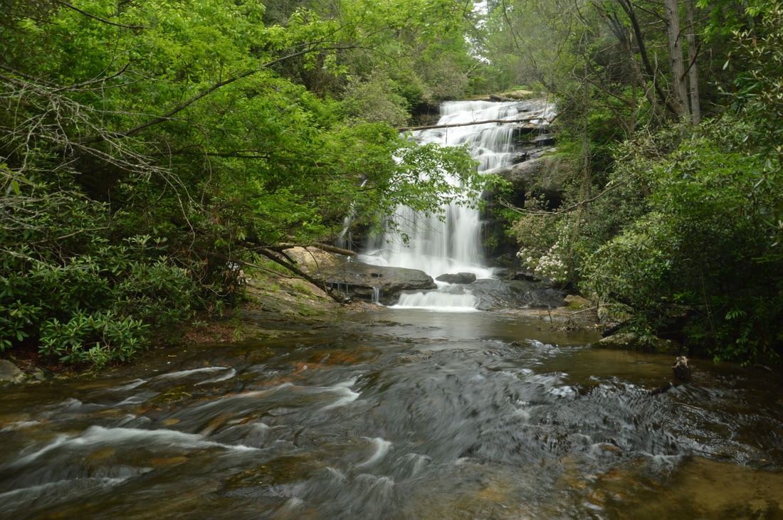
Mill Creek Falls is the name used collectively for a pair of waterfalls in the highest reaches of Swallow Creek Wildlife Management Area. Oddly, only one of the waterfalls is on Mill Creek itself, and the more picturesque of the two is on a tributary known as Ground Hog Branch. Visited together, these two waterfalls in the Mill Creek headwaters area make for a fairly easy and beautiful afternoon outing. A trail leads to both falls, although it is steep and slippery in places. This hike occurred on Saturday, June 24th, 2017. My plan was to hike out and back from Mill Creek Road to the upper and lower waterfall at Mill Creek Falls, with the former being on Ground Hog Branch and the latter being on Mill Creek itself just below its confluence with Groundhog Branch..
Chattahoochee National Forest: Lower & Upper Chinquapin Falls and Hickory Knob Falls, Helen, Georgia7/12/2017 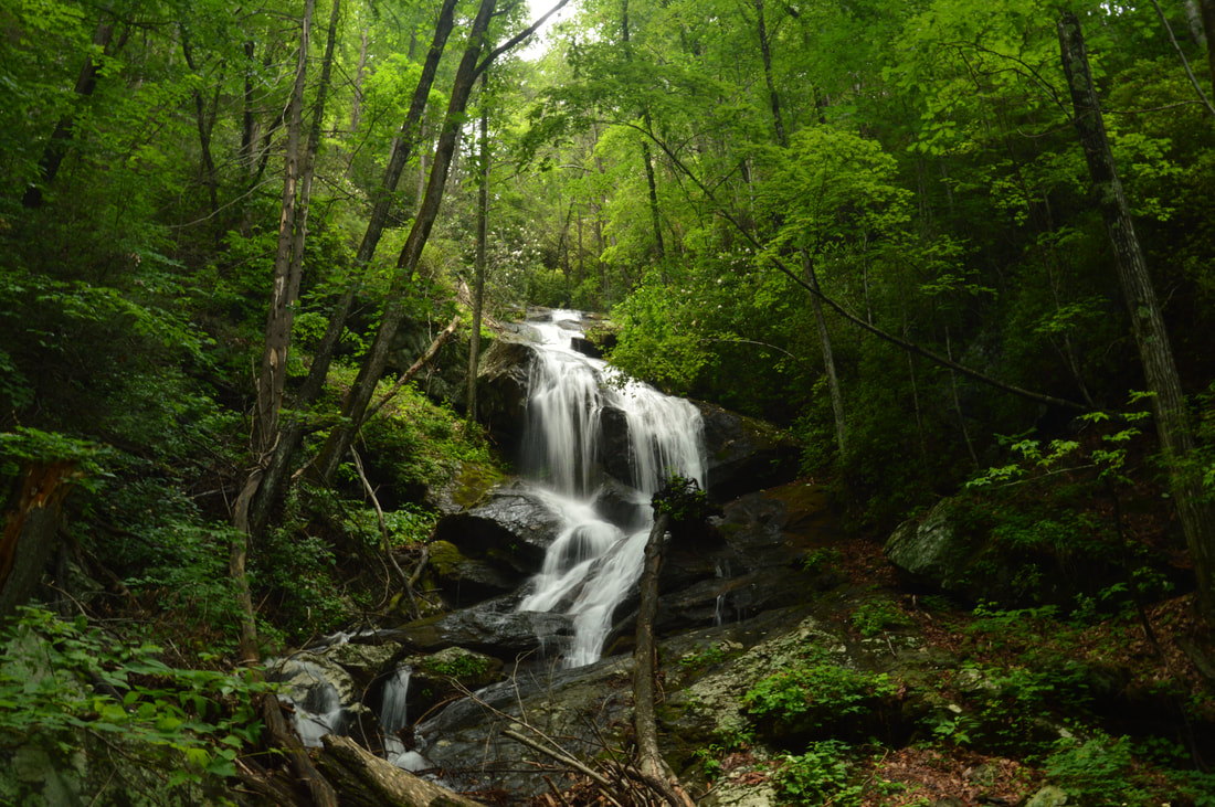
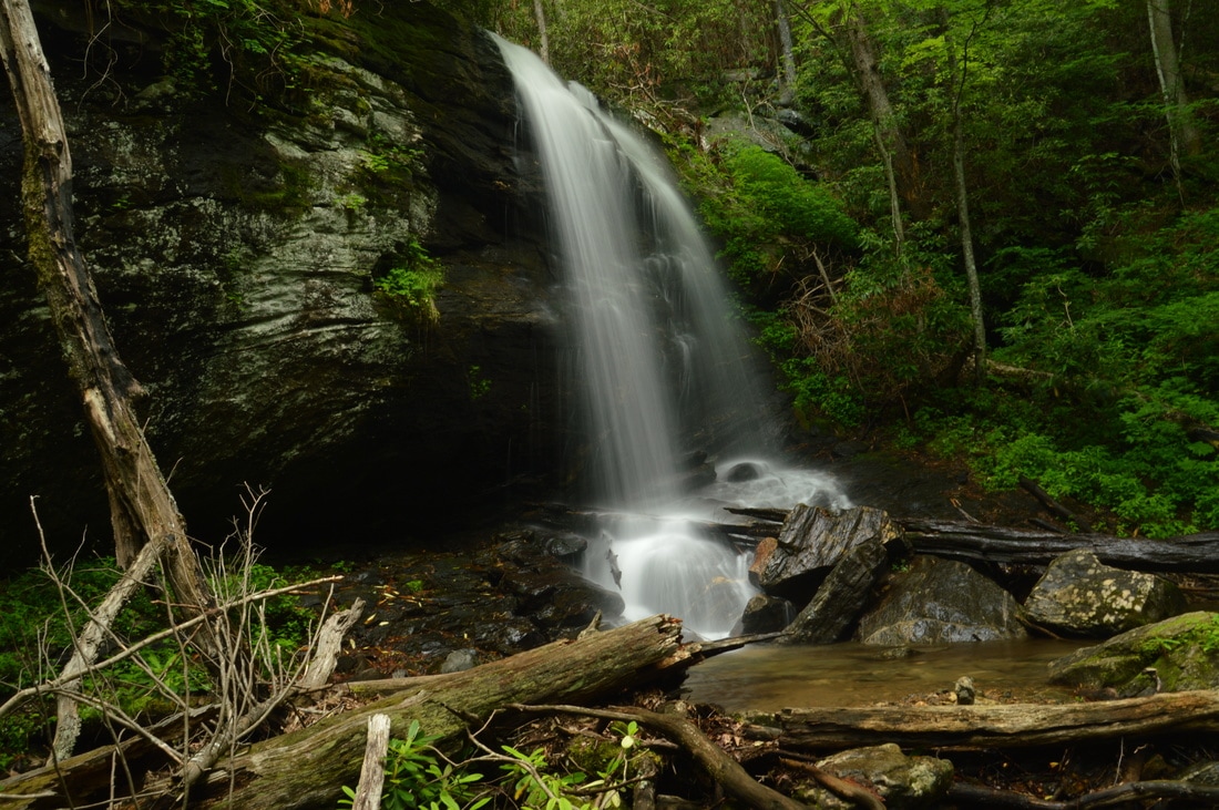
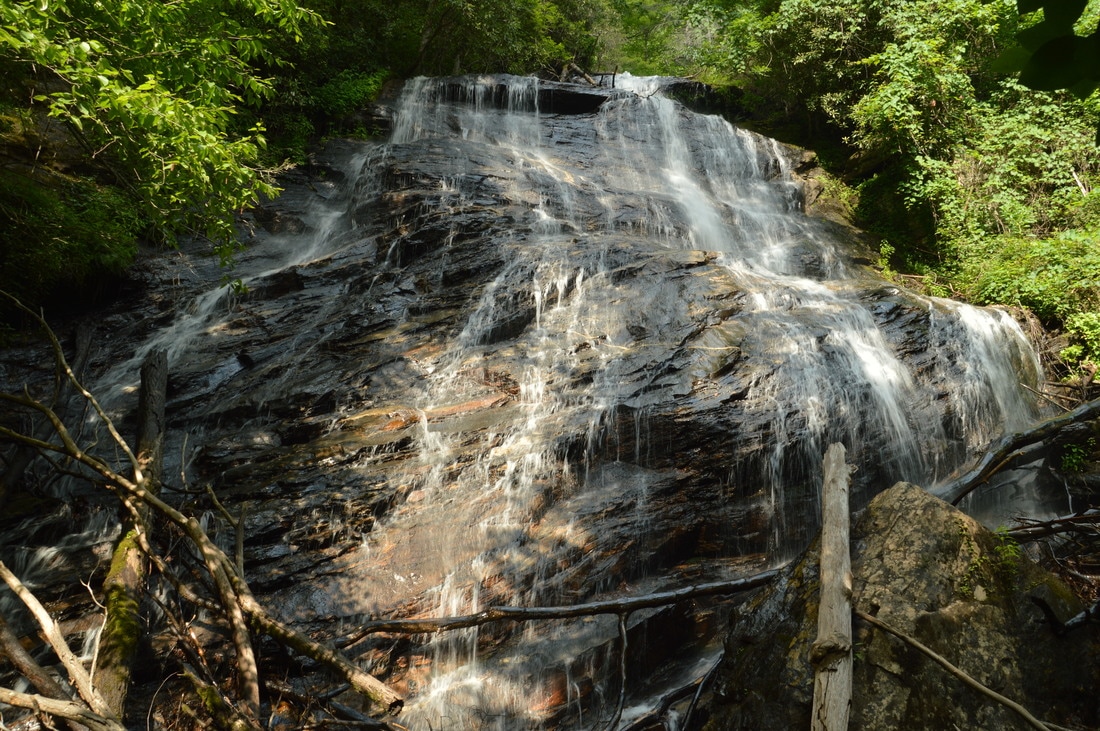
Chinquapin Branch is one of the streams that drain the Tray Mountain area near Helen. Beginning high in the Tray Mountain Wilderness, Chinquapin Branch passes over a tall cliff, crosses Tray Mountain Road, and then forms several more waterfalls. Cascading 200 feet partially out of sight, Lower Chinquapin Falls is the biggest waterfall of them all. Seeing the lower and middle waterfalls on Chinquapin Branch necessitates significant scrambling on an unmaintained trail, but intrepid hikers who hike the entire route will be rewarded with two pristine waterfalls on Chinquapin Branch and a third one on a tributary. This hike occurred on Saturday, June 24th, 2017. My plan was to follow an abandoned trail along Chinquapin Branch to Lower and Upper Chinquapin Falls, although I would only be able to view part of the Lower Falls. Along the way, I would make a side trip to Hickory Knob Falls on an unnamed tributary of Chinquapin Branch. Rather than returning the same way, I decided to hike off-trail to Tray Mountain Road from Upper Chinquapin Falls and then return along the road.
The mountains in the vicinity of Jasper are known more for their private residential communities and vacation homes than for their secluded hiking trails. It's not surprising, as most of the Mount Oglethorpe vicinity is developed heavily. There is an exception though: on the east side of Mount Oglethorpe is a 4500-acre tract of land that is part of Dawson Forest Wildlife Management Area and is owned by the state. Known as the Wildcat Tract, it is home to at least five waterfalls that are up to 80 feet high. A superb trail system with two trailheads was developed throughout the Wildcat Tract, facilitating access to the waterfalls and providing a number of options for day hikes/loops with various lengths. This hike occurred on Saturday, June 17th, 2017. My plan was to hike the outer Wildcat Creek Loop counter-clockwise from the Wildcat Campground. First, I would hike the Wildcat Creek Trail and Fall Creek Trail, taking side trails to four waterfalls on Fall Creek. At the end of the Fall Creek Trail, I would follow the Tobacco Pouch Trail and then Rocky Ford Trail back into the valley, visiting Rocky Ford Falls along the way. I would conclude the hike along the Turner Trail.
A classic Southern Appalachian wilderness hike, the Beech Creek Loop is a 'must-do' for all classes of hikers alike. I'll add that the Beech Creek Loop is among the top hikes that I have ever done, in Georgia or elsewhere. Over its eight-mile course, the loop visits two spectacular waterfalls - one of which is about 100 feet high - and passes a lengthy but worthwhile side trail to a breathtaking 180-degree view from Big Scaly Mountain into the Tallulah River Valley. In addition, the trail provides a perfect wilderness experience, full of solitude all throughout the Beech Creek gorge and on the slopes of Big Scaly Mountain. A short stretch of roadwalk is necessary to close the loop, but even walking along Tallulah River Road is nice, as you will get several views of the Tallulah River and its cascades. This hike occurred on Saturday, June 10th, 2017. My plan was to hike the Beech Creek Loop counter-clockwise, although I would use two cars to eliminate the 1.2-mile roadwalk. Along the way, I would take short side trips to Bull Cove Falls and High Falls and a much longer side trip to the vista on Big Scaly Mountain. Note that if you do the Beech Creek Loop, you must by all means take the time to go to the overlook as well.
Today nearly a ghost town, Tate City once was a prospering town centered around the logging business and the mining of corundum. A handful of folks live in Tate City through the year, but many houses in this quaint community are simply second homes. The pleasant drive through Tate City leads to a door into the Southern Nantahala Wilderness, a land of many top-tier waterfalls. The hike along the unofficial but well-defined Denton Creek Trail should be at the top of any waterfall hunter's list. In an easy to moderate two miles, folks who hike the Denton Creek Trail will visit three pristine waterfalls. Particularly attractive is Lower Denton Creek Falls, a free-fall waterfall that tumbles 40 feet over a sheer cliff speckled with lush green vegetation. In addition, hikers will be treated to continuous streamside scenery all throughout the Denton Creek Trail. This hike occurred on Saturday, June 10th, 2017. My plan was to hike out and back along the Denton Creek Trail to Upper Denton Creek Falls. Along the way, I would take the side trail to Lower Denton Creek Falls, and I would also make the short off-trail scramble down to Middle Denton Creek Falls.

Most of the streams that drain the Upper Tallulah River form waterfalls. Many of these waterfalls are significant, such as Flat Branch Falls: a multi-tier sliding waterfall that is over 200 feet high. Even though not all of it is visible from the base, the view is still impressive. Unfortunately, the trail to Flat Branch Falls had been damaged severely by the Rock Mountain Fire in November 2016. In fact, the once-easy trail to Flat Branch Falls has turned into an obstacle course complicated by numerous dead and fallen rhododendron branches. In addition, the trail to Flat Branch Falls begins with a steep scramble up a nearly vertical 20-foot slope. With a bit of common sense and navigational skills, however, the more seasoned hiker will get to Flat Branch Falls without much trouble. This hike occurred on Saturday, June 10th, 2017. My plan was to hike out and back to the base of Flat Branch Falls via the trail that begins at Bridge 4 on Tallulah River Road.
Lost House Branch is a pleasant gurgling stream that flows inconspicuously through a culvert under Highway 75 between Helen and Unicoi Gap. Few folks who drive across Lost House Branch suspect that there is a massive 100-foot waterfall less than a half-mile upstream. This is evidenced by the difficulty of the hike to Lost House Branch Falls, which involves walking in the creek itself, wading through knee-deep summer brush, and scrambling over or under numerous fallen trees. Not enough people have hiked to Lost House Branch Falls yet for a path to become established, but for the most persistent adventurers, the reward is a majestic waterfall. Lost House Branch splits into dozens of thin trickles as it slides down a huge rock face at the waterfall, although it is important to keep in mind that Lost House Branch needs a lot of water to look its best. This hike occurred on Saturday, June 3rd, 2017. My plan was to hike to Lost House Branch Falls out and back from Highway 75, initially following the south side of the stream to avoid trespassing on private property.
Motorists who drive north along Highway 75 from Helen may notice a deep valley/gorge on the left (west) side of the roadway, but most of them will not stop to muse about what's down there. When the more intrepid hiker takes a glance at the topographic map for the area around Spoilcane Creek and Highway 75, however, he will notice that there is significant waterfall potential in the Spoilcane Creek gorge. In fact, Spoilcane Creek has two major waterfalls - one of which is approximately 190 feet high! Additionally, folks who venture into the Spoilcane Creek gorge will find a bonus waterfall on an unnamed tributary to Spoilcane Creek. Access to the surprisingly rarely-visited Spoilcane Creek waterfalls is not very difficult thanks to a distinct path that follows the historical route of the Unicoi Turnpike and provides a close approach to all three waterfalls. This hike occurred on Saturday, June 3rd, 2017. My plan was to hike out and back to the Middle Falls on Spoilcane Creek via an unmarked trail from a pullout on the west side of Highway 75 just south of Unicoi Gap. Along the way, I would make the off-trail side trip to the Upper Falls on Spoilcane Creek and a waterfall on an unnamed tributary dubbed "Phil's Sister Falls".
Originating into North Carolina and then flowing into Georgia through the town of Sky Valley, Mud Creek is one incredible stream. Between the flats of Sky Valley and the floor of the Little Tennessee River Valley in Dillard, Mud Creek loses 1000 feet of elevation in just three miles! During this time, Mud Creek drops over several major waterfalls, including Estatoah Falls - one of Georgia's most famous waterfalls. A monster single-tier 160-foot waterfall, Estatoah Falls is unfortunately on private property and not accessible to the public. Upstream from Estatoah Falls is an 85-foot waterfall known as Mud Creek Falls or Little Estatoah Falls. What's best about this stunning waterfall is that unlike its bigger brother downstream, it is entirely on public property and is accessed by a short walk from a neighboring parking area or by a mile-long trail from Highway 246, depending on the visitor's preference. This hike occurred on Saturday, May 27th, 2017. My plan was to hike the Mud Creek Trail out and back to Mud Creek Falls from the trailhead pullout on Highway 246.
The streams that drain Warwoman Creek and the Chattooga River on the south side of Warwoman Road are generally not known for waterfalls as much as their more rugged counterparts to the north. Nevertheless, some notable exceptions exist, and Gold Mine Branch is perhaps one of the most major. On this creek, a 50-foot waterfall is stationed. No trail leads to Gold Mine Branch Falls, but despite this disadvantage, access is still fairly easy from Willis Knob Road, and with a couple of correct navigational decisions, one will get to the base of the falls in less than 30 minutes. This hike occurred on Saturday, May 27th, 2017. My plan was to hike off-trail out and back to the base of Gold Mine Branch Falls from Willis Knob Road via the most direct and recommended route.
Sarahs Creek is one of a handful of remote streams that drain the slopes of Rabun Bald, Georgia's second highest peak. Most of those streams form noteworthy waterfalls, but while some - such as Holcomb Creek Falls - are popular, others like the two waterfalls on Sarahs Creek are hardly known about. The hike from the end of Forest Road 155C to Upper and Lower Sarahs Creek Falls is fairly easy, but it does entail sections of creek-walk and minor bushwhacking in addition to navigating along faint paths. Those who reach both waterfalls will be rewarded with an interesting upper waterfall in a canyon flanked by a very tall cliff and a pristine lower waterfall that drops around 70 feet. This hike occurred on Saturday, May 27th, 2017. My plan was to hike the gated part of FS 155C from the gate to a faint trail that descended into the Sarahs Creek valley. I would follow the trail for some time, before leaving the trail and bushwhacking down to Sarahs Creek, and hike up the creek to Upper Sarahs Creek Falls. Finally, I would return to the trail and follow it down to Lower Sarahs Creek Falls. I would return the same way.
The Upper Tallulah River splits the Southern Nantahala Wilderness's lower region into two nearly separate parts. To the east of the Tallulah River, some of the wilderness's most famous landmarks are situated, such as Standing Indian Mountain, High Falls, and Denton Creek Falls, each of which is reached by well-used trails. The rugged terrain to the west of the Tallulah River tells a whole different story, however. Few official trails traverse this remote area, but a pair of unofficial footpaths provide access from the bottom of the valley all the way to the ridgetops. A beautiful waterfall called Oversoul Falls is found along the unmaintained Holden Cove Trail, and a difficult trek away from the Bly Gap Trail will lead an experienced hiker to Fall Branch Falls, a long series of steep cascades and slides. Even the Appalachian Trail in this area is used lightly compared to many other sections of the AT, and you're not likely to meet any people along the way to the breathtaking Ravenrock Cliff Overlook. This hike was occurred on Saturday, May 20th, 2017. My plan was to begin the day with a surprisingly difficult bushwhack from the Bly Gap Trailhead to Fall Branch Falls. Then, I would move on the main hike of the day, placing a second car at the Holden Cove Trailhead and hiking the Holden Cove Trail past Oversoul Falls to the Appalachian Trail and to Ravenrock Cliff Overlook. I would finish the hike by following the AT to Bly Gap and then hiking the Bly Gap Trail back to the first car. Folks without the option of taking two cars for the hike would have to make a final 2-mile roadwalk to complete the loop.
|
About MeMark Oleg Ozboyd Dear readers: I have invested a tremendous amount of time and effort in this website and the Georgia Waterfalls Database the past five years. All of the work that has gone in keeping these websites updated with my latest trip reports has almost been like a full-time job. This has not allowed me to pick up a paid job to save up money for college, and therefore, I I've had to take out loans. If you find the information on this website interesting, helpful, or time-saving, you can say "thanks" and help me out by clicking the button above and making a contribution. I will be very grateful for any amount of support you give, as all of it will apply toward my college tuition. Thank you!

Coming in 2022-2023?
Other Hiking WebsitesMiles HikedYear 1: 540.0 Miles
Year 2: 552.3 Miles Year 3: 518.4 Miles Year 4: 482.4 Miles Year 5: 259.9 Miles Archives
March 2021
Categories
All
|
 RSS Feed