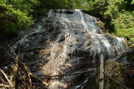
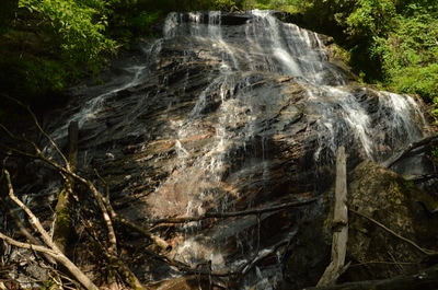
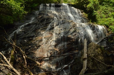
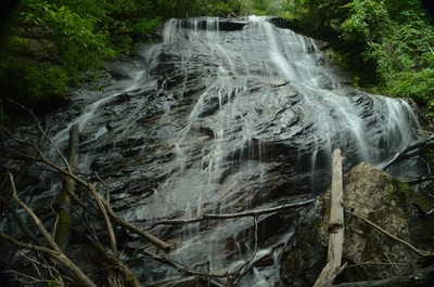
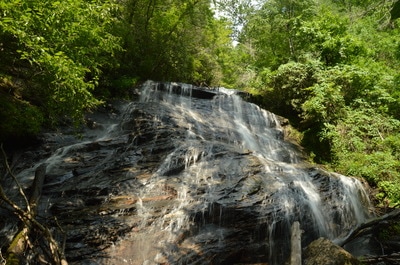
Lost House Branch is a pleasant gurgling stream that flows inconspicuously through a culvert under Highway 75 between Helen and Unicoi Gap. Few folks who drive across Lost House Branch suspect that there is a massive 100-foot waterfall less than a half-mile upstream. This is evidenced by the difficulty of the hike to Lost House Branch Falls, which involves walking in the creek itself, wading through knee-deep summer brush, and scrambling over or under numerous fallen trees. Not enough people have hiked to Lost House Branch Falls yet for a path to become established, but for the most persistent adventurers, the reward is a majestic waterfall. Lost House Branch splits into dozens of thin trickles as it slides down a huge rock face at the waterfall, although it is important to keep in mind that Lost House Branch needs a lot of water to look its best. This hike occurred on Saturday, June 3rd, 2017. My plan was to hike to Lost House Branch Falls out and back from Highway 75, initially following the south side of the stream to avoid trespassing on private property.
Summary
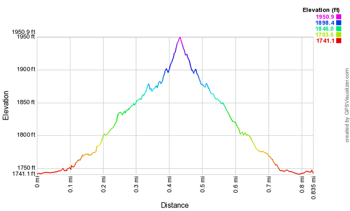
R/T Length of Trail: 0.8 Miles
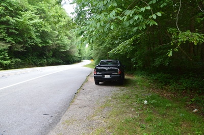
Duration of Hike: 1:30 Type of Hike: Out and Back Difficulty Rating: 7 out of 10 (easier in winter) Total Elevation Gain: 200 Feet Pros: None Cons: A wet, messy, and overall difficult bushwhack is required to reach Lost House Branch Falls Points of Interest: Lost House Branch Falls - 7 stars (higher after heavy rainfall) Trail Blaze Colors: None, no trail Best Seasons to Hike: Winter Fees: None Beginning Point: Pullout on Highway 75 just south of Lost House Branch culvert Directions from Helen, GA: From the intersection of Highway 75 and Highway 75 Alt north of Helen, follow Highway 75 North for 3.5 miles until a pullout on the left (west) side of the highway about 300 feet before Lost House Branch passes through a culvert under the highway. Right after the culvert, there is private property with stone house ruins on the right side of the highway. If you pass these old stone walls, you have driven too far. Map
Click here to download a track of this hike.
Details
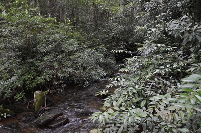
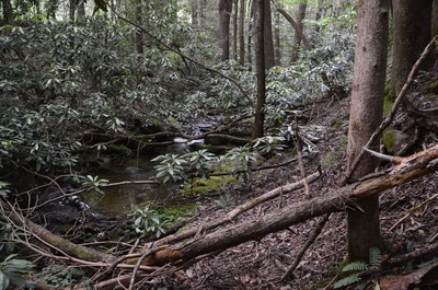
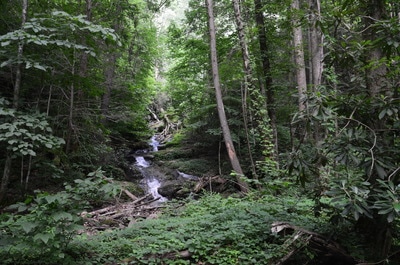
Folks, you're on your own for this one. It's hard to provide play-by-play directions for a full-flung creekside bushwhack with many different routes and options. On a map, the bushwhack to Lost House Branch Falls looks easy, as all you have to do is follow the creek for about 0.35 miles from Highway 75. In reality, it's much harder than that, as the bushwhack ranks among the most difficult that I've done. Based on reports that I have seen from fellow hikers, the bushwhack is significantly easier in the wintertime, but in the summer... it's a jungle. The only positive thing about the bushwhack is that it is fairly easy navigation-wise, as you'll eventually get to the waterfall if you keep the creek by your side. It's not that easy to stray away from the creek either, as Lost House Branch flows through a very steep-sided gorge. In fact, I think that the area of the gorge just below Lost House Branch Falls meets the criteria of a box canyon, due to the nearly vertical slopes that box in the creek on three sides.
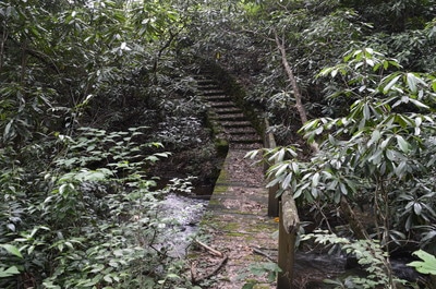
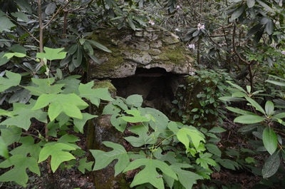
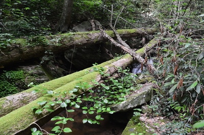
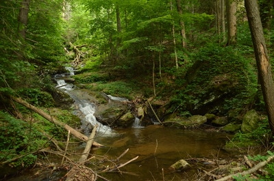
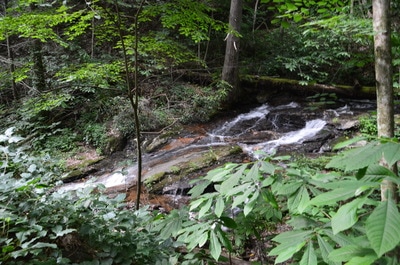
I bet that some hardcore waterfallers are already halfway out the door at the prospect of bushwhacking to a pristine and photogenic 100-foot waterfall, but I have to make an important note about the bushwhack. Posted private property occupies the north side of Lost House Branch for the first 0.25 miles eastward from Highway 75. It is mandatory that any hikers stay on the south side of the creek for the first quarter-mile or so of the bushwhack and do not cross the red paint that marks the property boundary. To get to Lost House Branch Falls, walk along Highway 75 for about 300 feet northward to the culvert across Lost House Branch. This is where the bushwhack begins. Make sure to follow the side of the creek that is closest to you (the south side), because the far side is private property. The bushwhack is difficult right away thanks to rhododendron thickets. At about 0.2 miles, you will reach a curious sight. An ancient footbridge crosses over to the private side of the creek and is followed by a staircase that curves out of sight toward stone house ruins. From the private side, a path comes onto the public south side of the creek, continues upstream for maybe 20 feet, and vanishes. At the footbridge, there is also a structure to the right that looks like it could possibly have once been an oven. Ignore the footbridge and continue bushwhacking along the same side of the creek. At around 0.25 miles, the other side of the creek turns public as well. There are several large blowdowns along the route in this area. At 0.35 miles, you will reach a picturesque cascade sliding into a shallow pool. Lost House Branch Falls may be visible through the trees ahead. To get around the cascade, scramble up the steep slope to the right of it, and then, walk on what can be considered as a semblance of a path that leads to and ends at Lost House Branch at 0.4 miles. Whew! Lost House Branch Falls is a photogenic waterfall, and after heavy rain, it likely becomes one of the best in the area. The waterfall is about 100 feet high in a single drop down a textured rock face with many different patterns and colors. Lost House Branch splits into dozens of thin trickles of water that cascade down all sides of the huge cliff. I think that this is a good waterfall for isolation photos, and depending on the water flow, the falls can be very good for slow-shutter shots. From Lost House Branch Falls, return along the same way to the parking pullout, concluding the hike back at the car at 0.8 miles. Mileage
0.0 - Highway 75 Pullout
0.4 - Lost House Branch Falls 0.8 - Highway 75 Pullout Variations
None
Bonus Stops
If you would like to spend a full day for chasing waterfalls around Helen, consider adding on the hike to the waterfalls of Spoilcane Creek. It is actually easier than the Lost House Branch bushwhack.
PicturesVideos
1 Comment
Richard D Lee
8/31/2021 08:49:48 pm
Any success with finishing the book?
Reply
Leave a Reply. |
About MeMark Oleg Ozboyd Dear readers: I have invested a tremendous amount of time and effort in this website and the Georgia Waterfalls Database the past five years. All of the work that has gone in keeping these websites updated with my latest trip reports has almost been like a full-time job. This has not allowed me to pick up a paid job to save up money for college, and therefore, I I've had to take out loans. If you find the information on this website interesting, helpful, or time-saving, you can say "thanks" and help me out by clicking the button above and making a contribution. I will be very grateful for any amount of support you give, as all of it will apply toward my college tuition. Thank you!
Coming in 2022-2023?
Other Hiking WebsitesMiles HikedYear 1: 540.0 Miles
Year 2: 552.3 Miles Year 3: 518.4 Miles Year 4: 482.4 Miles Year 5: 259.9 Miles Archives
March 2021
Categories
All
|

 RSS Feed