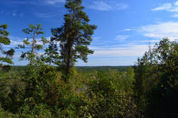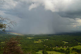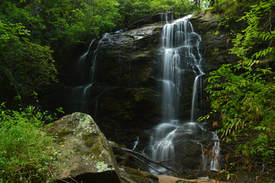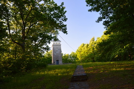
The Frady Branch Trail System is an often-overlooked collection of trails in the Lake Russell Wildlife Management Area near Toccoa. Even though the Frady Branch Trail System is located entirely in a low-elevation area with no mountain views, it has a surprising amount of points of interest, including three historic homesites, a small quarry, two ancient cemeteries, and perhaps most importantly: a 50-foot waterfall in the headwaters of Big Leatherwood Creek. Even though Big Leatherwood Falls is less than a quarter-mile from an official trail, it is a very little-known waterfall in a gorgeous pristine setting. Additionally, there is a second smaller waterfall along the loop - although both waterfalls are best seen during wet periods when they have the most water in them. This hike occurred on Saturday, September 30th, 2017. My plan was to hike the perimeter loop along the Frady Branch Trails clockwise.
4 Comments

The northeast sector of Lake Russell Wildlife Management Area is home to the Toccoa's area best-known peak: Currahee Mountain. Even though this prominent mountain has a relatively low elevation of 1740 feet above sea level, it still is situated well above the surrounding valleys and provides commanding long-range views to the north, east, and south. A steep trail used mostly by rock climbers leads from Highway 184 to the cliffs and views atop Currahee Mountain, from where one can reach the Frady Branch Trail System with some roadwalk. Even though much of the Upper Frady Branch Trail System follows broad forest roads, it has a surprising amount of points of interest, including three historic homesites, a small quarry, an ancient cemetery, and perhaps most importantly: a 50-foot waterfall in the headwaters of Big Leatherwood Creek. Even though Big Leatherwood Falls is less than a quarter-mile from an official trail, it is a very little-known waterfall in a gorgeous pristine setting, and getting to it can be tricky due to the lack of a good path. This hike occurred on Saturday, August 12th, 2017. My plan was to hike the Currahee Mountain Trail to the summit of Currahee Mountain. There, I would follow Currahee Mountain Road to the Latham Cemetery Trailhead. I would then make a loop along the upper portions of the Frady Branch Trail System, making side trips to four historic sites and BIg Leatherwood Falls. I would retrace my earlier steps once I re-emerged on Currahee Mountain Road.

The Lake Russell Wildlife Management Area covers the southeastern extremity of Chattahoochee National Forest. This low-elevation sector of the forest is not known for pleasant hiking trails and spectacular waterfalls/overlooks to the extent that other parts of the forest are. But despite its low elevation, the Lake Russell area is home to a number of waterfalls, most of which have slipped under the radar of hikers and waterfall enthusiasts for years. One of the most spectacular waterfalls is a 50-foot sheer drop - historically referenced to as Tabor Falls - that is located well up an unnamed tributary of the Middle Fork Broad River. Even though a distinct path leads almost to the base of Tabor Falls, the waterfall is largely unknown to the outdoors community, and you're unlikely to see other people in this remote corner of Lake Russell WMA - although there may be exceptions during hunting season. This hike occurred on Saturday, August 12th, 2017. My plan was to find the easiest route from Sellers Road to a waterfall that I discovered on terrain and satellite imagery on an unnamed tributary of the Middle Fork Broad River, learning after my hike that the waterfall's historical name is Tabor Falls. I was surprised to find an unofficial trail in great condition leading almost to the base of the waterfall with only a short off-trail scramble at the end.
*UPDATE 11/12/2023: Logging operations have ended along this hike, but the trail to Tabor Falls has become more difficult to hike. For the first quarter mile from the right turn off FR 89A, the trail has been widened to a logging road and full of small downed tree trunks placed for erosion control. Don't expect a smooth path until the second right turn at the bottom of the hill.

The Lake Russell trail system is often overlooked by hikers, who are interested in the "true" mountain hiking just a short drive to the north of Cornelia. The Lake Russell Recreation Area does not sit in the actual mountains, but these foothills provide quality hiking nonetheless. Several hiking trails can be found around Lake Russell and Nancytown Lake. On this hike, you will first see a couple of waterfalls on Nancytown Creek, before hiking along the shores of Nancytown Lake and then Russell Lake. The route becomes more difficult as the hike follows a seldom-used trail to the top of Chenocetah Mountain, where an old fire tower stands. Before your return to Nancytown Lake along a different trail, make sure to stop by the two clearings on Chenocetah Mountain that provide some views of Lake Russell and the distant Blue Ridge Mountains. This hike occurred on Saturday, May 7th, 2016. My plan was to hike several of the trails in the Lake Russell trail system. First, I would hike the Sourwood Trail. Then, I would take the Nancytown Lake Trail along the eastern shore of the lake, before connecting to the Lake Russell Loop and hiking the eastern and southern sides of the loop. From there, I would walk a short section of Lake Russell Road before taking the Campground Trail to the top of Chenocetah Mountain. I would return to Nancytown Lake using the Rhododendron Trail.
|
About MeMark Oleg Ozboyd Dear readers: I have invested a tremendous amount of time and effort in this website and the Georgia Waterfalls Database the past five years. All of the work that has gone in keeping these websites updated with my latest trip reports has almost been like a full-time job. This has not allowed me to pick up a paid job to save up money for college, and therefore, I I've had to take out loans. If you find the information on this website interesting, helpful, or time-saving, you can say "thanks" and help me out by clicking the button above and making a contribution. I will be very grateful for any amount of support you give, as all of it will apply toward my college tuition. Thank you!
Coming in 2022-2023?
Other Hiking WebsitesMiles HikedYear 1: 540.0 Miles
Year 2: 552.3 Miles Year 3: 518.4 Miles Year 4: 482.4 Miles Year 5: 259.9 Miles Archives
March 2021
Categories
All
|

 RSS Feed