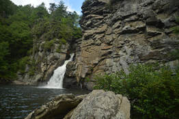
Linville Falls is one of the most photographed waterfalls in North Carolina. Located on the Linville River at the very head of Linville Gorge, the falls cascades over a hundred feet via multiple tiers, crashing into a huge plunge pool lined by tall cliffs at the end of the final 45-foot tier of the falls. A network of popular trails, stemming from the Linville Falls Visitor Center, weaves around the falls and leads to five different viewpoints of it (including the base itself). In addition, a bonus waterfall known as Duggers Creek Falls can be seen from one of the trails. This hike occurred on Friday, July 7th, 2017. My plan was to hike out and back to each of the five viewpoints of Linville Falls as well as Duggers Creek Falls from Linville Falls Visitor Center. This hike was the fifth of ten hikes that I did during a seven-day trip to the mountains of northwest North Carolina.
0 Comments
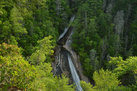
The Wilson Creek watershed in the Grandfather Ranger District of Pisgah National Forest is well-known for its numerous hiking trails and backpacking opportunities. One of the largest tributaries of Wilson Creek is Harper Creek. Harper Creek and its tributaries are home to several spectacular waterfalls in the shadow of Grandfather Mountain. Particularly impressive is South Harper Creek Falls: a massive 120-foot double sliding waterfall that can be viewed from three distinct locations: the base, the midpoint, and the cliffs on the other side of Harper Creek. If you hike the Harper Creek Loop, you'll also pass triple-tier Harper Creek Falls - that isn't too shabby either - and have the option to take a lengthy side trail to Bard Falls on North Harper Creek. However, it is best to be prepared for overgrown trails and over a dozen wet crossings of Harper Creek if you do hike the full loop. This hike occurred on Thursday, July 6th, 2017. My plan was to hike the Harper Creek Loop counter-clockwise from Brown Mountain Beach Road, following the Harper Creek Trail and then the Raider Camp Trail. Along the way, I would take a side trip to Bard Falls along the North Harper Creek Trail, and I would also take short side trails to Harper Creek Falls and three different viewpoints for South Harper Creek Falls. This hike was the fourth of ten hikes that I did during a seven-day trip to the mountains of northwest North Carolina.
 The Snake Mountain Trail easily makes the list for the top 5 best mountain hikes in North Carolina. Located in the Elk Knob Game Lands, the Snake Mountain ridge sports spectacular views in all directions from a trail that follows the very knife-edge crest of the ridge, passing over many rock outcrops and sometimes traveling mere inches from the edges of cliffs dozens of feet high. The hike to Snake Mountain is not for the average hiker due to the extremely steep ascent and the numerous technical scrambles along the ridge, but those who make it will be rewarded with some of the best views anywhere in the Southeast. The Sunalei Preserve and its homeowners must be commended for their willingness to allow public travel through the private property that the first part of the trail passes. This hike occurred on Wednesday, July 5th, 2017. My plan was to hike out and back along the Snake Mountain Trail over the North Peak and South Peak of Snake Mountain from the north trailhead off Meat Camp Road. Unfortunately, rain and fog ruined some of the views, but it still turned out to be a spectacular hike. This hike was the third of ten hikes that I did during a seven-day trip to the mountains of northwest North Carolina. Update #5 1/3/18: Unfortunately, hiking the Snake Mountain Trail is currently no longer legal. The property owners have gated the parking lot, placed purple paint alongside the road by the trailhead, and mentioned that hiking the trail right now is trespassing. At this time, the owners do not want people hiking the trail due to all the litter that has been left behind. I have chosen to hide the Snake Mountain trail guide on this page for the time being, out of respect for the owners' wishes. Should the access situation change, you'll hear it from me first. Let's keep our fingers crossed that this amazing piece of land may receive a conservation easement or be purchased by a conservancy sometime in the future.
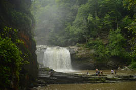
The Elk River is best known for its spectacular upper waterfall, Elk River Falls. But as the Elk River enters Tennessee, it encounters a twisting passage with a series of waterfalls collectively known as Twisting Falls that is even more jaw-dropping. The 35-foot lowermost drop of Twisting Falls, locally known as Compression Falls, creates one of the area's most impressive sights as it crashes with a deafening roar into a deep pool flanked by tall cliffs. The trail to the base of the falls is no joke though - the unofficial path descends over 400 feet to the Elk River in just a quarter-mile! The destination waterfall is well worth it, but be prepared to huff and puff on the way back up. This hike occurred on Wednesday, July 5th, 2017. My plan was to hike out and back to the base of the lowermost drop of Twisting Falls (aka Compression Falls). This hike was the second of ten hikes that I did during a seven-day trip to the mountains of northwest North Carolina.
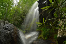
If you're looking for the perfect combination of beauty and ease of access to a waterfall in North Carolina, Elk River Falls has to be at the top of your list. A well-used relaxing trail leads along the banks of the mighty Elk River to the base of Elk River Falls, a tight sheer 50-foot drop into a huge plunge pool that is known for its swimming opportunities. Most folks who hike to Elk River Falls don't know that another excellent waterfall can be reached fairly easily from the same trailhead. 100-foot Jones Falls is on a small tributary of the Elk River and during the wetter months is a sight no less impressive than Elk River Falls. A signed spur trail from the Appalachian Trail facilitates access to this gorgeous spot. Hikers will be able to see both waterfalls with a hike of fewer than four miles. This hike occurred on Wednesday, July 5th, 2017. My plan was to hike out and back to Elk River Falls and then to follow a forest road and unofficial connector path to the Appalachian Trail, which I would use to reach Jones Falls. I would return the same way. This hike was the first of ten hikes that I did during a seven-day trip to the mountains of northwest North Carolina.
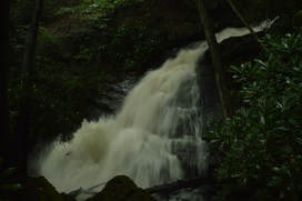
Canada Creek is one of my favorite mountain streams in North Georgia, due to a perfect combination of beauty, remoteness, and ease of access at each of the creek's four scenic waterfalls. A network of unofficial trails used by fishers and hunters weave around Canada Creek and provide fairly easy access to each of its waterfalls. The hikes to each particular waterfall aren't too long, but seeing all of the waterfalls together will take a good part of the day. A topographic map and compass are recommended for hikers who venture into the Canada Creek area, because many disorienting trail junctions are found throughout the trail system, and some of the paths are faint. This hike occurred on Saturday, July 1st, 2017. My original plan was to hike out and back to Yukon Falls on Canada Creek from the Upper Canada Creek Trailhead. After seeing the roaring state of the Yukon Falls though, I decided to use a connector to access Alberta Falls on Canada Creek and then loop back using a couple of roads.
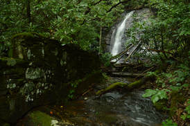
A tributary of Soapstone Creek, Sorrels Branch sports a pair of scenic waterfalls near Georgia Highway 180 and the former location of CCC Camp Soapstone. Access to both waterfalls is not difficult thanks to an unofficial trail along an old logging road that passes by them. The 50-foot sheer lower falls is more scenic than the small 25-foot upper slide, but the historical aspect of the Sorrels Branch waterfalls may be the most fascinating part of this hike. Perched precariously in the middle of the creek at the brink of the lower falls and near the base of the upper falls is a mysterious stone structure. The forest service, history books, and even the internet provide little clue to the origin of these ancient ruins, but you'll have fun coming up with your own guesses when you visit. This hike occurred on Saturday, July 1st, 2017. My plan was to hike out and back to Lower and Upper Sorrels Branch Falls from Highway 180.
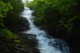
High Shoals Creek is home to two of Georgia's most popular waterfalls: High Shoals Falls and Blue Hole Falls. Very few people who hike to those waterfalls know that the same watershed is home to a remote waterfall no less impressive. Rogers Branch Falls is a tiered 80-foot waterfall on a tributary of High Shoals Creek, with additional small waterfalls above and below the main drop. Even though local residents are aware of the waterfall as evidenced by the well-used path to it, it is not publicized well at all and clearly off the radar for most hikers and waterfall hunters. The routes to the base of Rogers Branch Falls are not quite for everyone due to their steepness, but those who reach the viewing area at the base will be rewarded by a breathtaking sight. This hike occurred on Saturday, July 1st, 2017. My plan was to hike out and back to the base of Rogers Branch Falls from a popular camping area off Indian Grave Gap Road.
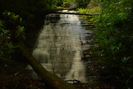
Buckeye Cove Falls is one of a handful of waterfalls in the Swallow Creek Wildlife Management Area near Hiawassee. About 80 feet high, this picturesque stairstep waterfall is easy to reach via a short hike, but it is located far enough in the middle of nowhere that you're not likely to find someone else at the waterfall. The lush green setting of Buckeye Cove Falls makes it appealing to waterfall enthusiasts and photographers during the warmer months. The falls is located in a very small watershed though, so it is best to visit during late spring or early summer. This hike occurred on Saturday, June 24th, 2017. My plan was to hike the unofficial path from the end of Swallow Creek Road out and back to Buckeye Cove Falls.
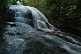
Mill Creek Falls is the name used collectively for a pair of waterfalls in the highest reaches of Swallow Creek Wildlife Management Area. Oddly, only one of the waterfalls is on Mill Creek itself, and the more picturesque of the two is on a tributary known as Ground Hog Branch. Visited together, these two waterfalls in the Mill Creek headwaters area make for a fairly easy and beautiful afternoon outing. A trail leads to both falls, although it is steep and slippery in places. This hike occurred on Saturday, June 24th, 2017. My plan was to hike out and back from Mill Creek Road to the upper and lower waterfall at Mill Creek Falls, with the former being on Ground Hog Branch and the latter being on Mill Creek itself just below its confluence with Groundhog Branch..
Chattahoochee National Forest: Lower & Upper Chinquapin Falls and Hickory Knob Falls, Helen, Georgia7/12/2017 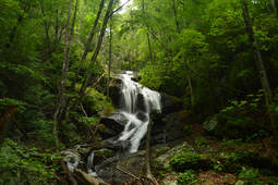
Chinquapin Branch is one of the streams that drain the Tray Mountain area near Helen. Beginning high in the Tray Mountain Wilderness, Chinquapin Branch passes over a tall cliff, crosses Tray Mountain Road, and then forms several more waterfalls. Cascading 200 feet partially out of sight, Lower Chinquapin Falls is the biggest waterfall of them all. Seeing the lower and middle waterfalls on Chinquapin Branch necessitates significant scrambling on an unmaintained trail, but intrepid hikers who hike the entire route will be rewarded with two pristine waterfalls on Chinquapin Branch and a third one on a tributary. This hike occurred on Saturday, June 24th, 2017. My plan was to follow an abandoned trail along Chinquapin Branch to Lower and Upper Chinquapin Falls, although I would only be able to view part of the Lower Falls. Along the way, I would make a side trip to Hickory Knob Falls on an unnamed tributary of Chinquapin Branch. Rather than returning the same way, I decided to hike off-trail to Tray Mountain Road from Upper Chinquapin Falls and then return along the road.
|
About MeMark Oleg Ozboyd Dear readers: I have invested a tremendous amount of time and effort in this website and the Georgia Waterfalls Database the past five years. All of the work that has gone in keeping these websites updated with my latest trip reports has almost been like a full-time job. This has not allowed me to pick up a paid job to save up money for college, and therefore, I I've had to take out loans. If you find the information on this website interesting, helpful, or time-saving, you can say "thanks" and help me out by clicking the button above and making a contribution. I will be very grateful for any amount of support you give, as all of it will apply toward my college tuition. Thank you!
Coming in 2022-2023?
Other Hiking WebsitesMiles HikedYear 1: 540.0 Miles
Year 2: 552.3 Miles Year 3: 518.4 Miles Year 4: 482.4 Miles Year 5: 259.9 Miles Archives
March 2021
Categories
All
|

 RSS Feed