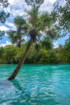
Silver Glen Springs is an oasis in the middle of Ocala National Forest, Florida's "big scrub". One of the forest's most scenic springs, Silver Glen Springs features strikingly transparent aquamarine waters that form a vivid contrast with the lush, tropical vegetation found along the shoreline. Not only is the spring a wonderful place to cool off on a scorching summer day, but it's also a natural aquarium, often housing hundreds of fish and even other species like the Atlantic stingray. A couple of nature trails branch out from the Silver Glen Springs Recreation Area. The Springs Boil Trail leads to a secondary spring called Jody's Spring, known for its many unique sand boils, nestled in the deep shade of a tropical hammock. The Lake George Trail meanders through uplands near Silver Glen Springs Run for a mile before reaching the shoreline of Lake George, Florida's second largest freshwater lake, so massive that it almost seems to be a sea. This hike occurred on Tuesday, August 28th, 2018. My plan was to hike both the Springs Boil Trail and Lake George Trail after exploring Silver Glen Springs.
0 Comments
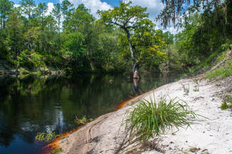
One of Florida's most attractive rivers valleys, the Suwannee River Valley has got it all: majestic bluffs, sandy beaches, tight and intricate tributaries, colorful springs, a surprising variety in elevation, and best of all, a 75-mile segment of the Florida Trail. The FT section between Camp Branch and Swift Creek - two special Suwannee feeder streams - is a true North Florida classic, showcasing most of the sights that make hiking along the Suwannee so wonderful. Even before you reach the Suwannee, you'll submerge into an unusual landscape, where the clear-bottomed Camp Branch (also known as Disappearing Creek) twists through a limestone chasm before vanishing into a dark sink, only to pop out at the Suwannee itself. From there, you'll pick up the Florida Trail, passing one gorgeous vista after another of the Suwannee River, crossing numerous scenic side streams like Jerry Branch, and scrambling through surprisingly deep ravines and up pointed hills. After close to 9 miles of hiking, you'll finally reach the hike's destination: Swift Creek, a lovely, cascading stream that dashes through Florida's version of the Grand Canyon before emptying into the Suwannee by an imposing limestone bluff. This hike occurred on Saturday, August 25th, 2018. My plan was to hike the blue-blazed FT access trail from the Camp Branch Trailhead to the Suwannee River (tracing the short Camp Branch Loop along the way), where I'd pick up the Florida Trail and follow it all the way to Swift Creek.
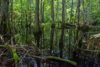
The Florida Trail section in the Rice Creek Conservation Area a few miles outside Palatka is short but truly unique and special. This hike dives right into the Rice Creek Swamp, the headwaters of Rice Creek - a major tributary of the St. Johns River. Back in the 19th century, the Rice Creek headwaters were actually a rice and indigo plantation. But today, the area is heavily wooded, and the only remaining traces of the past are the numerous levees crisscrossing the swamp. The Florida Trail loop utilizes several of these levees to provide a first-hand swamp experience. At the same time, the levees and an extraordinary system of boardwalks and footlogs allows you to keep your feet dry onto your journey into the swamp. You might even see a few gators or otters if you're lucky. A particularly remarkable point of interest along the Rice Creek section of the Florida Trail is Hoffman's Crossing - a slim boardwalk, 1,886 feet long, that crosses a branch of the swamp. This hike occurred on Wednesday, August 22nd, 2018. My plan was to hike the Rice Creek Loop from the Highway 100 Trailhead. Along the way, I'd extend my hike along the Florida Trail to see Hoffman's Crossing.
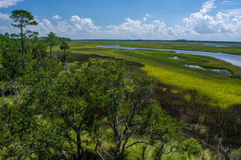
Just northeast of St. Augustine is a unique sliver of land stretching out between two estuarine bodies of water: the Tolomato River and the Guana River. The southern tip of the peninsula is occupied by the Guana Tolomato Matanzas (GTM) National Research Reserve, while the rest of it is protected by state-owned Guana River WMA. These two public land tracts are interconnected, both featuring an abundance of hiking trails surprisingly known little outside of the local community. The GTM Reserve trail system explores fairly dense woods with primarily oaks and pines, occasionally passing views of the Tolomato River. The character of the Guana River WMA trail system is vastly different. The west side of the WMA is uninteresting pine flatwoods, but it has a significant highlight: the Capo Creek observation tower. This tower provides breathtaking views of salt marshes along Capo Creek - a tidal creek feeding into the Tolomato River. The east side of the WMA features scenic hammocks along the shoreline of Guana Lake/River. The views from the Guana Lake observation tower don't quite match those of the Capo tower, but they're quite scenic as well. Regardless of whether visitors explore GTM Reserve, Guana River WMA, or both, they're likely to have a well-rounded hike with several scenic stops. This hike occurred on Saturday, August 18th, 2018. My plan was to hike a loop with the Purple Trail, Red Trail, and Blue Trail in GTM Reserve, followed by a loop to Capo Tower and Lake Tower in Guana River WMA.
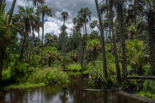
A slice of wilderness along Florida's Atlantic coastline, Bulow Creek State Park conserves several thousand acres of salt marshes and old-growth tropical hammocks in the Bulow Creek watershed between Ormond Beach and Flagler Beach. Traversing the park is the linear Bulow Woods Trail, a linear pathway over 6 miles long that takes you past several salt marsh views and through a tropical jungle with many old-growth palms and oaks. One of the hike's bigger highlights is a gorgeous palm-lined stream flowing toward Bulow Creek encountered along the north part of the trail. Between the magnificent 400-year old Fairchild Oak at the south end and the ruins of the largest sugar mill ever operated in Florida (the Bulow Sugar Mill & Plantation Ruins) at the north end, the Bulow Woods Trail has attractions even at its edges. This hike occurred on Saturday, August 11th, 2018. My plan was to hike out and back from the Fairchild Oak to the Bulow Plantation Ruins, hiking the Bulow Creek Loop counter-clockwise along the way. I would also stop at Boardman Pond.
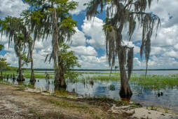
Hiking in Florida typically means looking for certain highlights such as interesting woods, creeks, lakes, or historic sites. But what if you could fit all of that into one hike? That's something the north loop at the Arbuckle Tract of Lake Wales Ridge State Forest manages to accomplish. In under just 14 miles, this trail visits the shorelines of Lake Arbuckle and Lake Godwin, affords numerous views of both Reedy Creek and Livingston Creek, and passes through a variety of different woods and ecosystems that range from unique pine flatwoods full of cutthroat seep grass to open, sandy scrub areas. This hike is easily among the most scenic I've done in Central Florida. Not often do you find such a mix of beautiful scenery on a single trail in Florida, keeping your interest piqued and letting the miles roll by faster. This hike occurred on Saturday, August 4th, 2018. My plan was to hike the North Loop in the Arbuckle Tract counter-clockwise from McLean Cabin Trailhead.
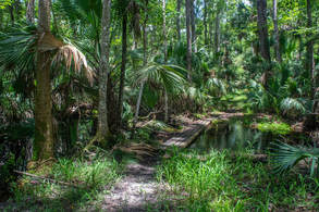
7000-acre Wekiwa Springs State Park is part of a ribbon of wild lands surrounding the St. Johns River on the northwest side of Orlando. The park's centerpoint is Wekiwa Springs, a second-magnitude spring that discharges 45 million gallons of water a day. However, there's a lot more to see in this park, which is crisscrossed by a series of single-track trails maintained by the Florida Trail Association. This hike follows the outermost White Trail all the way from Wekiwa Springs to the park's remote northern reaches. In the first half of the hike, you'll follow an elevated tramway through the wild Mill Creek Swamp and then immerse yourself into the palm hammocks of the Rock Springs Run floodplain, where you'll occasionally get your feet wet (particularly in the rainy season). A stark difference is found in the hike's second half, where you'll cruise through dry sandhills and pass sinkholes. Around the hike's midpoint, an inconspicuous connector path leads into Kelly park, where you can dip your toes in the refreshingly cool waters of the breathtaking, must-see Rock Springs before resuming your hike. This hike occurred on Wednesday, August 1st, 2018. My plan was to hike the White Trail counter-clockwise, starting out along the Wet-to-Dry Boardwalk by Wekiwa Springs.
Apalachicola National Forest: Leon Sinks Geological Area Trail System, Tallahassee, Florida1/9/2018 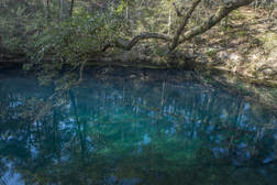
The Leon Sinks Geological Area is in the northeast corner of Apalachicola National Forest near Tallahassee. This fascinating area is home to over a dozen sinkholes, many of which have water in them. Particularly Hammock Sink is one of the most beautiful and photogenic natural sights in the region. The trail system at Leon Sinks also visits a disappearing stream with a natural bridge as well as a series of cypress swamps. Numerous points of interest are spaced throughout the 4.5-mile loop to keep your attention focused the entire hike. This hike occurred on Saturday, January 6th, 2018. My plan was to hike a counter-clockwise loop with the Sinkhole Trail and Gum Swamp Trail.
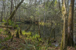
Most hikers of the Tallahassee area have heard of or even been to Leon Sinks. How many have heard of Wakulla River Sinks though? Along with adjacent Apalachicola National Forest, the River Sinks Tract - a lesser-known parcel of Wakulla Springs State Park - holds nearly two dozen water-filled sinkholes. The sinks serve as a portal to the mysterious underground water-filled cave system that eventually connects to the Wakulla River to the southeast. An official trail called the Wakulla River Sinks Trail passes by several small sinks, including the photogenic Clearcut Sink. If one extends their hike along the unofficial pathway that splits off and leads to a series of bigger sinks, including Promise Sink and Upper River Sink, they are bound to be astounded! This hike occurred on Saturday, January 6th, 2018. My plan was to hike the official Wakulla River Sinks Trail clockwise. Along the way, I would make out-and-back side trips to Clearcut Sink and along an unofficial trail to a series of sinks to the south.
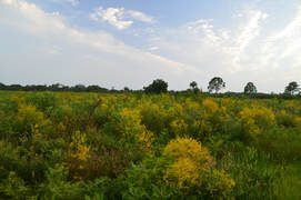
Nestled near the west Florida coastline between Sarasota and Venice, the underrated Oscar Scherer State Park is a haven for folks looking for a peaceful day hike in this part of southwest Florida. The park is known best as the home of the last remaining scrub jay habitat in southwest Florida, but it also has a superb color-coded trail system that introduces hikers to South Creek and its hammocks as well as the scrub and flatwoods nearby. In particular, the diverse Yellow Trail - part of the park's North Trail System - passes through a large range of ecosystems, crossing South Creek twice, passing a beautiful lake known as Big Lake, and travelling through a large section of the scrub. Hikers will even be able to see an old railroad trestle across South Creek. Thanks to its range of scenery and points of interest, the Yellow Trail at Oscar Scherer State Park has quickly turned into one of my favorite hikes in Southwest Florida. This hike occurred on Wednesday, August 2nd, 2017. My plan was to hike the Yellow Loop Trail counter-clockwise with a short detour to the Big Lake observation platform.
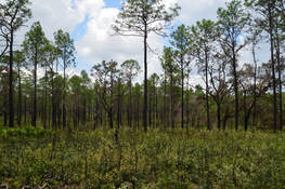
The Citrus Tract of Withlacoochee State Forest is home to some of Central Florida's most rugged terrain. Several major sinkholes and numerous caves are spread throughout the hilly Citrus Tract. The Citrus Trail, one of Florida's longest and most popular backpacking trails, is a 42-mile loop trail that passes near the perimeter of the Citrus Tract. Numerous forest roads crisscross the tract with many different starting points possible. For the convenience of day hikers, three cross-trails intersect the loop, providing shorter hiking opportunities. The southernmost loop of the Citrus Trail - Loop D - accesses one of the area's most unique sights: Dames Cave, a limestone cave with two chambers, a large open one and a smaller closed one. In addition to traversing dozens of rolling sandhills, Loop D of the Citrus Trail also passes through a bizarre rocky landscape in the vicinity of a broad sink known as Lizzie Hart Sink. This hike occurred on Saturday, July 29th, 2017. My plan was to hike Loop D of the Citrus Trail counter-clockwise from the Road 18 crossing. I would take the side trail to Dames Cave along the way.
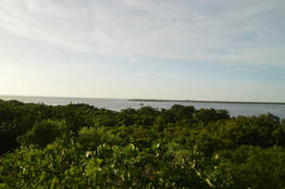
Emerson Point Preserve is one of several beautiful Manatee County coastline preserves. This preserve on Snead Island is rich with history, as there are several historic Indian mounds scattered throughout the park. The preserve's diverse trail system traverses both the Tampa Bay and Manatee River sides of the island, with several views of both, as well as an observation tower that provides a bird's-eye panorama of the preserve and Tampa Bay, with the Sunshine Skyway Bridge in the distance. Also, the park's primary trail system provides access to the Portavant Temple Mound - the biggest mound of all in the preserve. This hike occurred on Wednesday, July 26th, 2017. My plan was to hike the Portavant Mound Trail from the Ranger Station, making a side trip to the Manatee River view. Then, I would make a clockwise loop with the South Restoration Trail, Terra Ceia Trail, Tower Trail, and North Restoration Trail, making side trips to each of the three Tampa Bay views as well as the observation tower. I would conclude the hike by following a connector back to the Ranger Station.
Hinson Conservation & Recreation Area (Chipola River Greenway): Hinson Trail, Marianna, Florida5/25/2017 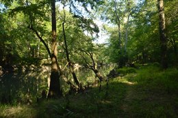
The Chipola River in the Central Florida Panhandle is preserved through many conservation areas, perhaps the best-known of which is Florida Caverns State Park. South of Marianna, however, lies a conservation area that is less-visited but no less interesting: the Hinson Recreation Area, which has a beautiful loop trail that is maintained by the Florida Trail Association. The Hinson Trail presents numerous views of the gorgeous Chipola River, and additionally, there are other highlights that include several sinkholes, an impressive cave that is also a natural bridge, and an abandoned railbed. This hike occurred on Sunday, May 14th, 2017. My plan was to hike the Hinson Loop Trail counter-clockwise from the trailhead at the end of Gator Hole Lane.
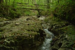
Three thousand feet of elevation gain on a hike in the mountains is fairly common; three thousand feet of elevation gain on a hike in Florida is unheard of. Florida is well-known for its flat terrain, but exceptions do exist. Located on the east side of the Apalachicola River in the middle of nowhere, Torreya State Park - one of Florida's most interesting natural areas - features dozens of steephead ravines, limestone bluffs, sharp hills, and even a waterfall. In fact, it is safe to say that the park's hiking trails are the most rugged in Florida. Torreya State Park also boasts a collection of rare plants and animals, including the extremely rare Florida torreya tree, that are not typically found this far south. You'll get quite a workout on this hike, ascending dozens of hills and visiting many scenic mini-canyons carved out by small streams that feed the Apalachicola River. Also, you'll view the Apalachicola River from blufftop overlooks in several places. This hike occurred on Sunday, April 16th, 2017. My plan was to hike the Torreya Loop Trail counter-clockwise starting via the Gregory House east access trail. Along the way, I would make side trips to Weeping Ridge Falls and to Rock Bluff Overlook, and additionally, I would hike the Rock Creek Loop counter-clockwise.
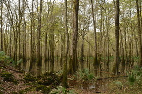
Florida Caverns State Park might be Florida's most famous state park, as it is the only state park with a show tour cave. Nestled in some of Florida's taller hills near the Chipola River, the park has a lot to offer in terms of outdoor recreation besides a public cave tour. The park is home to two trail systems: a smaller nature trail system east of the Chipola River and a longer trail system west of the river, and most people who visit the park to be guided through the cave are not aware of the beauty that awaits a short distance away on the park's trails. Along the short nature trail system, you will pass several limestone bluffs with great views of the Chipola River floodplain, and you will even hike through Tunnel Cave on Florida's only trail that passes through a cave. This hike occurred on Monday, January 2nd, 2017. My plan was to hike counter-clockwise the outermost loop in Florida Caverns State Park's nature trail system, by first hiking the Beech-Magnolia Trail, followed by the Floodplain Trail and Tunnel Cave.
|
About MeMark Oleg Ozboyd Dear readers: I have invested a tremendous amount of time and effort in this website and the Georgia Waterfalls Database the past five years. All of the work that has gone in keeping these websites updated with my latest trip reports has almost been like a full-time job. This has not allowed me to pick up a paid job to save up money for college, and therefore, I I've had to take out loans. If you find the information on this website interesting, helpful, or time-saving, you can say "thanks" and help me out by clicking the button above and making a contribution. I will be very grateful for any amount of support you give, as all of it will apply toward my college tuition. Thank you!
Coming in 2022-2023?
Other Hiking WebsitesMiles HikedYear 1: 540.0 Miles
Year 2: 552.3 Miles Year 3: 518.4 Miles Year 4: 482.4 Miles Year 5: 259.9 Miles Archives
March 2021
Categories
All
|

 RSS Feed