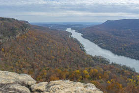
The Cumberland Trail, a work in progress that will be a 300-mile trail when completed, has its southern terminus at Signal Point in the Chattanooga metro area. One of the Cumberland Trail's most spectacular sections is its very first one as it traces the rim of the Tennessee River Gorge, visiting outstanding views at Signal Point and Edwards Point as well as a unique geological formation known as Mushroom Rock at the edge of the Suck Creek Gorge. Beside the Cumberland Trail, several lesser-used trails give hikers the option to turn a hike to Edwards Point into a full-day loop with additional sights. Most notable is a spectacular half-mile section of the Orange Trail as it follows a remote and rugged bluff line in the Middle Creek Gorge. This hike occurred on Saturday, November 25th, 2017. My plan was to hike a loop from Signal Point that would follow the Cumberland Trail past Edwards Point all the way to Mushroom Rock, from where I would follow the Mushroom Rock Trail, Blue Trail, Orange Trail, and Bee Branch Trail back to Signal Mountain. After coming out at Ohio Avenue, I would conclude the hike with a short roadwalk through the town of Signal Mountain to Signal Point.
2 Comments
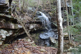 If there ever was a hike that you must absolutely not miss, no matter where you have hiked or are planning to hike, then this is it. As my personal favorite hike on the Cumberland Trail (at least to this date), this is one segment of the famous long-distance trail that has just about everything that you can find on the Cumberland Plateau, from tall bluff lines that stretch on for miles, to spectacular vistas of one of the area's most picturesque gorges, Chickamauga Gulch, to remote waterfalls set in some of the best settings I've yet to see in this area. This is truly one spectacular hike by all means. This hike occurred on Saturday, January 16th, 2016. My plan was to hike the Cumberland Trail from the trailhead on Montlake Road to Panther Branch Overlook. However, due to time-consuming photography of the countless points of interest on this hike, as well as to the extremely rugged and slow nature of the latter part of the hike, I was only able to reach Stevenson Branch Falls. That was okay with me, however, as I have hiked the excellent section of the Cumberland Trail north of Stevenson Branch Falls, and the section to the south, that I hiked on this day, proved to be even more spectacular. 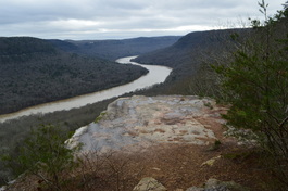 The Tennessee River is Tennessee's grand river. Near the city of Chattanooga, the river carves a passage through a deep gorge before becoming Nickajack Lake. On this hike atop a finger of the Cumberland Plateau that juts out into the Tennessee River Gorge, you will see several vistas of the river, a bizarre geological formation called the Natural Bridge, and a number of wet-weather waterfalls - they really are invisible, unless you happen to hike the trail in the middle or after a notable flooding event. Expect quite a workout curving throughout countless hollows before arriving at Ransom Hollow Overlook, one of the best vistas on the southern Cumberland Plateau. This hike occurred on Saturday, December 26th, 2015. My plan was to hike the Pot Point Loop clockwise from the Snoopers Rock Trailhead. Cumberland Trail: Shut-in Gap Road (East Trailhead) to White Pine Cascades, Spring City, Tennessee4/21/2015 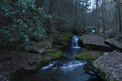
The Piney River is one of the larger waterways that the Cumberland Trail intersects or follows. Amidst its large watershed, the Cumberland Trail visits five cascades and waterfalls, and also provides excellent water views. In addition, visit Twin Rocks Overlook and make a fun rock scramble to reach the views at the top. This hike occurred on Saturday, March 28th, 2015. My plan was to hike the Cumberland Trail from the Piney River/Shut-in Gap Road Trailhead to at least White Pine Cascades with a side trip to Twin Rocks Overlook. Time permitting, I would continue all the way to the western Shut-In Gap Road Trailhead.
 The Cumberland Mountains is the Cumberland Plateau with a twist - the same canyons but higher elevations and better views. Frozen Head State Park has some of the best the Cumberland Mountains have to offer: two waterfalls and a fire tower with panoramic views. This hike occurred on January 24th, 2015. My plan was to hike the Panther Branch Trail to North Old Mac Trail, and take the North Old Mac Trail to Frozen Had Lookout Tower. Along the way, I would stop at DeBord Falls and do the spur trail to Emory Gap Falls. From the Lookout Tower, I would return by Lookout Tower Trail back to the main park road, and then follow it back to the trailhead. 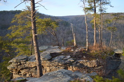 The Three Gorges segment of the Cumberland Trail is a very beautiful area, part of the Bowater Paper Company's former lands. The three main gorges on this segment of the Cumberland Trail get better in succession from south to north. It starts with the Soddy Creek Gorges, which are the only ones I haven't visited yet on this section (although I heard that they are not very interesting with few attractions). Just to the north, the Possum Creek Gorges are considerably more scenic, with more waterfalls and a few small views. The best of the three is Rock Creek Gorge, described in this post. The Rock Creek Gorge is full of pristine wilderness with many small cascades and outstanding views of the gorge from multiple viewpoints on the east rim. This hike occurred on Saturday, December 20th, 2014. My plan was starting from the Retro-Hughes Trailhead to hike the Cumberland Trail north into the Rock Creek Gorge. Once I would get to the end of the current Cumberland Trail section here, I would complete the short Rock Creek Loop with the side trip to the outstanding views from Leggett Point, then return the way I came on the Cumberland Trail. 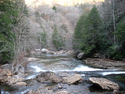 The Southern Cumberland Plateau is an incredibly scenic area. There's dozens of scenic gorges, full of waterfalls and rugged cliffs. North Chickamauga Creek Gorge is one of my ultimate favorites in this area after doing this hike. The rugged mountain streams in this gorge have beautiful waters, the gorge floor is incredibly beautiful, and the views of the upper section of the gorge are.... simply amazing. This hike occurred on Saturday, November 22nd, 2014. My plan was to start this hike from the gate at the end of the open Barker Camp Road, and follow Barker Camp Road on foot to the old turnaround. From there, I would follow an old jeep road to the Cumberland Trail, and take the Cumberland Trail south into North Chickamauga Creek Gorge. Before plunging into the gorge, I would stop at Panther Creek Overlook. Once in the gorge, I would ford Cooper Creek and reach the destination at Stevenson Branch Falls. My original destination was Boston Branch Overlook, but by seeing how much time it took to reach Stevenson Branch Falls, and seeing the deteriorating nature of the trail after Stevenson Branch Falls, I had to cut my plans by some. 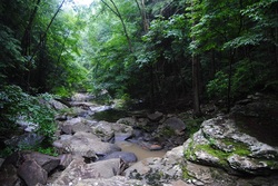 The Cumberland Trail. It's a beautiful trail, and the more I hike it, the more I like it. The Cumberland Plateau is the southern section of the Appalachian Plateau, and it covers Eastern Kentucky, Central Tennessee, portions of Northeast/Central Alabama, and a small portion of Northwest Georgia. The Plateau is littered with many sandstone outcroppings and bluffs, which in my opinion, give the Cumberland Plateau its characteristics. The Cumberland Trail, when it will be finished, will follow the eastern rim of the plateau known as Walden Ridge throughout Tennessee. The trail begins at Signal Point near Signal Mountain, Tennessee and ends at Cumberland Gap National Historic Park near Cumberland Gap, Kentucky. While many of its sections are under construction or even not planned out, it still provides great section hiking opportunities, and remains one of my personally more favorite long distance hiking trails. While the AT (Appalachian Trail) is much more grand from most hikers' point of view, the lesser traveled CT is in no way less attractive, and in some cases, rivals the AT. This hike occurred on Saturday, June 21st, 2014. My plan was to start at the Cumberland Trail parking pullout on Heiss Mountain Road near TN State Route 111, and to follow the CT through the Blanchard Creek Gorge. Following that, I would ascend to Bare Point, and then descend into the Big Possum Creek Gorge, only to ascend to Perkins Point. From Perkins Point, I would descend into the Little Possum Creek Gorge before reaching Imodium Falls. I would return the same way. 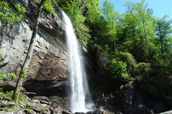 The Cumberland Trail is a beautiful trail. While it is not fully completed yet, each of its sections is quite beautiful, and I enjoy each of my hikes along the trail. The Cumberland Trail follows the Cumberland Plateau in Central Tennessee, and it has both waterfalls and scenic views. The unique geography of the Cumberland Plateau always makes the hikes interesting. There are dozens of small but steep gorges, and there's rocks everywhere. This hike occured on Saturday, May 3rd, 2014. My plan was to hike a portion of the Cumberland Trail in the Laurel-Snow Pocket Wilderness. I planned visiting Laurel Falls and Bryan Overlook, and then go up the opposite side of the gorge to Buzzard Point Overlook. While there were a couple unexpected things throughout the hike, my plan got fulfilled. 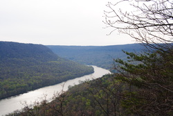 The Cumberland Trail is a state trail of Tennessee. It runs around 300 miles from its southern terminus at Signal Mountain, TN, to its northern terminus at Cumberland Gap, TN. It is not fully completed yet, but a lot of sections are open. It passes over the Cumberland Plateau of Tennessee, and is a very beautiful trail. I hope to hike many sections of it in the future. One of the most beautiful sections of it was the Tennessee River Gorge, my destination for this hike. This hike occurred on Saturday, April 5th, 2014. My plan was to hike the Cumberland Trail from its southern terminus at Signal Point Overlook to Edwards Point Overlook, and then return the same way. |
About MeMark Oleg Ozboyd Dear readers: I have invested a tremendous amount of time and effort in this website and the Georgia Waterfalls Database the past five years. All of the work that has gone in keeping these websites updated with my latest trip reports has almost been like a full-time job. This has not allowed me to pick up a paid job to save up money for college, and therefore, I I've had to take out loans. If you find the information on this website interesting, helpful, or time-saving, you can say "thanks" and help me out by clicking the button above and making a contribution. I will be very grateful for any amount of support you give, as all of it will apply toward my college tuition. Thank you!
Coming in 2022-2023?
Other Hiking WebsitesMiles HikedYear 1: 540.0 Miles
Year 2: 552.3 Miles Year 3: 518.4 Miles Year 4: 482.4 Miles Year 5: 259.9 Miles Archives
March 2021
Categories
All
|

 RSS Feed