Chattahoochee National Forest: Lower & Upper Chinquapin Falls and Hickory Knob Falls, Helen, Georgia7/12/2017 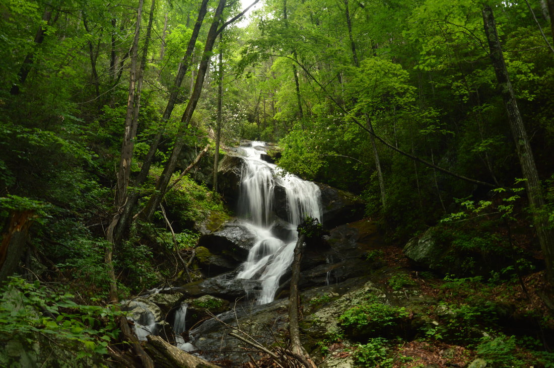
Chinquapin Branch is one of the streams that drain the Tray Mountain area near Helen. Beginning high in the Tray Mountain Wilderness, Chinquapin Branch passes over a tall cliff, crosses Tray Mountain Road, and then forms several more waterfalls. Cascading 200 feet partially out of sight, Lower Chinquapin Falls is the biggest waterfall of them all. Seeing the lower and middle waterfalls on Chinquapin Branch necessitates significant scrambling on an unmaintained trail, but intrepid hikers who hike the entire route will be rewarded with two pristine waterfalls on Chinquapin Branch and a third one on a tributary. This hike occurred on Saturday, June 24th, 2017. My plan was to follow an abandoned trail along Chinquapin Branch to Lower and Upper Chinquapin Falls, although I would only be able to view part of the Lower Falls. Along the way, I would make a side trip to Hickory Knob Falls on an unnamed tributary of Chinquapin Branch. Rather than returning the same way, I decided to hike off-trail to Tray Mountain Road from Upper Chinquapin Falls and then return along the road.
Summary
R/T Length of Trail: 4.4 Miles
Duration of Hike: 5:00 Type of Hike: Loop (Out and Back option is shorter but but probably more time-consuming) Difficulty Rating: 5 out of 10 Total Elevation Gain: 1286 Feet Pros: Remote and pristine setting along Chinquapin Branch and its waterfalls Cons: Portions of the trail to the Chinquapin waterfalls are heavily obscure or non-existent Points of Interest: Hickory Knob Falls - 5 stars (can vary depending on recent rainfall); Lower Chinquapin Falls - 8 stars; Upper Chinquapin Falls - 7 stars Trail Blaze Colors: None, not an official trail Best Seasons to Hike: Winter Fees: None Beginning Point: Campsite off Tray Mountain Road (Chimney Mountain Road) Directions from Helen, GA: From the intersection of GA 75 and GA 356 just north of downtown Helen, take GA 356 East and follow it for 5.2 miles. Then, turn left onto Chimney Mountain Road. After 0.1 miles, turn right to continue on Chimney Mountain Road. In another 1.8 miles, continue straight onto FS Road 79. This is known both as Chimney Mountain Road and Tray Mountain Road. A "Rough Road" sign is placed at the beginning of the road. Continue on this road for 0.7 miles to the parking area, which will be on the left at the junction of a rough side road to a campsite. There is space for two cars here without blocking the side road. It is not recommended to park in the campsite, but it is a large one, so if the space at the main road is full, then you should drive down the side road and find a place to park. There are a few large mud holes along Tray/Chimney Mountain Road but they should be navigable for most passenger vehicles unless it has rained a lot recently. Map
Click here to download a track of this hike.
Details
Anyone who studies topo maps will see the extreme elevation change that occurs on Chinquapin Branch in a short period of time as it drops off Tray Mountain. It's no wonder that there are several waterfalls in this short stretch of creek. Three distinct waterfalls are located below Tray Mountain Road - although one is hard to reach and probably not worth the effort - and there is also a waterfall above Tray Mountain Road that I have not been to. Chinquapin Branch is kindof like a miniature version of the much more expansive Left Fork Soquee River watershed just to the east, which also has waterfalls and perhaps even more of them. This trail report will describe the access to the two best waterfalls on Chinquapin Branch below Tray Mountain Road, as well as a tall waterfall on a smaller tributary. Even though a trail of sorts accesses the waterfalls, the trail has mainly been used by hunters and has fallen into disrepair. While portions of the trail are intact and easy to follow, there are also portions that are completely non-existent and obscured by downfall; nevertheless, this isn't a difficult hike relative to off-trail, as bushwhacking is minimal.
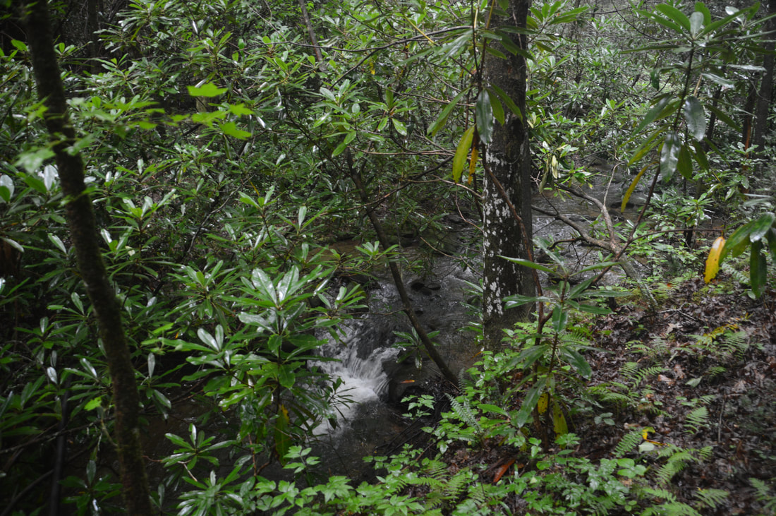
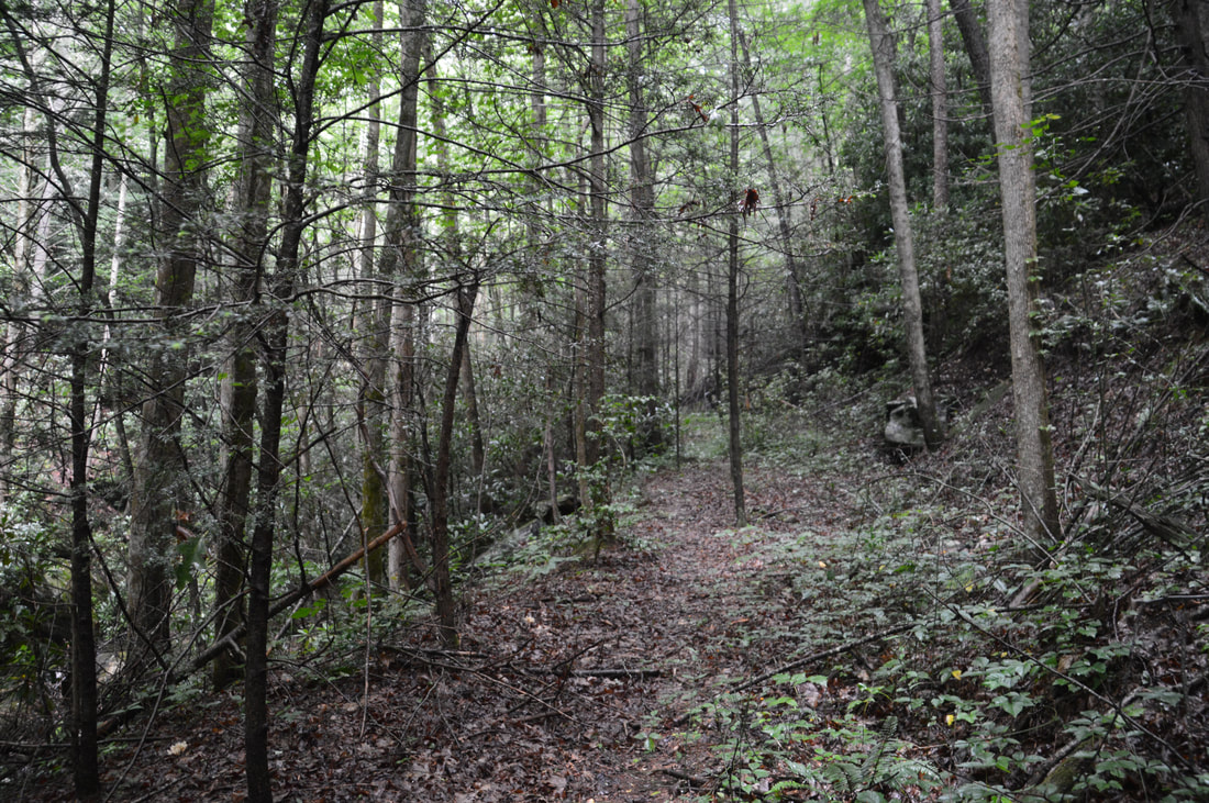
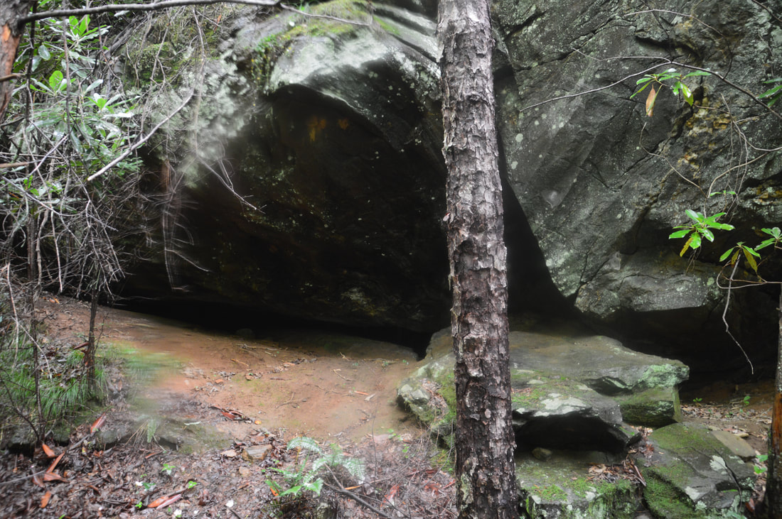
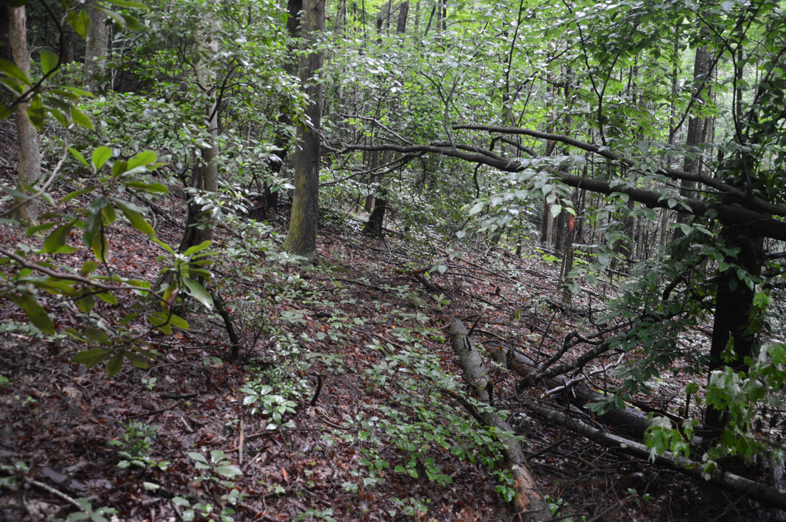
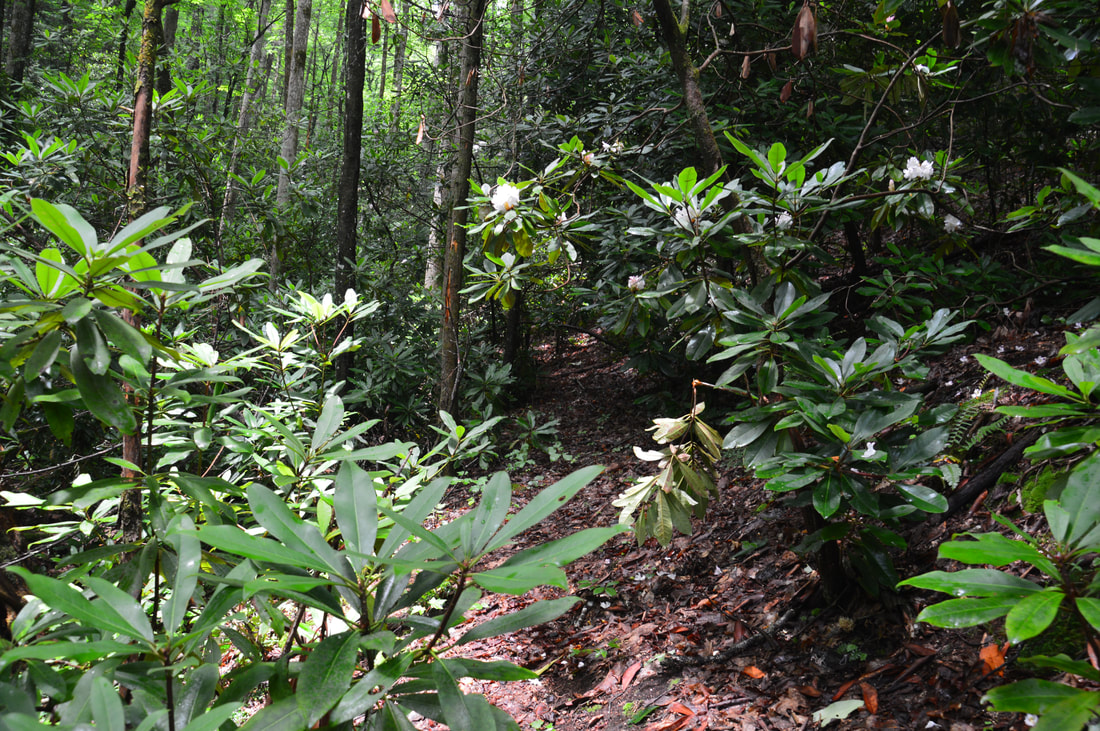
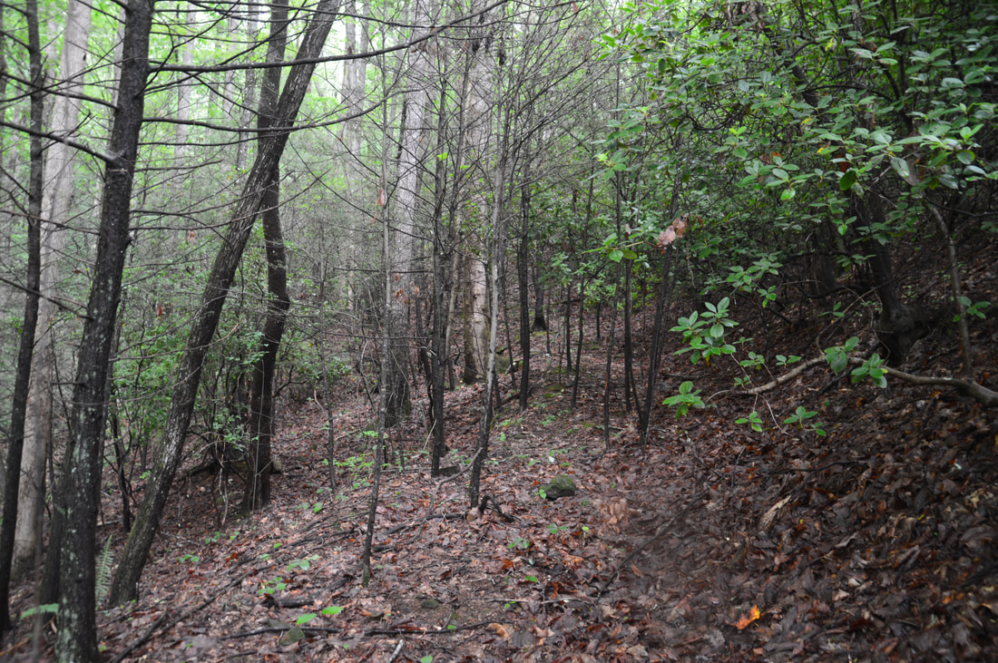
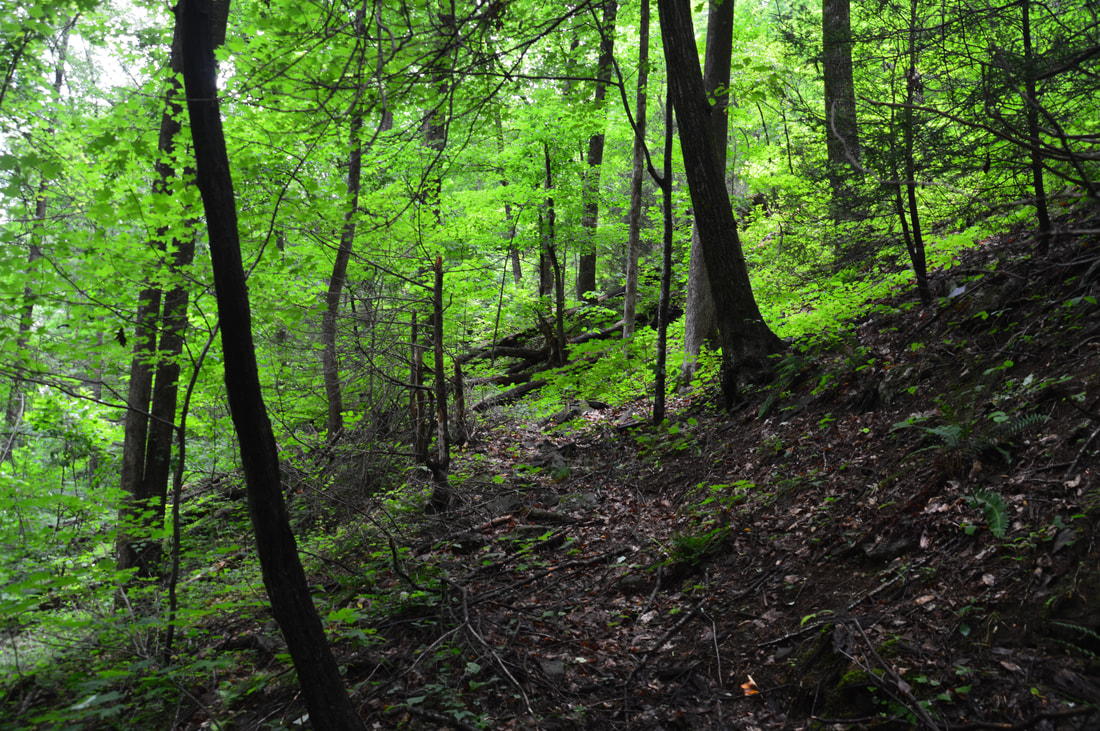
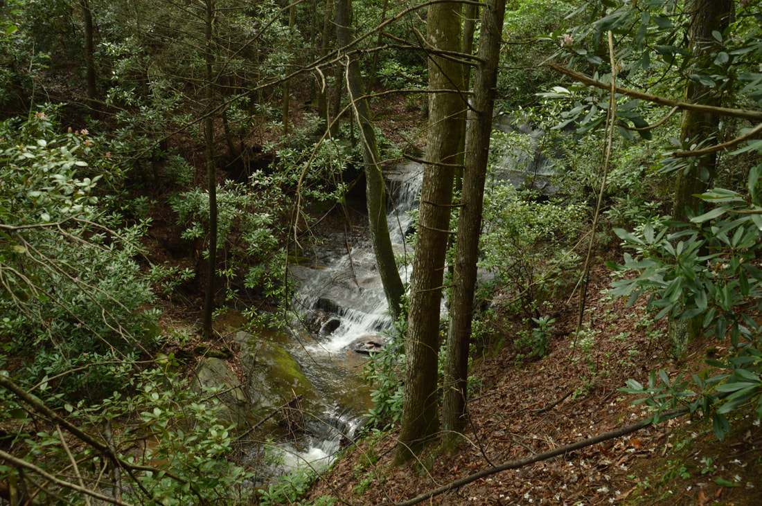
Begin the Chinquapin Branch hike by following the side road from Tray Mountain Road through the campsite. At the far end of the campsite, you will reach McClure Creek at or just above its confluence with Chinquapin Branch. Cross McClure Creek here and pick up an old logging road/path on the right (north) side of Chinquapin Branch (NOT McClure Creek). Even though there are a few downed trees on this old road, the path along it is easy to follow as it slowly ascends along the cascading Chinquapin Branch. At 0.35 miles, there is a 15-foot cascade on Chinquapin Branch down to the left. It is not very big or scenic but worth the quick scramble down if you have extra time. Meanwhile, the main trail passes a small rock shelter on the right around the same point. At 0.5 miles, near the confluence with Hickory Branch, the old logging road ends and the trail disappears. It may look tempting to cross Chinquapin Branch here, but that isn't the best thing to do; instead, you should bear right on the same side of the creek. The next 0.1 mile is the hardest part of the hike, because you will have to follow the route of least resistance along a steep slope with few signs of a path. I got stung by yellow jackets in this area when I did this hike. Around 0.6 miles, the slope moderates greatly and the route continues into gently sloping flats above Chinquapin Branch. While as of this writing the path was still absent much of the time, hiking through the open woods in this area is pretty easy, besides occasional blowdowns and scattered wooden debris. Remember that you should always be following Chinquapin Branch upstream, although the creek will be out of sight often. Around 0.7 miles, the route bends away from the creek briefly to cross a hollow. At 0.8 miles, reach a kindof obvious left turn onto a slightly more distinct path. When I did this hike, there were the remains of blue flagging tape on the ground at the turn. After the turn, the path comes much closer to Chinquapin Branch and begins to closely follow it. You may not see or hear it, but the unnamed tributary flowing from Hickory Knob joins Chinquapin Branch near the point the path rejoins the main creek. Thus, to see Hickory Knob Falls, it is best to turn left at 0.9 miles and cross Chinquapin Branch (even though there is no obvious path on the other side). The best place to cross is about 150 feet after the path comes to the creek. The crossing was dry on this day, but it will be a wet one if the water is up. 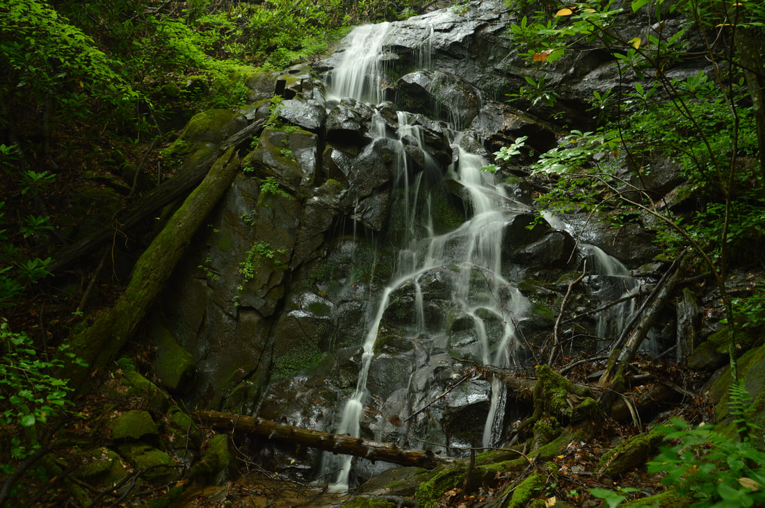
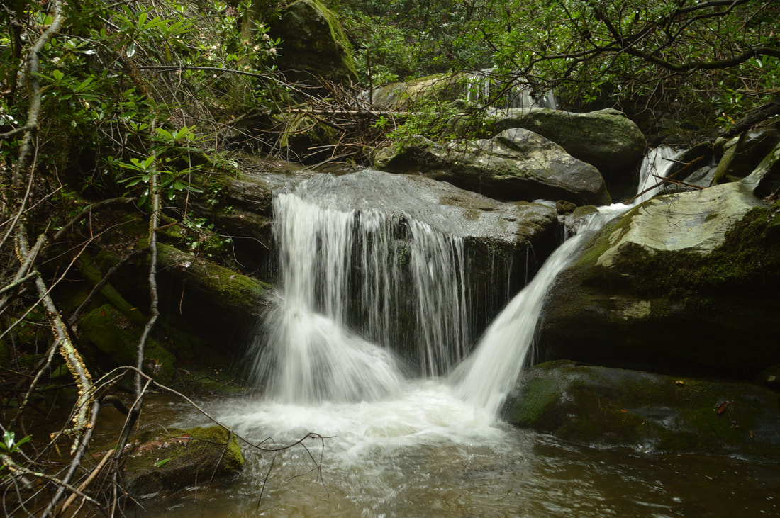
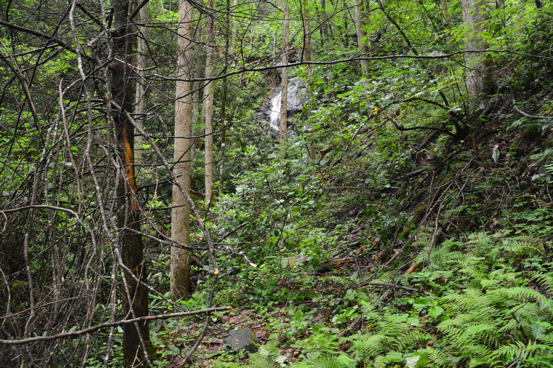
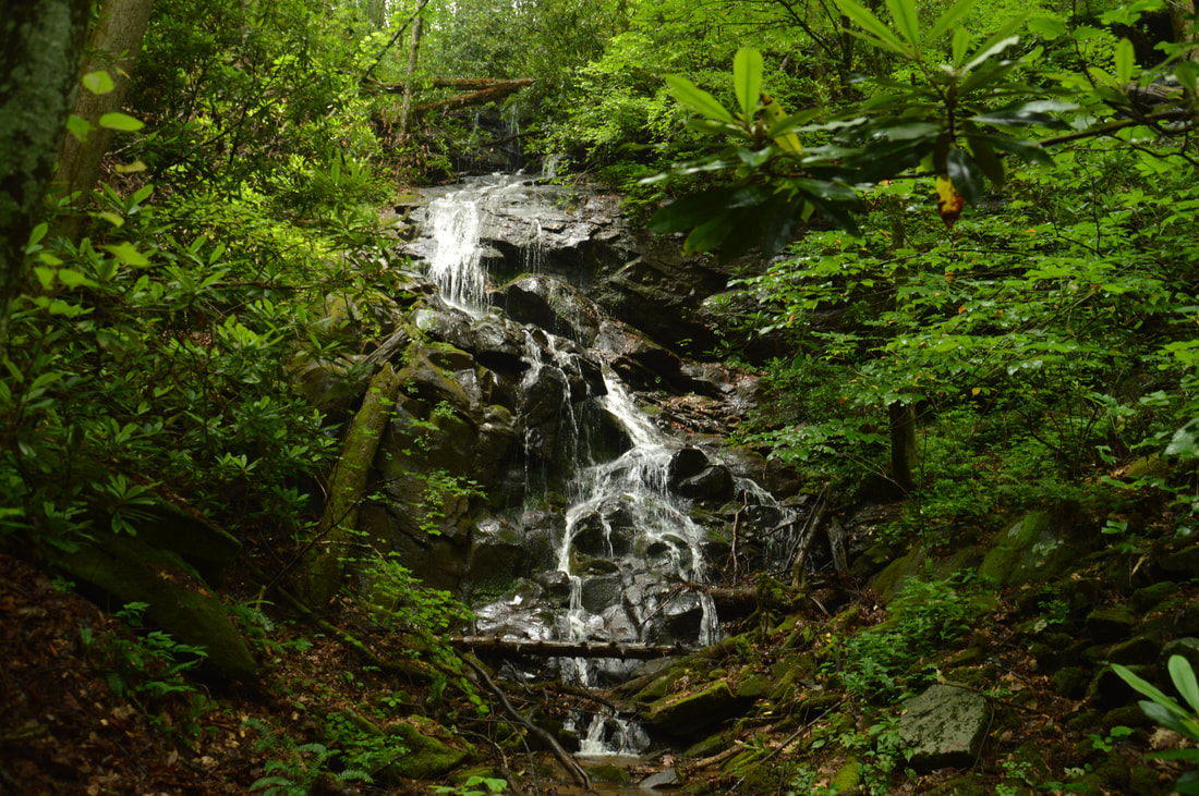
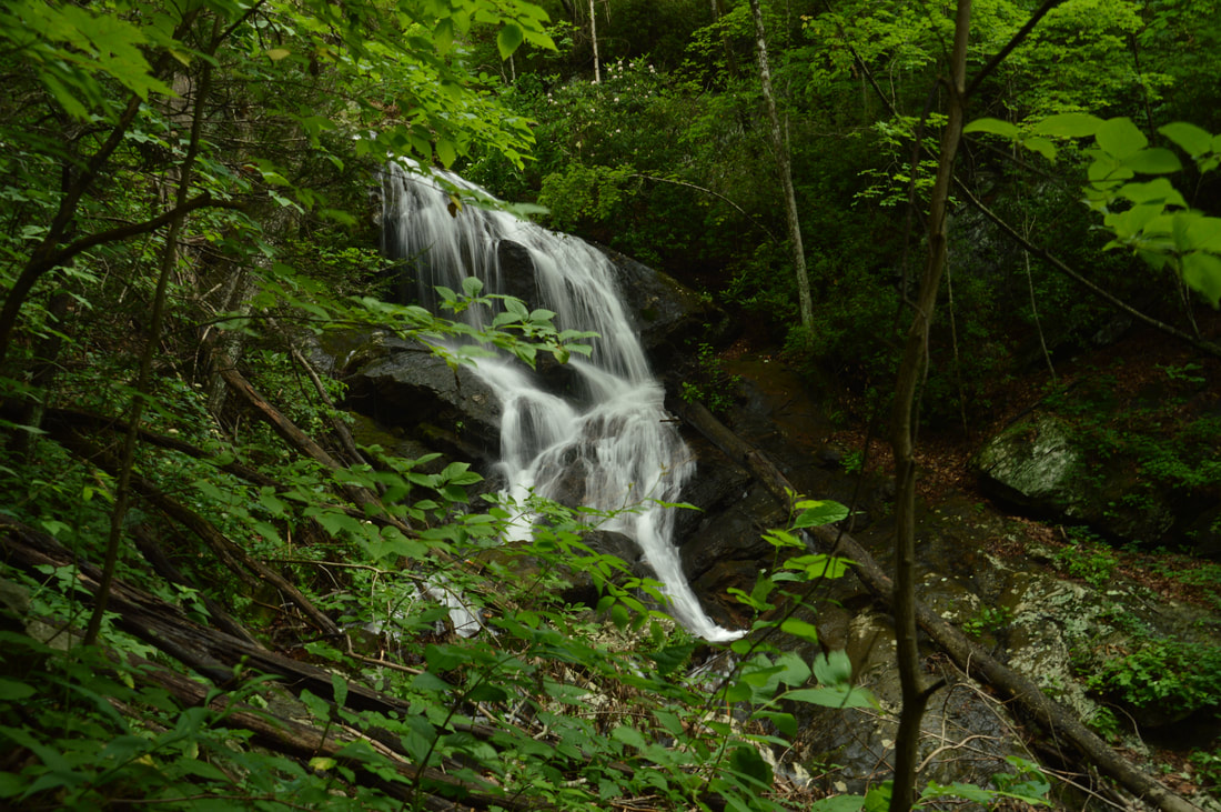
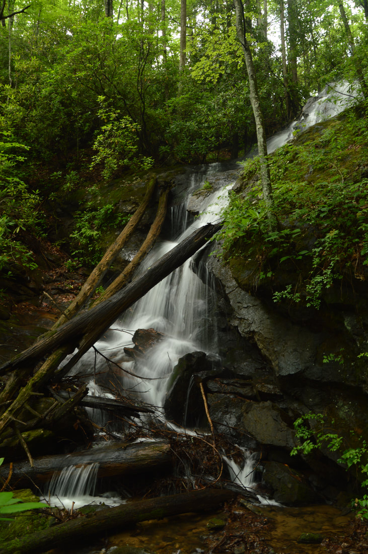
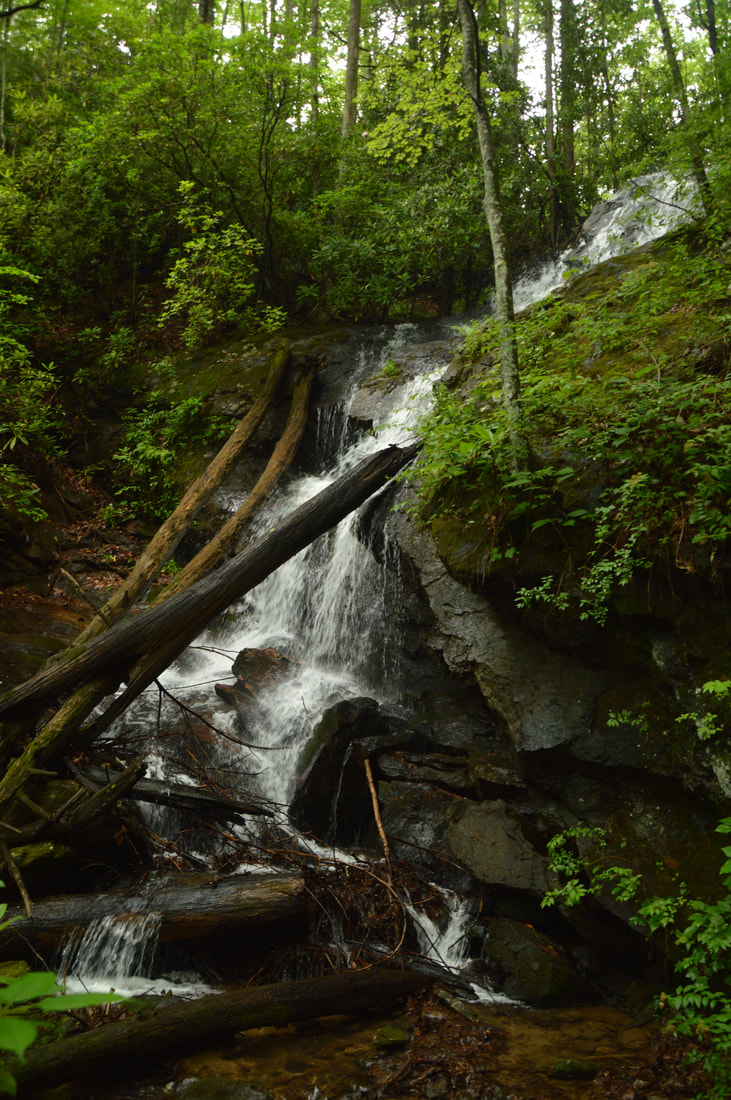
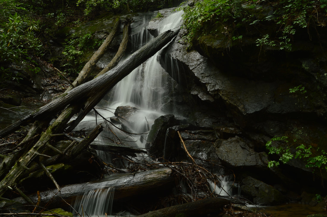
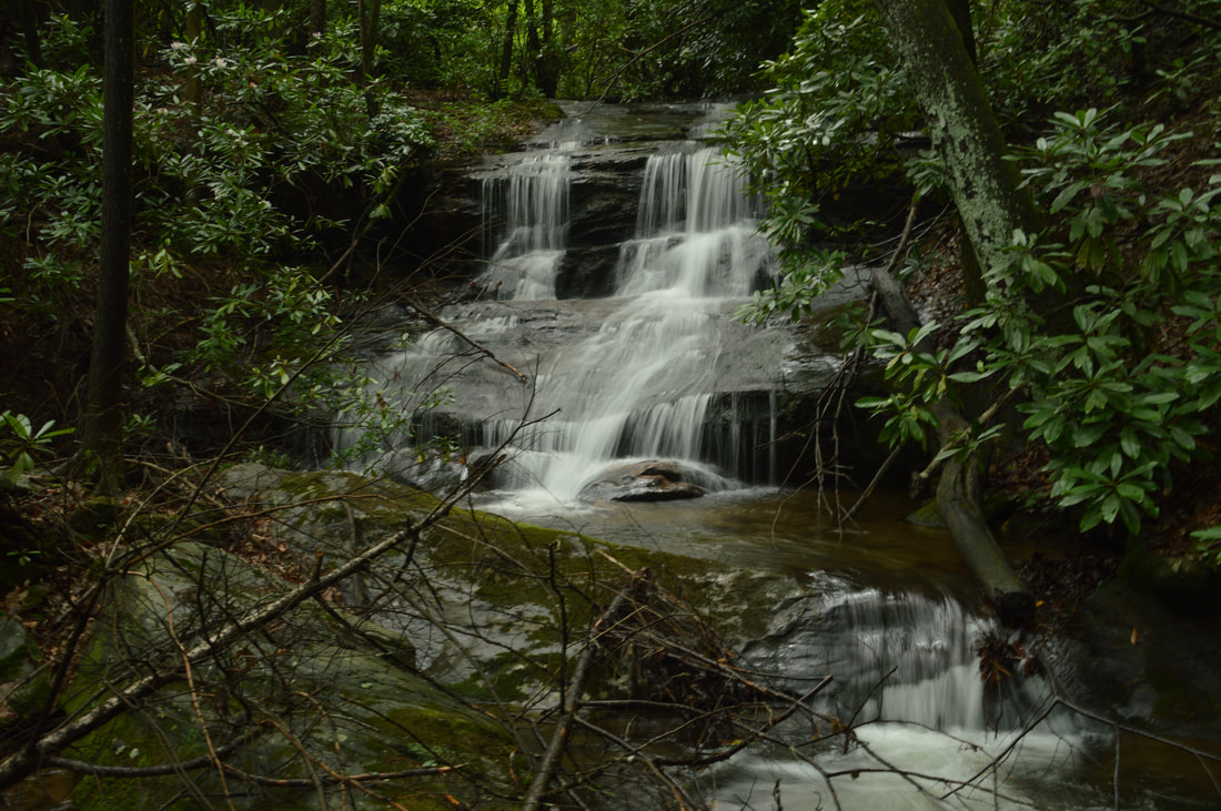
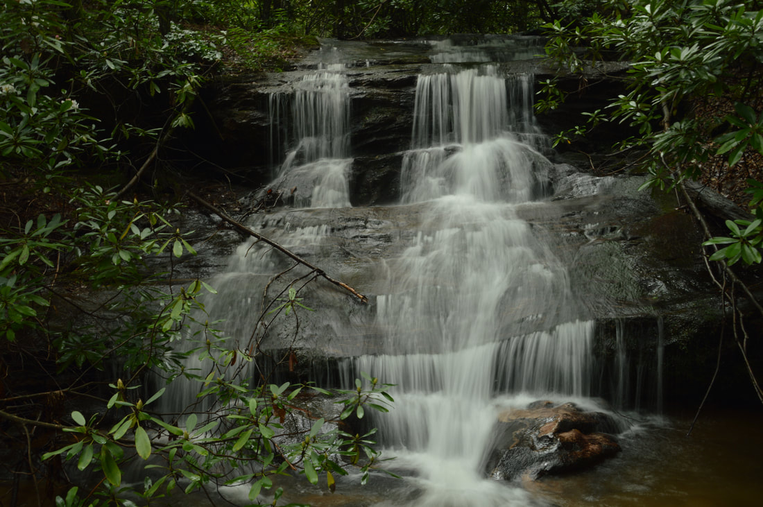
Despite its low volume, the numerous trickles of 70-foot Hickory Knob Falls make it quite photogenic and a nice bonus to the Chinquapin Falls hike.
On the other side of Chinquapin Branch, head in a straight line away from it. In 100 feet, bear right onto an old logging road/trail that ascends alongside the unnamed tributary. Expect to work your way through a few sizable blowdowns along the trail on the way to the falls. The trail ends at Hickory Knob Falls at 1.0 miles. For the best view, you will have to cross the stream.
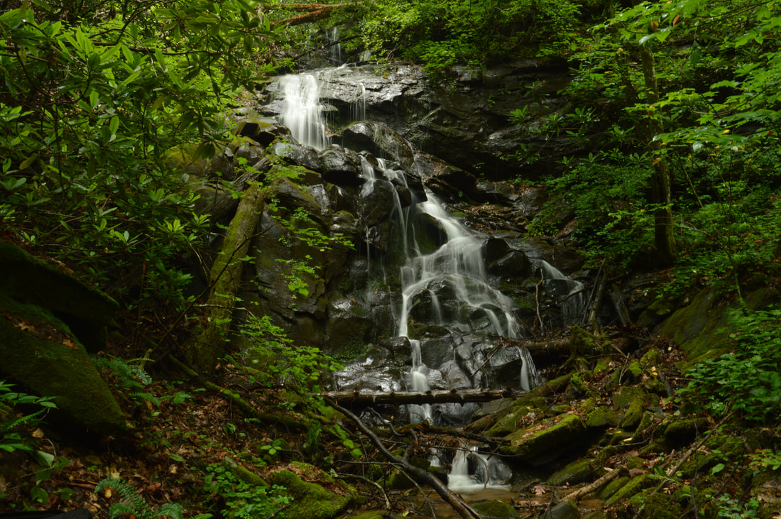
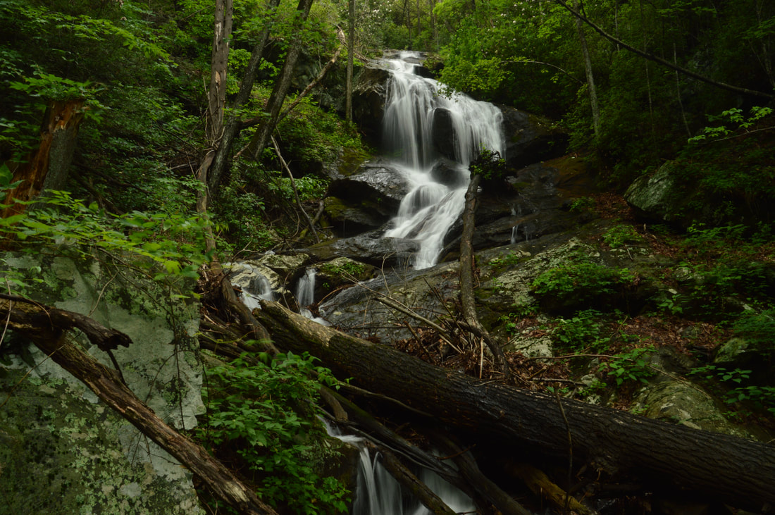
Having looked on Google Earth and Google Terrain, I knew that a waterfall was on this tributary but I didn't expect it to be this big. When I was planning my Chinquapin Falls hike, I was considering taking a brief look at the tributary until I got a note from local waterfall hunter Greg Ford with a picture of a massive waterfall on the tributary just below Lower Chinquapin Falls. This waterfall immediately jumped up my list, and I was not disappointed. Greg and I decided that this previously undocumented waterfall needs a name, so we christened it Hickory Knob Falls, as the unnamed stream it is on originates on the slopes of Hickory Knob. Thanks Greg for telling me about this waterfall and leading the way to it and Lower Chinquapin Falls! Hickory Knob Falls is 70 feet high, but the main tier is around 55 feet. It begins with a short slide and free-fall, followed by a turn in the water flow and a very photogenic trickling cascade down the broad rock face. The barely-visible 15-foot upper tier tucked away at the top of the falls adds beauty to the scene. The lower part of Hickory Knob Falls is great for isolation pictures, especially during the higher flow of winter. Pictures taken on a cloudy day will best illustrate the beautiful rock slabs of Hickory Knob Falls. From Hickory Knob Falls, return to the path on the east side of Chinquapin Branch, recrossing the stream. Briefly follow it upstream (less than 100 feet) and then find a good place to cross Chinquapin Branch again (back to the left-hand west side) for the side trip to Lower Chinquapin Falls. The best place to cross is just below a point where a hollow comes in from the right (before the slopes ahead steepen significantly). Now on the west side of Chinquapin Branch, you should follow the obvious route upstream - a steep path that appears to have once been a skid path for loggers. Around 1.2 miles, Lower Chinquapin Falls begins to come into view (this view is especially impressive in winter). Even though Lower Chinquapin Falls isn't a single-tier waterfall, its height and steep length make it an imposing sight. When the path ends at one of the lower sliding cascades of the falls, continue scrambling up the mostly open hillside on the left side of the creek to a view of the main free-falling drop of Lower Chinquapin Falls from a large boulder at 1.25 miles. 
A connection exists between Lower and Upper Chinquapin Falls in the form of a clearly-defined path with only a few blowdowns,
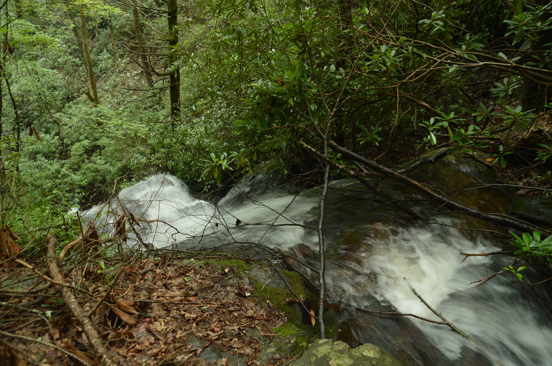
What makes Lower Chinquapin Falls (and the Chinquapin waterfalls as a whole) so great is the overall setting and the endless cascade, rather than any particular part of it - although the free-fall part of Lower Chinquapin Falls is the best section of the run. My visit to Chinquapin Branch was during summer. Even though the flow was slightly above summertime averages, I have no doubt that Lower Chinquapin Falls will be even more striking during regular winter flow. When the flow is good, several healthy ribbons of flow plunge down the free-fall section of Lower Chinquapin Falls. It is hard to gauge the height of the waterfall due to how long the whole run is. Starting from the top of the sliding cascades just above the free-fall and ending with the lowermost sliding drop, the height of Lower Chinquapin Falls would be about 100 to 120 feet. Immediately above and out of sight is another set of steep slides and cascades that totals to another 100 feet of falling water, and depending on your point of view, it could either be considered as part of Lower Chinquapin Falls or as Middle Chinquapin Falls. Either way though, Middle Chinquapin Falls is hard to reach because the trail does not pass it, so I suggest focusing your attention on the lower and upper falls.
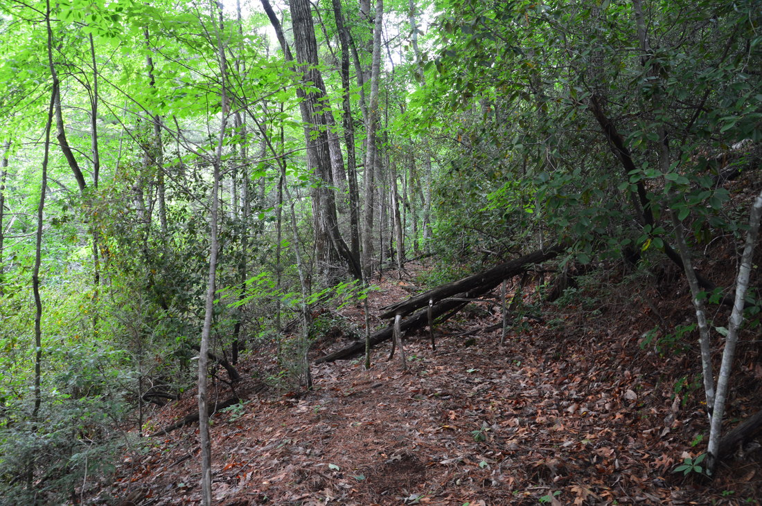
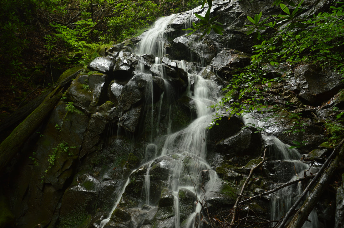
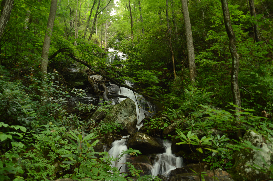
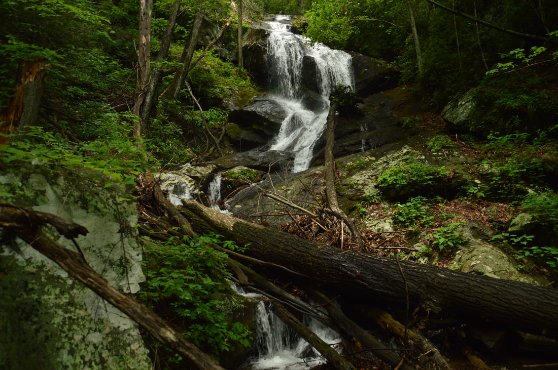
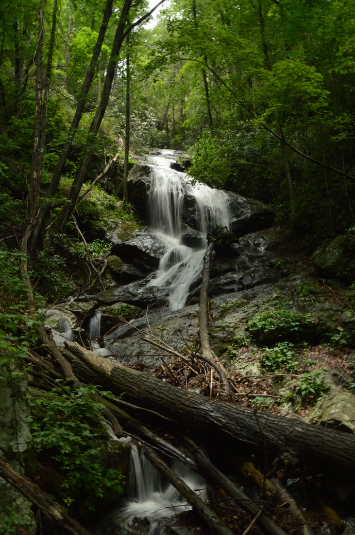
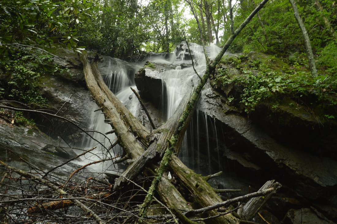
From Lower Chinquapin Falls, return to the creek crossing and the main path at 1.35 miles. Actually, the main path appears to end right around the crossing. What you have to do to reach Upper Chinquapin Falls is scramble up the steep slope eastward, away from the creek and the previous path. After about 150 feet, reach an old logging road with a distinct path and turn left onto it. With the exception of the final scramble, the rest of the hike to Middle Chinquapin Falls follows this old road. The road ascends steadily as it turns into a hollow well away from Chinquapin Branch to bypass the lower waterfalls. Around 1.45 miles, the path briefly narrows, detouring an obliterated section of the old road. At 1.6 miles, the path turns to the left at a switchback, crossing the hollow and heading back toward Chinquapin Branch. Shortly afterwards, there was a series of blowdowns at the time of this writing, the largest of which at 1.65 miles included four trees! Now well above the lower and middle falls, the trail curves back into the Chinquapin Branch gorge at 1.75 miles. You will hear a lot of crashing water below, and if you wish to attempt to see the middle falls, this would be the best place to do so, but I have not field-checked the route. At 1.8 miles, you should see part of Upper Chinquapin Falls to the left of the trail, and the best point to scramble to the base is when you can see a bit of the waterfall. Keep in mind that if you reach a pretty 20-foot cascade easily visible from the trail, you have just passed Upper Chinquapin Falls. The scramble to the base is pretty steep but through open woods. Upper Chinquapin Falls isn't as tall as its bigger brother downstream, but nevertheless, this 55-foot waterfall is still worthwhile. The waterfall begins with a sliding cascade that is followed by a short free-fall and another cascade with a jumble of fallen trees and branches. Actually, the falling water continues below the viewing area, with the creek dropping another 25 to 30 feet before briefly leveling out, but there isn't a good way to see that part. A unique feature of Upper Chinquapin Falls is a row of cliffs parallel to the creek on the right side of the waterfall. While the cliffs add beauty to the setting, there isn't a good way to include them in a picture and still represent the waterfall itself well. Actually, Upper Chinquapin Falls is quite difficult to photograph anyway, because the height is greatly distorted in pictures taken right at the base. The best angle for photos was slightly up the slope to the right. Also, Upper Chinquapin Falls is best represented in vertical photos that distort its dimensions less. 
The lower tier of 55-foot Upper Chinquapin Falls
You have two options at Upper Chinquapin Falls. One of them is to simply retrace your steps back to the trailhead, which would get you back to your car at 3.4 miles. Personally though, I don't believe this is the better choice, because working your way through some of the debris on the trail twice may not seem like fun. In my opinion, a better choice is to continue following the trail - which morphs into open woods that are easy to traverse - and connect to Tray Mountain Road, which is then easily followed downhill back to the trailhead. I think that this is a faster route, but it involves about 400 extra feet of elevation gain, so keep that in mind. To hike the route to Tray Mountain Road, return to the main trail and continue following it past the very photogenic 20-foot cascade above Upper Chinquapin Falls. It is worth the brief scramble down to the cascade, but make sure to be very careful around the top of the main falls which is only a few feet away. Shortly after the cascade, the creek flattens out and the trail sortof disappears. However, there is an easy route: simply bear right into a hollow/nearly level gully, leaving the creek at 1.9 miles. You will enter increasingly thinner woods that make for easy walking. The ascent begins fairly easy, but at 2.1 miles, the ascent quickly steepens at a split in the gullies. Bear left to stay in the left-hand gully (it is very open), which leads toward Tray Mountain Road. You will ascend 200 feet in the next 0.15 miles along the obvious route. At the top of the hill, simply continue in a straight line when the gully disappears and you will reach a distinct path at 2.25 miles. Turn left onto the path, which descends gently past a camping area. The path morphs into an ATV trail with several jeep mounds before ending at Tray Mountain Road in a gap at 2.35 miles.
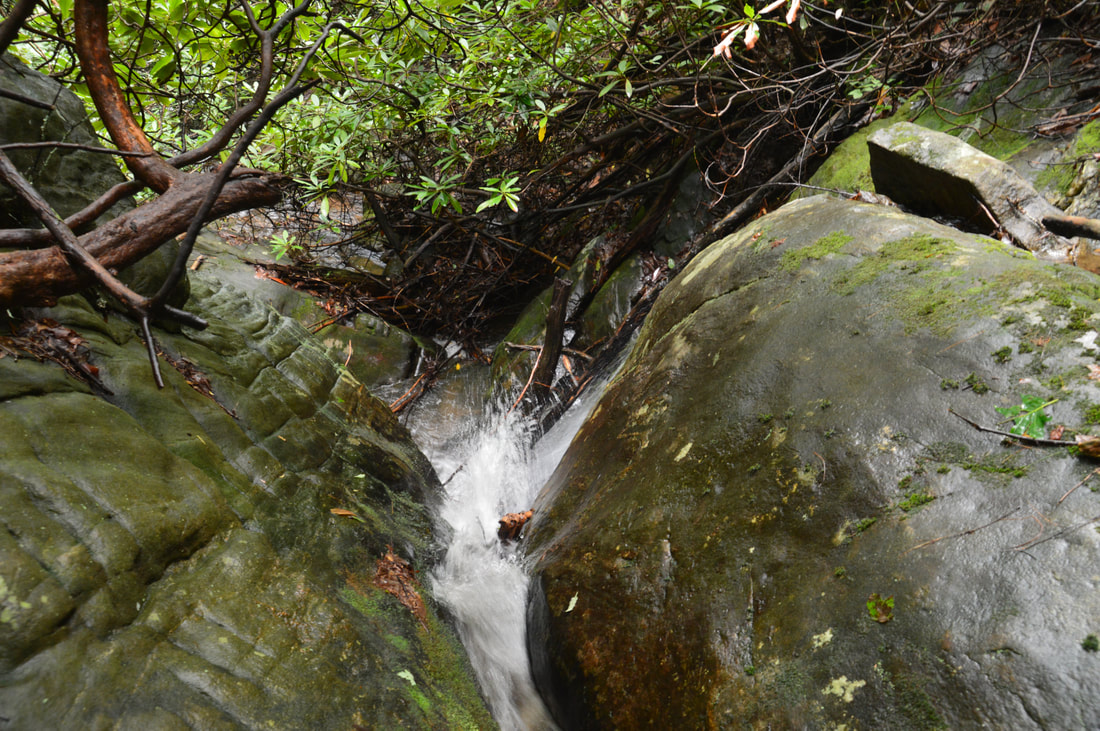
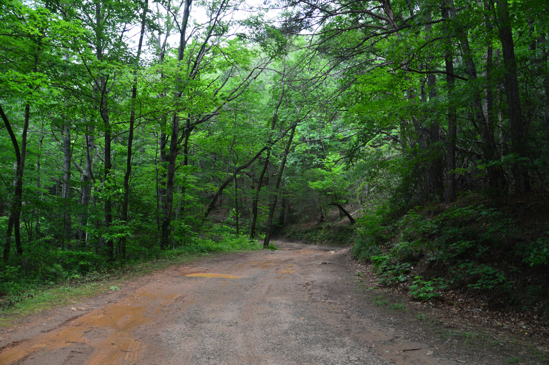
To return to your car, turn right onto Tray Mountain Road. The stretch of road to the trailhead is completely downhill. The road does not receive a whole lot of traffic, but it is popular with the four-wheel crowd due to its very rough state above Chinquapin Branch. At 2.6 miles, a cairn marks a path on the right to a pretty 30-foot roadside waterfall on the Left Branch of McClure Creek. During high flow, it may be worthwhile; I didn't take any picture as it was raining. At 2.85 miles, a well-defined old road on the left (with a small Tray Mountain Wilderness sign nailed to a tree) is the beginning of the Chimney Mountain Trail, a moderate hike with great views. There is another roadside waterfall on McClure Creek to the right at 3.75 miles, but I didn't see a good way to access the base and it may not be worth the effort. As the relaxing downhill gradually comes to an end, you will reach the trailhead and your car at 4.4 miles, concluding the hike. Mileage
0.0 - Chinquapin Branch Trailhead
0.35 - 15-Foot Cascade 0.5 - Logging Road End 1.0 - Hickory Knob Falls 1.25 - Lower Chinquapin Falls 1.8 - Upper Chinquapin Falls 2.25 - Highest Point on the Loop Hike (junction with trail to road) 2.35 - Tray Mountain Road 2.6 - Upper Roadside Waterfall (on Left Branch of McClure Creek) 2.85 - Chimney Mountain Trailhead 3.75 - Lower Roadside Waterfall (on McClure Creek) 4.4 - Chinquapin Branch Trailhead Variations
Hike out and back to Hickory Knob Falls and Lower Chinquapin Falls - 2.4 Miles
Hike out and back to Hickory Knob Falls, Lower, and Upper Chiquapin Falls - 3.4 Miles Bonus Stops
Accessed off Tray Mountain Road as well, Chimney Mountain is a great hike along an unofficial trail to viewpoints facing Mount Yonah and the Georgia Piedmont.
PicturesVideos
3 Comments
Greg Ford
7/20/2017 12:14:02 pm
Fantastic job Mark! For those of you who ventured to see these falls, you'll be incredibly blessed when you see just how dynamic they are. True hidden treasures that need to be explored!
Bill Solomon
6/22/2018 02:37:03 pm
Hi Mark,
Alex
9/19/2018 11:21:13 pm
I hiked this trail today. Recent blowdown made especially the side trip to hickory knob difficult. I am glad I took the loop instead of backtracking! Next time I will take my bf so I can safely explore lower chinquapin falls more and possibly skip the others! Great detailed report though, I only got mildly lost at the very end, missing the last distinct path to the road and ending up in brief rhododendron hell. Thanks for all your work! Leave a Reply. |
About MeMark Oleg Ozboyd Dear readers: I have invested a tremendous amount of time and effort in this website and the Georgia Waterfalls Database the past five years. All of the work that has gone in keeping these websites updated with my latest trip reports has almost been like a full-time job. This has not allowed me to pick up a paid job to save up money for college, and therefore, I I've had to take out loans. If you find the information on this website interesting, helpful, or time-saving, you can say "thanks" and help me out by clicking the button above and making a contribution. I will be very grateful for any amount of support you give, as all of it will apply toward my college tuition. Thank you!

Coming in 2022-2023?
Other Hiking WebsitesMiles HikedYear 1: 540.0 Miles
Year 2: 552.3 Miles Year 3: 518.4 Miles Year 4: 482.4 Miles Year 5: 259.9 Miles Archives
March 2021
Categories
All
|


 RSS Feed