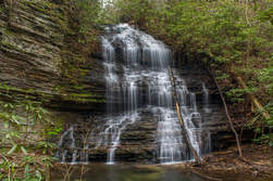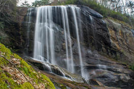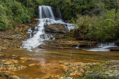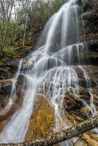
The 244-acre Rock Creek Gorge Scenic Area in Polk County is one of Southeast Tennessee's most spectacular natural areas. The Rock Creek Gorge is home to a jaw-dropping sixteen named waterfalls, spread across Rock Creek and several of its tributaries flowing off Chilhowee Mountain. All are scenic and many are tall. The only easily-accessible waterfalls are Rock Creek Falls, Benton Falls, and arguably Chestnut Mountain Falls. All of the others involve various degrees of creek-walking and/or bushwhacking. While one could visit all sixteen falls in one day, it will require a high level of physical capability and off-trail experience. Folks who chose to visit the waterfalls in several different trips will still be well-rewarded. The best time of year to visit the waterfalls of the Rock Creek Gorge Scenic Area is winter or spring, when the waterfalls are flowing more boldly and when the area is less overgrown. This hike occurred on Saturday, April 14th, 2018. My plan was to hike the Scenic Spur Trail from Highway 30 to Rock Creek Falls. I would follow a scramble path to Chestnut Mountain Falls. From there, I would begin the off-trail section of the hike by first visiting the waterfalls on Laurel Branch and then walking up Rock Creek past several waterfalls to the Slickrock Branch confluence. Next, I would bushwhack alongside Slickrock Branch out to the Rim Rock Trail, visiting more waterfalls along the way. I would then follow the Clemmer Trail to Benton Falls, also bushwhacking to Elora Falls and Silvermine Branch Falls. Finally, I would return to Highway 30 along the Clemmer Trail.
3 Comments

Adjacent to the popular Panthertown Valley hiking area lies a much-lesser-visited valley: the Flat Creek watershed. This remote area is home to two very scenic waterfalls on Flat Creek. The massive Flat Creek Falls is among the most spectacular and stunning waterfalls in the Southeast. Dropping as much as 200 feet in a series of powerful cascades, slides, and a huge free-fall, Flat Creek Falls evokes a sense of amazement among anyone who finds their way to its base. Flat Creek features a much smaller but equally notable waterfall as well: Nellie's Falls. Located a couple of miles upstream, Nellie's Falls is a very picturesque double-drop waterfall. The lush, tropical-like setting of Nellie's Falls - the long moss-covered rock slabs near the base of the falls, in particular - help to make it a very scenic destination. Both waterfalls can be seen in the same hike, which utilizes mostly old roadbeds and unmaintained paths. Although the majority of the hike to both falls is fairly easy, getting to the base of Flat Creek Falls involves a steep off-trail descent. This hike occurred on Saturday, April 7th, 2018. My plan was to hike out and back from the end of Rock Bridge Road first to Nellie's and then to Flat Creek Falls.

A major tributary of the Chattooga River, Scotsman Creek runs alongside Bull Pen Road and drops over three waterfalls on its way to the river. The highlight is Scotsman Falls, an impressive 45-foot waterfall where the stream first free-falls over a sheer ledge and then cascades down a stairstep rock face. Near the base of Scotsman Falls, the creek splits around a densely-vegetated island. As the forks rejoin, Scotsman Creek tumbles swiftly out of sight, shortly coming over the less scenic Lower Scotsman Falls before dumping into the Chattooga. A steep path leads to Scotsman Falls from Bull Pen Road. The path is quite short and easy to follow, although visitors will need to make a rough, muddy scramble at the end. This hike occurred on Saturday, February 24th, 2018. My plan was to hike out and back to Scotsman Falls before embarking on a longer hike along the Chattooga River Trail later in the day.
 Dozens of streams flow off the slopes of the Plott Balsam Mountains, a high, rugged range of peaks near Sylva. Most of these streams form multiple waterfalls as they cascade into the valleys, but few are as impressive as the pair of waterfalls on Buff Creek. First, Buff Creek comes over a massive cliff to form Upper Buff Creek Falls, a remote and stunning part-free-fall waterfall over 100 feet high. Even taller, Lower Buff Creek Falls comes next as the creek slides steeply down a long, broad rock slab. While the lower falls can look skinny in dry periods, the upper falls is gorgeous in almost any condition! Upper Buff Creek Falls is among the most beautiful waterfalls in southwest North Carolina, but access to it presents problems. Shortly after dropping over the lower falls, Buff Creek enters private property as it comes alongside Buff Creek Road. The only legal way to see the waterfalls is a long hike along old logging roads from the trail to Blackrock Mountain. I visited both waterfalls on Saturday, March 24th, 2018. This is not a typical trail report as I do not have enough information to provide a step-by-step guide for the public route to the waterfalls. Instead, this report serves to acknowledge the existence and beauty of these waterfalls, as well as the possible options for accessing them. |
About MeMark Oleg Ozboyd Dear readers: I have invested a tremendous amount of time and effort in this website and the Georgia Waterfalls Database the past five years. All of the work that has gone in keeping these websites updated with my latest trip reports has almost been like a full-time job. This has not allowed me to pick up a paid job to save up money for college, and therefore, I I've had to take out loans. If you find the information on this website interesting, helpful, or time-saving, you can say "thanks" and help me out by clicking the button above and making a contribution. I will be very grateful for any amount of support you give, as all of it will apply toward my college tuition. Thank you!
Coming in 2022-2023?
Other Hiking WebsitesMiles HikedYear 1: 540.0 Miles
Year 2: 552.3 Miles Year 3: 518.4 Miles Year 4: 482.4 Miles Year 5: 259.9 Miles Archives
March 2021
Categories
All
|

 RSS Feed