Hillsborough River State Park: Rapids Trail and Florida Trail Loop, Thonotosassa, Florida11/14/2016 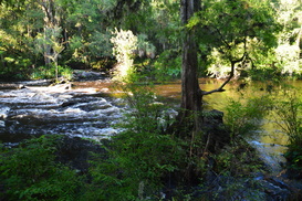
Hillsborough River State Park is one of the most popular outdoor recreation destinations in the Tampa Bay area, and for good reason. This state park, which is home to one of the southernmost sets of rapids in Florida - a set of Class II rapids on the Hillsborough River - as well as a suspension bridge that dates back to the CCC days. For the hiker, the park has several trails. The Rapids Trail provides an easy access to the Hillsborough River Rapids, a unique sight this far south in such a flat landscape. The Baynard Trail provides a quick excursion on the north side of the river, and the more remote Florida Trail Loop, which was built by the Florida Trail Association, is your best for a more remote hike that explores a wild and lush swampy area north of the Hillsborough River. The loop trail then circles back along the river, with numerous superb views of this urban yet wild waterway. This hike occurred on Wednesday, July 27th, 2016. My plan was to hike the north side of the Rapids Trail to the Baynard Trail, then hike the Baynard Trail, before completing the Florida Trail Loop counter-clockwise. I would finish by returning along the south side of the Rapids Trail. An unexpected closure of the suspension bridge forced me to abandon my plan of hiking the Baynard Trail, but I fulfilled the rest of my plan.
0 Comments
Triple Creek Preserve and Balm-Boyette Scrub Preserve Hiking Trail, Sun City Center, Florida10/23/2016 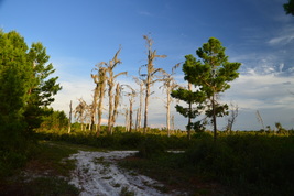
The Florida scrub is an endangered habitat that is found mainly on sand ridges throughout the state. It is relatively common to encounter a scrub in central Florida along the Lake Wales Ridge, as well as in coastal areas of eastern Florida and the state's panhandle. However, Balm-Boyette Scrub is one of a few rare scrubs in west Florida and around the Tampa area, which makes it more special than some of the scrubs on the Lake Wales Ridge. Two preserves adjacent to each other facilitate hiking access into the scrub. The main hiking trail also passes past several creeks, all of which are tributaries of the Alafia River. This hike occurred on Wednesday, July 20th, 2016. My plan was to hike clockwise the loop trail that passes through both Triple Creek Preserve and Balm-Boyette Scrub Preserve.
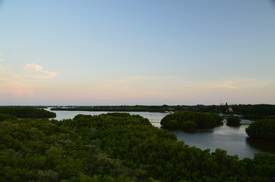
Once a state park, now a county park, Weedon Island Preserve is one of the greatest outdoor recreation destinations in the Tampa/St. Petersburg/Clearwater urban area. The park, which protects more than 3000 acres of a peninsula stretching out into Tampa Bay between Tampa and St. Petersburg, is home to an extensive trail system that leads over two boardwalks and past many views of lakes and mangrove channels. On the south end of the trail system, you'll find an observation tower with a grand view, where you can see the St. Petersburg skyline and the Tampa skyline at the same time. After the hike, you will have a chance to check out the Weedon Island Preserve Cultural and Natural History Center. This hike occurred on Wednesday, July 6th, 2016. My plan was to hike the entire extent of the main trail system at Weedon Island Preserve, as follows. I would first hike the north side of the Boy Scout Loop Trail, before hiking out and back along the Lookout Point Trail. Then, I would hike the Bay Boardwalk, before following the paved Upland Trail to the Tower Boardwalk and its observation tower. Lastly, I would return via the Upland Trail again and then along the south side of the Boy Scout Loop.
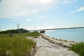
Caladesi Island, Honeymoon Island, and Anclote Key are three mostly undeveloped and protected barrier islands of Florida's Suncoast near Clearwater and Tarpon Springs. Of the three, Honeymoon Island is the only one that has road access, making it also the most visited. The main attraction for most visitors is the beach on Honeymoon Island, including the dog beach area (as not many beaches allow dogs). However, there's other attractions too. The primary hiking trails are the Opsrey Trail and Pelican Cove Trail, which lead to the north tip of a peninsula that juts out from the main island and into St. Joseph Sound. The Pelican Cove Trail is the highlight of the trail system, providing views of both Pelican Cove and St. Joseph Sound, where you can even spot a manatee. If this isn't enough for you, you can hike along the island beach to North Point, or take a ferry to neighboring Caladesi Island, which has its own trail system. This hike occurred on Sunday, June 26th, 2016. My plan was to hike the east and southwest sections of the Osprey Trail, as well as the Pelican Cove Trail.
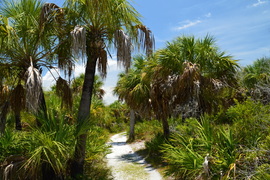
Most Florida islands with beaches have become developed, due to beaches acting as a magnet for vacationers and resort developments. Luckily, Caladesi Island - a barrier island off the coastline of Pinellas County - was purchased by the state of Florida. It is now accessible only by boat or ferry, or by a long walk along the beach from Clearwater Beach through sand-filled Dunedin Pass. Today, we have a couple of miles of undisturbed beaches on the island, as well as a several-mile hiking trail that leads through the island scrub and into a hammock where you will get to see the Scharrer Homestead. That is, if you're brave enough to face the mosquitoes. This hike occurred on Sunday, June 26th, 2016. My plan was to take the ferry from Honeymoon Island to Caladesi Island in order to hike the trail system on Caladesi Island. From the ferry dock, I would take the Island Trail to the Hammock Loop. Then, I would hike the Hammock Loop, as well as the spur trail to the Scharrer Homestead, before taking the Beach Trail and then returning to the ferry dock via the beach.
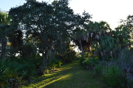 Protecting over 2000 acres of land along and near Old Tampa Bay, this park is an important preserve of one of the few natural habitats along Tampa Bay, where most of the shoreline is now developed and the native ecosystems are gone. The park has three trails that explore different ecosystems near the bay. The Otter Trail is the park's longest trail - it explores upland forest near an estuarine creek known as Double Branch Creek. This hike occurred on Saturday, November 28th, 2015. My plan was to hike the Otter Trail clockwise. This was the third and final trail in the park that I hiked on this day. 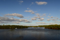 Protecting over 2000 acres of land along and near Old Tampa Bay, this park is an important preserve of one of the few natural habitats along Tampa Bay, where most of the shoreline is now developed and the native ecosystems are gone. The park has three trails that explore different ecosystems near the bay. On this short trail, you'll get to see some of the salt marshes and marl prairies that are found along this section of Old Tampa Bay. You'll also take a close look at Double Branch Creek, an estuary near Old Tampa Bay. This hike occurred on Saturday, November 28th, 2015. My plan was to hike the Bobcat Trail counter-clockwise. This would be the second out of three trails in the park that I hiked on this day. 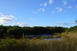 Protecting over 2000 acres of land along and near Old Tampa Bay, this park is an important preserve of one of the few natural habitats along Tampa Bay, where most of the shoreline is now developed and the native ecosystems are gone. On a short half-mile trail in the park, you can explore some of Old Tampa Bay's native salt marshes and get a view of the bay itself. This hike occurred on Saturday, November 28th, 2015. My plan was to hike the Eagle Trail out and back to a view of Upper Tampa Bay. I would then hike two other short trails in the park - they are described separately. Little Manatee River State Park: Little Manatee River/Cypress Creek Loop, Parrish, Florida8/27/2015 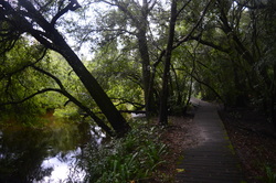
Close to the large Tampa metro area, this hike along the Little Manatee River showcases the beauty of Florida's rivers. Despite how short this hike is, you'll get to see a variety of ecosystems, including miniature palmetto prairies, swamps, and a river habitat. If you're lucky, you may spot an alligator in or near the river - although maybe that's not something you exactly want to wish for. This hike occurred on Wednesday, July 15th, 2015. My plan was to hike the main hiking loop in Little Manatee River State Park counter-clockwise. Along the way, I would also take the short spur trail to the primitive campsite.
|
About MeMark Oleg Ozboyd Dear readers: I have invested a tremendous amount of time and effort in this website and the Georgia Waterfalls Database the past five years. All of the work that has gone in keeping these websites updated with my latest trip reports has almost been like a full-time job. This has not allowed me to pick up a paid job to save up money for college, and therefore, I I've had to take out loans. If you find the information on this website interesting, helpful, or time-saving, you can say "thanks" and help me out by clicking the button above and making a contribution. I will be very grateful for any amount of support you give, as all of it will apply toward my college tuition. Thank you!
Coming in 2022-2023?
Other Hiking WebsitesMiles HikedYear 1: 540.0 Miles
Year 2: 552.3 Miles Year 3: 518.4 Miles Year 4: 482.4 Miles Year 5: 259.9 Miles Archives
March 2021
Categories
All
|

 RSS Feed