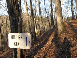
 Miller Trek. Thinking of the name brings to mind a touristy pathway leading to a large waterfall or a panoramic vista. Instead, what you'll find on this short hike is nothing but one of the best experiences of North Georgia's mountain's forests and a touch of solitude. Located in the Brasstown Valley area of extreme northern Georgia, this little-used loop might be one of the best winter hikes in Georgia, as when the leaves are down, you will find a lot of views in various directions. The name is after Zell Miller, a former Georgia senator. He and his wife loved the nature around Brasstown Valley, and they wanted to save the area from developments. Since recently Brasstown Valley Resort and the National Forest Service partnered together to create the Miller Trek, Miller's dream came true. This hike occurred on Wednesday, December 31st, 2014. My plan was to hike the Miller Trek Loop clockwise.
1 Comment
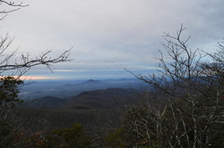 One of the most remote sections of Georgia's Appalachian Trail lies in Tray Mountain Wilderness. Are you ready for a rollercoaster ride? You better be if you're planning to do this hike. From the Moccasin Creek watershed, you will traverse eight, yes eight, mountains before finally reaching Tray Mountain and its excellent viewpoint. During most of this hike, you're going to feel like you're really out there in the wilderness - even the road leading to the trailhead looks like it. This hike occurred on Saturday, December 27th, 2014. My plan was to start this hike at the small trailhead at the end of Wildcat Creek Road. I would follow the old, gated section of Wildcat Creek Road to Addis Gap on the Appalachian Trail. From there, I would turn left onto the AT and follow it to Tray Mountain. I would return the same way. 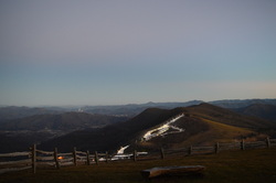 The Cataloochee area of the Great Smoky Mountains National Park is an overlooked and very scenic region. Cataloochee Divide marks the eastern boundary of GSMNP in this area, separating Cataloochee Valley and Maggie Valley. Cataloochee Divide Trail might be one of the most spectacular trail in the entire park, if hiked during winter. Views sprout in all directions. However, the section described here is a good hike even during summer, with amazing views from Hemphill Bald and Purchase Knob. Along the way back, take a minute to stop at and explore the Ferguson Cabin located just below Purchase Knob. This hike occurred on Thursday, December 25th, 2014. My plan was to park at the gate on Purchase Road, and then hike up Purchase Road to Purchase Knob. From there, I would pick up the Cataloochee Divide Trail and follow it past the The SWAG to Hemphill Bald. I would retrace my steps back, but instead of climbing back up Purchase Knob, I would shortcut it using the Ferguson Cabin Trail. 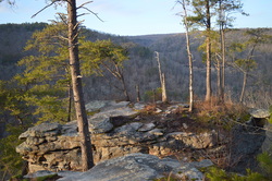 The Three Gorges segment of the Cumberland Trail is a very beautiful area, part of the Bowater Paper Company's former lands. The three main gorges on this segment of the Cumberland Trail get better in succession from south to north. It starts with the Soddy Creek Gorges, which are the only ones I haven't visited yet on this section (although I heard that they are not very interesting with few attractions). Just to the north, the Possum Creek Gorges are considerably more scenic, with more waterfalls and a few small views. The best of the three is Rock Creek Gorge, described in this post. The Rock Creek Gorge is full of pristine wilderness with many small cascades and outstanding views of the gorge from multiple viewpoints on the east rim. This hike occurred on Saturday, December 20th, 2014. My plan was starting from the Retro-Hughes Trailhead to hike the Cumberland Trail north into the Rock Creek Gorge. Once I would get to the end of the current Cumberland Trail section here, I would complete the short Rock Creek Loop with the side trip to the outstanding views from Leggett Point, then return the way I came on the Cumberland Trail. 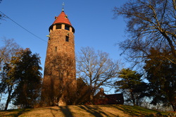 Berry College has a campus of 30,000 acres - the largest in the world. It was Martha's Berry dream to create a good school for mountain children, and it started way back in 1902. 20 years later, the grateful students of Marta's school built her a resort house on the summit of Lavender Mountain. While she would rarely spend the night in the house, she would often invite guests to the house and spend days with them together. From the house, you have good views of the Oostanaula River Valley, as well as some views of Berry College's campus. Below the mountain, the Old Mill is a historical attraction that attracts many people on good days. The Longleaf Trail goes through an experimental longleaf pine forest - controlled burns along that trail open up various views. This hike occurred on Saturday, December 13th, 2014. My plan was to park at the Old Mill, then go down the gravel road to Longleaf Trail. Next, I planned to hike the steep Longleaf Trail to the House O' Dreams Loop. My plan was to turn right and follow first the old forest road, then the gravel road, to the House O' Dreams. From there, I would follow the Hike/Bike Trail over Lavender Mountain back to the old forest road, and turn left to go back to Longleaf Trail and close the loop. 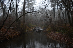 Ever hiked in Georgia's Piedmont? You'll be treated to lakes, rolling hills, and scattered woodlands. It's different from the mountains, and many hikers may fInd it boring. This hike close to Augusta's metro area is a primer for the area though. You'll be treated to views of Clarks Hill Lake, a canyon caused by soil erosion from poor farming activities, and a small natural rock dam on Boehler Creek. This hike is one of the easiest ones on this website. It is suitable for most ages and levels of experience, and the lay of the land is easy to traverse. This hike occurred on Saturday, December 6th, 2014. My plan was starting from Misteltoe State Park's Trailhead, to hike the Cliatt Creek Nature Trail to Rock Dam Trail, and then hike the Rock Dam Trail back to the trailhead. Along the way, there would be 4 fords - two of Cliatt Creek and two of Boehler Creek. 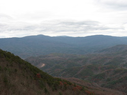 Fort Mountain is one of the most prominent features in northwestern Georgia. While its elevation is low relative to the Cohutta Mountains just to the north, the steep drop-off of the mountain can be recognized from dozens of miles away. The mountain is pretty significant historically. The very summit of Fort Mountain is marked by a CCC Stone Tower, which is currently closed to the public. Just below the summit, an 800-foot wall of mysterious origin follows the south slope of the mountain. The Gahuti Trail takes you farther from the summit of the mountain into more remote regions, where you can find waterfalls on Goldmine Creek. This hike occurred on Saturday, November 29th, 2014. My plan was to start at the Cool Springs Trailhead, and after checking out the Cool Springs Overlook, to follow the Gahuti to the Stone Tower Loop. After hiking the Stone Tower Loop, I would leave the crowded sections of the park and hike the Gahuti Loop counter-clockwise. If time would remain, I would take the #301 Bike Trail down the mountain to see some of the lower waterfalls on Goldmine Creek. |
About MeMark Oleg Ozboyd Dear readers: I have invested a tremendous amount of time and effort in this website and the Georgia Waterfalls Database the past five years. All of the work that has gone in keeping these websites updated with my latest trip reports has almost been like a full-time job. This has not allowed me to pick up a paid job to save up money for college, and therefore, I I've had to take out loans. If you find the information on this website interesting, helpful, or time-saving, you can say "thanks" and help me out by clicking the button above and making a contribution. I will be very grateful for any amount of support you give, as all of it will apply toward my college tuition. Thank you!
Coming in 2022-2023?
Other Hiking WebsitesMiles HikedYear 1: 540.0 Miles
Year 2: 552.3 Miles Year 3: 518.4 Miles Year 4: 482.4 Miles Year 5: 259.9 Miles Archives
March 2021
Categories
All
|

 RSS Feed