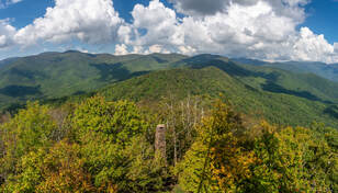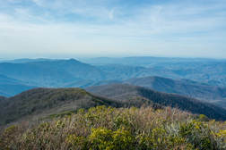
Twentymile is the southwesternmost major access point to Great Smoky Mountains National Park, and also one of the quietest. With nothing but a sleepy ranger station, small parking area, and trailhead, plus no significant destinations in close proximity, the Twentymile area remains little-visited compared to areas of the park like Cades Cove and Roaring Fork. Yet those who are willing to hike longer will find the Twentymile area quite interesting. The lengthy loop described here first follows the scenic cascades of Twentymile Creek before climbing to the Appalachian Trail and reaching the historic Shuckstack fire tower with its birds-eye view of Fontana Lake. The hike then heads deeper into the Smokies backcountry, traversing the Gregory Bald Trail - the eastern section of which near Doe Knob is one of the least-hiked trails in the park - before reaching the open grassy summit of Gregory Bald, featuring stunning 360-degree views. Even though both Shuckstack Tower and Gregory Bald can be reached via separate shorter hikes, it's hard to beat combining these two spectacular destinations into one large loop. This hike occurred on Saturday, October 6th, 2018. My plan was to initially hike the Twentymile Trail to the Appalachian Trail. After a side trip to Shuckstack, I would follow the AT north to Doe Knob. There, I'd pick up the Gregory Bald Trail and follow it all the way to Gregory Bald. On the other side of Gregory Bald, I would take the Wolf Ridge Trail and descend back to Twentymile. Although I completed this hike as a long day hike, you may find it more enjoyable as a two- or even three-day backpacking trip.
0 Comments

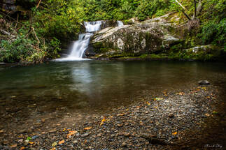
Imagine a large mountain waterway winding its way through a wilderness for nearly a dozen miles with zero road access. Picture a rugged, little-traveled pathway following this waterway, crisscrossing the creek many times through deep, slick fords, circumnavigating countless blowdowns and rock scrambles. There, you've discovered the Slickrock Creek Trail! This is the best creek trail I've ever walked in the Southern Appalachian Mountains, and I'm not even exaggerating. Nowhere else have I found a combination of such remote beauty and rugged wilderness trail, which never follows any of the logging roads customary to most North Carolina waterways. As if you needed more incentive to tackle this hike, the Slickrock Creek Trail features two secluded waterfalls - Wildcat Falls and Lower Falls - with swimming holes that couldn't be any more refreshing after a long summer day in the backcountry. This hike occurred on Saturday, September 15th, 2018. My plan was to day hike a lengthy loop through the heart of the Joyce Kilmer-Slickrock Creek Wilderness backcountry. I would start off along the Slickrock Creek Trail at Cheoah Dam along US 129, but before long, I would take the Ike Branch Trail. At Yellowhammer Gap, I would pick up the Yellowhammer Gap Trail, followed by the Nichols Cove Trail and Windy Gap Trail. The Windy Gap Trail would finally bring me to Slickrock Creek, from where I'd spend the rest of the day tracing the Slickrock Creek Trail back to US 129.

Right on the doorstep of the quaint town of Robbinsville is the Joyce Kilmer-Slickrock Wilderness, a massive wild area covering over 17,000 acres between the Cherohala Skyway and US 129. The area is known best for the Joyce Kilmer Memorial Forest - an area of virgin forest in the Little Santeetlah Creek watershed, featuring numerous old, grand trees. The wilderness area's central destination, however, is an inconspicuous rock outcropping on a lead below Haoe Bald called The Hangover. The Hangover features a breathtaking 360-degree view of the wilderness, with little in sight but endless mountain ridges and several lakes. The panoramic vista atop The Hangover encompasses Santeetlah Lake, Calderwood Lake, and the Little Tennessee River. This hike loops several trails from the Joyce Kilmer Recreation Area to visit The Hangover via the Memorial Forest. This hike occurred on Saturday, April 21st, 2018. My plan was to hike a clockwise loop with the Joyce Kilmer Memorial Forest Poplar Cove Trail, Naked Ground Trail, Haoe Lead Trail, and Jenkins Meadow Trail. I would of course take a side trip along the Hangover Lead Trail to The Hangover.

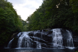
Deep in the Cheoah Ranger District of Nantahala National Forest flows a pristine wilderness waterway, Snowbird Creek. Snowbird Creek, encompassed by the large Snowbird Backcountry Area, is one of the more remote regions in western North Carolina, where trails can be overgrown streamside paths and where the junctions often go unsigned. Snowbird Creek and its tributaries sport numerous waterfalls, even some large ones - on this hike you'll get to see as many as four sizable waterfalls. It's no walk in the park to get as far as Upper Falls though - be prepared to traverse faint, steep paths on Burntrock Ridge and along Snowbird Creek. This hike occurred on Saturday, August 15th, 2015. My plan was to hike the Snowbird Creek Trail to the Sassafras Creek Trail, and then take Sassafras Creek Trail upstream along Sassafras Creek past Sassafras Creek Trail. Next, I would take the Burntrock Ridge Trail over Burntrock Ridge, ending up again on the Snowbird Creek Trail. I would take the Snowbird Creek Trail upstream to Upper Falls and then downstream to Middle Falls, Big Falls, and back to the trailhead.
|
About MeMark Oleg Ozboyd Dear readers: I have invested a tremendous amount of time and effort in this website and the Georgia Waterfalls Database the past five years. All of the work that has gone in keeping these websites updated with my latest trip reports has almost been like a full-time job. This has not allowed me to pick up a paid job to save up money for college, and therefore, I I've had to take out loans. If you find the information on this website interesting, helpful, or time-saving, you can say "thanks" and help me out by clicking the button above and making a contribution. I will be very grateful for any amount of support you give, as all of it will apply toward my college tuition. Thank you!
Coming in 2022-2023?
Other Hiking WebsitesMiles HikedYear 1: 540.0 Miles
Year 2: 552.3 Miles Year 3: 518.4 Miles Year 4: 482.4 Miles Year 5: 259.9 Miles Archives
March 2021
Categories
All
|

 RSS Feed