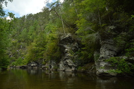
Looking at a topographic map of the Jacks River area, one can easily make out the iconic Horseshoe Bend in the river, where the land sticks out in the form of a horseshoe. The Jacks River Trail is a trail that is over a dozen miles long and has over forty river fords, as it follows the Jacks River for much of its length and crisscrosses it numerous times. This trail provides the easiest access into the beautiful stretch of the Jacks River at Horseshoe Bend. A lesser-used trail known as the Horseshoe Bend Trail can be used to accessed the area as well, and there's also a catch: it passes mere feet away from one of the most beautiful vistas in the Cohutta Mountains. On this hike, you'll first hike through upland areas south of the Jacks River, passing the spectacular Horseshoe Bend vista, before hiking through the scenic Jacks River Gorge to Jacks River Falls. This hike occurred on Saturday, September 3rd, 2016. My plan was to follow the Horseshoe Bend Trail from FS Road 51 to the Jacks River Trail. From there, I would hike out and back along the Jacks River Trail upstream to Jacks River Falls, and then, I would follow the Jacks River Trail downstream to the Alaculsy Trailhead. I arranged to have two cars for this point-to-point hike: one car was placed at the Horseshoe Bend Trailhead and another car was placed at the Alaculsy Jacks River Trailhead.
1 Comment
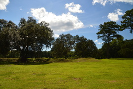
Prospect Bluff, located on the east side of the Apalachicola River deep in present-day Apalachicola National Forest, is the site of two forts, including Fort Gadsden, which had remained there until 1821, when Florida became a US territory. At the time, no highways or railroads existed, so the fort was located in a strategic spot at a high point near the Apalachicola River, which used to be the main transportation route for the area. Traces of the old fort can still be seen today on this short hike, and the Fort Gadsden Interpretive Area has detailed information regarding the history of this site. This hike occurred on Saturday, August 20th, 2016. My plan was to hike the Fort Gadsden Nature Trail counter-clockwise. This trail is also known as the Wiregrass-Genetian Trail, named for a rare wildflower that can be seen in the woods near Prospect Bluff.
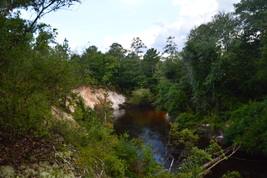
Traverse dozens of ravines, view fast streams and tumbling cascades, visit bluffs with excellent views of a a creek gorge - sounds like a perfect hike for your mountain vacation, right? Oh wait! It's right in Florida. The Econfina Creek segment of the Florida Trail is as unique as a hike could get in Florida, and you would barely be able to tell that you're in Florida, if the palmetto wasn't there. This spectacular section of the FT first descends into the Econfina Creek valley, passing some rapids on the creek, before following this waterway for many miles with a number of scenic sights along the way. This hike occurred on Friday, August 19th, 2016. My plan was to hike the Florida Trail out and back from Scott Road to Devil's Hole Recreation Area. Along the way, I would also hike the side trail to Trap Pond.
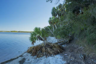
St. Joseph Bay State Buffer Preserve is a 5000-acre preserve near St. Joseph Bay that was created to protect the bay's water quality and conserve the natural shoreline habitats. The main tract of the preserve lies just east of County Road 30A, providing numerous hiking possibilities in the sand dune system there along many forest roads. A separate small tract of the preserve, known as the Deal Tract, is located on St. Joseph Peninsula near Cape San Blas. This preserve is home to two short hiking trails that lead through several island ecosystems and to great views of St. Joseph Bay. This hike occurred on Saturday, August 13th, 2016. My plan was to hike the Old Pine Bay Trail out and back to the main St. Joseph Bay observation area. On my return trip, I would also hike the Hammock Spur Trail out and back. I returned on Saturday, December 30th, 2017, discovering several changes to the trail.
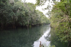
Out of all of the different aspects of nature in Florida, the springs are perhaps the best-known. There are dozens of large springs in northern Florida, some of which pump out millions of gallons of water per day. A lot of the biggest springs are the focal points of state parks, and a large amount of people find them suitable for various recreational uses, including swimming in the crystal clear waters or kayaking the outflow streams that flow away from the springs. Manatee Springs is one such example. This spring is a first-magnitude spring with an output of about 100 million gallons of water per day! While Manatee Springs are certainly the primary point of interest in Manatee Springs State Park, an extensive trail system also meanders through other portions of this large park, although unfortunately, on this day, I did not have the opportunity to check it out. This hike occurred on Sunday, July 31st, 2016. My plan was to visit Manatee Springs, before hiking the boardwalk along Manatee Springs Run to its mouth at the Suwannee River. I would return the same way.
Hillsborough River State Park: Rapids Trail and Florida Trail Loop, Thonotosassa, Florida11/14/2016 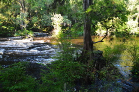
Hillsborough River State Park is one of the most popular outdoor recreation destinations in the Tampa Bay area, and for good reason. This state park, which is home to one of the southernmost sets of rapids in Florida - a set of Class II rapids on the Hillsborough River - as well as a suspension bridge that dates back to the CCC days. For the hiker, the park has several trails. The Rapids Trail provides an easy access to the Hillsborough River Rapids, a unique sight this far south in such a flat landscape. The Baynard Trail provides a quick excursion on the north side of the river, and the more remote Florida Trail Loop, which was built by the Florida Trail Association, is your best for a more remote hike that explores a wild and lush swampy area north of the Hillsborough River. The loop trail then circles back along the river, with numerous superb views of this urban yet wild waterway. This hike occurred on Wednesday, July 27th, 2016. My plan was to hike the north side of the Rapids Trail to the Baynard Trail, then hike the Baynard Trail, before completing the Florida Trail Loop counter-clockwise. I would finish by returning along the south side of the Rapids Trail. An unexpected closure of the suspension bridge forced me to abandon my plan of hiking the Baynard Trail, but I fulfilled the rest of my plan.
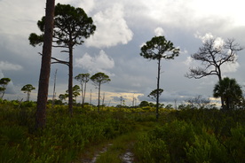
Coming in at 11,500 acres, Jonathan Dickinson State Park is one of the largest state parks in Florida, and it is complete with an extensive trail system of over twenty miles. The park has a variety of habitats, ranging from scrubby sand dunes on the east end, with Hobe Mountain being the highest, to pine flatwoods dotted by cypress domes that occupy much of the park, to wetter hammocks along Kitching Creek and the Loxahatchee River in the park's western and southern regions. This hike occurred on Saturday, July 23rd, 2016. My plan was to hike the Kitching Creek Loop and the the Ocean-to-Lake Trail to the White Loop, completing the White Loop as well. Unfortunately, major changes in the trail system brought me into ultimate confusion and forced me to greatly alter my plans. I ended up hiking only part of the Kitching Creek Loop and White Loop, and I also accidentally hiked a portion of the Ocean-to-Lake Trail westward. Additionally, I ended the hike with a several-mile roadwalk due to exhaustion and time shortage.
|
About MeMark Oleg Ozboyd Dear readers: I have invested a tremendous amount of time and effort in this website and the Georgia Waterfalls Database the past five years. All of the work that has gone in keeping these websites updated with my latest trip reports has almost been like a full-time job. This has not allowed me to pick up a paid job to save up money for college, and therefore, I I've had to take out loans. If you find the information on this website interesting, helpful, or time-saving, you can say "thanks" and help me out by clicking the button above and making a contribution. I will be very grateful for any amount of support you give, as all of it will apply toward my college tuition. Thank you!
Coming in 2022-2023?
Other Hiking WebsitesMiles HikedYear 1: 540.0 Miles
Year 2: 552.3 Miles Year 3: 518.4 Miles Year 4: 482.4 Miles Year 5: 259.9 Miles Archives
March 2021
Categories
All
|

 RSS Feed