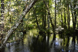
In many cases, a long hike through a swamp is a challenging hike that is not for the light-hearted. But the twelve-mile balloon loop through Bird Rookery Swamp is a mostly dry hike along old logging tramways that leads into the heart of the wild swamp without the hiker expending a lot of effort. On this hike, you will make a large loop through this remote corner of the Corkscrew Swamp Land and Water Trust, where alligators abound in great numbers, and hawks look down upon you from the dry canopy above the water. This hike occurred on Saturday, July 9th, 2016. My plan was to hike the Bird Rookery Swamp balloon loop counter-clockwise from the trailhead on Shady Hollow Boulevard.
1 Comment
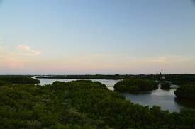
Once a state park, now a county park, Weedon Island Preserve is one of the greatest outdoor recreation destinations in the Tampa/St. Petersburg/Clearwater urban area. The park, which protects more than 3000 acres of a peninsula stretching out into Tampa Bay between Tampa and St. Petersburg, is home to an extensive trail system that leads over two boardwalks and past many views of lakes and mangrove channels. On the south end of the trail system, you'll find an observation tower with a grand view, where you can see the St. Petersburg skyline and the Tampa skyline at the same time. After the hike, you will have a chance to check out the Weedon Island Preserve Cultural and Natural History Center. This hike occurred on Wednesday, July 6th, 2016. My plan was to hike the entire extent of the main trail system at Weedon Island Preserve, as follows. I would first hike the north side of the Boy Scout Loop Trail, before hiking out and back along the Lookout Point Trail. Then, I would hike the Bay Boardwalk, before following the paved Upland Trail to the Tower Boardwalk and its observation tower. Lastly, I would return via the Upland Trail again and then along the south side of the Boy Scout Loop.
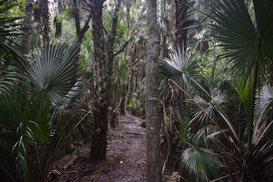
The name may turn out to be slightly deceiving, for you are not likely to sight black bears on this hike. Nonetheless, there's plenty of other things to see on this hike that the name does not suggest. The rugged relatively new 7-mile trail in Black Bear Wilderness follows a series of dikes, some narrow, some wide, for most of its route through densely vegetated swamps in the St. Johns River floodplain and along the river itself. The muggy jungle-like forest with dozens of palms and palmettos on every bit of dry land may have you thinking that you're actually walking through a tropical rainforest. Just watch your footing around the countless roots (and trees) that are positioned on the dike. This hike occurred on Saturday, July 2nd, 2016. My plan was to hike counter-clockwise the entire loop in Black Bear Wilderness.
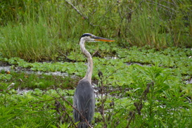
Anhingas. Egrets. Alligators. You'll see them all on this spectacular hike through a ranch-turned-preserve near the shores of Lake Hancock and just outside of the Lakeland city limits. Circle B Bar Reserve, renowned throughout Florida for its spectacular photo opportunities, attracts flocks of hikers every day to see the wildlife on its trails. The hike begins in a hammock with huge live oaks, before following the shore of Lake Hancock, where alligators shuffle into the water to the left and right. The hike then passes through wetlands where wading birds are in abundance (as well as more alligators) before passing an old windmill and returning to the trailhead. This hike occurred on Saturday, July 2nd, 2016. My plan was to make an outer loop through Circle B Bar Reserve's Trail System, as follows. First, I would take the Shady Oak Trail to Lake Hancock, where I would follow the Alligator Alley Trail past a lake observation area and along the shores of the lake. Then, after leaving the lake, I would take the Eagle Roost Trail along the southwest boundary of the preserve. There, I accidentally did the out and back along the Circle B Bar Connector Trail, although I didn't regret it. Lastly, I would take the Wading Bird Way to the Windmill Whisper Trail, before using the Treefrog Trail to finish the hike.
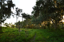
Located in a sprawling urban area along the southwest Florida coast, Oscar Scherer State Park protects a large swath of land that is considered as an urban getaway. South Creek flows through the center of the park, and large areas of prime scrub jay habitat lie on either side. Oscar Scherer State Park is considered as the only remaining haven for scrub jays in southwest Florida. There are several hiking trails in the park that you can explore, split into two trail general trail systems: the North Trail System and the South Trail System. On this day, I hiked the entire South Trail System, first along the shores of South Creek and then through scrub where scrub jays flew from tree to tree and an old bald eagle nest from the past spring was perched high up in a grand pine tree. This hike occurred on Wednesday, June 29th, 2016. My plan was to hike the South Creek Trail and Lester Finley Trail out and back. I would then hike the Green Trail loop clockwise, before finishing up with the short walk around Lake Osprey.
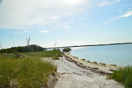
Caladesi Island, Honeymoon Island, and Anclote Key are three mostly undeveloped and protected barrier islands of Florida's Suncoast near Clearwater and Tarpon Springs. Of the three, Honeymoon Island is the only one that has road access, making it also the most visited. The main attraction for most visitors is the beach on Honeymoon Island, including the dog beach area (as not many beaches allow dogs). However, there's other attractions too. The primary hiking trails are the Opsrey Trail and Pelican Cove Trail, which lead to the north tip of a peninsula that juts out from the main island and into St. Joseph Sound. The Pelican Cove Trail is the highlight of the trail system, providing views of both Pelican Cove and St. Joseph Sound, where you can even spot a manatee. If this isn't enough for you, you can hike along the island beach to North Point, or take a ferry to neighboring Caladesi Island, which has its own trail system. This hike occurred on Sunday, June 26th, 2016. My plan was to hike the east and southwest sections of the Osprey Trail, as well as the Pelican Cove Trail.
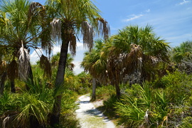
Most Florida islands with beaches have become developed, due to beaches acting as a magnet for vacationers and resort developments. Luckily, Caladesi Island - a barrier island off the coastline of Pinellas County - was purchased by the state of Florida. It is now accessible only by boat or ferry, or by a long walk along the beach from Clearwater Beach through sand-filled Dunedin Pass. Today, we have a couple of miles of undisturbed beaches on the island, as well as a several-mile hiking trail that leads through the island scrub and into a hammock where you will get to see the Scharrer Homestead. That is, if you're brave enough to face the mosquitoes. This hike occurred on Sunday, June 26th, 2016. My plan was to take the ferry from Honeymoon Island to Caladesi Island in order to hike the trail system on Caladesi Island. From the ferry dock, I would take the Island Trail to the Hammock Loop. Then, I would hike the Hammock Loop, as well as the spur trail to the Scharrer Homestead, before taking the Beach Trail and then returning to the ferry dock via the beach.
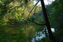
While this hike is actually in Georgia, the parking for it is in South Carolina, and you'll walk across the state line as you cross the Highway 76 bridge across the Chattooga River. In fact, the entire hike stays close to the state line. This is because the Chattooga River straddles the Georgia/South Carolina border for much of its length. The Chattooga River is a federally designated Wild and Scenic River. It is a whitewater kayaker's paradise, as there are many Class IV and Class V rapids throughout the river's course. In fact, you will get up close to Bull Sluice - a Class V rapid - on this hike, and you may even see some kayakers make their way down it. Leaving Bull Sluice, this hike will follow the Chattooga River Trail across a number of ridges near the river. Along the way, you'll be treated to several good views of this mountain river. This hike occurred on Saturday, June 11th, 2016. My plan was to hike the Chattooga River Trail from the Highway 76 bridge to Sandy Ford Road, making the short side trip to Bull Sluice along the way. I arranged to have two cars for this point-to-point hike: one car was placed at the Highway 76 trailhead and another car was placed at the Sandy Ford trailhead.
|
About MeMark Oleg Ozboyd Dear readers: I have invested a tremendous amount of time and effort in this website and the Georgia Waterfalls Database the past five years. All of the work that has gone in keeping these websites updated with my latest trip reports has almost been like a full-time job. This has not allowed me to pick up a paid job to save up money for college, and therefore, I I've had to take out loans. If you find the information on this website interesting, helpful, or time-saving, you can say "thanks" and help me out by clicking the button above and making a contribution. I will be very grateful for any amount of support you give, as all of it will apply toward my college tuition. Thank you!
Coming in 2022-2023?
Other Hiking WebsitesMiles HikedYear 1: 540.0 Miles
Year 2: 552.3 Miles Year 3: 518.4 Miles Year 4: 482.4 Miles Year 5: 259.9 Miles Archives
March 2021
Categories
All
|

 RSS Feed