HIKING THE APPALACHIANS AND BEYOND
  • Home
  • Trail Reports
    • Best Hikes
    • Hikes with Scenic Views
    • Hikes with Water Features
    • Alabama
    • Georgia
    • Florida
    • North Carolina
    • South Carolina
    • Tennessee
    • Vermont
    • Virginia
  • Map
  • Hike List
  • Testimonials
  • Resources
  • Contact Us
  • Southeast Nature Society
    • Our Team
  • Georgia Waterfalls Database

Southern Nantahala Wilderness: Denton Creek Trail to Lower, Middle, and Upper Denton Creek Falls, Tate City, Georgia

6/14/2017

3 Comments

 
Picture
Today nearly a ghost town, Tate City ​once was a prospering town centered around the logging business and the mining of corundum. A handful of folks live in Tate City through the year, but many houses in this quaint community are simply second homes. The pleasant drive through Tate City leads to a door into the Southern Nantahala Wilderness, a land of many top-tier waterfalls. The hike along the unofficial but well-defined Denton Creek Trail should be at the top of any waterfall hunter's list. In an easy to moderate two miles, folks who hike the Denton Creek Trail will visit three pristine waterfalls. Particularly attractive is Lower Denton Creek Falls, a free-fall waterfall that tumbles 40 feet over a sheer cliff speckled with lush green vegetation. In addition, hikers will be treated to continuous streamside scenery all throughout the Denton Creek Trail. This hike occurred on Saturday, June 10th, 2017. My plan was to hike out and back along the Denton Creek Trail to Upper Denton Creek Falls. Along the way, I would take the side trail to Lower Denton Creek Falls, and I would also make the short off-trail scramble down to Middle Denton Creek Falls. 

Summary

R/T Length of Trail: 1.9 Miles
Duration of Hike: 2:00 
Type of Hike: Out and Back 
Difficulty Rating: 3 out of 10 
Total Elevation Gain: 639 Feet
Pros: Despite the ease of access to the waterfalls, they are not going to be crowded
Cons: Getting to Middle Denton Creek Falls requires getting off the trail and scrambling steeply down
Points of Interest: Lower Denton Creek Falls - 9 stars; Middle Denton Creek Falls - 5 stars; Upper Denton Creek Falls - 7 stars
Trail Blaze Colors: None 
Best Seasons to Hike: Late Spring & Early Summer 
Fees: None 
Beginning Point: End of unnamed side road from Tallulah River Road in Tate City
Directions from Clayton, GA: From the intersection of Rickman Drive, Savannah Street, and US Route 23/441 in downtown Clayton, follow Savannah Street (US 76) West for 8.0 miles. Then, turn right onto Persimmon Road. In another 4.2 miles, turn left onto Tallulah River Road, and continue for exactly 6.4 miles. Just before a bridge over Denton Creek, where Tallulah River exits Tate City, there will be an unmarked and unnamed narrow dirt road that leaves to the right. Turn onto this road and follow it for about 0.2 miles to two pullouts on the right just before the end of the road. There is also a third pullout on the left closer to the beginning of the narrow road. Each pullout has space for two to three cars. The trail begins at the end of the old road at Denton Creek just beyond the third and largest pullout. There is a muddy area between the second and third pullout, so it is recommended for low clearance/2WD vehicles to park in either of the first two pullouts. 

Map

Picture
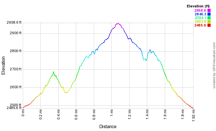
Click here to download a track of this hike. 

Details

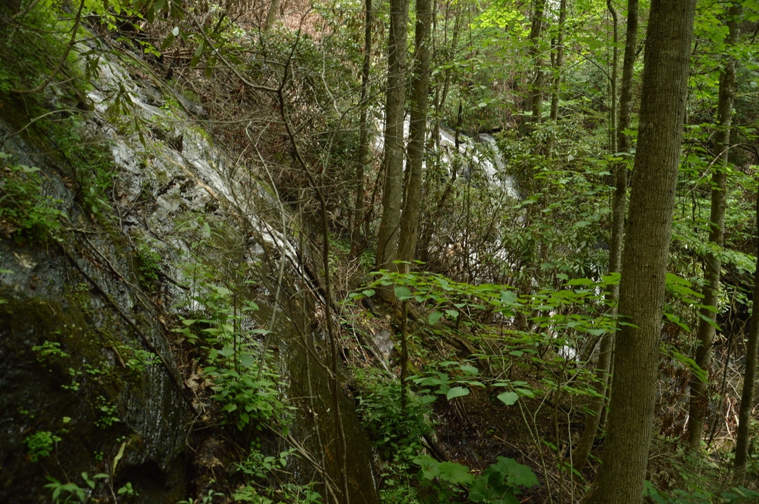
Lower Denton Creek Falls or simply Denton Creek Falls is one of the better-known waterfalls in the Tallulah River valley. That is not surprising, as the free-fall waterfall is unusual for Georgia, and it sits in a strikingly lush and green setting. More in-depth research, however, reveals that there are two more waterfalls on Denton Creek. While neither is as spectacular as the lower falls, both are still beautiful and well worth the hike. Interestingly, an established path leads to Upper Denton Creek Falls as well, leaving me to wonder why that waterfall is essentially off the radar. Middle Denton Creek Falls is accessed by the same trail, but it is at an inconspicuous location ​a hundred vertical feet in a tight gorge below the trail, so many people who hike to the upper falls don't know that the middle falls even exists.

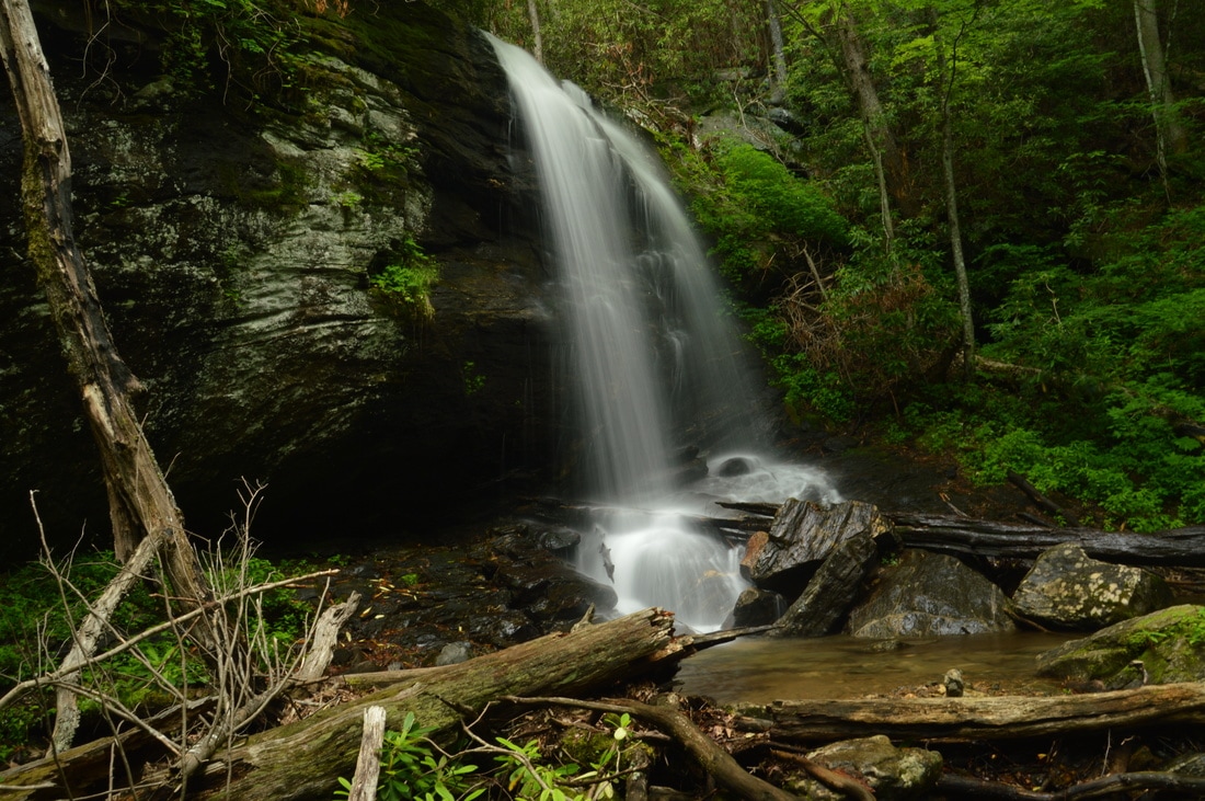
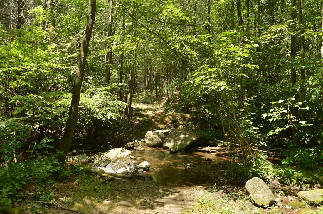
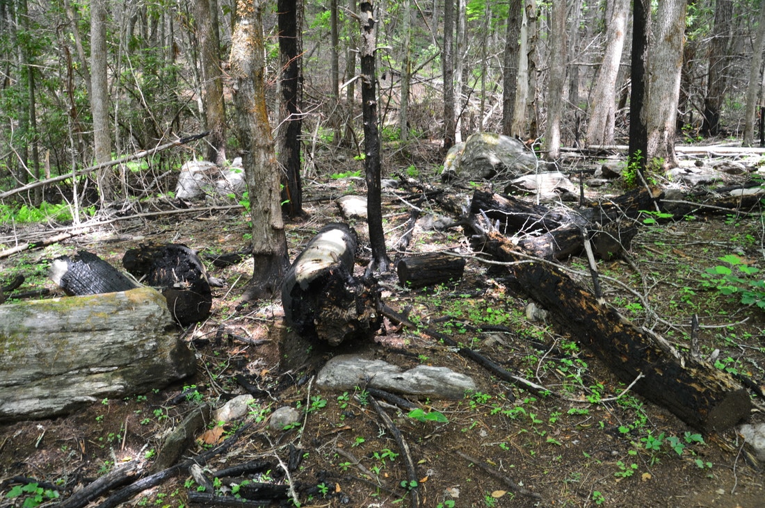
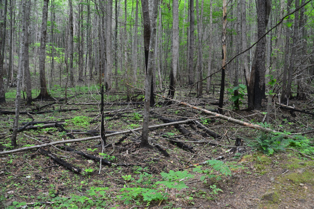
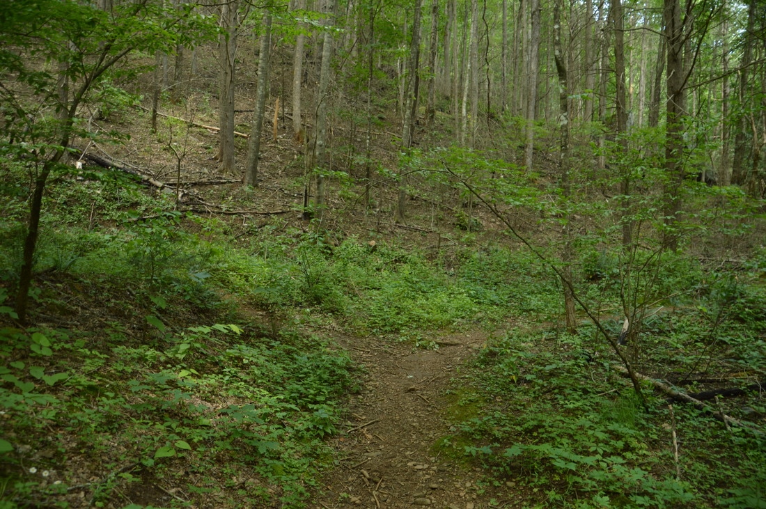
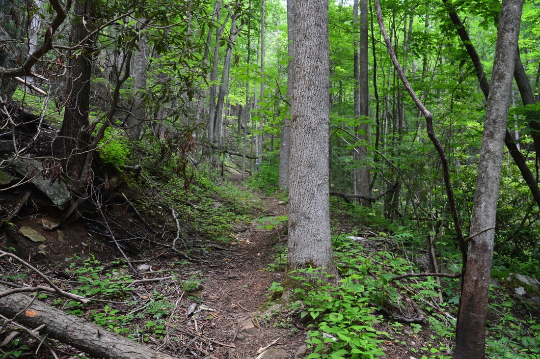
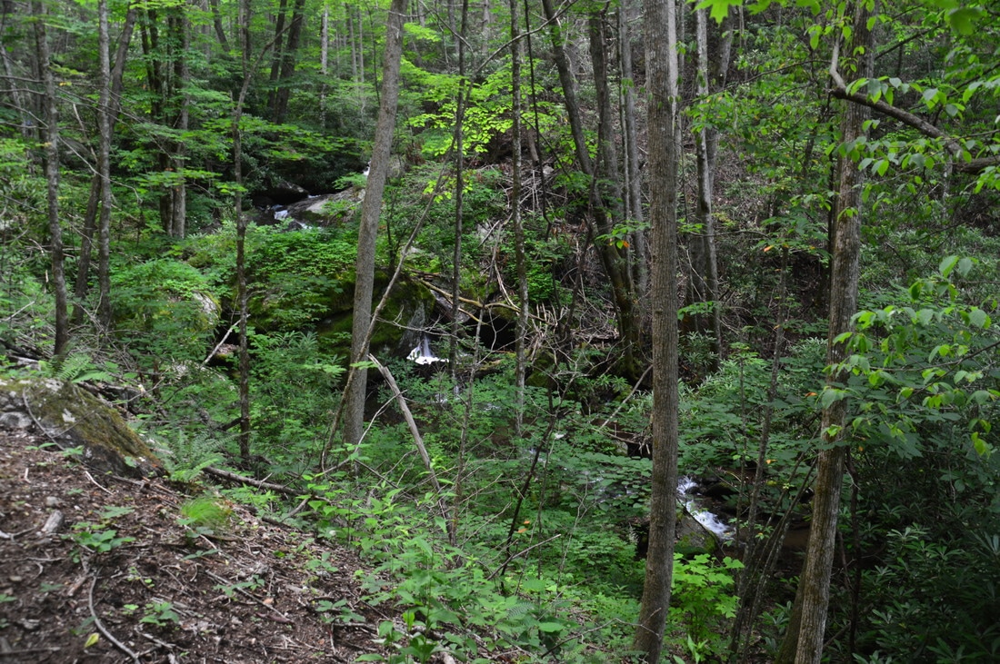
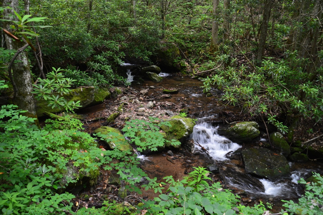
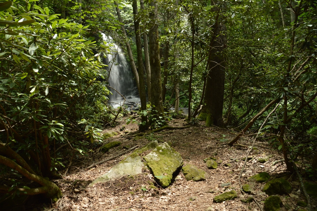
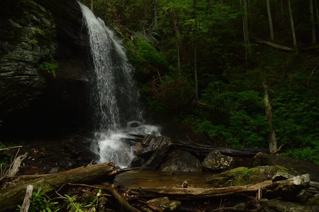
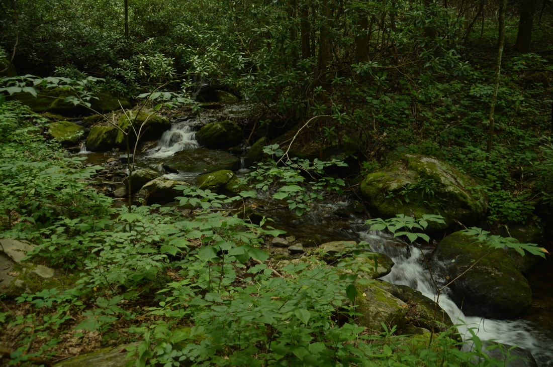
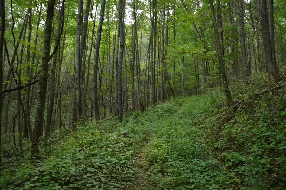
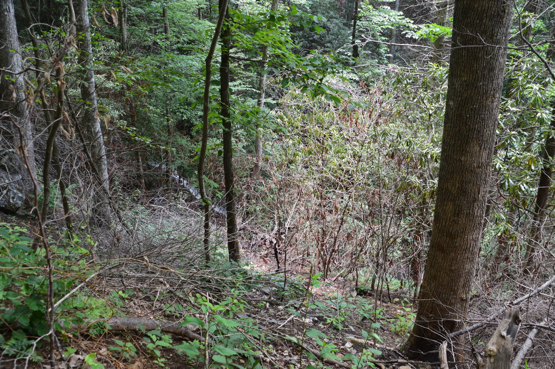
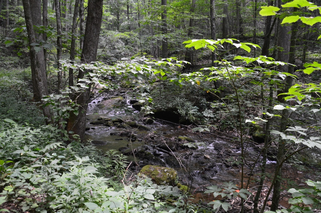
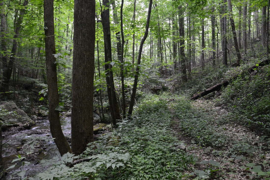
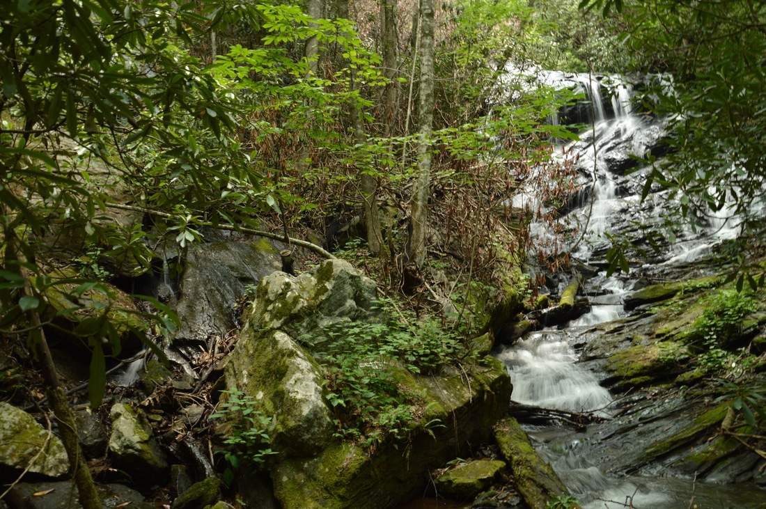
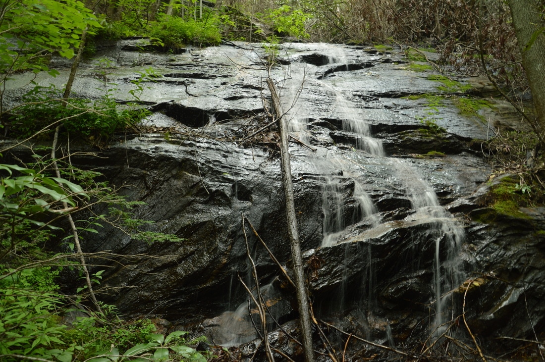
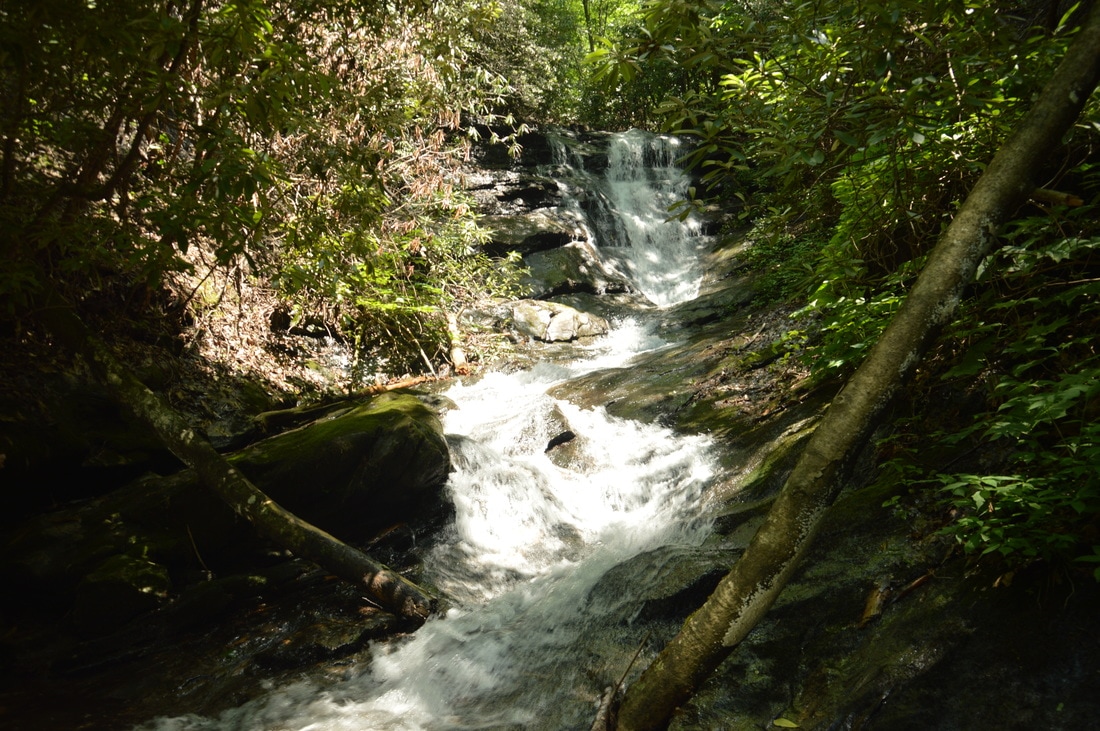
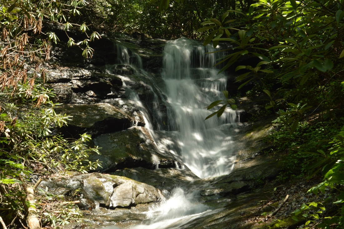
The hike begins at the end of the side road leading along Denton Creek from Tallulah River Road. The mileage listed here is from the second pullout, where I parked due to a large mud hole on the road between the second and third pullout. In about 200 feet, the drivable part of the road ends at Denton Creek. This is where the Denton Creek Trail begins on the other side of the creek. Cross the creek on stepping stones and boulders. Usually, this is a dry crossing, but after heavy rain, some of the stones may become submerged. The trail continues on a gentle ascent along a broad pathway that follows an old roadbed, shortly entering the Southern Nantahala Wilderness Area. As you round a corner, there will be clusters of burned trees and charred logs on the left: signs of the Rock Mountain Fire that engulfed much of the Tate City valley in November 2016. At 0.2 miles, there is a unmarked junction where a narrower path leaves to the left and the main trail continues straight. Make a mental note about this intersection, as the trail to Lower Denton Creek Falls is the one that continues straight while you will need to take the narrower trail later to reach Middle and Upper Denton Creek Falls. For now, continue on the trail to the Lower Falls as the gorge tightens considerably. A few feet farther, a path on the right leads to a cascade, and shortly thereafter, another path leaves left to a group of particularly large boulders. 

At 0.3 miles, there is a particularly impressive drop of cascades and shoals in Denton Creek on the right. This drop blends in nicely with the surroundings in the gorge, making for a beautiful scene. The trail crosses a side channel of Denton Creek and reaches the base of Lower Denton Creek Falls at 0.35 miles. This is a fantastic waterfall! Denton Creek drops about 40 feet in a complete free-fall over the side of an overhanging cliff. Rare spray community plants grow along the cliff. The lush greenery that peppers the cliff and surrounds the waterfall turns the setting quite attractive. I think that Lower Denton Creek Falls is a top-notch waterfall due to its uniqueness, as free-fall waterfalls are very uncommon in Georgia. It would be possible to walk behind Lower Denton Creek Falls, but I beg you not to do any unnecessary walking in the vicinity of the cliff, as it would be easy to trample the rare plants. In my opinion, the best time for photography at Lower Denton Creek Falls would be a cloudy/rainy late spring day. 
Picture
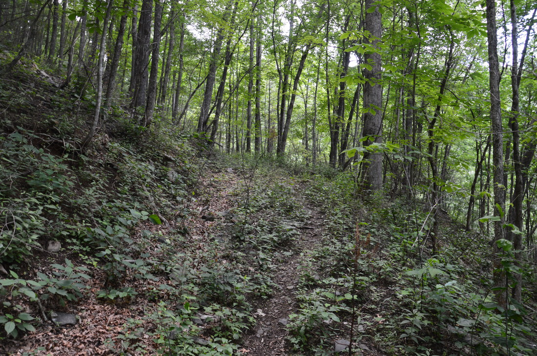
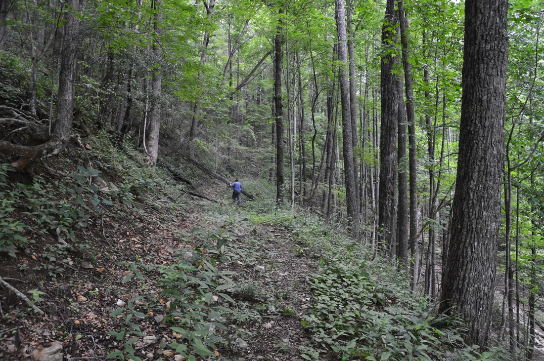
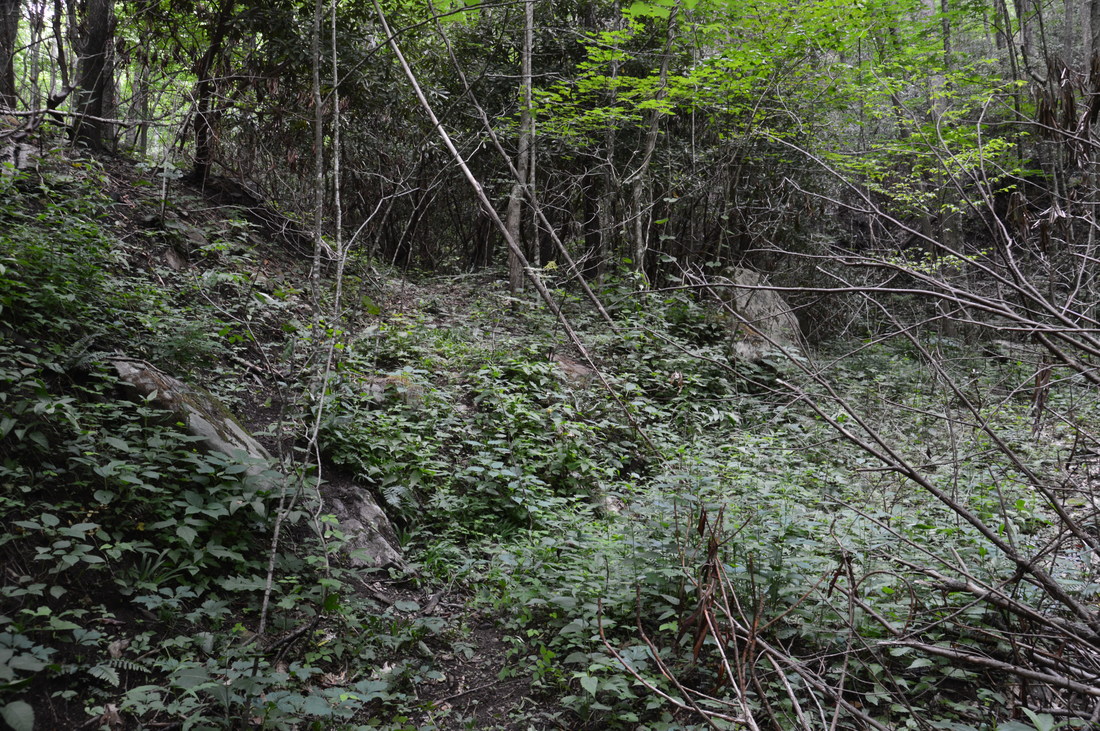
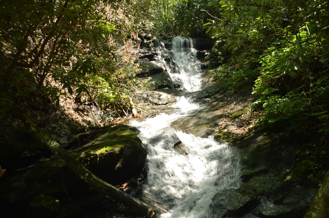
From Lower Denton Creek Falls, retrace your steps back to the junction that I saw earlier. Turn right onto the narrower trail at 0.5 miles, which first ascends moderately along a cove and then turns right to steeply ascend onto a slope high above the creek. The path, which continues to follow the old roadbed, is fainter than the trail to Lower Denton Creek Falls, but clearly, it still receives a good amount of use. At 0.8 miles, there is a roar down in the creek valley below to the right. That is Lower Denton Creek Falls. About 150 feet farther, there will be more rushing water far below. The noise that you hear now is Middle Denton Creek Falls. Getting to it requires turning right off-trail and scrambling down the steep but open slope to the creek. While the scramble is not complicated, I suggest that you do it later and continue on the main trail. In a few yards, the Middle Falls will be visible through the trees down below. After this, the trail catches up with the creek and follows it to a junction at 0.95 miles. The broad logging road bears right and crosses Denton Creek, but the obvious path bears left and leaves the logging road. Do not follow the logging road, as it bypasses the Upper Falls and climbs much higher up the valley. Instead, take the narrower path, which continues on the same side of the creek parallel to it. Some impressive cliffs appear high above to the left as the trail approaches Upper Denton Creek Falls. Reach the terminus of the trail at Upper Denton Creek Falls at 1.1 miles. 

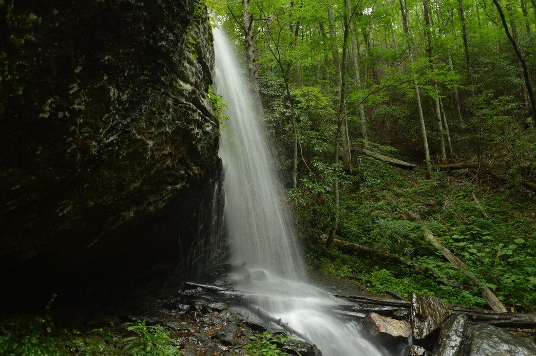
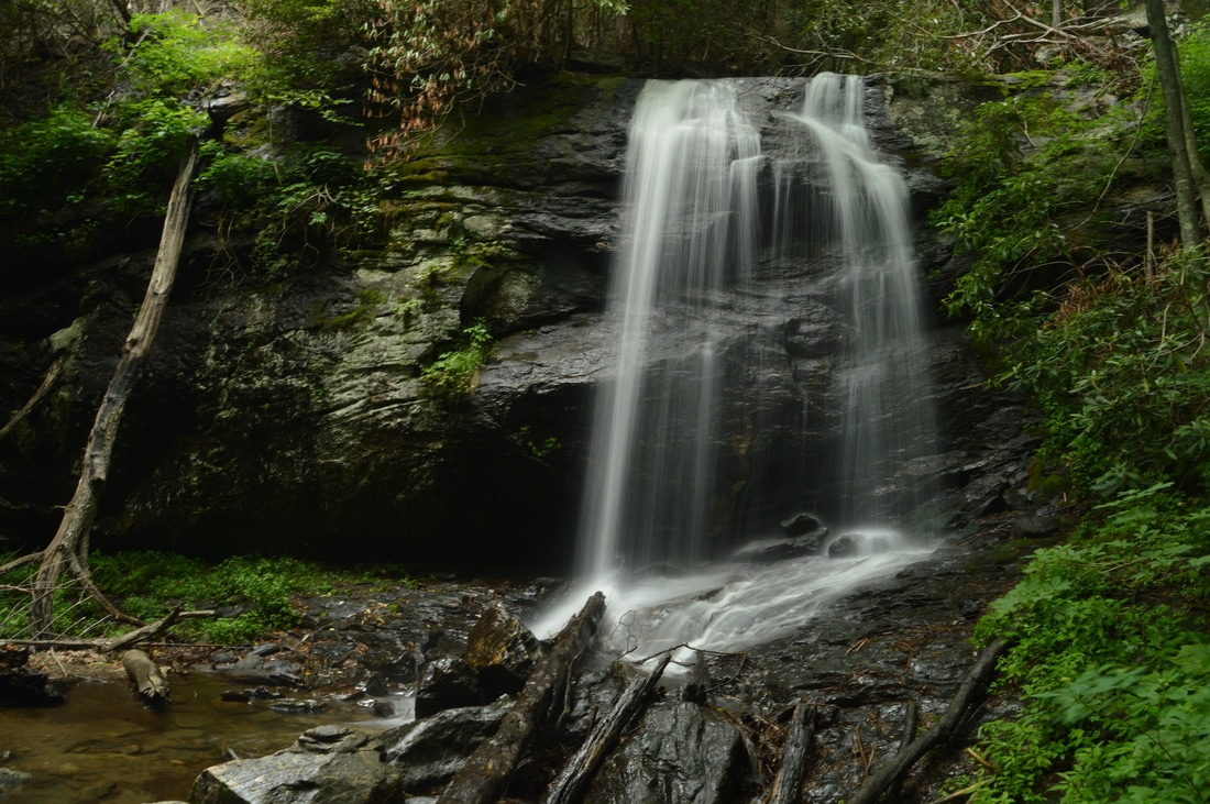
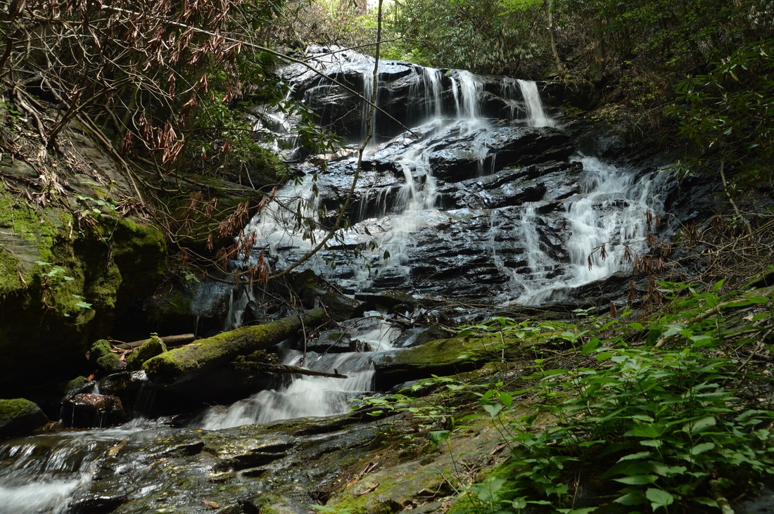
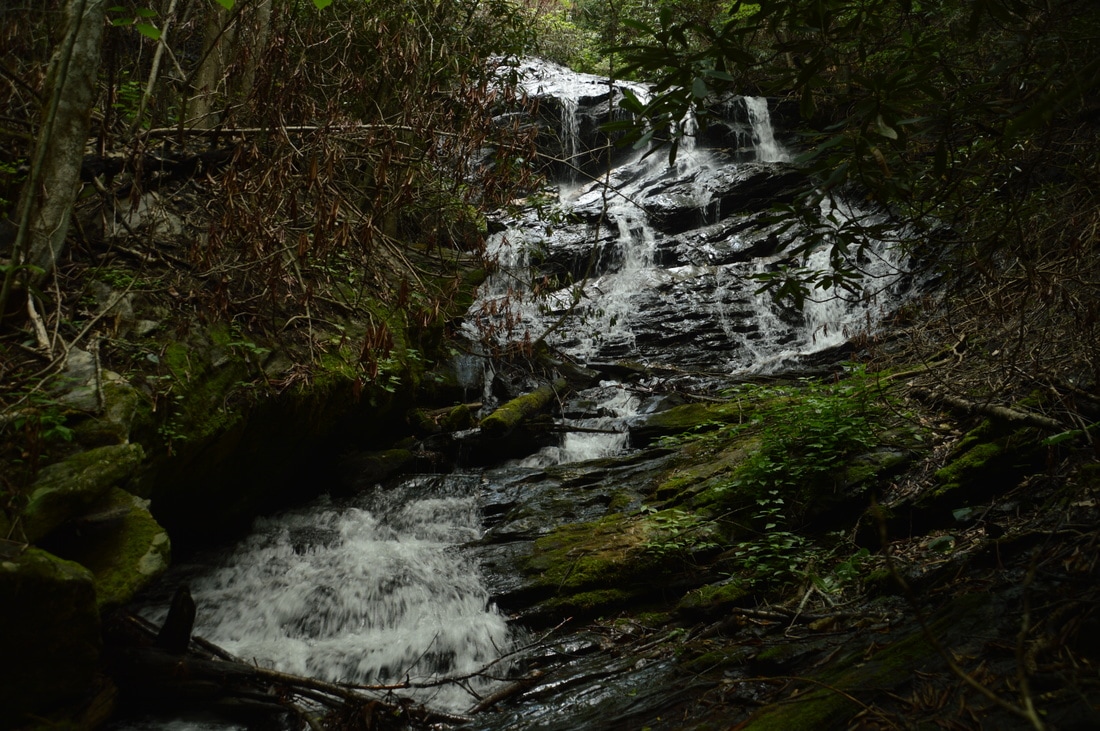
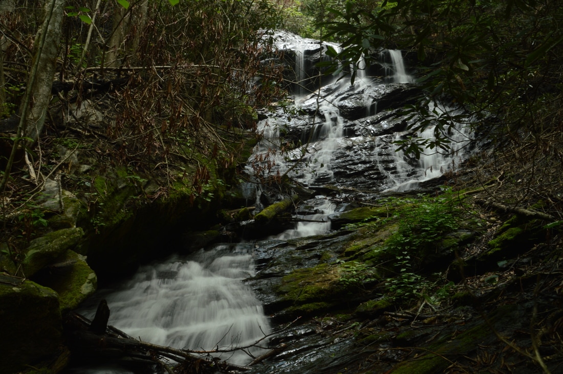
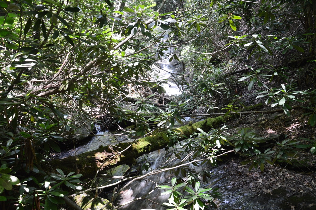
Upper Denton Creek Falls is another really good waterfall. In my opinion, it is almost as gorgeous as Lower Denton Creek Falls. Denton Creek falls down a vertical cliff in several different trickles. Then, the trickles join together for a long sliding drop into a small pool. The total height of the waterfall is about 50 feet. On the left, a separate stream - a small tributary - joins Denton Creek after creating its own waterfall. The tributary actually slides down a surprisingly tall cliff, although with the exception of immediately after heavy rainfall, the waterfall will be low-flow. The tributary joins Denton Creek just below the waterfalls. It is difficult to get a good picture of Upper Denton Creek Falls due to how it is set far back in the narrow gorge. The best view is attained by wading the shallow pool below the falls and scrambling up the right side of the creek. Beware of the slick rocks around the waterfall. 

From Upper Denton Creek Falls, retrace your steps back to the turn-off point for Middle Denton Creek Falls. This spot is easier to find on the way back. First, you will see the waterfall through the trees on the left, and then, there will be a gully on the left that leads down in the direction of the creek. Scramble off-trail steeply down to the creek along or near the gully. Once you reach the creek, walk upstream along it (this may require wading depending on the water level) to the base of Middle Denton Creek Falls at about 1.4 miles. Middle Denton Creek Falls is my least favorite waterfall on Denton Creek but it is still great. The 30-foot waterfall consists of a single sliding drop where the creek is squeezed into a tight channel by cliffs on both sides, followed by a long cascading run-out into a shallow pool full of deadfall. The waterfall would be more photogenic if the pool could be included in the picture, but unfortunately, this is not possible due to deadfall that would block the view. 
Picture
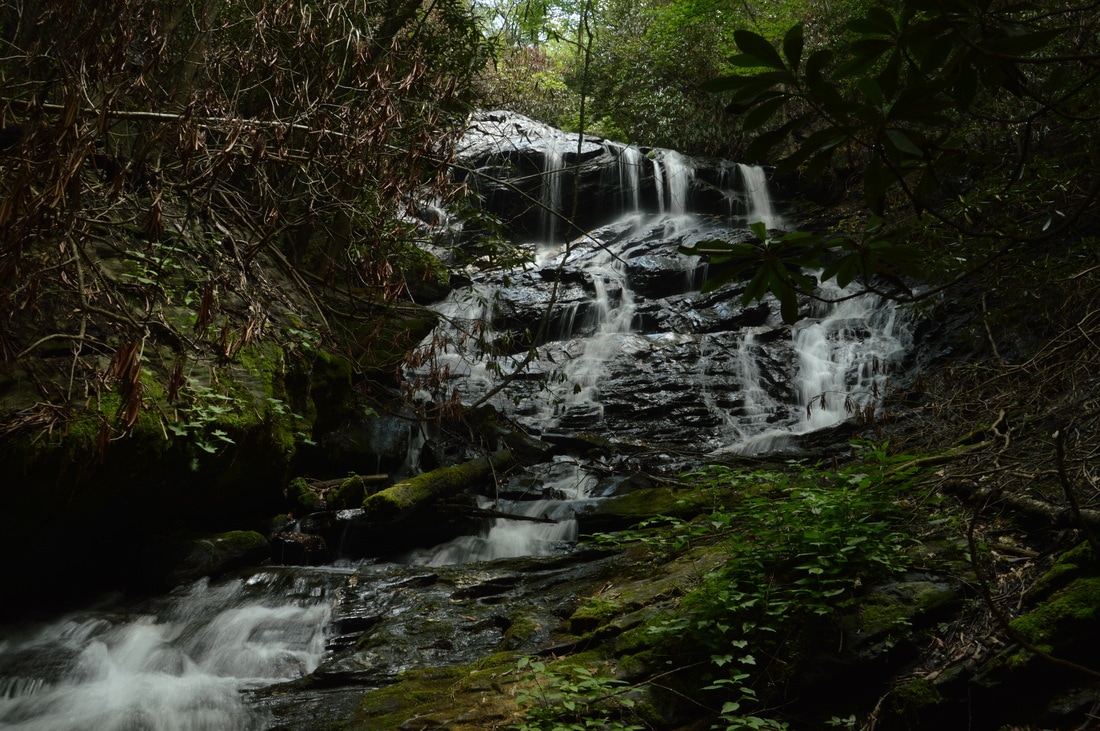
Many streaks of water flowing down a jagged rock face define 45-foot Upper Denton Creek Falls.
From Middle Denton Creek Falls, return to the Denton Creek Trail. Continue following the trail downhill back to the junction below the Lower Falls and continue retracing your steps back to the trailhead. You will return to your car and conclude the hike at 1.9 miles. Due to the spectacular water features along the Denton Creek Trail, I decided to rate this a "Best Hike". For amount of waterfalls and their beauty, ease of access, and length of trail, it is hard to beat Denton Creek. Even novice hikers will have no problem getting to Upper and Lower Denton Creek Falls, and in addition, anyone who hikes this trail will be treated to many beautiful stream views along the way to the waterfalls. Last but not least, the uniqueness of Lower Denton Creek Falls makes this hike even more special, as finding free-fall waterfalls in Northeast Georgia is not easy at all. 
Best Hike!

Mileage

0.0 - Denton Creek Trailhead
0.2 - Junction with Trail to Middle/Upper Falls
0.35 - Lower Denton Creek Falls 
0.5 - Junction with Trail to Middle/Upper Falls 
0.95 - Junction with Trail to Upper Falls 
1.1 - Upper Denton Creek Falls 
1.4 - Middle Denton Creek Falls 
1.9 - Denton Creek Trailhead

Variations

Hike out and back to Lower Denton Creek Falls - 0.7 Miles ​
Skipping Middle Denton Creek Falls makes a negligible difference mileage-wise, but it does make the hike notably easier. Novice hikers may want to skip the steep scramble. 

Bonus Stops

There are several short waterfall hikes along Tallulah River Road that are great to combine with the hike to Denton Creek Falls. One possible add-on is the short but rough hike to Flat Branch Falls, a tall sliding waterfall on a small stream. Another possible add-on is the Coleman River Trail, which follows the Coleman River for a mile, passing many scenic cascades and small waterfalls. 

Pictures

Videos

3 Comments
Theresa Wages link
11/17/2017 11:44:38 am

Just wanted to Thank you for sharing Upper Denton Falls!
I've been to lower countless times & always wondered where that old road bed leads.... We take a lot " of non-hikers " to Lower Denton & use it when we are constrained on time. Upper Denton was spectacular last week & the trail was beautiful . Thanks so much for pointing the way!
Theresa
( we also took your advice on Bullcove which we skipped on our last hike to High Falls)

Reply
Cliff Rahl
4/22/2018 06:41:14 pm

Appreciation! In mid-April '18, with this information, I viewed these waterfalls in the company of a number of Spring wildflowers; a palatable mix of white, pink, purple and maroon colors that dotted the moist greenery. I identified a white Two-wing Silverbell flower with my field guide for the first time.

Some additional information to find the trailhead: If you enter the National Forest, you've gone too far. As Mark indicates, turn right prior to the small bridge. The dirt road Trailhead is located directly across from "River Run N" street which is a private residence with two mailboxes that are white and red.

Reply
Sharon
7/8/2021 06:53:44 am

I visited the upper falls on 7/5/2021 and the trail was VERY overgrown and looked like it had seen little use. Despite having been to the lower falls in April, I wasn’t sure I was on the right trail to the upper falls at first. The poison oak was almost waist high. Be aware that the trail is very weedy this time of year and difficult to follow for the first 10 minutes or so.

Reply


Leave a Reply.

    About Me

    Mark Oleg Ozboyd
    I'm an avid outdoor explorer and a hobbyist landscape photographer. I'm 21 years old and have been hiking since 2011. Originally based out of Atlanta, Georgia, I started out by occasionally hiking short trails throughout well-known Georgia State Parks. During 2012 and 2013, I began to expand my trips into adjacent states, as well as into the wilder National Forest areas rather than just State Parks. Throughout the years that followed, as I slowly ran out of popular hiking trails in my area, I began to search for and hike in more seldom-visited areas. Today, you can find me out in the woods every weekend, whether it's on an official trail or bushwhacking through cross-country terrain without any paths. I now attend Washington & Lee University and am exploring Virginia and West Virginia. My other hobbies include chess, science, old music, and meteorology. I have 3 years of amateur weather forecasting experience, having studied a lot of meteorology basics over the years. I am also a student at European School of Music where I learned that music and nature have a lot in common. Listening to good music inspires me to capture nature's beauty on the camera in different aspects that also make me recall many beautiful music pieces that I've heard.​


    Dear readers: I have invested a tremendous amount of time and effort in this website and the Georgia Waterfalls Database the past five years. All of the work that has gone in keeping these websites updated with my latest trip reports has almost been like a full-time job. This has not allowed me to pick up a paid job to save up money for college, and therefore, I I've had to take out loans. If you find the information on this website interesting, helpful, or time-saving, you can say "thanks" and help me out by clicking the button above and making a contribution. I will be very grateful for any amount of support you give, as all of it will apply toward my college tuition. Thank you! 

    Enter your email address to subscribe for trail reports:

    Delivered by FeedBurner


    Picture
    Coming in 2022-2023?

    Other Hiking Websites

    DWHike's Adventures
    Florida's Natural Wonders
    Florida Trailblazer
    Meanderthals
    Mountain Images
    by Bernie Boyer

    North Carolina Waterfalls with
    ​Kevin Adams
    Take-a-Hike!
    Tennessee Landforms
    Waterfall Page
    Waterfall Adventurer
    Zach's Mild Adventures

    Miles Hiked

    Year 1: 540.0 Miles
    Year 2: 552.3 Miles
    ​Year 3: 518.4 Miles
    Year 4: 482.4 Miles
    Year 5: 259.9 Miles

    Archives

    March 2021
    February 2021
    January 2021
    November 2019
    October 2019
    September 2019
    August 2019
    July 2019
    June 2019
    February 2019
    January 2019
    December 2018
    November 2018
    October 2018
    August 2018
    July 2018
    June 2018
    May 2018
    April 2018
    March 2018
    February 2018
    January 2018
    December 2017
    November 2017
    October 2017
    September 2017
    August 2017
    July 2017
    June 2017
    May 2017
    April 2017
    March 2017
    February 2017
    January 2017
    December 2016
    November 2016
    October 2016
    September 2016
    August 2016
    June 2016
    May 2016
    April 2016
    March 2016
    January 2016
    December 2015
    November 2015
    October 2015
    September 2015
    August 2015
    July 2015
    June 2015
    May 2015
    April 2015
    March 2015
    February 2015
    January 2015
    December 2014
    November 2014
    October 2014
    September 2014
    August 2014
    July 2014
    June 2014
    May 2014
    April 2014
    March 2014
    February 2014

    Categories

    All
    Adel
    Adirondack Park
    Alabama
    Alfred A. Ring Park
    Allegheny Trail
    Amicalola Falls State Park
    Anniston Area
    Apalachicola Bluffs And Ravines Preserve
    Apalachicola National Forest
    Apalachicola/Port St. Joe Area
    Apopka
    Appalachian Trail
    Appling
    Art Loeb Trail
    Aska Trail System
    Bakersville
    Balm-Boyette Scrub Preserve
    Balsam Lake Recreation Area
    Bankhead National Forest
    Bartow County Parks
    Bartram Trail
    Basinger
    Beersheba Springs
    Benton
    Benton Mackaye Trail
    Berry College Trail System
    Best Hike
    Big South Fork National Recreation Area
    Black Bear Wilderness
    Black Rock Mountain State Park
    Blairsville
    Blakely
    Blood Mountain Wilderness
    Blowing Rock
    Blue Ridge
    Blue Ridge Parkway
    Boone
    Bradenton
    Bradenton Beach
    Brasstown Bald
    Brasstown Wilderness
    Brevard
    Bryson City
    Buchanan
    Bucks Pocket State Park
    Bulow Creek State Park
    Bulow Plantation Ruins State Park
    Caesars Head State Park
    Caladesi Island State Park
    Calhoun
    Camel's Hump State Park
    Cashiers
    Caspersen Beach Park
    Catfish Creek State Park
    Caves
    CC Putnam State Forest
    Cedar Point Environmental Park
    Chatsworth
    Chattahoochee National Forest
    Chattanooga
    Chattanooga Valley
    Chattooga National Wild And Scenic River
    Cheaha Wilderness
    Cherohala Skyway
    Cherokee
    Cherokee National Forest
    Chiefland Area
    Chillhowee Recreation Area
    Chipley
    Chunky Gal Trail
    Circle B Bar Reserve
    Citico Creek Wilderness
    Citrus Wildlife Management Area
    Clarkesville
    Clayton
    Cleevland
    Cleveland
    Cloudland Canyon State Park
    Cohutta Wilderness
    Collier-Seminole State Park
    Cordele
    Cornelia
    Covington
    Crestview Area
    Crew-land-and-water-trust
    Cullowhee
    Cumberland Trail
    Dahlonega
    Dalton
    Dawson Forest Wildlife Management Area
    Dawsonville
    Dayton
    De Soto National Memorial
    DeSoto State Park
    Dillard
    Double Springs
    Ducktown
    Duncan Ridge Trail
    Dunlap
    Eagle's Rest Park
    Eastpoint
    Econfina Creek Wildife Management Area
    Eglin Air Force Base
    Elizabethton
    Elkins
    Elk Knob Game Lands
    Elk Park
    Ellicott Rock Wilderness
    Ellijay
    Emerson Point Preserve
    Englewood Area
    Enota Retreat
    Erwin
    Falling Waters State Park
    Fayetteville
    Fires Creek Recreation Area
    Fire Tower
    Flint River
    Florence Area
    Florida
    Florida Caverns State Park
    Florida Trail
    Foothills Trail
    Fort Mountain State Park
    Fort Myers Area
    Fort Payne
    Fort Payne Area
    Fort Yargo State Park
    Franklin
    Franklin Delano Roosevelt State Park
    Franklin-Marion State Forest
    Frozen Head State Park
    Gainesville
    Gainesville Area
    Gatlinburg
    George Washington National Forest
    Georgia
    Georgia Veterans Memorial State Park
    Glasgow
    Gorges State Park
    Grandfather Mountain State Park
    Great Smoky Mountains National Park
    Greeneville
    Green River Game Lands
    Gruetli-Laager
    Grundy Forest State Natural Area
    GTM Reserve
    Guana River Wildlife Management Area
    Hayesville
    Helen
    Hiawassee
    High Falls State Park
    Highlands
    Highlands Scenic Highway
    Hillsborough River State Park
    Hinson Conservation & Recreation Area
    Historic Sites
    Honeymoon Island State Park
    Hot Springs
    Huntington
    Inverness Area
    Jackson
    Jasper
    Jefferson National Forest
    Joan M. Durante Park
    Jonathan Dickinson State Park
    Jones Gap State Park
    Joyce Kilmer Slickrock Wilderness
    Joyce Kilmer - Slickrock Wilderness
    Juniper Prairie Wilderness
    Kelly Park
    Keown Falls Recreation Area
    Kolomoki Mounds State Park
    LaFayette
    Lake City Area
    Lake George Wild Forest
    Lake June-in-Winter State Park
    Lakeland Area
    Lake Placid
    Lake Russell Wildlife Management Area
    Lake Wales Ridge State Forest
    Laurel Fork North Wilderness
    Leffis Key Preserve
    Leon Sinks Geological Area
    Lexington
    Lineville
    Linville
    Linville Gorge Wilderness
    Lithia Springs
    Little Frog Wilderness
    Little Manatee River State Park
    Little River Canyon National Preserve
    Longboat Key
    Long Trail
    Lookout Mountain
    Lookout Mountain Battlefield
    Lovingston
    Lula Lake Land Trust
    Lumpkin
    Maggie Valley
    Manatee Springs State Park
    Marianna Area
    Mark Trail Wilderness
    Marlinton
    Mccaysville
    McMinville
    Mentone
    Middlesex
    Mistletoe State Park
    Monongahela National Forest
    Montreat
    Mountain Bridge Wilderness Area
    Mountain City
    Mountains To Sea Trail
    Mountains-to-Sea Trail
    Mount Rogers National Recreation Area
    Myakka River State Park
    Myron B. Hodge City Park
    Nantahala National Forest
    Naples
    Naples Area
    Natural Bridge State Park
    Neal Preserve
    New Castle
    Newport
    New River Gorge National Park
    New York
    North Carolina
    Ocala Area
    Ocala National Forest
    Ocean-to-Lake Trail
    Oconee State Park
    Oconee Station Historic Site
    Okaloacoochee Slough State Forest
    Oldsmar
    Oneida
    Orlando Area
    Ormond Beach
    Oscar Scherer State Park
    Oxford
    Palatka
    Palmetto Trail
    Panama City Area
    Panthertown Valley
    Parrish
    Paynes Creek Historic State Park
    Peaks Of Otter Recreation Area
    Pigeon Crockford Mountain Wildlife Management Area
    Pigeon-Crockford Mountain Wildlife Management Area
    Pigeon-Crockford Wildlife Management Area
    Pine Mountain
    Pinhoti Trail
    Pinnacle Park
    Pisgah Civitan Park
    Pisgah National Forest
    Pittman Center
    Pond Mountain Wilderness
    Ponds/Lakes
    Prentice Cooper State Forest
    Providence Canyon State Park
    Pumpkintown
    Quick Point Nature Preserve
    Raven Cliffs Wilderness
    Reed Bingham State Park
    Reliance
    Rice Creek Conservation Area
    Riverview Pointe Preserve
    Robbinsville
    Robinson Preserve
    Rock Creek Gorge Scenic Area
    Rock Island State Park
    Rome
    Rosman
    Sale Creek
    Salem
    Salt Springs
    Saluda
    Santa Rosa Beach
    Sarasota
    Sarasota Area
    Savage Gulf State Natural Area
    Scenic Views
    Scottsboro Area
    Sebring Area
    Sewanee
    Sheltowee Trace Trail
    Shining Rock Wilderness
    Signal Mountain
    Sipsey Wilderness
    Sky Valley
    Smithgall Woods State Park
    Snowbird Backcountry Area
    Soddy Daisy
    Soddy-Daisy
    Sopchoppy
    South Carolina
    South Cumberland State Park
    Southeastern Cave Conservancy
    Southern Nantahala Wilderness
    Sparta
    Sprewell Bluff Park
    Spring City
    Spring Hill
    Springs
    Spruce Pine
    Standing Indian Backcountry Area
    St. Augustine
    St. George Island State Park
    St. Joseph Bay State Buffer Preserve
    St. Marks Area
    St. Marks National Wildlife Refuge
    Stone Mountain
    Stone Mountain Park
    Suches
    Sumatra
    Sumter National Forest
    Suwannee River
    Swallow Creek Wildlife Management Area
    Sweetwater Creek State Park
    Sylva
    Talladega National Forest
    Tallahassee Area
    Tallulah Falls
    Tallulah Gorge State Park
    Tampa Bay Area
    Tate City
    Tate's Hell State Forest
    Tea Creek Wildlife Management Area
    Tellico Plains
    Tennessee
    Thomaston
    Toccoa
    Topsail Hill State Park
    Torreya State Park
    Townsend
    Tracy City
    Tray Mountain Wilderness
    Trenton
    Triple Creek Preserve
    Troutdale
    Unaka Mountain Wilderness
    Upper Tampa Bay County Park
    Venice
    Vermont
    Virgin Falls State Natural Area
    Virginia
    Virginia Outdoors Foundation
    Vogel State Park
    Wakulla Springs State Park
    Waleska
    Walhalla
    Wartburg
    Water Features
    Waynesville
    Weedon Island Preserve
    Weeki Wachee Preserve
    Wekiwa Springs State Park
    West Palm Beach Area
    West Virginia
    Whitehall
    White Springs
    Winder
    Withlacoochee State Forest
    Young Harris

    RSS Feed

TRAIL REPORTS

Hikes in Alabama
​Hikes in Florida
Hikes in Georgia
Hikes in North Carolina
Hikes in South Carolina
Hikes in Tennessee
Hikes in Virginia

Hiking Resources

Alabama Resources
​
Florida Resources
Georgia Resources
North Carolina Resources
​South Carolina Resources
​
Tennessee Resources

Other

Contact
Map of Hikes
Alphabetical List of Hikes
Southeast Nature Society
© COPYRIGHT 2014-2018
​ALL RIGHTS RESERVED.
Important: I disclaim any responsibility for any damage or personal injury that may occur as a result of the activities and information found on this website. All outdoor activities, especially off-trail hiking, are done at your own risk. Never hike or head into that area that may be above your fitness or experience level.
  • Home
  • Trail Reports
    • Best Hikes
    • Hikes with Scenic Views
    • Hikes with Water Features
    • Alabama
    • Georgia
    • Florida
    • North Carolina
    • South Carolina
    • Tennessee
    • Vermont
    • Virginia
  • Map
  • Hike List
  • Testimonials
  • Resources
  • Contact Us
  • Southeast Nature Society
    • Our Team
  • Georgia Waterfalls Database