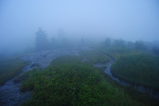
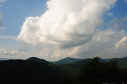
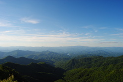
 The North Carolina High Country is a beautiful area. It is part of the Pisgah National Forest, and part of it is also classified as the Shining Rock Wilderness. The NC High Country is where the mountain tops are bald, black balsam trees/forests are abundant, and steep, rushing streams descend into the valleys below to form some of the bigger rivers in the area. The drainages on the south side eventually end up in the Mills River, whereas the drainages on the north side end up in the Pigeon River. Yellowstone Prong is one of the major tributaries of the Mills River on the south side. Just below the bald summit of Black Balsam Mountain, Yellowstone Prong begins its journey southward towards the Mills River, and on the way, it passes through an outlier: a somewhat swampy, lush mountain meadow known as Graveyard Fields. This hike occurred on Saturday, July 19th, 2014, My original plan was to start at the Graveyard Fields Overlook on the Blue Ridge Parkway, hike down into Graveyard Fields via the Graveyard Fields Loop on the west side, and then take the spur trail to Upper Falls out and back. From there, I would take the Graveyard Ridge Connector to the Graveyard Ridge Trail, and the Graveyard Ridge Trail west to the Mountains-to-Sea Trail. Next, I would take the M-t-S to Black Balsam Road, and then the Art Loeb Trail over the bald summits of Black Balsam Mountain and Tennent Mountain to Ivestor Gap. From here, I would return by taking the Graveyard Ridge Trail southward back to the M-t-S. However, to add variety, I would turn left onto the M-t-S at the junction, and then return via the M-t-S Connector to Graveyard Fields Loop. Finally, I would return via the paved path out of Graveyard Fields to the parking area at the overlook. Sounds good enough, eh? Well, what actually happened was a little different. I got to a false gap what I thought was Ivestor Gap, and when I couldn't find Graveyard Ridge Trail, I took the old logging road that went to the left and connected with Ivestor Gap Trail. I followed Ivestor Gap Trail to Black Balsam Road, and finished the hike with 3 miles of roadwalk. This description will follow the actual route of my hike.
1 Comment
 The Bartram Trail was created to extend from Northeast Georgia to Southwest North Carolina in the footsteps of the traveler William Bartram. His book, "The Travels of William Bartram", describes both his travels across the Southeast and the flora and fauna that he discovered in this area. In 1775, he visited a lush watery valley in Northeast Georgia now known as Warwoman Dell, from where he sent specimens of the flora and fauna to London. He was one of the first main explorers of the area. The section of the Bartram Trail described in this post is a section that is surprisingly short for as much as 3 attractions. This hike occurred on Saturday, July 12, 2014. The plan was to follow the Bartram Trail from Warwoman Dell by Becky Branch Falls and Martin Creek Falls to the Pinnacle Knob Trail.. From there, I would take the Pinnacle Knob Trail to the summit of Pinnacle Knob to be treated to what was in my opinion the best view I have seen yet in Georgia. Appalachian Trail: Nantahala Outdoor Center (NOC) to Wesser Bald, Bryson City, North Carolina7/14/2014 
The Nantahala River is a premiere location for whitewater rafting and water slalom. The Nantahala Outdoor Center is situated right along the banks of the Nantahala's rushing waters, and on a good weekend, you can expect at least a hundred people here. Meanwhile, there's something for us hikers too. The Appalachian Trail passes through the NOC, crossing the busy US 74 and the Nantahala River. The Appalachian Trail offers a couple destinations in this area, including Cheoah Bald and Wesser Bald. While both are not easy to reach, both have ultimate rewarding views. This hike occurred on Friday, July 4th, 2014. My plan was to follow the Appalachian Trail from the NOC southward to the Jump-Up, and then even further to Wesser Bald and its fire tower. I would come back the same way.
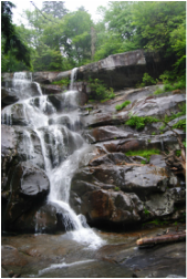
 There's an assortment of waterfalls throughout the Smokies. Waterfalls aren't really my thing, but there are exceptions to that. Ramsey Cascades is the tallest waterfall in the park that is accessed by trail. Mill Creek Falls is slightly taller, but accessible by off-trail means only. Ramsey Cascades is around a hundred feet high, but what makes this waterfall more unusual than other is that it is not a "single drop waterfall", but rather, water cascading straight down a number of rock ledges. Not only is the destination of this hike rewarding, but the trail is too. On the trail, you will cross Ramsey Prong several times, as well as pass through an old-growth forest that contains some of the largest trees in the park. This hike occurred on Saturday, June 28, 2014. My plan was to follow the Ramsey Cascades Trail to Ramsey Cascades, and return the same way, since there were no other ways to return from the waterfall. |
About MeMark Oleg Ozboyd Dear readers: I have invested a tremendous amount of time and effort in this website and the Georgia Waterfalls Database the past five years. All of the work that has gone in keeping these websites updated with my latest trip reports has almost been like a full-time job. This has not allowed me to pick up a paid job to save up money for college, and therefore, I I've had to take out loans. If you find the information on this website interesting, helpful, or time-saving, you can say "thanks" and help me out by clicking the button above and making a contribution. I will be very grateful for any amount of support you give, as all of it will apply toward my college tuition. Thank you!
Coming in 2022-2023?
Other Hiking WebsitesMiles HikedYear 1: 540.0 Miles
Year 2: 552.3 Miles Year 3: 518.4 Miles Year 4: 482.4 Miles Year 5: 259.9 Miles Archives
March 2021
Categories
All
|

 RSS Feed