HIKING THE APPALACHIANS AND BEYOND
  • Home
  • Trail Reports
    • Best Hikes
    • Hikes with Scenic Views
    • Hikes with Water Features
    • Alabama
    • Georgia
    • Florida
    • North Carolina
    • South Carolina
    • Tennessee
    • Vermont
    • Virginia
  • Map
  • Hike List
  • Testimonials
  • Resources
  • Contact Us
  • Southeast Nature Society
    • Our Team
  • Georgia Waterfalls Database

Chattahoochee National Forest: Waterfalls of Sarahs Creek, Clayton, Georgia

5/31/2017

6 Comments

 
Picture
Sarahs Creek is one of a handful of remote streams that drain the slopes of Rabun Bald, Georgia's second highest peak. Most of those streams form noteworthy waterfalls, but while some - such as Holcomb Creek Falls - are popular, others like the two waterfalls on Sarahs Creek are hardly known about. The hike from the end of Forest Road 155C to Upper and Lower Sarahs Creek Falls is fairly easy, but it does entail sections of creek-walk and minor bushwhacking in addition to navigating along faint paths. Those who reach both waterfalls will be rewarded with an interesting upper waterfall in a canyon flanked by a very tall cliff and a pristine lower waterfall that drops around 70 feet. This hike occurred on Saturday, May 27th, 2017. My plan was to hike the gated part of FS 155C from the gate to a faint trail that descended into the Sarahs Creek valley. I would follow the trail for some time, before leaving the trail and bushwhacking down to Sarahs Creek, and hike up the creek to Upper Sarahs Creek Falls. Finally, I would return to the trail and follow it down to Lower Sarahs Creek Falls. I would return the same way. 

Summary

R/T Length of Trail: 1.2 Miles
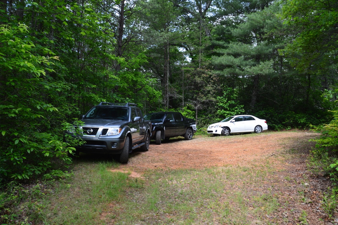
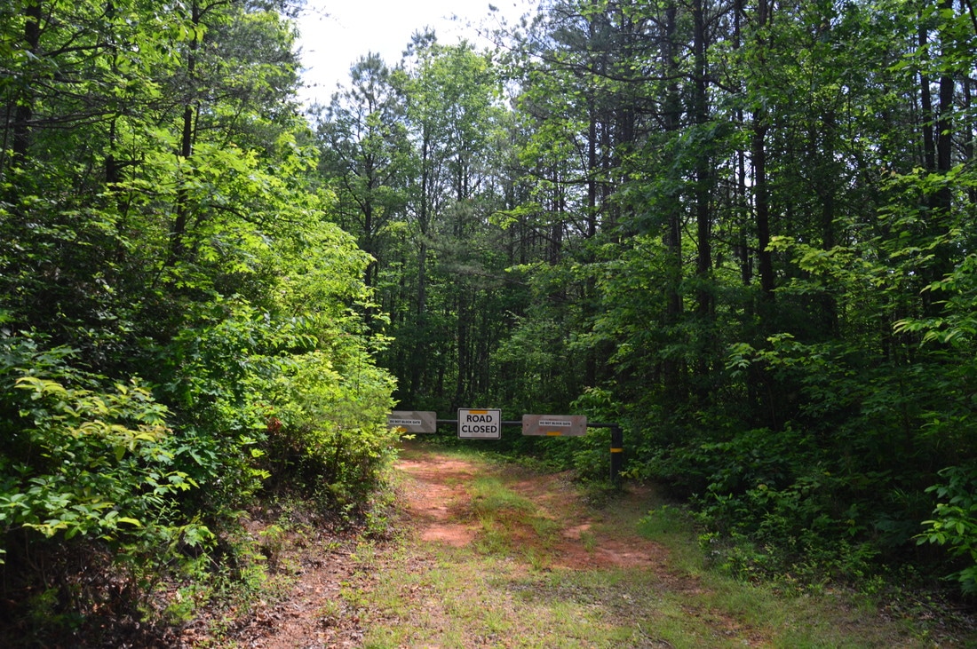
Duration of Hike: 2:30 
Type of Hike: Y-Configuration 
Difficulty Rating: 4 out of 10
Total Elevation Gain: 412 Feet 
Pros: No serious bushwhacking is required despite the remote nature of these waterfalls
Cons: A "creek-walk" is required to reach both the upper and lower waterfalls, and during high water, these creek-walks will be time-consuming ​
Points of Interest: Upper Sarahs Creek Falls - 5 stars; Lower Sarahs Creek Falls - 7 stars 
Trail Blaze Colors: None 
Best Seasons to Hike: Summer
Fees: None 
Beginning Point: End of FS 155C
Directions from Clayton, GA: From the intersection of Rickman Drive, Savannah Street, and US Route 23/441 in Clayton, follow Rickman Drive East. In 0.5 miles, bear diagonally right onto Warwoman Road. Follow Warwoman Road for 8.6 miles. Then, turn left onto Sarahs Creek Road (FS Road 156) and continue for 2.1 miles past the Sarahs Creek Campground and across a bridge over Sarahs Creek. The road begins paved but turns into a well-maintained gravel road. Right after the bridge, turn left onto Wilson Gap Road (FS Road 155) and continue for another 0.3 miles. In a small gap, the more rustic FS Road 155C leaves to the left. Turn left onto this road, which is still easily passable by most passenger vehicles, and continue to its end in 0.1 miles at a gate and large turnaround with plenty of parking space. Make sure to not block the gate. You will pass the signed trail to Kell Cemetery along the drive on FS 155C. 

Map

Picture
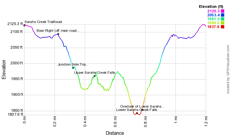
Click here to download a track of this hike. 

Details

Rabun County is a hotspot for waterfalls in Georgia, both in terms of quantity and beauty. Previously undocumented waterfalls are still being discovered in this area on remote streams shrouded by impenetrable rhododendron thickets. The waterfalls on Sarahs Creek are both recent finds by Alan Cressler (upper falls) and Bernie Boyer (lower falls), Fortunately, access to both waterfalls involves very little bushwhacking and is relatively easy for casual hikers who are searching for new remote waterfalls. 

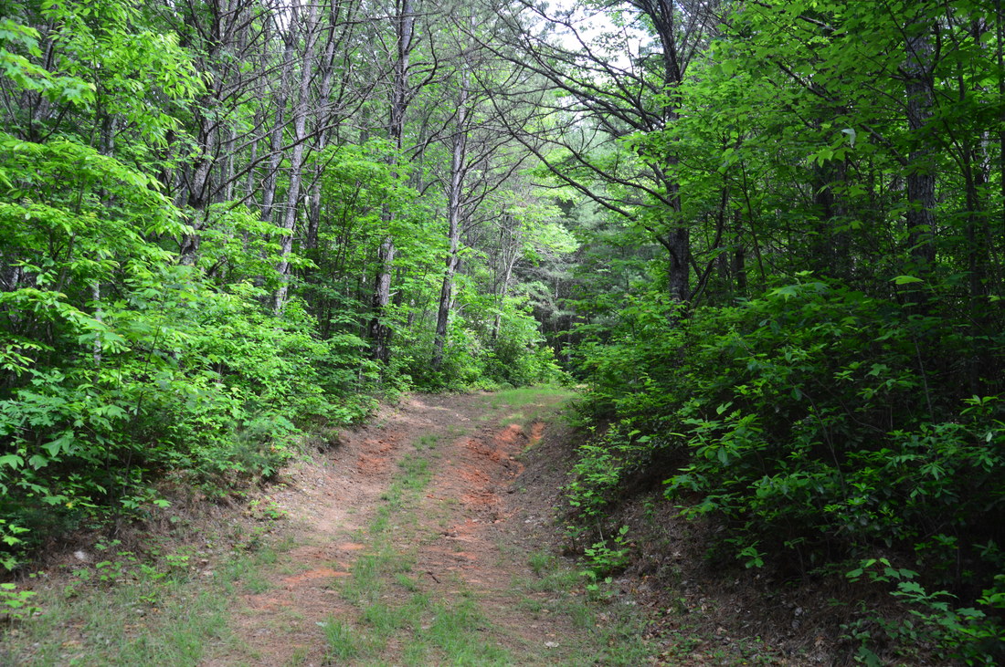
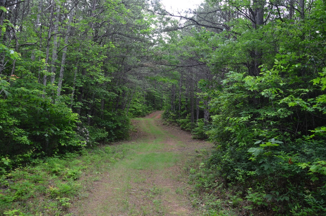
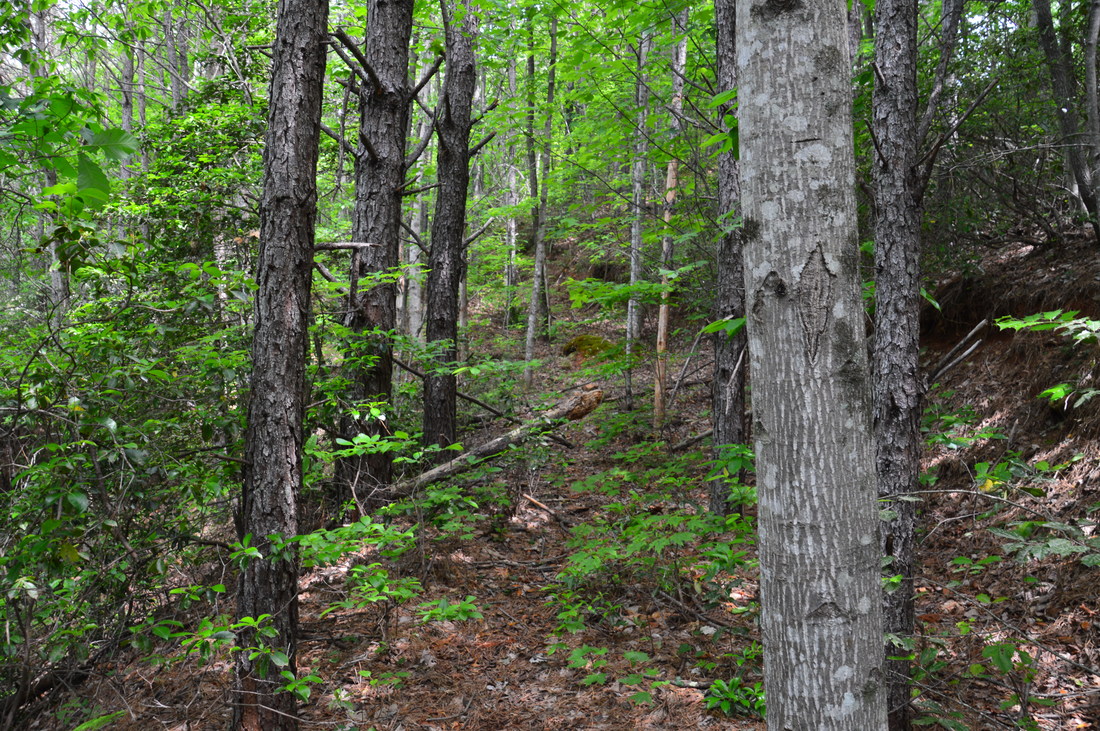
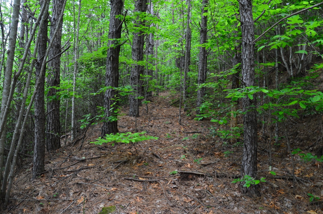
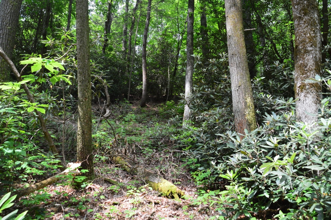
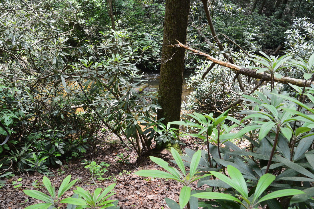
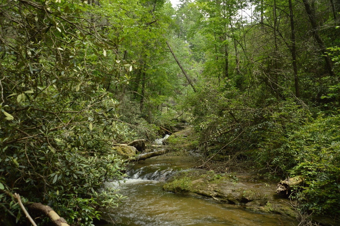
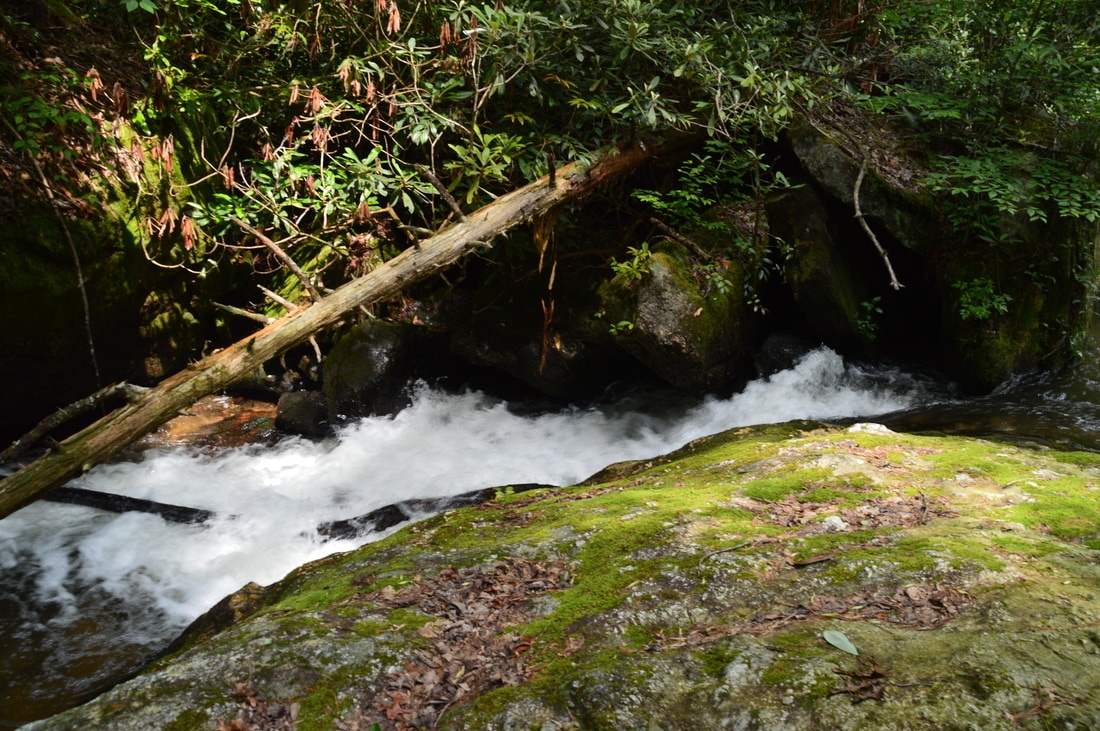
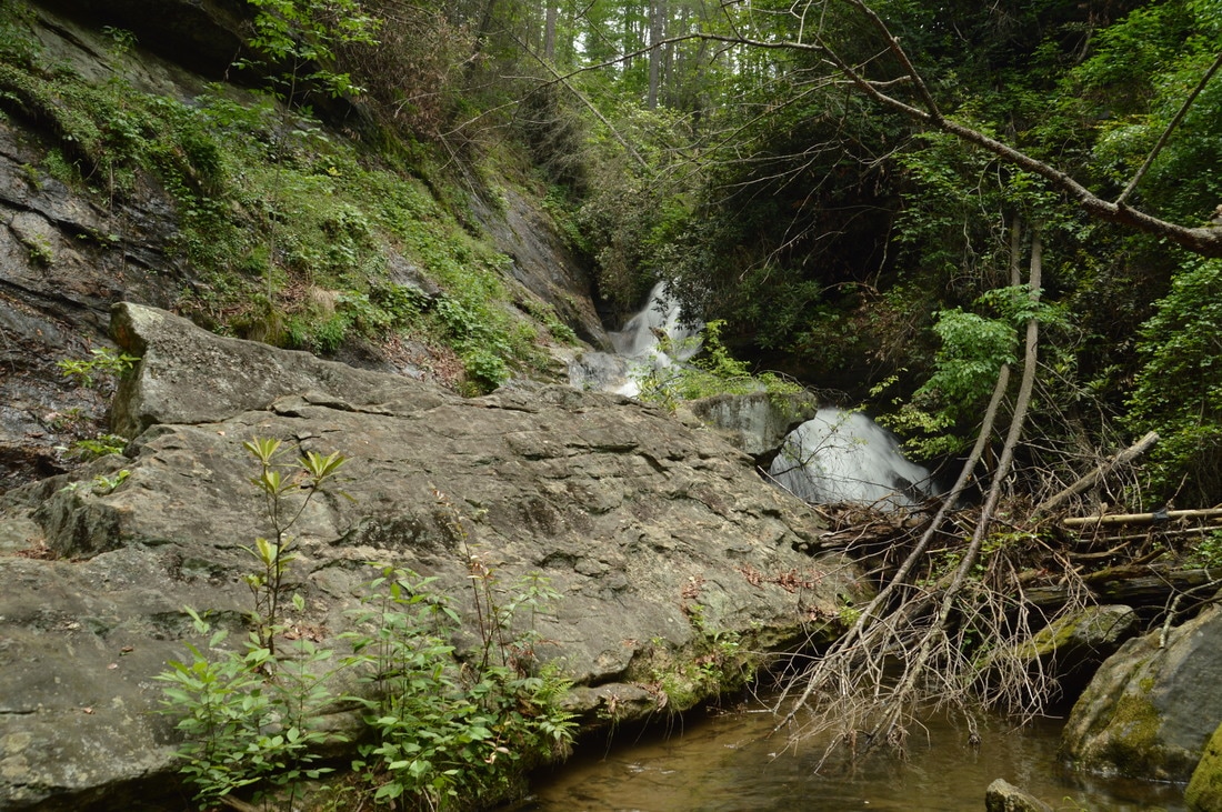
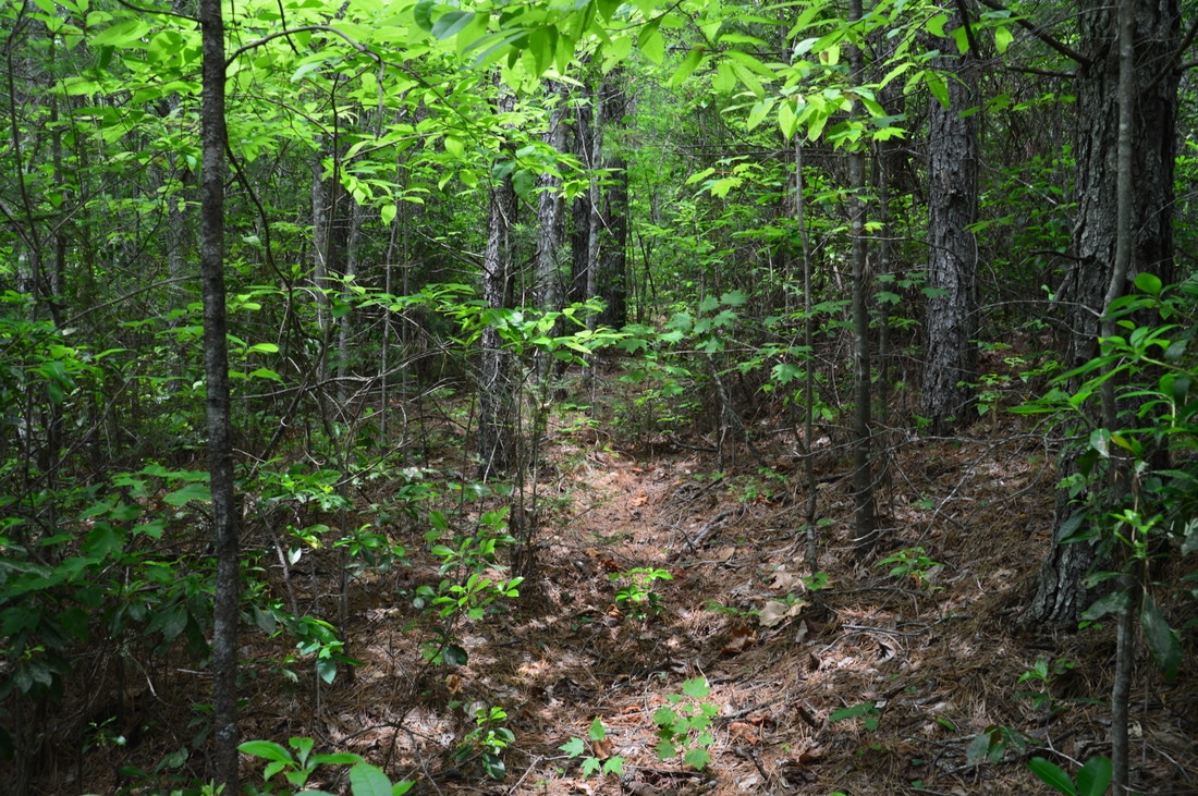
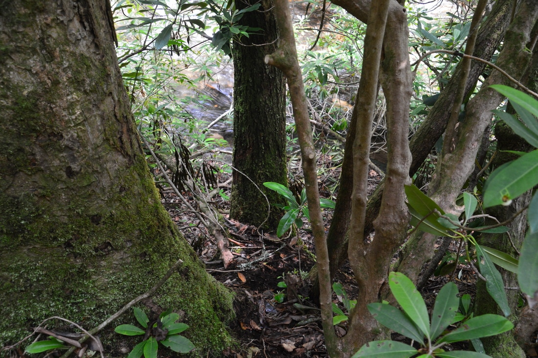
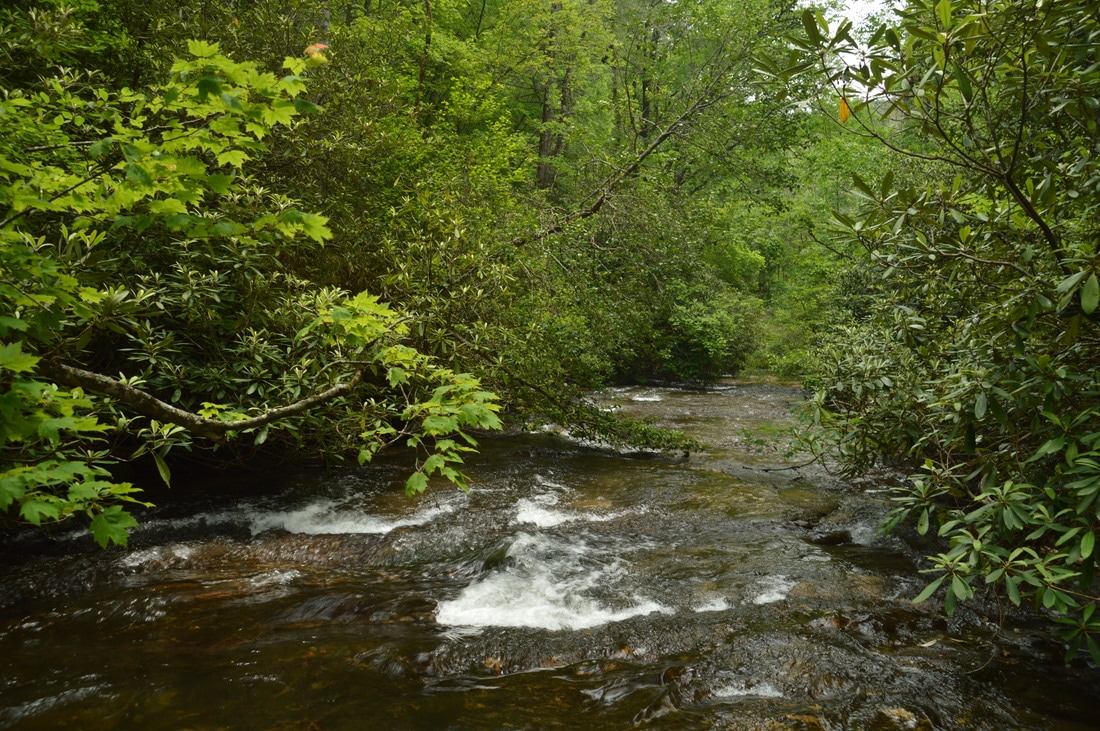
The hike begins at the end of drivable Forest Road 155C. Walk around the gate and follow the grassy forest road southeastward toward Sarahs Creek, descending gently. About 0.2 miles from the trailhead, you will need to leave the forest road and bear right on a faint and narrow path that begins descending more steeply, initially paralleling the main forest road. Note that if you reach the large wildlife clearing at the end of the main forest road, you have gone too far and missed the intersection. The turn-off is very easy to miss until a more distinct path is formed. Once on the path, you will descend moderately along a ridge that extends southward along Sarahs Creek. At about 0.3 miles, you will hear a big roar in Sarahs Creek below, and you will possibly see Upper Sarahs Creek Falls on the far left through the trees. This is a good place to turn left, leaving the path and bushwhacking down the slope toward Sarahs Creek. The woods are fairly open so progress is quite easy along the route of least resistance to Sarahs Creek. There is a semblance of a path closer to the creek. At 0.4 miles, reach Sarahs Creek. From here, the easiest and best way to get to Upper Sarahs Creek Falls is to follow the creekbed, which does involve getting wet. Begin hiking along Sarahs Creek upstream, staying in and out of water that is up to knee-deep. About 100 feet from the beginning of the creek-walk, walk around a cascade on nearly flat rocks to the right. About 200 feet from the beginning of the creek-walk, there is another cascade that presents a slightly more challenging obstacle. First, scramble up the rocks on the left side, and then walk to the right, wading in the main creek channel above the cascade. Shortly after this, at 0.45 miles, reach a view of Upper Sarahs Creek Falls in front of a deep pool.
Picture
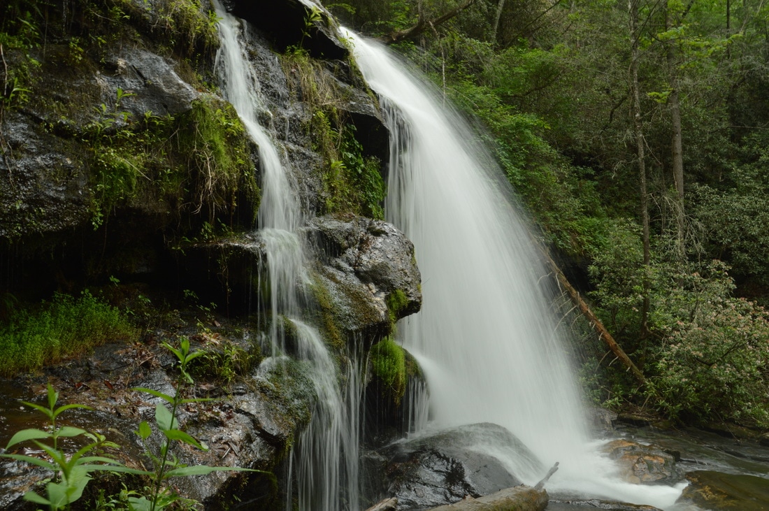
Upper Sarahs Creek Falls, while not an impressive waterfall by itself, has one of the more intriguing settings I've seen at any waterfall in Georgia. A tall sheer cliff, blanketed by grasses, moss, and ivy, lines the left side of Sarahs Creek at the falls, and the creek itself gets squeezed into a surprisingly narrow passage.
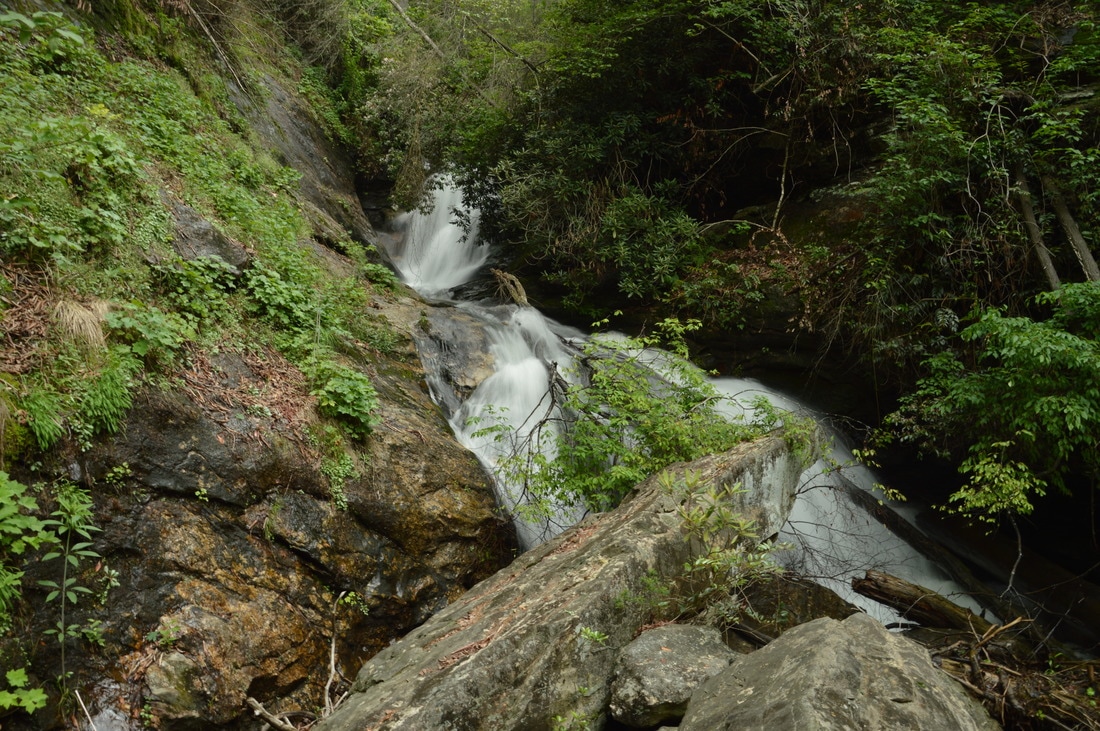
Upper Sarahs Creek Falls by itself is just an average waterfall. The falls is about 40 feet high, although I am convinced that there is more falling water hidden around the bend that the creek makes. The waterfall consists of a free-fall drop of approximately 20 feet followed by a broad slide of the same height. The setting around Upper Sarahs Creek Falls is unique and really spices up the waterfall itself however. A long and tall sheer cliff - blanketed by grasses, ivy, and moss - stretches along the left side of the creek, starting from the beginning of the pool below the falls all the way to the top of the falls. A jumble of boulders lies at the far end of the pool and separates twin channels of the creek just below the falls. The top of the biggest (narrow) boulder in front of the falls provides a closer view of the falls, but getting to it is tricky due to the deepness of the water in the pool, which was above my waist. I can confirm that I tripped over an underwater log in the pool in the process of getting to the boulder and got immersed nearly up to my shoulders. 

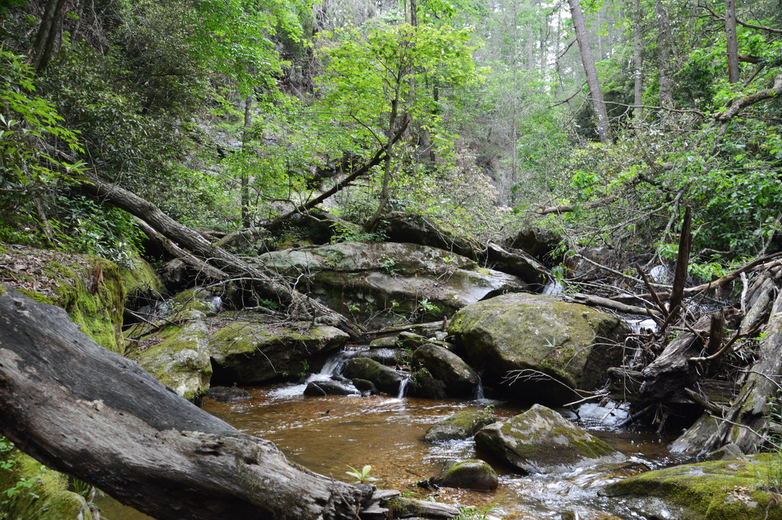
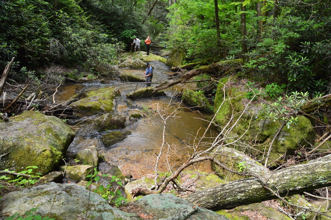
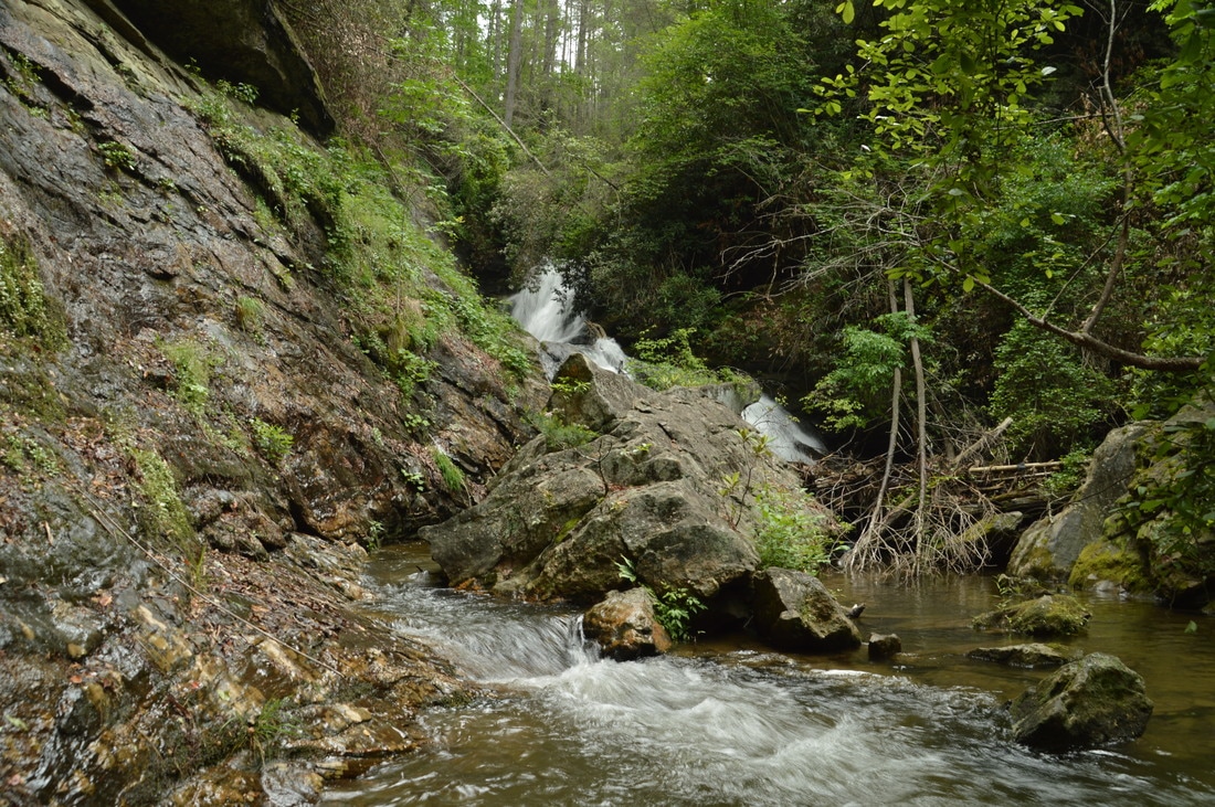
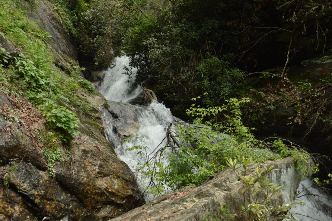
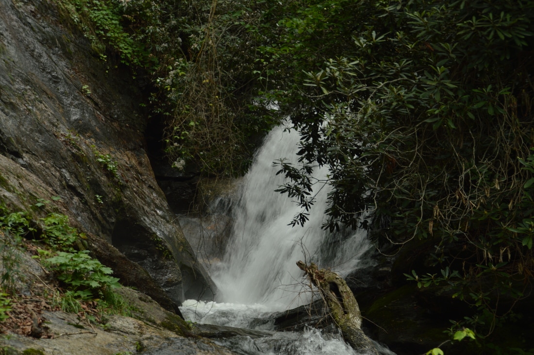
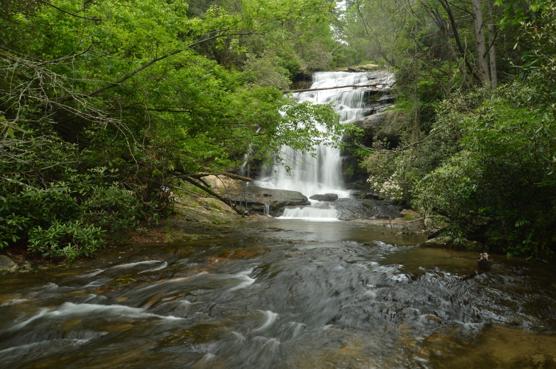
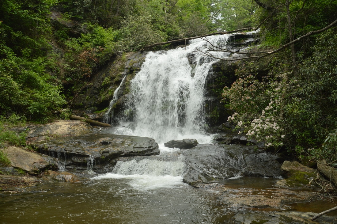
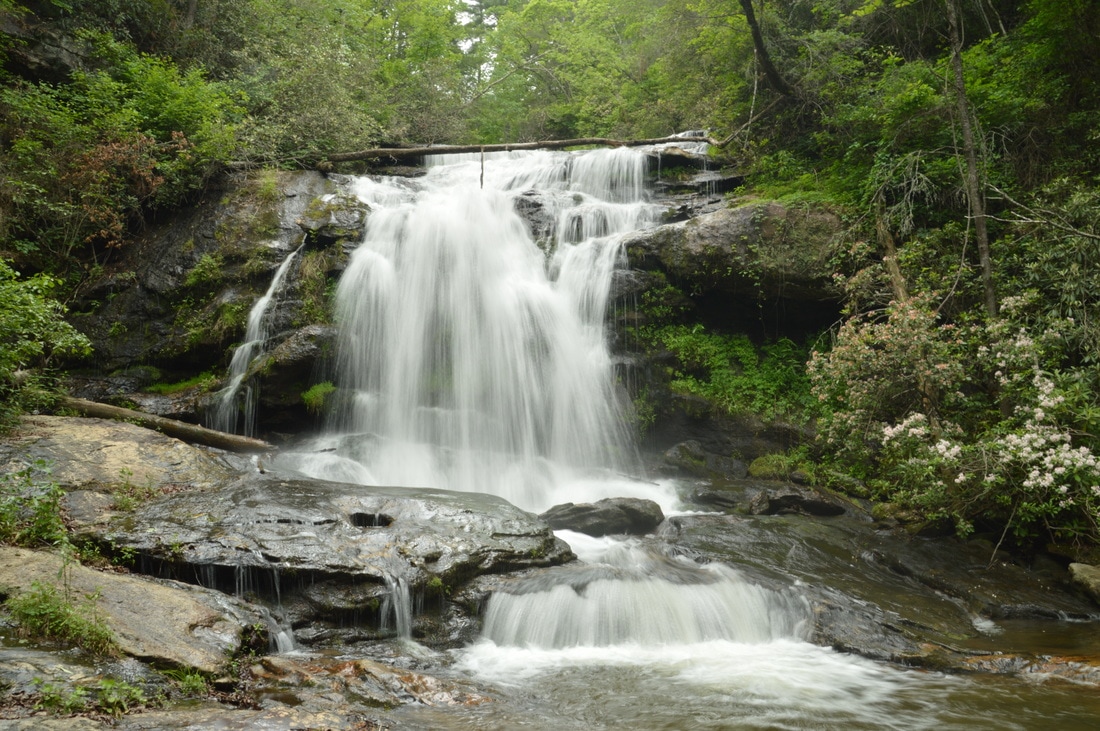
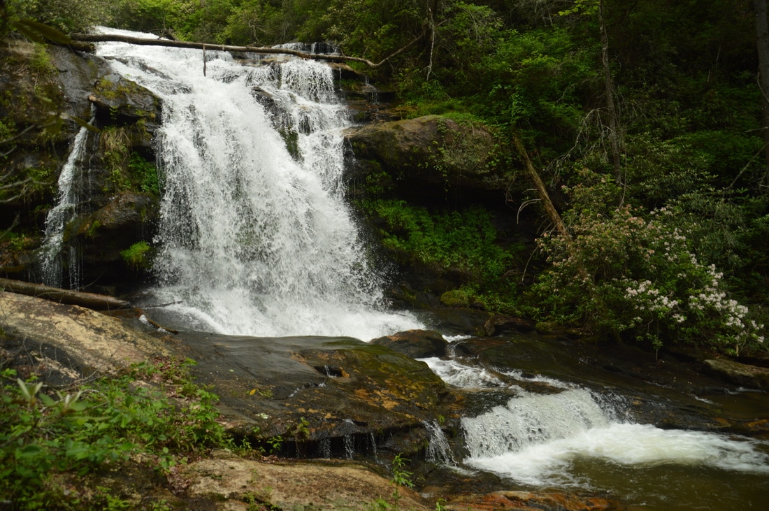
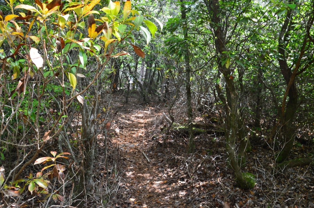
From Upper Sarahs Creek Falls, return along the same way back to the "trail" that follows the spine of the ridge parallel to Sarahs Creek. Turn left onto the faint path and continue following it steeply down the ridge. You may find some flagging tape that helps to reaffirm the correct route. As the trail gets closer to Lower Sarahs Creek Falls, it actually becomes more distinct and exhibits signs of usage. At 0.7 miles, there is a semi-open area to the left that provides a good overlook of Lower Sarahs Creek Falls. The full waterfall is around 70 feet high, but from the base, you will only be able to see the lower half. If the tree (fallen directly across the waterfall) is still there, it will serve as a good indicator of how much of the falls is visible from the base. Thus, the overlook provides a unique view in the sense that you can see the full run of the waterfall from it. From the overlook, continue following the path, which becomes very steep before ending at Sarahs Creek. For the final 100 feet, it is necessary to walk in the creekbed upstream to the falls from here, although depending on the water level, you may be able to stay dry. When all of the rocks are underwater, they become very slippery, so proceed with caution. Reach Lower Sarahs Creek Falls at 0.75 miles. A broad rock slab on the left side of the creek provides a safe and dry viewing location for the waterfall. 
Picture
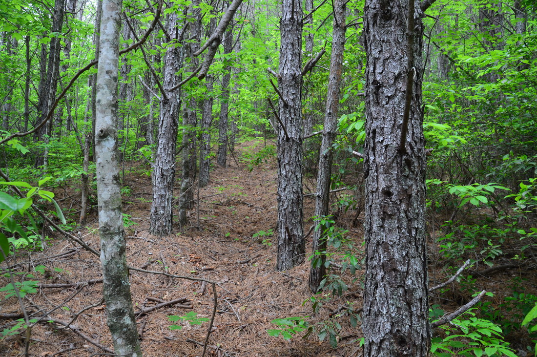
Most of the hike to Lower Sarahs Creek Falls is on a faint but discernible path.
From the viewing area at the base of Lower Sarahs Creek Falls, you'll be surprised that only about 35 feet of the waterfall - the section below the fallen tree - is in the view. Nevertheless, this is a gorgeous and powerful waterfall. Sarahs Creek forms a dense curtain of white as it spills over the sheer ledge that forms the lower part of the falls, and during normal water levels, a separate ribbon of falling water forms to the left of the main flow channel. All around the falls are rock outcrops and slopes covered in lush green vegetation. You will notice that despite its short length, this hike took me two and a half hours complete. Part of the reason is that my hiking partners and I spent at least 30 minutes on photography at each waterfall. 

From Lower Sarahs Creek Falls, simply retrace your steps back along the trail and forest road to the trailhead, concluding the hike at 1.2 miles having viewed two great waterfalls without expanding much effort. The climb up to the forest road is reasonably steep, so take your time. 

Mileage

0.0 - FS 155C Trailhead 
0.45 - Upper Sarahs Creek Falls 
0.75 - Lower Sarahs Creek Falls 
1.2 - FS 155C Trailhead 

Variations

Hike out and back to just Upper Sarahs Creek Falls - 0.9 Miles
Hike out and back to just Lower Sarahs Creek Falls - 0.9 Miles

Bonus Stops

Along the way on FS 155C to the trailhead, you will pass the signed trail to Kell Cemetery. This short trail is worth a quick stop before or after the Sarahs Creek hike. The 5-minute trail leads to a large and old cemetery at the top of a knoll. There are only two inscribed stones in the cemetery, which has over 50 graves altogether. Both of the inscribed stones have dates from the 1800s. I have added a few photos of the walk to the cemetery in the gallery below. 

Pictures

Videos

6 Comments
Robert Marshall
2/12/2019 10:33:13 pm

My grandmother Essie McCall was borin in 1898 just above Big Creek and climbed Rabun Bald when she was 14 years old just to be closer to God. Was there any visible names and dates on the two tombstones?

Reply
Sarah Pannell
9/6/2019 11:48:57 pm

I am named after Sarah's Creek it was given to me by my father. I have plans to visit its unique beauty someday because the last time I was their was when my mother was pregnant with me.

Reply
John Stembel
8/30/2020 09:07:14 pm

Hiked these two beautiful falls with my wife and pups. Someone flagged the trail to the creek between the two falls. It is an incredible view to hike downstream to the top of the lower falls.

Reply
Stephen
3/28/2021 12:16:30 pm

Mark - most of your track downloads do not work. They take you to a sales page on the Garmin site.

But the rest of your work is great! I have used your work, Boyer's, Adam's, and multiple others and my wife and I have seen 550+ falls in GA, SC, NC. Thanks.

Reply
Alex
6/24/2021 10:57:22 am

Stephen,

We are long time follower of Mark's website as well.

You can click on the "view larger map" square on the google map on this page and it will open the whole track in a new window. Then click the 3 vertical dots on the upperright corner of the left panel, a drop down menu will appear, scroll down and click the "Download KML" item, it will allow you to save the GPS track in KMZ/KML format.

Reply
Robert Marshall
9/21/2021 02:09:28 pm

I discovered my grandmother was born on a small farm near Hedden Cteek and not near Big Creek. Her mother was Martha Hedden and My grandfather Samuel McCall was buried in Hedden Cemetarty. I have been to Hedden Creek Falls.

Reply


Leave a Reply.

    About Me

    Mark Oleg Ozboyd
    I'm an avid outdoor explorer and a hobbyist landscape photographer. I'm 21 years old and have been hiking since 2011. Originally based out of Atlanta, Georgia, I started out by occasionally hiking short trails throughout well-known Georgia State Parks. During 2012 and 2013, I began to expand my trips into adjacent states, as well as into the wilder National Forest areas rather than just State Parks. Throughout the years that followed, as I slowly ran out of popular hiking trails in my area, I began to search for and hike in more seldom-visited areas. Today, you can find me out in the woods every weekend, whether it's on an official trail or bushwhacking through cross-country terrain without any paths. I now attend Washington & Lee University and am exploring Virginia and West Virginia. My other hobbies include chess, science, old music, and meteorology. I have 3 years of amateur weather forecasting experience, having studied a lot of meteorology basics over the years. I am also a student at European School of Music where I learned that music and nature have a lot in common. Listening to good music inspires me to capture nature's beauty on the camera in different aspects that also make me recall many beautiful music pieces that I've heard.​


    Dear readers: I have invested a tremendous amount of time and effort in this website and the Georgia Waterfalls Database the past five years. All of the work that has gone in keeping these websites updated with my latest trip reports has almost been like a full-time job. This has not allowed me to pick up a paid job to save up money for college, and therefore, I I've had to take out loans. If you find the information on this website interesting, helpful, or time-saving, you can say "thanks" and help me out by clicking the button above and making a contribution. I will be very grateful for any amount of support you give, as all of it will apply toward my college tuition. Thank you! 

    Enter your email address to subscribe for trail reports:

    Delivered by FeedBurner


    Picture
    Coming in 2022-2023?

    Other Hiking Websites

    DWHike's Adventures
    Florida's Natural Wonders
    Florida Trailblazer
    Meanderthals
    Mountain Images
    by Bernie Boyer

    North Carolina Waterfalls with
    ​Kevin Adams
    Take-a-Hike!
    Tennessee Landforms
    Waterfall Page
    Waterfall Adventurer
    Zach's Mild Adventures

    Miles Hiked

    Year 1: 540.0 Miles
    Year 2: 552.3 Miles
    ​Year 3: 518.4 Miles
    Year 4: 482.4 Miles
    Year 5: 259.9 Miles

    Archives

    March 2021
    February 2021
    January 2021
    November 2019
    October 2019
    September 2019
    August 2019
    July 2019
    June 2019
    February 2019
    January 2019
    December 2018
    November 2018
    October 2018
    August 2018
    July 2018
    June 2018
    May 2018
    April 2018
    March 2018
    February 2018
    January 2018
    December 2017
    November 2017
    October 2017
    September 2017
    August 2017
    July 2017
    June 2017
    May 2017
    April 2017
    March 2017
    February 2017
    January 2017
    December 2016
    November 2016
    October 2016
    September 2016
    August 2016
    June 2016
    May 2016
    April 2016
    March 2016
    January 2016
    December 2015
    November 2015
    October 2015
    September 2015
    August 2015
    July 2015
    June 2015
    May 2015
    April 2015
    March 2015
    February 2015
    January 2015
    December 2014
    November 2014
    October 2014
    September 2014
    August 2014
    July 2014
    June 2014
    May 2014
    April 2014
    March 2014
    February 2014

    Categories

    All
    Adel
    Adirondack Park
    Alabama
    Alfred A. Ring Park
    Allegheny Trail
    Amicalola Falls State Park
    Anniston Area
    Apalachicola Bluffs And Ravines Preserve
    Apalachicola National Forest
    Apalachicola/Port St. Joe Area
    Apopka
    Appalachian Trail
    Appling
    Art Loeb Trail
    Aska Trail System
    Bakersville
    Balm-Boyette Scrub Preserve
    Balsam Lake Recreation Area
    Bankhead National Forest
    Bartow County Parks
    Bartram Trail
    Basinger
    Beersheba Springs
    Benton
    Benton Mackaye Trail
    Berry College Trail System
    Best Hike
    Big South Fork National Recreation Area
    Black Bear Wilderness
    Black Rock Mountain State Park
    Blairsville
    Blakely
    Blood Mountain Wilderness
    Blowing Rock
    Blue Ridge
    Blue Ridge Parkway
    Boone
    Bradenton
    Bradenton Beach
    Brasstown Bald
    Brasstown Wilderness
    Brevard
    Bryson City
    Buchanan
    Bucks Pocket State Park
    Bulow Creek State Park
    Bulow Plantation Ruins State Park
    Caesars Head State Park
    Caladesi Island State Park
    Calhoun
    Camel's Hump State Park
    Cashiers
    Caspersen Beach Park
    Catfish Creek State Park
    Caves
    CC Putnam State Forest
    Cedar Point Environmental Park
    Chatsworth
    Chattahoochee National Forest
    Chattanooga
    Chattanooga Valley
    Chattooga National Wild And Scenic River
    Cheaha Wilderness
    Cherohala Skyway
    Cherokee
    Cherokee National Forest
    Chiefland Area
    Chillhowee Recreation Area
    Chipley
    Chunky Gal Trail
    Circle B Bar Reserve
    Citico Creek Wilderness
    Citrus Wildlife Management Area
    Clarkesville
    Clayton
    Cleevland
    Cleveland
    Cloudland Canyon State Park
    Cohutta Wilderness
    Collier-Seminole State Park
    Cordele
    Cornelia
    Covington
    Crestview Area
    Crew-land-and-water-trust
    Cullowhee
    Cumberland Trail
    Dahlonega
    Dalton
    Dawson Forest Wildlife Management Area
    Dawsonville
    Dayton
    De Soto National Memorial
    DeSoto State Park
    Dillard
    Double Springs
    Ducktown
    Duncan Ridge Trail
    Dunlap
    Eagle's Rest Park
    Eastpoint
    Econfina Creek Wildife Management Area
    Eglin Air Force Base
    Elizabethton
    Elkins
    Elk Knob Game Lands
    Elk Park
    Ellicott Rock Wilderness
    Ellijay
    Emerson Point Preserve
    Englewood Area
    Enota Retreat
    Erwin
    Falling Waters State Park
    Fayetteville
    Fires Creek Recreation Area
    Fire Tower
    Flint River
    Florence Area
    Florida
    Florida Caverns State Park
    Florida Trail
    Foothills Trail
    Fort Mountain State Park
    Fort Myers Area
    Fort Payne
    Fort Payne Area
    Fort Yargo State Park
    Franklin
    Franklin Delano Roosevelt State Park
    Franklin-Marion State Forest
    Frozen Head State Park
    Gainesville
    Gainesville Area
    Gatlinburg
    George Washington National Forest
    Georgia
    Georgia Veterans Memorial State Park
    Glasgow
    Gorges State Park
    Grandfather Mountain State Park
    Great Smoky Mountains National Park
    Greeneville
    Green River Game Lands
    Gruetli-Laager
    Grundy Forest State Natural Area
    GTM Reserve
    Guana River Wildlife Management Area
    Hayesville
    Helen
    Hiawassee
    High Falls State Park
    Highlands
    Highlands Scenic Highway
    Hillsborough River State Park
    Hinson Conservation & Recreation Area
    Historic Sites
    Honeymoon Island State Park
    Hot Springs
    Huntington
    Inverness Area
    Jackson
    Jasper
    Jefferson National Forest
    Joan M. Durante Park
    Jonathan Dickinson State Park
    Jones Gap State Park
    Joyce Kilmer Slickrock Wilderness
    Joyce Kilmer - Slickrock Wilderness
    Juniper Prairie Wilderness
    Kelly Park
    Keown Falls Recreation Area
    Kolomoki Mounds State Park
    LaFayette
    Lake City Area
    Lake George Wild Forest
    Lake June-in-Winter State Park
    Lakeland Area
    Lake Placid
    Lake Russell Wildlife Management Area
    Lake Wales Ridge State Forest
    Laurel Fork North Wilderness
    Leffis Key Preserve
    Leon Sinks Geological Area
    Lexington
    Lineville
    Linville
    Linville Gorge Wilderness
    Lithia Springs
    Little Frog Wilderness
    Little Manatee River State Park
    Little River Canyon National Preserve
    Longboat Key
    Long Trail
    Lookout Mountain
    Lookout Mountain Battlefield
    Lovingston
    Lula Lake Land Trust
    Lumpkin
    Maggie Valley
    Manatee Springs State Park
    Marianna Area
    Mark Trail Wilderness
    Marlinton
    Mccaysville
    McMinville
    Mentone
    Middlesex
    Mistletoe State Park
    Monongahela National Forest
    Montreat
    Mountain Bridge Wilderness Area
    Mountain City
    Mountains To Sea Trail
    Mountains-to-Sea Trail
    Mount Rogers National Recreation Area
    Myakka River State Park
    Myron B. Hodge City Park
    Nantahala National Forest
    Naples
    Naples Area
    Natural Bridge State Park
    Neal Preserve
    New Castle
    Newport
    New River Gorge National Park
    New York
    North Carolina
    Ocala Area
    Ocala National Forest
    Ocean-to-Lake Trail
    Oconee State Park
    Oconee Station Historic Site
    Okaloacoochee Slough State Forest
    Oldsmar
    Oneida
    Orlando Area
    Ormond Beach
    Oscar Scherer State Park
    Oxford
    Palatka
    Palmetto Trail
    Panama City Area
    Panthertown Valley
    Parrish
    Paynes Creek Historic State Park
    Peaks Of Otter Recreation Area
    Pigeon Crockford Mountain Wildlife Management Area
    Pigeon-Crockford Mountain Wildlife Management Area
    Pigeon-Crockford Wildlife Management Area
    Pine Mountain
    Pinhoti Trail
    Pinnacle Park
    Pisgah Civitan Park
    Pisgah National Forest
    Pittman Center
    Pond Mountain Wilderness
    Ponds/Lakes
    Prentice Cooper State Forest
    Providence Canyon State Park
    Pumpkintown
    Quick Point Nature Preserve
    Raven Cliffs Wilderness
    Reed Bingham State Park
    Reliance
    Rice Creek Conservation Area
    Riverview Pointe Preserve
    Robbinsville
    Robinson Preserve
    Rock Creek Gorge Scenic Area
    Rock Island State Park
    Rome
    Rosman
    Sale Creek
    Salem
    Salt Springs
    Saluda
    Santa Rosa Beach
    Sarasota
    Sarasota Area
    Savage Gulf State Natural Area
    Scenic Views
    Scottsboro Area
    Sebring Area
    Sewanee
    Sheltowee Trace Trail
    Shining Rock Wilderness
    Signal Mountain
    Sipsey Wilderness
    Sky Valley
    Smithgall Woods State Park
    Snowbird Backcountry Area
    Soddy Daisy
    Soddy-Daisy
    Sopchoppy
    South Carolina
    South Cumberland State Park
    Southeastern Cave Conservancy
    Southern Nantahala Wilderness
    Sparta
    Sprewell Bluff Park
    Spring City
    Spring Hill
    Springs
    Spruce Pine
    Standing Indian Backcountry Area
    St. Augustine
    St. George Island State Park
    St. Joseph Bay State Buffer Preserve
    St. Marks Area
    St. Marks National Wildlife Refuge
    Stone Mountain
    Stone Mountain Park
    Suches
    Sumatra
    Sumter National Forest
    Suwannee River
    Swallow Creek Wildlife Management Area
    Sweetwater Creek State Park
    Sylva
    Talladega National Forest
    Tallahassee Area
    Tallulah Falls
    Tallulah Gorge State Park
    Tampa Bay Area
    Tate City
    Tate's Hell State Forest
    Tea Creek Wildlife Management Area
    Tellico Plains
    Tennessee
    Thomaston
    Toccoa
    Topsail Hill State Park
    Torreya State Park
    Townsend
    Tracy City
    Tray Mountain Wilderness
    Trenton
    Triple Creek Preserve
    Troutdale
    Unaka Mountain Wilderness
    Upper Tampa Bay County Park
    Venice
    Vermont
    Virgin Falls State Natural Area
    Virginia
    Virginia Outdoors Foundation
    Vogel State Park
    Wakulla Springs State Park
    Waleska
    Walhalla
    Wartburg
    Water Features
    Waynesville
    Weedon Island Preserve
    Weeki Wachee Preserve
    Wekiwa Springs State Park
    West Palm Beach Area
    West Virginia
    Whitehall
    White Springs
    Winder
    Withlacoochee State Forest
    Young Harris

    RSS Feed

TRAIL REPORTS

Hikes in Alabama
​Hikes in Florida
Hikes in Georgia
Hikes in North Carolina
Hikes in South Carolina
Hikes in Tennessee
Hikes in Virginia

Hiking Resources

Alabama Resources
​
Florida Resources
Georgia Resources
North Carolina Resources
​South Carolina Resources
​
Tennessee Resources

Other

Contact
Map of Hikes
Alphabetical List of Hikes
Southeast Nature Society
© COPYRIGHT 2014-2024
​ALL RIGHTS RESERVED.
Important: I disclaim any responsibility for any damage or personal injury that may occur as a result of the activities and information found on this website. All outdoor activities, especially off-trail hiking, are done at your own risk. Never hike or head into that area that may be above your fitness or experience level.
  • Home
  • Trail Reports
    • Best Hikes
    • Hikes with Scenic Views
    • Hikes with Water Features
    • Alabama
    • Georgia
    • Florida
    • North Carolina
    • South Carolina
    • Tennessee
    • Vermont
    • Virginia
  • Map
  • Hike List
  • Testimonials
  • Resources
  • Contact Us
  • Southeast Nature Society
    • Our Team
  • Georgia Waterfalls Database