HIKING THE APPALACHIANS AND BEYOND
  • Home
  • Trail Reports
    • Best Hikes
    • Hikes with Scenic Views
    • Hikes with Water Features
    • Alabama
    • Georgia
    • Florida
    • North Carolina
    • South Carolina
    • Tennessee
    • Vermont
    • Virginia
  • Map
  • Hike List
  • Testimonials
  • Resources
  • Contact Us
  • Southeast Nature Society
    • Our Team
  • Georgia Waterfalls Database

Chattahoochee National Forest: Lower & Upper Sorrels Branch Falls, Hiawassee, Georgia

7/21/2017

1 Comment

 
Picture
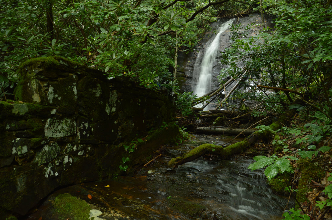
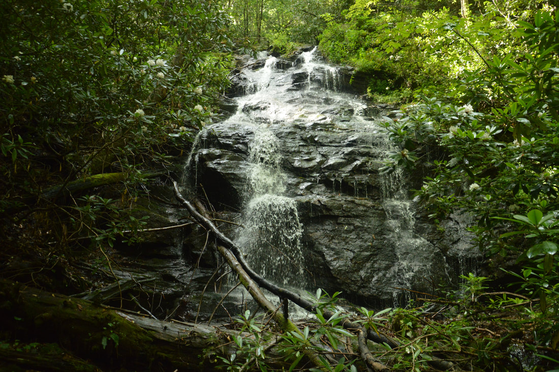
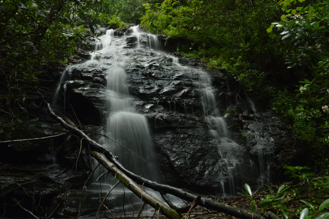
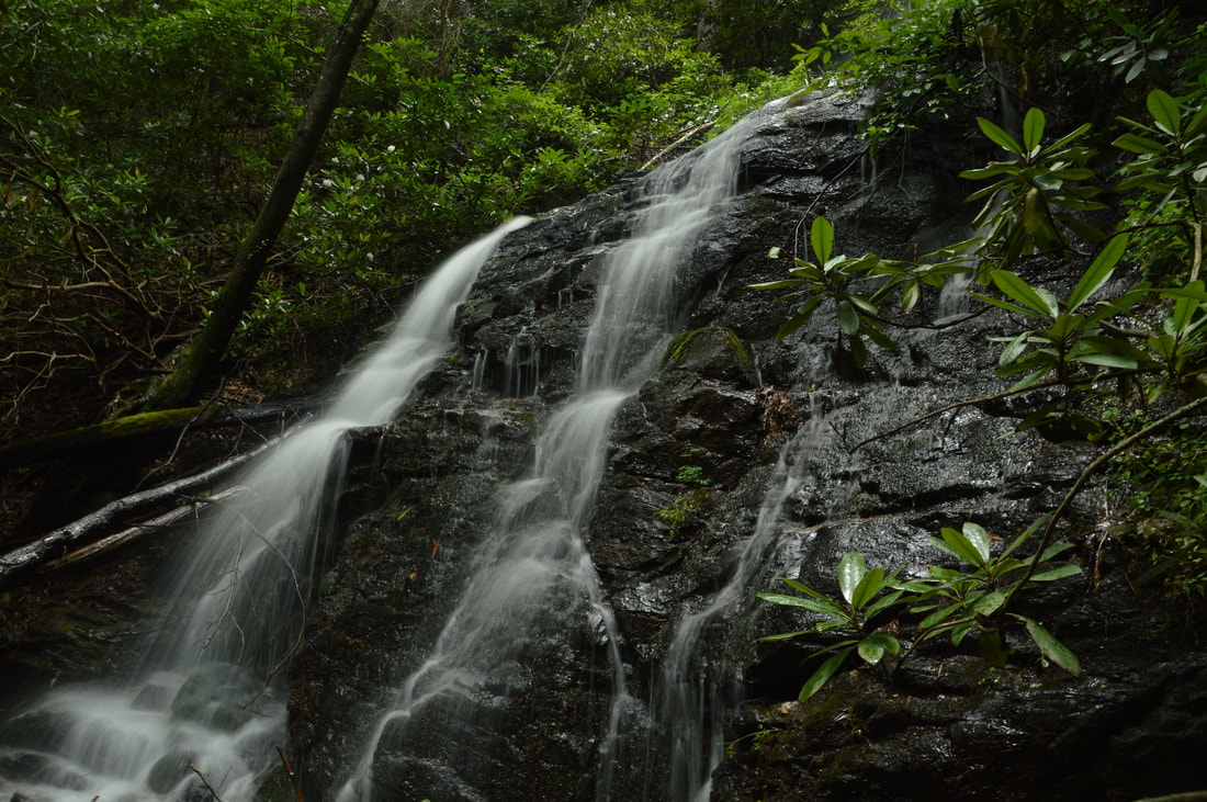
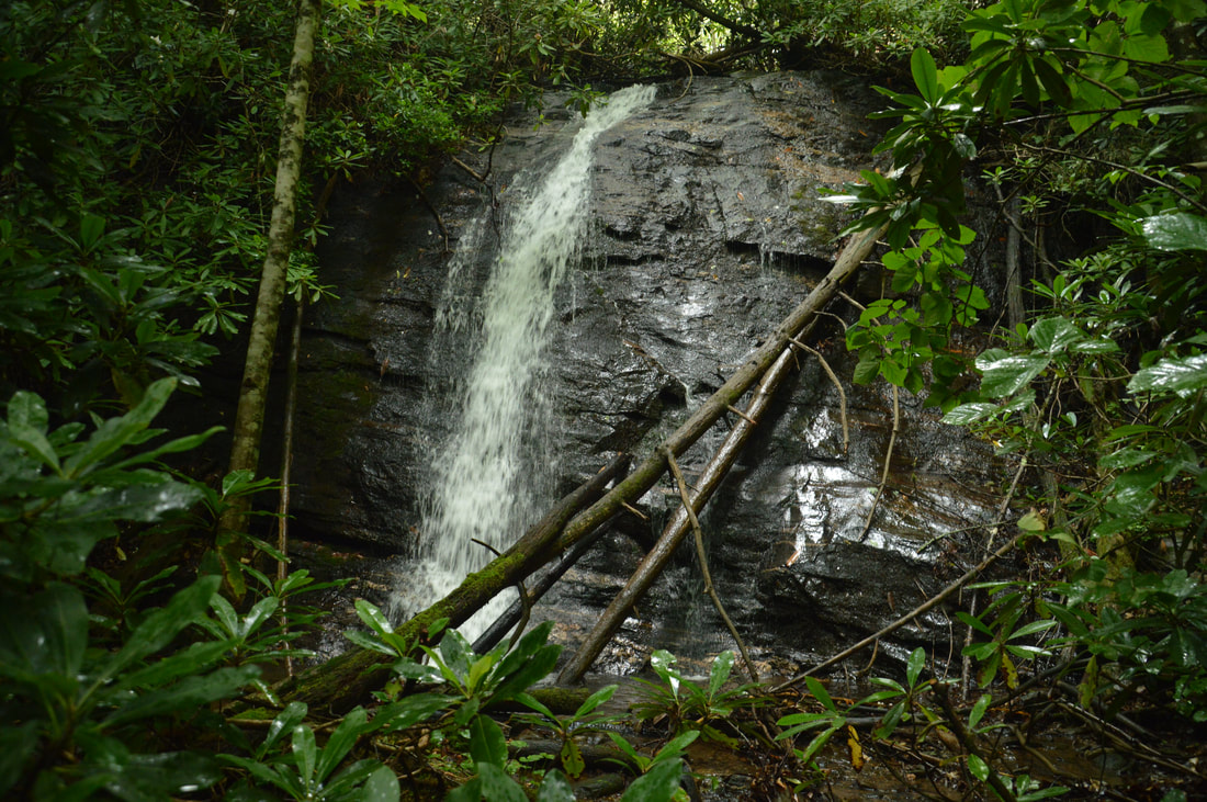
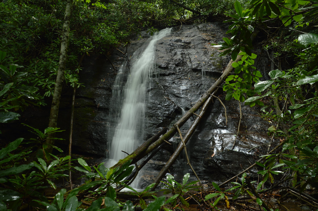
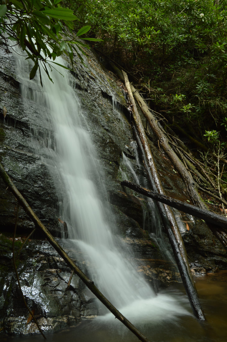
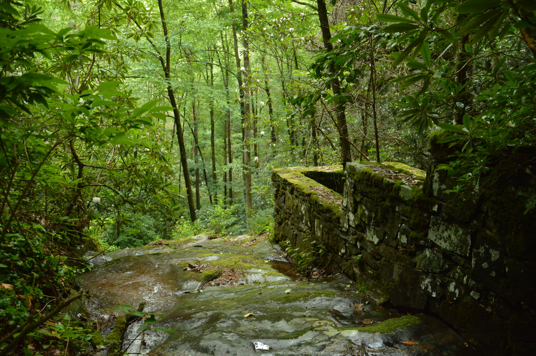
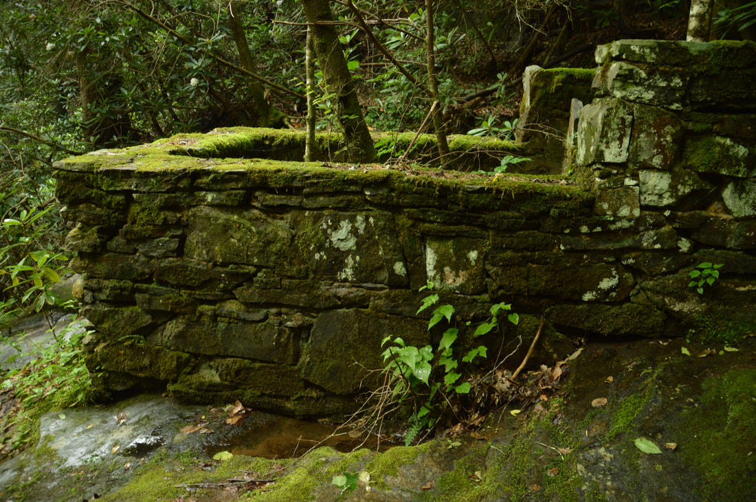
A tributary of Soapstone Creek, Sorrels Branch sports a pair of scenic waterfalls near Georgia Highway 180 and the former location of CCC Camp Soapstone. Access to both waterfalls is not difficult thanks to an unofficial trail along an old logging road that passes by them. The 50-foot sheer lower falls is more scenic than the small 25-foot upper slide, but the historical aspect of the Sorrels Branch waterfalls may be the most fascinating part of this hike. Perched precariously in the middle of the creek at the brink of the lower falls and near the base of the upper falls is a mysterious stone structure. The forest service, history books, and even the internet provide little clue to the origin of these ancient ruins, but you'll have fun coming up with your own guesses when you visit. This hike occurred on Saturday, July 1st, 2017. My plan was to hike out and back to Lower and Upper Sorrels Branch Falls from Highway 180. 

Summary

R/T Length of Trail: 0.8 Miles 
Duration of Hike: 1:40 
Type of Hike: Out and Back 
Difficulty Rating: 3 out of 10 
Total Elevation Gain: 255 Feet 
Pros: Unique historical aspect of the waterfalls 
Cons: Lack of parking at the trailhead; the route to the base of Upper Sorrels Branch Falls is very obscure 
Points of Interest: Lower Sorrels Branch Falls - 5 stars; Upper Sorrels Branch Falls - 3 stars; Mysterious ruins between the lower and upper falls
Trail Blaze Colors: None, not an official trail 
Best Seasons to Hike: Winter; Spring 
Fees: None 
Beginning Point: Junction of Highway 180 and dirt road near Sorrels Branch 
Directions from Hiawassee, GA: From the intersection of Main Street (US 76/GA 17/75) and Bell Street in downtown Hiawassee, follow Main Street South (US 76 East/GA 17/15 South) for 2.7 miles. Then, turn right onto GA 17/75 South and continue for 6.3 miles before turning right onto GA 180 West. As you're driving on GA 180 West, you will pass over Sorrels Branch (which flows through a culvert) at 0.9 miles after leaving GA 75. While the trailhead is here, there is no parking space. Continue driving along GA 180 for about 0.15 miles to a place where the main road curves right while a dirt road leaves diagonally left. There is space for a couple of cars right where the dirt road begins. If for some reason this spot is full or if you're not comfortable parking here, you can drive down the dirt road a couple hundred feet to a fork with a pullout in front for one car. Another couple hundred feet down the left fork is another pullout with space for a couple of cars. 

Map

Picture
Click here to download a track of this hike. 

Details

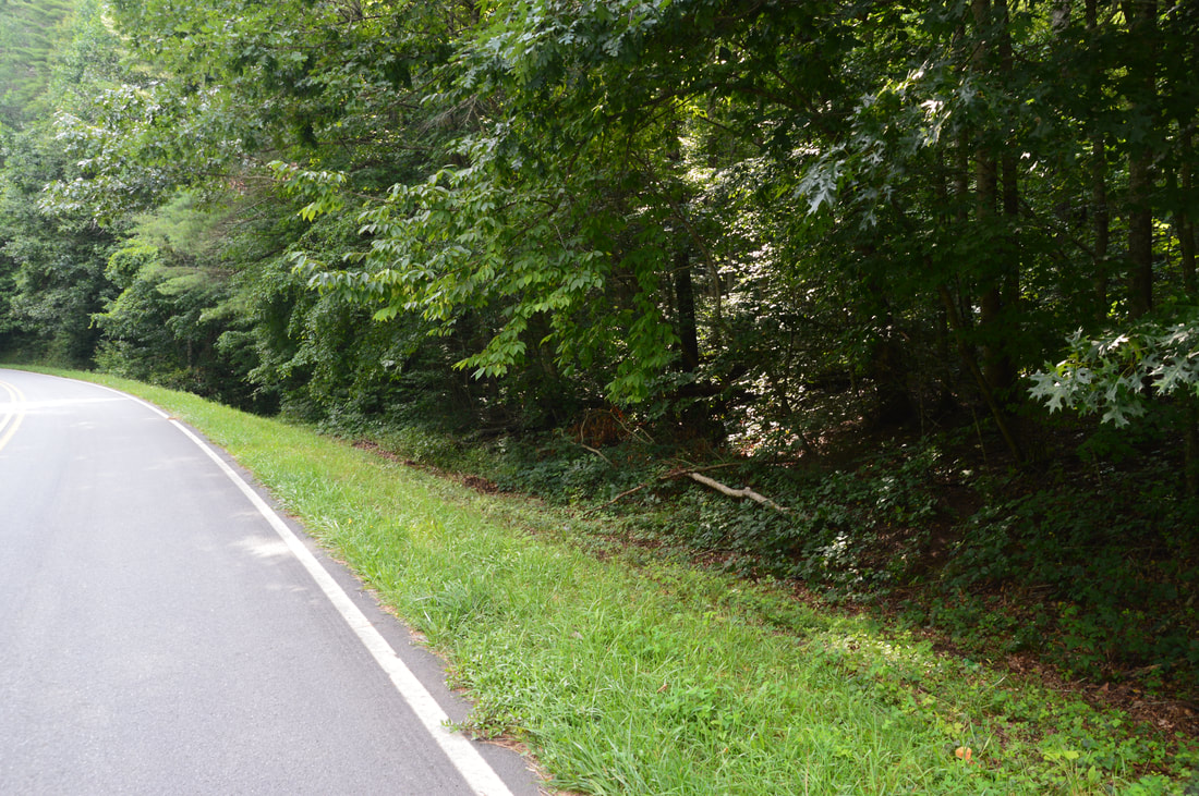
The waterfalls on Sorrels Branch are a perfect example of Georgia's many waterfalls that are located so close to roadways and yet rarely ever visited. One thing that may stop people visiting Lower and Upper Sorrels Branch Falls is the lack of parking at the trailhead, but the extra walk along the road only increases the length of this short hike by 0.3 miles. The mileage in this trail report begins at the intersection of GA 180 and an unnamed dirt road just west of Sorrels Branch. 

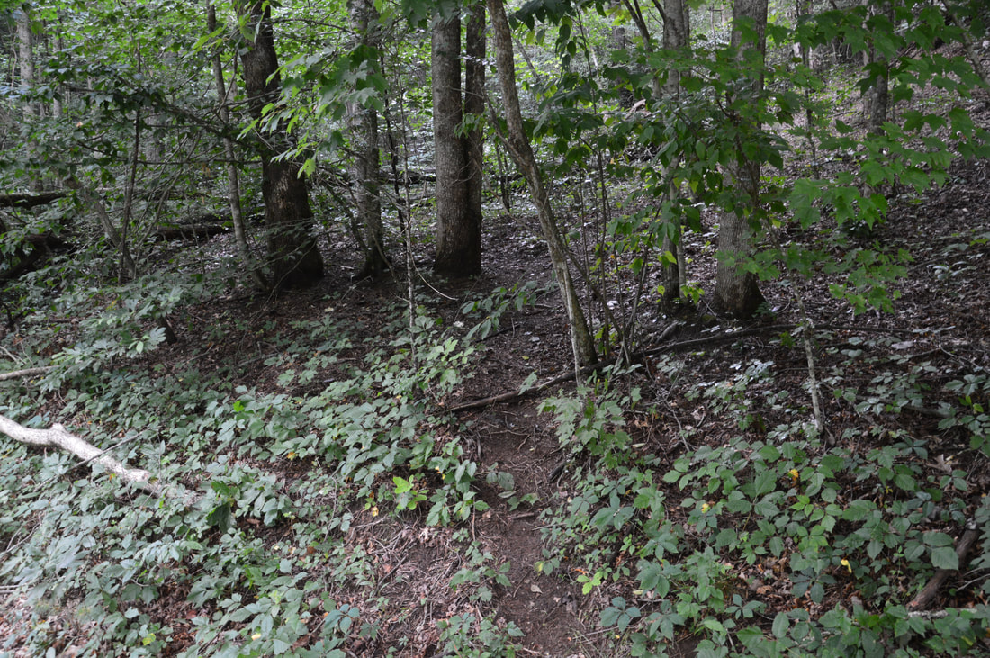
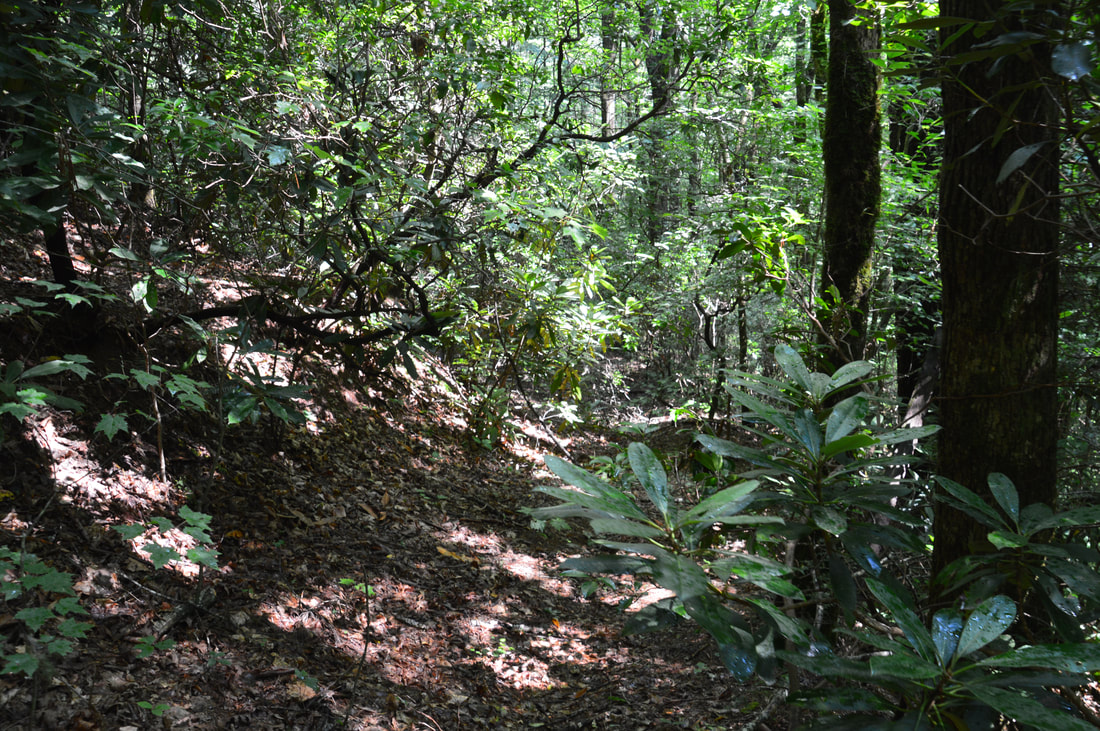
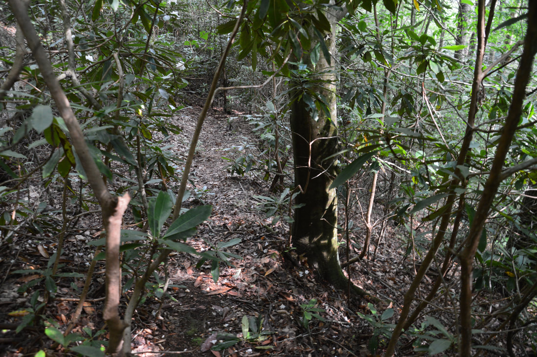
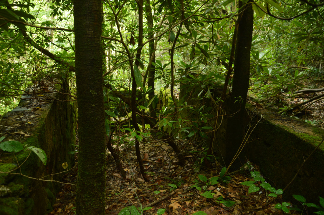
From the road intersection, hike along the broad grassy shoulder of GA 180 East for 0.15 miles. About 150 feet after the road crosses Sorrels Branch via a culvert, as the road makes a slight curve to the right, look closely for a narrow but well-used path on the left. This path heads up the bank and then appears to split. Stay left, crossing a large fallen tree, and the path will reappear and broaden as it joins an old logging road. As you follow the obvious trail, you should get a glimpse of the top of Lower Sorrels Branch Falls off to the left. This is a good place to turn left and head through the open woods toward the falls - there are some signs of a path. In about 200 feet, the path ends at an open spot with a view of the falls and the stone ruins at the top. To reach the base of the falls, take the steep scramble path on the left through a narrow opening in the rhododendron just before the open viewpoint. There is a short hop at the end, where the trail comes out at the creek below the falls. Walk up the creek to the base of Lower Sorrels Branch Falls at 0.3 miles. 

Lower Sorrels Branch Falls is a nice single-tier 50-foot waterfall. It is neat how the flow splits into several different branches across the sheer rock face of the falls. This effect will be more pronounced during high water. From the base of the falls, you can't see the ruins at the top, but that is where you're headed next. While the upper falls is neither as tall nor as scenic as the lower falls, the ruins make it a unique and special destination that is worth the extra distance. Return to the main path along the old logging road and continue following it as it ascends moderately around and above the lower falls. About 700 feet after returning to the old road, you may be able to hear the upper falls down to the left. Around here is a good place to leave the trail to access the ruins and the upper falls. Start down a bit of a path with some cut branches. In a few feet, it will be best to turn left and descend alongside the upper falls down a short but steep slope. You could have avoided this part altogether by turning off the trail slightly earlier, but that point is also steep and hard to recognize. You will eventually come out at the creek around the base of Upper Sorrels Branch Falls at 0.45 miles. 

Upper Sorrels Branch Falls itself is a nearly-vertical sliding waterfall of about 30 feet. It isn't very photogenic but it can be a nice bonus to the Sorrels Branch hike. Of more interest though are the ruins at the falls. Stretching between the base of the upper falls and the top of the lower falls - only a few dozen feet downstream - is an odd stone enclosure with several levels. It is completely surrounded by walls on four sides. As best as I can tell through my research, there is no clear history of this structure out there, and even the forest service didn't know. It would make sense for this to be some sort of structure related to power generation for CCC Camp Soapstone, but in that scenario, it would be strange that the lower end of the stone enclosure is walled off too. Another somewhat likely guess is that this was once a grist mill, but it doesn't make sense that a mill would be constructed at such a hard-to-access (at the top of a waterfall) place! Perhaps the stone enclosure is just the ruin of something that was never finished. If you have a tip regarding the origin of this stone structure, please comment or message me. Until someone comes back with concrete evidence, all of us will only be able to guess about the origin of the ruins. 

From Upper Sorrels Branch Falls, simply return along the same way back to Highway 180 and then your car. You will conclude the hike at 0.8 miles. 

Mileage

0.0 - Highway 180/Dirt Road Junction 
0.15 - Sorrels Branch Trailhead
0.3 - Lower Sorrels Branch Falls 
0.45 - Upper Sorrels Branch Falls 
0.8 - Highway 180/Dirt Road Junction

Variations

Hike just to Lower Sorrels Branch Falls - 0.6 Miles 

Bonus Stops

Another good waterfall with a short hike to see in the area is ​Rogers Branch Falls off Indian Grave Gap Road. 

Pictures

Videos

1 Comment
Henry Paris
8/10/2021 03:38:06 pm

The stone structures appear to be trout "tanks" which were used to raise trout for stocking streams for fishermen. They look similar to those at other former CCC camps including at Warwoman Dell, among others.

Reply


Leave a Reply.

    About Me

    Mark Oleg Ozboyd
    I'm an avid outdoor explorer and a hobbyist landscape photographer. I'm 21 years old and have been hiking since 2011. Originally based out of Atlanta, Georgia, I started out by occasionally hiking short trails throughout well-known Georgia State Parks. During 2012 and 2013, I began to expand my trips into adjacent states, as well as into the wilder National Forest areas rather than just State Parks. Throughout the years that followed, as I slowly ran out of popular hiking trails in my area, I began to search for and hike in more seldom-visited areas. Today, you can find me out in the woods every weekend, whether it's on an official trail or bushwhacking through cross-country terrain without any paths. I now attend Washington & Lee University and am exploring Virginia and West Virginia. My other hobbies include chess, science, old music, and meteorology. I have 3 years of amateur weather forecasting experience, having studied a lot of meteorology basics over the years. I am also a student at European School of Music where I learned that music and nature have a lot in common. Listening to good music inspires me to capture nature's beauty on the camera in different aspects that also make me recall many beautiful music pieces that I've heard.​


    Dear readers: I have invested a tremendous amount of time and effort in this website and the Georgia Waterfalls Database the past five years. All of the work that has gone in keeping these websites updated with my latest trip reports has almost been like a full-time job. This has not allowed me to pick up a paid job to save up money for college, and therefore, I I've had to take out loans. If you find the information on this website interesting, helpful, or time-saving, you can say "thanks" and help me out by clicking the button above and making a contribution. I will be very grateful for any amount of support you give, as all of it will apply toward my college tuition. Thank you! 

    Enter your email address to subscribe for trail reports:

    Delivered by FeedBurner


    Picture
    Coming in 2022-2023?

    Other Hiking Websites

    DWHike's Adventures
    Florida's Natural Wonders
    Florida Trailblazer
    Meanderthals
    Mountain Images
    by Bernie Boyer

    North Carolina Waterfalls with
    ​Kevin Adams
    Take-a-Hike!
    Tennessee Landforms
    Waterfall Page
    Waterfall Adventurer
    Zach's Mild Adventures

    Miles Hiked

    Year 1: 540.0 Miles
    Year 2: 552.3 Miles
    ​Year 3: 518.4 Miles
    Year 4: 482.4 Miles
    Year 5: 259.9 Miles

    Archives

    March 2021
    February 2021
    January 2021
    November 2019
    October 2019
    September 2019
    August 2019
    July 2019
    June 2019
    February 2019
    January 2019
    December 2018
    November 2018
    October 2018
    August 2018
    July 2018
    June 2018
    May 2018
    April 2018
    March 2018
    February 2018
    January 2018
    December 2017
    November 2017
    October 2017
    September 2017
    August 2017
    July 2017
    June 2017
    May 2017
    April 2017
    March 2017
    February 2017
    January 2017
    December 2016
    November 2016
    October 2016
    September 2016
    August 2016
    June 2016
    May 2016
    April 2016
    March 2016
    January 2016
    December 2015
    November 2015
    October 2015
    September 2015
    August 2015
    July 2015
    June 2015
    May 2015
    April 2015
    March 2015
    February 2015
    January 2015
    December 2014
    November 2014
    October 2014
    September 2014
    August 2014
    July 2014
    June 2014
    May 2014
    April 2014
    March 2014
    February 2014

    Categories

    All
    Adel
    Adirondack Park
    Alabama
    Alfred A. Ring Park
    Allegheny Trail
    Amicalola Falls State Park
    Anniston Area
    Apalachicola Bluffs And Ravines Preserve
    Apalachicola National Forest
    Apalachicola/Port St. Joe Area
    Apopka
    Appalachian Trail
    Appling
    Art Loeb Trail
    Aska Trail System
    Bakersville
    Balm-Boyette Scrub Preserve
    Balsam Lake Recreation Area
    Bankhead National Forest
    Bartow County Parks
    Bartram Trail
    Basinger
    Beersheba Springs
    Benton
    Benton Mackaye Trail
    Berry College Trail System
    Best Hike
    Big South Fork National Recreation Area
    Black Bear Wilderness
    Black Rock Mountain State Park
    Blairsville
    Blakely
    Blood Mountain Wilderness
    Blowing Rock
    Blue Ridge
    Blue Ridge Parkway
    Boone
    Bradenton
    Bradenton Beach
    Brasstown Bald
    Brasstown Wilderness
    Brevard
    Bryson City
    Buchanan
    Bucks Pocket State Park
    Bulow Creek State Park
    Bulow Plantation Ruins State Park
    Caesars Head State Park
    Caladesi Island State Park
    Calhoun
    Camel's Hump State Park
    Cashiers
    Caspersen Beach Park
    Catfish Creek State Park
    Caves
    CC Putnam State Forest
    Cedar Point Environmental Park
    Chatsworth
    Chattahoochee National Forest
    Chattanooga
    Chattanooga Valley
    Chattooga National Wild And Scenic River
    Cheaha Wilderness
    Cherohala Skyway
    Cherokee
    Cherokee National Forest
    Chiefland Area
    Chillhowee Recreation Area
    Chipley
    Chunky Gal Trail
    Circle B Bar Reserve
    Citico Creek Wilderness
    Citrus Wildlife Management Area
    Clarkesville
    Clayton
    Cleevland
    Cleveland
    Cloudland Canyon State Park
    Cohutta Wilderness
    Collier-Seminole State Park
    Cordele
    Cornelia
    Covington
    Crestview Area
    Crew-land-and-water-trust
    Cullowhee
    Cumberland Trail
    Dahlonega
    Dalton
    Dawson Forest Wildlife Management Area
    Dawsonville
    Dayton
    De Soto National Memorial
    DeSoto State Park
    Dillard
    Double Springs
    Ducktown
    Duncan Ridge Trail
    Dunlap
    Eagle's Rest Park
    Eastpoint
    Econfina Creek Wildife Management Area
    Eglin Air Force Base
    Elizabethton
    Elkins
    Elk Knob Game Lands
    Elk Park
    Ellicott Rock Wilderness
    Ellijay
    Emerson Point Preserve
    Englewood Area
    Enota Retreat
    Erwin
    Falling Waters State Park
    Fayetteville
    Fires Creek Recreation Area
    Fire Tower
    Flint River
    Florence Area
    Florida
    Florida Caverns State Park
    Florida Trail
    Foothills Trail
    Fort Mountain State Park
    Fort Myers Area
    Fort Payne
    Fort Payne Area
    Fort Yargo State Park
    Franklin
    Franklin Delano Roosevelt State Park
    Franklin-Marion State Forest
    Frozen Head State Park
    Gainesville
    Gainesville Area
    Gatlinburg
    George Washington National Forest
    Georgia
    Georgia Veterans Memorial State Park
    Glasgow
    Gorges State Park
    Grandfather Mountain State Park
    Great Smoky Mountains National Park
    Greeneville
    Green River Game Lands
    Gruetli-Laager
    Grundy Forest State Natural Area
    GTM Reserve
    Guana River Wildlife Management Area
    Hayesville
    Helen
    Hiawassee
    High Falls State Park
    Highlands
    Highlands Scenic Highway
    Hillsborough River State Park
    Hinson Conservation & Recreation Area
    Historic Sites
    Honeymoon Island State Park
    Hot Springs
    Huntington
    Inverness Area
    Jackson
    Jasper
    Jefferson National Forest
    Joan M. Durante Park
    Jonathan Dickinson State Park
    Jones Gap State Park
    Joyce Kilmer Slickrock Wilderness
    Joyce Kilmer - Slickrock Wilderness
    Juniper Prairie Wilderness
    Kelly Park
    Keown Falls Recreation Area
    Kolomoki Mounds State Park
    LaFayette
    Lake City Area
    Lake George Wild Forest
    Lake June-in-Winter State Park
    Lakeland Area
    Lake Placid
    Lake Russell Wildlife Management Area
    Lake Wales Ridge State Forest
    Laurel Fork North Wilderness
    Leffis Key Preserve
    Leon Sinks Geological Area
    Lexington
    Lineville
    Linville
    Linville Gorge Wilderness
    Lithia Springs
    Little Frog Wilderness
    Little Manatee River State Park
    Little River Canyon National Preserve
    Longboat Key
    Long Trail
    Lookout Mountain
    Lookout Mountain Battlefield
    Lovingston
    Lula Lake Land Trust
    Lumpkin
    Maggie Valley
    Manatee Springs State Park
    Marianna Area
    Mark Trail Wilderness
    Marlinton
    Mccaysville
    McMinville
    Mentone
    Middlesex
    Mistletoe State Park
    Monongahela National Forest
    Montreat
    Mountain Bridge Wilderness Area
    Mountain City
    Mountains To Sea Trail
    Mountains-to-Sea Trail
    Mount Rogers National Recreation Area
    Myakka River State Park
    Myron B. Hodge City Park
    Nantahala National Forest
    Naples
    Naples Area
    Natural Bridge State Park
    Neal Preserve
    New Castle
    Newport
    New River Gorge National Park
    New York
    North Carolina
    Ocala Area
    Ocala National Forest
    Ocean-to-Lake Trail
    Oconee State Park
    Oconee Station Historic Site
    Okaloacoochee Slough State Forest
    Oldsmar
    Oneida
    Orlando Area
    Ormond Beach
    Oscar Scherer State Park
    Oxford
    Palatka
    Palmetto Trail
    Panama City Area
    Panthertown Valley
    Parrish
    Paynes Creek Historic State Park
    Peaks Of Otter Recreation Area
    Pigeon Crockford Mountain Wildlife Management Area
    Pigeon-Crockford Mountain Wildlife Management Area
    Pigeon-Crockford Wildlife Management Area
    Pine Mountain
    Pinhoti Trail
    Pinnacle Park
    Pisgah Civitan Park
    Pisgah National Forest
    Pittman Center
    Pond Mountain Wilderness
    Ponds/Lakes
    Prentice Cooper State Forest
    Providence Canyon State Park
    Pumpkintown
    Quick Point Nature Preserve
    Raven Cliffs Wilderness
    Reed Bingham State Park
    Reliance
    Rice Creek Conservation Area
    Riverview Pointe Preserve
    Robbinsville
    Robinson Preserve
    Rock Creek Gorge Scenic Area
    Rock Island State Park
    Rome
    Rosman
    Sale Creek
    Salem
    Salt Springs
    Saluda
    Santa Rosa Beach
    Sarasota
    Sarasota Area
    Savage Gulf State Natural Area
    Scenic Views
    Scottsboro Area
    Sebring Area
    Sewanee
    Sheltowee Trace Trail
    Shining Rock Wilderness
    Signal Mountain
    Sipsey Wilderness
    Sky Valley
    Smithgall Woods State Park
    Snowbird Backcountry Area
    Soddy Daisy
    Soddy-Daisy
    Sopchoppy
    South Carolina
    South Cumberland State Park
    Southeastern Cave Conservancy
    Southern Nantahala Wilderness
    Sparta
    Sprewell Bluff Park
    Spring City
    Spring Hill
    Springs
    Spruce Pine
    Standing Indian Backcountry Area
    St. Augustine
    St. George Island State Park
    St. Joseph Bay State Buffer Preserve
    St. Marks Area
    St. Marks National Wildlife Refuge
    Stone Mountain
    Stone Mountain Park
    Suches
    Sumatra
    Sumter National Forest
    Suwannee River
    Swallow Creek Wildlife Management Area
    Sweetwater Creek State Park
    Sylva
    Talladega National Forest
    Tallahassee Area
    Tallulah Falls
    Tallulah Gorge State Park
    Tampa Bay Area
    Tate City
    Tate's Hell State Forest
    Tea Creek Wildlife Management Area
    Tellico Plains
    Tennessee
    Thomaston
    Toccoa
    Topsail Hill State Park
    Torreya State Park
    Townsend
    Tracy City
    Tray Mountain Wilderness
    Trenton
    Triple Creek Preserve
    Troutdale
    Unaka Mountain Wilderness
    Upper Tampa Bay County Park
    Venice
    Vermont
    Virgin Falls State Natural Area
    Virginia
    Virginia Outdoors Foundation
    Vogel State Park
    Wakulla Springs State Park
    Waleska
    Walhalla
    Wartburg
    Water Features
    Waynesville
    Weedon Island Preserve
    Weeki Wachee Preserve
    Wekiwa Springs State Park
    West Palm Beach Area
    West Virginia
    Whitehall
    White Springs
    Winder
    Withlacoochee State Forest
    Young Harris

    RSS Feed

TRAIL REPORTS

Hikes in Alabama
​Hikes in Florida
Hikes in Georgia
Hikes in North Carolina
Hikes in South Carolina
Hikes in Tennessee
Hikes in Virginia

Hiking Resources

Alabama Resources
​
Florida Resources
Georgia Resources
North Carolina Resources
​South Carolina Resources
​
Tennessee Resources

Other

Contact
Map of Hikes
Alphabetical List of Hikes
Southeast Nature Society
© COPYRIGHT 2014-2018
​ALL RIGHTS RESERVED.
Important: I disclaim any responsibility for any damage or personal injury that may occur as a result of the activities and information found on this website. All outdoor activities, especially off-trail hiking, are done at your own risk. Never hike or head into that area that may be above your fitness or experience level.
  • Home
  • Trail Reports
    • Best Hikes
    • Hikes with Scenic Views
    • Hikes with Water Features
    • Alabama
    • Georgia
    • Florida
    • North Carolina
    • South Carolina
    • Tennessee
    • Vermont
    • Virginia
  • Map
  • Hike List
  • Testimonials
  • Resources
  • Contact Us
  • Southeast Nature Society
    • Our Team
  • Georgia Waterfalls Database