
Motorists who drive north along Highway 75 from Helen may notice a deep valley/gorge on the left (west) side of the roadway, but most of them will not stop to muse about what's down there. When the more intrepid hiker takes a glance at the topographic map for the area around Spoilcane Creek and Highway 75, however, he will notice that there is significant waterfall potential in the Spoilcane Creek gorge. In fact, Spoilcane Creek has two major waterfalls - one of which is approximately 190 feet high! Additionally, folks who venture into the Spoilcane Creek gorge will find a bonus waterfall on an unnamed tributary to Spoilcane Creek. Access to the surprisingly rarely-visited Spoilcane Creek waterfalls is not very difficult thanks to a distinct path that follows the historical route of the Unicoi Turnpike and provides a close approach to all three waterfalls. This hike occurred on Saturday, June 3rd, 2017. My plan was to hike out and back to the Middle Falls on Spoilcane Creek via an unmarked trail from a pullout on the west side of Highway 75 just south of Unicoi Gap. Along the way, I would make the off-trail side trip to the Upper Falls on Spoilcane Creek and a waterfall on an unnamed tributary dubbed "Phil's Sister Falls".
Summary
R/T Length of Trail: 2.8 Miles
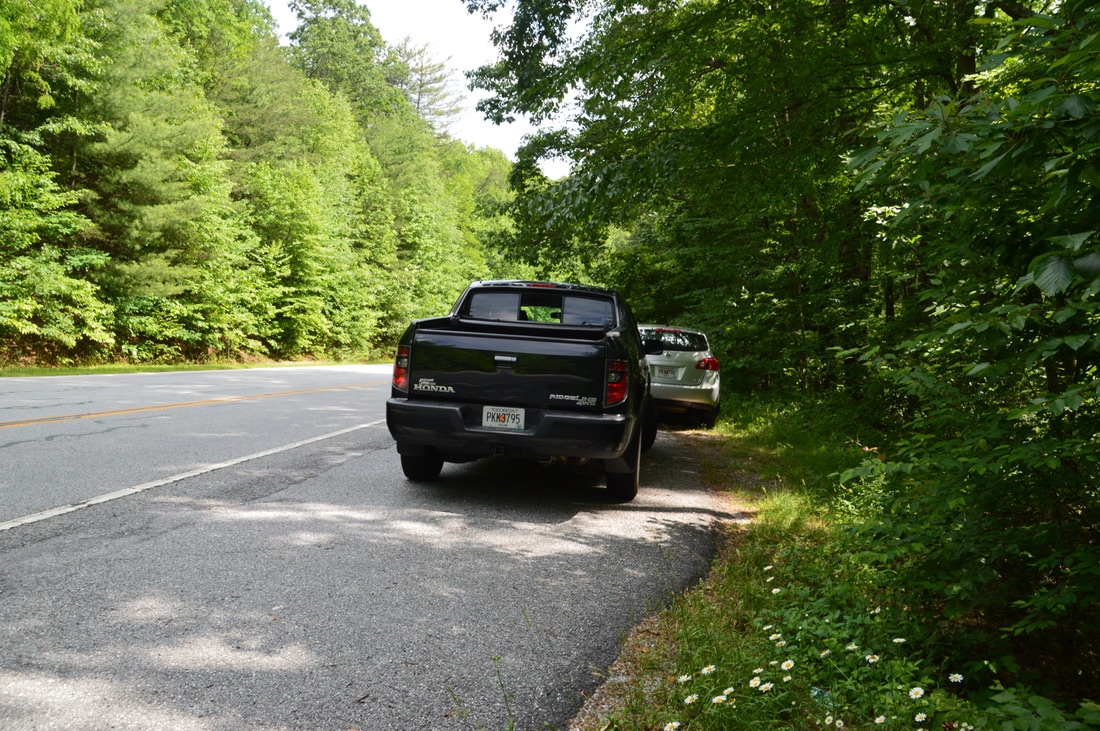
Duration of Hike: 5:20 (Note: Normally, this hike will take up to four hours, or even less if you do not spend a lot of time on photography. I spent a lot more time than average at each waterfall and I was hiking at a below normal pace) Type of Hike: Out and Back with Side Trip Difficulty Rating: 5 out of 10 Total Elevation Gain: 774 Feet Pros: Mostly easy-to-follow old road/path to the waterfalls; historical aspect to the hike, which follows the old roadbed of the Unicoi Turnpike's former route Cons: Getting to the base of Middle Spoilcane Creek Falls is rather tricky and can be hazardous if care is not taken Points of Interest: Upper Spoilcane Creek Falls - 4 stars; Phil's Sister Falls - 3 stars; Middle Spoilcane Creek Falls - 6 stars; Rock walls along the old Unicoi Turnpike Trail Blaze Colors: None, this hike is not on official trails Best Seasons to Hike: Winter Fees: None Beginning Point: Double pullout on west side of Highway 75 0.3 miles south of Unicoi Gap Directions from Helen, GA: From the intersection of Highway 75 and Highway 75 Alt north of Helen, follow Highway 75 North for 7.5 miles until a double pullout on the left (west) side of the highway. The first pullout is a long one with space for at least six cars followed by a shorter pullout with space for two cars. The pullouts, located around Mile Marker 15, are 0.3 miles south of Unicoi Gap, so if you have reached Unicoi Gap and the Appalachian Trail crossing, you have driven too far. Map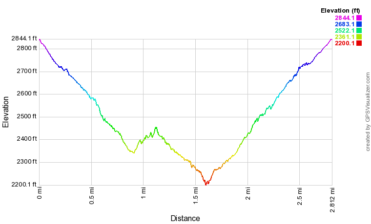
Click here to download a track of this hike.
Details
Exploring the waterfalls on Spoilcane Creek had been on my list for a long time ever since I learned about them from a couple of friends and an online search turned up zero information. What I was waiting for was water levels high enough to make the hike worth it (as Spoilcane Creek - especially at the upper falls - is a small-volume stream). By the early part of June, it seemed like most mountain streams and rivers had recovered (or nearly so) from the exceptional drought of the preceding fall and winter, so off we went, joined by my waterfaller friend Bernie.
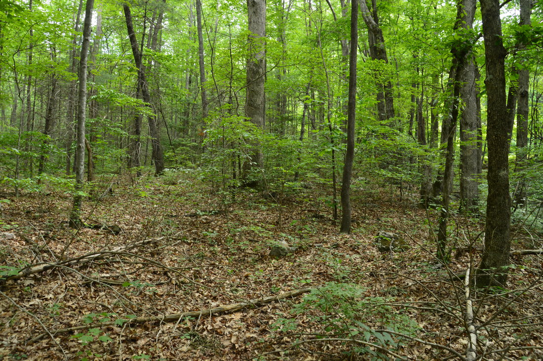
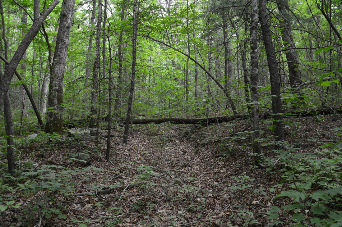
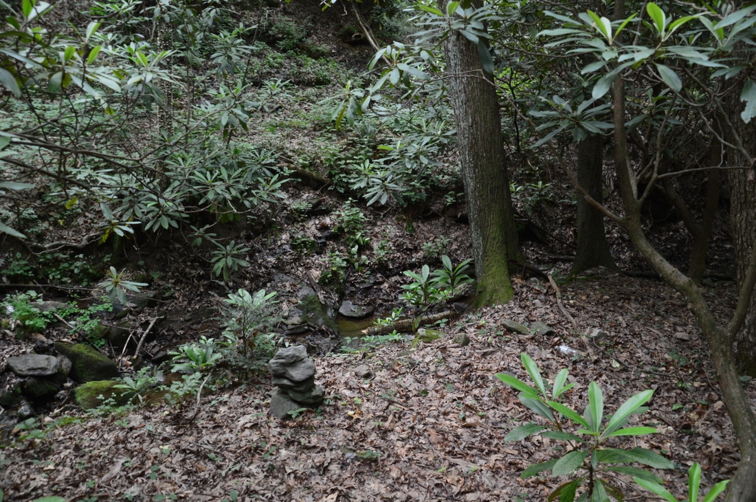
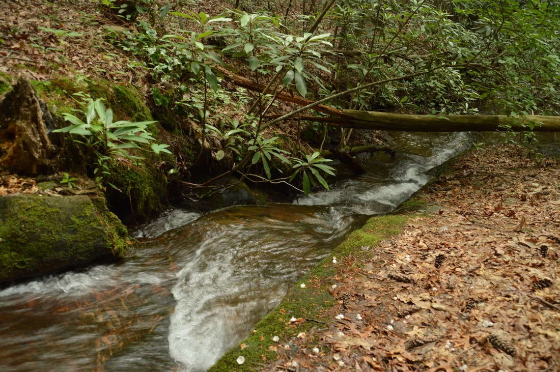
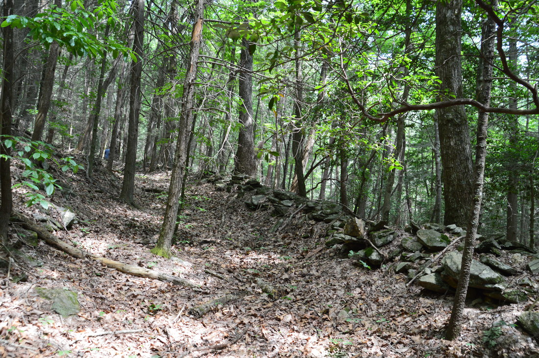
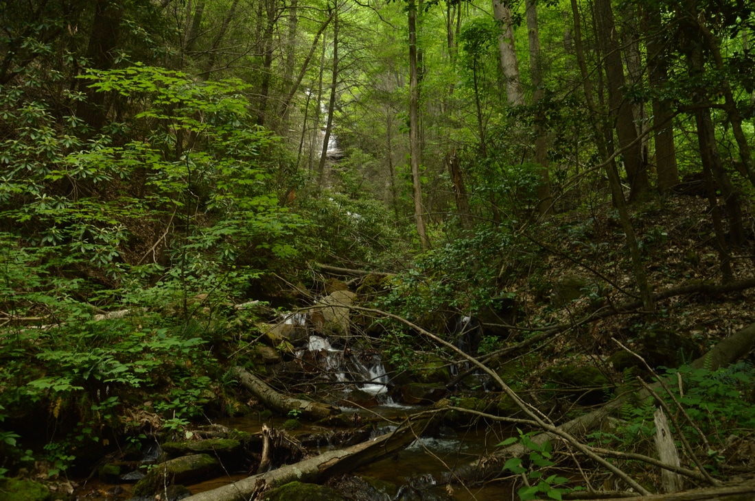
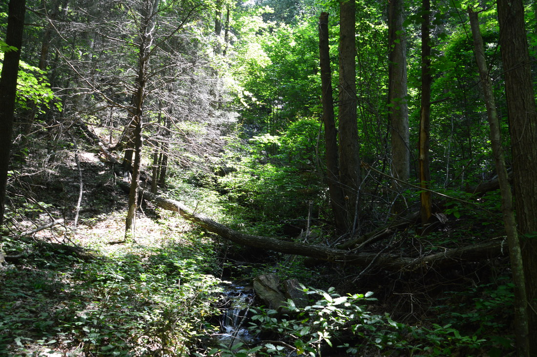
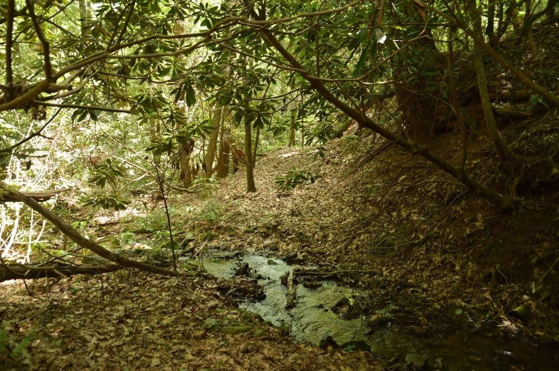
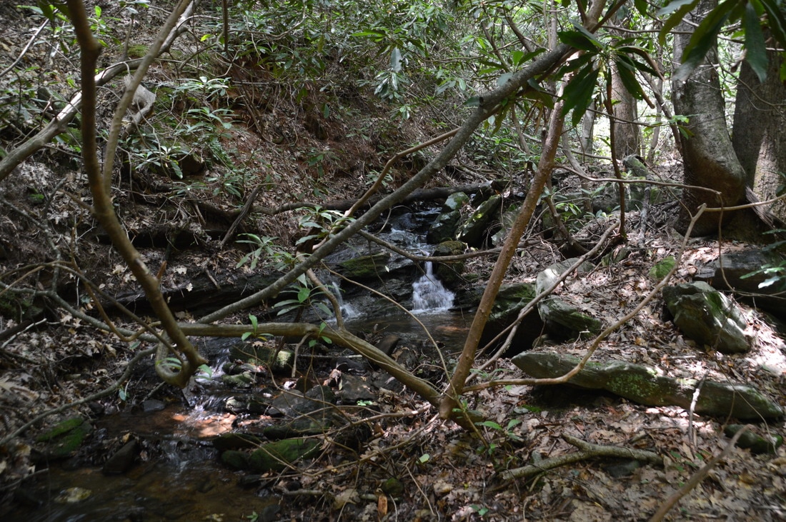
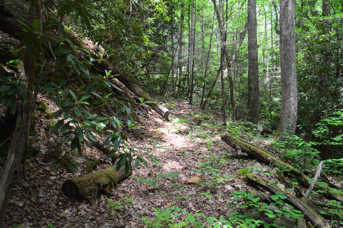
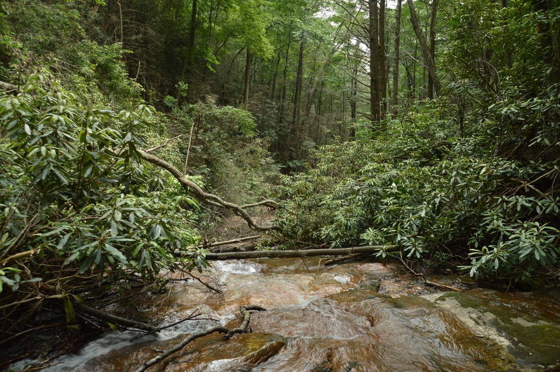
The hike to the Spoilcane Creek waterfalls is mostly a non-bushwhack, although there are a few short segments that can be categorized as low-level bushwhacks. In my opinion, the beginning of the hike is actually the most confusing part. There are two options for the first leg of the hike. The first option is to head northwest down a small drainage channel (with roadside trash) from the second smaller (northernmost) pullout, at a compass bearing of about 310 degrees. In about 100 feet, the drainage channel morphs into an old roadbed, onto which you must bear left. At first, the old roadbed is not very distinct and is slightly overgrown, but as you hike south on it toward Spoilcane Creek, it steadily becomes more distinct. The second option is to head southwest through the open woods on the north (right-hand) side of a deepening ravine from the same northernmost pullout, at a compass bearing of about 230 degrees. Approximately 0.15 miles from Highway 75, you will diagonally intersect the old roadbed (assuming that you were hiking in a generally straight line), which is a lot more distinct here. In general, the two options are about the same in terms of difficulty and distance, although there is more of a path if you use the first option, as long as you find the old road. The second option was a little more straight-forward to me, but there is no path at all until you reach the old roadbed. Regardless, the most important thing here is to follow the old roadbed southward on the east side of Spoilcane Creek, as it's impossible to miss when it's closer to the ravine. At 0.2 miles, the roadbed reaches a small tributary of Spoilcane Creek. A rock cairn marks the correct way as the path turns left across the tributary and then turns right to follow the tributary downstream, which shortly merges into Spoilcane Creek, a larger stream. The path remains distinct, remaining around fifty feet above Spoilcane Creek. At times, it appears to be following an old road as well. In fact, there will even be some old anti-erosion structures on the right at 0.3 miles. At the same time, you can hear Highway 75 in the clearing not far up the steep slope to the left. There will be some blowdowns just before the trail levels out next to Spoilcane Creek and bears right to cross it at 0.4 miles. This should be a dry crossing under most conditions. Below the crossing, Spoilcane Creek enters a scenic rock-framed chute. The top of Upper Spoilcane Creek Falls lies only around a hundred feet downstream. 
Most of the hike to the waterfalls of Spoilcane Creek follows the old Unicoi Turnpike roadbed, which was a very important route that connected Tennessee, North Carolina, and Georgia back in the 1800s.
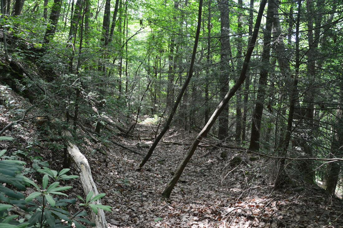
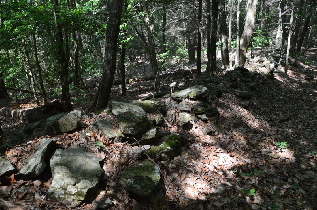
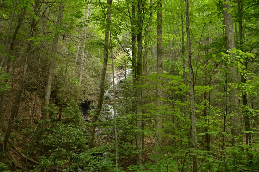
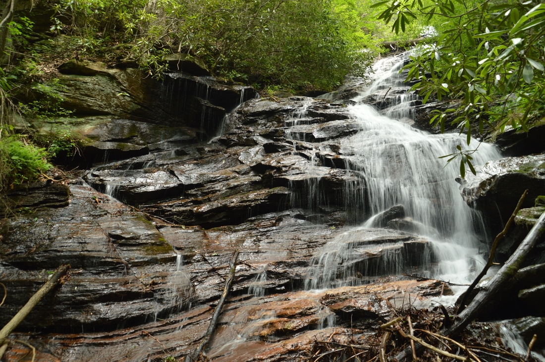
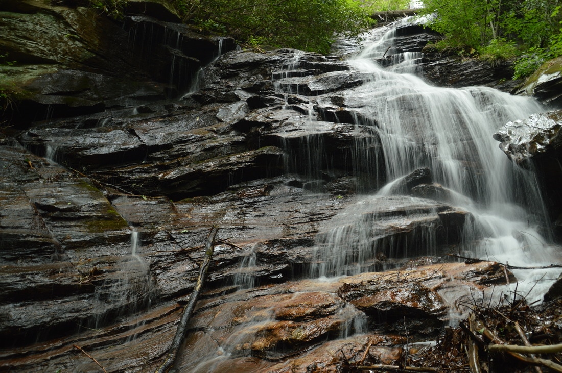
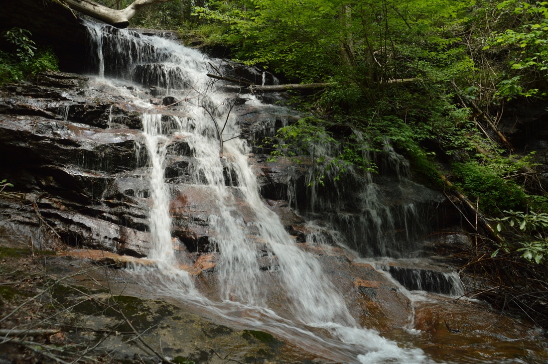
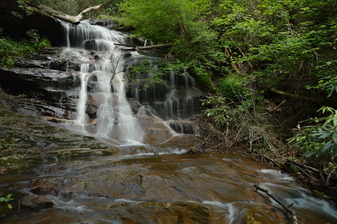
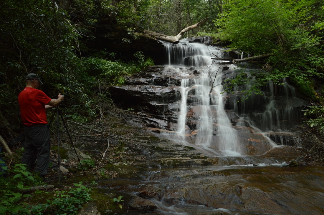
The area around Upper Spoilcane Creek Falls is very steep. The falls, which is nearly 200 feet high, drops off a nearly vertical escarpment and into a deep gorge. For this reason, the old road/trail swings westward far away from the creek right after the crossing and makes several switchbacks as it descends into the gorge. The first of these switchbacks is to the left at 0.6 miles, and the second switchback is to the right at 0.75 miles, just as you spot Spoilcane Creek below. Over the course of the descent, you will probably notice several impressive stacked rock walls that line the old road. As it turns out, the old road that follows Spoilcane Creek is not your typical streamside logging road. The old road that you have been following for all of this time is actually the former route of the Unicoi Turnpike! Today, the Unicoi Turnpike is Highway 75 - the road that stays to the east and high above of Spoilcane Creek coming out of Helen. However, the original route of the Unicoi Turnpike, in effect back in the 1800s, was the old road that you are following now. The Unicoi Turnpike actually began at the Tellico Block House near Knoxville, Tennessee. It traveled east into North Carolina, passing through the Murphy area, before turning south, crossing into Georgia, passing through the same Unicoi Gap that Highway 75 passes through today, and continuing into the Sautee-Nacoochee Valley, eventually turning east for its final leg to Toccoa. It is fascinating that the footpath to the waterfalls of Spoilcane Creek follows the same track that all kinds of people traveled back in the day.
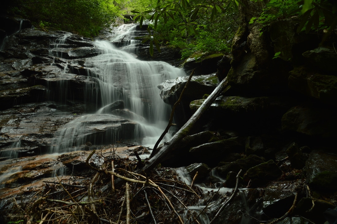
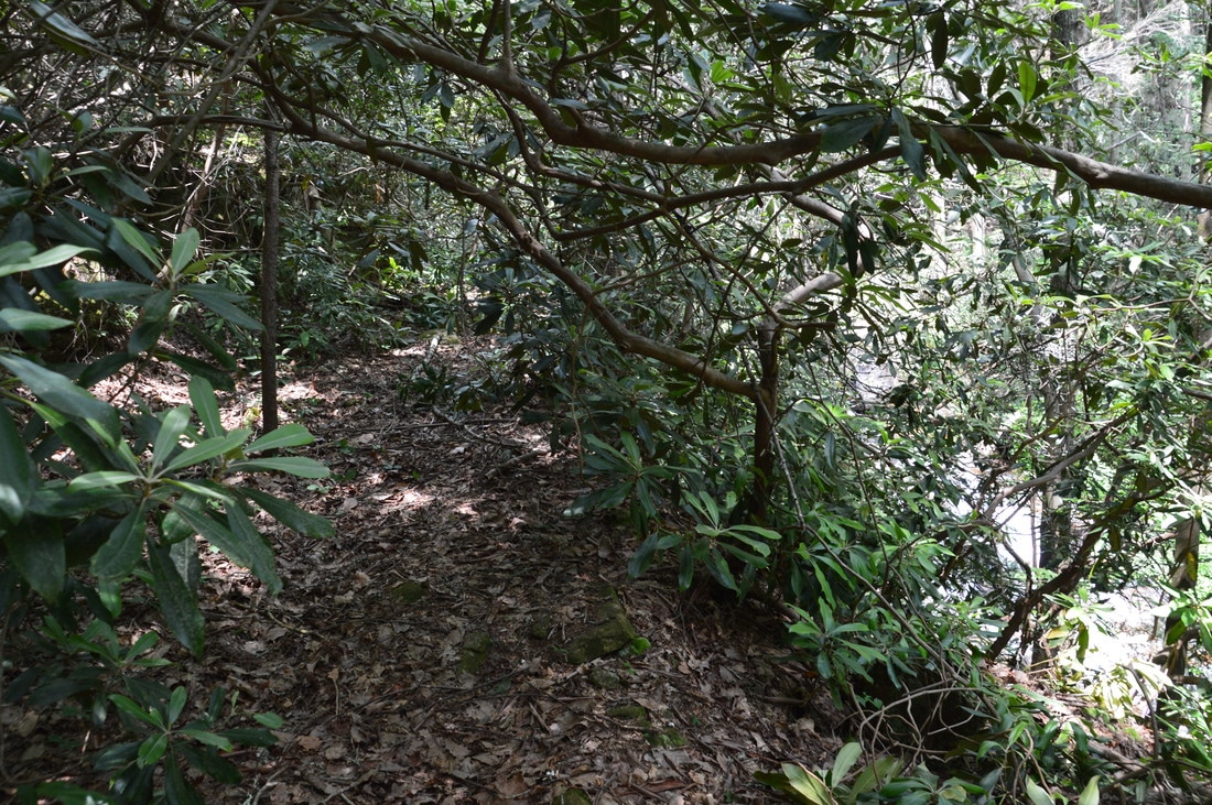
At a third switchback to the left at 0.8 miles, there is a fork in the road, with a second lower road branching off and paralleling the main road. Keep sharply left on the main upper road. At 0.9 miles, the old road finally catches up with Spoilcane Creek, having reached the gorge floor. This is a good place to turn left off the road and hike off-trail up to the base of Upper Spoilcane Creek Falls, which lies a short distance upstream. First, hike upstream through the open woods (no trail) on the left side of Spoilcane Creek for about 200 feet. As the left side steepens, there is a good spot to cross Spoilcane Creek to the right. This may be a wet crossing depending on recent rainfall, although I was able to stay dry today. Once you're on the right side of the creek, continue following it upstream through mostly open woods. In areas of thicker growth, look for a semblance of a path and some signs of maintenance. At one point, it will be necessary to scramble over a large fallen tree. There are a few noisy cascades on the creek. Around 1.0 miles, the very tall Upper Spoilcane Creek Falls shows up through the trees ahead. During the winter, there will be a particularly good view of the entire 190-foot falls, but even in summer, most of it is visible through the foliage. Continue following the route of least resistance on the east side of Spoilcane Creek. Just below the falls, reach a tributary that flows in from the east. This tributary has its own waterfall, known as Phil's Sister Falls, but for now, cross the tributary and continue up to the base of the main falls at 1.05 miles, passing to the left a pile of tires and pipes washed down from Highway 75. The view from the true base of the waterfall at the lowermost cascades is not very good. For a better view, scramble up the right side of the creek around the lowermost cascades and to the base of the first impressive drop of the waterfall. Upper Spoilcane Creek Falls is one of the tallest waterfalls in Georgia, and it is a wonder that the falls is not known better. Part of the reason for this is likely that the falls is less attractive than some other tall waterfalls, due to its multiple drops, all of which are hard to see together from any one point (although the viewing situation is better in winter). In a way, it reminded me the considerably more popular Dukes Creek Falls. The difficulty to view and photograph all of the waterfall at once influenced my relatively low beauty rating for Upper Spoilcane Creek Falls. Nevertheless, don't underestimate the beauty of the lowermost big drop of the waterfall. The rock outcrop that the creek slides down is picturesque, and in particular, the trickles on the left side of the rock outcrop (during high water) are very photogenic. This is a great spot for shooting slow-shutter water photos. I do have to note that the setting of Upper Spoilcane Creek Falls is neither remote nor pristine, due to noise from nearby Highway 75 and junk scattered around the area. 
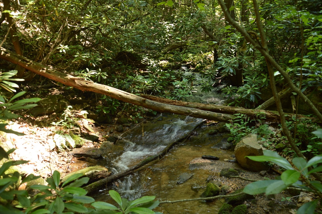
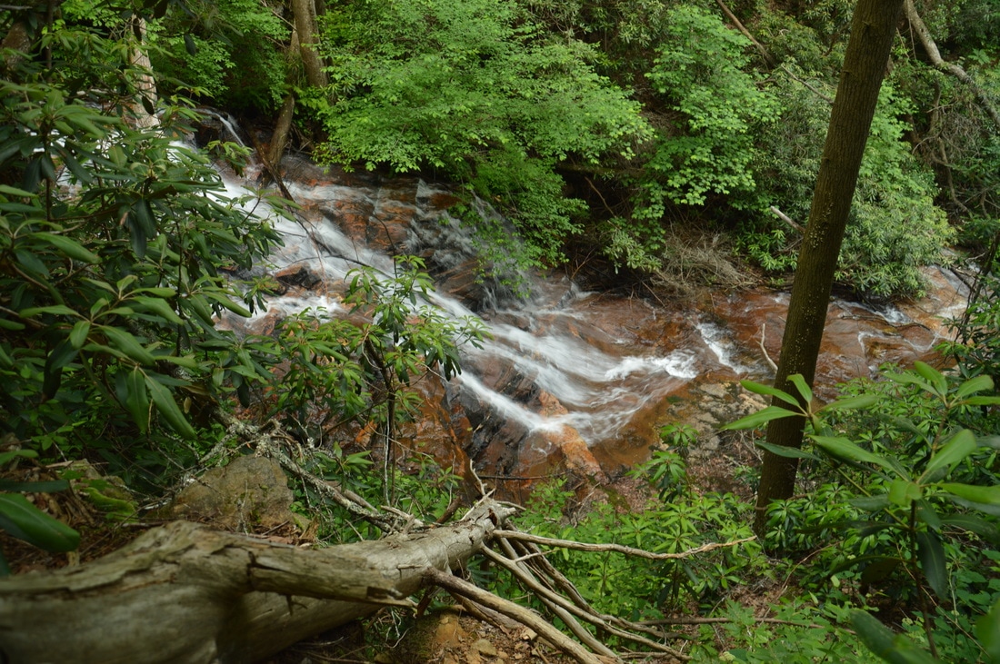
Phil's Sister Falls is a low-volume but highly photogenic waterfall on a tributary of Spoilcane Creek. After heavy rain, the countless little cascades and drops down the striking rock face of the waterfall become very scenic.
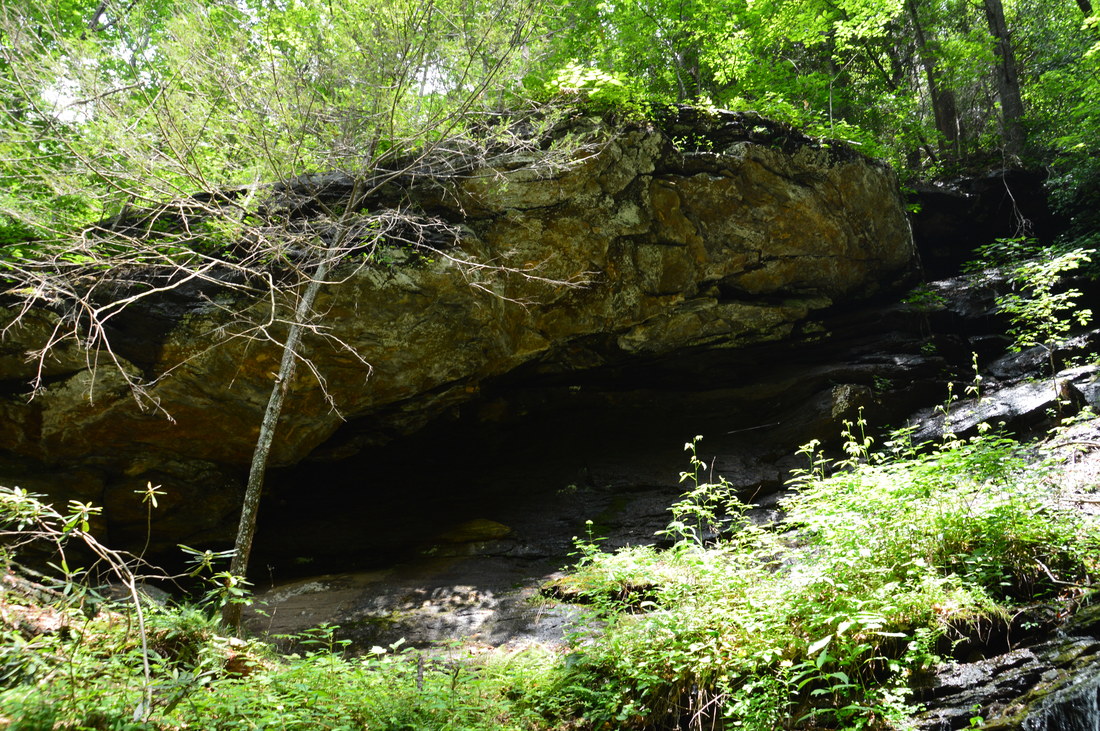
From Upper Spoilcane Creek Falls, return to the tributary. Before leaving this area, scramble up the left side of the tributary in the direction of Phil's Sister Falls, which is visible through the tree foliage ahead. Just below the waterfall, it is best to cross over to the right side of the small stream. At 1.1 miles, reach the base of Phil's Sister Falls. This waterfall was christened as such by Mike Hiler, who first documented it in March 2016. This 25-foot waterfall is quite unique. If there was more water in the tributary, I would give Phil's Sister Falls a much higher beauty rating. The countless stairstep cascades and miniature leaps that drop down the beautiful rock face and into a small pool can turn this waterfall into a highly photogenic one. If this was not enough, there is a beautiful rock shelter under a cliff on the left (north) side of Phil's Sister Falls. Thus, no matter the water flow, I still highly recommend taking the side trip to this interesting little falls.
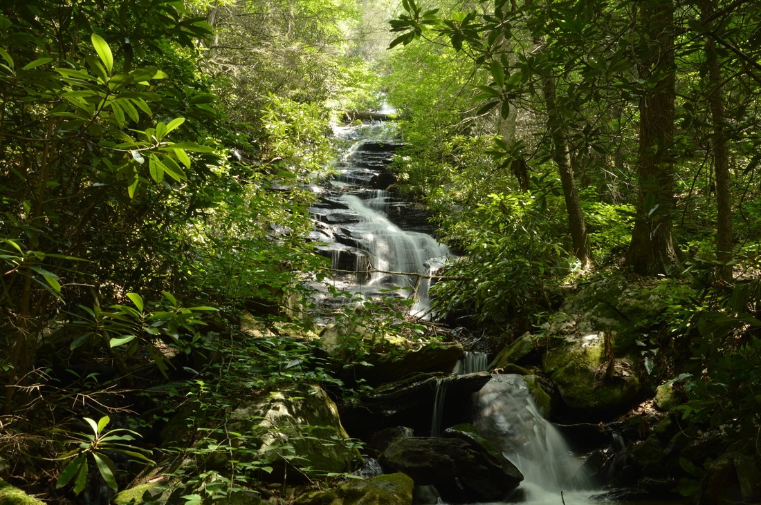
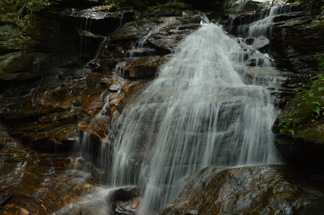
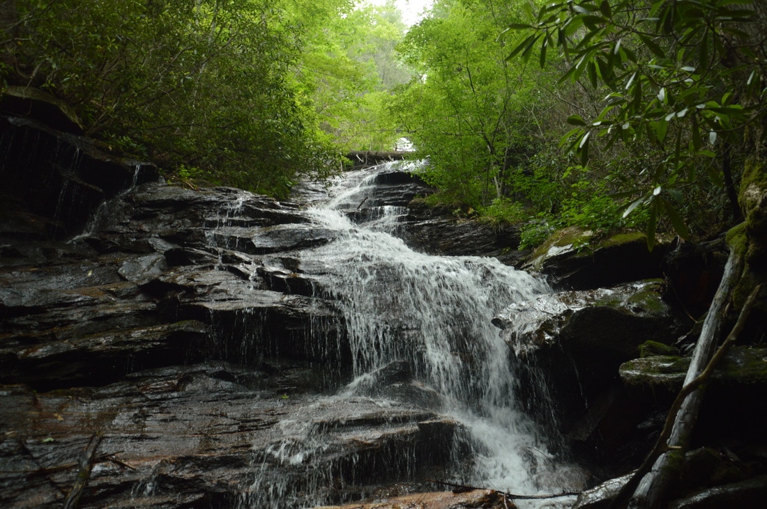
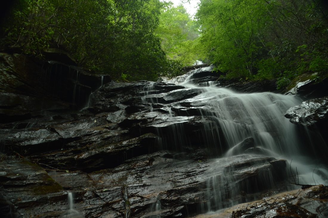
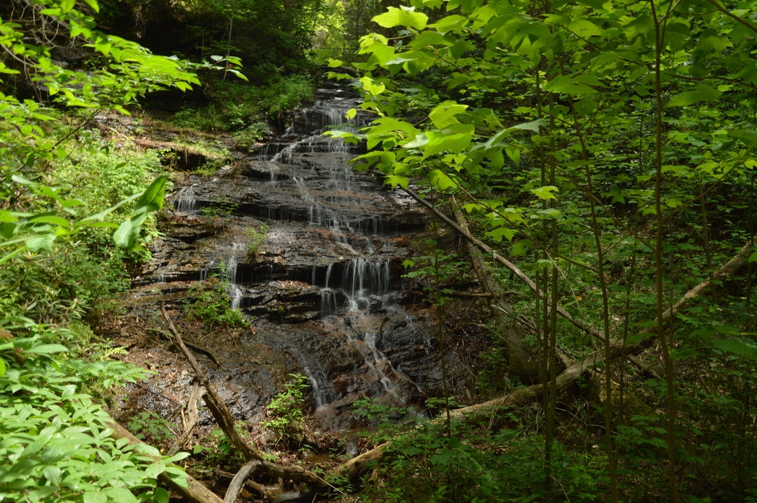
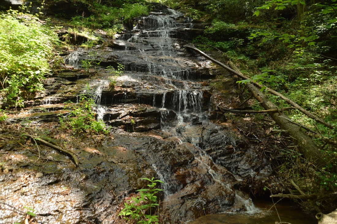
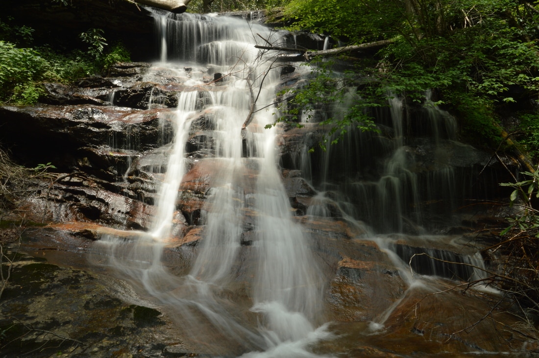
From Phil's Sister Falls, return to Spoilcane Creek and retrace your steps back to the main trail/old road, which you will reach at 1.3 miles. Don't hike back to the car just yet! To reach Middle Spoilcane Creek Falls, which I consider to be the best waterfall of the three seen on this hike, turn left on the old road and continue following it south and downstream along Spoilcane Creek. Shortly after you return to the road, there will be a series of blowdowns that are best to bypass on the right. The roadbed becomes a lot more distinct again at a tributary crossing at 1.35 miles. There are some signs of maintenance as the wide trail closely follows Spoilcane Creek. As the creek begins to drop off to the left, you will reach the top of Middle Spoilcane Creek Falls at 1.55 miles. Continuing a hundred feet farther, you will see the Middle Falls down below to the left. At first glance, getting down to the falls here looks dangerous. In reality, it's not that difficult. My suggestion is to descend right at the falls, because if you descend farther, you will come out below another sliding cascade, from the base of which only a small portion of the main falls is visible. Thus, begin scrambling to the left down the steep slope toward the base of Middle Spoilcane Creek Falls. Near the falls, there is a small cliff. To reach the base, descend to the right of the cliff onto a narrow shelf, and then, follow the shelf to the left to the broad rock slab at the base of Middle Spoilcane Creek Falls. I suggest taking care while descending to the falls, because it's easy to erode the steep hillside and significantly complicate the approach for others. You will reach the base of Middle Spoilcane Creek Falls at 1.6 miles. 
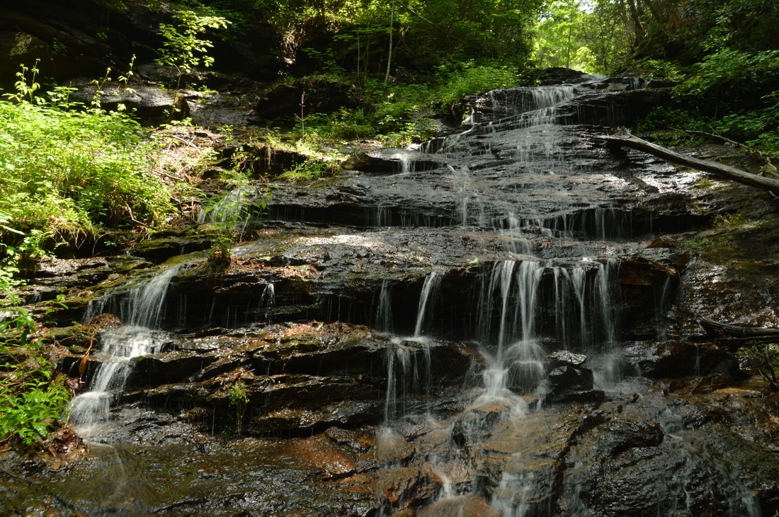
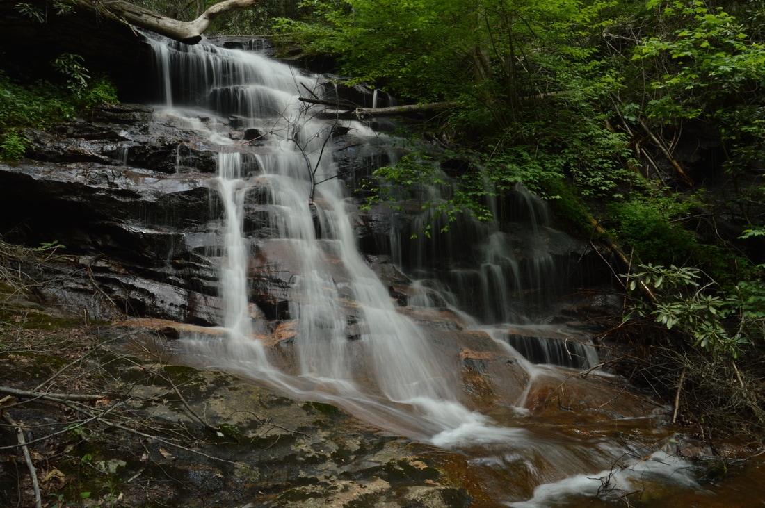
While only 30 feet high, Middle Spoilcane Creek Falls is a very photogenic cascading waterfall set in a remote gorge without any signs of the nearby Highway 75.
Middle Spoilcane Creek Falls greatly exceeded my expectations for its small height! While it is only around 30 feet high, the waterfall is very photogenic due to all of the leaps and cascades that the creek makes in many parallel ribbons of water down the steep cliff. The broad rock slab that the creek flows over just below the falls has striking patterns in it. Just below the falls, the creek continues its plunge in several slides and cascades, although in my opinion, it is not worth going any lower. Middle Spoilcane Creek Falls also sits at the head of a remote narrow gorge, and there is neither junk nor noise from the highway at this waterfall. If you are visiting Upper Spoilcane Creek Falls and Phil's Sister Falls, I highly recommend continuing on to the Middle Falls as well. It is not harder to reach, although the scramble at the end is time-consuming.
Based on the name "Middle", you're probably wondering about a Lower Spoilcane Creek Falls. As the name implies, such a lower waterfall does exist. However, the Lower Falls - located around a tenth of a mile downstream - is only about 15 feet high,consisting of a small vertical drop that is followed by a long and gradual slide. In my opinion, it is not worth the extra distance and effort. From Middle Spoilcane Creek Falls, return to the main trail and simply retrace your steps back to the trailhead parking area. You will return to the pullouts and reach your car at 2.8 miles, concluding the hike. Mileage
0.0 - Spoilcane Creek Trailhead
1.05 - Upper Spoilcane Creek Falls 1.1 - Phil's Sister Falls 1.6 - Middle Spoilcane Creek Falls 2.8 - Spoilcane Creek Trailhead Variations
Hike just out and back to Upper Spoilcane Creek Falls and Phil's Sister Falls (not recommended) - 2.2 Miles
Bonus Stops
Consider hiking to Lost House Branch Falls, just down Highway 75, after the hike to the waterfalls on Spoilcane Creek. Keep in mind that the hike to Lost House Branch Falls is a difficult bushwhack that involves wading in the creek and scrambling over/under numerous fallen trees. The bushwhack, while less than a quarter mile, is not for beginners.
Videos
2 Comments
SBowen
7/16/2017 05:58:34 pm
Great trail description!
Alex
9/19/2018 11:02:06 am
Tried to find these falls in the spring of 2018. Could not reach them due to the immense amount of blowdown from the storms of fall 2017. Unicoi gap was hit pretty hard and this area was not spared. If anyone has any tips for finding these falls recently, I'd love to hear them! I want to go back badly and try again, as the hike was relatively easy and I felt like I was getting close. However, on the return trip I had to walk all the way to the road to the Upper Chattahoochee WMA and then walk 75 to my car. Appreciate the detailed trail report immensely! Leave a Reply. |
About MeMark Oleg Ozboyd Dear readers: I have invested a tremendous amount of time and effort in this website and the Georgia Waterfalls Database the past five years. All of the work that has gone in keeping these websites updated with my latest trip reports has almost been like a full-time job. This has not allowed me to pick up a paid job to save up money for college, and therefore, I I've had to take out loans. If you find the information on this website interesting, helpful, or time-saving, you can say "thanks" and help me out by clicking the button above and making a contribution. I will be very grateful for any amount of support you give, as all of it will apply toward my college tuition. Thank you!

Coming in 2022-2023?
Other Hiking WebsitesMiles HikedYear 1: 540.0 Miles
Year 2: 552.3 Miles Year 3: 518.4 Miles Year 4: 482.4 Miles Year 5: 259.9 Miles Archives
March 2021
Categories
All
|


 RSS Feed