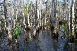
 You have probably wanted to see the famous swamp network known as the Everglades... from the safety of a wide, dry boardwalk. But have you wanted to see this enormous, wild swamp the hard way? Collier-Seminole State Park, on the western edge of the Everglades, protects a section of the swamp where black bears and Florida panthers abound. The primary focus on hiking in the park is the "Adventure Trail", a nearly 7-mile long slog across the dark swamp waters into one of Florida's most remote areas. This hike occurred on Thursday, November 26th, 2015 (Thanksgiving Day). My plan was to hike the Adventure Hiking Trail loop counter-clockwise, although by the time I was 2/3 of the way through, I was confident that the opposite direction would've been better.
7 Comments
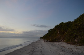 In southwest Florida, there's very few beaches left that are not developed, but thanks to conservation efforts, a few wild strips of beach remain. One of them is Caspersen Beach, a several-mile long section of preserved, wild beach near Venice. The small, linear county park that protects the beach also has a couple of nature trails that lead to and along the Intracoastal Waterway. This hike occurred on Tuesday, November 24th, 2015. My plan was to hike the short nature trail to the Intracoastal Waterway and near the beach. I would then hike the old road/trail that follows the strip of land between the beach and the Intracoastal Waterway to the southern boundary of the park. I would return via Caspersen Beach. 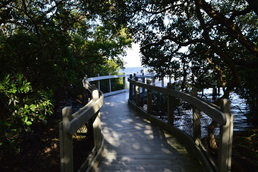 The barrier island of Longboat Key is home to a series of upscale development along the Longboat Key beach, generally referred to as the town of Longboat Key. By now, nearly the entire island is developed with very few of the native salt marshes and mangrove jungles left. Joan M. Durante Park preserves one of the last wild spots on Longboat Key, a place where you can hike on easy nature trails through salt marshes to the mangrove-lined shores of Sarasota Bay. This hike occurred on Monday, November 23rd, 2015. My plan was to hike the largest loop of the nature trails in Joan M. Durante Park. 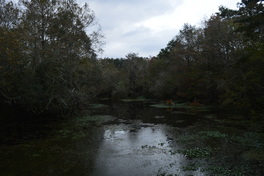 There's not many hiking trails across southern Georgia, as nearly all of the land is developed. There are several state parks such as Reed Bingham State Park that have short hiking trails showcasing the few wilder areas of southern Georgia. Reed Bingham State Park protects a several-mile section of the Little River with a small lake at the southern end. The park's hiking trails travel through uplands just east of Little River, with several sections of trail along the river. This hike occurred on Saturday, November 21st, 2015. My plan was to hike some of the Upland Loop to get onto the Little River Trail along Little River. I would return to the trailhead using Birdwalk Trail. 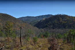 The Warriors Passage Trail is one of two National Recreational Trails in Cherokee National Forest. This seldom-traveled pathway traverses a couple of low-elevation stream valleys before climbing up to Waucheesi Mountain, a small bald summit with views across the Tellico Ranger District. This hike occurred on Saturday, November 14th, 2015. My plan was to hike the entire Warriors Passage Trail out and back from Lyons Creek Trailhead to Waucheesi Mountain. Franklin Delano Roosevelt State Park: Dowdell Knob Loop via Hines Gap Road, Pine Mountain, Georgia12/17/2015 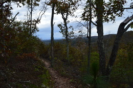 The Pine Mountain Trail is a 23 mile trail that travels across the majority of Pine Mountain Range, an elevated tract of land located in southwest Georgia. The ridge is the southernmost area of land in the eastern US that is higher than 1000 feet above sea level, and in fact, the ridge's high point, Dowdell Knob, that this hike visits, is nearly 1400 feet high. The ridge stretches from Lake Harding on the AL/GA border to the Flint River near Thomaston. This hike occurred on Saturday, November 7, 2015. My plan was to follow the Pine Mountain Trail from Hines Gap Road over Dowdell Knob to the second junction with Boottop Trail. I would then return via the Boottop Trail. 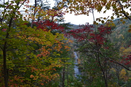 Two large rivers are the highlights of southern Cherokee National Forest's Ocoee/Hiwassee Ranger District: the Ocoee River and the Hiwassee River. Both rivers run through gorgeous canyons and are full of whitewater rapids. The John Muir Trail (and partially in conjunction with the Benton Mackaye Trail) runs along the northern shores of the Hiwassee River for a distance of nearly 20 miles, presenting opportunities to see the river's rapids and rock formations up close. This hike occurred on October 24th, 2015. My plan was to hike the John Muir Trail/Benton Mackaye Trail from the Big Bend Recreation Area to the Coker Creek footbridge at Duckett Ridge Trailhead. I would return almost the same way, although on the return trip, I would attempt to follow the old route of the John Muir Trail past Apalachia Powerhouse. 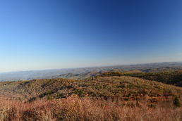 The Shining Rock Wilderness and adjacent areas is North Carolina's High Country. A multitude of peaks, some above 6000 feet, with astonishing views is accessed via rugged, wilderness pathways from the Blue Ridge Parkway. As you immerse into the backcountry of this wild region, you will also see many water features and scenic streams. My long, difficult hike in this area proved to be spectacular on one fall day when the fall colors were at peak level. This hike occurred on Saturday, October 17th, 2015. My plan was to follow the Mountains-to-Sea Trail from Looking Glass Rock Overlook to Black Balsam Road, with a stop along the way at Skinny Dip Falls and a short side trip to Second Falls in Graveyard Fields. From Black Balsam Road, I would follow the Art Loeb Trail over Black Balsam Mountain, Tennent Mountain, and to Ivestor Gap. From Ivestor Gap, I would take the Greasy Cove Trail to the Big East Fork, and finally, I would take the Big East Fork Trail back to Looking Glass Overlook. 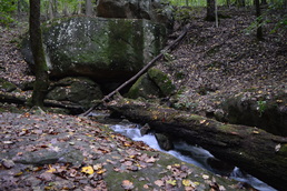 The Lookout Mountain Battlefield is a large tract of conserved land that covers the better portion of Lookout Mountain's slopes. The area that this tract covers is the site of the Battle of Lookout Mountain (a battle that was a part of the US Civil War's Chattanooga Campaign). The area is home to an assortment of interesting sights, most notably several rather large springs, as well as many important historic sights and even some good vistas. The mountain is crisscrossed by trails, and there are many ways to create long day hikes on Lookout Mountain. This hike occurred on October 10th, 2015. My plan was to hike to a number of features on the west side of Lookout Mountain: Skyuka Spring, Sunset Rock, and Gum Spring, but due to some confusing intersections, the total mileage of the hike had to be increased to the point that only Skyuka Spring was seen in the daylight. My plan was to start on the Kiddie Trail. I would then take the Skyuka Trail to Skyuka Spring, and follow the John Smartt Trail and later the Jackson Gap Trail to the Bluff Trail. The Bluff Trail would be followed to Sunset Rock, and then using the Gum Spring Trail and Lower Gum Spring Trail, I would return to the trailhead. As you'll see below, this plan didn't quite work out. 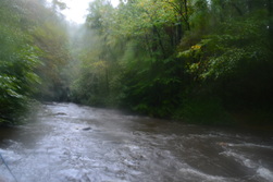
The Eastern Continental Divide is a geographically important mountain ridge that separates the waters of the Tennessee River from the waters of the Savannah River. When hiking the Hemp Top Trail, you'll be on top of this very ridge. Just to the west of the ridge, the Cohutta Mountains' most famous river, Jacks River, is a must-see after heavy rainfall in flood stage. Just don't try to ford it... even though I forded it several times on this day (it was in flood stage), it would be a risky procedure when the river is as high as it was on this day. This hike occurred on Saturday, October 3rd, 2015. My original plan was to hike the Penitentiary Loop - to first hike the Hemp Top Trail until the Penitentiary Branch Trail. I would then hike the Penitentiary Branch Trail. I would reach the Jacks River and follow the Jacks River Trail back to the trailhead, fording the Jacks River 18 times in the meantime. However, circumstances made me hike out and back to the Jacks River area at the end of Penitentiary Branch Trail.
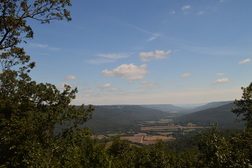
Franklin-Marion State Forest is a large tract of conserved land on the southern Cumberland Plateau, totaling to nearly 8000 acres. An assortment of hiking trails circles the forest, leading to various vistas of the surrounding coves and several small waterfalls. Unfortunately, the trail system has been let down in recent years and now receives mainly horse traffic. The horse traffic makes this hike rather unattractive, but still, it has its rewards. This hike occurred on Saturday, September 19th, 2015. My plan was to hike the Cave Spring Trail to the West Rim Trail and then follow the West Rim Trail to its northern terminus. From there, I would do the North Rim Trail out and back. Finally, I would do the Sweden Cove Trail to TN State Route 156 and return to the trailhead via TN 156.
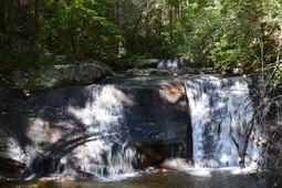
Emery Creek is a mountain stream located on the southern fringe of the Cohutta Mountains. The creek is full of waterfalls and cascades, with five waterfalls visible from near the trail and many more smaller cascades. To see all of the waterfalls on Emery Creek, you'll have to get a bit wet, with two dozen fords roundtrip, but it's worth it. Additionally, you can extend your hike to Little Bald Mountain, where in the winter, the views are extensive, and in the summer, the trail goes through whole fields of ferns. This hike occurred on Saturday, September 12th, 2015. My plan was to hike the Emery Creek Trail out and back from the southern terminus near Holly Creek to the northern terminus near Little Bald Mountain.
|
About MeMark Oleg Ozboyd Dear readers: I have invested a tremendous amount of time and effort in this website and the Georgia Waterfalls Database the past five years. All of the work that has gone in keeping these websites updated with my latest trip reports has almost been like a full-time job. This has not allowed me to pick up a paid job to save up money for college, and therefore, I I've had to take out loans. If you find the information on this website interesting, helpful, or time-saving, you can say "thanks" and help me out by clicking the button above and making a contribution. I will be very grateful for any amount of support you give, as all of it will apply toward my college tuition. Thank you!
Coming in 2022-2023?
Other Hiking WebsitesMiles HikedYear 1: 540.0 Miles
Year 2: 552.3 Miles Year 3: 518.4 Miles Year 4: 482.4 Miles Year 5: 259.9 Miles Archives
March 2021
Categories
All
|

 RSS Feed