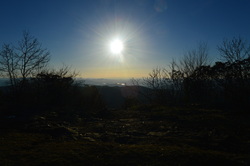
Southern Nantahala Wilderness is one of only two wilderness areas in Nantahala National Forest. However, it covers some very rugged and beautiful terrain across extreme southern North Carolina and a small section of north Georgia. The Tallulah River is one of the main rivers that eventually forms the Savannah River. Its headwaters are here. On this hike, you'll have a chance to see several of the headwater streams, at least two waterfalls, and an outstanding view. One thing though - be prepared for everything except an easy hike. This hike occurred on Saturday, March 7th, 2015. My plan was to hike the Deep Gap Branch Trail from the Dreamcatcher Cove Trailhead to its end on the Appalachian Trail at Deep Gap. From there, I would follow the Appalachian Trail to check out the vista on Standing Indian Mountain, this time in it's winter state, and then continue to Beech Gap. From Beech Gap, I would take an overgrown connector trail to Beech Creek Trail, and then continue down Beech Creek Trail to its end near the North Carolina/Georgia state line. I would finish the hike with a little roadwalk.
19 Comments
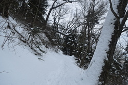
Mount LeConte is the most famous mountain in Great Smoky Mountains National Park. Being in the list of the top 25 highest peaks in the eastern US, it is also the tallest peak in the eastern US measured directly from its base near Gatlinburg. The mountain is home to a hikers lodge, accessed only by foot. The lodge provides amenities in all times of the year except winter. Due to the popularity of LeConte, five trails lead to the summit. If you have followed this blog for a little bit, you might have seen that I have already hiked to Mount LeConte via Alum Cave Trail. Unfortunately, I came to a fogged in overlook. This was my second attempt of seeing the views on Mount LeConte, with an even more challenging hike. And this time, due to my hiking partner not being in shape, the 4000-foot climb took considerably more time than expected. I arrived at the summit in the dark, but at least I was able to capture a good night picture of Pigeon Forge - even that wasn't possible last time. One day I'll set out on my third attempt to hike up to LeConte to see the views, and I know I won't fail that time. This hike occurred on February 28, 2015. My plan was to hike up to Mount LeConte via Rainbow Falls Trail, see the views from Cliff Tops, Myrtle Point, and Rocky Spur, and then return by Bullhead Trail.
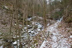 Fort Mountain State Park has one of the most impressive trail systems in Georgia's state parks. The western section of the park has over a dozen talc mines. While these mines are closed to the public, they can be viewed from the extensive trail system in that area. In addition, the park's two main streams, Mill Creek and Goldmine Creek, both have sets of picturesque cascades and waterfalls. The light snow cover along with ice from the preceding week's cold blast made this hike an excellent one. This hike occurred on February 21st, 2015. My plan was to hike Bike/Hike Trail #301 counter-clockwise. Old Fort Road, the road leading to the trailhead, was closed due to ice and snow, so I ended up also hiking Bike/Hike Trail #303 from Fort Mountain Lake Trailhead. 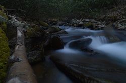 The Chunky Gal Trail is a 21-mile long hiking trail that connects the Nantahala Mountains with the Tusquitee Mountains. Despite its unfortunate name, it has many great vistas and is a good trail. This is the first time I visited it, but I was pretty happy with it - and I will return. The trail visits key peaks of the area such as Tusquitee Bald and Boetler Peak, as well as Muskrat Creek Shelter on the Appalachian Trail, which is where it ends. This hike occurred on February 14th, 2015. Originally, my plan was to hike the Chunky Gal Trail westward from Tusquitee Gap all the way to Tusquitee Bald, but it turned out to be a much longer hike than information had suggested, so I decided to turn around at some cascades on Tuni Creek.  Pigeon Mountain is a giant extension of the Cumberland Plateau in northwest Georgia, spread away from the rest of the plateau that generally lies along and northwest of a I-59 in Alabama and Georgia to I-75 in Tennessee corridor. There are some differences in Pigeon Mountain from the rest of the plateau. The elevation is slightly higher, the canyons are less rugged, and the terrain is less rocky. There are a few mountain vistas and water features, but did you know what the place is most famous for? It's Ellison's Cave, one of the biggest and deepest caves in North America. Ellison's Cave contains The Fantastic Pit, which at over 500 feet in depth, is the deepest cave pit in the US. On this hike, you'll have a chance to see a few best-in-winter vistas from the highest point on the mountain, simply known as High Point, and also take a short side trip and see the entrance to Ellison's Cave. This hike occurred on February 7th, 2015. My plan was to hike the High Point Loop counter-clockwise, starting from the Pocket Trailhead. There would be stops along the way at South Pocket Falls, High Point, and possibly Ellison's Cave, if there would be clear signage to it, as I forgot to look up precise directions to it.  The Tellico River watershed is home to some of the most pristine and beautiful streams in Tennessee. Two wilderness areas, Bald River Gorge Wlderness and Citico Creek Wilderness, protect some of its major tributaries, and many hiking trails pass through the region. One of the more notable trails is the Benton Mackaye Trail, a nearly 300-mile trail that start in northern Georgia and ends in the Smoky Mountains. The section of the Benton Mackaye Trail described here is long and hard, but the view at the end is stunning. However, if you go, don't be like me and end up hiking nearly 30 miles instead of no more than 17 from one mistake. This hike occurred on January 31st, 2015. My plan was to hike the Benton Mackaye Trail from Tellico Trout Hatchery at the Tellico River to Whiggs Meadow. Much of this hike would also be along Sycamore Creek Trail. From Whiggs Meadow, I opted for a shorter return route, along Whiggs Ridge Trail... except I didn't find the trail. I will explain more on this later. |
About MeMark Oleg Ozboyd Dear readers: I have invested a tremendous amount of time and effort in this website and the Georgia Waterfalls Database the past five years. All of the work that has gone in keeping these websites updated with my latest trip reports has almost been like a full-time job. This has not allowed me to pick up a paid job to save up money for college, and therefore, I I've had to take out loans. If you find the information on this website interesting, helpful, or time-saving, you can say "thanks" and help me out by clicking the button above and making a contribution. I will be very grateful for any amount of support you give, as all of it will apply toward my college tuition. Thank you!
Coming in 2022-2023?
Other Hiking WebsitesMiles HikedYear 1: 540.0 Miles
Year 2: 552.3 Miles Year 3: 518.4 Miles Year 4: 482.4 Miles Year 5: 259.9 Miles Archives
March 2021
Categories
All
|

 RSS Feed