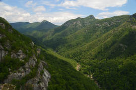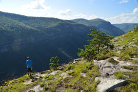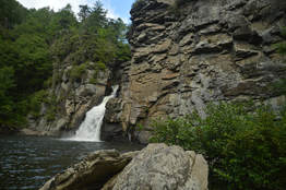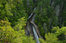
The Linville Gorge Wilderness of Pisgah National Forest, North Carolina's third largest wilderness area, encompasses an area that is one of the most rugged areas in the Southeast: Linville Gorge. Flowing along the bottom of the gorge is the boulder-strewn Linville River, located as much as over 1500 feet below the gorge's rims at its deepest spots. The Linville Gorge Trail runs through nearly the entire length of the gorge, passing countless obstacles as it follows the steep banks of the Linville River for miles. An array of trails and roads runs along the rims of the gorge, and a number of extremely steep paths provide access to the gorge floor, allowing one to hike loops of varying length encompassing both the gorge floor and rim. One of those loops is the Rock Jock Loop: a spectacular yet grueling hike that passes at least six particularly breathtaking vistas and many other smaller views as well as numerous cataracts on the Linville River and one tall waterfall on its tributary. While it is possible to hike the Rock Jock Loop in one day like I did, it will be very tiring, and in order to get the most enjoyable and relaxing experience, turning the Rock Jock Loop into a weekend backpacking trip could be a good idea. This hike occurred on Saturday, July 8th, 2017. My plan was to hike the Rock Jock Loop/Linville Gorge Loop counter-clockwise from the Conley Cove Trailhead. This hike was the seventh of ten hikes that I did during a seven-day trip to the mountains of northwest North Carolina.
0 Comments

If I had to name the ten best hikes that I have ever done, the hike along the east rim of Linville Gorge to Table Rock and the North Carolina Wall would make the list without question. This section of the Mountains-to-Sea Trail provides access to several jaw-dropping vistas of Linville Gorge as well as its surroundings. North of the Table Rock Picnic Area is the summit of Table Rock, whose lofty peak is surrounded by cliffs hundreds of feet high and whose elongated rocky summit is home to a series of grand vistas that encompass a 360-degree view. Meanwhile, to the south, the MST first passes through a place called The Chimneys, a series of wild and jagged rock outcrops of all shapes and sizes, where the knife-edge ridge with 360-degree views forms a boundary between the rolling hills of the North Carolina Piedmont and the ruggedness of Linville Gorge. Then, if all of that wasn't enough, a pair of side trails lead to the North Carolina Wall. Rising hundreds of feet high, the North Carolina Wall is an incredible line of cliffs with continuous views over a half-mile long along the east rim of the gorge. This hike occurred on Friday, July 7th, 2017. My plan was to hike the Mountains-to-Sea Trail and Table Rock Trail from the Table Rock Picnic Area to the summit of Table Rock. On my way back, I would take a side trail to an area of cliffs known as the Devil's Cellar. Then, I would follow the Mountains-to-Sea Trail in the other direction to and through The Chimneys, before taking a side trail down to an area on the rim of the gorge known as The Amphitheater. Finally, I would follow another faint trail along the top of the NC Wall back to the MST, before retracing my steps back to the picnic area. This hike was the sixth of ten hikes that I did during a seven-day trip to the mountains of northwest North Carolina.

Linville Falls is one of the most photographed waterfalls in North Carolina. Located on the Linville River at the very head of Linville Gorge, the falls cascades over a hundred feet via multiple tiers, crashing into a huge plunge pool lined by tall cliffs at the end of the final 45-foot tier of the falls. A network of popular trails, stemming from the Linville Falls Visitor Center, weaves around the falls and leads to five different viewpoints of it (including the base itself). In addition, a bonus waterfall known as Duggers Creek Falls can be seen from one of the trails. This hike occurred on Friday, July 7th, 2017. My plan was to hike out and back to each of the five viewpoints of Linville Falls as well as Duggers Creek Falls from Linville Falls Visitor Center. This hike was the fifth of ten hikes that I did during a seven-day trip to the mountains of northwest North Carolina.

The Wilson Creek watershed in the Grandfather Ranger District of Pisgah National Forest is well-known for its numerous hiking trails and backpacking opportunities. One of the largest tributaries of Wilson Creek is Harper Creek. Harper Creek and its tributaries are home to several spectacular waterfalls in the shadow of Grandfather Mountain. Particularly impressive is South Harper Creek Falls: a massive 120-foot double sliding waterfall that can be viewed from three distinct locations: the base, the midpoint, and the cliffs on the other side of Harper Creek. If you hike the Harper Creek Loop, you'll also pass triple-tier Harper Creek Falls - that isn't too shabby either - and have the option to take a lengthy side trail to Bard Falls on North Harper Creek. However, it is best to be prepared for overgrown trails and over a dozen wet crossings of Harper Creek if you do hike the full loop. This hike occurred on Thursday, July 6th, 2017. My plan was to hike the Harper Creek Loop counter-clockwise from Brown Mountain Beach Road, following the Harper Creek Trail and then the Raider Camp Trail. Along the way, I would take a side trip to Bard Falls along the North Harper Creek Trail, and I would also take short side trails to Harper Creek Falls and three different viewpoints for South Harper Creek Falls. This hike was the fourth of ten hikes that I did during a seven-day trip to the mountains of northwest North Carolina.
|
About MeMark Oleg Ozboyd Dear readers: I have invested a tremendous amount of time and effort in this website and the Georgia Waterfalls Database the past five years. All of the work that has gone in keeping these websites updated with my latest trip reports has almost been like a full-time job. This has not allowed me to pick up a paid job to save up money for college, and therefore, I I've had to take out loans. If you find the information on this website interesting, helpful, or time-saving, you can say "thanks" and help me out by clicking the button above and making a contribution. I will be very grateful for any amount of support you give, as all of it will apply toward my college tuition. Thank you!
Coming in 2022-2023?
Other Hiking WebsitesMiles HikedYear 1: 540.0 Miles
Year 2: 552.3 Miles Year 3: 518.4 Miles Year 4: 482.4 Miles Year 5: 259.9 Miles Archives
March 2021
Categories
All
|

 RSS Feed