A classic Southern Appalachian wilderness hike, the Beech Creek Loop is a 'must-do' for all classes of hikers alike. I'll add that the Beech Creek Loop is among the top hikes that I have ever done, in Georgia or elsewhere. Over its eight-mile course, the loop visits two spectacular waterfalls - one of which is about 100 feet high - and passes a lengthy but worthwhile side trail to a breathtaking 180-degree view from Big Scaly Mountain into the Tallulah River Valley. In addition, the trail provides a perfect wilderness experience, full of solitude all throughout the Beech Creek gorge and on the slopes of Big Scaly Mountain. A short stretch of roadwalk is necessary to close the loop, but even walking along Tallulah River Road is nice, as you will get several views of the Tallulah River and its cascades. This hike occurred on Saturday, June 10th, 2017. My plan was to hike the Beech Creek Loop counter-clockwise, although I would use two cars to eliminate the 1.2-mile roadwalk. Along the way, I would take short side trips to Bull Cove Falls and High Falls and a much longer side trip to the vista on Big Scaly Mountain. Note that if you do the Beech Creek Loop, you must by all means take the time to go to the overlook as well.
Summary
R/T Length of Trail: 10.3 Miles (9.1 Miles with two cars)
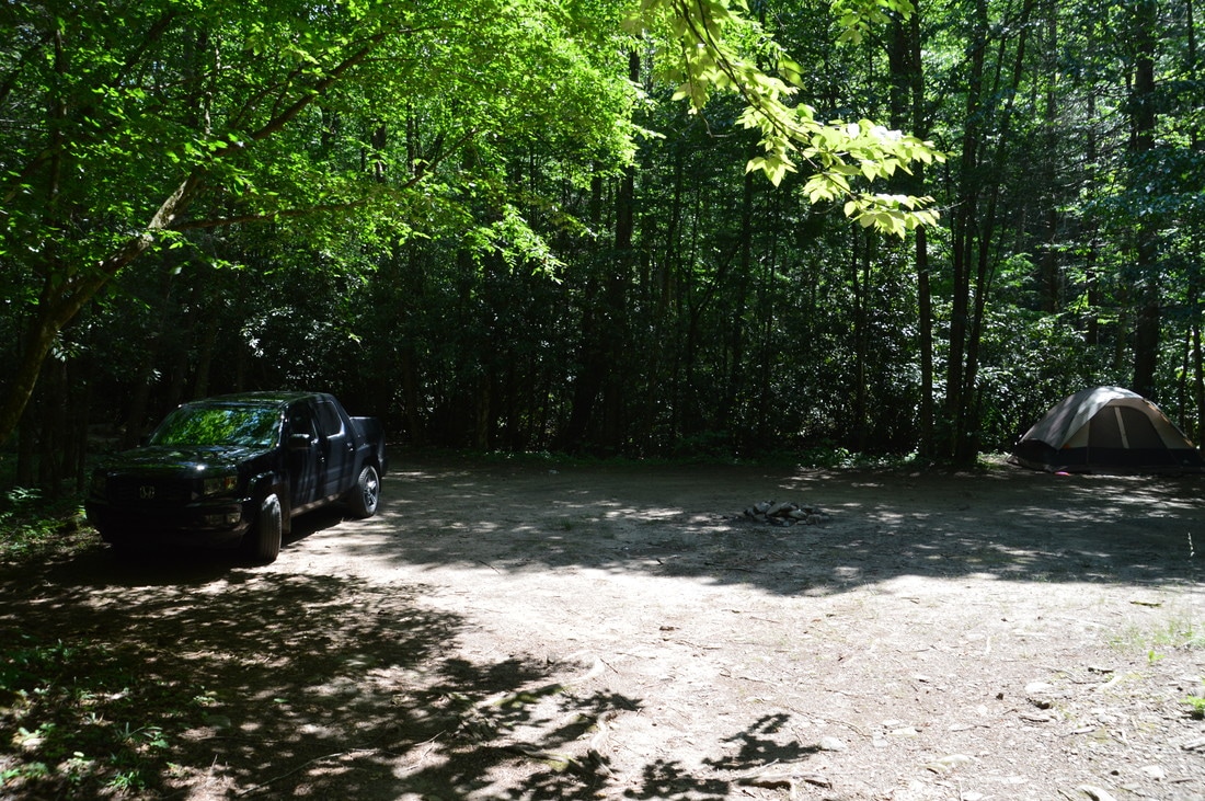
Duration of Hike: 8:30 (this does not include the ~30 minutes that should be allotted for the roadwalk) Type of Hike: Loop Difficulty Rating: 8 out of 10 Total Elevation Gain: 3173 Feet Pros: The Beech Creek Loop provides an amazing wilderness experience that tops nearly all wilderness hikes in Georgia Cons: Portions of the Beech Creek Trail are steep and overgrown; Big Scaly Mountain Trail was damaged by the Rock Mountain Fire Points of Interest: Bull Cove Falls - 6 stars; Bear Creek Falls - 1 star (2 stars in winter when upper part is visible through the trees); High Falls - 10 stars; Big Scaly Mountain Vista - 10 stars Trail Blaze Colors: Beech Creek Trail - Blue; Bull Cove Falls Side Trail - None; High Falls Side Trail - None; Big Scaly Mountain Trail - None; Deep Gap Branch Trail - Blue Best Seasons to Hike: Spring Fees: None Beginning Point: Beech Creek Trailhead (South) Directions from Clayton, GA: From the intersection of Rickman Drive, Savannah Street, and US Route 23/441 in downtown Clayton, follow Savannah Street (US 76) West for 8.0 miles. Then, turn right onto Persimmon Road. In another 4.2 miles, turn left onto Tallulah River Road, and continue for exactly 7.7 miles. At this point, there will be a short side road leading left to a campsite. The road also leads to a circular parking area/turnaround. This is the parking area for the Beech Creek Trail, which begins 50 feet down the road. Map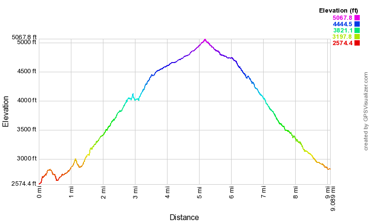
Click here to download a track of this hike.
Note: the map and elevation profile do not include the 1.2-mile roadwalk along Tallulah River Road that is required to close the loop. Details
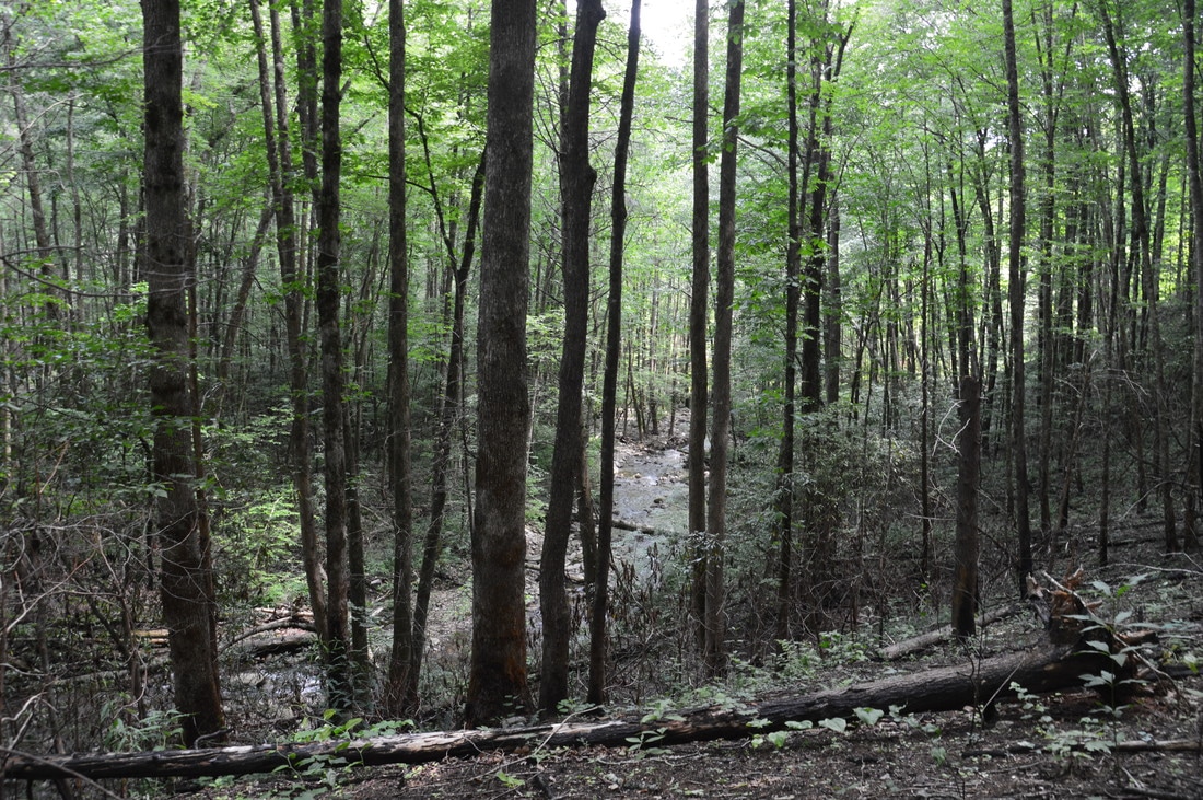
The Beech Creek Loop is actually entire in the North Carolina part of the Southern Nantahala Wilderness, but the only way to get to the trailheads for it is to drive through Tate City, Georgia, on Tallulah River Road, so I still consider this area part of Georgia, although on the map it is not. Rarely have I enjoyed a hike so much as I did the Beech Creek Loop. The Southern Nantahala Wilderness has always been one of my favorite hiking areas, but the Beech Creek Loop took it up to a whole new level. A remote forest filled all of the wilderness, peppered with cliffs and full of gorgeous mountain stream scenery. There were several waterfalls on the loop, but High Falls is worthy of extra mention. High Falls is one of the best waterfalls that I've seen, due to its size in both width and height, and all of that is in addition to the strong water flow that is often present at this falls. I gave High Falls a 10-star rating, which is fairly rare. Furthermore, the breathtaking 180-degree panoramic view from Big Scaly Mountain also received a 10-star rating from me, and when there are two 10-star points of interest on a hike, it is something special.
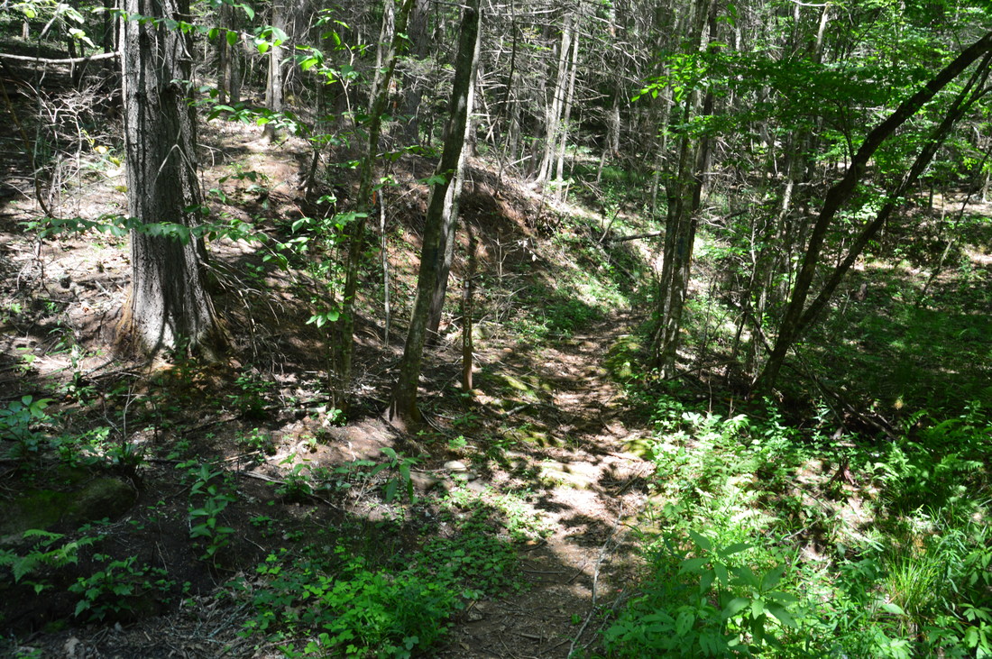
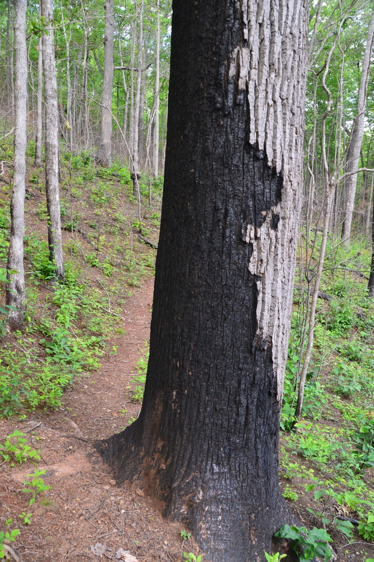
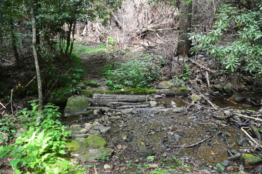
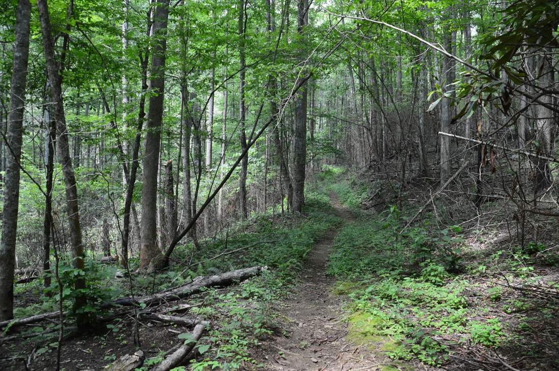
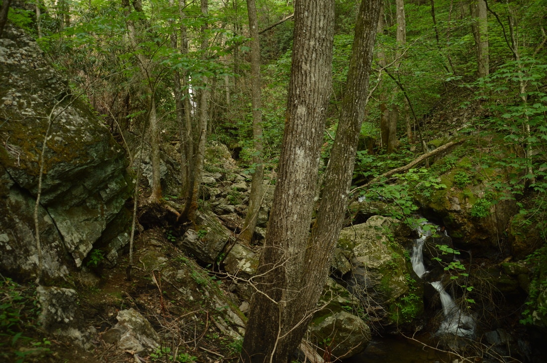
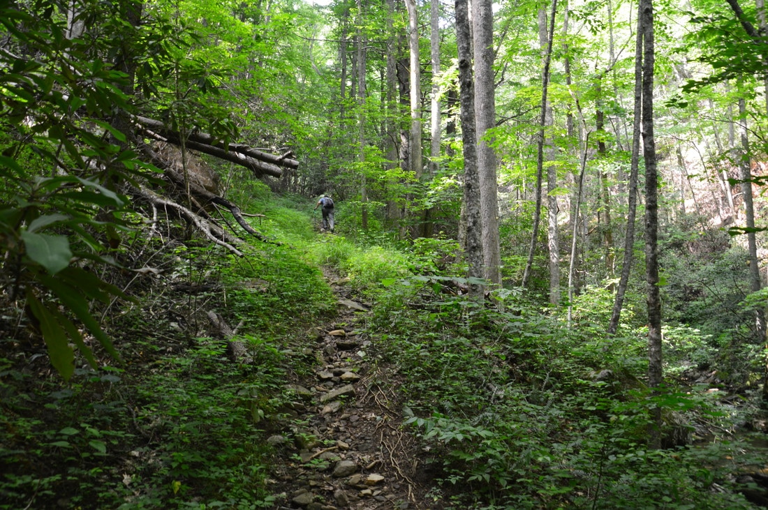
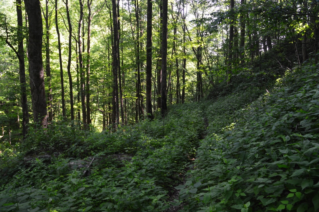
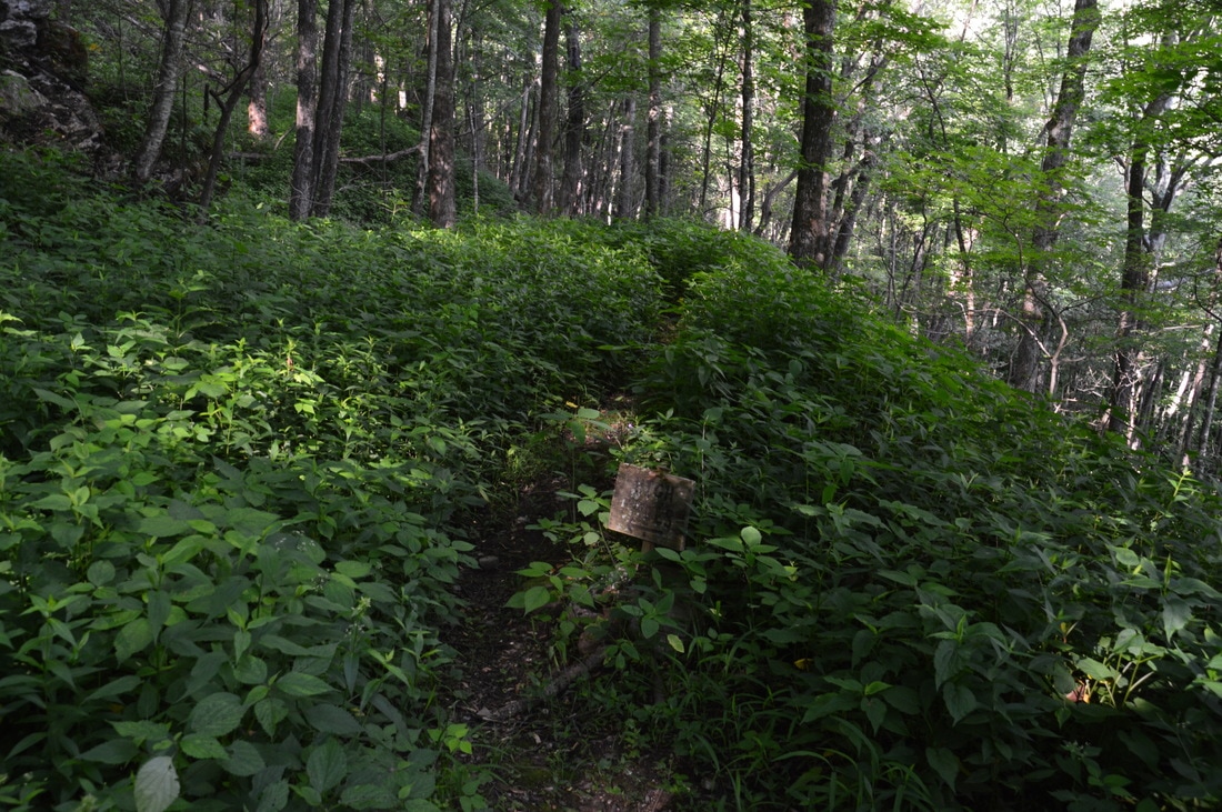
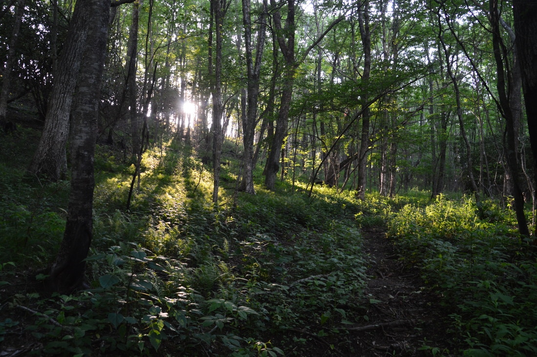
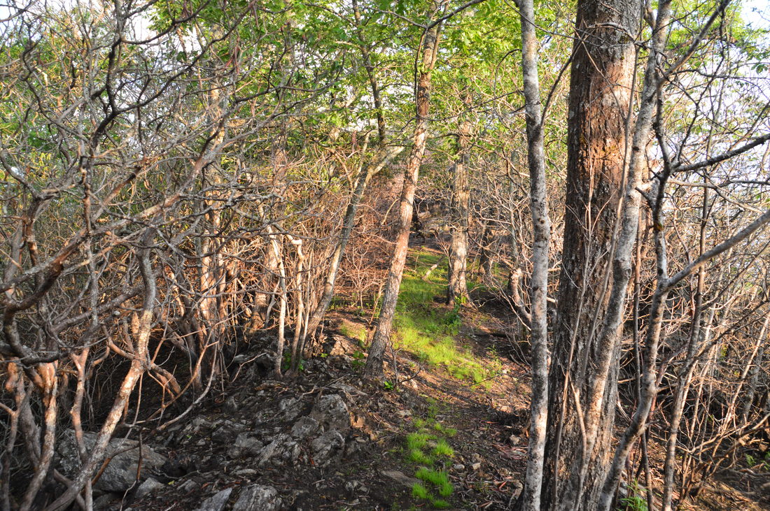
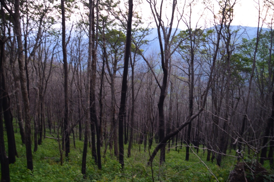
Deciding which direction to hike the Beech Creek Loop in and from which trailhead to hike is difficult. Hiking clockwise will make the main climb slightly shorter, but there will be one final steep ascent at the end. Hiking counter-clockwise will make the climb longer, but there will be stops at waterfalls along the way. I decided to hike the loop clockwise, and in the end, I think it was a good choice, although keep in mind that the direction in which to hike it does not make a crucial difference. From the southern Beech Creek parking area (to which directions are listed), walk to the road and turn right onto it. In less than 50 feet, the Beech Creek Trail will begin on the left, marked by a carsonite stake. Pick up the blue-blazed trail as it enters the Southern Nantahala Wilderness and promptly begins a short but steep 250-foot ascent. In about 150 feet, the main trail leaves left while the much more obvious shortcut continues ahead. Please use the switchbacks to prevent them from completely disappearing; do not use the shortcuts! It is unfortunate that the switchbacks here have fallen into such disuse that they are easy to miss now. The trail returns to the top of the first shortcut and bears left at 0.15 miles. Shortly afterwards, the trail bears right as a very steep shortcut continues ahead. After two more hard-to-identify switchbacks, the Beech Creek Trail becomes a lot more distinct as it reaches the top of the last shortcut, and at 0.3 miles, it passes through a gap in Scaly Ridge. After the gap, the Beech Creek Trail descends only slightly more gradually into the Beech Creek valley. At one point, there is a blue arrow painted on a tree and pointing to the right. I have no clue as to what it could be pointing toward, because the trail does not go there and there are no waterfalls that I know of in that area. As you hike along the Beech Creek Trail, you will notice numerous charred trees and black ground - all signs of the Rock Mountain Fire that hit this area in November 2016. At 0.55 miles, the trail comes alongside Beech Creek, a broad cascading stream. The trail crosses Beech Creek almost as soon as it reaches it, and it is easy to miss the crossing, because it is not marked well and a faint path continues straight for a few dozen feet. If you suddenly reach the end of the trail, then backtrack and look for a path and flagging tape on the opposite side of the creek. When I did this hike, there were two fallen trees at the crossing point that provided a dry route across. If these trees get carried away in a flood, then the crossing will likely become a wet one except during late summer and early fall water levels. On the other side of the creek, the trail passes through a flat area before reaching an important turn at 0.65 miles. The Beech Creek Trail turns left onto an old roadbed that also continues in the form of a distinct path to the right. To the right, the roadbed leads to private property near the mouth of Beech Creek. If hiking this loop in the opposite direction, it is easy to miss this turn and continue hiking on the old roadbed, although a rock cairn did mark the intersection as of this writing. Just keep in mind that even if you miss the turn coming from the other direction, you will not end up in a totally different place (you will come out slightly south of the trailhead), but you will have to hike through private property, so I cannot condone that. 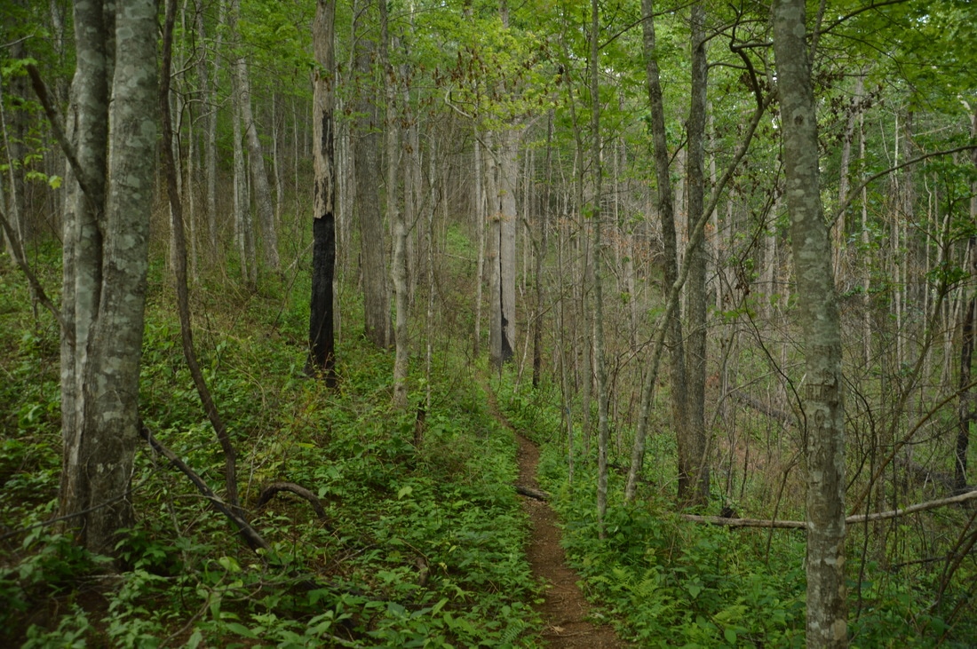
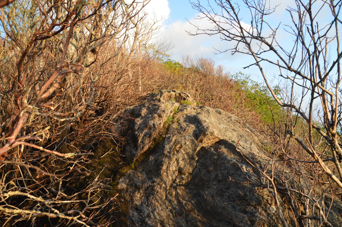
The first leg of the Beech Creek Trail crosses the southernmost extent of Big Scaly Ridge, a major lead that begins at the top of 5040-foot Big Scaly Mountain.
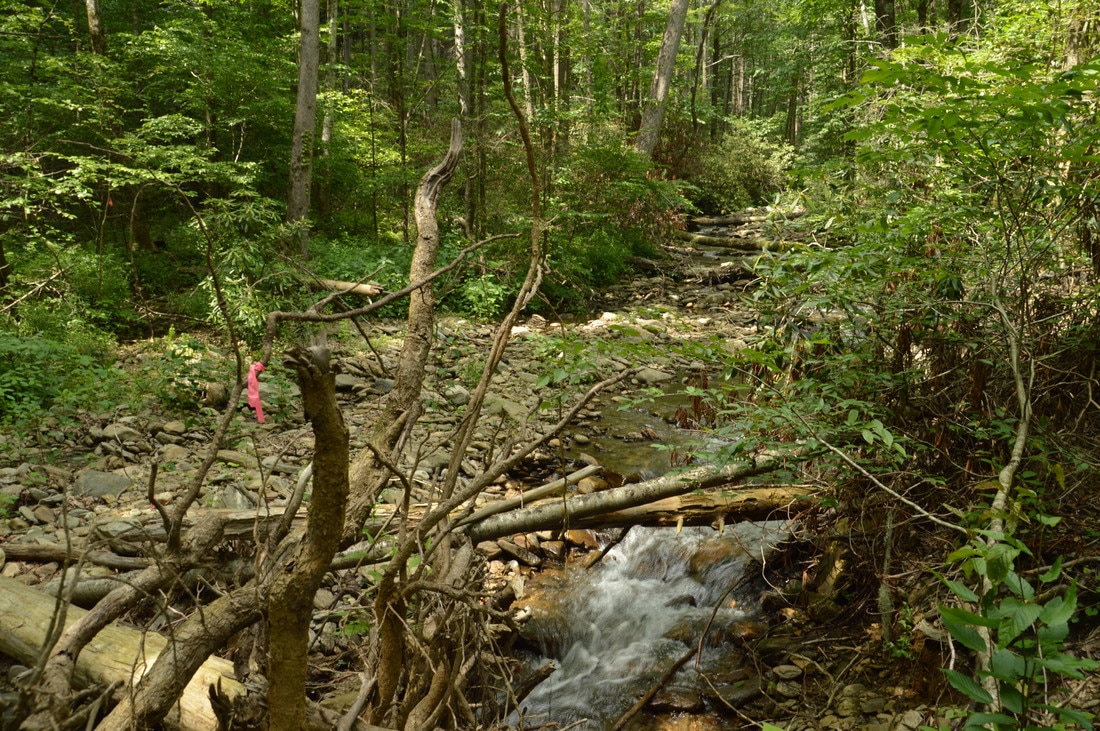
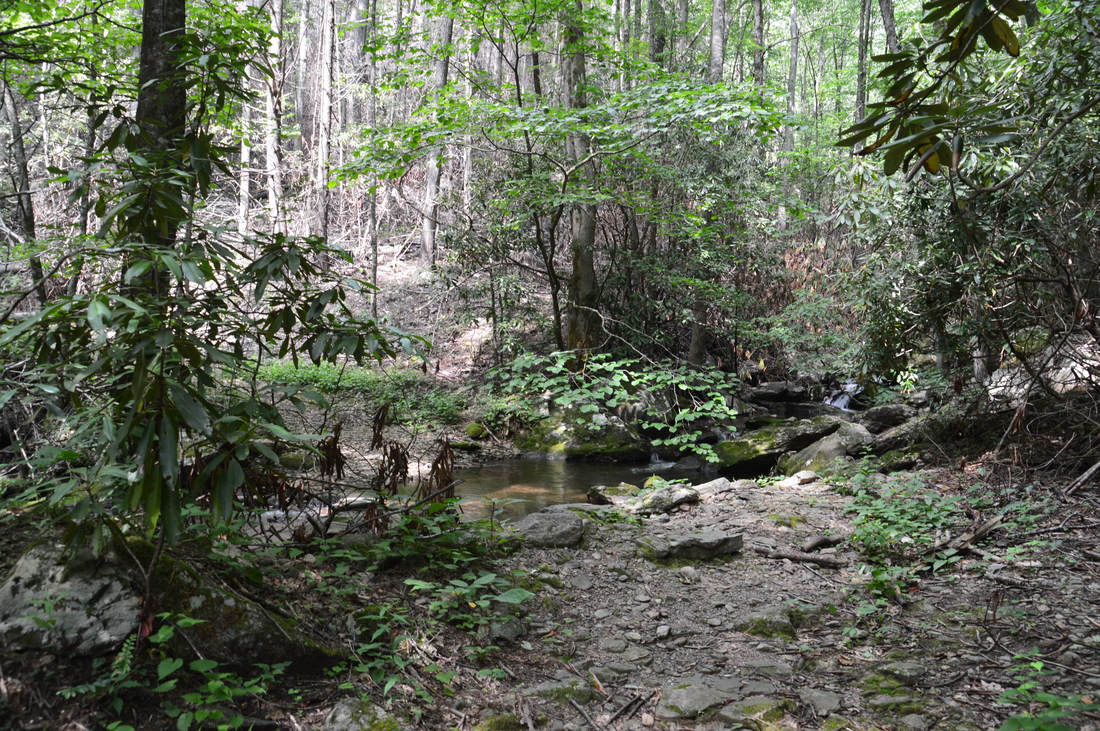
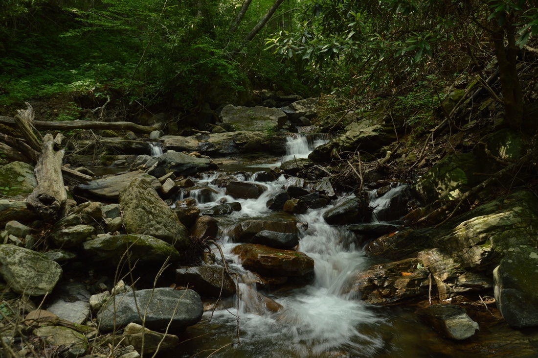
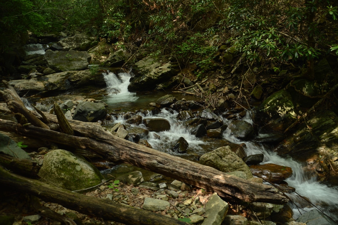
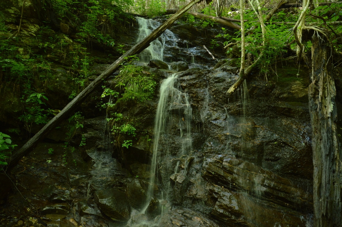
After turning left onto the old roadbed, an easy ascent will begin along Beech Creek. At 0.75, there is a multi-log crossing of a small stream. As the trail approaches Bull Cove Creek, it gets slightly rockier, crossing it at 1.05 miles. Bull Cove Creek is a fairly large tributary of Beech Creek. The Beech Trail crosses Bull Cove Creek on stepping stones, although the rocks may be submerged after heavy rain. Right after the creek crossing, the unmarked 0.1-mile side trail to Bull Cove Falls turns off to the right up the slope. It begins just before a fallen tree on the trail. Take this side trail, which initially is indistinct. After several dozen feet, the trail passes a campfire ring and becomes easier to follow along the side of Bull Cove Creek. The terrain becomes a lot rougher as the falls comes into view. The final stretch of the trail requires scrambling through an impressive boulder field along the base of tall cliffs. Reach the base of Bull Cove Falls at 1.15 miles.
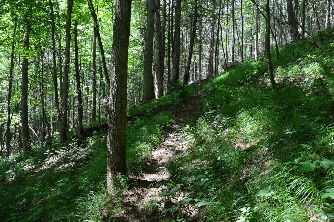
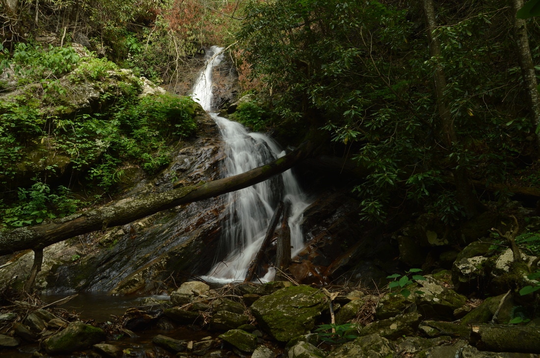
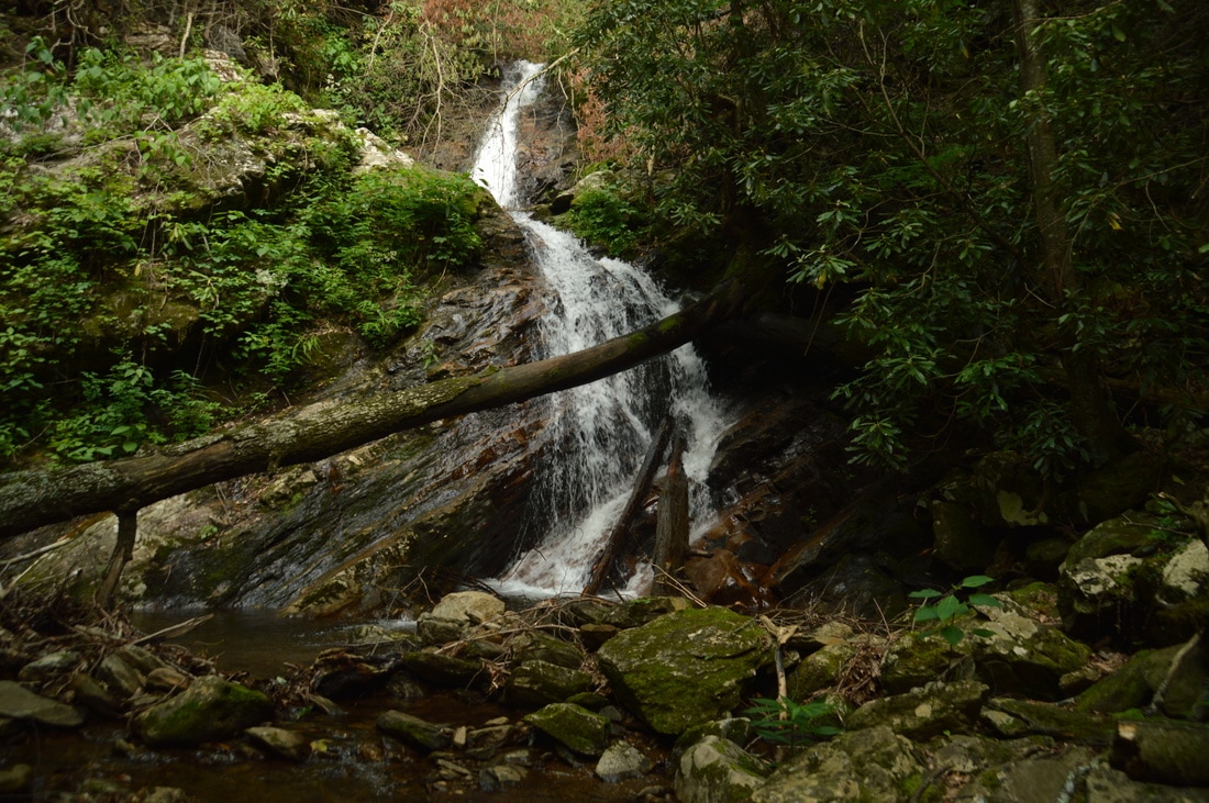
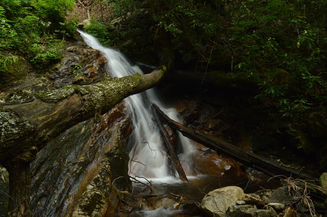
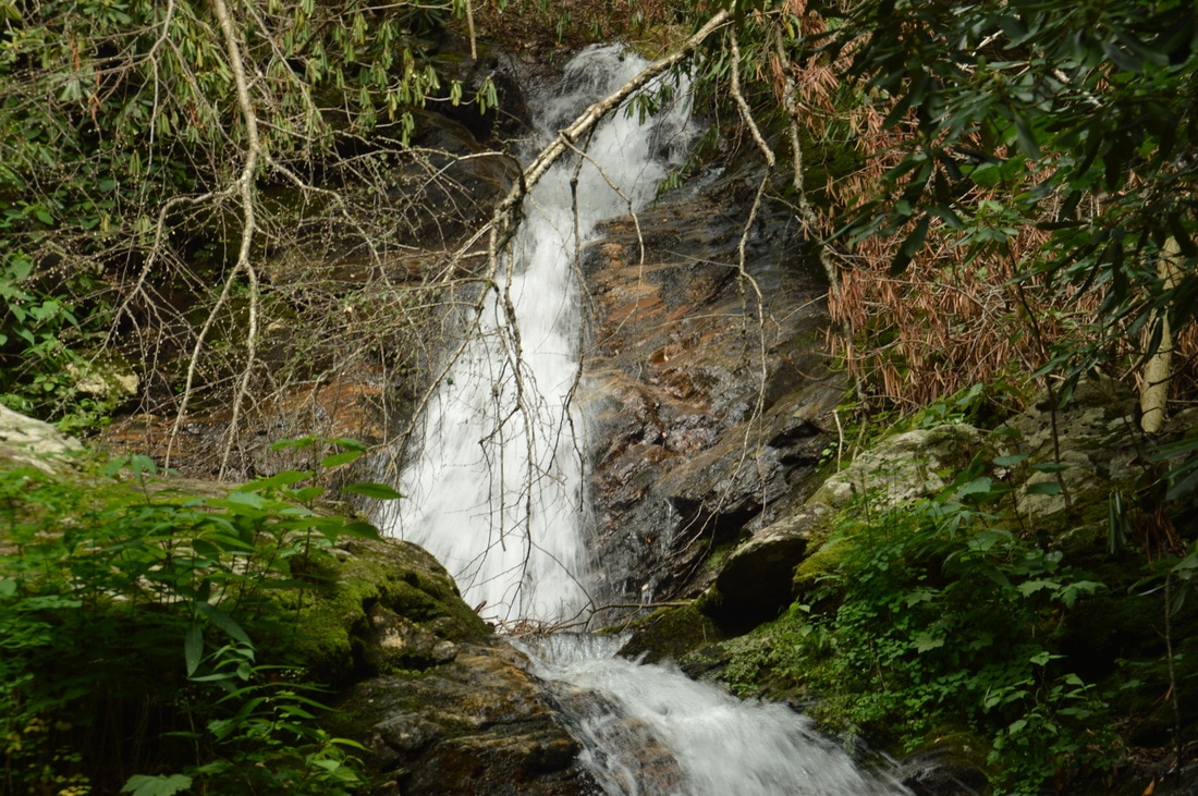
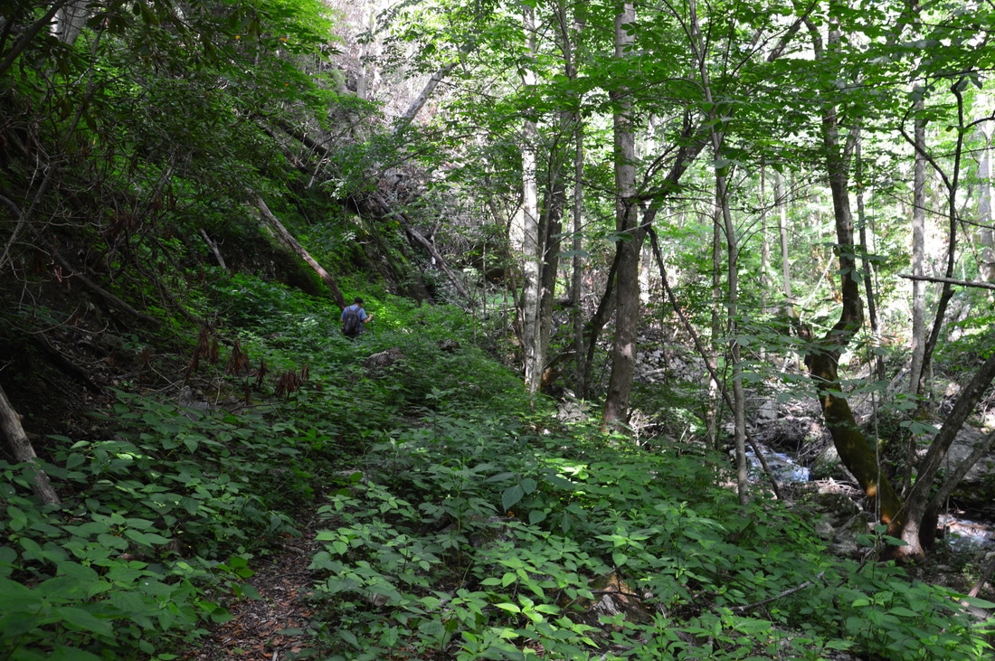
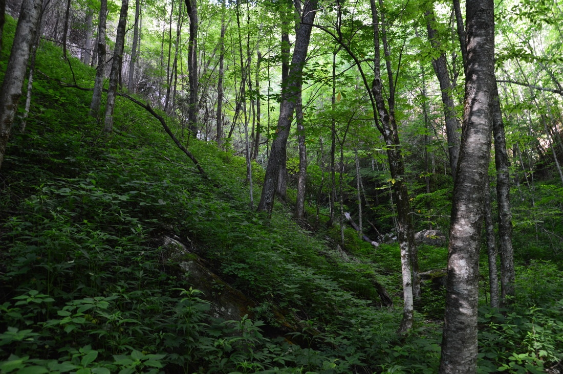
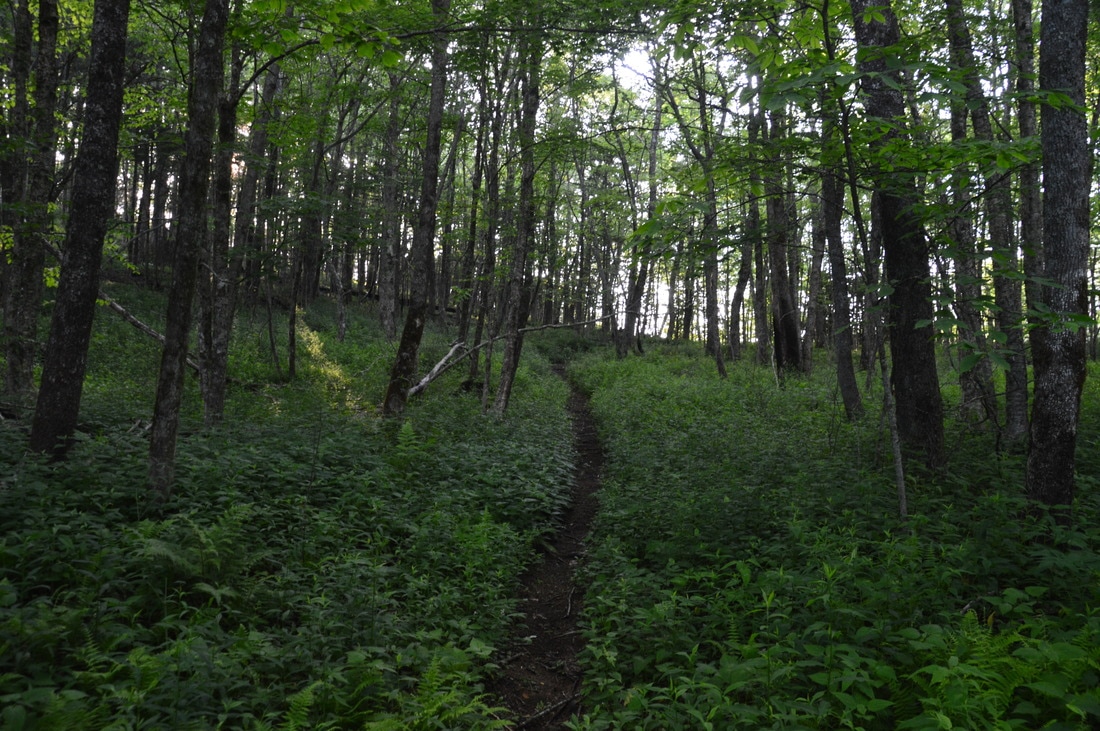
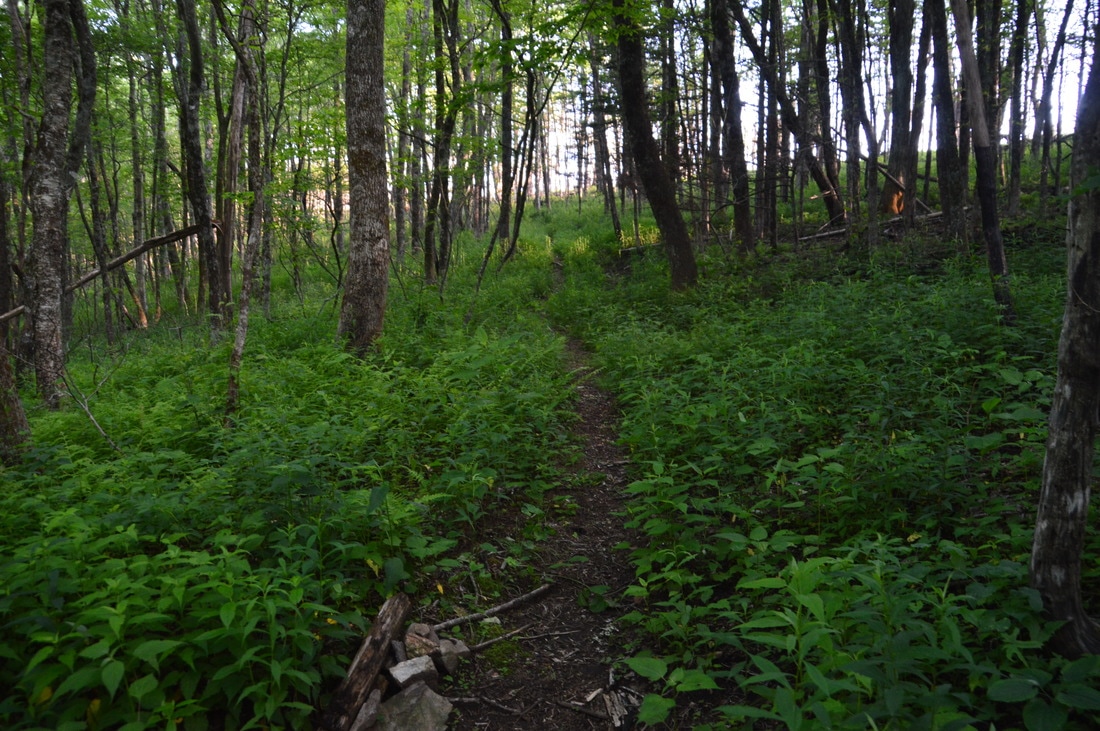
Bull Cove Falls is a pretty 40-foot double waterfall. Both the upper and lower halves are slides. A tree has fallen across the lower part, blocking the view slightly, although I liked the perspective that the tree gave in profile photos of the lower drop. When you visit Bull Cove Falls, notice the huge cliffs on the left side of the creek. The cliffs, which are over 100 feet high, add originality to the setting, as cliffs of this size are uncommon at Georgia waterfalls. Photographing of Bull Cove Falls on a sunny afternoon will be very tough, because the upper drop will be in full sunshine while the lower drop will usually be in the shade. From Bull Cove Falls, return to the Beech Creek Trail and continue following it. You will pass the remains of an old gate shortly. At 1.35 miles, the trail crosses Beech Creek for the second and last time just below a scenic set of cascades. This crossing is likely to be wet during the high water levels of winter and spring, but on this day, rock hopping across was a possibility. The crossing marks the beginning of a very long moderate ascent to High Falls and eventually Case Knife Gap north of Big Scaly Mountain. In the next 2.8 miles, the Beech Creek Trail gains approximately 1850 feet in elevation, excluding the High Falls side trail! My opinion is the ascent is manageable because generally most of the grades are upper-end moderate (with a few strenuous stretches), but it becomes more difficult due to how long and relentless it is, so keep that in mind when you do this hike. As the trail ascends along Beech Creek, it becomes increasingly overgrown - especially in the summer. Even though the trail follows an old roadbed, only a narrow path is visible among the weeds and grass that are swallowing the roadbed. Down to the right, there are countless cascades and small waterfalls on Beech Creek. Throughout the ascent, the trail crosses several small streams that cascade steeply down to join Beech Creek. The largest such stream appears to be known as Bear Creek, which the trail crosses at 1.8 miles. Bear Creek actually forms a rain-dependent 20-foot waterfall that spills out from the left right onto the trail. In the winter, you can see a much taller waterfall on Bear Creek sliding down a tall cliff well above the trail. Getting to the tall waterfall looked like it would involve a difficult off-trail scramble, and thus, it would be worth it only during a monsoon. 
One of the highlights of the Beech Creek Loop is Bull Cove Falls, a 40-foot double waterfall.
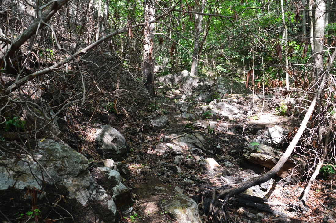
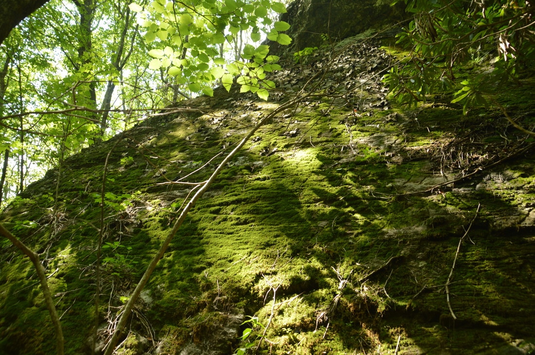
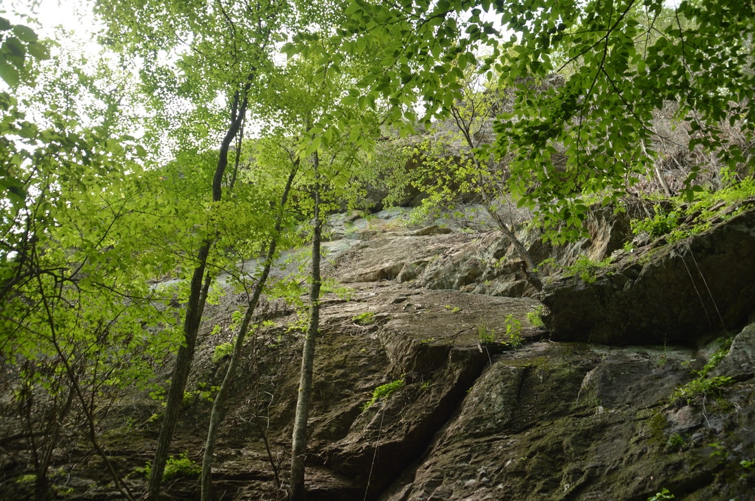
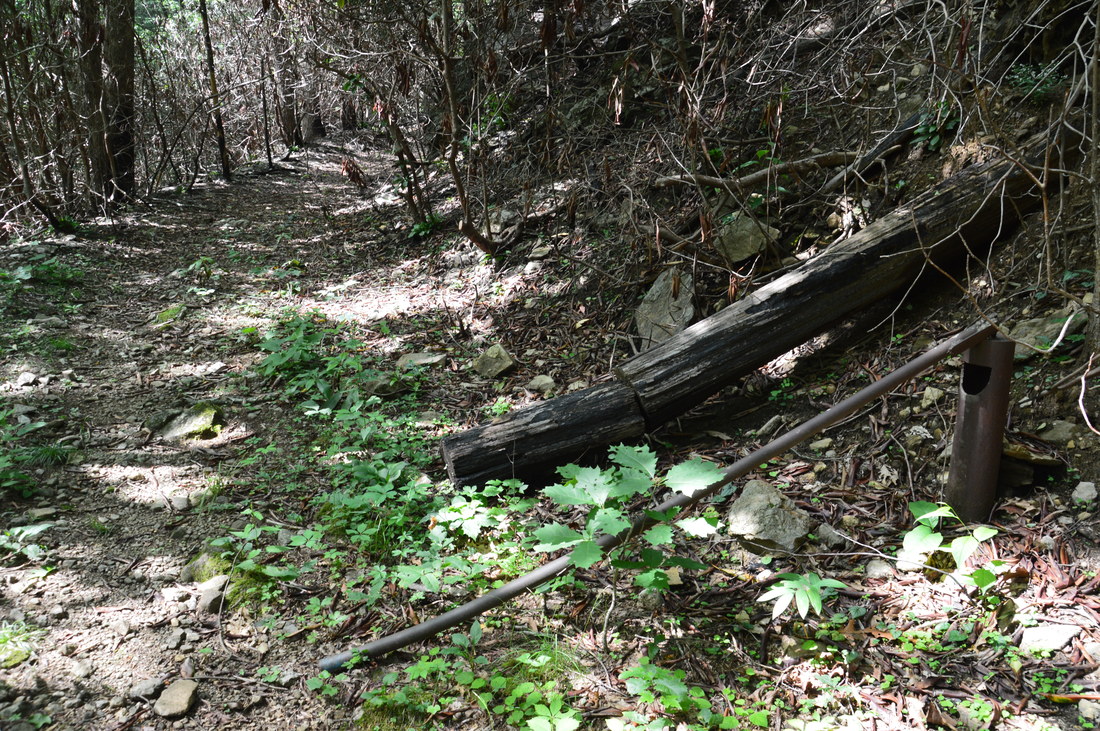
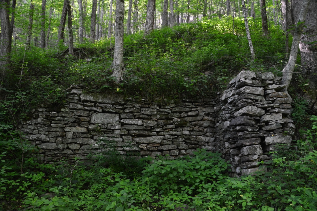
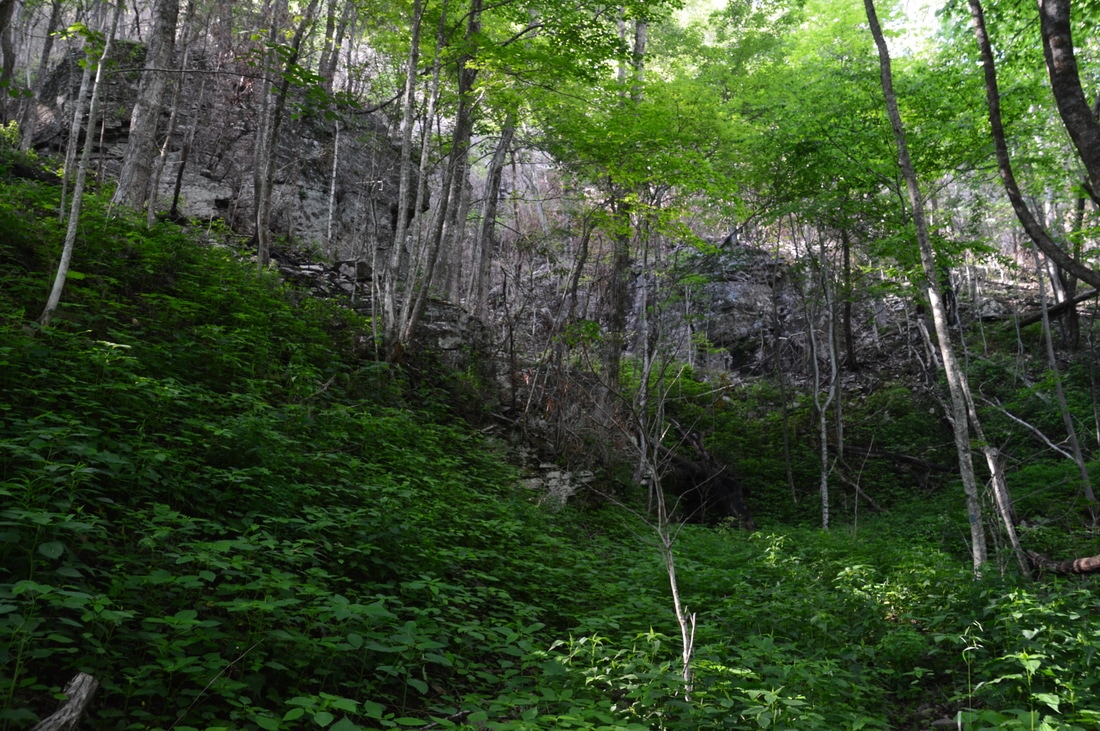
At 2.5 miles, a rock wall stands to the left of the trail. This is a relic from the days when corundum was mined in the Tallulah River valley. Corundum was crushed at this wall back when the mine was active. Right after the rock wall, as the trail makes a switchback - the first of six - to the left, there is a junction. An unmarked narrow path continues straight as an unofficial and unmaintained trail to a crossing of Beech Creek and then makes an extremely steep half-mile climb to the Appalachian Trail at Beech Gap. While this connector to the AT can be useful for folks wishing to get to places such as Albert Mountain from the Tallulah River valley, keep in mind that I have hiked the trail before and can confirm that it was one of the steepest trails I've been on. Meanwhile, the Beech Creek Trail begins a steeper ascent up the steep escarpment that forms High Falls. The switchbacks are helpful in making the ascent easier. At 2.7 miles, you will see lines of cliffs to the left above the trail. The south side of Big Scaly Mountain is lined with numerous lines of cliffs. In fact, I have never seen so many bluff lines on any one hike in the Southern Appalachians outside of the Cumberland Plateau! At the third sharp switchback at 2.8 miles, there is an important junction with the 0.15-mile side trail to High Falls. This side trail continues straight just ahead as the main trail turns acutely left. With how outstanding High Falls is, you definitely do not want to skip the side trail. On this day, a ground-level sign with the words "<-- High Falls" marked the side trail when I did this hike, but I have read that the sign can go missing.
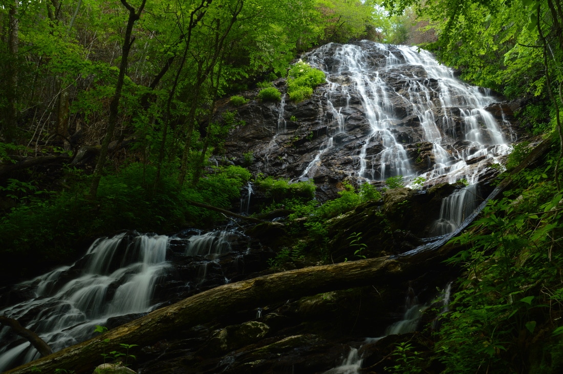
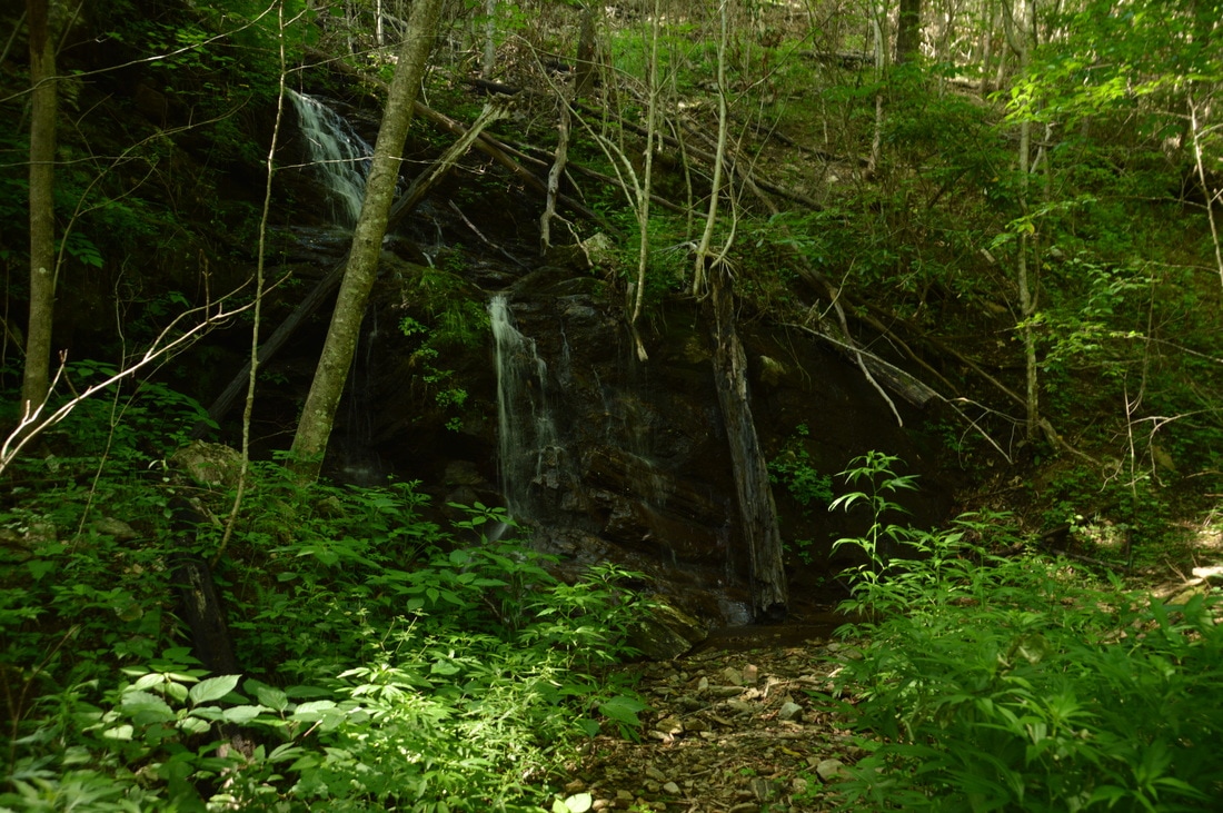
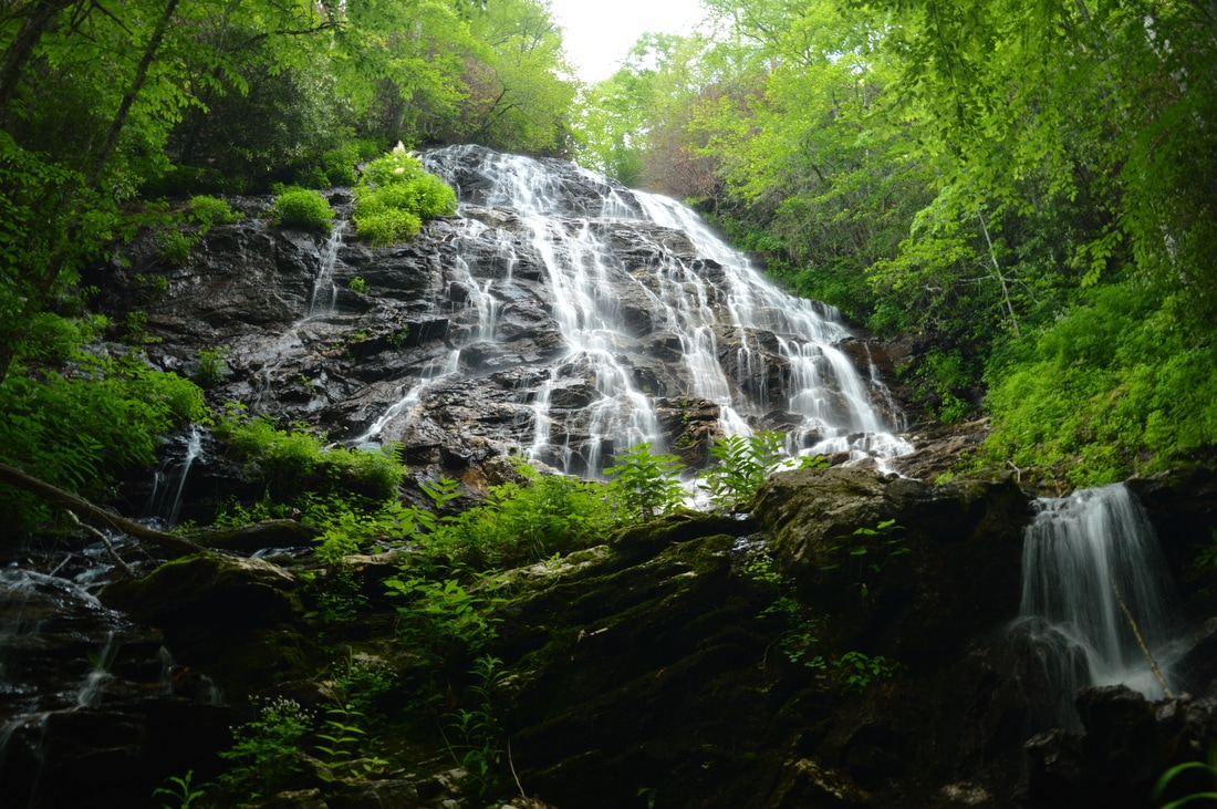
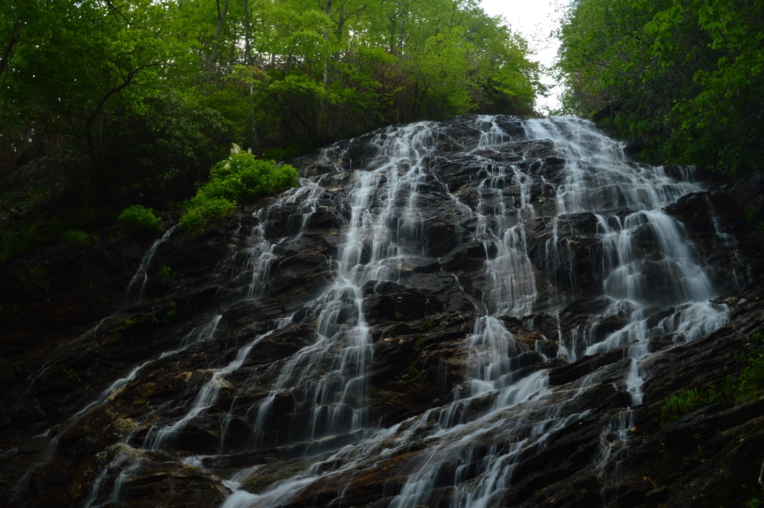
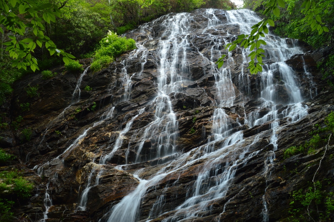
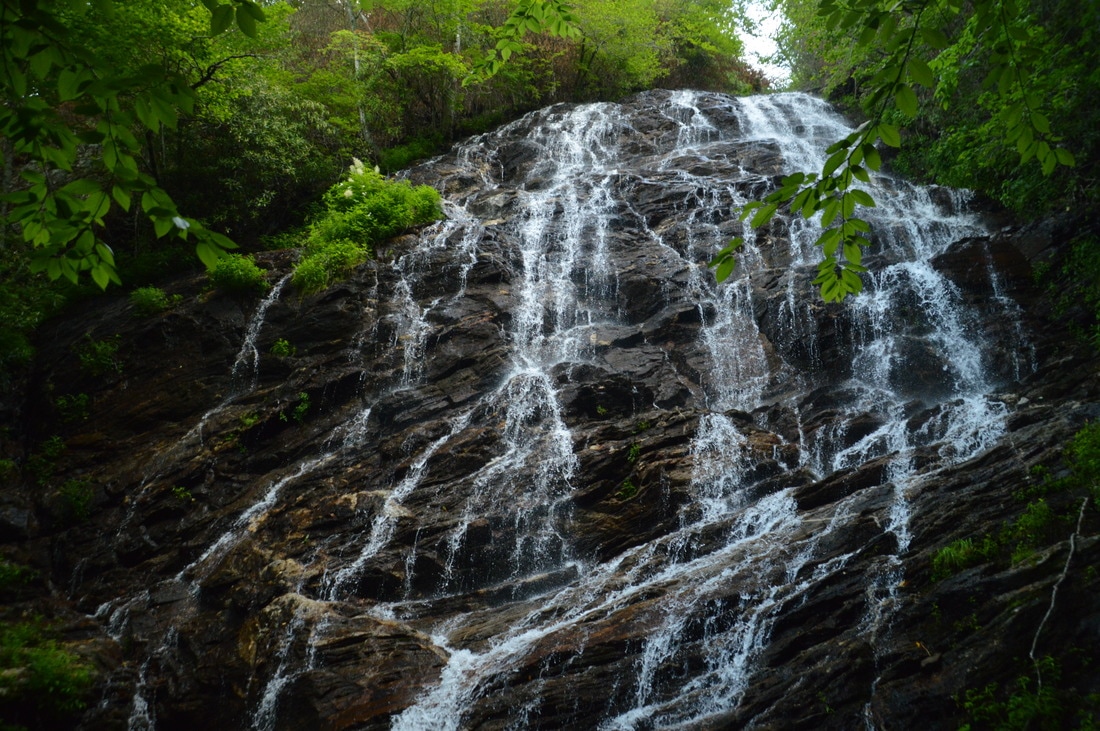
Once you take the side trail, you will have to make a slippery and steep descent to Beech Creek. The trail then follows the creek for a couple hundred feet before ending at the base of High Falls at 2.95 miles. High Falls is an amazing sight! This jaw-dropping waterfall is over 100 feet high (at least 70 feet for the main upper drop and around 30 feet for the lower drop). What's particularly remarkable about High Falls is that at its widest part, the upper tier of the waterfall is probably over 40 feet wide! As a result, Beech Creek splits into dozens of thin streaks of water as it falls down the beautiful rock face. The lower tier of High Falls is like a miniature version of the main tier. In general, all of the different water trickles turn High Falls into one of the area's most photogenic waterfalls. As with most waterfalls, photos of High Falls turn out best on cloudy days, but clear blue skies are probably acceptable as well, because the waterfall is so open and massive. From High Falls, return to the Beech Creek Trail and continue ascending on it steeply as it rises above High Falls. At 3.3 miles (at the sixth and final switchback), there is a gorgeous row of cliffs with additional boulders scattered around. Around 3.4 miles, the trail makes a turn to the north-northwest and finally becomes a lot easier as it reaches the top of the escarpment. Above High Falls, Beech Creek passes through a rare hanging valley. The trail is nearly flat for the next 1.1 miles as it slowly works its way to the top of the hanging valley. This was a welcome change after all of the climbing at and below High Falls. The accompanying sound of Beech Creek eventually fades as the trail passes above the creek's headwater spring. At 4.5 miles, about 50 feet before Case Knife Gap, the Beech Creek Trail reaches an unmarked but important junction with the side trail to Big Scaly Mountain. For confirmation, when viewed from the Beech Creek Trail, the narrow but distinct side trail looks like it angles up the side of the ridge (and it shortly joins the ridge itself). If you passed through the large gap (Case Knife Gap) and began descending downhill, then you missed the junction. 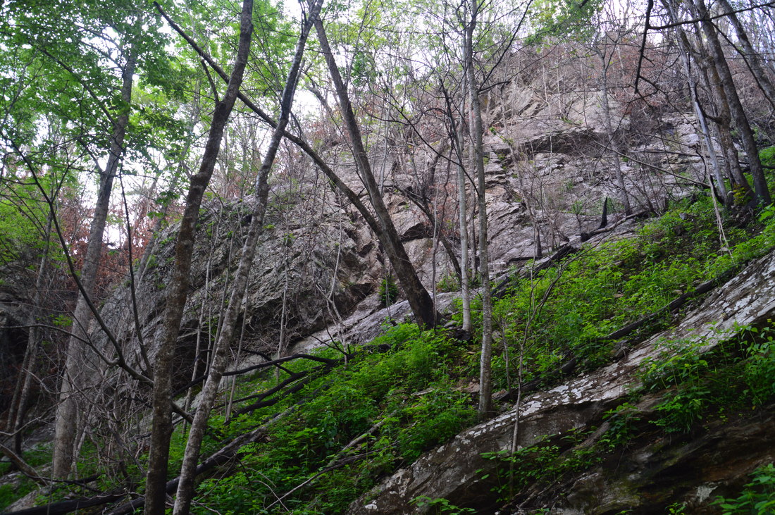
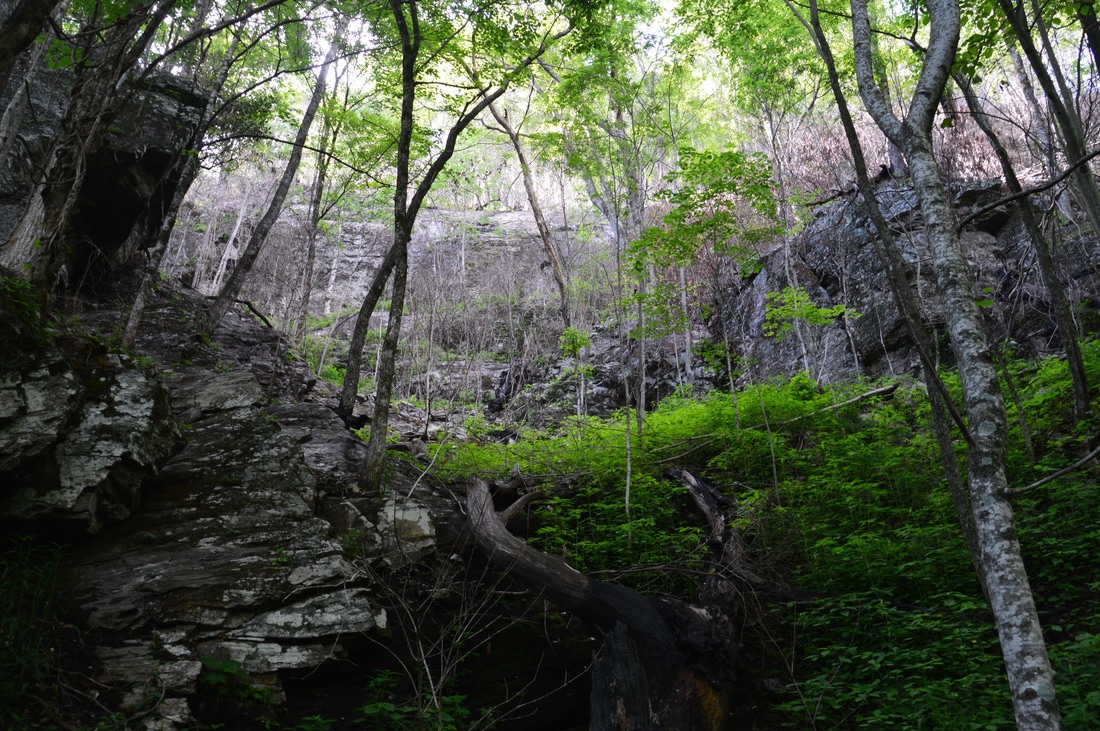
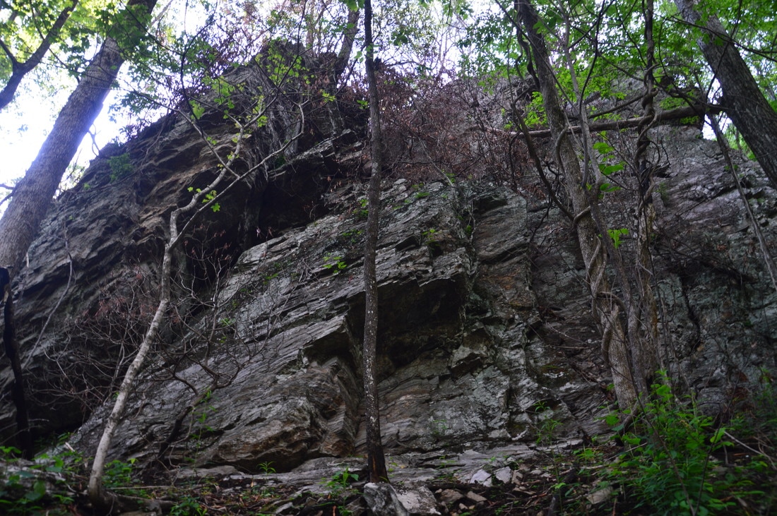
Numerous lines of gorgeous cliffs pepper the south side of Big Scaly Mountain, and many of them are visible from the Beech Creek Trail - especially in the vicinity of High Falls.
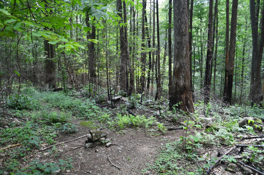
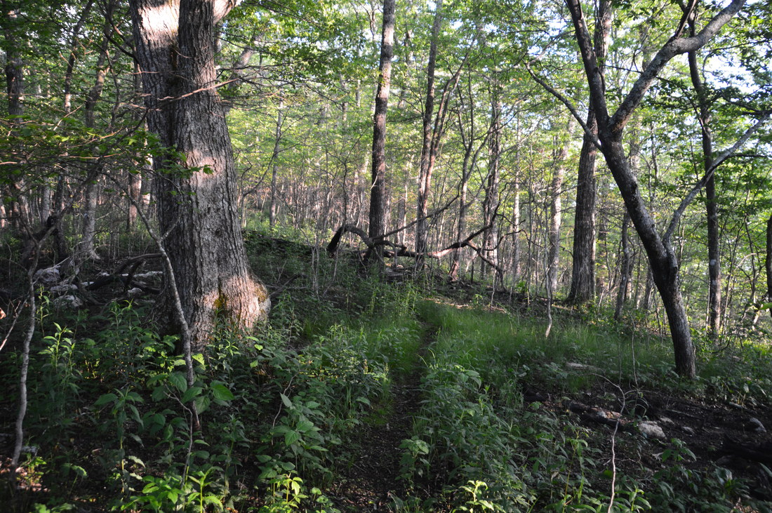
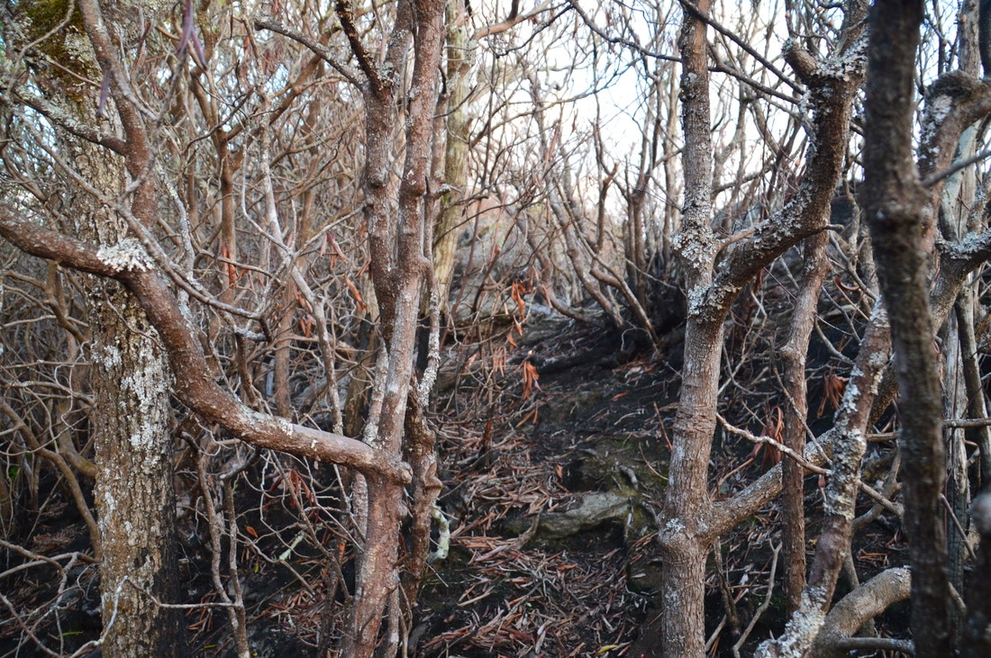
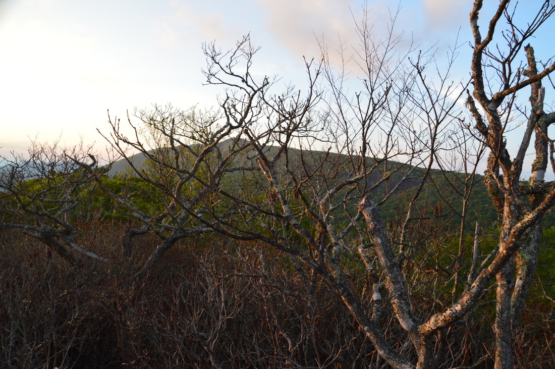
The vista from Big Scaly Mountain may be one of the most underrated overlooks that I have visited. The 0.7-mile side trail along Fork Ridge to Big Scaly Mountain is fairly easy, and yet, most people who hike the Beech Creek Loop never take this side trail. The view from Big Scaly Mountain is among the top views that I've seen, and you absolutely must not miss it. in any case, the side trail - even with the extra 1.4 miles - will barely make the hike any harder. The side trail ascends only around 300 feet in its course. Thus, turn left onto the Big Scaly Mountain Trail and follow it to the ridgeline, which it reaches about 200 feet after leaving the Beech Creek Trail. You will stay on Fork Ridge for the rest of the trail's length. Note: it seems like the top of Fork Ridge and the area around the summit of Big Scaly Mountain sustained significantly more fire damage than any place along the rest of the hike. Because of this, portions of the Big Scaly Mountain Trail have burned out and become difficult to recognize. If you think that you got off the trail, simply continue to follow the crest of the ridge through open woods, as you are bound to intersect the trail shortly. I hope that this trail will be marked in some way one day.
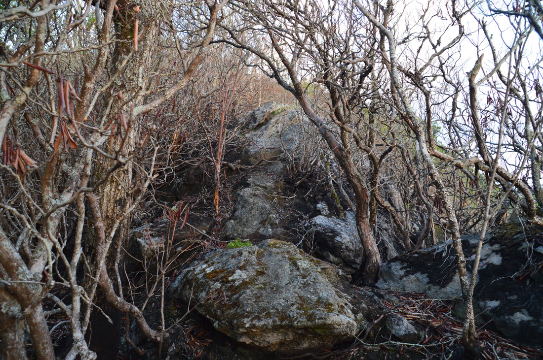
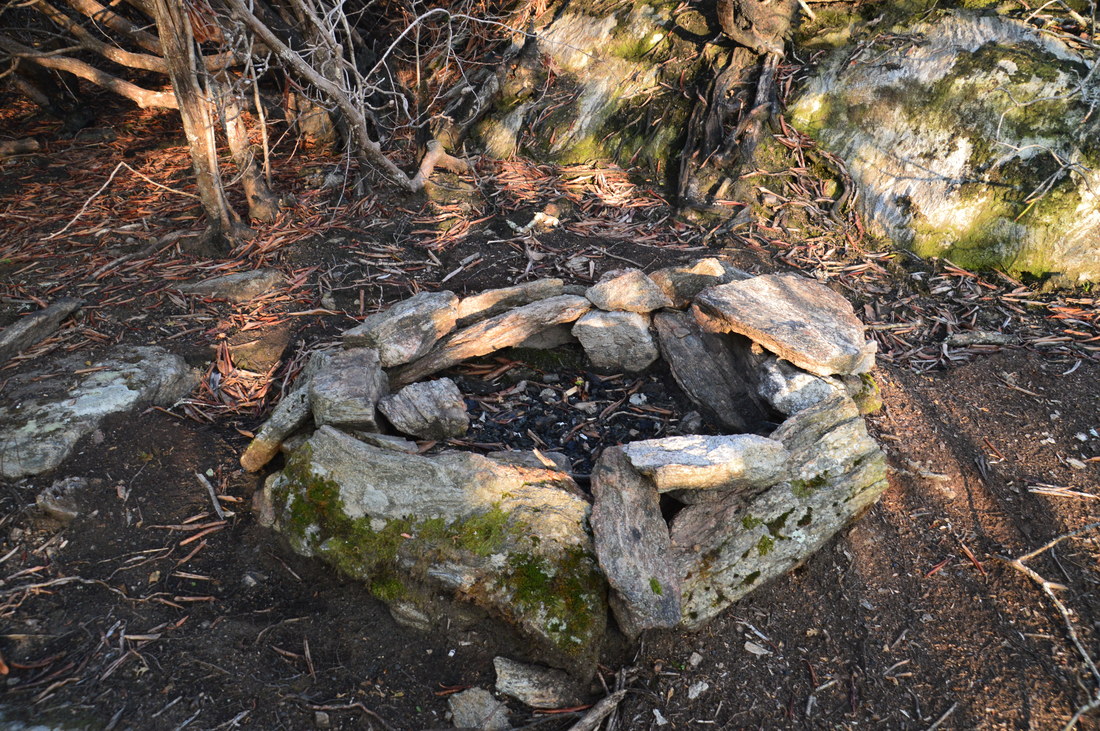
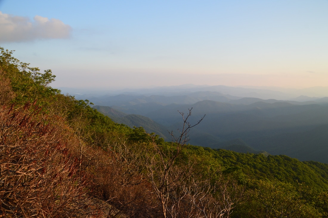
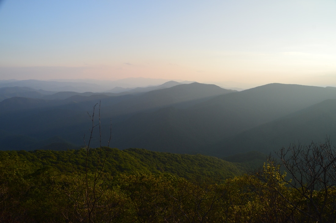
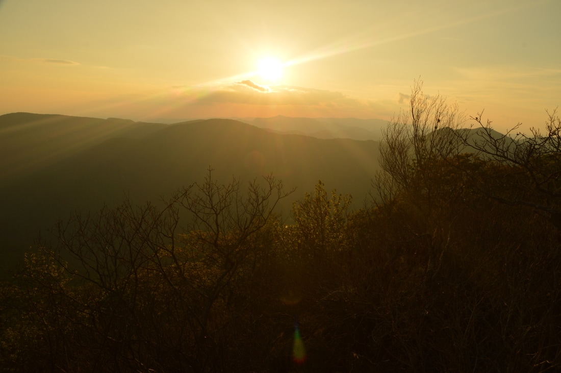
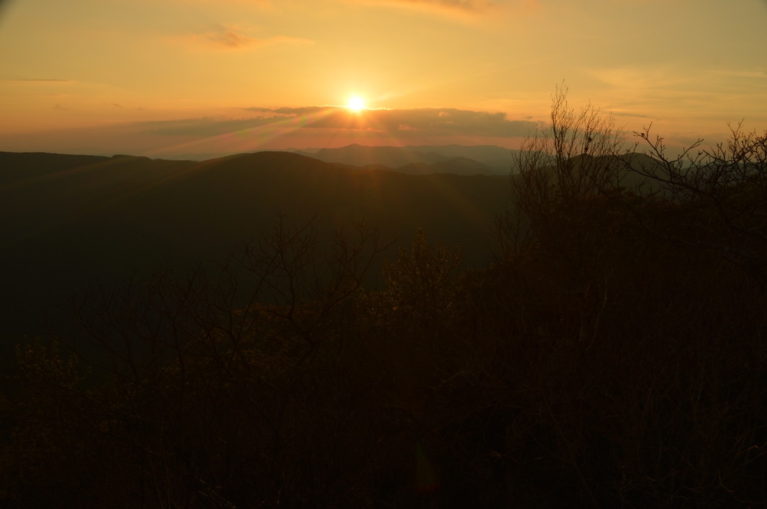
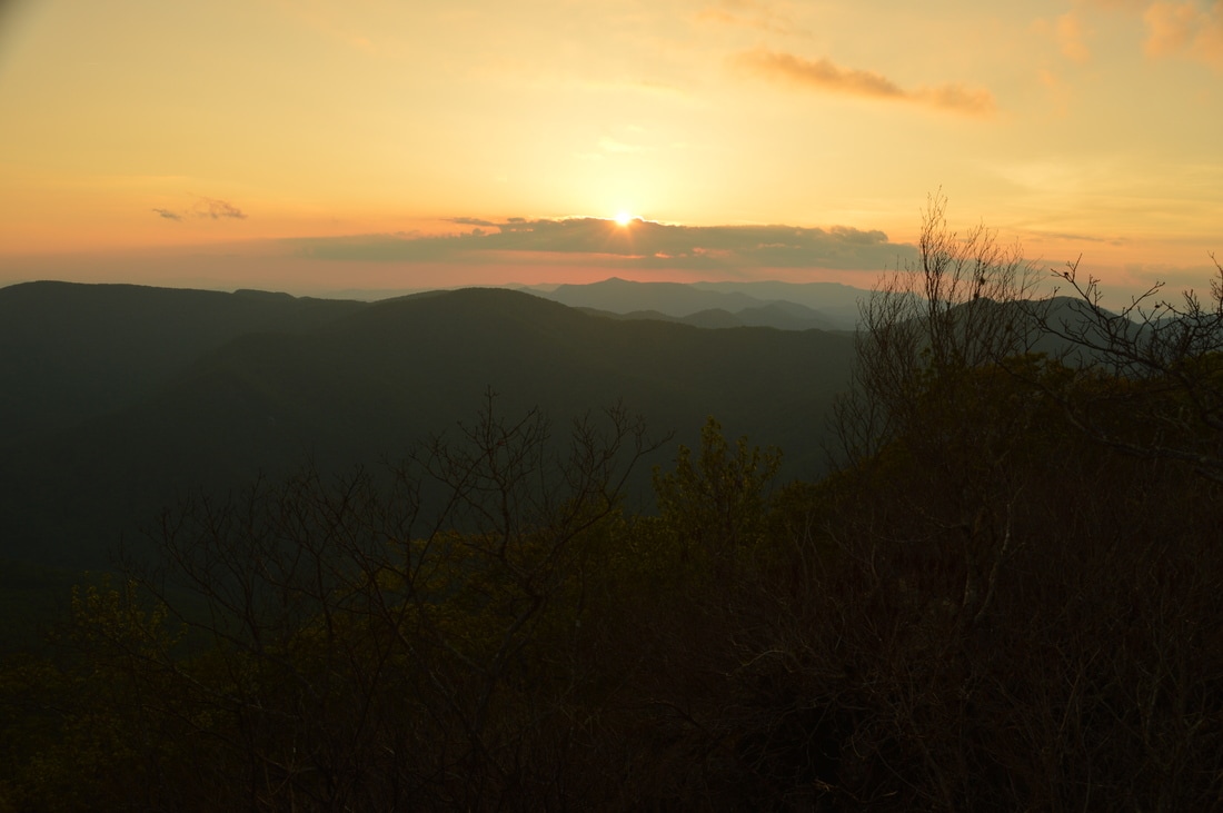
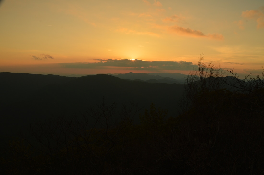
As the Big Scaly Mountain Trail approaches the overlook, rhododendron tangles make an appearance and the terrain becomes rockier. At 5.1 miles, the trail reaches the base of a huge rock outcrop. Pass around the rock outcrop on the left on the indistinct trail. Some fallen rhododendrons were cut to clear the trail here; thank you to whoever who volunteered to do this! In 150 feet, the trail reaches the base of another large rock outcrop. This time, bypass it to the right and then scramble up to the spine of the rocky ridge. As the rock outcrops keep getting broader and taller, continue to follow the crest of the ridge, passing a campfire ring before reaching the terminus of the trail at an open broad rock outcrop with cliffs below. This is the Big Scaly Mountain Vista; the rock outcrop is unmistakable. The view from Big Scaly Mountain is breathtaking! In some ways, it is similar to the view from Standing Indian Mountain, but I actually like it better, because it is less crowded and it offers a closer view of the mountains that form the Tennessee Valley Divide on the other side of the Tallulah River Valley. My favorite part of the view is to the left (south/southwest). On a clear day, you can see at least five lines of ridges in that direction, and Lake Burton & Lake Rabun in the far left corner add character to the view. Directly below you is the Tallulah River Valley, and on the other side - to the west - is the Tennessee Valley Divide and Blue Ridge. Farther to the northwest at the horizon rises Boteler Peak. It is amazing to see how far down your car is at the very base of the valley below! The only negative about the Big Scaly Mountain Vista is the dead rhododendron around the rock outcrop. All of the rhododendron here was killed during the Rock Mountain Fire, but with time, it will recover. The rhododendron did open up a limited vista to the east and northeast, with Standing Indian Mountain and more of the Blue Ridge (Tennessee Valley Divide) in the view. It is interesting how the Blue Ridge makes a semicircle around the Tallulah River valley, thus isolating this remote corner of North Carolina from the rest of the state. 
The view from Big Scaly Mountain is nothing short of incredible. In this picture, which faces west-southwest, a portion of the Blue Ridge west of the Tallulah River valley is visible, in addition to lines of ridges stretching away into Georgia.
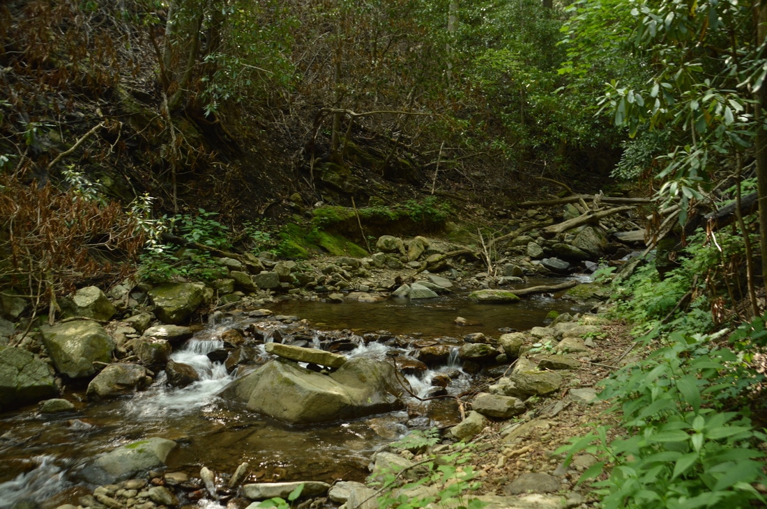
From the Big Scaly Mountain Vista, retrace your steps to the Beech Creek Trail, reaching it at 5.9 miles. Turn left onto the trail and pass through Case Knife Gap, where there is a campsite on the right. I have read and been told several times that an unofficial trail splits off to the right (northeast) at this point and makes an extremely steep climb to the Appalachian Trail near Standing Indian Mountain, but I have not hiked this trail. Meanwhile, the Beech Creek Trail begins a long descent back into the Tallulah River valley. Most of the descent is moderate, with a few steep stretches thrown in. Initially, the trail descends nearly parallel to Fork Ridge, passing through another area with evidence of severe fire damage that actually opened up views to the west. Around 6.8 miles, shortly after crossing small streams that form the headwaters of Chimney Rock Branch, the Beech Creek Trail turns west. Around 6.9 miles, there should be a side trail that leaves left toward Chimney Rock - a unique rock formation that resembles a towering chimney - but I missed it in the gathering darkness. At 7.3 miles, the trail enters gap in an east-west lead from Big Scaly Mountain and then switchbacks to the right into the Chimney Rock Branch drainage. The next quarter-mile is the steepest part of the descent. The trail approaches Chimney Rock Branch at 7.8 miles but then turns away from it at a switchback. Make sure to turn acutely right to stay on the trail at a confusing junction at 8.2 miles, where a clear path (not the trail) continues straight. The Beech Creek Trail reaches noisy Chimney Rock Branch at 8.45 miles, and after turning left and downhill along it, the broad trail finally reaches a junction with the Deep Gap Branch Trail just above the Tallulah River at 8.6 miles.
As the Deep Gap Branch Trail leaves acutely right to cross Chimney Rock Branch, bear left to stay on the Beech Creek Trail, which has turned into a rocky old roadbed. Shortly after the junction, there will be an overgrown field on the left that is the site of a former Girl Scout camp. As the Tallulah River thunders to the right, the Beech Creek Trail ends at its northern trailhead - also known as the Deep Gap Trailhead - at 9.1 miles. Unless you have a second car conveniently placed here, walk through the parking area and follow Tallulah River Road southward for about 1.2 miles back to the southern trailhead for the Beech Creek Trail (where your car is located), reaching it at 10.3 miles and concluding the hike. As soon as I finished hiking the Beech Creek Loop, I immediately knew that it is worth a "Best Hike" designation. A breathtaking overlook and two excellent waterfalls are just some of this hike's attractions. The peaceful forest, gorgeous cliffs, and numerous spring wildflowers are several other factors that make this a Best Hike. All in all, the Beech Creek Loop provides an excellent wilderness immersion and is one of the best hikes in Georgia and southwest North Carolina. Mileage
0.0 - Beech Creek Trailhead (South)
0.3 - Gap in Scaly Ridge 0.55 - Crossing 1 of Beech Creek 1.15 - Bull Cove Falls 1.35 - Crossing 2 of Beech Creek 1.8 - Bear Creek Falls 2.5 - Rock Wall 2.95 - High Falls 4.5 - Case Knife Gap 5.2 - Big Scaly Mountain Vista 5.9 - Case Knife Gap 8.6 - Deep Gap Branch Trail Junction 9.1 - Deep Gap Trailhead (Beech Creek Trailhead - North) 10.3 - Beech Creek Trailhead (South) Variations
Hike out and back to Bull Cove Falls - 2.3 Miles
Hike out and back to High Falls - 5.9 Miles Hike out and back to Big Scaly Mountain Vista from Deep Gap Trailhead - 7.8 Miles Hike the Beech Creek Loop without the side trip to Big Scaly Mountain (not recommended) - 8.9 Miles Bonus Stops
If you still have extra energy after the main hike, a good hike to add on to the Beech Creek Loop is the short hike to several waterfalls on Denton Creek. It is also accessed from Tallulah River Road.
PicturesVideos
10 Comments
Sean
6/28/2017 09:11:43 am
Great write up. Inspiring.
Mark Oleg
6/28/2017 10:16:02 am
Hi Sean,
Sean V
7/18/2017 01:11:40 pm
Mark, 9/17/2017 05:59:36 pm
I love this area and this hike. From Case Knife Gap you can ascend the ridge opposite Big Scaly via an unmaintained trail that in the past has been marked with pink markers tied to branches, and hit the AT near Standing Indian Mountain. It's a really steep climb up that ridge.
Ken Fedor
1/21/2020 11:12:16 am
Inspired by your writeup, we chose MLK day 2020 to winter hike at least a portion of the trail and camp at Case Knife gap. Well, Mother nature laughed and threw us a challenge. Beginning at the north end and hiking this section clockwise, the objective was to set up camp and catch the sunset at Big Scaly. High winds and dropping temps dictated otherwise so we hunkered down at Case Knife for the night. 40-50 mph wind gusts all night, waking up to 14 F! Hiked out without seeing Big Scaly views which gives us a reason to return. A few trail notes: many springs flow over the trail which erodes the surface and exposes fist-sized rocks making the hike less than smooth. The grade is a moderate/easy but a constant pitch up all the way up to Case Knife Gap. This gap does offer some protection from the wind and is the only area flat enough for camping during the entire route we hiked. A rock fire ring exists. This camping area is just 50 feet or so from the Big Scaly side trail, you can't miss it.
Michael Maffett
9/1/2021 08:44:13 pm
I am retired to Lake Burton. I first hiked this loop in the 1970's. I feature a picture from Big Scaly with Tate City below in my book, Our Southern Eden, published to celebrate the centennial of the lake (2020). It is also a deep history of the Upper Tallulah Valley. Your description and photography are 5 star. I have hiked much of the southern mountains and like you rate it was one of the best.
Michael Schaub
10/29/2021 08:10:49 am
As a boy, I also hiked all over the same trails you mention with my family especially my dad. We also found the old mine. It was my understanding that it was Carborundum not Corundum. If you were there in the 70s, it was still Girl Scout property. My family was big into scouting and we visited this property and the old cabin a couple times of year. Some of my best childhood memories. Recently my sister and I visited and did the chimney rock hike. But did not have the nerve to climb all the way to the top. Take care, Mike
Bobby Rone
9/15/2023 05:43:41 pm
Just a note about the old mining stamp mill. The mine was for corundum, which is crystalline aluminum oxide used as an industrial abrasive. In other words, it is the same stuff as ruby and sapphire.
Bobby Rone
4/24/2022 01:22:01 pm
Mike,
Sara M
1/17/2024 04:28:19 pm
This is an awesome write up. I hope to use the majority of this information you have provided to do this hike in February of 2024. Thank you for posting maps! I have used your advice and guidance for many hikes that I've done! Leave a Reply. |
About MeMark Oleg Ozboyd Dear readers: I have invested a tremendous amount of time and effort in this website and the Georgia Waterfalls Database the past five years. All of the work that has gone in keeping these websites updated with my latest trip reports has almost been like a full-time job. This has not allowed me to pick up a paid job to save up money for college, and therefore, I I've had to take out loans. If you find the information on this website interesting, helpful, or time-saving, you can say "thanks" and help me out by clicking the button above and making a contribution. I will be very grateful for any amount of support you give, as all of it will apply toward my college tuition. Thank you!

Coming in 2022-2023?
Other Hiking WebsitesMiles HikedYear 1: 540.0 Miles
Year 2: 552.3 Miles Year 3: 518.4 Miles Year 4: 482.4 Miles Year 5: 259.9 Miles Archives
March 2021
Categories
All
|


 RSS Feed