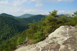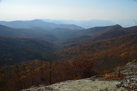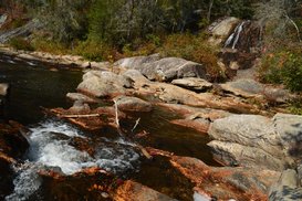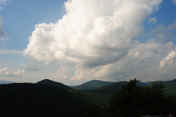
A rocky peak that towers over the Stekoa Creek valley and Clayton, Pinnacle Knob provides a 270-degree vista that is one of Northeast Georgia's best. The view from the top includes an attractive foreground of valleys and mountains with a beautiful background of fading lines of ridges. Two different hikes provide access to Pinnacle Knob: a longer hike from Warwoman Road and a shorter hike from Pinnacle Drive near US 441. While the longer route has the added benefit of passing two pretty waterfalls, the shorter route via the Courthouse Gap Trail is convenient for folks who are looking for a great payoff without a full-day hike. Furthermore, the side trail from the Bartram Trail was to the top of Pinnacle Knob was recently rerouted and lengthened to allow easier access to Pinnacle Knob's clifftop views. This hike occurred on Saturday, May 27th, 2017. My plan was to hike out and back to Pinnacle Knob via the Courthouse Gap Trail, Bartram Trail, and Pinnacle Knob Trail, starting at Courthouse Gap Road.
4 Comments

The Bartram Trail, which is a lesser-used footpath that stretches across portions of Georgia and North Carolina, stays close to the Tennessee Valley Divide for a number of miles in Georgia's Rabun County, passing over Rabun Bald, which is the second highest mountain in Georgia. In the vicinity, several other mountains provide noteworthy views, such as Double Knob, Flat Top Mountain, and Flint Knob. While the views from Rabun Bald are arguably better than some of these views, the other overlooks in the area are certainly worth visit as well. On this hike, you'll follow the Bartram Trail and then a side trail to three or four mountains with views in different directions. If you're feeling up to it, you will have the opportunity to tackle Rabun Bald and experience the 360-degree view from the top as well. This hike occurred on Saturday, November 12th, 2016. My plan was to hike the Bartram Trail out and back from Wilson Gap Road to Rabun Bald. Along the way, I would make the side trip to Flint Knob and possibly Alex Mountain, and I would also bushwhack up to Double Knob, in addition to seeing the view from Flat Top Mountain. Unfortunately, due to the length of the side trips, I was not able to hike the Bartram Trail from Flint Gap to Rabun Bald.
Chattooga River Trail: Sandy Ford Road to Dicks Creek Falls to Russell Bridge, Clayton, Georgia1/12/2017 
The Chattooga Wild and Scenic River is one of the longest and largest remaining wild waterways in the southeastern US, with no dams and very little human development for all of its length down to Lake Tugaloo. In fact, it is the only wild and scenic river east of the Mississippi River that is actually commercially rafted. For nearly twenty miles, the Chattooga River Trail stays near the river or even follows it along its Georgia side. Unfortunately, the Georgia Chattooga River Trail leaves something to be desired, as there are surprisingly few views of the river throughout the length of the trail. Still, the Chattooga River Trail passes by several points of interest, including Dicks Creek Falls on Section Two. This hike occurred on Saturday, November 5th, 2016. My plan was to hike the Chattooga River Trail from the Sandy Ford Road/Dicks Creek Falls trailhead to the Russell Bridge Trailhead. This is also known as Section Two of the Chattooga River Trail. Along the way, I would take side trips to Dicks Creek Falls and Adline Ford. I arranged to have two cars for this point-to-point hike: one car was placed at the Sandy Ford Road trailhead, and another car was placed at Russell Bridge on Highway 28.
 The Fishawk Mountains west of Highlands are a small ridgeline and part of the Bartram Trail's route. In this area, the mountains house massive rock faces and fantastic panoramas of the Little Tennessee River Valley and Nantahala Mountains. This is easily one of the best hikes in the Highlands area. This hike occurred on Saturday, August 16th, 2014. My plan was to start my hike at the Jones Gap Trailhead and hike on the Bartram Trail to Wolf Rock. I would return the same way. Also, I would check out Jones Knob and Whiterock Mountain along the way. I would skip the Fishawk Mountain spur, though.  The Bartram Trail was created to extend from Northeast Georgia to Southwest North Carolina in the footsteps of the traveler William Bartram. His book, "The Travels of William Bartram", describes both his travels across the Southeast and the flora and fauna that he discovered in this area. In 1775, he visited a lush watery valley in Northeast Georgia now known as Warwoman Dell, from where he sent specimens of the flora and fauna to London. He was one of the first main explorers of the area. The section of the Bartram Trail described in this post is a section that is surprisingly short for as much as 3 attractions. This hike occurred on Saturday, July 12, 2014. The plan was to follow the Bartram Trail from Warwoman Dell by Becky Branch Falls and Martin Creek Falls to the Pinnacle Knob Trail.. From there, I would take the Pinnacle Knob Trail to the summit of Pinnacle Knob to be treated to what was in my opinion the best view I have seen yet in Georgia. |
About MeMark Oleg Ozboyd Dear readers: I have invested a tremendous amount of time and effort in this website and the Georgia Waterfalls Database the past five years. All of the work that has gone in keeping these websites updated with my latest trip reports has almost been like a full-time job. This has not allowed me to pick up a paid job to save up money for college, and therefore, I I've had to take out loans. If you find the information on this website interesting, helpful, or time-saving, you can say "thanks" and help me out by clicking the button above and making a contribution. I will be very grateful for any amount of support you give, as all of it will apply toward my college tuition. Thank you!
Coming in 2022-2023?
Other Hiking WebsitesMiles HikedYear 1: 540.0 Miles
Year 2: 552.3 Miles Year 3: 518.4 Miles Year 4: 482.4 Miles Year 5: 259.9 Miles Archives
March 2021
Categories
All
|

 RSS Feed