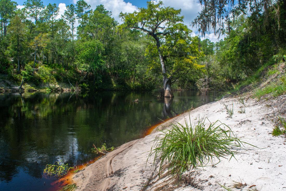
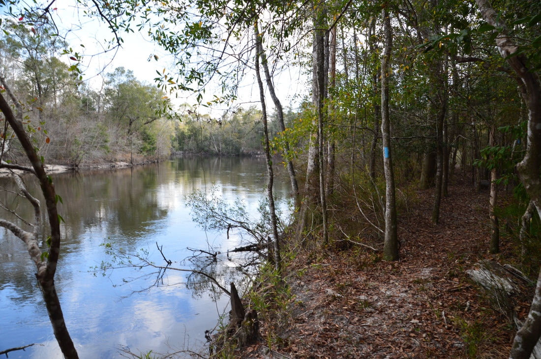
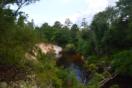
One of Florida's most attractive rivers valleys, the Suwannee River Valley has got it all: majestic bluffs, sandy beaches, tight and intricate tributaries, colorful springs, a surprising variety in elevation, and best of all, a 75-mile segment of the Florida Trail. The FT section between Camp Branch and Swift Creek - two special Suwannee feeder streams - is a true North Florida classic, showcasing most of the sights that make hiking along the Suwannee so wonderful. Even before you reach the Suwannee, you'll submerge into an unusual landscape, where the clear-bottomed Camp Branch (also known as Disappearing Creek) twists through a limestone chasm before vanishing into a dark sink, only to pop out at the Suwannee itself. From there, you'll pick up the Florida Trail, passing one gorgeous vista after another of the Suwannee River, crossing numerous scenic side streams like Jerry Branch, and scrambling through surprisingly deep ravines and up pointed hills. After close to 9 miles of hiking, you'll finally reach the hike's destination: Swift Creek, a lovely, cascading stream that dashes through Florida's version of the Grand Canyon before emptying into the Suwannee by an imposing limestone bluff. This hike occurred on Saturday, August 25th, 2018. My plan was to hike the blue-blazed FT access trail from the Camp Branch Trailhead to the Suwannee River (tracing the short Camp Branch Loop along the way), where I'd pick up the Florida Trail and follow it all the way to Swift Creek.
2 Comments
The Citrus Tract of Withlacoochee State Forest is home to some of Central Florida's most rugged terrain. Several major sinkholes and numerous caves are spread throughout the hilly Citrus Tract. The Citrus Trail, one of Florida's longest and most popular backpacking trails, is a 42-mile loop trail that passes near the perimeter of the Citrus Tract. Numerous forest roads crisscross the tract with many different starting points possible. For the convenience of day hikers, three cross-trails intersect the loop, providing shorter hiking opportunities. The southernmost loop of the Citrus Trail - Loop D - accesses one of the area's most unique sights: Dames Cave, a limestone cave with two chambers, a large open one and a smaller closed one. In addition to traversing dozens of rolling sandhills, Loop D of the Citrus Trail also passes through a bizarre rocky landscape in the vicinity of a broad sink known as Lizzie Hart Sink. This hike occurred on Saturday, July 29th, 2017. My plan was to hike Loop D of the Citrus Trail counter-clockwise from the Road 18 crossing. I would take the side trail to Dames Cave along the way.
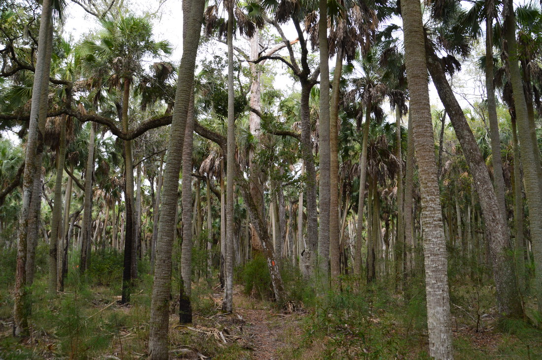
St. Marks National Wildlife Refuge is one of the most beautiful natural areas in Florida. Nearly 50 miles of the Florida Trail pass through the refuge, which has a mixture of wetlands, pine flatwoods, palm hammocks, creeks, and even springs and salt water views. Shepherd Spring is one of the major points of interest in St. Marks NWR, and the nearby Cathedral of Palms - a large patch of old growth cabbage palm forest - is a very unique sight. This hike on the Florida Trail visits both of these features using the long way through a variety of ecosystems east of Wakulla Beach Road. This hike occurred on Saturday, December 31st, 2016. My plan was to hike the Florida Trail from the Thompson House Trailhead near US 98 to Shepherd Spring, passing through the Cathedral of Palms. My return route would include much of the same trail, but to make a difference, I would use two high water routes on my way back.
The Cimarron segment of the Florida Trail runs through the northern edge of the Eglin Air Force Base, in the vicinity of the Yellow River. While at the moment, this trail segment is not part of the official route of the Florida Trail - due to the lack of a bridge across the Yellow River - it is still maintained by the Florida Trail Association and often hiked. The Cimarron Trail passes through several miles of pine flatwoods and other upland ecosystems before dropping down into a Yellow River floodplain swamp, where there are multiple views of the river, a variety of sloughs to see, and a potential swamp slog depending on recent rainfall. This hike occurred on Saturday, December 24th, 2016. My plan was to hike the Cimarron Trail out and back from Highway 85 to the terminus of the trail at the Yellow River.
Traverse dozens of ravines, view fast streams and tumbling cascades, visit bluffs with excellent views of a a creek gorge - sounds like a perfect hike for your mountain vacation, right? Oh wait! It's right in Florida. The Econfina Creek segment of the Florida Trail is as unique as a hike could get in Florida, and you would barely be able to tell that you're in Florida, if the palmetto wasn't there. This spectacular section of the FT first descends into the Econfina Creek valley, passing some rapids on the creek, before following this waterway for many miles with a number of scenic sights along the way. This hike occurred on Friday, August 19th, 2016. My plan was to hike the Florida Trail out and back from Scott Road to Devil's Hole Recreation Area. Along the way, I would also hike the side trail to Trap Pond.
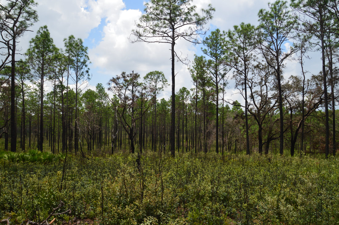
Nearly 80 miles of the Florida Trail pass through Apalachicola National Forest, Florida's largest national forest. At the very northwest end of the forest is Camel Lake, a small natural lake with a campground and a developed recreation area. On its route through the forest, the Florida Trail passes near Camel Lake. Nearby, an alternate trail called the Trail of Lakes can be used to loop this section of the FT. On this loop hike, you will visit two lakes, pass several blackwater streams, and hike through miles of sandhills topped by rows of pine trees. This hike occurred on Sunday, April 17, 2016. My plan was to hike the Trail of Lakes Loop clockwise.
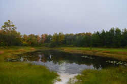
Florida Trail: Bell Springs to Robinson Branch Falls and Big Shoals, White Springs, Florida9/20/2015 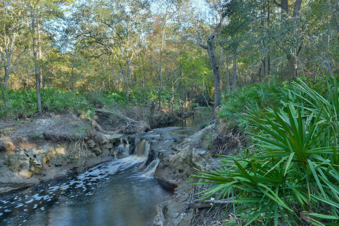
Have you ever wanted to see a waterfall in Florida? Here's your chance. The waterfall on this hike is not high at all, but it's interesting in other aspects, not to mention that it's pretty powerful. Besides the waterfall, you'll get to experience the beauty of the Suwanee River Valley. Additionally, the hike continues to an anomalous natural sight: one of only two Class III whitewater rapids in Florida. This hike occurred on Sunday, July 19th, 2015. My plan was to hike the Florida Trail from the trailhead at Bell Springs to at least Robinson Branch Falls. Depending on conditions, I wanted to visit the Big Shoals on the Suwannee River, but a deep-looking ford of Robinson Branch happened to be my turnaround point, as I didn't have the proper gear for fording at the time. On Saturday, November 4th, 2017, I returned to the Bell Springs section of the Florida Trail at a time of lower water conditions. This time, with proper gear for fording the creek, I hiked all the way to Big Shoals, and the trail report has been updated for the trail between Robinson Branch Falls and Big Shoals.
The Kissimmee River is one of the largest rivers in Florida. In its large floodplain lies the route of the Florida Trail. The section of the Florida Trail that continues southeast from US Route 98 is known as the Chandler Slough section. The piece that I did on this day was overgrown and sometimes underwater. I eventually had to revise my plans, as this is one of those Florida hikes that is best done during winter. This hike occurred on Sunday, July 12th, 2015. My plan was to hike the Florida Trail from the Micco Landing Trailhead on US 98 to the Chandler Slough West Trailhead that is also on US 98. Unfortunately, I only did a short part of my plan due to the poor conditions of the trail.
The Ocala National Forest is home to the endangered sand scrub pine habitat. In the Ocala is the largest unbroken tract of this habitat in the world. This long but beautiful hike on the Florida Trail showcases the beauty of the sand scrub pine habitat and the vast prairies that surround it. On this excursion, you will also see Hidden Pond, a small pond in the middle of the prairie land, and you will see the Long Cemetery, a small, old cemetery located on the historic Yearling Trail. This hike occurred on Sunday, July 5th, 2015. My plan was to hike the Florida Trail from the trailhead on Florida State Route 40 to the junction with the Yearling Trail 10 miles later. From there, I would take the Yearling Trail to the Long Cemetery. I would return the same way.
|
About MeMark Oleg Ozboyd Dear readers: I have invested a tremendous amount of time and effort in this website and the Georgia Waterfalls Database the past five years. All of the work that has gone in keeping these websites updated with my latest trip reports has almost been like a full-time job. This has not allowed me to pick up a paid job to save up money for college, and therefore, I I've had to take out loans. If you find the information on this website interesting, helpful, or time-saving, you can say "thanks" and help me out by clicking the button above and making a contribution. I will be very grateful for any amount of support you give, as all of it will apply toward my college tuition. Thank you!

Coming in 2022-2023?
Other Hiking WebsitesMiles HikedYear 1: 540.0 Miles
Year 2: 552.3 Miles Year 3: 518.4 Miles Year 4: 482.4 Miles Year 5: 259.9 Miles Archives
March 2021
Categories
All
|
 RSS Feed