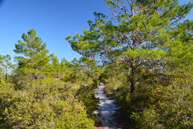
With a size of over 200,000 acres, Tate's Hell State Forest is one of Florida's largest state forests. Its only official hiking trail is the High Bluff Coastal Trail, which traverses pine flatwoods and ancient sand dunes near the Forgotten Coast. In fact, one of the sand dunes is tall enough to provide an elevated view toward the southern end of the forest, where the Gulf of Mexico is just a thin blue sliver. In addition, black bears are common in Tate's Hell State Forest and neighboring Apalachicola National Forest, and on this hike, it is possible to spot this elusive creature or find evidence of its activity. This hike occurred on Monday, December 26th, 2016. My plan was to hike the High Bluff Coastal Loop in a clockwise direction. Along the way, I would take a short side trail to an elevated view of the surrounding terrain and the Gulf of Mexico in the distance.
0 Comments
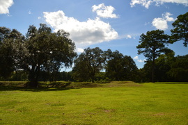
Prospect Bluff, located on the east side of the Apalachicola River deep in present-day Apalachicola National Forest, is the site of two forts, including Fort Gadsden, which had remained there until 1821, when Florida became a US territory. At the time, no highways or railroads existed, so the fort was located in a strategic spot at a high point near the Apalachicola River, which used to be the main transportation route for the area. Traces of the old fort can still be seen today on this short hike, and the Fort Gadsden Interpretive Area has detailed information regarding the history of this site. This hike occurred on Saturday, August 20th, 2016. My plan was to hike the Fort Gadsden Nature Trail counter-clockwise. This trail is also known as the Wiregrass-Genetian Trail, named for a rare wildflower that can be seen in the woods near Prospect Bluff.
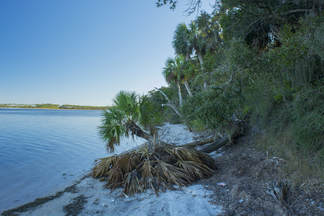
St. Joseph Bay State Buffer Preserve is a 5000-acre preserve near St. Joseph Bay that was created to protect the bay's water quality and conserve the natural shoreline habitats. The main tract of the preserve lies just east of County Road 30A, providing numerous hiking possibilities in the sand dune system there along many forest roads. A separate small tract of the preserve, known as the Deal Tract, is located on St. Joseph Peninsula near Cape San Blas. This preserve is home to two short hiking trails that lead through several island ecosystems and to great views of St. Joseph Bay. This hike occurred on Saturday, August 13th, 2016. My plan was to hike the Old Pine Bay Trail out and back to the main St. Joseph Bay observation area. On my return trip, I would also hike the Hammock Spur Trail out and back. I returned on Saturday, December 30th, 2017, discovering several changes to the trail.
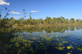
Nearly 80 miles of the Florida Trail pass through Apalachicola National Forest, Florida's largest national forest. At the very northwest end of the forest is Camel Lake, a small natural lake with a campground and a developed recreation area. On its route through the forest, the Florida Trail passes near Camel Lake. Nearby, an alternate trail called the Trail of Lakes can be used to loop this section of the FT. On this loop hike, you will visit two lakes, pass several blackwater streams, and hike through miles of sandhills topped by rows of pine trees. This hike occurred on Sunday, April 17, 2016. My plan was to hike the Trail of Lakes Loop clockwise.
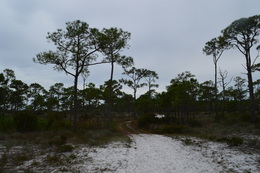 St. George Island is a barrier island near the Florida Panhandle, located at the mouth of the Apalachicola River. The island stretches for 20 miles along the coast, and most of the island is developed. However, St. George Island State Park protects the eastern tier of the island. In this park, a scenic drive and several hiking trails provide views of dunes twice the height of a human, as well as a coastal scrub habitat. This hike occurred on Saturday, January 2nd, 2016. My plan was to hike the East Slough Trail to the Gap Point Trail, and then hike the Gap Point Trail to Gap Point. Along the way, I would hike the spur trails to the campground and to Primitive Campsite #2. I would return the same way. 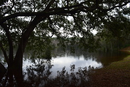 Coming in at over 600,000 acres, Apalachicola National Forest is Florida's largest national forest - it is the home to the famed Bradwell Bay Wilderness, one of the wildest swamps in Florida. While the forest may be best-known for the large swamp expanse of Bradwell Bay, it is also home to an uncommon sight - numerous pitcher plant bogs scattered throughout the area. One particular hiking trail, the Wright Lake Loop, visits several of these pitcher plant bogs in the western section of the forest that are easy to get to. However, after a month of historical rains, they may not be quite so easy to get to. This hike occurred on Thursday, December 31, 2015. My plan was to hike the entire Wright Lake Loop, but due to impassable sections of trail with pretty severe flooding ongoing in all of the nearby creeks, I was forced to abandon my plan and hike merely a small segment of the Wright Lake Loop. 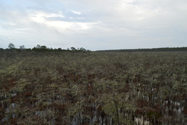 Located along Florida's Gulf Coast, Tate's Hell State Forest is one of Florida's largest state forests - and one of its wildest. Tate's Hell State Forest is home to several dwarf cypress swamps, one of the most bizarre sights to be seen in Florida. On this short boardwalk, you will get a chance to see one of the largest dwarf cypress swamps in Tate's Hell, where none of the cypress trees are taller than 15 feet, and some are over 300 years old. This hike occurred on Tuesday, December 29th, 2015. My plan was to follow the Ralph G. Kendrick Dwarf Cypress Boardwalk out and back to an observation area overlooking the dwarf cypress swamp. 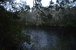 The Sopchoppy River is a minor river that originates in the Apalachicola National Forest in Florida's Big Bend region. On its way south to the Gulf of Mexico, it flows into the Ochlockonee River and becomes part of an important estuary network at Ochlockonee Bay. The small, historic town of Sopchoppy, based in 1894 and currently with a population of less than 500 people, sits on the banks of the Sopchoppy River. The town's park does not amount to much when one thinks of hiking trails, but its short nature trail leads to and along the river, allowing visitors to see the blackwater river and the habitats found along it up-close. This hike occurred on Monday, December 28th, 2015. My plan was to simply hike the short nature trail from the Sopchoppy City Park to some views of the Sopchoppy River. |
About MeMark Oleg Ozboyd Dear readers: I have invested a tremendous amount of time and effort in this website and the Georgia Waterfalls Database the past five years. All of the work that has gone in keeping these websites updated with my latest trip reports has almost been like a full-time job. This has not allowed me to pick up a paid job to save up money for college, and therefore, I I've had to take out loans. If you find the information on this website interesting, helpful, or time-saving, you can say "thanks" and help me out by clicking the button above and making a contribution. I will be very grateful for any amount of support you give, as all of it will apply toward my college tuition. Thank you!
Coming in 2022-2023?
Other Hiking WebsitesMiles HikedYear 1: 540.0 Miles
Year 2: 552.3 Miles Year 3: 518.4 Miles Year 4: 482.4 Miles Year 5: 259.9 Miles Archives
March 2021
Categories
All
|

 RSS Feed