Blood Mountain Wilderness: Slaughter Creek Loop and Blood Mountain via Freeman Loop, Suches, Georgia12/20/2016 
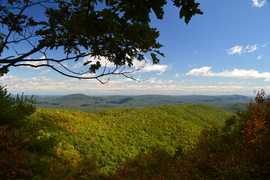
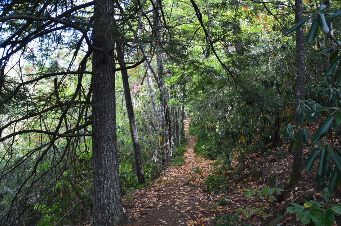
Blood Mountain is one of the best-known mountains in Georgia for a variety of reasons, including the ease of access to the great views from the several rock slabs near the summit of the peak. The easiest approach to the top is from Highway 129, but several other trails, in addition to the Appalachian Trail itself, are found in the vicinity of Blood Mountain. Two such trails - the Jarrard Gap Trail and Slaughter Creek Trail - leave the Lake Winfield Scott Recreation Area and access the AT west of Blood Mountain. Another trail, the Freeman Trail, winds around hollows on the south side of Blood Mountain, providing a tricky passage through numerous boulder fields. You'll walk all of these trails as you hike to Blood Mountain using the "back way". This hike occurred on Saturday, October 15th, 2016. My plan was to hike the Jarrard Gap Trail from Lake Winfield Scott to the Appalachian Trail, from where I would follow the AT to the Freeman Trail, taking the spur trail to Woods Hole Shelter. Then, I would take the Freeman Trail around the south side of Blood Mountain, before meeting the Appalachian Trail again and following it to the top of Blood Mountain. I would finish the hike by descending on the Appalachian Trail to the Slaughter Creek Trail and taking the Slaughter Creek Trail back to Lake Winfield Scott.
1 Comment
The Appalachian Trail has both grand vistas as well as much smaller ones that are equally breathtaking. The view from Wolfstake Knob falls into the latter category. Located on the Tennessee Valley Divide, Wolfstake Knob provides a memorable view to the east with Lake Burton and the mountains of Rabun County in the picture. On this hike, you will follow the Appalachian Trail to the great view from Wolfstake Knob, and then, you will continue following the footpath which becomes much less used and provides plenty of solitude around Kelly Knob and Addis Gap. This hike occurred on Saturday, October 8th, 2016. My plan was to hike the Appalachian Trail out and back from Dicks Creek Gap to Addis Gap. I would take the spur trail to Wolfstake Knob and its views, as well as the spur trail to Deep Gap Shelter, along the way.
The Cataloochee Valley in Great Smoky Mountains National Park is a place where beauty and history mingle together. By the mid 1800s, there were several settlements in the valley, the remains of which we can still see today. The mountains around the Cataloochee Valley are home to areas of gorgeous old-growth forest, where tall trees tower proudly into the sky in areas that have never been logged. On this hike, you will first hike along the Caldwell Fork - a picturesque mountain stream - before taking the Boogerman Trail past some of the area's most remarkable trees, as well as a couple of significant historic points, including an old cemetery and an old stone wall. You will then follow the Big Fork Ridge Trail across a low ridge that separates the Caldwell Fork valley from the Cataloochee Valley, before concluding the hike along Cataloochee Road and seeing several more historical points of interest. If you're lucky, you might also spot the renowned Cataloochee elk. This hike occurred on Saturday, October 1st, 2016. My plan was to hike the Caldwell Fork Trail to the lower Boogerman Trail junction, from where I would follow the Boogerman Trail to its end farther up on the Caldwell Fork Trail. I would then take the Caldwell Fork Trail to the Big Fork Ridge Trail, which I would follow to Cataloochee Road. I would finish the hike by walking Cataloochee Road back to the trailhead.
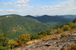
The Appalachian Trail in Georgia passes through some of the state's highest terrain, passing many different views. Some are very popular, such as Springer Mountain, Blood Mountain, and Tray Mountain. But the best and perhaps underrated view lies on Cowrock Mountain: a 3800-foot peak that lies in the Raven Cliffs Wilderness on the Blue Ridge Valley Divide. The Appalachian Trail passes right over the summit of the mountain, and just to the south of the AT, a pair of magnificent vistas await. To the east of Cowrock Mountain, the Appalachian Trail passes over a second mountain - Wildcat Mountain - where another rock slab gives additional views. Furthermore, a lesser-used access trail, known as the Logan Turnpike Trail, joins the AT between the two mountains via the picturesque Town Creek valley along the route of an old toll road. On this hike, you will use the Logan Turnpike Trail to reach the Appalachian Trail and visit both Cowrock Mountain and Wildcat Mountain. This hike occurred on Saturday, September 17th, 2016. My plan was to hike the Logan Turnpike Trail up to Tesnatee Gap, where it joins the Appalachian Trail. From there, I would first hike the AT northbound over Wildcat Mountain and to Hogpen Gap. Then, I would return to Tesnatee Gap, and I would hike the AT southbound to Cowrock Mountain. I would finish the hike by retracing my steps to Tesnatee Gap and down the Logan Turnpike Trail.
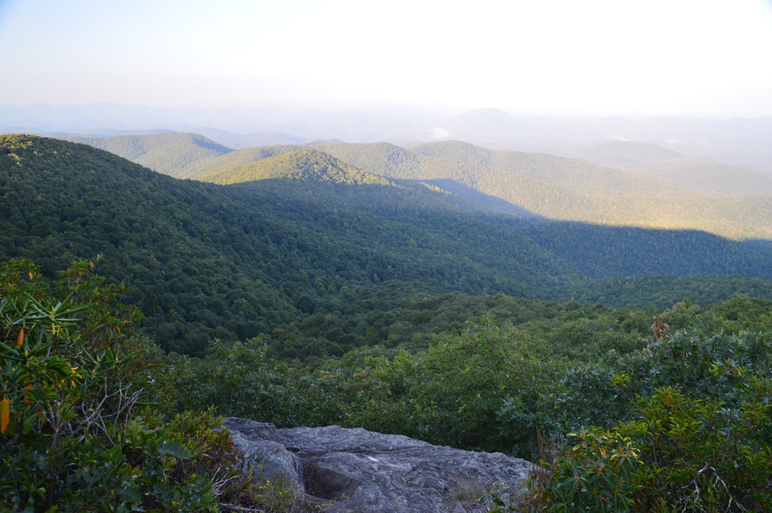
Rocky Mountain and Tray Mountain are two rocky peaks with impessive views on the Appalachian Trail in north Georgia near Helen. Tray Mountain is also the seventh-highest mountain in Georgia. Other than the Appalachian Trail, a couple of additional trails are used to access the area. The Rocky Mountain Trail bends around the northern side of Rocky Mountain, which serves as a bypass for the rocky summit area of Rocky Mountain as well creates a popular loop hike. The Andrews Cove Trail begins nearly two thousand feet below the summit of Rocky Mountain and ascends through a lush mountain cove past several small tumbling streams before joining the Appalachian Trail. On this hike, you will first ascend along the Andrews Cove Trail to the Appalachian Trail, before hiking the Rocky Mountain Loop past the great views from the namesake peak, and finishing with an outing along the AT to the summit of Tray Mountain, where more views await. This hike occurred on Saturday, September 10th, 2016. My plan was to hike the Andrews Cove Trail to the Appalachian Trail at Indian Grave Gap. From there, I would hike the Rocky Mountain Loop clockwise, and then, I would hike the Appalachian Trail out and back to the summit of Tray Mountain as well as locate a little-known vista on the mountain's east side. I would finish by retracing my steps along the Andrews Cove Trail.
|
About MeMark Oleg Ozboyd Dear readers: I have invested a tremendous amount of time and effort in this website and the Georgia Waterfalls Database the past five years. All of the work that has gone in keeping these websites updated with my latest trip reports has almost been like a full-time job. This has not allowed me to pick up a paid job to save up money for college, and therefore, I I've had to take out loans. If you find the information on this website interesting, helpful, or time-saving, you can say "thanks" and help me out by clicking the button above and making a contribution. I will be very grateful for any amount of support you give, as all of it will apply toward my college tuition. Thank you!

Coming in 2022-2023?
Other Hiking WebsitesMiles HikedYear 1: 540.0 Miles
Year 2: 552.3 Miles Year 3: 518.4 Miles Year 4: 482.4 Miles Year 5: 259.9 Miles Archives
March 2021
Categories
All
|
 RSS Feed