The streams that drain Warwoman Creek and the Chattooga River on the south side of Warwoman Road are generally not known for waterfalls as much as their more rugged counterparts to the north. Nevertheless, some notable exceptions exist, and Gold Mine Branch is perhaps one of the most major. On this creek, a 50-foot waterfall is stationed. No trail leads to Gold Mine Branch Falls, but despite this disadvantage, access is still fairly easy from Willis Knob Road, and with a couple of correct navigational decisions, one will get to the base of the falls in less than 30 minutes. This hike occurred on Saturday, May 27th, 2017. My plan was to hike off-trail out and back to the base of Gold Mine Branch Falls from Willis Knob Road via the most direct and recommended route.
Summary
R/T Length of Trail: 0.6 Miles
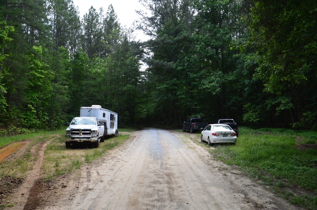
Duration of Hike: 1:00 Type of Hike: Out and Back Difficulty Rating: 2 out of 10 Total Elevation Gain: 160 Feet Pros: None Cons: Gold Mine Branch Falls is located on a small stream and needs a lot of water to look good Points of Interest: Gold Mine Branch Falls - 6 stars Trail Blaze Colors: None, No Trail Best Seasons to Hike: Spring Fees: None Beginning Point: Wide pullout area on Willis Knob Road Directions from Clayton, GA: From the intersection of Rickman Drive, Savannah Street, and US Route 23/441 in Clayton, follow Rickman Drive East. In 0.5 miles, bear diagonally right onto Warwoman Road. Follow Warwoman Road for 10.7 miles. Then, turn right onto WIllis Knob Road (FS Road 157). Continue for 1.75 miles to a very wide area in the road, with large grassy pullouts on both sides. This is the parking area for the hike to Gold Mine Branch Falls. Map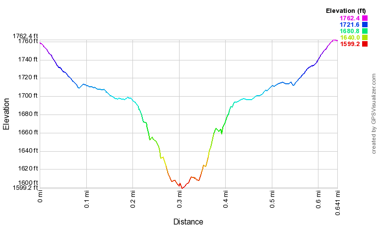
Click here to download a track of this hike.
Details
Gold Mine Branch Falls is the type of destination that acts as a nice and easy bonus stop to a longer or more difficult hike in the area. By itself, the short hike to Gold Mine Branch Falls will only fill up a small part of the day. A good combination is to hike to Gold Mine Branch Falls and the two waterfalls on Sarahs Creek in one day.
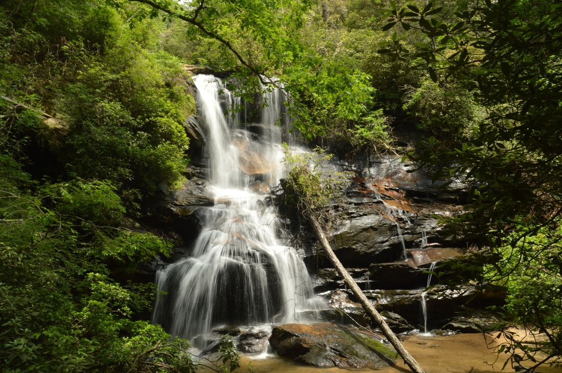
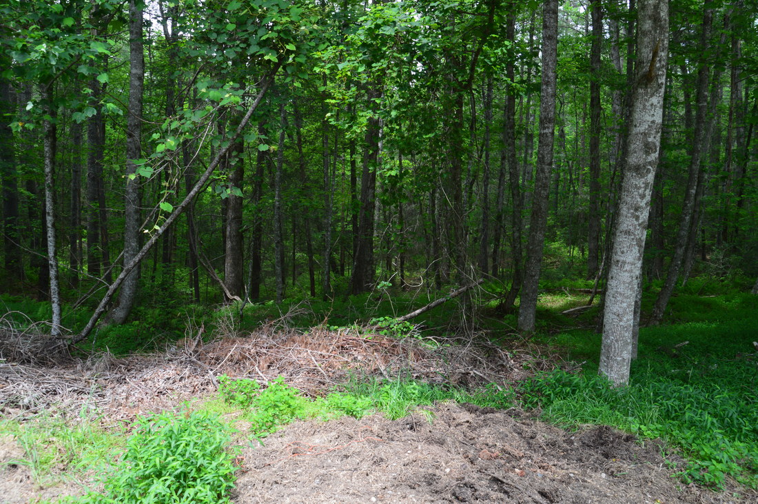
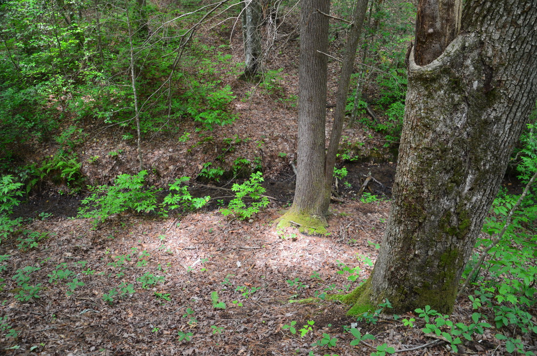
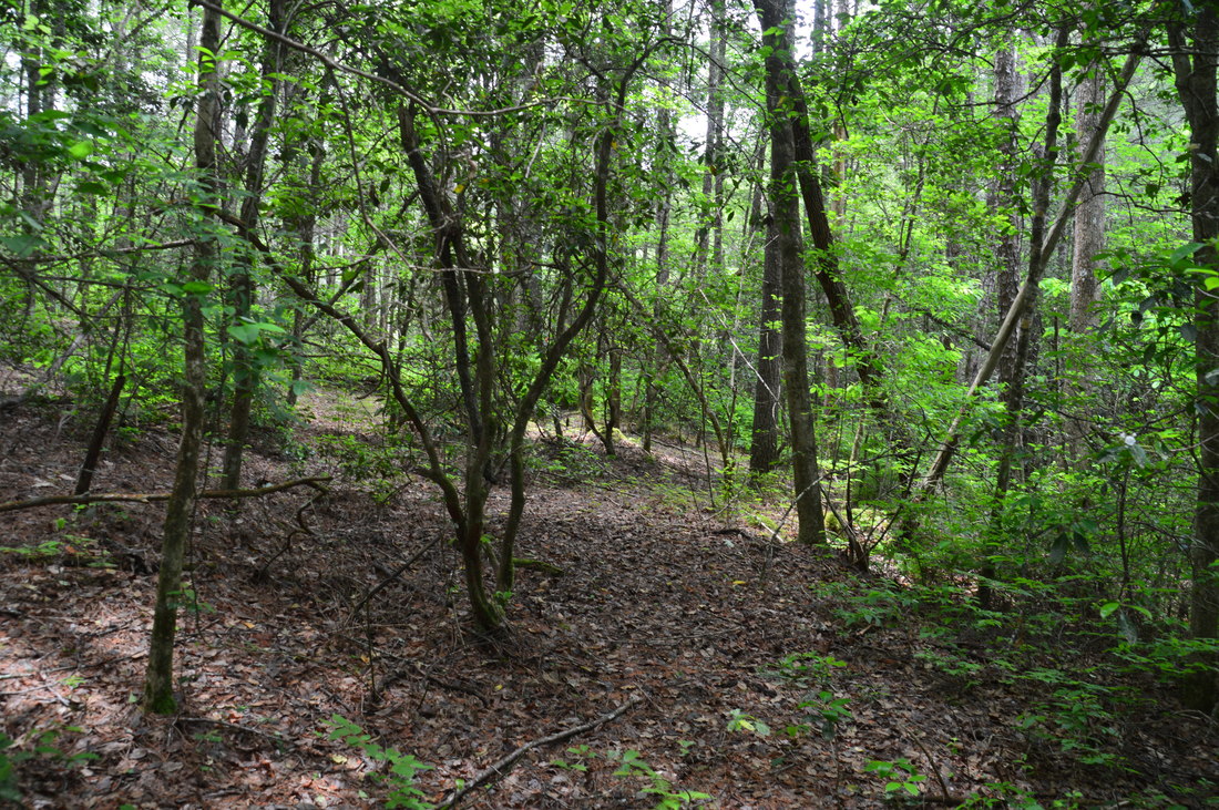
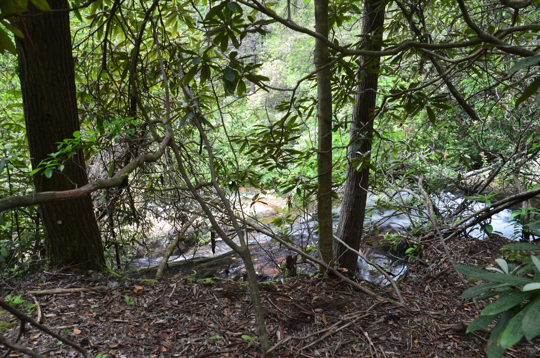
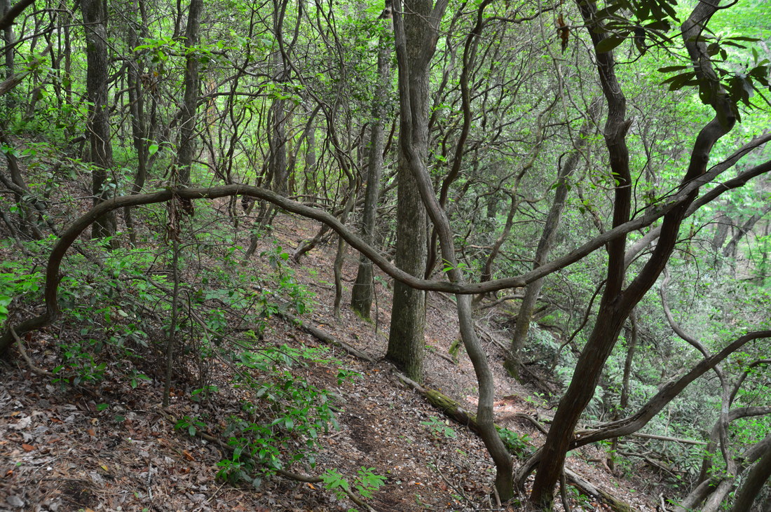
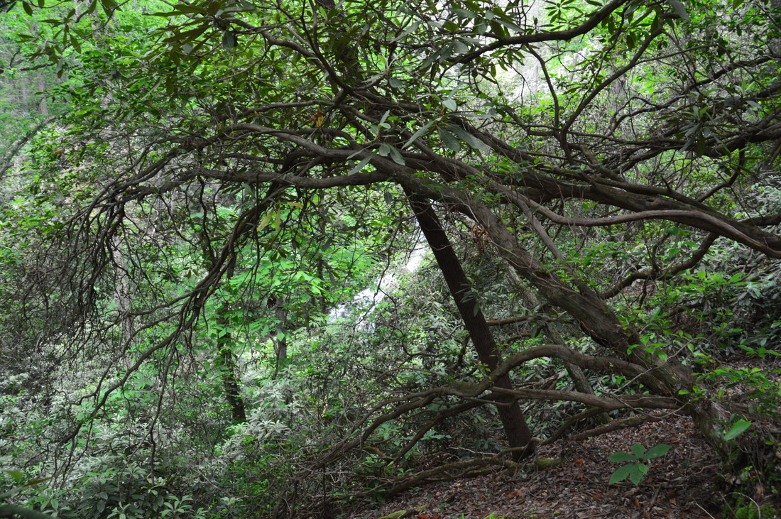
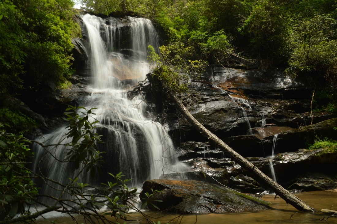
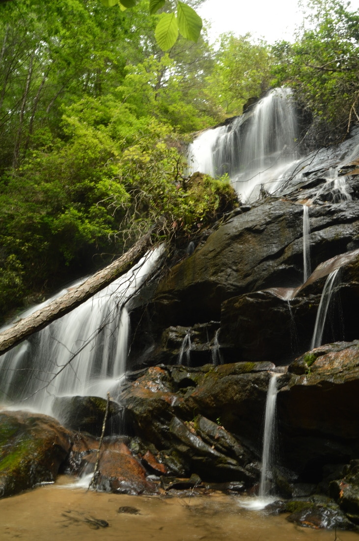
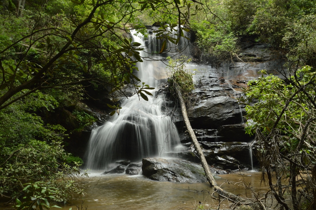
Begin the hike by heading northwest over a large brush pile and into the open woods from the pullout on Willis Knob Road. In other words, head away from the road and pullout that is on the right-hand side of Willis Knob Road (if coming from Warwoman Road via the directions listed). The easiest way is to descend into a small hollow, where there is a semblance of a path that others have taken. At 0.1 miles, cross a small trickle, and follow the path to a point where it dissipates within sight of Gold Mine Branch at 0.15 miles. Now, you should begin following the creek downstream through open woods, crossing a stream and then reaching a flat at the top of Gold Mine Branch Falls at 0.2 miles. The full waterfall is about 80 feet high, but what you are seeing from the top is two sliding portions of the waterfall (about 30 feet of elevation change total) that are above the main vertical drop and are not visible from the base. In order to reach the base of Gold Mine Branch Falls, it is best to swing away from the top area on the left (east) side of the creek. Initially, contour along the slope on the east side of the creek and falls. As you do this, following a sort of path, you will have some glimpses of the waterfall through the trees on the right. Once it appears that you have passed the waterfall, and once the steep slope to the right turns from a rhododendron thicket into open woods - around 0.25 miles - it is safe to bear right and descend down to Gold Mine Branch below the falls. Once you reach Gold Mine Branch, follow a path upstream toward the falls. Just before the falls, the path crosses the creek (usually rock-hoppable) before ending in front of Gold Mine Branch Falls and a shallow sandy pool at 0.3 miles. The structure of 50-foot Gold Mine Branch Falls makes it a very photogenic waterfall. Most of the stream spills down the left side of the sheer cliff in twin ribbons of water that briefly converge into one cascade at the waterfall's middle section. In times of higher flow, a third thin ribbon of water forms a stairstep cascade down the outcrops on the right side of the cliff. This waterfall is best to visit during times of higher flow due to the small watershed of Gold Mine Branch. Spring is likely the best time to see it, because during mid and late spring, there will typically be enough water to keep the waterfall looking good, and at the same time, lush greenery all around the falls turns the setting into an attractive one. From Gold Mine Branch Falls, simply retrace your steps back to the trailhead along the same route, concluding the hike at 0.6 miles. Mileage
0.0 -Willis Knob Road
0.15 - Top of Gold Mine Branch Falls 0.3 - Base of Gold Mine Branch Falls 0.6 - Willis Knob Road Variations
None
Bonus Stops
A good hike to combine with Gold Mine Branch Falls is the hike to two waterfalls on Sarahs Creek.
PicturesVideos
1 Comment
Freesia
4/23/2023 05:26:04 pm
This was a great find. I had to restart 2 or 3 times heading into the woods at the NW direction, as I didn’t enter it ‘left’ enough. But the distance tips and the photos really helped. The falls have a lot of new downed trees so the scale down to the base needed creativity. Lots of bugs due to sitting water around the down trees. But what a gem of a fall, and pretty massive. Thank you for posting all the info about this!! Leave a Reply. |
About MeMark Oleg Ozboyd Dear readers: I have invested a tremendous amount of time and effort in this website and the Georgia Waterfalls Database the past five years. All of the work that has gone in keeping these websites updated with my latest trip reports has almost been like a full-time job. This has not allowed me to pick up a paid job to save up money for college, and therefore, I I've had to take out loans. If you find the information on this website interesting, helpful, or time-saving, you can say "thanks" and help me out by clicking the button above and making a contribution. I will be very grateful for any amount of support you give, as all of it will apply toward my college tuition. Thank you!

Coming in 2022-2023?
Other Hiking WebsitesMiles HikedYear 1: 540.0 Miles
Year 2: 552.3 Miles Year 3: 518.4 Miles Year 4: 482.4 Miles Year 5: 259.9 Miles Archives
March 2021
Categories
All
|


 RSS Feed