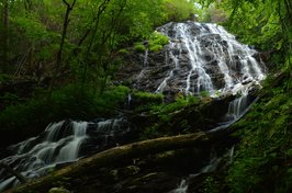
A classic Southern Appalachian wilderness hike, the Beech Creek Loop is a 'must-do' for all classes of hikers alike. I'll add that the Beech Creek Loop is among the top hikes that I have ever done, in Georgia or elsewhere. Over its eight-mile course, the loop visits two spectacular waterfalls - one of which is about 100 feet high - and passes a lengthy but worthwhile side trail to a breathtaking 180-degree view from Big Scaly Mountain into the Tallulah River Valley. In addition, the trail provides a perfect wilderness experience, full of solitude all throughout the Beech Creek gorge and on the slopes of Big Scaly Mountain. A short stretch of roadwalk is necessary to close the loop, but even walking along Tallulah River Road is nice, as you will get several views of the Tallulah River and its cascades. This hike occurred on Saturday, June 10th, 2017. My plan was to hike the Beech Creek Loop counter-clockwise, although I would use two cars to eliminate the 1.2-mile roadwalk. Along the way, I would take short side trips to Bull Cove Falls and High Falls and a much longer side trip to the vista on Big Scaly Mountain. Note that if you do the Beech Creek Loop, you must by all means take the time to go to the overlook as well.
10 Comments
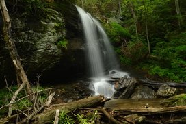
Today nearly a ghost town, Tate City once was a prospering town centered around the logging business and the mining of corundum. A handful of folks live in Tate City through the year, but many houses in this quaint community are simply second homes. The pleasant drive through Tate City leads to a door into the Southern Nantahala Wilderness, a land of many top-tier waterfalls. The hike along the unofficial but well-defined Denton Creek Trail should be at the top of any waterfall hunter's list. In an easy to moderate two miles, folks who hike the Denton Creek Trail will visit three pristine waterfalls. Particularly attractive is Lower Denton Creek Falls, a free-fall waterfall that tumbles 40 feet over a sheer cliff speckled with lush green vegetation. In addition, hikers will be treated to continuous streamside scenery all throughout the Denton Creek Trail. This hike occurred on Saturday, June 10th, 2017. My plan was to hike out and back along the Denton Creek Trail to Upper Denton Creek Falls. Along the way, I would take the side trail to Lower Denton Creek Falls, and I would also make the short off-trail scramble down to Middle Denton Creek Falls.
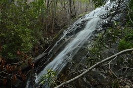
Most of the streams that drain the Upper Tallulah River form waterfalls. Many of these waterfalls are significant, such as Flat Branch Falls: a multi-tier sliding waterfall that is over 200 feet high. Even though not all of it is visible from the base, the view is still impressive. Unfortunately, the trail to Flat Branch Falls had been damaged severely by the Rock Mountain Fire in November 2016. In fact, the once-easy trail to Flat Branch Falls has turned into an obstacle course complicated by numerous dead and fallen rhododendron branches. In addition, the trail to Flat Branch Falls begins with a steep scramble up a nearly vertical 20-foot slope. With a bit of common sense and navigational skills, however, the more seasoned hiker will get to Flat Branch Falls without much trouble. This hike occurred on Saturday, June 10th, 2017. My plan was to hike out and back to the base of Flat Branch Falls via the trail that begins at Bridge 4 on Tallulah River Road.
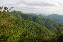
The Upper Tallulah River splits the Southern Nantahala Wilderness's lower region into two nearly separate parts. To the east of the Tallulah River, some of the wilderness's most famous landmarks are situated, such as Standing Indian Mountain, High Falls, and Denton Creek Falls, each of which is reached by well-used trails. The rugged terrain to the west of the Tallulah River tells a whole different story, however. Few official trails traverse this remote area, but a pair of unofficial footpaths provide access from the bottom of the valley all the way to the ridgetops. A beautiful waterfall called Oversoul Falls is found along the unmaintained Holden Cove Trail, and a difficult trek away from the Bly Gap Trail will lead an experienced hiker to Fall Branch Falls, a long series of steep cascades and slides. Even the Appalachian Trail in this area is used lightly compared to many other sections of the AT, and you're not likely to meet any people along the way to the breathtaking Ravenrock Cliff Overlook. This hike was occurred on Saturday, May 20th, 2017. My plan was to begin the day with a surprisingly difficult bushwhack from the Bly Gap Trailhead to Fall Branch Falls. Then, I would move on the main hike of the day, placing a second car at the Holden Cove Trailhead and hiking the Holden Cove Trail past Oversoul Falls to the Appalachian Trail and to Ravenrock Cliff Overlook. I would finish the hike by following the AT to Bly Gap and then hiking the Bly Gap Trail back to the first car. Folks without the option of taking two cars for the hike would have to make a final 2-mile roadwalk to complete the loop.

Southern Nantahala Wilderness is one of only two wilderness areas in Nantahala National Forest. However, it covers some very rugged and beautiful terrain across extreme southern North Carolina and a small section of north Georgia. The Tallulah River is one of the main rivers that eventually forms the Savannah River. Its headwaters are here. On this hike, you'll have a chance to see several of the headwater streams, at least two waterfalls, and an outstanding view. One thing though - be prepared for everything except an easy hike. This hike occurred on Saturday, March 7th, 2015. My plan was to hike the Deep Gap Branch Trail from the Dreamcatcher Cove Trailhead to its end on the Appalachian Trail at Deep Gap. From there, I would follow the Appalachian Trail to check out the vista on Standing Indian Mountain, this time in it's winter state, and then continue to Beech Gap. From Beech Gap, I would take an overgrown connector trail to Beech Creek Trail, and then continue down Beech Creek Trail to its end near the North Carolina/Georgia state line. I would finish the hike with a little roadwalk.
|
About MeMark Oleg Ozboyd Dear readers: I have invested a tremendous amount of time and effort in this website and the Georgia Waterfalls Database the past five years. All of the work that has gone in keeping these websites updated with my latest trip reports has almost been like a full-time job. This has not allowed me to pick up a paid job to save up money for college, and therefore, I I've had to take out loans. If you find the information on this website interesting, helpful, or time-saving, you can say "thanks" and help me out by clicking the button above and making a contribution. I will be very grateful for any amount of support you give, as all of it will apply toward my college tuition. Thank you!
Coming in 2022-2023?
Other Hiking WebsitesMiles HikedYear 1: 540.0 Miles
Year 2: 552.3 Miles Year 3: 518.4 Miles Year 4: 482.4 Miles Year 5: 259.9 Miles Archives
March 2021
Categories
All
|

 RSS Feed