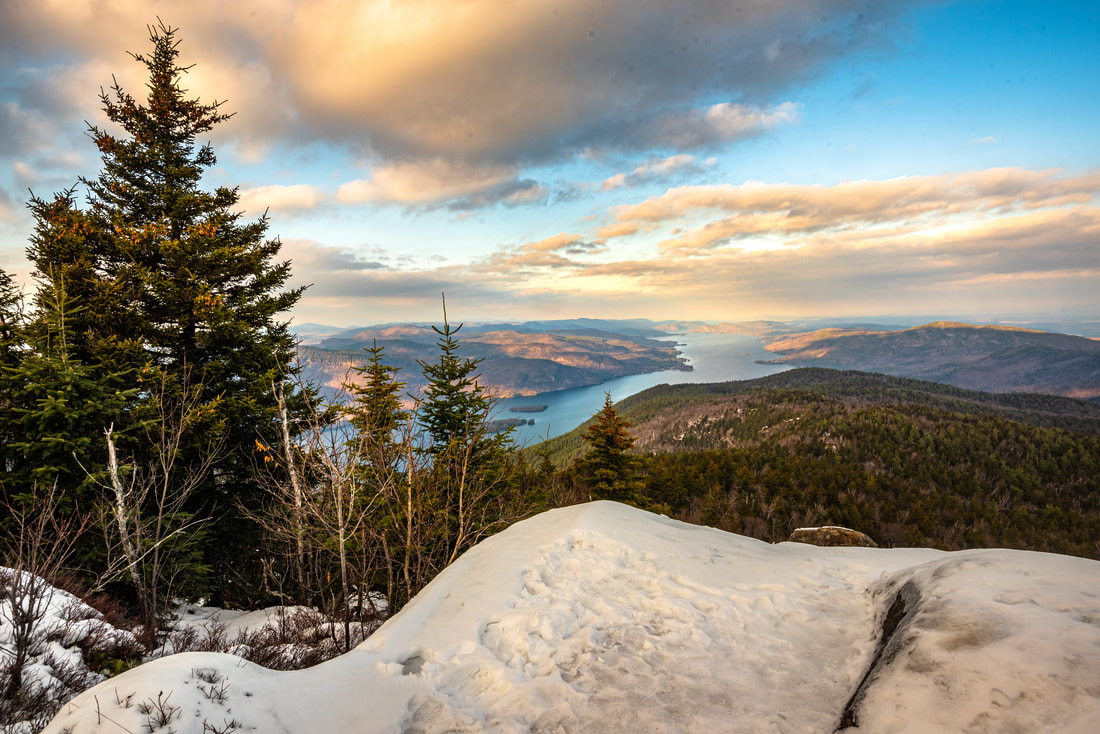
Towering over 2,000 feet above the east shore of Lake George is the little-known summit of Black Mountain. Given the fantastic views of Lake George and vicinity that Black Mountain provides both northward and southward, it is a wonder that this hike tends to stay so under-represented in the hiking community. Pike Brook Road serves as the starting point of the Black Mountain Trail, which reaches the summit in 2.5 miles with a remarkably well-graded climb. What's more, the full 7-mile loop drops down the back side of Black Mountain past multiple additional vistas before an exceptionally scenic traverse past Black Mountain Pond, Round Pond, and Lapland Pond. The Black Mountain Loop is definitely one of the highlight hikes of the Lake George area. Furthermore, this hike is a great winter pick for less experienced snowshoers, thanks to the trail's moderate grades and lack of the rock scrambling so typical to other parts of the Adirondack Park. This hike occurred on Tuesday, November 26th, 2019. My plan was to hike the Black Mountain Loop in a counter-clockwise direction from Pike Brook Road.
1 Comment
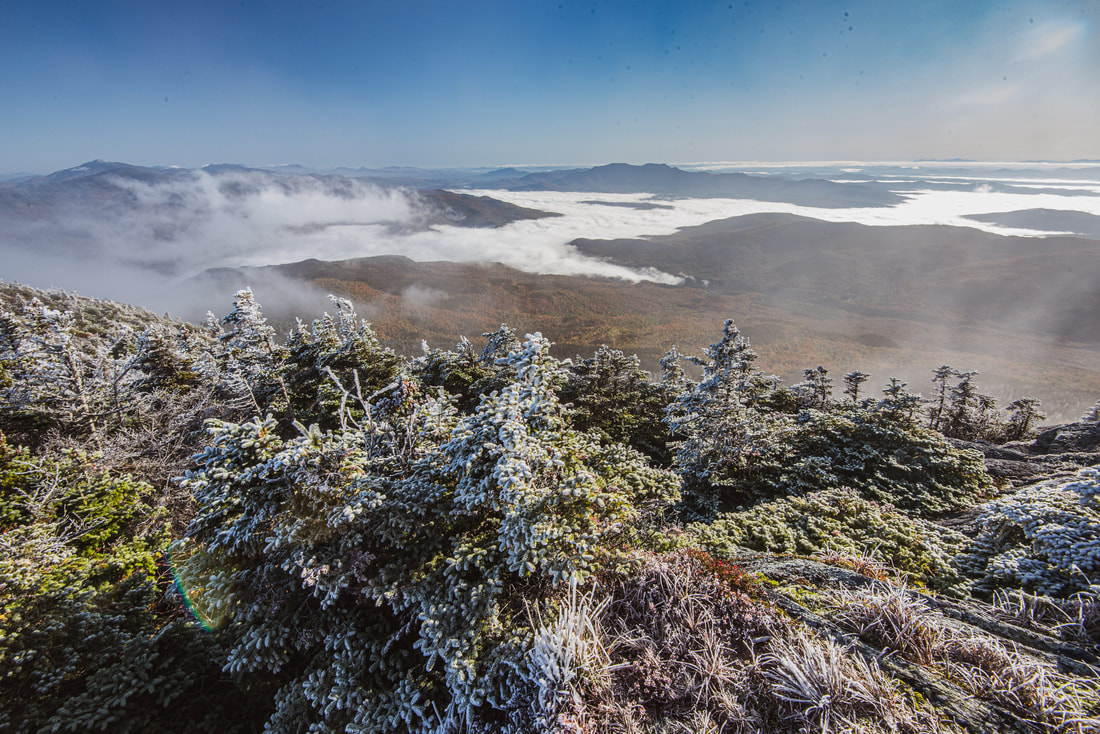
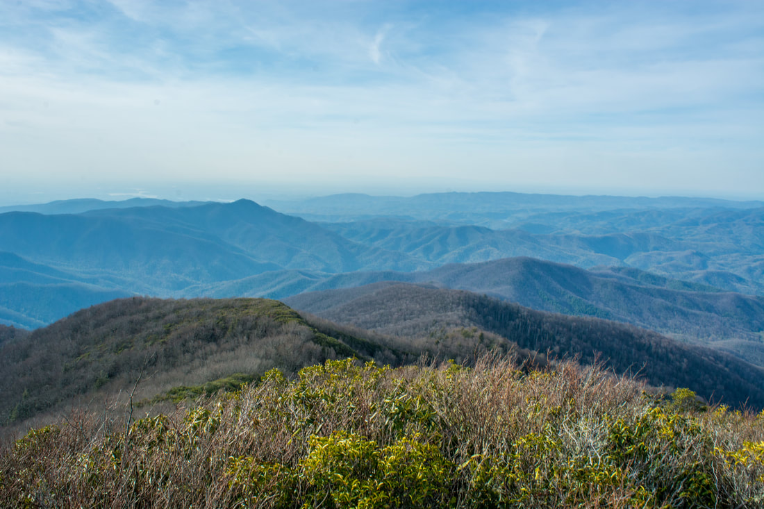
One of the most distinctive landmarks in Vermont and the third-tallest peak in the state, the rocky, alpine dome of 4,085-foot Camel's Hump is known well for its incredible 360-degree views overlooking a lengthy swath of the Green Mountains, with Lake Champlain, the Adirondacks, and the Whites all in view. Although Long Trail - Vermont's own long-distance trail - directly crosses the summit, getting there is still a steep, strenuous ascent from any direction. What some people fail to realize though is that Camel's Hump is just one highlight of the Long Trail as it runs south to Highway 17. The 11.7-mile section of the Long Trail between Camel's Hump and Appalachian Gap is never dull, featuring a variety of overlooks, spectacular bluffs, intricate rock mazes, bogs, and the signature viewpoint atop Burntrock Mountain. Expect this to be a difficult and slow hike that will take all day and test your physical shape. This hike occurred on Saturday, October 5th, 2019. My plan was to leave two cars - one at Appalachian Gap on Hwy 17 and one at the Burrows Trailhead - and start ascending the Burrows Trail to Camel's Hump. I would join the Long Trail near the summit, and I'd follow the Long Trail the rest of the day to Appalachian Gap.
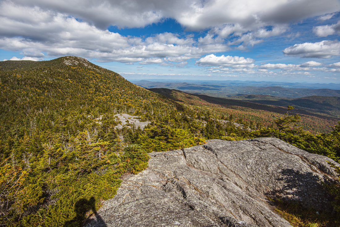
Situated just east of the town of Stowe in Northern Vermont, the Worcester Range is an elongated ridge of rocky peaks that seems to stay under the radar as a hiking destination for two very simple reasons: it isn't part of the famous Long Trail's route, and there are no 4000-foot peaks, which are frequently the primary focus of New Englanders' outdoor explorations. The Skyline Trail runs along the spine of the range and connects its two most prominent peaks: Mount Worcester and Mount Hunger. Not having the time for an ambitious exploration of the full ridge, I settled for a hike that looped around the south end, visiting Mount Hunger and its impressive subpeak Whiterock Mountain. Featuring multiple rock scrambles and 360-degree panoramic views that include some of Vermont's most iconic landmarks like Camel's Hump and Mount Mansfield, this is an incredible hike that has definitely stayed underappreciated. This hike occurred on Saturday, September 21st, 2019. My plan was to climb Mount Hunger via the Middlesex Trail and then descend via the Bob Kemp Trail, making the side trip to Whiterock Mountain along the way.
Twentymile is the southwesternmost major access point to Great Smoky Mountains National Park, and also one of the quietest. With nothing but a sleepy ranger station, small parking area, and trailhead, plus no significant destinations in close proximity, the Twentymile area remains little-visited compared to areas of the park like Cades Cove and Roaring Fork. Yet those who are willing to hike longer will find the Twentymile area quite interesting. The lengthy loop described here first follows the scenic cascades of Twentymile Creek before climbing to the Appalachian Trail and reaching the historic Shuckstack fire tower with its birds-eye view of Fontana Lake. The hike then heads deeper into the Smokies backcountry, traversing the Gregory Bald Trail - the eastern section of which near Doe Knob is one of the least-hiked trails in the park - before reaching the open grassy summit of Gregory Bald, featuring stunning 360-degree views. Even though both Shuckstack Tower and Gregory Bald can be reached via separate shorter hikes, it's hard to beat combining these two spectacular destinations into one large loop. This hike occurred on Saturday, October 6th, 2018. My plan was to initially hike the Twentymile Trail to the Appalachian Trail. After a side trip to Shuckstack, I would follow the AT north to Doe Knob. There, I'd pick up the Gregory Bald Trail and follow it all the way to Gregory Bald. On the other side of Gregory Bald, I would take the Wolf Ridge Trail and descend back to Twentymile. Although I completed this hike as a long day hike, you may find it more enjoyable as a two- or even three-day backpacking trip.

The Shining Rock Wilderness is Southwest North Carolina's high country - an area crowned by numerous 6000-foot peaks with stunning mountain views. Deep in the Little East Fork Pigeon River valley is the Daniel Boone Scout Camp, a convenient entry point to the Shining Rock Wilderness near its northern end. Two trails, Little East Fork Trail and Art Loeb Trail, leave the camp and make for a long, scenic loop visiting a number of the wilderness's highlights in its north sector. Climbing steeply out of the valley, the Art Loeb Trail's first stop is Deep Gap, where a 1.5-mile side trail leads to several panoramic overlooks atop Cold Mountain. The Art Loeb then embarks on an exciting journey through The Narrows, where a series of ups and downs along a knife-edge ridge take you past two great views and numerous rock outcrops. After a gradual climb up Stairs Mountain through gorgeous mossy spruce-fir forest, the Art Loeb approaches the wilderness's center point: Shining Rock. Featuring its own panoramic views, Shining Rock is a huge outcropping of brilliant white quartz amidst a sea of evergreen. Backpackers will find Shining Rock to be a great sunset-viewing location. Your exit route from the wilderness is the Little East Fork Trail, which descends an old roadbed along the countless pleasant cascades of Little East Fork's scenic run. This hike occurred on Saturday, June 9th, 2018. My plan was to hike the Scout Camp Loop clockwise, first hiking the Art Loeb Trail and then Little East Fork Trail. Along the way, I took side trips to Cold Mountain and Shining Rock.

The scenic crest of the Bald Mountains that straddles the Tennessee/North Carolina border south of Greeneville, TN, features a set of spectacular vistas in the vicinity of the Appalachian Trail. The views actually begin even before you leave your car as you arrive at the beautiful Jones Meadow with a panoramic vista of Camp Creek Bald and Blackstack Cliffs. Two excellent vistas are accessed by a very short, easy walk from the parking area: Whiterock Cliff facing south into North Carolina and Blackstack Cliffs facing north into Tennessee. The Appalachian Trail then continues onto a new section, which scrambles along the knife-edge ridge-crest for over a mile across Big Firescald Knob, affording several outstanding 360-degree panoramic vistas. On your return trip, you may choose to follow the alternate bad-weather AT route, a little-used pathway on the north flanks of Big Firescald Knob that adds variety to the hike. This hike occurred on Friday, April 27th, 2018. My plan was to hike the Appalachian Trail from Jones Meadow over Big Firescald Knob, taking side trails to Whiterock Cliff and Blackstack Cliffs along the way. Rather than retracing my steps along the Big Firescald Knob ridge-crest, I would return along the AT bad-weather bypass. This hike was the third of six hikes that I did during a four-day trip to the mountains of northeast Tennessee and northwest North Carolina.
Just off NC 281 is a lesser-known entrance to the backcountry of Panthertown Valley: the West Fork Way trailhead. The unofficial West Fork Way ascends through the West Fork French Broad River watershed for several miles, passing the extremely steep access trail to three spectacular waterfalls: Rhapsodie Falls, Dismal Falls, and Lower Dismal Falls. West Fork Way then connects to another unofficial trail on the fringes of Panthertown Valley called the Shelton-Pisgah Trail, which follows a seldom-hiked pathway along the ridge of Shelton-Pisgah Mountain to Cold Mountain. A cliff on the west side of Cold Mountain, nicknamed the High Bethel View features an outstanding vista of Panthertown Valley spread out to the west - arguably the best of the valley's five views. This hike occurred on Saturday, May 12th, 2018. My plan was to hike West Fork Way and Shelton-Pisgah Trail out and back to Cold Mountain. Along the way, I would take the side trails to Rhapsodie Falls, Dismal Falls, and Lower Dismal Falls. I would also stop by two other small falls - Aunt Sally's Falls and Lower Rhapsodie Falls.
Right on the doorstep of the quaint town of Robbinsville is the Joyce Kilmer-Slickrock Wilderness, a massive wild area covering over 17,000 acres between the Cherohala Skyway and US 129. The area is known best for the Joyce Kilmer Memorial Forest - an area of virgin forest in the Little Santeetlah Creek watershed, featuring numerous old, grand trees. The wilderness area's central destination, however, is an inconspicuous rock outcropping on a lead below Haoe Bald called The Hangover. The Hangover features a breathtaking 360-degree view of the wilderness, with little in sight but endless mountain ridges and several lakes. The panoramic vista atop The Hangover encompasses Santeetlah Lake, Calderwood Lake, and the Little Tennessee River. This hike loops several trails from the Joyce Kilmer Recreation Area to visit The Hangover via the Memorial Forest. This hike occurred on Saturday, April 21st, 2018. My plan was to hike a clockwise loop with the Joyce Kilmer Memorial Forest Poplar Cove Trail, Naked Ground Trail, Haoe Lead Trail, and Jenkins Meadow Trail. I would of course take a side trip along the Hangover Lead Trail to The Hangover.
The trails at the west end of Panthertown Valley feature several popular waterfalls: Wilderness Falls, Frolictown Falls, and Granny Burrell Falls, as well as a spectacular well-known cliff line on the south side of Big Green Mountain called the Great Wall. This hike visits all of these destinations, in addition to lesser-known views atop Big Green Mountain itself. This hike also follows the Deep Gap Trail out of Panthertown Valley onto the seldom-hiked Laurel Knob Trail, a climbers' access trail that leads to the base of the 1200-foot cliffs of Laurel Knob. Laurel Knob boasts of the tallest uninterrupted cliff face in the entire Eastern United States! This hike occurred on Saturday, March 31st, 2018. My plan was to start out at the Salt Rock Gap Trailhead, where I'd take the Wilderness Falls Trail past Wilderness Falls to the Deep Gap Trail at Frolictown Falls. I'd then hike the Deep Gap Trail and Laurel Knob Trail out and back to the base of the Laurel Knob cliffs. Next, I'd return to Frolictown Falls, and I'd take the Great Wall Trail toward the top of Big Green Mountain, making a side trip to Granny Burrell Falls along the way. I would then follow the Big Green Trail past several views and continue down an unofficial connector to Macs Gap Trail. Finally, I'd follow the Macs Gap Trail and Panthertown Valley Trail back out to Salt Rock Gap.
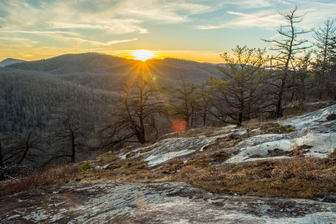
Protecting a small gulch on the east side of Lake Guntersville, Bucks Pocket State Park is one of Alabama's most underrated state parks. Bucks Pocket features a small slice of beautiful, wild scenery typical to the Cumberland Plateau. Two scenic, cliff-lined gorges are found in the park: those of Little Sauty Creek and South Sauty Creek. The park's best-known trail, the Point Rock Trail, follows Little Sauty Creek through numerous mossy boulder fields and woods that feature an abundance of wildflowers in spring, passing a small but very scenic waterfall on the stream. The Point Rock Trail then ascends to the rim of the gorge and ends at its namesake rock outcrop, which features panoramic views from a point on the rim high above the confluence of Little Sauty Creek and South Sauty Creek. This hike occurred on Saturday, March 17th, 2018. My plan was to hike the Point Rock Trail out and back to Point Rock from the Bucks Pocket Campground.
Pisgah Civitan Park: Pisgah Gorge Trail and Little Bryant Creek Waterfalls, Pisgah, Alabama5/9/2018 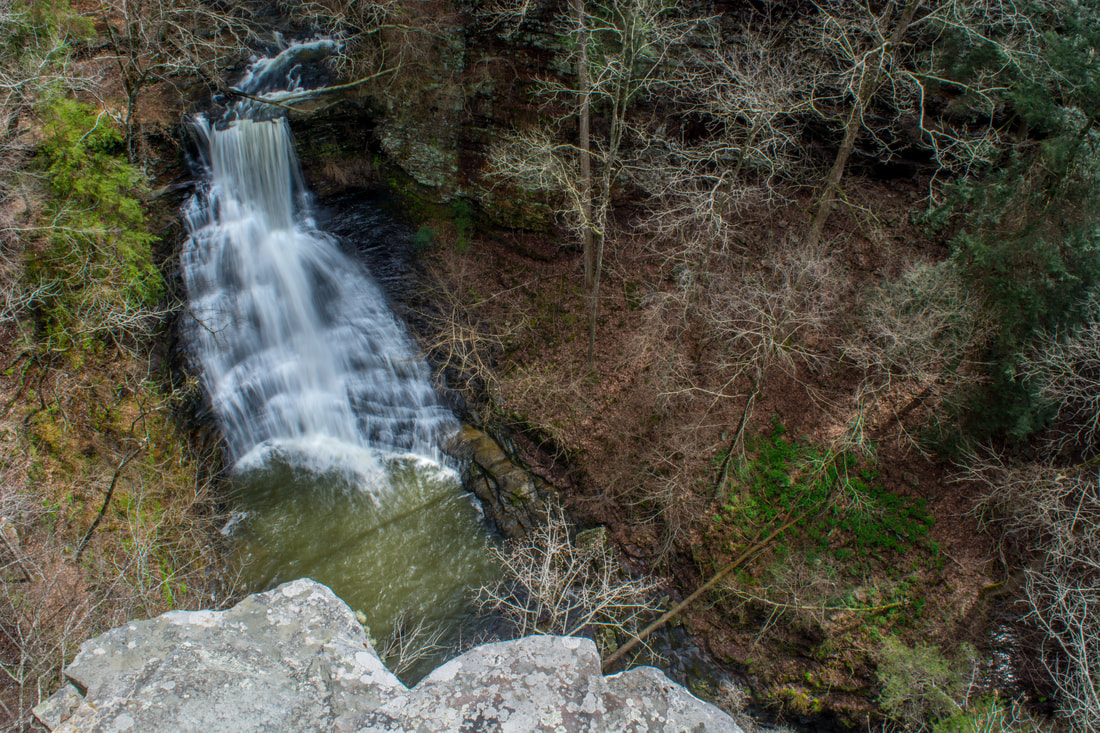
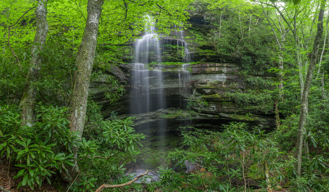
Inside the city limits of the quaint town of Pisgah in northeast Alabama is one of the area's most under-appreciated pieces of public land: the Pisgah Civitan Park. This small community park protects a section of the course of Little Bryant Creek through Pisgah Gorge that features three notable waterfalls - two of which are significant - and an extraordinary natural bridge. An easy trail follows the rim of the gorge, accessing several clifftop perches with sweeping birds-eye views of the gorge and its waterfalls. More adventurous hikers will find a faint, rugged pathway that drops into the gorge, accessing the base of Middle Little Bryant Creek Falls and the natural bridge. Pisgah Gorge features a sampling of some of Northeast Alabama's finest natural scenery and must not be missed! This hike occurred on Saturday, March 17th, 2018. My plan was to first hike the rim trail out and back to views of Upper Little Bryant Creek Falls, Middle Little Bryant Creek Falls, and the Pisgah Gorge downstream. I would then descend the trail into the gorge to get up-close and personal with the middle falls and the arch. In addition, I would check out a side trail leading to an old mill site at the top of the upper falls.
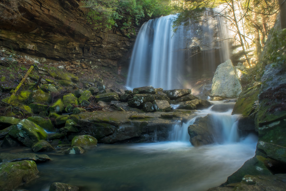
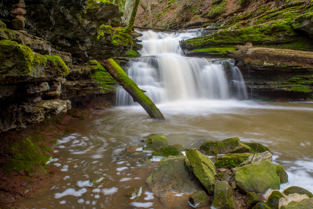
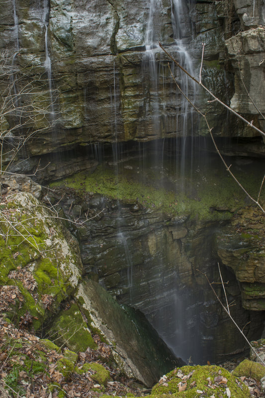
One of three rocky gorges in the Savage Gulf State Natural Area sector of South Cumberland State Park, Collins Gulf features some of the most spectacular, wild scenery on the Cumberland Plateau in Tennessee. The true star of the Collins Gulf hike is Suter Falls, a majestic 40-foot waterfall on Rocky Mountain Creek (a tributary of the Collins River) surrounded by cliffs in an awe-inspiring setting. Beside Suter Falls, the hike features as many as four other waterfalls (two are largely ephemeral). As the Collins Gulf Trail treks through the rugged gorge carved out by the Collins River, it passes a small but powerful block-type waterfall on the river called Horsepound Falls, as well as set of remarkable sinks on Collins River and Fall Creek. The second part of the hike follows the Collins Rim Trail, where the trail provides nice seasonal views into the gorge as it crosses countless tumbling streams before re-entering the gorge and crossing the Collins River on a mighty suspension bridge at a particularly gorgeous boulder-strewn section of the river. This hike occurred on Sunday, February 18th, 2018. My plan was to hike the Collins Gulf Loop clockwise from the 55th Avenue Trailhead.
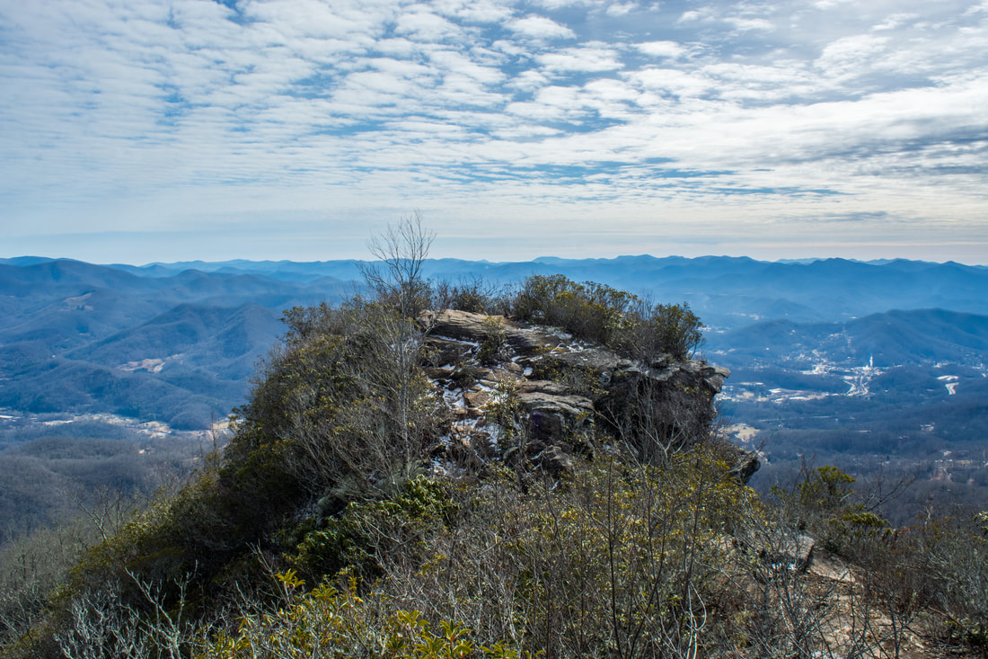
The Pinnacle, a famous rock outcrop that stands sentinel over the town of Sylva, is known well throughout the hiking community for its breathtaking views. The Pinnacle and Blackrock Mountain - a nearby peak with another stunning view - are part of the Plott Balsam Mountains, which are among the highest mountains in the Southeast. The area around The Pinnacle and Blackrock used to be a watershed that provided all of Sylva's drinking water and was strictly off-limits. However, as Sylva became in need of a better water supply, the watershed was transformed into Pinnacle Park. Later, the Blackrock Ridge Tract - an area of previously-private land that included Blackrock Mountain - was purchased, and today, a well-used network of trails connects The Pinnacle and Blackrock to the park's entrance off Fisher Creek Road and to the Blue Ridge Parkway. This hike occurred on Saturday, February 3rd, 2018. My plan was to hike the West Fork/East Fork Loop clockwise. Along the way, I would make side trips to The Pinnacle and Blackrock, and I would also bushwhack to Gina Falls and Fisher Falls.
Caesars Head State Park/Mountain Bridge Wilderness: Naturaland Trust Loop, Cleveland, South Carolina1/25/2018 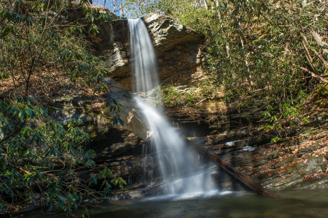
The west half of the Mountain Bridge Wilderness is encompassed by Caesars Head State Park, named for a prominent rock outcrop with striking views of the South Carolina Upstate. One of the area's main highlights is Raven Cliff Falls, a majestic waterfall on Matthews Creek that is cited to be 420 feet high. Among the wilderness's most scenic trails, the Naturaland Trust Trail provides direct access into the Matthew Creek gorge, passing views of Raven Cliff Falls after crossing an elegant suspension bridge at the waterfall's top. Several other trails in the park can be used to create the 12-mile loop Naturaland Trust Loop, which is not only among South Carolina's top hikes but also a very strenuous one. An added bonus for hiking the full loop, however, is optional access to two more gorgeous waterfalls on the property of Asbury Hills Camp: Moonshine Falls and Confusion Falls. This hike occurred on Saturday, January 20th, 2018. My plan was to hike the Naturaland Trust Loop clockwise from the Raven Cliff Falls parking area, although I came away with the feeling that hiking the loop counter-clockwise is better.
Chamberlain Trail is one of only two trails that ascends the east side of Pigeon Mountain from base to top. This lesser-known trail climbs at an easy to moderate pace through Atwood Gulf before meeting up with the Atwood Trail atop the mountain. While there aren't any notable attractions along the trail itself, a fantastic natural sight lies off-trail in Atwood Gulf: Nash Pit Falls. Have you ever heard the words pit and waterfall in one sentence? At Nash Pit Falls, a small stream flows out of a cave and instantly drops over 70 feet into the Nash Pit, a small but deep hole in the ground. In addition to the stunning Nash Pit Falls, this hike also visits a pair of McLemore Cove vistas on High Point - the highest point on Pigeon Mountain. This hike occurred on Saturday, January 13th, 2018. My plan was to hike the Chamberlain Trail from Chamberlain Road to Atwood Trail, making the bushwhack to Nash Pit Falls along the way. Next, I would follow the Atwood Trail to the Pocket/Bluff Trail. I would then follow the Pocket Trail and Bluff Trail in conjunction to the views on High Point. I would retrace my steps the same way.
|
About MeMark Oleg Ozboyd Dear readers: I have invested a tremendous amount of time and effort in this website and the Georgia Waterfalls Database the past five years. All of the work that has gone in keeping these websites updated with my latest trip reports has almost been like a full-time job. This has not allowed me to pick up a paid job to save up money for college, and therefore, I I've had to take out loans. If you find the information on this website interesting, helpful, or time-saving, you can say "thanks" and help me out by clicking the button above and making a contribution. I will be very grateful for any amount of support you give, as all of it will apply toward my college tuition. Thank you!

Coming in 2022-2023?
Other Hiking WebsitesMiles HikedYear 1: 540.0 Miles
Year 2: 552.3 Miles Year 3: 518.4 Miles Year 4: 482.4 Miles Year 5: 259.9 Miles Archives
March 2021
Categories
All
|
 RSS Feed