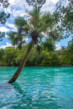
Silver Glen Springs is an oasis in the middle of Ocala National Forest, Florida's "big scrub". One of the forest's most scenic springs, Silver Glen Springs features strikingly transparent aquamarine waters that form a vivid contrast with the lush, tropical vegetation found along the shoreline. Not only is the spring a wonderful place to cool off on a scorching summer day, but it's also a natural aquarium, often housing hundreds of fish and even other species like the Atlantic stingray. A couple of nature trails branch out from the Silver Glen Springs Recreation Area. The Springs Boil Trail leads to a secondary spring called Jody's Spring, known for its many unique sand boils, nestled in the deep shade of a tropical hammock. The Lake George Trail meanders through uplands near Silver Glen Springs Run for a mile before reaching the shoreline of Lake George, Florida's second largest freshwater lake, so massive that it almost seems to be a sea. This hike occurred on Tuesday, August 28th, 2018. My plan was to hike both the Springs Boil Trail and Lake George Trail after exploring Silver Glen Springs.
0 Comments
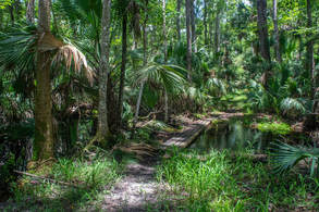
7000-acre Wekiwa Springs State Park is part of a ribbon of wild lands surrounding the St. Johns River on the northwest side of Orlando. The park's centerpoint is Wekiwa Springs, a second-magnitude spring that discharges 45 million gallons of water a day. However, there's a lot more to see in this park, which is crisscrossed by a series of single-track trails maintained by the Florida Trail Association. This hike follows the outermost White Trail all the way from Wekiwa Springs to the park's remote northern reaches. In the first half of the hike, you'll follow an elevated tramway through the wild Mill Creek Swamp and then immerse yourself into the palm hammocks of the Rock Springs Run floodplain, where you'll occasionally get your feet wet (particularly in the rainy season). A stark difference is found in the hike's second half, where you'll cruise through dry sandhills and pass sinkholes. Around the hike's midpoint, an inconspicuous connector path leads into Kelly park, where you can dip your toes in the refreshingly cool waters of the breathtaking, must-see Rock Springs before resuming your hike. This hike occurred on Wednesday, August 1st, 2018. My plan was to hike the White Trail counter-clockwise, starting out along the Wet-to-Dry Boardwalk by Wekiwa Springs.
Apalachicola National Forest: Leon Sinks Geological Area Trail System, Tallahassee, Florida1/9/2018 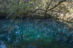
The Leon Sinks Geological Area is in the northeast corner of Apalachicola National Forest near Tallahassee. This fascinating area is home to over a dozen sinkholes, many of which have water in them. Particularly Hammock Sink is one of the most beautiful and photogenic natural sights in the region. The trail system at Leon Sinks also visits a disappearing stream with a natural bridge as well as a series of cypress swamps. Numerous points of interest are spaced throughout the 4.5-mile loop to keep your attention focused the entire hike. This hike occurred on Saturday, January 6th, 2018. My plan was to hike a counter-clockwise loop with the Sinkhole Trail and Gum Swamp Trail.
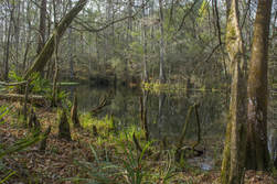
Most hikers of the Tallahassee area have heard of or even been to Leon Sinks. How many have heard of Wakulla River Sinks though? Along with adjacent Apalachicola National Forest, the River Sinks Tract - a lesser-known parcel of Wakulla Springs State Park - holds nearly two dozen water-filled sinkholes. The sinks serve as a portal to the mysterious underground water-filled cave system that eventually connects to the Wakulla River to the southeast. An official trail called the Wakulla River Sinks Trail passes by several small sinks, including the photogenic Clearcut Sink. If one extends their hike along the unofficial pathway that splits off and leads to a series of bigger sinks, including Promise Sink and Upper River Sink, they are bound to be astounded! This hike occurred on Saturday, January 6th, 2018. My plan was to hike the official Wakulla River Sinks Trail clockwise. Along the way, I would make out-and-back side trips to Clearcut Sink and along an unofficial trail to a series of sinks to the south.
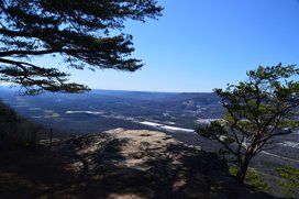
Lookout Mountain Battlefield, which is part of the Chickamauga & Chattanooga National Military Park, covers an impressive portion of Lookout Mountain, where the "Battle Above the Clouds" occurred during the Civil War. The battlefield's extensive trail system provides easy access to some of the mountain's signature features, such as Sunset Rock and Point Park, both of which have panoramic vistas. The park's most scenic trail, Bluff Trail, follows the bluff line along the west side of Lookout Mountain for several miles, connecting to other trails with more views and other points of interest such as mountain springs. This hike occurred on Saturday, January 28th, 2017. My plan was to hike the Bluff Trail from Ochs Gateway to Point Park. Along the way, I would take a side trip along the Jackson Gap Trail and also to Sunset Rock. From Point Park, I would follow the Mountain Beautiful Trail and Hardy Trail to Cravens House, from where I would take the Rifle Pits Trail to the Upper Truck Trail. Then, I would hike along the Upper Truck Trail past the ruins of Camp Demaray to the Gum Spring Trail. Lastly, I would follow the Gum Spring Trail up to the Bluff Trail, concluding the hike by retracing my steps on a portion of my earlier route along the Bluff Trail.
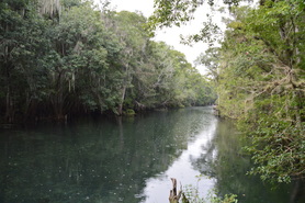
Out of all of the different aspects of nature in Florida, the springs are perhaps the best-known. There are dozens of large springs in northern Florida, some of which pump out millions of gallons of water per day. A lot of the biggest springs are the focal points of state parks, and a large amount of people find them suitable for various recreational uses, including swimming in the crystal clear waters or kayaking the outflow streams that flow away from the springs. Manatee Springs is one such example. This spring is a first-magnitude spring with an output of about 100 million gallons of water per day! While Manatee Springs are certainly the primary point of interest in Manatee Springs State Park, an extensive trail system also meanders through other portions of this large park, although unfortunately, on this day, I did not have the opportunity to check it out. This hike occurred on Sunday, July 31st, 2016. My plan was to visit Manatee Springs, before hiking the boardwalk along Manatee Springs Run to its mouth at the Suwannee River. I would return the same way.
|
About MeMark Oleg Ozboyd Dear readers: I have invested a tremendous amount of time and effort in this website and the Georgia Waterfalls Database the past five years. All of the work that has gone in keeping these websites updated with my latest trip reports has almost been like a full-time job. This has not allowed me to pick up a paid job to save up money for college, and therefore, I I've had to take out loans. If you find the information on this website interesting, helpful, or time-saving, you can say "thanks" and help me out by clicking the button above and making a contribution. I will be very grateful for any amount of support you give, as all of it will apply toward my college tuition. Thank you!
Coming in 2022-2023?
Other Hiking WebsitesMiles HikedYear 1: 540.0 Miles
Year 2: 552.3 Miles Year 3: 518.4 Miles Year 4: 482.4 Miles Year 5: 259.9 Miles Archives
March 2021
Categories
All
|

 RSS Feed