HIKING THE APPALACHIANS AND BEYOND
  • Home
  • Trail Reports
    • Best Hikes
    • Hikes with Scenic Views
    • Hikes with Water Features
    • Alabama
    • Georgia
    • Florida
    • North Carolina
    • South Carolina
    • Tennessee
    • Vermont
    • Virginia
  • Map
  • Hike List
  • Testimonials
  • Resources
  • Contact Us
  • Southeast Nature Society
    • Our Team
  • Georgia Waterfalls Database

Mud Creek Trail to Mud Creek Falls, Sky Valley, Georgia

6/4/2017

1 Comment

 
Picture
Originating into North Carolina and then flowing into Georgia through the town of Sky Valley, Mud Creek is one incredible stream. Between the flats of Sky Valley and the floor of the Little Tennessee River Valley in Dillard, Mud Creek loses 1000 feet of elevation in just three miles! During this time, Mud Creek drops over several major waterfalls, including Estatoah Falls - one of Georgia's most famous waterfalls. A monster single-tier 160-foot waterfall, Estatoah Falls is unfortunately on private property and not accessible to the public. Upstream from Estatoah Falls is an 85-foot waterfall known as Mud Creek Falls or Little Estatoah Falls. What's best about this stunning waterfall is that unlike its bigger brother downstream, it is entirely on public property and is accessed by a short walk from a neighboring parking area or by a mile-long trail from Highway 246, depending on the visitor's preference. This hike occurred on Saturday, May 27th, 2017. My plan was to hike the Mud Creek Trail out and back to Mud Creek Falls from the trailhead pullout on Highway 246. 

Summary

R/T Length of Trail: 2.2 Miles 
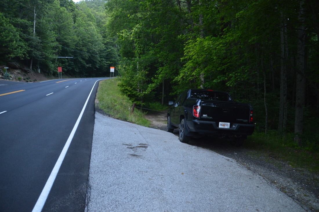
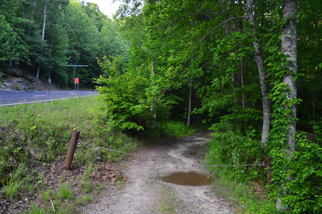
Duration of Hike: 1:05 
Type of Hike: Out and Back
Difficulty Rating: 2 out of 10 
Total Elevation Gain: 300 Feet
Pros: Very well-graded and easy trail along Mud Creek 
Cons: Drive-up access to Mud Creek Falls attracts crowds 
​Points of Interest: Mud Creek Falls - 10 stars 
Trail Blaze Colors: Mud Creek Trail - None 
Best Seasons to Hike: Spring 
Fees: None 
Beginning Point: Mud Creek Trailhead on Highway 246 
Directions from Dillard: The trailhead for this hike is in the city of Sky Valley. From the intersection of GA 246 and US 23/441 in Dillard, follow GA 246 East for 3.1 miles to the Mud Creek Trailhead. The trailhead parking area will be in a small pullout with space for two to three cars at a dirt road about 0.1 miles after Sky Valley Overlook. Note that the dirt road at the trailhead may be gated, as it was on the day of my latest visited, but if it is not gated, I am told that it is perfectly fine to park in the turnaround/parking area 50 feet into the woods on the dirt road. Also, if by any chance the small pullout is full, it is fine to park at the Sky Valley Overlook and walk up the road to the trailhead. By navigating a series of roads in the town of Sky Valley, one can also drive almost right up to Mud Creek Falls, but I recommend hiking the full trail. 

Map

Picture
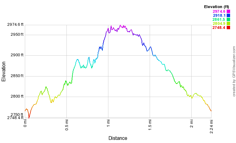
Click here to download a track of this hike. 

Details

Most drive-up or easily accessible waterfalls in Georgia, such as Toccoa Falls, Anna Ruby Falls, and Amicalola Falls, have become "tourist traps" that are always crowded and have certain limitations, such as paid access, paved trails views from observation decks, etc. Fortunately, for now, Mud Creek Falls - while as easy to get to as any waterfall on the list - has escaped from becoming a tourist trap. Even though you're typically not likely to find Mud Creek Falls to yourself, the hoards of people that typically occupy the viewing areas of easily accessible waterfalls are absent here. In addition, as of this writing, access has graciously remained free. 

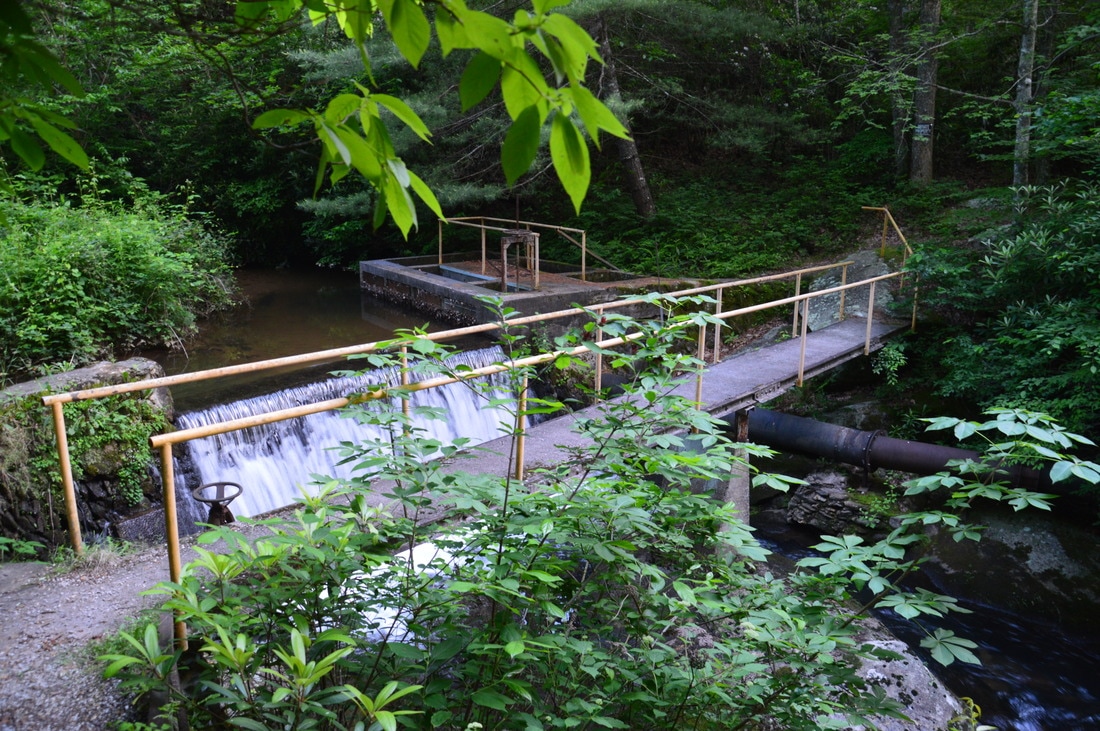
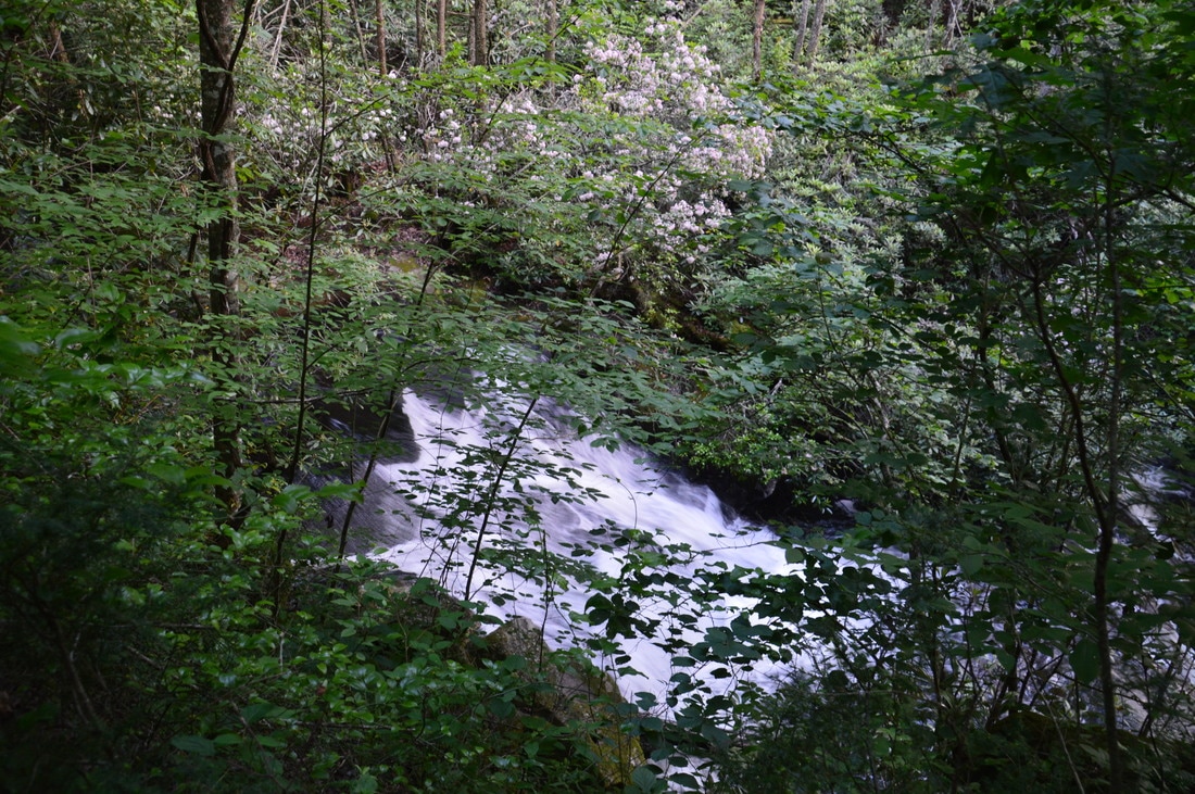
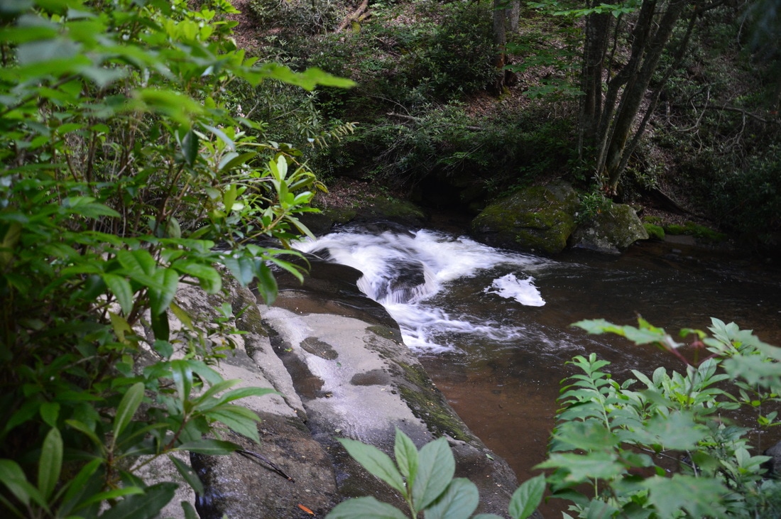
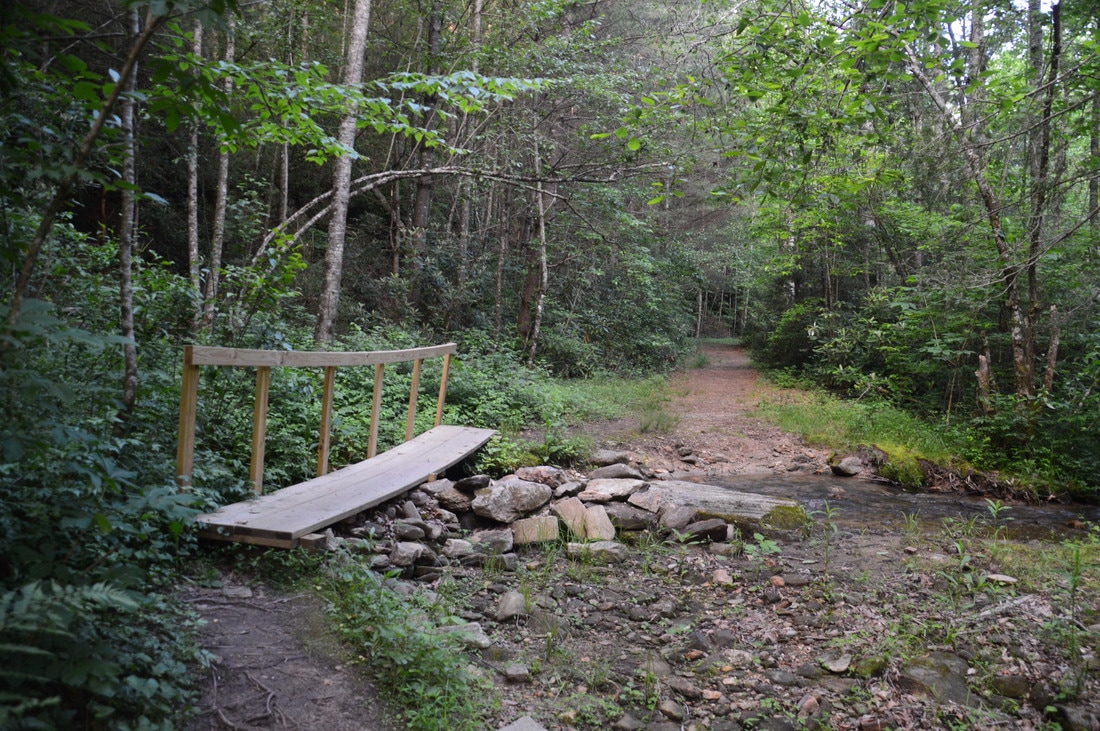
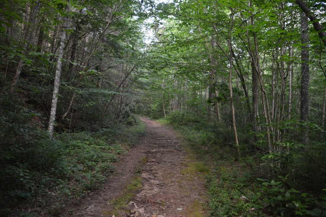
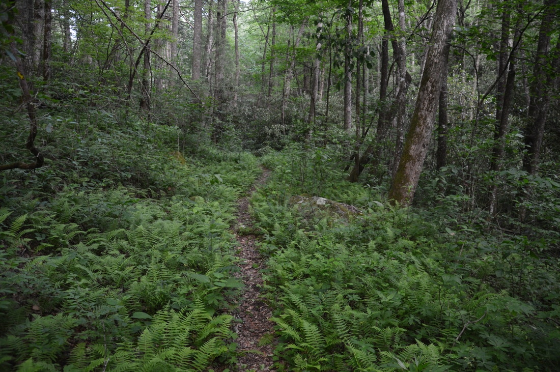
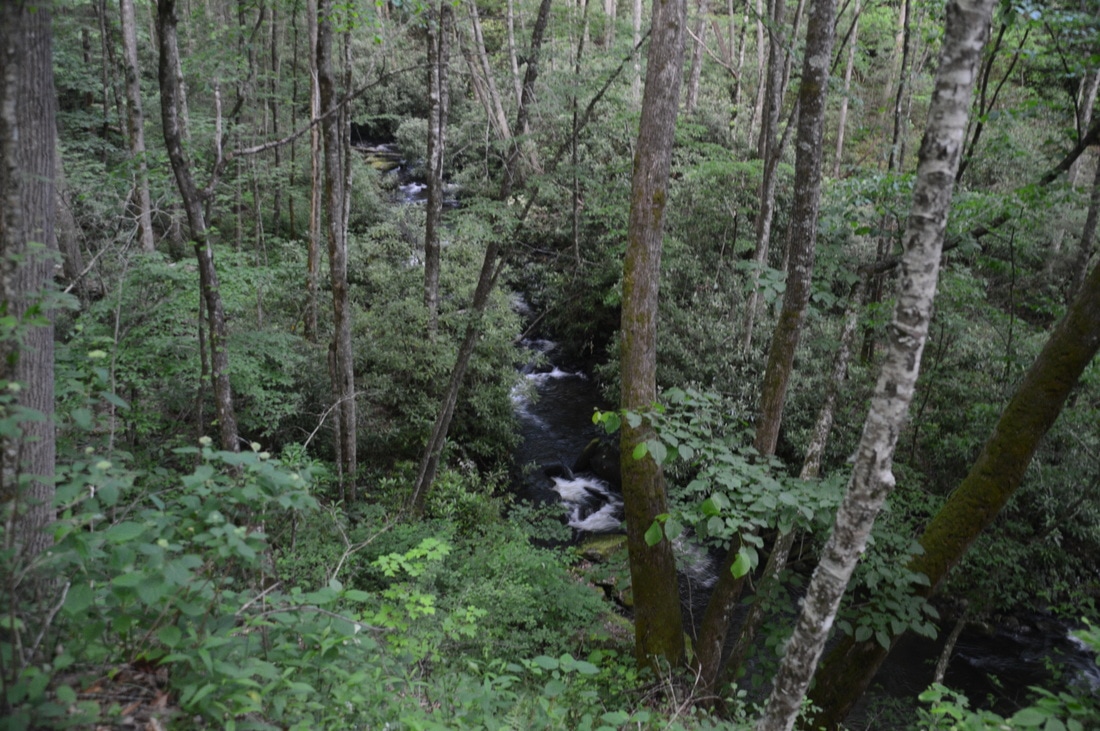
Begin the hike by following the dirt road down from pullout off Highway 246. In 100 feet, there is a turnaround and parking area that may or may not be open to vehicles. The main trail continues ahead on the narrowing road, but first, turn right onto a path that leads to an interesting dam structure on Mud Creek at 0.05 miles. Don't cross the bridge, as the other side of the creek is private property. After viewing the dam, return to the main trail and continue following the dirt road. At 0.15 miles, the road narrows and becomes a lot more-trail like. Laying on the ground here beside a cable was a "Tow Away Zone" sign. The trail initially remains well above Mud Creek, but swift cascades in the gorge below produce quite a noise after heavy rain. At 0.3 miles, a narrow side trail bears right down a set of stone steps. This side trail is well worth taking, as it leads to a large photogenic cascade flanked by mountain laurel on Mud Creek in 150 feet. After viewing the cascade, again return to the main trail and continue following it. The trail now follows Mud Creek more closely, passing several noteworthy slides and cascades. The main trail ascends very gradually on a well-graded trail. At 0.5 miles, the trail crosses a Mud Creek tributary via a footbridge. Shortly afterwards, you will see several houses through the trees to the right across the creek. 
Picture
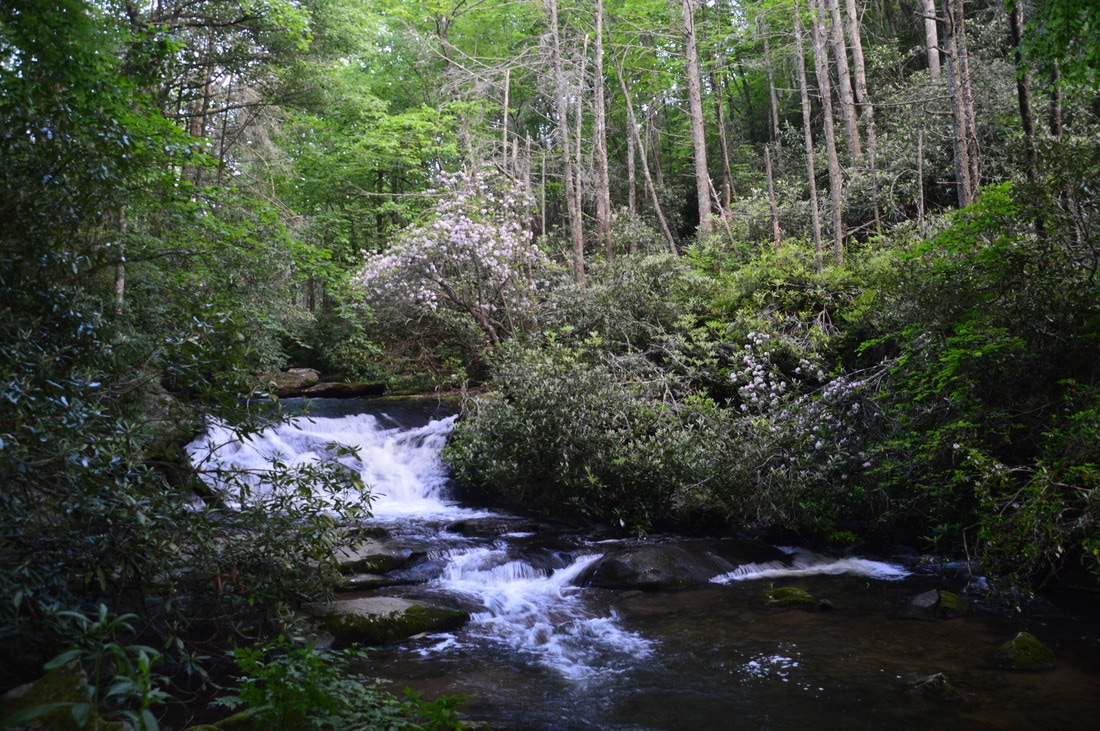
Beside Mud Creek Falls itself, Mud Creek has many beautiful slides and cascades that are easily viewed from the Mud Creek Trail or its side trails.
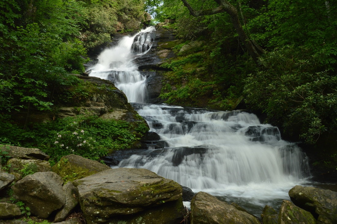
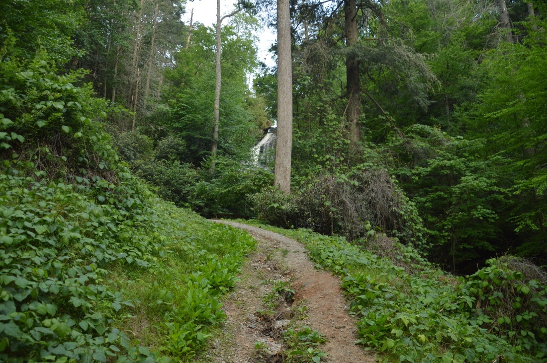
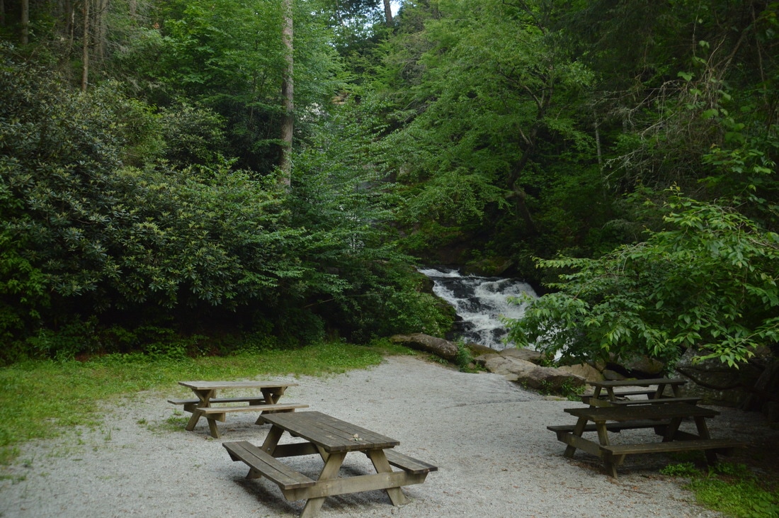
At 0.8 miles, an alternate trail bears right, descends down stone steps, and continues as a narrow path along Mud Creek. I suggest taking this more primitive trail on the way in and returning along the main trail. The alternate trail provides closer views of Mud Creek and the vegetation that surrounds the stream. At 0.9 miles, bear left at a Y-split in the path to return to the main trail, which is still following a broad forest road. Finally, the trail enters a clearing as Mud Creek Falls comes into view through the trees ahead. At 1.2 miles, the Mud Creek Trail ends at a picnic area at Mud Creek Falls. To the left, just barely in sight is the parking area off Tahoe Road for Mud Creek Falls. Walk down through the picnic area to the base of the breathtaking Mud Creek Falls. 

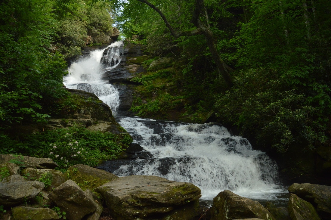
​Mud Creek Falls is a very steep 85-foot waterfall that is located just below the Sky Valley Golf Club, although you cannot see any hint of development above from the base. The upper one-third of the waterfall is a near free-fall, and the lower two-thirds consist of stairstep cascades. During high water, Mud Creek Falls becomes of the best waterfalls that I have seen in Georgia, as near the top of the falls, the powerful creek drops through a chute onto a large rock slab, where the water then bounces off in all directions like a natural fountain. This effect is what makes Mud Creek Falls so unique, although during low water, it is a lot less noticeable. Mud Creek Falls is best to see in the spring when fresh spring greenery surrounds the falls and the neighboring mountain laurel is blooming, although Mud Creek is a fairly large creek, so this waterfall is an excellent choice during all seasons.

From Mud Creek Falls, simply retrace your steps back to the trailhead along the Mud Creek Trail, avoiding the alternate trail and side trails on the way back. You will return to the car and conclude the hike at 2.2 miles. 
Picture
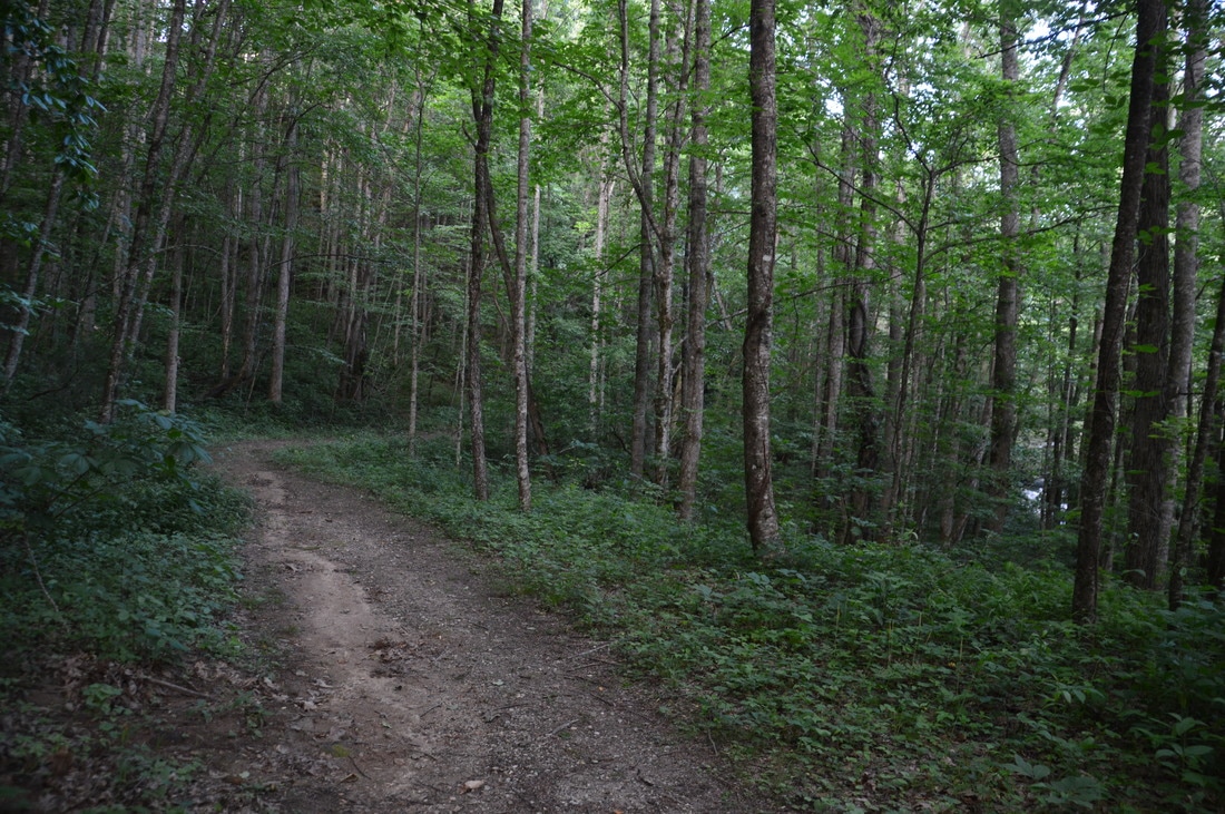
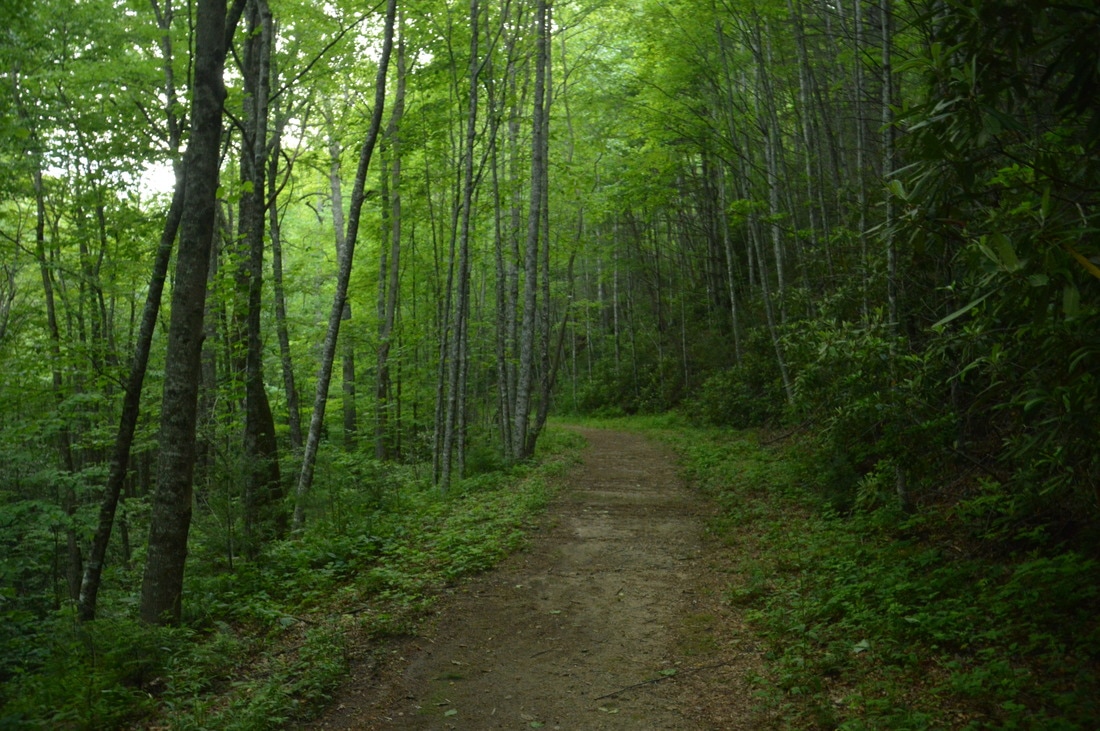
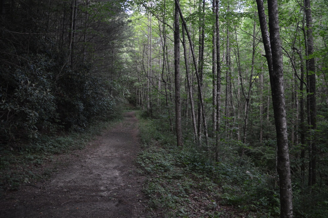
Most of the Mud Creek Trail follows a broad forest road that parallels Mud Creek.

Mileage

0.0 - Mud Creek Trailhead
0.05 - Dam Structure
0.3 - Large Cascade
0.8-0.9 - Alternate Trail 
1.2 - Mud Creek Falls 
2.2 - Mud Creek Trailhead

Variations

You can drive up to Mud Creek Falls via Tahoe Road in Sky Valley, if you're not feeling like hiking the full trail.

Bonus Stops

Also in Sky Valley are two other hikes that can done before or after the Mud Creek hike. The hike to Rabun Bald from Beegum Gap is one of the more popular hikes in Rabun County, but it is well worth it, as the observation tower at the top provides 360-degree views. A lesser-known hike in Sky Valley is to the breathtaking panoramas from cliffs on Flint Knob and Flint Knob East. 

Pictures

Videos

1 Comment
Robin Michiele
9/12/2021 10:38:57 am

My boyfriend and I discovered this dam waterfall in 1972 and spent many weekends camping beside it. There was barely a place to pull off of the road. Nothing more than a deer trail. In around 1974 we hiked up the creek to find this fabulous 85 foot waterfall. Imagine our Horror when we reached the top and saw red dirt ... just red dirt...no more trees or forest...They had clear cut the woods and were building the lake. We had noticed that the water was a little murky; it wasn't as crystal clear as before because the sediment from the logging had drained into the water. I sank to my knees and sobbed. I was still a teenager and had experienced the massecre of my childhood forest as they cleared the land to build a four lane highway. Now my new found Paradise had been stripped bare. We never went back. We never saw anyone while we were there so for 2 years it was out special place. Fifty years ago it was still old forest. Those hills were a pristine paradise. And Sky Valley cut them down.

Reply


Leave a Reply.

    About Me

    Mark Oleg Ozboyd
    I'm an avid outdoor explorer and a hobbyist landscape photographer. I'm 21 years old and have been hiking since 2011. Originally based out of Atlanta, Georgia, I started out by occasionally hiking short trails throughout well-known Georgia State Parks. During 2012 and 2013, I began to expand my trips into adjacent states, as well as into the wilder National Forest areas rather than just State Parks. Throughout the years that followed, as I slowly ran out of popular hiking trails in my area, I began to search for and hike in more seldom-visited areas. Today, you can find me out in the woods every weekend, whether it's on an official trail or bushwhacking through cross-country terrain without any paths. I now attend Washington & Lee University and am exploring Virginia and West Virginia. My other hobbies include chess, science, old music, and meteorology. I have 3 years of amateur weather forecasting experience, having studied a lot of meteorology basics over the years. I am also a student at European School of Music where I learned that music and nature have a lot in common. Listening to good music inspires me to capture nature's beauty on the camera in different aspects that also make me recall many beautiful music pieces that I've heard.​


    Dear readers: I have invested a tremendous amount of time and effort in this website and the Georgia Waterfalls Database the past five years. All of the work that has gone in keeping these websites updated with my latest trip reports has almost been like a full-time job. This has not allowed me to pick up a paid job to save up money for college, and therefore, I I've had to take out loans. If you find the information on this website interesting, helpful, or time-saving, you can say "thanks" and help me out by clicking the button above and making a contribution. I will be very grateful for any amount of support you give, as all of it will apply toward my college tuition. Thank you! 

    Enter your email address to subscribe for trail reports:

    Delivered by FeedBurner


    Picture
    Coming in 2022-2023?

    Other Hiking Websites

    DWHike's Adventures
    Florida's Natural Wonders
    Florida Trailblazer
    Meanderthals
    Mountain Images
    by Bernie Boyer

    North Carolina Waterfalls with
    ​Kevin Adams
    Take-a-Hike!
    Tennessee Landforms
    Waterfall Page
    Waterfall Adventurer
    Zach's Mild Adventures

    Miles Hiked

    Year 1: 540.0 Miles
    Year 2: 552.3 Miles
    ​Year 3: 518.4 Miles
    Year 4: 482.4 Miles
    Year 5: 259.9 Miles

    Archives

    March 2021
    February 2021
    January 2021
    November 2019
    October 2019
    September 2019
    August 2019
    July 2019
    June 2019
    February 2019
    January 2019
    December 2018
    November 2018
    October 2018
    August 2018
    July 2018
    June 2018
    May 2018
    April 2018
    March 2018
    February 2018
    January 2018
    December 2017
    November 2017
    October 2017
    September 2017
    August 2017
    July 2017
    June 2017
    May 2017
    April 2017
    March 2017
    February 2017
    January 2017
    December 2016
    November 2016
    October 2016
    September 2016
    August 2016
    June 2016
    May 2016
    April 2016
    March 2016
    January 2016
    December 2015
    November 2015
    October 2015
    September 2015
    August 2015
    July 2015
    June 2015
    May 2015
    April 2015
    March 2015
    February 2015
    January 2015
    December 2014
    November 2014
    October 2014
    September 2014
    August 2014
    July 2014
    June 2014
    May 2014
    April 2014
    March 2014
    February 2014

    Categories

    All
    Adel
    Adirondack Park
    Alabama
    Alfred A. Ring Park
    Allegheny Trail
    Amicalola Falls State Park
    Anniston Area
    Apalachicola Bluffs And Ravines Preserve
    Apalachicola National Forest
    Apalachicola/Port St. Joe Area
    Apopka
    Appalachian Trail
    Appling
    Art Loeb Trail
    Aska Trail System
    Bakersville
    Balm-Boyette Scrub Preserve
    Balsam Lake Recreation Area
    Bankhead National Forest
    Bartow County Parks
    Bartram Trail
    Basinger
    Beersheba Springs
    Benton
    Benton Mackaye Trail
    Berry College Trail System
    Best Hike
    Big South Fork National Recreation Area
    Black Bear Wilderness
    Black Rock Mountain State Park
    Blairsville
    Blakely
    Blood Mountain Wilderness
    Blowing Rock
    Blue Ridge
    Blue Ridge Parkway
    Boone
    Bradenton
    Bradenton Beach
    Brasstown Bald
    Brasstown Wilderness
    Brevard
    Bryson City
    Buchanan
    Bucks Pocket State Park
    Bulow Creek State Park
    Bulow Plantation Ruins State Park
    Caesars Head State Park
    Caladesi Island State Park
    Calhoun
    Camel's Hump State Park
    Cashiers
    Caspersen Beach Park
    Catfish Creek State Park
    Caves
    CC Putnam State Forest
    Cedar Point Environmental Park
    Chatsworth
    Chattahoochee National Forest
    Chattanooga
    Chattanooga Valley
    Chattooga National Wild And Scenic River
    Cheaha Wilderness
    Cherohala Skyway
    Cherokee
    Cherokee National Forest
    Chiefland Area
    Chillhowee Recreation Area
    Chipley
    Chunky Gal Trail
    Circle B Bar Reserve
    Citico Creek Wilderness
    Citrus Wildlife Management Area
    Clarkesville
    Clayton
    Cleevland
    Cleveland
    Cloudland Canyon State Park
    Cohutta Wilderness
    Collier-Seminole State Park
    Cordele
    Cornelia
    Covington
    Crestview Area
    Crew-land-and-water-trust
    Cullowhee
    Cumberland Trail
    Dahlonega
    Dalton
    Dawson Forest Wildlife Management Area
    Dawsonville
    Dayton
    De Soto National Memorial
    DeSoto State Park
    Dillard
    Double Springs
    Ducktown
    Duncan Ridge Trail
    Dunlap
    Eagle's Rest Park
    Eastpoint
    Econfina Creek Wildife Management Area
    Eglin Air Force Base
    Elizabethton
    Elkins
    Elk Knob Game Lands
    Elk Park
    Ellicott Rock Wilderness
    Ellijay
    Emerson Point Preserve
    Englewood Area
    Enota Retreat
    Erwin
    Falling Waters State Park
    Fayetteville
    Fires Creek Recreation Area
    Fire Tower
    Flint River
    Florence Area
    Florida
    Florida Caverns State Park
    Florida Trail
    Foothills Trail
    Fort Mountain State Park
    Fort Myers Area
    Fort Payne
    Fort Payne Area
    Fort Yargo State Park
    Franklin
    Franklin Delano Roosevelt State Park
    Franklin-Marion State Forest
    Frozen Head State Park
    Gainesville
    Gainesville Area
    Gatlinburg
    George Washington National Forest
    Georgia
    Georgia Veterans Memorial State Park
    Glasgow
    Gorges State Park
    Grandfather Mountain State Park
    Great Smoky Mountains National Park
    Greeneville
    Green River Game Lands
    Gruetli-Laager
    Grundy Forest State Natural Area
    GTM Reserve
    Guana River Wildlife Management Area
    Hayesville
    Helen
    Hiawassee
    High Falls State Park
    Highlands
    Highlands Scenic Highway
    Hillsborough River State Park
    Hinson Conservation & Recreation Area
    Historic Sites
    Honeymoon Island State Park
    Hot Springs
    Huntington
    Inverness Area
    Jackson
    Jasper
    Jefferson National Forest
    Joan M. Durante Park
    Jonathan Dickinson State Park
    Jones Gap State Park
    Joyce Kilmer Slickrock Wilderness
    Joyce Kilmer - Slickrock Wilderness
    Juniper Prairie Wilderness
    Kelly Park
    Keown Falls Recreation Area
    Kolomoki Mounds State Park
    LaFayette
    Lake City Area
    Lake George Wild Forest
    Lake June-in-Winter State Park
    Lakeland Area
    Lake Placid
    Lake Russell Wildlife Management Area
    Lake Wales Ridge State Forest
    Laurel Fork North Wilderness
    Leffis Key Preserve
    Leon Sinks Geological Area
    Lexington
    Lineville
    Linville
    Linville Gorge Wilderness
    Lithia Springs
    Little Frog Wilderness
    Little Manatee River State Park
    Little River Canyon National Preserve
    Longboat Key
    Long Trail
    Lookout Mountain
    Lookout Mountain Battlefield
    Lovingston
    Lula Lake Land Trust
    Lumpkin
    Maggie Valley
    Manatee Springs State Park
    Marianna Area
    Mark Trail Wilderness
    Marlinton
    Mccaysville
    McMinville
    Mentone
    Middlesex
    Mistletoe State Park
    Monongahela National Forest
    Montreat
    Mountain Bridge Wilderness Area
    Mountain City
    Mountains To Sea Trail
    Mountains-to-Sea Trail
    Mount Rogers National Recreation Area
    Myakka River State Park
    Myron B. Hodge City Park
    Nantahala National Forest
    Naples
    Naples Area
    Natural Bridge State Park
    Neal Preserve
    New Castle
    Newport
    New River Gorge National Park
    New York
    North Carolina
    Ocala Area
    Ocala National Forest
    Ocean-to-Lake Trail
    Oconee State Park
    Oconee Station Historic Site
    Okaloacoochee Slough State Forest
    Oldsmar
    Oneida
    Orlando Area
    Ormond Beach
    Oscar Scherer State Park
    Oxford
    Palatka
    Palmetto Trail
    Panama City Area
    Panthertown Valley
    Parrish
    Paynes Creek Historic State Park
    Peaks Of Otter Recreation Area
    Pigeon Crockford Mountain Wildlife Management Area
    Pigeon-Crockford Mountain Wildlife Management Area
    Pigeon-Crockford Wildlife Management Area
    Pine Mountain
    Pinhoti Trail
    Pinnacle Park
    Pisgah Civitan Park
    Pisgah National Forest
    Pittman Center
    Pond Mountain Wilderness
    Ponds/Lakes
    Prentice Cooper State Forest
    Providence Canyon State Park
    Pumpkintown
    Quick Point Nature Preserve
    Raven Cliffs Wilderness
    Reed Bingham State Park
    Reliance
    Rice Creek Conservation Area
    Riverview Pointe Preserve
    Robbinsville
    Robinson Preserve
    Rock Creek Gorge Scenic Area
    Rock Island State Park
    Rome
    Rosman
    Sale Creek
    Salem
    Salt Springs
    Saluda
    Santa Rosa Beach
    Sarasota
    Sarasota Area
    Savage Gulf State Natural Area
    Scenic Views
    Scottsboro Area
    Sebring Area
    Sewanee
    Sheltowee Trace Trail
    Shining Rock Wilderness
    Signal Mountain
    Sipsey Wilderness
    Sky Valley
    Smithgall Woods State Park
    Snowbird Backcountry Area
    Soddy Daisy
    Soddy-Daisy
    Sopchoppy
    South Carolina
    South Cumberland State Park
    Southeastern Cave Conservancy
    Southern Nantahala Wilderness
    Sparta
    Sprewell Bluff Park
    Spring City
    Spring Hill
    Springs
    Spruce Pine
    Standing Indian Backcountry Area
    St. Augustine
    St. George Island State Park
    St. Joseph Bay State Buffer Preserve
    St. Marks Area
    St. Marks National Wildlife Refuge
    Stone Mountain
    Stone Mountain Park
    Suches
    Sumatra
    Sumter National Forest
    Suwannee River
    Swallow Creek Wildlife Management Area
    Sweetwater Creek State Park
    Sylva
    Talladega National Forest
    Tallahassee Area
    Tallulah Falls
    Tallulah Gorge State Park
    Tampa Bay Area
    Tate City
    Tate's Hell State Forest
    Tea Creek Wildlife Management Area
    Tellico Plains
    Tennessee
    Thomaston
    Toccoa
    Topsail Hill State Park
    Torreya State Park
    Townsend
    Tracy City
    Tray Mountain Wilderness
    Trenton
    Triple Creek Preserve
    Troutdale
    Unaka Mountain Wilderness
    Upper Tampa Bay County Park
    Venice
    Vermont
    Virgin Falls State Natural Area
    Virginia
    Virginia Outdoors Foundation
    Vogel State Park
    Wakulla Springs State Park
    Waleska
    Walhalla
    Wartburg
    Water Features
    Waynesville
    Weedon Island Preserve
    Weeki Wachee Preserve
    Wekiwa Springs State Park
    West Palm Beach Area
    West Virginia
    Whitehall
    White Springs
    Winder
    Withlacoochee State Forest
    Young Harris

    RSS Feed

TRAIL REPORTS

Hikes in Alabama
​Hikes in Florida
Hikes in Georgia
Hikes in North Carolina
Hikes in South Carolina
Hikes in Tennessee
Hikes in Virginia

Hiking Resources

Alabama Resources
​
Florida Resources
Georgia Resources
North Carolina Resources
​South Carolina Resources
​
Tennessee Resources

Other

Contact
Map of Hikes
Alphabetical List of Hikes
Southeast Nature Society
© COPYRIGHT 2014-2018
​ALL RIGHTS RESERVED.
Important: I disclaim any responsibility for any damage or personal injury that may occur as a result of the activities and information found on this website. All outdoor activities, especially off-trail hiking, are done at your own risk. Never hike or head into that area that may be above your fitness or experience level.
  • Home
  • Trail Reports
    • Best Hikes
    • Hikes with Scenic Views
    • Hikes with Water Features
    • Alabama
    • Georgia
    • Florida
    • North Carolina
    • South Carolina
    • Tennessee
    • Vermont
    • Virginia
  • Map
  • Hike List
  • Testimonials
  • Resources
  • Contact Us
  • Southeast Nature Society
    • Our Team
  • Georgia Waterfalls Database