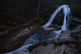
The Roaring Run gorge in Virginia's Blue Ridge sports numerous scenic slides and cascades, on top of a spectacular 35-foot Roaring Run Falls. Several short nature trails provide easy access to this pristine location. The area also has an interesting iron ore mining history, which can be observed today in the form of the Roaring Run Furnace, an iconic sight along this short loop hike in the vicinity of Roaring Run. This hike occurred on Saturday, November 26th, 2016. My plan was to hike the Roaring Run Falls Loop clockwise, by first following the Streamside Trail and then returning along the Woodland Trail, after hiking the side trail to Roaring Run Falls. This hike was the sixth of seven hikes that I did during a four-day Thanksgiving trip to the mountains of western Virginia.
0 Comments
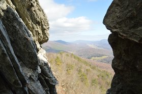
Virginia's "Triple Crown" hike involves a strenuous overnight backpack to three of the area's most famed vistas: McAfee Knob, Dragons Tooth, and Tinker Cliffs. All of these vistas are known for their sweeping long-range panoramas. While getting to all three of these overlooks in one hike requires serious stamina and overnight gear, hiking to any one of the three involves just a simple day hike. Out of the three, Dragons Tooth - as well as the hike to it - might be the most unusual. Dragons Tooth is a unique rock formation that towers like a spire at the southwest end of Cove Mountain. Those who are brave and skilled enough to climb to the top will be awarded with a stunning panorama that encompasses much of Catawba Valley. The hike to Dragons Tooth is no picnic either; this short stretch of the AT - dubbed as the most rugged stretch of the long-distance footpath south of Maine - involves a tricky and time-consuming rock scramble. This hike occurred on Saturday, November 26th, 2016. My plan was to hike the Dragons Tooth Trail to Lost Spectacles Gap, from where I would hike to Dragons Tooth out and back along the Appalachian Trail. After that, I would loop my return route by following the AT northeast to the Boy Scout Trail, concluding the hike along the Boy Scout Trail. This hike was the fifth of seven hikes that I did during a four-day Thanksgiving trip to the mountains of western Virginia.
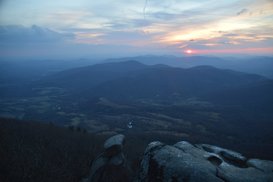
The Peaks of Otter - Sharp Top, Flat Top, and Harkening Hill - are three distinct mountains in the vicinity of the Blue Ridge Parkway. Several centuries ago, it was believed by Thomas Jefferson that the Peaks of Otter - along with the Blue Ridge Mountains in general - are the tallest peaks in the United States, but of course, this was later proved wrong, although not before stones were sampled from the Peaks of Otter and sent to be part of the Washington Monument. Hiking trails lead to each of the three peaks, and two of the three peaks provide excellent views. In fact, the rocky pinnacle at the summit of Sharp Top Mountain provides a 360-degree panorama that overlooks the Virginia Piedmont and the Blue Ridge Mountains that are scattered through the area. This hike occurred on Friday, November 25th, 2016. My plan was to hike the Sharp Top Mountain Trail out and back from Abbot Lake. I would make the short side trip to Buzzards Roost - a separate rock formation and viewpoint - along the way. This hike was the fourth of seven hikes that I did during a four-day Thanksgiving trip to the mountains of western Virginia.
Jefferson National Forest: Apple Orchard Falls Trail and Cornelius Creek Trail, Buchanan, Virginia1/24/2017 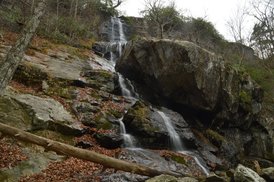
Virginia is known for its mountain vistas much more than for its streams and waterfalls. Interestingly, much of the terrain in the mountains of Virginia is not very supportive for large waterfalls, so when your Virginia hike takes you to a waterfall that is around two hundred feet high, it can be considered something special for sure. This hike visits Apple Orchard Falls. At 200 feet high, this waterfall is one of the highest in Virginia. Furthermore, the popular loop along North Creek, Apple Orchard Branch, and Cornelius Creek is one of the most beautiful stream hikes in George Washington and Jefferson National Forest and perhaps in all of Virginia. This hike occurred on Friday, November 25th, 2016. My plan was to hike the Apple Orchard Falls/Cornelius Creek Loop clockwise, by first following the Apple Orchard Falls Trail to and past Apple Orchard Falls. Then, I would hike the Cornelius Creek Spur Trail to the Cornelius Creek Trail, finishing the loop by taking the Cornelius Creek Trail back to the trailhead. This hike was the third of seven hikes that I did during a four-day Thanksgiving trip to the mountains of western Virginia.
Appalachian Trail: The Scales to Pine Mountain & Grayson Highlands State Park, Troutdale, Virginia4/22/2014 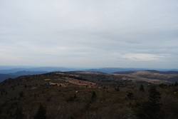 The Highlands of Virginia have a unique environment, and some of the best hiking in the Southeast. Apart from a few places in North Carolina's Pisgah National Forest, I don't know of any other places like the Mount Rogers National Recreation Area in Virginia. While Mount Rogers itself is not the most interesting mountain, the Grayson Highlands, Wilburn Ridge, and Pine Mountain - all that sits off the flank of Mount Rogers - provide incredible long-range views. This hike occurred on Saturday, April 19, 2014. My plan was to take the Appalachian Trail northbound from The Scales to The Pine Mountain Trail. From there, I planned hiking the Pine Mountain Trail to a point on the Appalachian Trail south of the original starting point, and follow the AT northbound to The Scales. I got to a late start in the late afternoon, due to the distance of the trail from my house, but I still thought I would finish it off shortly after dark. Not so fast, my friend. |
About MeMark Oleg Ozboyd Dear readers: I have invested a tremendous amount of time and effort in this website and the Georgia Waterfalls Database the past five years. All of the work that has gone in keeping these websites updated with my latest trip reports has almost been like a full-time job. This has not allowed me to pick up a paid job to save up money for college, and therefore, I I've had to take out loans. If you find the information on this website interesting, helpful, or time-saving, you can say "thanks" and help me out by clicking the button above and making a contribution. I will be very grateful for any amount of support you give, as all of it will apply toward my college tuition. Thank you!
Coming in 2022-2023?
Other Hiking WebsitesMiles HikedYear 1: 540.0 Miles
Year 2: 552.3 Miles Year 3: 518.4 Miles Year 4: 482.4 Miles Year 5: 259.9 Miles Archives
March 2021
Categories
All
|

 RSS Feed