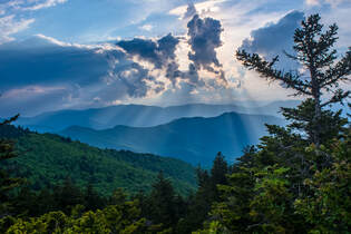
The Shining Rock Wilderness is Southwest North Carolina's high country - an area crowned by numerous 6000-foot peaks with stunning mountain views. Deep in the Little East Fork Pigeon River valley is the Daniel Boone Scout Camp, a convenient entry point to the Shining Rock Wilderness near its northern end. Two trails, Little East Fork Trail and Art Loeb Trail, leave the camp and make for a long, scenic loop visiting a number of the wilderness's highlights in its north sector. Climbing steeply out of the valley, the Art Loeb Trail's first stop is Deep Gap, where a 1.5-mile side trail leads to several panoramic overlooks atop Cold Mountain. The Art Loeb then embarks on an exciting journey through The Narrows, where a series of ups and downs along a knife-edge ridge take you past two great views and numerous rock outcrops. After a gradual climb up Stairs Mountain through gorgeous mossy spruce-fir forest, the Art Loeb approaches the wilderness's center point: Shining Rock. Featuring its own panoramic views, Shining Rock is a huge outcropping of brilliant white quartz amidst a sea of evergreen. Backpackers will find Shining Rock to be a great sunset-viewing location. Your exit route from the wilderness is the Little East Fork Trail, which descends an old roadbed along the countless pleasant cascades of Little East Fork's scenic run. This hike occurred on Saturday, June 9th, 2018. My plan was to hike the Scout Camp Loop clockwise, first hiking the Art Loeb Trail and then Little East Fork Trail. Along the way, I took side trips to Cold Mountain and Shining Rock.
2 Comments
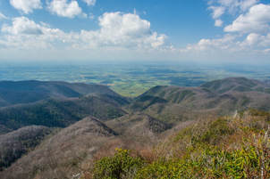
The scenic crest of the Bald Mountains that straddles the Tennessee/North Carolina border south of Greeneville, TN, features a set of spectacular vistas in the vicinity of the Appalachian Trail. The views actually begin even before you leave your car as you arrive at the beautiful Jones Meadow with a panoramic vista of Camp Creek Bald and Blackstack Cliffs. Two excellent vistas are accessed by a very short, easy walk from the parking area: Whiterock Cliff facing south into North Carolina and Blackstack Cliffs facing north into Tennessee. The Appalachian Trail then continues onto a new section, which scrambles along the knife-edge ridge-crest for over a mile across Big Firescald Knob, affording several outstanding 360-degree panoramic vistas. On your return trip, you may choose to follow the alternate bad-weather AT route, a little-used pathway on the north flanks of Big Firescald Knob that adds variety to the hike. This hike occurred on Friday, April 27th, 2018. My plan was to hike the Appalachian Trail from Jones Meadow over Big Firescald Knob, taking side trails to Whiterock Cliff and Blackstack Cliffs along the way. Rather than retracing my steps along the Big Firescald Knob ridge-crest, I would return along the AT bad-weather bypass. This hike was the third of six hikes that I did during a four-day trip to the mountains of northeast Tennessee and northwest North Carolina.
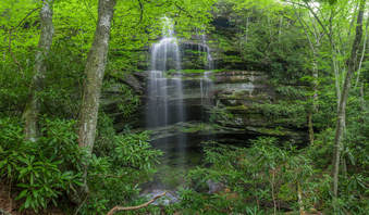
Just off NC 281 is a lesser-known entrance to the backcountry of Panthertown Valley: the West Fork Way trailhead. The unofficial West Fork Way ascends through the West Fork French Broad River watershed for several miles, passing the extremely steep access trail to three spectacular waterfalls: Rhapsodie Falls, Dismal Falls, and Lower Dismal Falls. West Fork Way then connects to another unofficial trail on the fringes of Panthertown Valley called the Shelton-Pisgah Trail, which follows a seldom-hiked pathway along the ridge of Shelton-Pisgah Mountain to Cold Mountain. A cliff on the west side of Cold Mountain, nicknamed the High Bethel View features an outstanding vista of Panthertown Valley spread out to the west - arguably the best of the valley's five views. This hike occurred on Saturday, May 12th, 2018. My plan was to hike West Fork Way and Shelton-Pisgah Trail out and back to Cold Mountain. Along the way, I would take the side trails to Rhapsodie Falls, Dismal Falls, and Lower Dismal Falls. I would also stop by two other small falls - Aunt Sally's Falls and Lower Rhapsodie Falls.
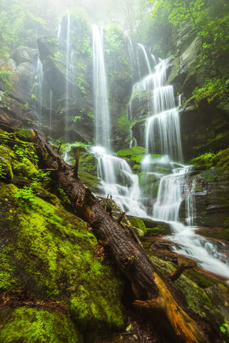 A 50-foot waterfall that spouts water from all sides of a jagged sheer cliff, accessible by a steep and tricky yet short path from the Blue Ridge Parkway: that's the matching description for English Falls. Located in Northwest North Carolina not far from the quaint town of Spruce Pine, English Falls possesses charm of a level that few other of the state's waterfalls seem to reach. The setting of the waterfall is magical, due to the lush greenery that peppers the cliffs and boulders at and around the falls. A small drawback of English Falls is that it is on a small unnamed stream, so the flow can be low during parts of the year. Nevertheless, visiting English Falls at the right time will yield one of the most unusual and photogenic waterfalls that you'll ever see. This hike occurred on Tuesday, July 11th, 2017, and a revisit occurred on Wednesday, June 17th, 2020. My plan was to hike out and back to English Falls via the access path from the Blue Ridge Parkway. In 2017, this hike was the tenth and final of ten hikes that I did during a seven-day trip to the mountains of northwest North Carolina. Update 6/23/20: I have finally revisited English Falls almost three years later. The trail has changed in several ways. English Falls has seen an explosion in visitation over the last few years so the trail is now very trampled down and eroded. As a result, the hike has actually become more difficult. The slope is very slick with few footholds or handholds. Agility and experience with ropes are a must to complete this scramble safely. The trip report has been revised with the most recent directions plus information about Upper English Falls. UPDATE JULY 2023: ROADSIDE PARKING IS NOW PROHIBITED ALL ALONG THE BLUE RIDGE PARKWAY NEAR ENGLISH FALLS. ILLEGALLY-PARKED VEHICLES WILL BE TICKETED. The nearest authorized parking area is over a mile away. The status of the scramble path itself is unclear. Most of the path lies on National Park Service land. It is widely rumored to be closed but no official word has been obtained from the NPS. 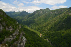
The Linville Gorge Wilderness of Pisgah National Forest, North Carolina's third largest wilderness area, encompasses an area that is one of the most rugged areas in the Southeast: Linville Gorge. Flowing along the bottom of the gorge is the boulder-strewn Linville River, located as much as over 1500 feet below the gorge's rims at its deepest spots. The Linville Gorge Trail runs through nearly the entire length of the gorge, passing countless obstacles as it follows the steep banks of the Linville River for miles. An array of trails and roads runs along the rims of the gorge, and a number of extremely steep paths provide access to the gorge floor, allowing one to hike loops of varying length encompassing both the gorge floor and rim. One of those loops is the Rock Jock Loop: a spectacular yet grueling hike that passes at least six particularly breathtaking vistas and many other smaller views as well as numerous cataracts on the Linville River and one tall waterfall on its tributary. While it is possible to hike the Rock Jock Loop in one day like I did, it will be very tiring, and in order to get the most enjoyable and relaxing experience, turning the Rock Jock Loop into a weekend backpacking trip could be a good idea. This hike occurred on Saturday, July 8th, 2017. My plan was to hike the Rock Jock Loop/Linville Gorge Loop counter-clockwise from the Conley Cove Trailhead. This hike was the seventh of ten hikes that I did during a seven-day trip to the mountains of northwest North Carolina.
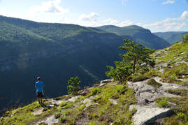
If I had to name the ten best hikes that I have ever done, the hike along the east rim of Linville Gorge to Table Rock and the North Carolina Wall would make the list without question. This section of the Mountains-to-Sea Trail provides access to several jaw-dropping vistas of Linville Gorge as well as its surroundings. North of the Table Rock Picnic Area is the summit of Table Rock, whose lofty peak is surrounded by cliffs hundreds of feet high and whose elongated rocky summit is home to a series of grand vistas that encompass a 360-degree view. Meanwhile, to the south, the MST first passes through a place called The Chimneys, a series of wild and jagged rock outcrops of all shapes and sizes, where the knife-edge ridge with 360-degree views forms a boundary between the rolling hills of the North Carolina Piedmont and the ruggedness of Linville Gorge. Then, if all of that wasn't enough, a pair of side trails lead to the North Carolina Wall. Rising hundreds of feet high, the North Carolina Wall is an incredible line of cliffs with continuous views over a half-mile long along the east rim of the gorge. This hike occurred on Friday, July 7th, 2017. My plan was to hike the Mountains-to-Sea Trail and Table Rock Trail from the Table Rock Picnic Area to the summit of Table Rock. On my way back, I would take a side trail to an area of cliffs known as the Devil's Cellar. Then, I would follow the Mountains-to-Sea Trail in the other direction to and through The Chimneys, before taking a side trail down to an area on the rim of the gorge known as The Amphitheater. Finally, I would follow another faint trail along the top of the NC Wall back to the MST, before retracing my steps back to the picnic area. This hike was the sixth of ten hikes that I did during a seven-day trip to the mountains of northwest North Carolina.
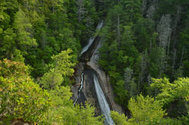
The Wilson Creek watershed in the Grandfather Ranger District of Pisgah National Forest is well-known for its numerous hiking trails and backpacking opportunities. One of the largest tributaries of Wilson Creek is Harper Creek. Harper Creek and its tributaries are home to several spectacular waterfalls in the shadow of Grandfather Mountain. Particularly impressive is South Harper Creek Falls: a massive 120-foot double sliding waterfall that can be viewed from three distinct locations: the base, the midpoint, and the cliffs on the other side of Harper Creek. If you hike the Harper Creek Loop, you'll also pass triple-tier Harper Creek Falls - that isn't too shabby either - and have the option to take a lengthy side trail to Bard Falls on North Harper Creek. However, it is best to be prepared for overgrown trails and over a dozen wet crossings of Harper Creek if you do hike the full loop. This hike occurred on Thursday, July 6th, 2017. My plan was to hike the Harper Creek Loop counter-clockwise from Brown Mountain Beach Road, following the Harper Creek Trail and then the Raider Camp Trail. Along the way, I would take a side trip to Bard Falls along the North Harper Creek Trail, and I would also take short side trails to Harper Creek Falls and three different viewpoints for South Harper Creek Falls. This hike was the fourth of ten hikes that I did during a seven-day trip to the mountains of northwest North Carolina.
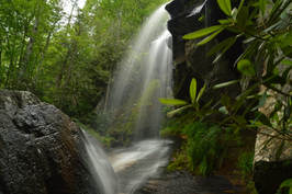
If you're looking for the perfect combination of beauty and ease of access to a waterfall in North Carolina, Elk River Falls has to be at the top of your list. A well-used relaxing trail leads along the banks of the mighty Elk River to the base of Elk River Falls, a tight sheer 50-foot drop into a huge plunge pool that is known for its swimming opportunities. Most folks who hike to Elk River Falls don't know that another excellent waterfall can be reached fairly easily from the same trailhead. 100-foot Jones Falls is on a small tributary of the Elk River and during the wetter months is a sight no less impressive than Elk River Falls. A signed spur trail from the Appalachian Trail facilitates access to this gorgeous spot. Hikers will be able to see both waterfalls with a hike of fewer than four miles. This hike occurred on Wednesday, July 5th, 2017. My plan was to hike out and back to Elk River Falls and then to follow a forest road and unofficial connector path to the Appalachian Trail, which I would use to reach Jones Falls. I would return the same way. This hike was the first of ten hikes that I did during a seven-day trip to the mountains of northwest North Carolina.
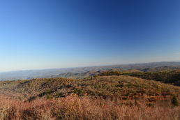 The Shining Rock Wilderness and adjacent areas is North Carolina's High Country. A multitude of peaks, some above 6000 feet, with astonishing views is accessed via rugged, wilderness pathways from the Blue Ridge Parkway. As you immerse into the backcountry of this wild region, you will also see many water features and scenic streams. My long, difficult hike in this area proved to be spectacular on one fall day when the fall colors were at peak level. This hike occurred on Saturday, October 17th, 2015. My plan was to follow the Mountains-to-Sea Trail from Looking Glass Rock Overlook to Black Balsam Road, with a stop along the way at Skinny Dip Falls and a short side trip to Second Falls in Graveyard Fields. From Black Balsam Road, I would follow the Art Loeb Trail over Black Balsam Mountain, Tennent Mountain, and to Ivestor Gap. From Ivestor Gap, I would take the Greasy Cove Trail to the Big East Fork, and finally, I would take the Big East Fork Trail back to Looking Glass Overlook. 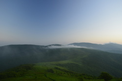
Deep in the mountains of northwestern North Carolina and northeastern Tennessee lie the Highlands of Roan. This widely-known name represents one of the most beautiful spots in the Southeast, and perhaps the entire Appalachian Mountains. This series of mountain balds lies on the route of the Appalachian Trail, and quite a scenic of a hike it is. Whether you're coming here for the spring wildflowers, the autumn foliage show, or after a winter snowstorm, you're not likely to be disappointed (except it may be a little too cold in winter). Although only the most seasoned hiker will be able to do this physically difficult and tiring trek in a single day, there are several variations that can split this hike into several, and then, there's always the backpacking option. This hike occurred on Saturday, June 13th, 2015. My plan was to hike the Appalachian Trail from Carvers Gap over Round Bald, Jane Bald, and Little Hump Mountain, finishing at Big Hump Mountain. I would return the same way. I would also take the spur trails to Grassy Ridge Bald and Overmountain Shelter.
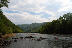 Hot Springs is a small, tourist town, with a lot of history and legends behind it. It used to be bigger, but following two consecutive hotel fires, the current resort there is much smaller, so there's not as many people as used to come. For hikers like us, though, the main point of Hot Spring is that the AT passes right through the town, and follows the Main Street sidewalk for a mile. On this hike, there will be multiple features of interest - Lovers Leap Overlook, Mill Ridge, and most importantly, Rich Mountain Fire Tower. This hike occurred on August 30, 2014. Start off by following a section of the Appalachian Trail from Silvermine Trailhead to Rich Mountain. You'll return by a much shorter, albeit steeper way down the Roundtop Ridge Trail back into Hot Springs.  The North Carolina High Country is a beautiful area. It is part of the Pisgah National Forest, and part of it is also classified as the Shining Rock Wilderness. The NC High Country is where the mountain tops are bald, black balsam trees/forests are abundant, and steep, rushing streams descend into the valleys below to form some of the bigger rivers in the area. The drainages on the south side eventually end up in the Mills River, whereas the drainages on the north side end up in the Pigeon River. Yellowstone Prong is one of the major tributaries of the Mills River on the south side. Just below the bald summit of Black Balsam Mountain, Yellowstone Prong begins its journey southward towards the Mills River, and on the way, it passes through an outlier: a somewhat swampy, lush mountain meadow known as Graveyard Fields. This hike occurred on Saturday, July 19th, 2014, My original plan was to start at the Graveyard Fields Overlook on the Blue Ridge Parkway, hike down into Graveyard Fields via the Graveyard Fields Loop on the west side, and then take the spur trail to Upper Falls out and back. From there, I would take the Graveyard Ridge Connector to the Graveyard Ridge Trail, and the Graveyard Ridge Trail west to the Mountains-to-Sea Trail. Next, I would take the M-t-S to Black Balsam Road, and then the Art Loeb Trail over the bald summits of Black Balsam Mountain and Tennent Mountain to Ivestor Gap. From here, I would return by taking the Graveyard Ridge Trail southward back to the M-t-S. However, to add variety, I would turn left onto the M-t-S at the junction, and then return via the M-t-S Connector to Graveyard Fields Loop. Finally, I would return via the paved path out of Graveyard Fields to the parking area at the overlook. Sounds good enough, eh? Well, what actually happened was a little different. I got to a false gap what I thought was Ivestor Gap, and when I couldn't find Graveyard Ridge Trail, I took the old logging road that went to the left and connected with Ivestor Gap Trail. I followed Ivestor Gap Trail to Black Balsam Road, and finished the hike with 3 miles of roadwalk. This description will follow the actual route of my hike. Blue Ridge Parkway: Sam Knob - Flat Laurel Creek - Chestnut Bald Loop Trail, Brevard, North Carolina5/13/2014 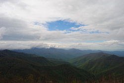 The Blue Ridge Parkway has some of the best hiking destinations in North Carolina, and this is only the second time I've been there (after Mount Pisgah three years ago). The Black Balsam/Sam Knob area is a small triangle between two wilderness areas and the Parkway. The views are grand from the whole hike, and many mountain tops are treeless. According to what I've heard, Sam Knob originally was only grass and rock, but it is being gradually covered up by brush and bushes. The views are incredible, nevertheless. This hike occurred on Saturday, May 10th, 2014. My plan was to take the Sam Knob trail from the Black Balsam Trailhead. At the junction with the Summit Trail, I planned taking the Summit Trail to the top of Sam Knob, and then go back down to the Sam Knob trail, and down to Flat Laurel Creek. After Flat Laurel Creek, I planned taking the Flat Laurel Creek Trail to the Little Sam Knob Trail, and from there, follow the Little Sam Knob Trail to the Mountains-to-Sea Trail. Finally, I planned finishing by taking the MtS to the Art Loeb Trail, and following the Art Loeb Trail to Black Balsam Road. The last part of the hike would be a road walk on Black Balsam Road. |
About MeMark Oleg Ozboyd Dear readers: I have invested a tremendous amount of time and effort in this website and the Georgia Waterfalls Database the past five years. All of the work that has gone in keeping these websites updated with my latest trip reports has almost been like a full-time job. This has not allowed me to pick up a paid job to save up money for college, and therefore, I I've had to take out loans. If you find the information on this website interesting, helpful, or time-saving, you can say "thanks" and help me out by clicking the button above and making a contribution. I will be very grateful for any amount of support you give, as all of it will apply toward my college tuition. Thank you!
Coming in 2022-2023?
Other Hiking WebsitesMiles HikedYear 1: 540.0 Miles
Year 2: 552.3 Miles Year 3: 518.4 Miles Year 4: 482.4 Miles Year 5: 259.9 Miles Archives
March 2021
Categories
All
|

 RSS Feed