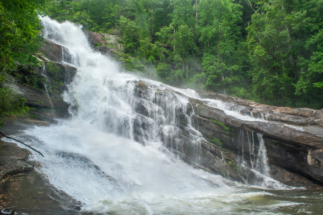
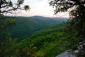
The Thompson River is one of several great rivers in the Jocassee Gorges region on the south side of Lake Toxaway. Although the Thompson River isn't as well-known as the nearby Whitewater River (due to Whitewater Falls) or Horsepasture River (due to Rainbow Falls), the Thompson features a collection of gorgeous waterfalls, including a 200-foot monster called Big Falls. Big Falls on Thompson River is an awesome, massive waterfall that crashes down through an enormous open area full of cliffs and borders. This spectacular waterfall should be on every experienced waterfaller's must-see list. Much of the hike to Big Falls follow an unofficial moderate trail along an old logging road that meanders near the Thompson River. However, the final section of the Big Falls hike is an extreme descent into the gorge, including several short rock scrambles. Along the Big Falls hike, you'll pass side trails to three other beautiful waterfalls that are all unique in their own ways and are worth seeing. This hike occurred on Saturday, May 26th, 2018. My plan was to hike out and back to Big Falls from Brewer Road. On my way in, I would make a side trip to Simon Falls. On my return trip, I would make side trips to Rich Falls and High Falls. Unfortunately, a series of heavy thunderstorms messed up my plans slightly, but it was still a great day.
0 Comments
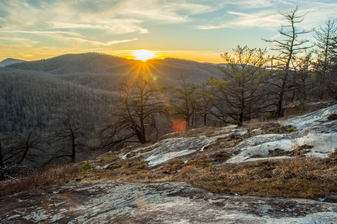
The trails at the west end of Panthertown Valley feature several popular waterfalls: Wilderness Falls, Frolictown Falls, and Granny Burrell Falls, as well as a spectacular well-known cliff line on the south side of Big Green Mountain called the Great Wall. This hike visits all of these destinations, in addition to lesser-known views atop Big Green Mountain itself. This hike also follows the Deep Gap Trail out of Panthertown Valley onto the seldom-hiked Laurel Knob Trail, a climbers' access trail that leads to the base of the 1200-foot cliffs of Laurel Knob. Laurel Knob boasts of the tallest uninterrupted cliff face in the entire Eastern United States! This hike occurred on Saturday, March 31st, 2018. My plan was to start out at the Salt Rock Gap Trailhead, where I'd take the Wilderness Falls Trail past Wilderness Falls to the Deep Gap Trail at Frolictown Falls. I'd then hike the Deep Gap Trail and Laurel Knob Trail out and back to the base of the Laurel Knob cliffs. Next, I'd return to Frolictown Falls, and I'd take the Great Wall Trail toward the top of Big Green Mountain, making a side trip to Granny Burrell Falls along the way. I would then follow the Big Green Trail past several views and continue down an unofficial connector to Macs Gap Trail. Finally, I'd follow the Macs Gap Trail and Panthertown Valley Trail back out to Salt Rock Gap.
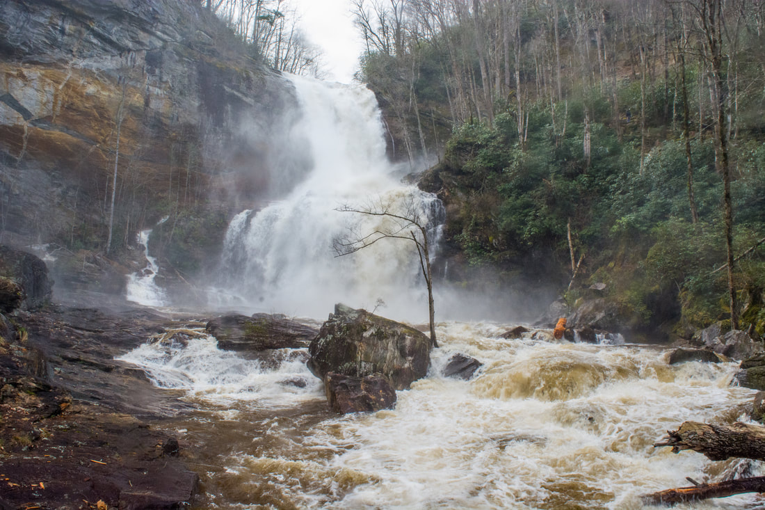
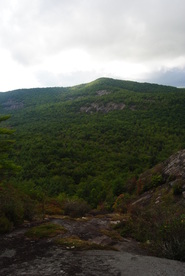
Below the Lake Glenville Dam, the West Fork of the Tuckasegee River comes over a mighty 100-foot cataract known as High Falls (locally as Cullowhee Falls). Most of the year, the dam severely restricts the watershed flow, reducing the water level at High Falls to only a few slim ribbons. But there's a few times in the year when High Falls is transformed into a monster. Several days a year, water is released from Lake Glenville down the West Fork Tuckasegee River for kayakers, and the water subsequently crashes over High Falls. Watching High Falls transform in mere seconds from a low-flow waterfall into one that's totally flooded out is an astounding experience! Two trails lead to the base of High Falls: a steep, official trail through Duke Energy land from The Pines Recreation Area by the shores of Lake Glenville to the south, and an easy, unofficial pathway through private land from Shoal Creek Mountain Road to the north. This trail report describes the Shoal Creek Mountain Road access, which the property owners have graciously opened to the public. Even though it's over twice longer, the north access is highly recommended due to the relaxing nature of the pathway, the better vantage points of High Falls, and a bonus waterfall called Rough Run Falls. This hike occurred on Saturday, April 7th, 2018. My plan was to hike out and back to High Falls from Shoal Creek Mountain Road, stopping by Rough Run Falls along the way.
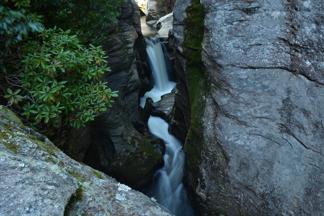
The Whitewater River is one of the most spectacular rivers in the Southeastern US. In its 15-mile length, the river plummets over two of the region's tallest and most breathtaking waterfalls, through a rare narrow slot canyon, and over nearly a dozen smaller waterfalls. Most folks familiar with the Whitewater River only know about Upper & Lower Whitewater Falls. This report focuses on the area immediately upstream, known as the Upper Whitewater River area, which is one of the most rugged, pristine, and gorgeous stretches of river that I've hiked. The Upper Whitewater Slot Canyon is a particularly unique location, where the mighty Whitewater River squeezes into a narrow canyon about 300 feet long and only a feet wide, lined by sheer cliffs rising dozens of feet. The river even crashes over two significant waterfalls - Sculpted Falls & Little Canyon Falls - in the canyon, as well as two others - Entrance Falls and Exit Falls - at both ends of it. While the waterfalls around the canyon are this hike's biggest highlight, many other photogenic waterfalls such as 55 MPH Falls lie between the canyon and Route 281, and the scenic Hornet Falls on Democrat Creek, a Whitewater River tributary, is a great bonus too. Seeing all of the waterfalls along the Upper Whitewater River requires a cross-country trek about as challenging as any in the North Carolina mountains, although access to a few selected waterfalls by themselves is easier. This hike occurred on Saturday, September 9th, 2017. Placing one car at NC 281 and another on Heady Mountain Road, my plan was to follow the easiest route downstream along the Whitewater River between the two parking areas, making sure to visit all waterfalls on the river as well as Hornet Falls on Democrat Creek.
 Panthertown Valley is a mecca for outdoor recreation, with over a dozen waterfalls and many mountains that provide spectacular views. Some locations, such as Schoolhouse Falls and Little Green Mountain, are very popular. Other locations, such as Riding Ford Falls and Panthertail Mountain, are seldom visited or even heard of. On this hike, you will get to see as many as five waterfalls, with several others just a short ways off. Also, you'll visit two mountaintop vistas, with a third one nearby. Just make sure not to stray off too far on the unclear trail system on Panthertail Mountain, because you might have a long way back. This hike occurred on Saturday, May 28th, 2016. My plan was to begin this hike at Cold Mountain Gap, where I would take the Mac's Gap Trail to Greenland Creek. After hiking te short spur trail to Greenland Creek Falls, I would take the Greenland Creek Trail downstream along Greenland Creek, before turning onto an unofficial trail that led past Mac's Falls and Pothole Falls to Schoolhouse Falls. From Schoolhouse Falls, I would follow the Devil's Elbow Trail to its terminus at Shelton-Pisgah Trail, (with a short side trip to Riding Ford Falls along the way). Then, I would take the Shelton-Pisgah Trail across Shelton-Pisgah Mountain, before venturing onto a set of unofficial trails to Panthertail Mountain. From here, my plan was to return to Panthertown Valley by way of Little Green Creek, but things turned out otherwise, and I ended up following an unknown-to-me trail to Cold Mountain Gap Road.
 Highlands and Cashiers are two small, wealthy towns in the mountains of Southwest North Carolina surrounded by mountains with great views and great hiking trails. The Panthertown Valley Recreation Area is one of the best hiking destinations in the area, with several mountains with great views, and at least a dozen accessible waterfalls. Panthertown Valley, nicknamed "The Yosemite of the East". Mountains like Little Green Mountain alone are worth doing this hike - traversing it's open rocky faces with incredible views is quite a feeling. This hike occurred on Saturday, September 13th, 2014. My plan was as follows (and it's a long one): From the Packs Gap Trailhead, take the Blackrock Spur Trail to Blackrock Trail. From there, I'd follow the Blackrock Trail to Overlook Trail. I would take the Overlook Trail to Blackrock Mountain Overlook and to the Powerline Trail. I would turn right on the Powerline Trail and go all the way to Panthertown Valley Trail. Along the way, I would do the short out-and-back to Wardens Falls. Then, I would turn left on Panthertown Valley Trail, followed by turning right onto Little Green Trail. After visiting Schoolhouse Falls, I would summit Little Green Mountain and on the other side of the mountain, turn left on Mac's Gap Trail. Then, I would turn right onto Big Green Trail and follow it to Great Wall Trail. I would turn left onto the Great Wall Trail and follow it to Granny Burrel Falls Trail. After doing the short out-and-back to Granny Burrell Falls, I would continue on the Great Wall Trail to Deep Gap Trail. I would turn left onto Deep Gap Trail, and immediately right onto Wilderness Falls Trail. Finally, I would finish by turning left onto the Panthertown Valley Trail and ascend to Packs Gap.
|
About MeMark Oleg Ozboyd Dear readers: I have invested a tremendous amount of time and effort in this website and the Georgia Waterfalls Database the past five years. All of the work that has gone in keeping these websites updated with my latest trip reports has almost been like a full-time job. This has not allowed me to pick up a paid job to save up money for college, and therefore, I I've had to take out loans. If you find the information on this website interesting, helpful, or time-saving, you can say "thanks" and help me out by clicking the button above and making a contribution. I will be very grateful for any amount of support you give, as all of it will apply toward my college tuition. Thank you!

Coming in 2022-2023?
Other Hiking WebsitesMiles HikedYear 1: 540.0 Miles
Year 2: 552.3 Miles Year 3: 518.4 Miles Year 4: 482.4 Miles Year 5: 259.9 Miles Archives
March 2021
Categories
All
|
 RSS Feed