
The mountains in the vicinity of Jasper are known more for their private residential communities and vacation homes than for their secluded hiking trails. It's not surprising, as most of the Mount Oglethorpe vicinity is developed heavily. There is an exception though: on the east side of Mount Oglethorpe is a 4500-acre tract of land that is part of Dawson Forest Wildlife Management Area and is owned by the state. Known as the Wildcat Tract, it is home to at least five waterfalls that are up to 80 feet high. A superb trail system with two trailheads was developed throughout the Wildcat Tract, facilitating access to the waterfalls and providing a number of options for day hikes/loops with various lengths. This hike occurred on Saturday, June 17th, 2017. My plan was to hike the outer Wildcat Creek Loop counter-clockwise from the Wildcat Campground. First, I would hike the Wildcat Creek Trail and Fall Creek Trail, taking side trails to four waterfalls on Fall Creek. At the end of the Fall Creek Trail, I would follow the Tobacco Pouch Trail and then Rocky Ford Trail back into the valley, visiting Rocky Ford Falls along the way. I would conclude the hike along the Turner Trail.
Summary
R/T Length of Trail: 11.0 Miles
Duration of Hike: 8:30 Type of Hike: Loop Difficulty Rating: 7 out of 10 Total Elevation Gain: 2726 Feet Pros: A lot of waterfalls on one hike; lack of crowds despite ease of access to some waterfalls Cons: None Points of Interest: 4th Falls on Fall Creek - 7 stars; 3rd Falls on Fall Creek - 7 stars; 2nd Falls on Fall Creek - 9 stars; 1st Falls on Fall Creek - 3 stars cumulatively; Rocky Ford Falls - 6 stars Trail Blaze Colors: Wildcat Creek Trail - Green; Fall Creek Trail - White (sometimes gray-ish); Tobacco Pouch Trail - Blue; Rocky Ford Trail - Red; Turner Trail - Orange Best Seasons to Hike: Spring Fees: To hike in Dawson Forest Wildlife Management Area, a GORP pass is required for most people. This pass can only be obtained online or through the phone. The 3-day pass for one person costs $3.50, the annual pass for one person costs $19, the 3-day pass for up to eight people costs $10, and the annual pass for up to eight people costs $35. People who are under 16 years old or over 65 years old do not need this pass. Learn more about this pass and how to get it at www.georgiawildlife.com/Georgia-Outdoor-Recreational-Pass. Beginning Point: Wildcat Campground Trailhead Directions from Dawsonville, GA: From the courthouse circle in downtown Dawsonville, follow GA 53 West (Main Street) for 10.7 miles. Then, turn right onto Steve Tate Road and follow it northward for 7.2 miles to the easy-to-miss Wildcat Campground Road on the left. Turn onto the unpaved road and follow it for 0.9 miles to a parking area at a trailhead kiosk located near the entrance to Wildcat Campground. Even though the road is a bit bumpy with some minor potholes, I think that most passenger vehicles will make it. Map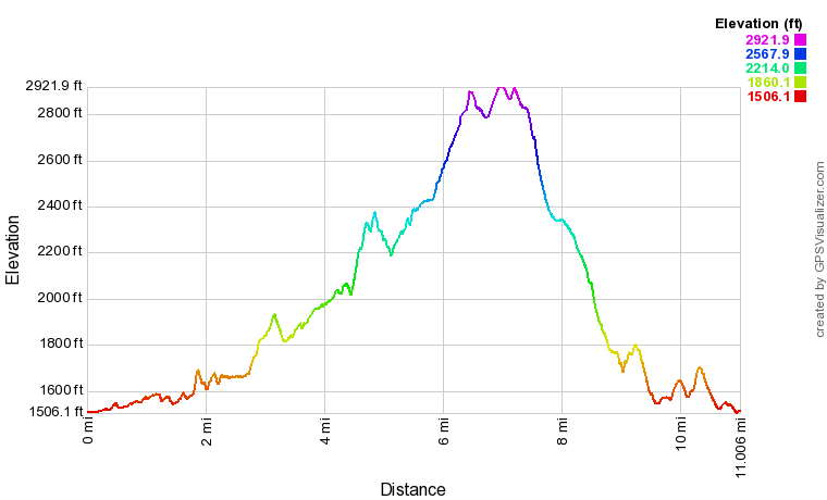
Click here to download a track of this hike.
Details
My first visit to the Wildcat Tract of Dawson Forest WMA was in January 2013. At the time, I was not a very experienced hiker and knew little about the trails at the Wildcat Tract. In fact, before that day, I had never even forded a river! The hike I did included temperatures in the low to mid 30s - accompanied by a mix of rain and snow - and the two wet fords (that I didn't know about) on the hike remained very memorable. In fact, I actually slipped in the middle of the ford of Rocky Ford Creek and fell into the creek. Can you imagine that on a cold winter day? Since I was inexperienced at the time, I also didn't know about most of the waterfalls on the trails, so I only went to 2nd Falls on Fall Creek. Ever since I learned about all of the other waterfalls, I've been wanting to return. This wasn't hard to do, as Wildcat Campground is only around an hour from my house, but for some reason, other hikes kept grabbing my attention more. Over four years later, I finally returned to the Wildcat Tract to hike the full Wildcat Creek Loop, visiting four waterfalls on Fall Creek and one on Rocky Ford Creek. In case you haven't figured it out yet, the full Wildcat Creek Loop is an outstanding hike, not only because of all the waterfalls but also because of the scenic streamside trails. Many thanks to the Mountain Stewards for maintaining these trails so well!
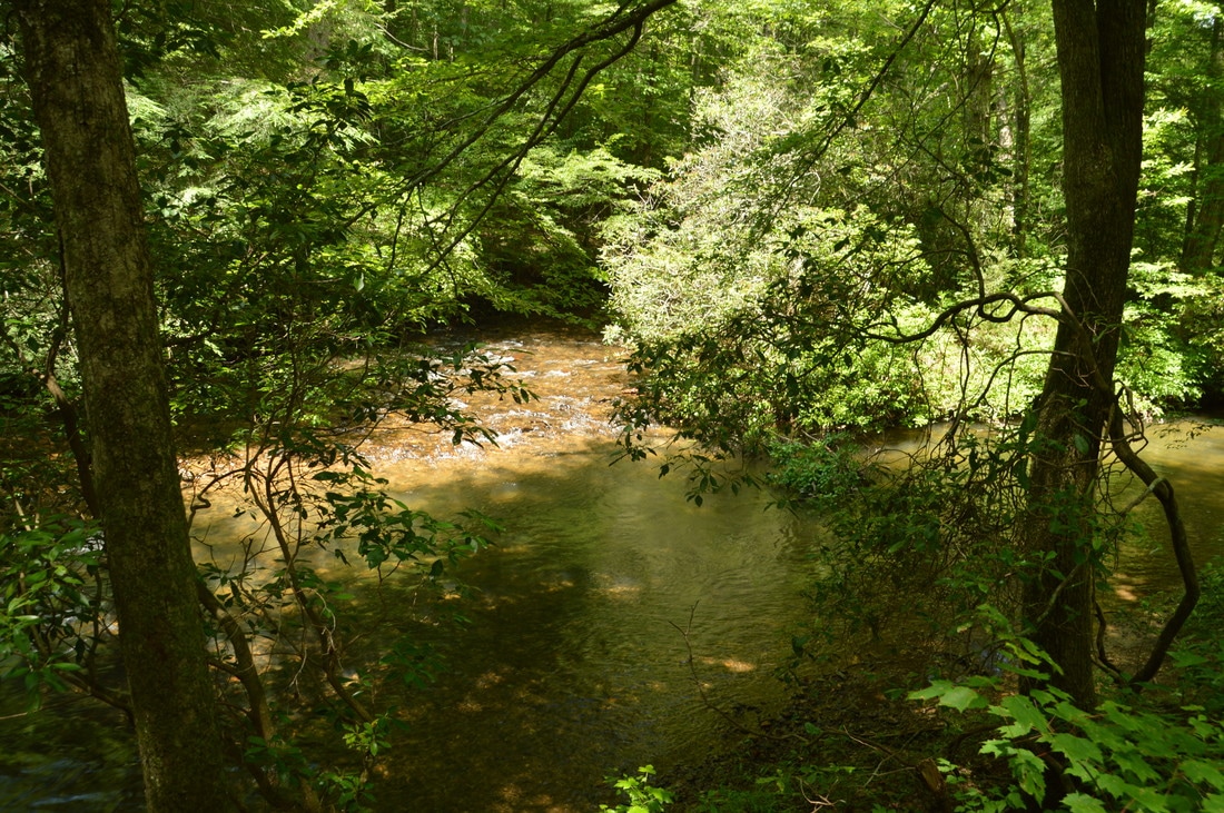
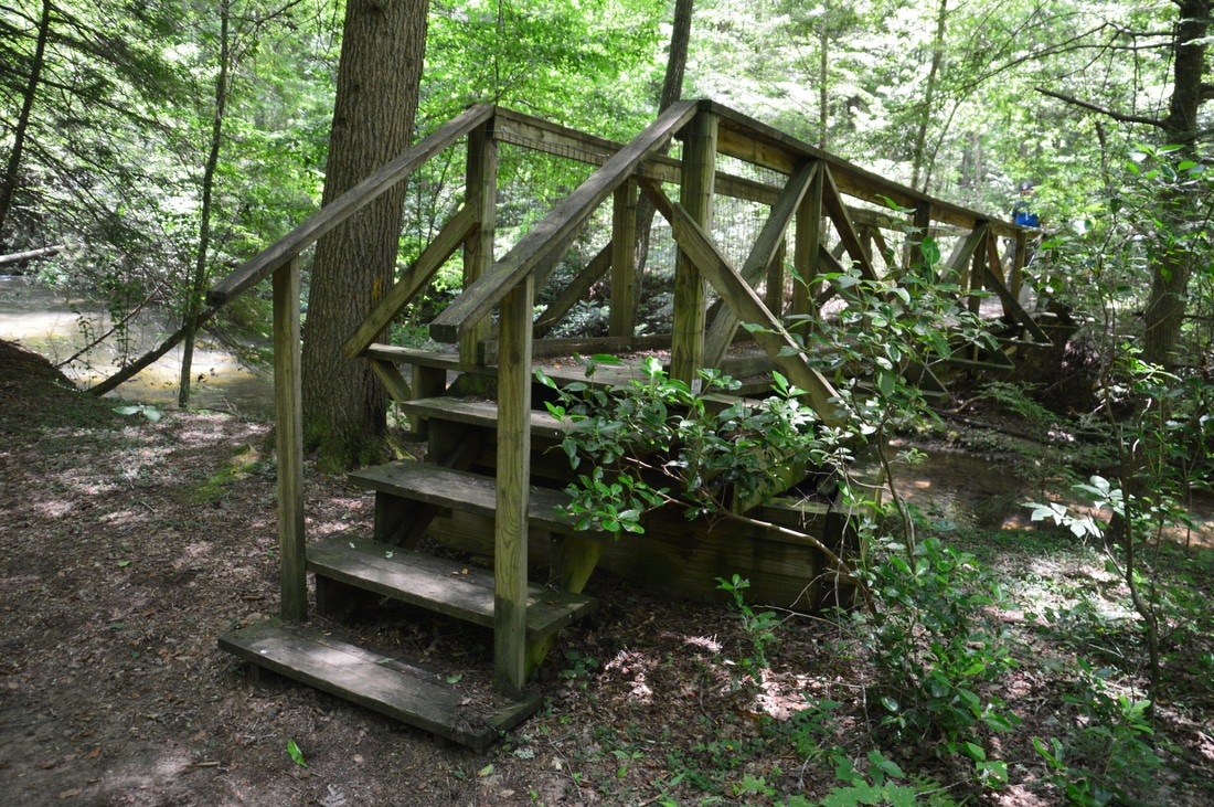
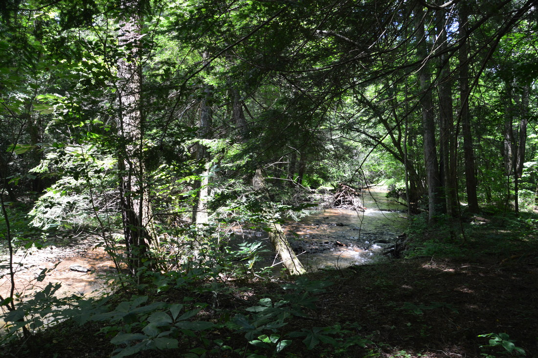
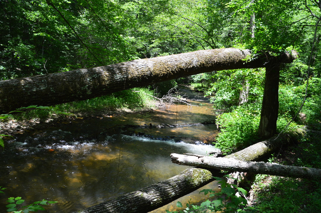
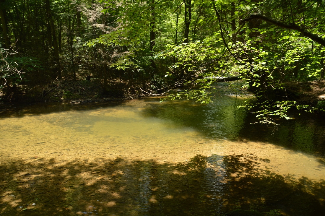
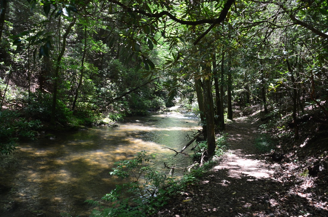
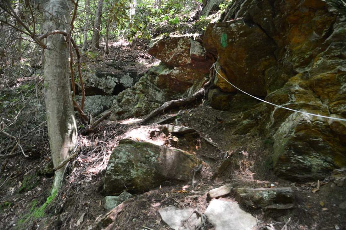
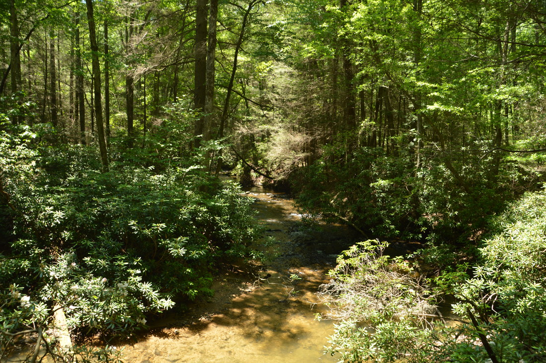
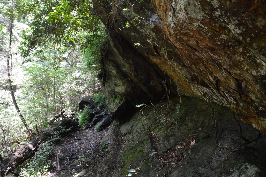
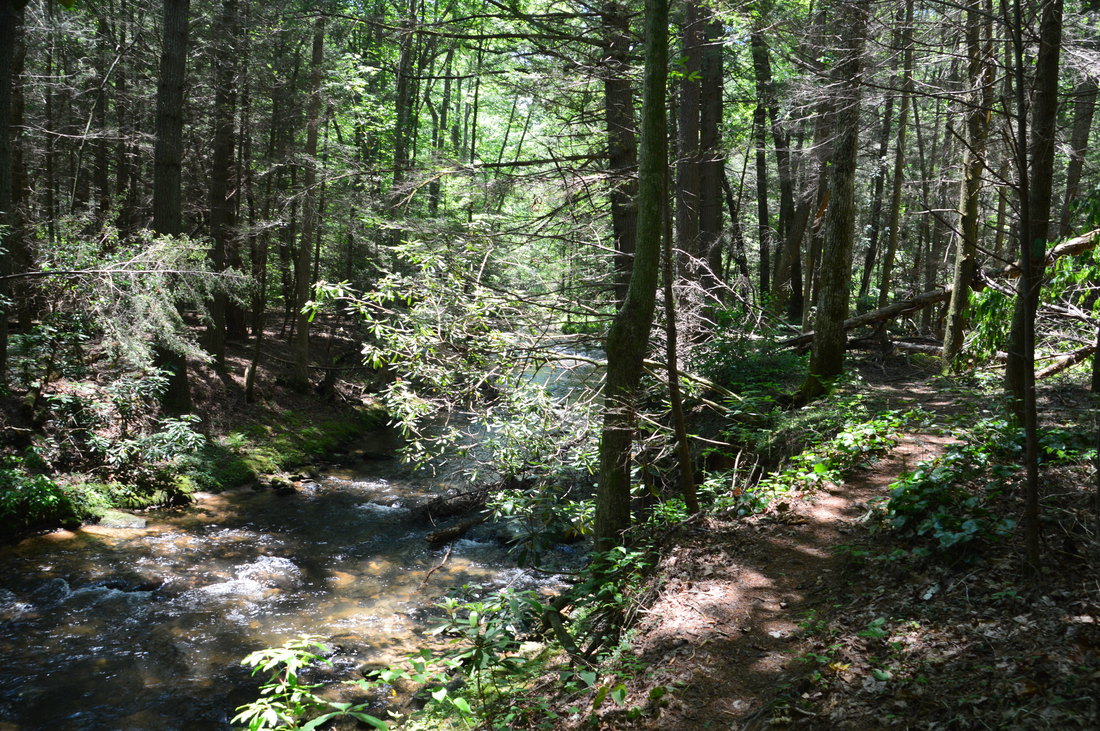
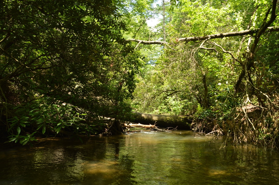
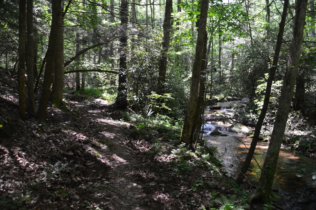
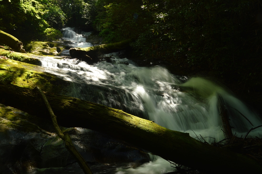
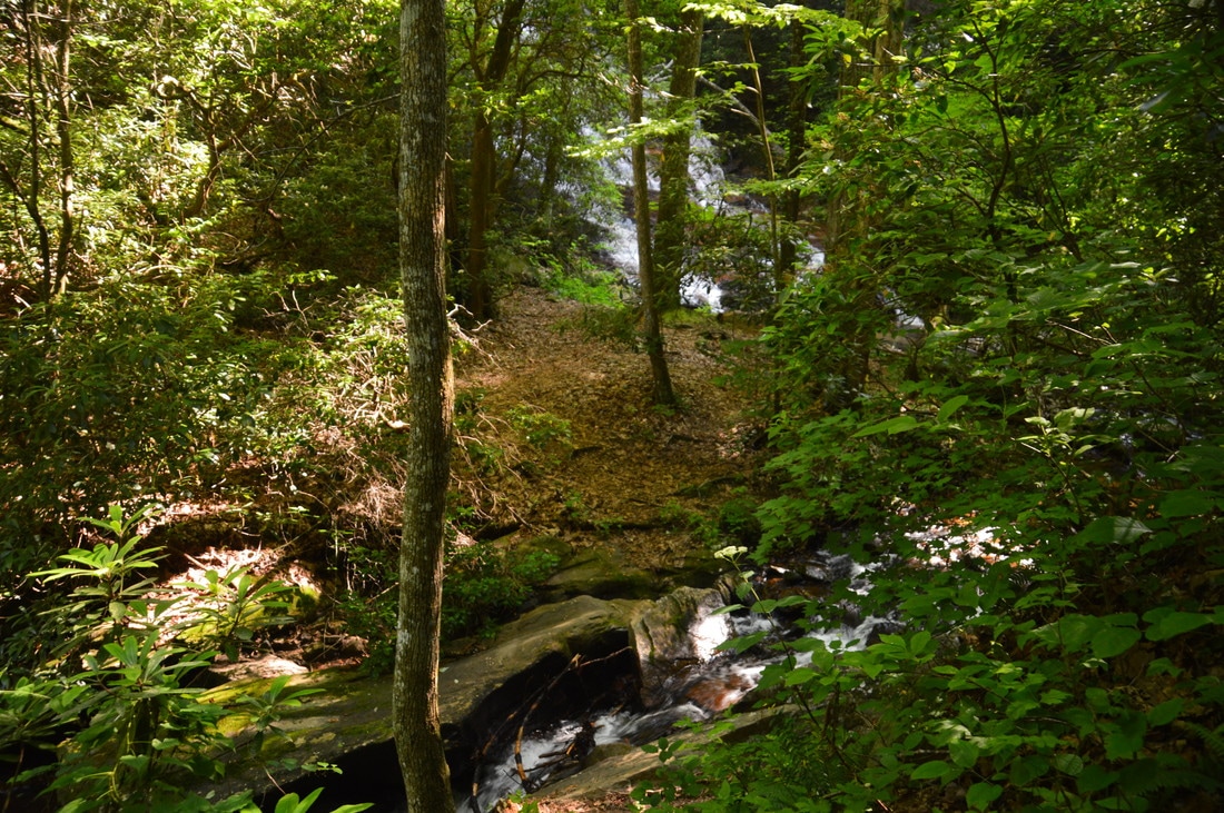
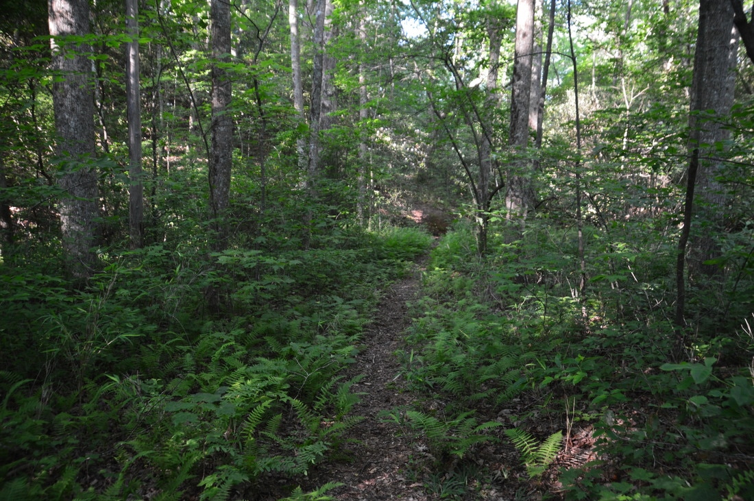
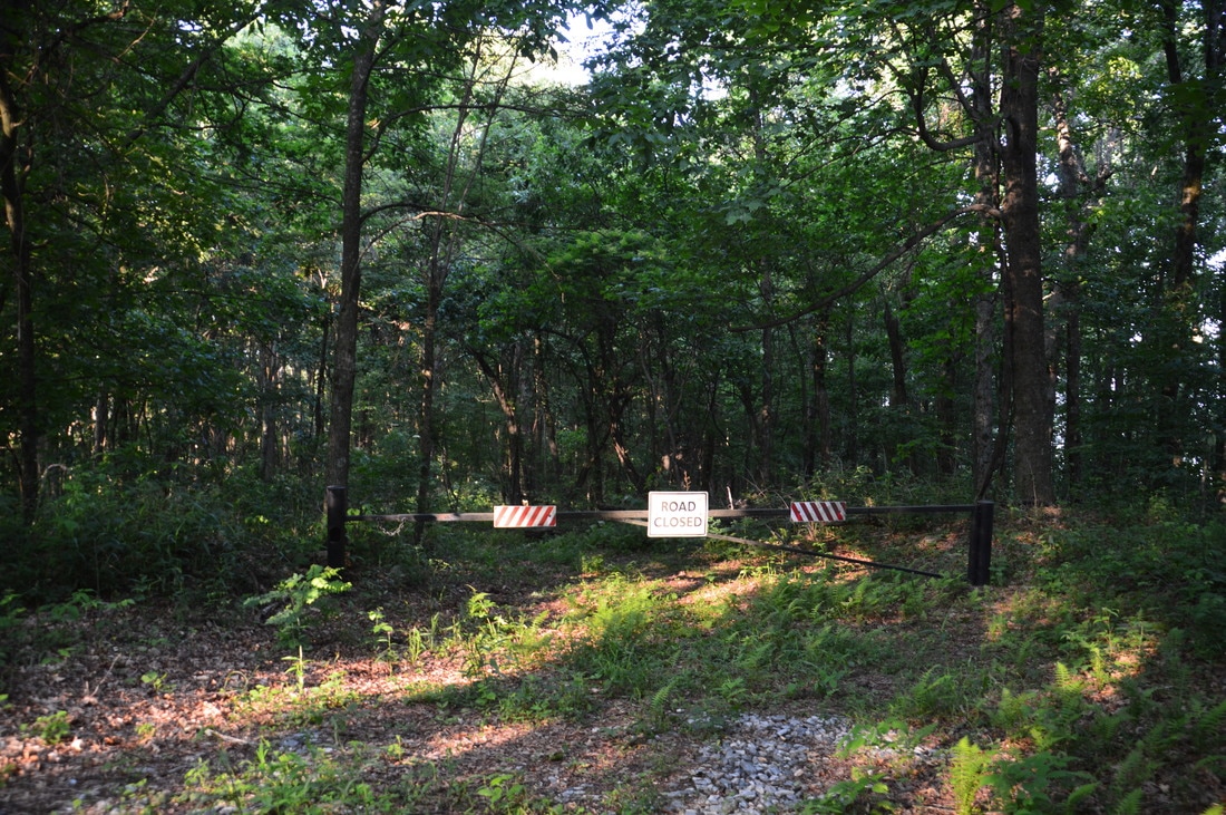
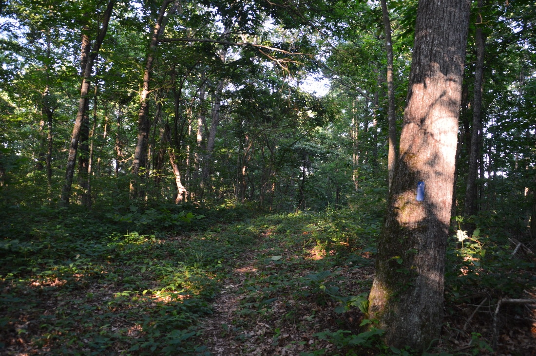
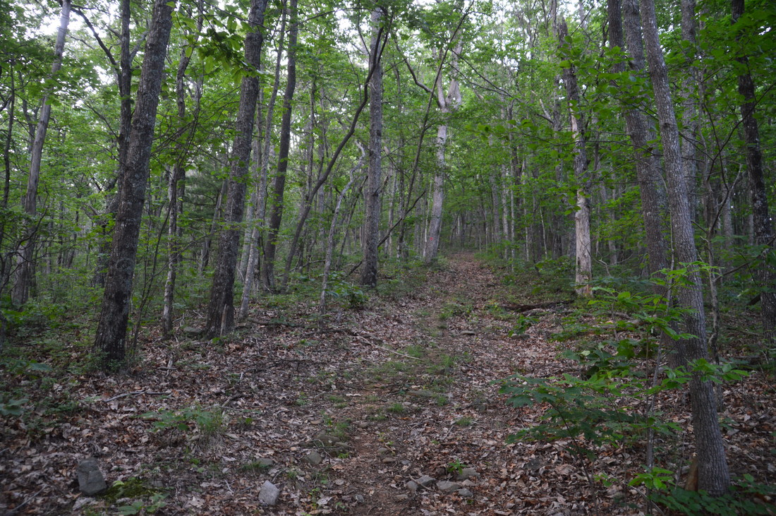
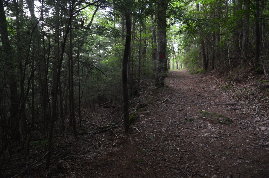
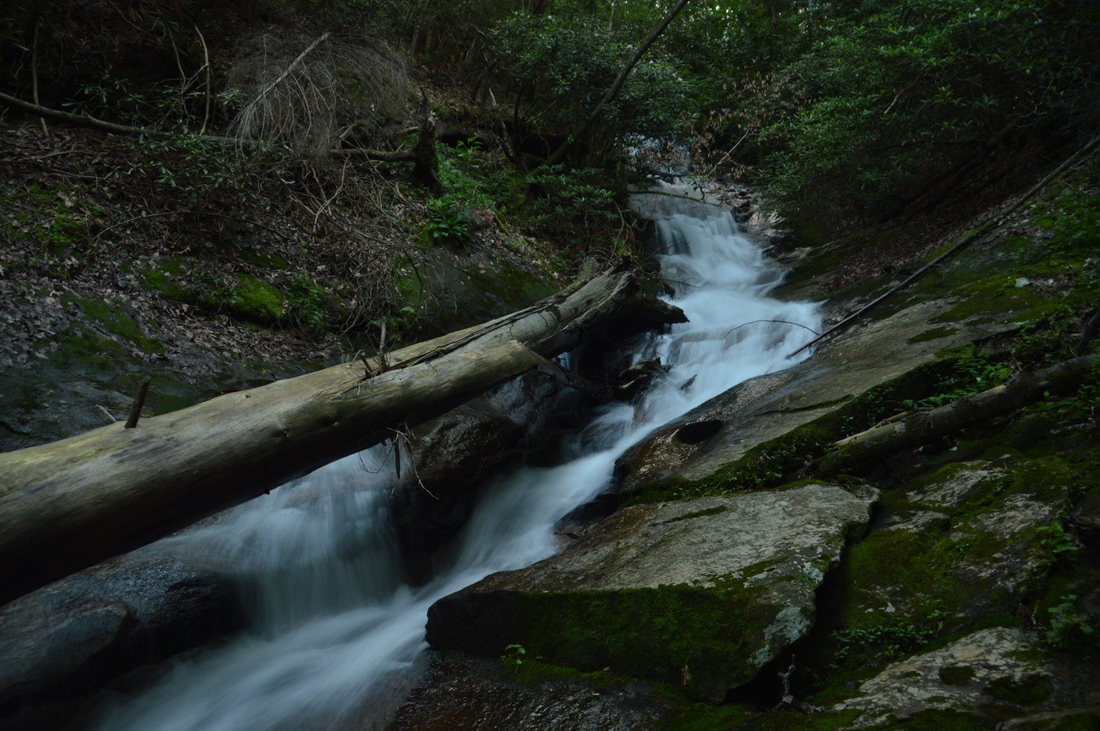
When given such an option, it is always best to begin hikes at the lowest possible point. That is why Wildcat Campground (where I parked) is a much better starting point for this hike than Monument Road Trailhead, located at the highest point on the entire trail system! Two trails leave the Wildcat Campground Trailhead: Wildcat Creek Trail and Turner Trail. The Turner Trail will be your return route. From the parking area, stay to the right of the kiosk on the road leading into the campground. You will walk through the entire campground (a relatively small but very nice one) to the end of the road, where there is a sign for the Wildcat Creek Trail at 0.1 miles. Pick up the Wildcat Creek Trail, leaving the campground and coming alongside Amicalola Creek. At 0.15 miles, the confluence of Amicalola Creek and Wildcat Creek (far left) will be visible. The trail doesn't follow Amicalola Creek for long, as it crosses the creek via a well-built footbridge at 0.2 miles. Then, the trail traverses flats near the confluence and comes alongside the cascading Wildcat Creek (note that some topographic maps may show this creek is Fall Creek). As you hike the Wildcat Creek Trail - especially during its first part - note all of the hemlocks that line Wildcat Creek, adding beauty to the stream and trail. This is one of the few healthy hemlock populations in Georgia, as the hemlocks here were specifically treated for the hemlock woolly adelgid. Over the next 1.55 miles, the Wildcat Creek Trail closely follows Wildcat Creek. While much of this section of the trail is flat, that isn't always the case, as several ridges extend down to the creek, forming 'bumps' on the trail. Most of these bumps simply require short ups and downs with a bit of scrambling in places. Cables are placed alongside the trail in the trickiest spots, although they are not really needed. Around 0.5 miles, the trail passes a gorgeous pool on Wildcat Creek. At approximately 1.5 miles, there is a particularly neat spot where an overhanging cliff on the right parallels to the trail. There usually is at least some water dripping from the cliff, so if by any chance this spot is dry, then the waterfalls will be flowing very poorly. In general, the Wildcat Creek Trail is a very scenic trail due to the numerous creek views on it. At 1.8 miles, the Wildcat Creek Trail reaches an intersection with the Turner Trail just after crossing an old forest road. The Turner Trail leaves to the left and crosses Wildcat Creek via another beautiful footbridge. A great loop for folks who don't have the time or energy for a full day of hiking is the Wildcat Creek/Turner Loop, perhaps with an extension to 4th Falls on Fall Creek. 
The Wildcat Creek Trail closely follows Wildcat Creek, passing this cliff along the way.
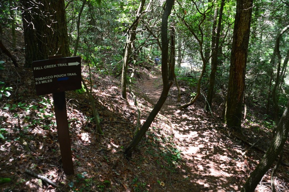
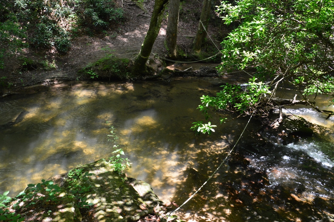
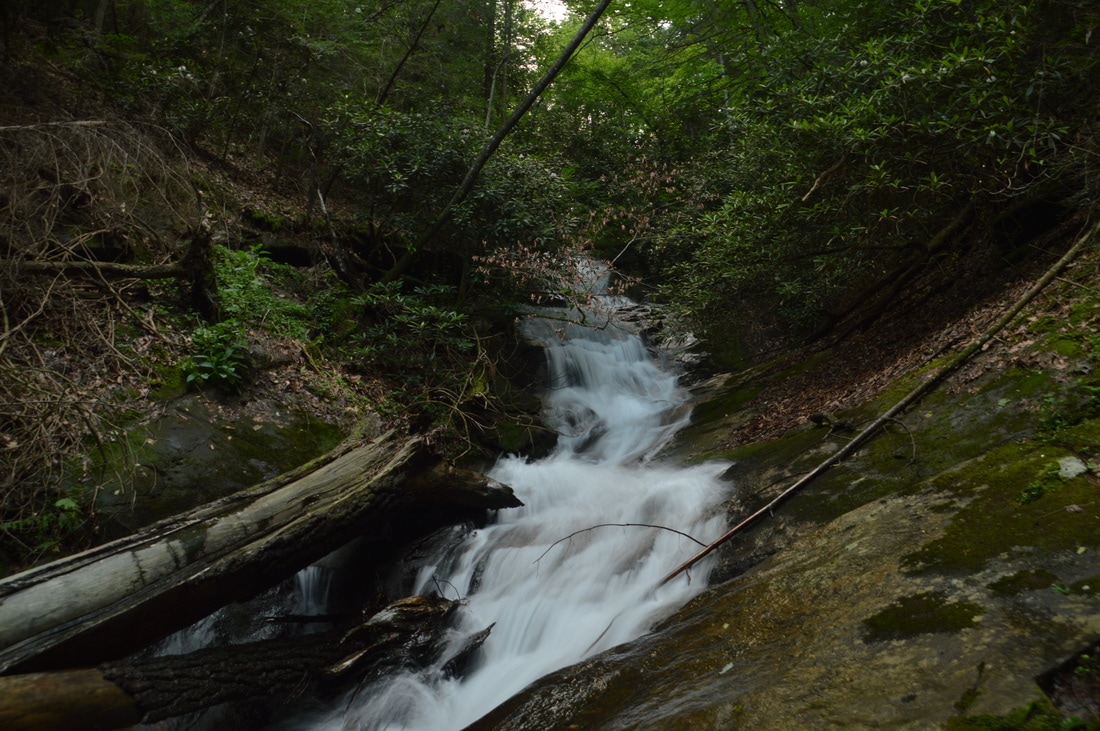
To continue on the main hike, follow the Wildcat Creek Trail as it briefly leaves the creek, ascending a small hill. Just before the trail returns to Wildcat Creek, there is a switchback with a few signs and trail markers. This is where the Wildcat Creek Trail changes its name to Fall Creek Trail, as it will leave Wildcat Creek shortly. At 2.2 miles, the trail reaches a ford of Wildcat Creek. This is a deep ford; in fact, at normal levels, it can be mid-thigh-deep. There are ropes strung across the creek at the crossing, but I think that the place where there is a rope is not a good place to cross due to slick rocks at a cascade. I suggest fording Wildcat Creek in the deeper but calmer area to the right of the ropes. On the other side of the creek, follow the distinct trail uphill for 250 feet to a junction at 2.25 miles. As the Fall Creek Trail bears left, the unmarked but well-used side trail to Fourth Falls on Fall Creek turns right on an old roadbed. Don't miss the side trail, which begins descending northward in the direction of Fall Creek. At one point, a path bypasses a large blowdown on the trail. At 2.45 miles, there is a T-intersection - stay left on the main path, which shortly reaches a ford of Fall Creek. The falls is visible in the upstream direction. Follow a path along the same side of Fall Creek up to the falls, reaching Fourth Falls at 2.5 miles. For the best view of the falls, you will have to wade the creek to the large flat area on the opposite side.
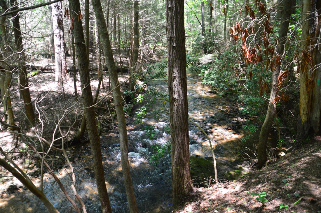
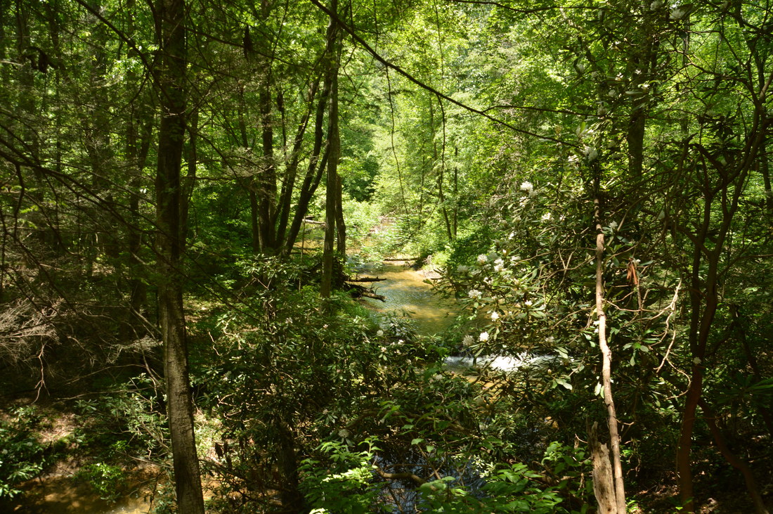
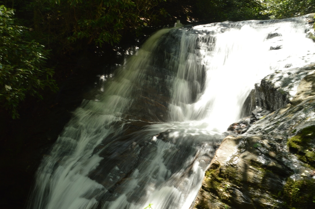
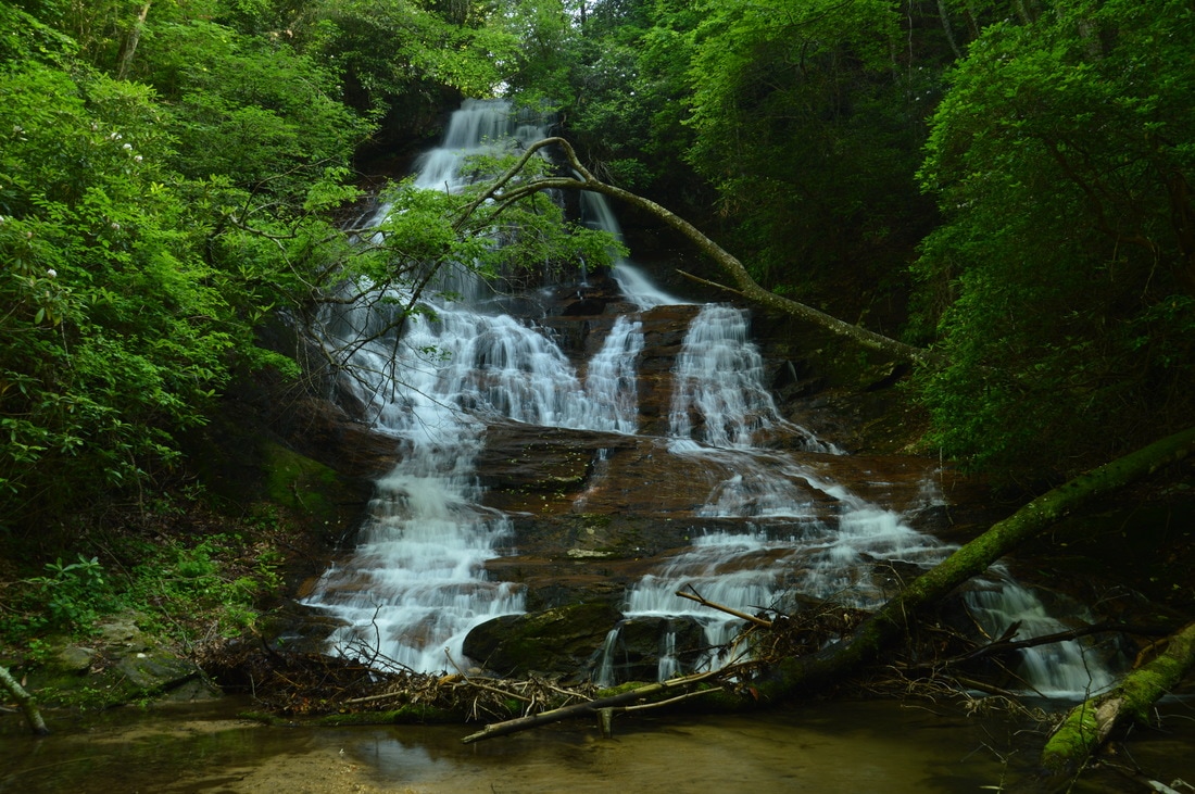
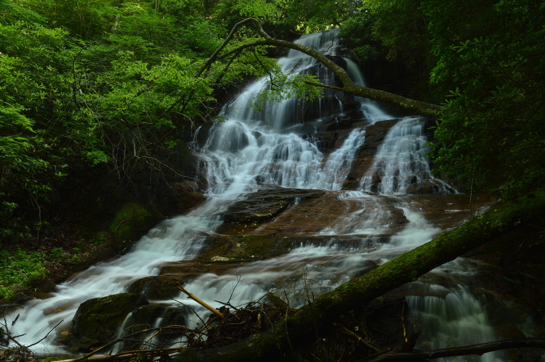
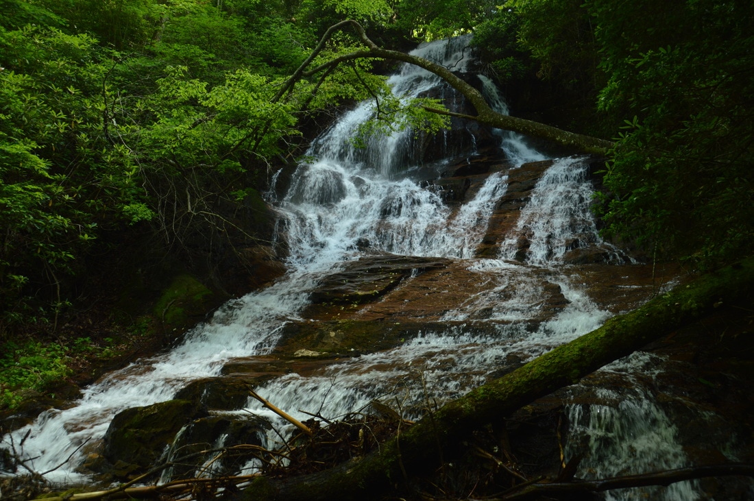
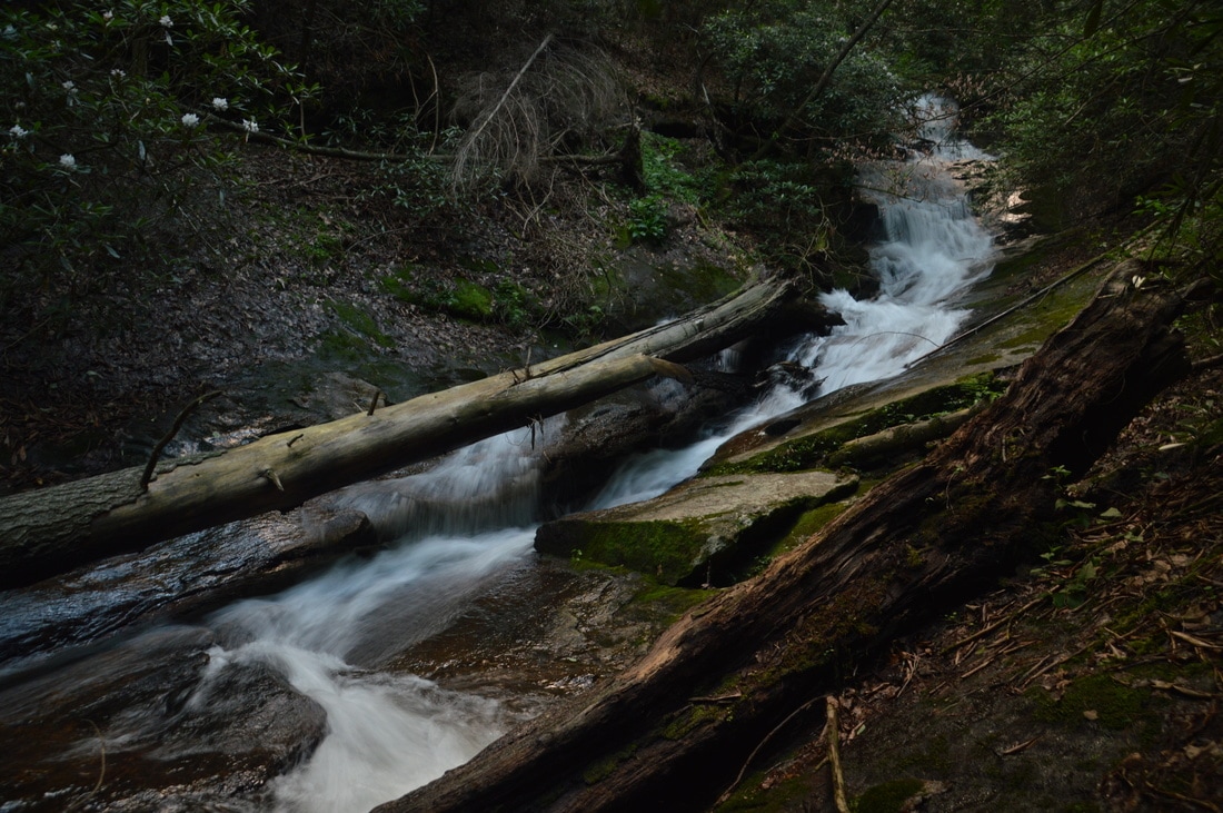
Fourth Falls on Fall Creek is a small but powerful waterfall. Even though the main tier is only 25 to 30 feet high, the falls is still quite photogenic. A small depression in the middle of the waterfall makes it seem like the water falls into a hole! Falls Creek spreads out into a shallow pool lined by a small sandy strip near the base of the waterfall. Cloudy days are best for photography of this waterfall, because the upper part of it gets washed out under sunny conditions. From Fourth Falls, return to the main trail and continue following it as it joins an old road and ascends a low ridge above Fall Creek. You will briefly hear Fourth Falls well below the trail. The ascent is actually fairly steep just before a gap where there is a junction with the Tobacco Pouch Trail at 3.15 miles. The Tobacco Pouch Trail, which leaves left, leads to the Monument Road Trailhead, and while it is another way to shorten this loop, I do not recommend using this shortcut because you will miss several waterfalls - including the best one on the hike. Following the junction, the Fall Creek Trail descends to Fall Creek, coming alongside it at 3.4 miles after passing through a pretty field of ferns. The trail once again rises slightly above the creek after only 250 feet. Around 3.6 miles, you will probably be able to hear a roar down to the right of the trail - this is the Third Falls on Fall Creek. Around the same place, look closely for a faint user-created path that urns acutely right off the main trail and leads to the falls. Take this narrow side trail as it descends steeply down to Fall Creek. Heading in the direction of the noise, you will come out at Fall Creek near the base of Third Falls at 3.65 miles. Third Falls on Fall Creek greatly exceeded my expectations. It is an impressive 50-foot sliding waterfall that drops into a fairly deep pool. A large tree has fallen across the creek just below the waterfall, so the tree will be part of the more distant pictures. To get a close-up view of the waterfall, you will once again have to wade into the creek, under the tree, and to the edge of the pool. As with Fourth Falls, the best pictures of Third Falls will be taken when it's cloudy, although with a bit of creativity, you may be able to shoot from an angle that hides the bright areas in a picture taken on a sunny day here. From Third Falls, retrace your steps back to the Fall Creek Trail and continue following it upstream along Fall Creek. The trail crosses Fall Creek at 3.7 miles - this is usually a rock hop but it can also be a shallow wade. The next stretch of the trail is quite pleasant, as the trail meanders through nearly flat areas along Fall Creek with little elevation gain. At 4.3 miles, reach a signed intersection with a side trail on the left to Second Falls on Fall Creek. The signs marks the side trail simply as "Fall Creek Waterfall". Of course, there is more than one waterfall on Fall Creek, but Second Falls is by far the most spectacular of them all. The spur trail crosses Fall Creek just below Second Falls. Those who are sure-footed can get across dry. Then, the trail ends in a flat area at the base of the majestic Second Falls on Fall Creek at 4.4 miles. 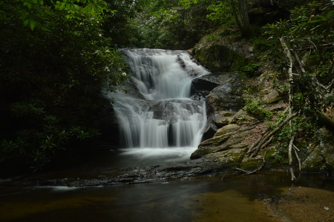
While small, the powerful Fourth Falls on Fall Creek is a beauty.
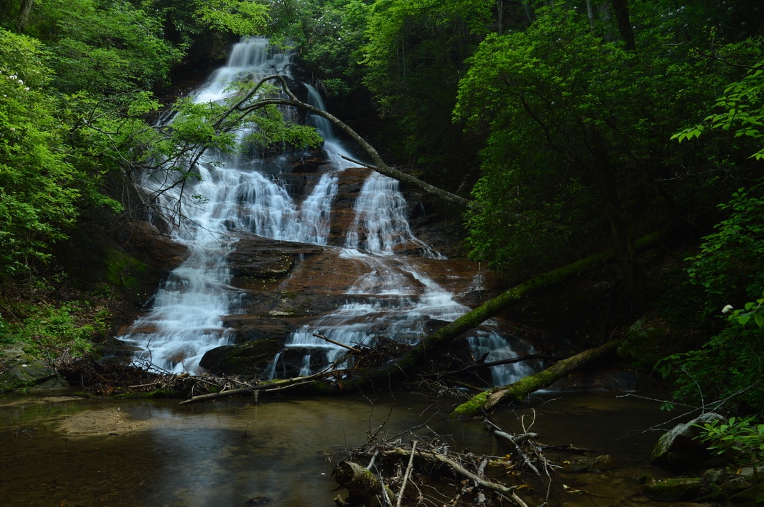
Second Falls consists of a gorgeous 80-foot sheer drop. It is best to visit this waterfall (and the other waterfalls on this hike) in late winter and early spring, when the water levels will be highest. At full capacity, Second Falls on Fall Creek is one of the region's best waterfalls. There are several great angles to photograph the waterfall from, including the far side of the pool at the base. Unfortunately, a small tree blocks out a little portion of the middle of the waterfall, but it does not greatly detract the beauty. Depending on the position of the sun, photos of Second Falls may turn out good even on sunny days, as by the time I got here in the late afternoon, the waterfall was entirely in the shade. Before continuing the hike, make sure to take a short break at the base of Second Falls and re-energize yourself for the steep ascent coming up ahead.
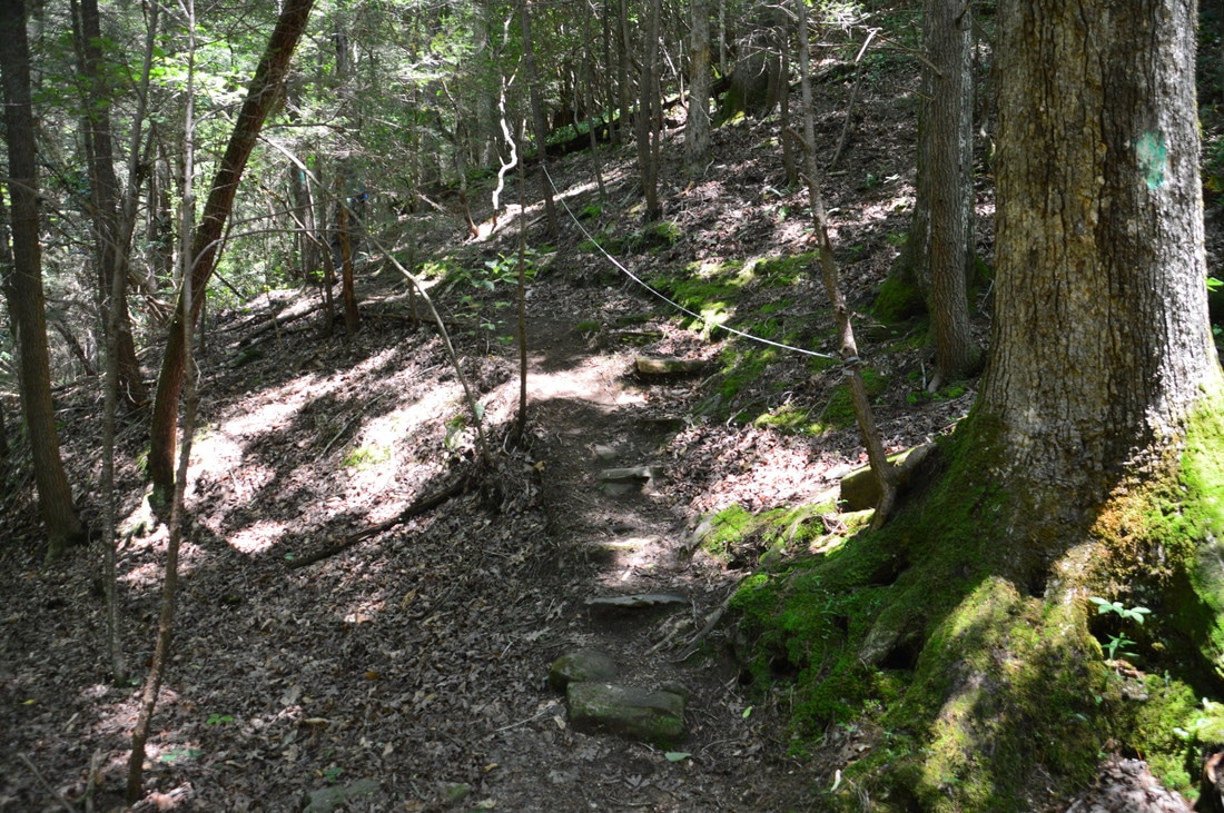
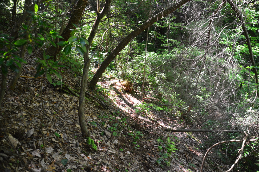
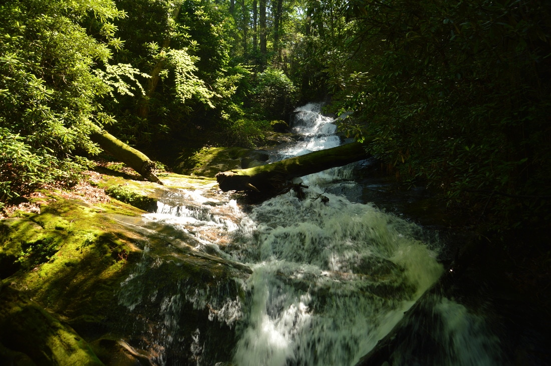
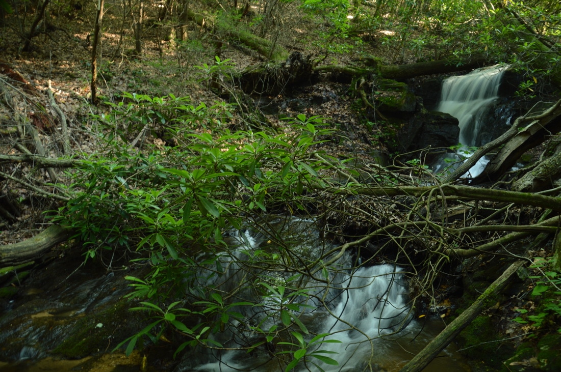
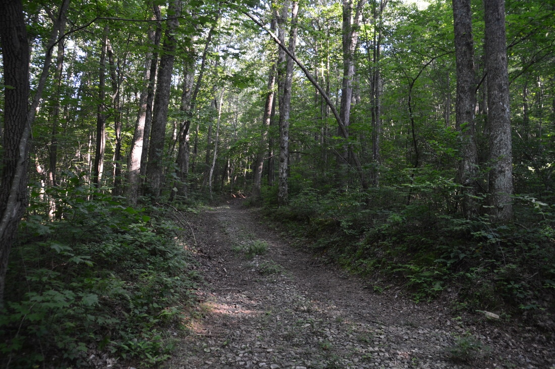
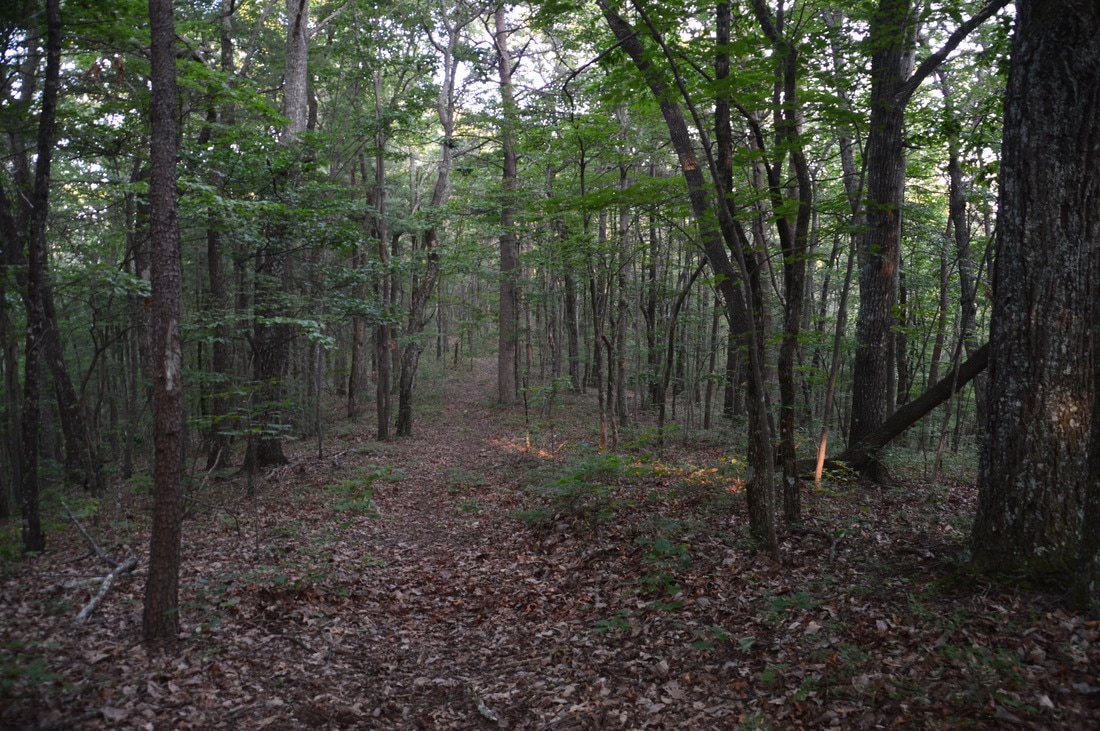
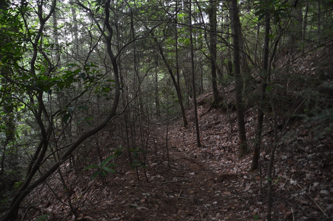
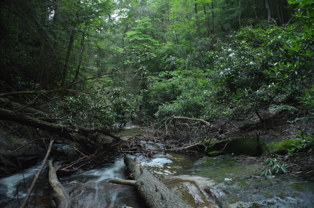
From Second Falls, return to the Fall Creek Trail and continue following it uphill. At 4.55 miles, there is a confusing T-intersection with an old roadbed. While it appears that a trail heads in both directions, the official Fall Creek Trail turns right onto the old road and begins a steep ascent to bypass the treacherous area around Second Falls. This section of trail is what us hikers refer to as a "Pointless Up and Down" though, because the trail ascends around 300 feet (when it could have ascended a lot less) only to lose most of that elevation, finally rejoining Fall Creek above Second Falls at 5.15 miles. Winding in and out of a hollow, the trail continues a gradual ascent before reaching a view of some impressive cascades to the left on Fall Creek below the trail at 5.4 miles. This is the lower part of First Falls on Fall Creek. If you have the time and energy for the steep scramble down, I suggest doing it, as these cascades are quite pretty. Unfortunately, there is no good way to see the entire First Falls from any one point, due to how long it is. Return to the main trail at 5.5 miles and follow it for another 200 feet. Around 5.55 miles, a short spur trail on the left leads to the base of the upper drop of First Falls, which is visible from the trail. This is a nice 15-foot drop over a small cliff. Unfortunately, there is a lot of messy deadfall that shrouds the run-out cascades below the main drop. In my opinion, this is still the most scenic part of First Falls. Return to the Fall Creek Trail and follow it to a second crossing of Fall Creek at 5.6 miles. Normally, this will be a simple rock hop. The trail then meanders through flats on the south side of Fall Creek, crossing a tributary along the way, before reaching a junction with a broad forest road at 5.8 miles. A double white blaze points the trail as it turns left onto the forest road and begins a steep climb to the Tobacco Pouch Trail. Over the next 0.65 miles, the forest road that the Fall Creek Trail follows gains around 500 feet of elevation, making this the most difficult part of the hike. Oddly, there is some fairly fresh gravel on this forest road, leading me to believe that some of the forest roads in the Wildcat Tract may be open to vehicles during hunting season. The main ascent finally ends at the Fall Creek Trail's terminus at 6.45 miles, where the blue-blazed Tobacco Pouch Trail bears right toward the Monument Road Trailhead (reaching it in around a quarter-mile) and turns sharply left back into the heart of the Wildcat Tract. To continue following the loop, turn left onto the Tobacco Pouch Trail, descending gradually along another broad forest road. At 6.75 miles, the trail passes through a gap and then ascends a pair of small knobs on the ridge, the second being twice lower than the first. This section of the trail has great winter views. At 7.35 miles, the wide forest road ends at a turnaround in front of a gate, and the trail nearly becomes single-track as it continues onto a much more overgrown old road. 
Part of the blue-blazed Tobacco Pouch Trail follows a broad forest road.
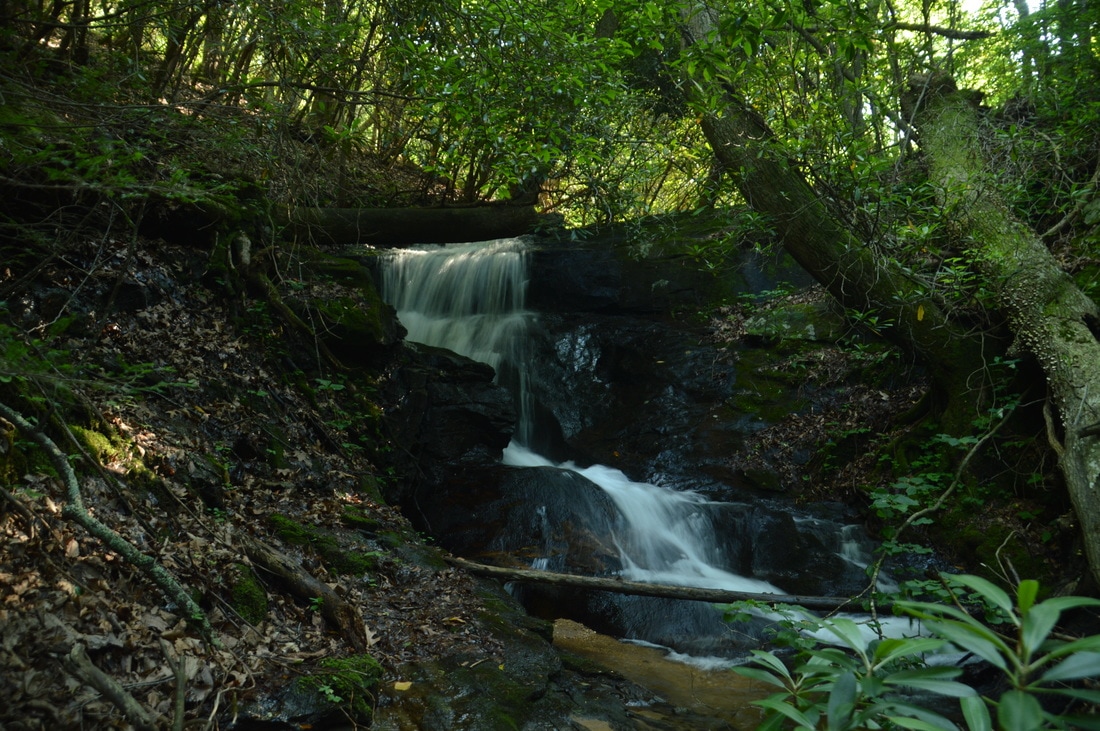
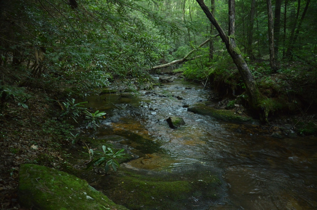
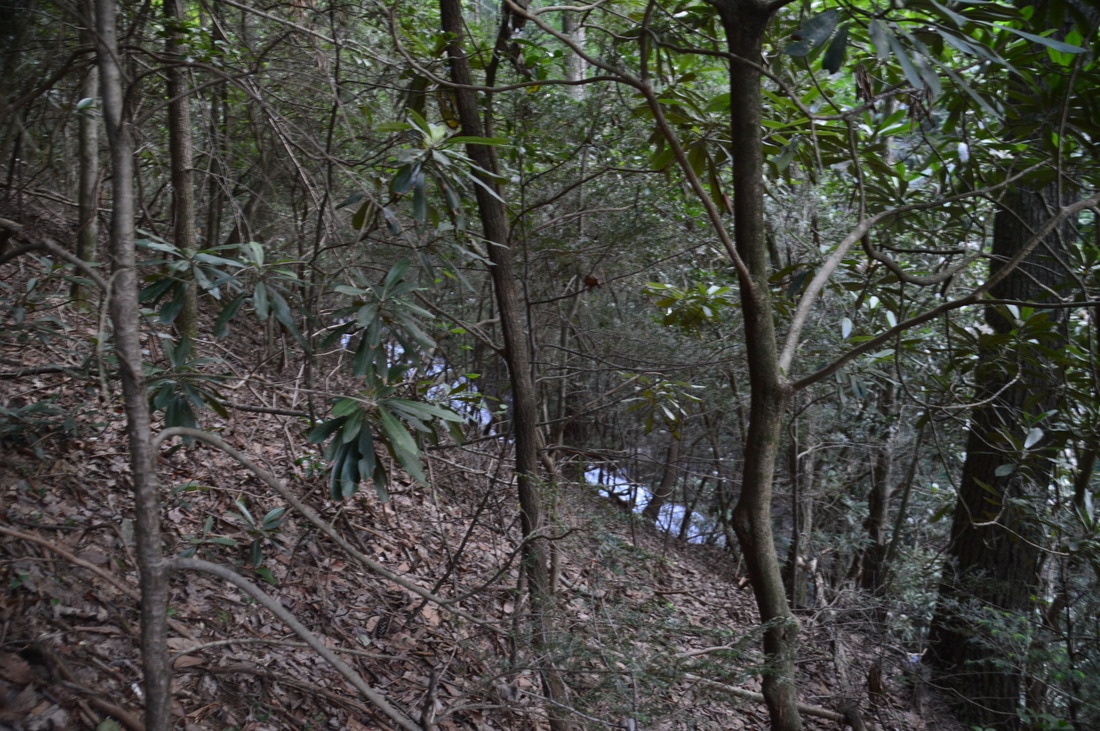
After a period of steep descent and two small switchbacks, the Tobacco Pouch Trail reaches the unsigned junction with the red-blazed Rocky Ford Trail at 7.55 miles. This junction is easy to miss, so start paying attention immediately after the second small switchback. The red blaze at the beginning of the Rocky Ford Trail is the only marker at the junction. Turn right onto the Rocky Ford Trail as it begins an extremely steep descent down the nose of a ridge, losing over 300 feet of elevation in just 0.3 miles. After the initial plummet, the descent becomes a lot more gentle as the trail follows a ridge toward Rocky Ford Creek. At 8.35 miles, the Rocky Ford Trail turns off the ridge and descends moderately into the Rocky Ford Creek valley. Just before reaching Rocky Ford Creek, the trail turns abruptly left at a sign as an old logging road turns right to private property. At 8.85 miles, the trail fords Rocky Ford Creek. This will be an ankle-deep ford most of the year. Rocky Ford Creek is a very pretty stream, with cascades above and below the ford. At 8.9 miles, the aqua-blazed Windy Ridge Trail splits off to the right from the Rocky Ford Trail at a sign. My original plan for the day included hiking the Windy Ridge Trail, but I ran out of time for it. After the junction, pay close attention as you are hiking along the Rocky Ford Trail; 150 feet after the Windy Ridge Trail split, an unmarked but well-used path bears left off the main trail and onto an old logging grade. This is the trail to Rocky Ford Falls, the final waterfall of the hike.
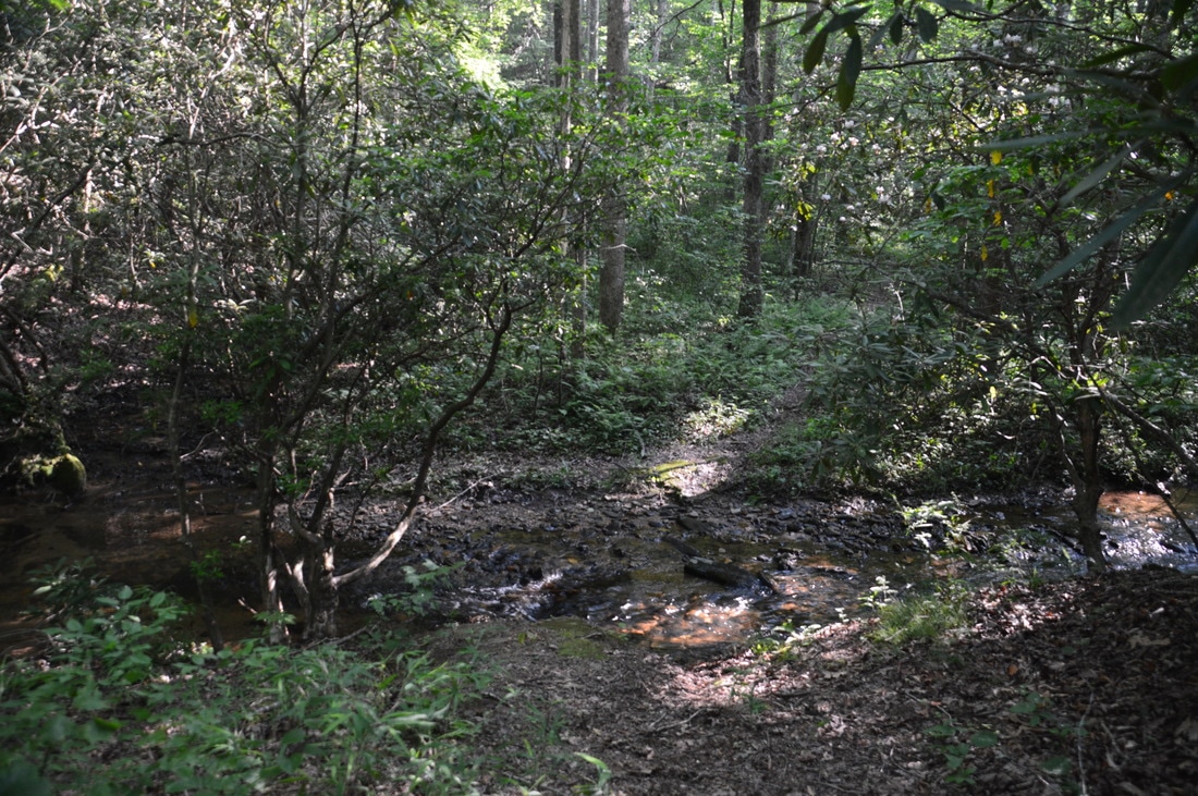
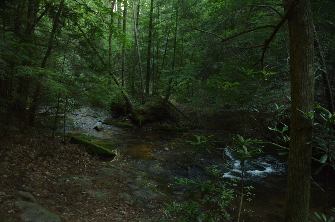
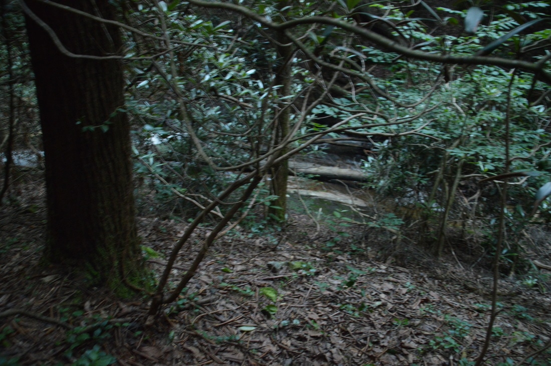
Turn left onto the side trail, which starts off easy as it contours above Rocky Ford Creek. Before long, a portion of the sliding Rocky Ford Falls come into view below. A good place to leave the old logging grade is around 350 feet after you turned onto it. You can see what looks like the base of the waterfall below (note that the waterfall does not look very impressive from this point). Scramble to the left down the steep slope to the creek. Careful - the final few feet to the base of Rocky Ford Falls involve tiptoeing down a very slick sloping rock! You will reach the base of Rocky Ford Falls at 9.05 miles. In some ways, this long slide resembles Third Falls on Fall Creek, but while I think Rocky Ford Falls is slightly less scenic, it has its own distinctive features. One notable thing about Rocky Ford Falls is how compressed it is, making it a fairly powerful waterfall - I'd love to see this place an hour after a heavy thunderstorm. Also, I think that the log resting in the middle of the split ribbons of flow in the waterfall's lower part makes it more photogenic. The neat pothole in the rocks on the right side of Rocky Ford Falls is another unique feature of the waterfall. As with many of the waterfalls on this hike, the best pictures may involve wading into the creek. From Rocky Ford Falls, return to the Rocky Ford Trail and continue following it downhill eastward into the Wildcat Creek valley. The gradual descent here is quite pleasant after a tough day. At 9.5 miles, the Rocky Ford Trail ends at a junction with the Turner Trail near Wildcat Creek. For the shortest way back to the trailhead, turn right onto the orange-blazed Turner Trail, which follows an old forest road. Unfortunately, the following section of the Turner Trail is anything but flat. After a junction with the south end of the Windy Ridge Trail at 9.85 miles, the Turner Trail ascends to a low ridge, passing around a gate at the top at 10.0 miles. After a descent into a small drainage, the trail crosses another ridge via a short but fairly steep ascent on the now broader forest road. Finally, at 10.35 miles, the trail begins descending back into the Amicalola Creek valley. There is a slightly confusing switchback at 10.85 miles, where the Turner Trail turns sharply left to continue following the forest road, while a trail labeled "Foot Traffic Welcome" leaves to the right. Stay on the Turner Trail as it enters a large flat near Amicalola Creek with campsites on both sides of the trail. Just before the forest road fords Amicalola Creek, bear right off the road and onto the trail as it crosses Amicalola Creek on a wooden footbridge. Follow the obvious trail on the other side of the creek to its terminus at the trailhead parking area, where you will conclude your hike at 11.0 miles. 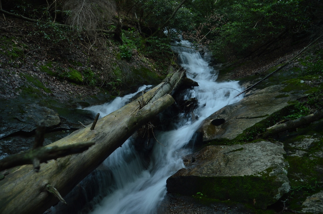
Rocky Ford Falls, a long picturesque slide, is the fifth and final waterfall on the Wildcat Creek Loop.
The Wildcat Creek Loop is a superb hike. In it's 11-mile length, it passes five gorgeous waterfalls, and even though the full loop is a fairly difficult day hike, all of the waterfalls can be reached by separate easier hike. This hike also has a lot of beautiful creekside scenery, in particular along the Wildcat Creek Trail. With the trailhead being only an hour to hour and a half from the Atlanta metro area - and with the trails in the Wildcat Tract not being as heavily traveled as one might expect - the Wildcat Creek Loop should be on the top of all hikers' lists. I rate this hike a "Best Hike".
Mileage
0.0 - Wildcat Campground Trailhead
0.2 - Amicalola Creek Footbridge 1.8 - Turner Trail Junction 2.2 - Wildcat Creek Ford 2.5 - Fourth Falls on Fall Creek 3.15 - Tobacco Pouch Trail Junction 3.65 - Third Falls on Fall Creek 3.7 - Crossing 1 of Fall Creek 4.4 - Second Falls on Fall Creek 5.4-5.55 - First Falls on Fall Creek 5.6 - Crossing 2 of Fall Creek 6.45 - Terminus of Fall Creek Trail 7.35 - Rocky Ford Trail Junction 8.85 - Rocky Ford Creek Ford 8.9 - Windy Ridge Trail Junction (North) 9.05 - Rocky Ford Falls 9.5 - Rocky Ford Trail Terminus 9.85 - Windy Ridge Trail Junction (South) 11.0 - Wildcat Campground Trailhead Variations
Hike out and back to Fourth Falls on Fall Creek via Wildcat Creek Trail - 5.0 Miles
Hike out and back to Fourth, Third, and Second Falls on Fall Creek via Wildcat Creek Trail - 8.2 Miles Hike out and back to Rocky Ford Falls via Turner Trail - 3.9 Miles Bonus Stops
Consider checking out the nearby Eagle's Rest Park with several views on the top of Mount Oglethorpe.
PicturesVideos
4 Comments
Jammz
7/8/2017 02:32:19 pm
Were there any backcountry campsites out along the wildcat creek loop or would you have to camp at the Wildcat Campground and simply hike this 11 mile loop as a day hike?
Fred
11/27/2017 10:10:57 pm
I saw a few but not sure if camping is allowed ?
Melissa Chalk
1/21/2018 08:35:16 am
Did you ever find out of camping was allowed?
Mark Oleg
3/12/2018 06:23:44 pm
I don't know if camping is allowed. I have never seen a no camping rule, but I havent seen any designated campsites along the trails either. Leave a Reply. |
About MeMark Oleg Ozboyd Dear readers: I have invested a tremendous amount of time and effort in this website and the Georgia Waterfalls Database the past five years. All of the work that has gone in keeping these websites updated with my latest trip reports has almost been like a full-time job. This has not allowed me to pick up a paid job to save up money for college, and therefore, I I've had to take out loans. If you find the information on this website interesting, helpful, or time-saving, you can say "thanks" and help me out by clicking the button above and making a contribution. I will be very grateful for any amount of support you give, as all of it will apply toward my college tuition. Thank you!

Coming in 2022-2023?
Other Hiking WebsitesMiles HikedYear 1: 540.0 Miles
Year 2: 552.3 Miles Year 3: 518.4 Miles Year 4: 482.4 Miles Year 5: 259.9 Miles Archives
March 2021
Categories
All
|


 RSS Feed