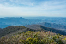
Right on the doorstep of the quaint town of Robbinsville is the Joyce Kilmer-Slickrock Wilderness, a massive wild area covering over 17,000 acres between the Cherohala Skyway and US 129. The area is known best for the Joyce Kilmer Memorial Forest - an area of virgin forest in the Little Santeetlah Creek watershed, featuring numerous old, grand trees. The wilderness area's central destination, however, is an inconspicuous rock outcropping on a lead below Haoe Bald called The Hangover. The Hangover features a breathtaking 360-degree view of the wilderness, with little in sight but endless mountain ridges and several lakes. The panoramic vista atop The Hangover encompasses Santeetlah Lake, Calderwood Lake, and the Little Tennessee River. This hike loops several trails from the Joyce Kilmer Recreation Area to visit The Hangover via the Memorial Forest. This hike occurred on Saturday, April 21st, 2018. My plan was to hike a clockwise loop with the Joyce Kilmer Memorial Forest Poplar Cove Trail, Naked Ground Trail, Haoe Lead Trail, and Jenkins Meadow Trail. I would of course take a side trip along the Hangover Lead Trail to The Hangover.
2 Comments
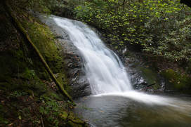
The Jacks River is known best for its spectacular huge waterfall Jacks River Falls, but much further upstream is another waterfall that is much smaller and less-known but still quite scenic: Shadow Falls. Located on the South Fork of the Jacks River, 20-foot Shadow Falls is easily accessible via the South Fork Trail. The waterfall is situated between two knobs near Jacks River Fields Campground in an area of the Jacks River watershed that otherwise has only gradual elevation loss along the course of the river. If you choose to turn the short waterfall hike into a much longer day hike or overnight, a few historic features around Flat Top Mountain await. In addition, you'll find plenty of solitude on the little-used trails on this hike, perhaps with an exception around Shadow Falls and Jacks River Fields. This hike occurred on Saturday, August 26th, 2017. My plan was to hike the South Fork Trail from the trailhead near Elliot Road, shortly joining the Benton Mackaye Trail, south to Shadow Falls and the small lower waterfall. From there, I'd hike the Benton Mackaye Trail to Flat Top Mountain, where there is a historic homestead and the foundations of an old fire tower. I would also make a side trip to the historic Dyer Cemetery along the way. I would then return along the BMT to FS Road 64 and follow FS 64 West past Jacks River Fields Campground to Buddy Cove Gap. I would conclude the hike by following the Pinhoti Trail northward back to South Fork Trail and Elliot Road.
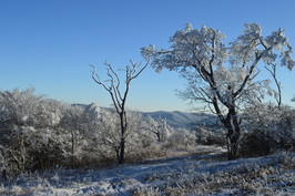
The Unicoi Mountains straddle the Tennessee/North Carolina border in the Cherohala Skyway area. Bob Bald is one of the higher mountains in the range. At an elevation of 5294 feet, Bob Bald provides extensive views of the Citico Creek Wilderness and Joyce Kilmer-Slickrock Wilderness. There are several different ways to reach Bob Bald, but the easiest one is from Beech Gap on the Cherohala Skyway. You will first follow an abandoned forest road along the State Line Ridge, before taking off onto a singletrack trail that leads straight to Bob Bald. This hike occurred on Saturday, February 27, 2016. My plan was to hike closed Forest Road 217H from Beech Gap to the Bob Bald Connector Trail. From there, I would take the Bob Bald Connector Trail to the summit of Bob Bald. After visiting Bob Bald, I would return the same way.
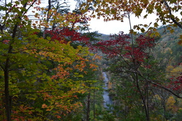 Two large rivers are the highlights of southern Cherokee National Forest's Ocoee/Hiwassee Ranger District: the Ocoee River and the Hiwassee River. Both rivers run through gorgeous canyons and are full of whitewater rapids. The John Muir Trail (and partially in conjunction with the Benton Mackaye Trail) runs along the northern shores of the Hiwassee River for a distance of nearly 20 miles, presenting opportunities to see the river's rapids and rock formations up close. This hike occurred on October 24th, 2015. My plan was to hike the John Muir Trail/Benton Mackaye Trail from the Big Bend Recreation Area to the Coker Creek footbridge at Duckett Ridge Trailhead. I would return almost the same way, although on the return trip, I would attempt to follow the old route of the John Muir Trail past Apalachia Powerhouse. 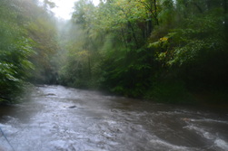
The Eastern Continental Divide is a geographically important mountain ridge that separates the waters of the Tennessee River from the waters of the Savannah River. When hiking the Hemp Top Trail, you'll be on top of this very ridge. Just to the west of the ridge, the Cohutta Mountains' most famous river, Jacks River, is a must-see after heavy rainfall in flood stage. Just don't try to ford it... even though I forded it several times on this day (it was in flood stage), it would be a risky procedure when the river is as high as it was on this day. This hike occurred on Saturday, October 3rd, 2015. My original plan was to hike the Penitentiary Loop - to first hike the Hemp Top Trail until the Penitentiary Branch Trail. I would then hike the Penitentiary Branch Trail. I would reach the Jacks River and follow the Jacks River Trail back to the trailhead, fording the Jacks River 18 times in the meantime. However, circumstances made me hike out and back to the Jacks River area at the end of Penitentiary Branch Trail.
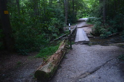
Springer Mountain is not any regular mountain. It's a special place. Springer Mountain is the southern terminus of the famous Appalachian Trail. Every year, thousands of hikers start a journey here that will last many months. Other hikers finish their long thru-hikes at this point, and when they reach the summit of the mountain, after hiking in from Three Forks, they've achieved an accomplishment. On this day hike, you'll feel almost like those southbound thru-hikers as you make the southernmost climb on the Appalachian to reach the first (or last) white blaze on the Appalachian Trail. You'll return using a lesser-traveled route using the alternative Benton Mackaye Trail. This hike occurred on Saturday, August 1st, 2015. My plan was to follow the Appalachian Trail from Three Forks to the summit of Springer Mountain. I would return back to Three Forks via the Benton Mackaye Trail.
 The Tellico River watershed is home to some of the most pristine and beautiful streams in Tennessee. Two wilderness areas, Bald River Gorge Wlderness and Citico Creek Wilderness, protect some of its major tributaries, and many hiking trails pass through the region. One of the more notable trails is the Benton Mackaye Trail, a nearly 300-mile trail that start in northern Georgia and ends in the Smoky Mountains. The section of the Benton Mackaye Trail described here is long and hard, but the view at the end is stunning. However, if you go, don't be like me and end up hiking nearly 30 miles instead of no more than 17 from one mistake. This hike occurred on January 31st, 2015. My plan was to hike the Benton Mackaye Trail from Tellico Trout Hatchery at the Tellico River to Whiggs Meadow. Much of this hike would also be along Sycamore Creek Trail. From Whiggs Meadow, I opted for a shorter return route, along Whiggs Ridge Trail... except I didn't find the trail. I will explain more on this later.  Big Frog Mountain is the highest mountain in southeastern Tennessee, topping out at over 4000 feet. The mountain and surrounding areas are protected by the combined Cohutta - Big Frog Wilderness. The newest addition to the area, though, is the Little Frog Wilderness, a smaller tract of land across from Big Frog Wilderness and US Highway 64. This tract protects the Panther Knob area, the better portion of Dry Pond Lead, and Rock Creek/Pressley Cove. Two trails, the Dry Pond Lead Trail and the Rock Creek Trail, provide access to the wilderness area, and you won't regret hiking them. This hike occurred on November 15th, 2014. My plan was to hike through most of the Little Frog Wilderness by starting at the Rock Creek Trailhead and hiking the entire Rock Creek Trail to the junction with the Dry Pond Lead Trail/Benton Mackaye Trail. Here, I would turn south onto the Dry Pond Lead Trail and follow it to US-64 and Ocoee Powerhouse No. 3. Then, I would enter the Tanasi Trail System, and take the Thunder Rock Express Trail to the Chestnut Mountain Trail. Next, I would follow the Chestnut Mountain Trail east, before exiting onto the Bear Paw Paw Trail that would lead down to Ocoee Whitewater Center. I would close the loop by hitchhiking 0.8 miles of US-64 to Rock Creek Trailhead (something I wouldn't recommend you to do!).  Polk County, Tennessee, is the Gateway to the Cherokee National Forest. In this beautiful corner of extreme southeast Tennessee, the rivers cut their way through valleys, bordered by the low-lying peaks of the Unicoi Mountains. The Benton Mackaye Trail's route goes straight through the area, following rolling hills and wooded slopes. One of the more prominent landmarks in the area is called Buck Bald, a small mountain with the summit being nothing more than a grassy clearing accessible via Buck Bald Road. While the BMT doesn't directly go over the top, it passes close by, and access to the bald is easy. This hike occurred on Saturday, October 25th, 2014. My plan was from Highway 68 to follow the Benton Mackaye Trail north to Buck Bald Road, and then take Buck Bald Road to the summit of Buck Bald. This short hike is an excellent way to spend your afternoon and watch the sunset. |
About MeMark Oleg Ozboyd Dear readers: I have invested a tremendous amount of time and effort in this website and the Georgia Waterfalls Database the past five years. All of the work that has gone in keeping these websites updated with my latest trip reports has almost been like a full-time job. This has not allowed me to pick up a paid job to save up money for college, and therefore, I I've had to take out loans. If you find the information on this website interesting, helpful, or time-saving, you can say "thanks" and help me out by clicking the button above and making a contribution. I will be very grateful for any amount of support you give, as all of it will apply toward my college tuition. Thank you!
Coming in 2022-2023?
Other Hiking WebsitesMiles HikedYear 1: 540.0 Miles
Year 2: 552.3 Miles Year 3: 518.4 Miles Year 4: 482.4 Miles Year 5: 259.9 Miles Archives
March 2021
Categories
All
|

 RSS Feed