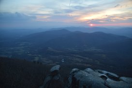
The Peaks of Otter - Sharp Top, Flat Top, and Harkening Hill - are three distinct mountains in the vicinity of the Blue Ridge Parkway. Several centuries ago, it was believed by Thomas Jefferson that the Peaks of Otter - along with the Blue Ridge Mountains in general - are the tallest peaks in the United States, but of course, this was later proved wrong, although not before stones were sampled from the Peaks of Otter and sent to be part of the Washington Monument. Hiking trails lead to each of the three peaks, and two of the three peaks provide excellent views. In fact, the rocky pinnacle at the summit of Sharp Top Mountain provides a 360-degree panorama that overlooks the Virginia Piedmont and the Blue Ridge Mountains that are scattered through the area. This hike occurred on Friday, November 25th, 2016. My plan was to hike the Sharp Top Mountain Trail out and back from Abbot Lake. I would make the short side trip to Buzzards Roost - a separate rock formation and viewpoint - along the way. This hike was the fourth of seven hikes that I did during a four-day Thanksgiving trip to the mountains of western Virginia.
0 Comments
Jefferson National Forest: Apple Orchard Falls Trail and Cornelius Creek Trail, Buchanan, Virginia1/24/2017 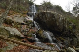
Virginia is known for its mountain vistas much more than for its streams and waterfalls. Interestingly, much of the terrain in the mountains of Virginia is not very supportive for large waterfalls, so when your Virginia hike takes you to a waterfall that is around two hundred feet high, it can be considered something special for sure. This hike visits Apple Orchard Falls. At 200 feet high, this waterfall is one of the highest in Virginia. Furthermore, the popular loop along North Creek, Apple Orchard Branch, and Cornelius Creek is one of the most beautiful stream hikes in George Washington and Jefferson National Forest and perhaps in all of Virginia. This hike occurred on Friday, November 25th, 2016. My plan was to hike the Apple Orchard Falls/Cornelius Creek Loop clockwise, by first following the Apple Orchard Falls Trail to and past Apple Orchard Falls. Then, I would hike the Cornelius Creek Spur Trail to the Cornelius Creek Trail, finishing the loop by taking the Cornelius Creek Trail back to the trailhead. This hike was the third of seven hikes that I did during a four-day Thanksgiving trip to the mountains of western Virginia.
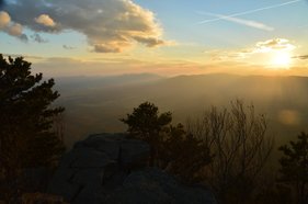
Driving through the vicinity of the town of Lexington, Virginia, one cannot fail to notice two twin summits rising up sharply to the northwest of town. The distant peaks tower out of the valley farmlands as you drive along US Route 11 near Lexington, and when you drive on I-64, the peaks are still there, although their character has changed as you see them from a different angle. The peaks are none other than Big and Little House Mountain, two mountains with outstanding 180-degree to 270-degree views. The House Mountain area was preserved by the Virginia Outdoors Foundation, and there are now established hiking trails to viewpoints on both mountains. In addition to the grand views that you'll see, you'll also get to visit a Big House Mountain boulder field that is home to a unique rock formation known as Tabletop Rock. This hike occurred on Thursday, November 24th, 2016. My plan was to hike to along a gated forest road to the saddle between Big House Mountain and Little House Mountain. Once there, I would hike out and back along the Big House Mountain Trail to Goat Point Overlook and Tabletop Rock on Big House Mountain. Then, I would return to the saddle and hike out and back to the vista on Little House Mountain. I would finish the hike by retracing my steps back down along the gated forest road. This hike was the second of seven hikes that I did during a four-day Thanksgiving trip to the mountains of western Virginia. Unfortunately, I got a late start and reached the Little House Mountain vistas after dark.
*Note: I am hoping to re-hike this trail in 2021 and update this trip report with better information and daylight pictures from Little House Mountain!
Natural Bridge State Park: Cedar Creek Trail to Natural Bridge and Lace Falls, Glasgow, Virginia1/18/2017 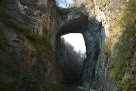
The 215-foot natural bridge that is carved out by Cedar Creek is the centerpiece of Natural Bridge State Park, Virginia's newest state park. The Cedar Creek Trail travels through the Cedar Creek gorge for about a mile, passing a cave along the way, before terminating at Lace Falls, which is a beautiful multi-tiered 50-foot waterfall. Even though the incredible natural bridge is the main attraction on this hike, the trail visits several other features in this little known-area of Virginia. This hike occurred on Thursday, November 24th, 2016. My plan was to hike the Cedar Creek Trail out and back, passing under the Natural Bridge, past Saltpeter Cave, and reaching Lace Falls. This hike was the first of seven hikes that I did during a four-day Thanksgiving trip to the mountains of western Virginia.
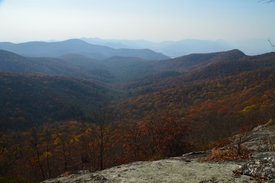
The Bartram Trail, which is a lesser-used footpath that stretches across portions of Georgia and North Carolina, stays close to the Tennessee Valley Divide for a number of miles in Georgia's Rabun County, passing over Rabun Bald, which is the second highest mountain in Georgia. In the vicinity, several other mountains provide noteworthy views, such as Double Knob, Flat Top Mountain, and Flint Knob. While the views from Rabun Bald are arguably better than some of these views, the other overlooks in the area are certainly worth visit as well. On this hike, you'll follow the Bartram Trail and then a side trail to three or four mountains with views in different directions. If you're feeling up to it, you will have the opportunity to tackle Rabun Bald and experience the 360-degree view from the top as well. This hike occurred on Saturday, November 12th, 2016. My plan was to hike the Bartram Trail out and back from Wilson Gap Road to Rabun Bald. Along the way, I would make the side trip to Flint Knob and possibly Alex Mountain, and I would also bushwhack up to Double Knob, in addition to seeing the view from Flat Top Mountain. Unfortunately, due to the length of the side trips, I was not able to hike the Bartram Trail from Flint Gap to Rabun Bald.
Chattooga River Trail: Sandy Ford Road to Dicks Creek Falls to Russell Bridge, Clayton, Georgia1/12/2017 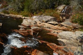
The Chattooga Wild and Scenic River is one of the longest and largest remaining wild waterways in the southeastern US, with no dams and very little human development for all of its length down to Lake Tugaloo. In fact, it is the only wild and scenic river east of the Mississippi River that is actually commercially rafted. For nearly twenty miles, the Chattooga River Trail stays near the river or even follows it along its Georgia side. Unfortunately, the Georgia Chattooga River Trail leaves something to be desired, as there are surprisingly few views of the river throughout the length of the trail. Still, the Chattooga River Trail passes by several points of interest, including Dicks Creek Falls on Section Two. This hike occurred on Saturday, November 5th, 2016. My plan was to hike the Chattooga River Trail from the Sandy Ford Road/Dicks Creek Falls trailhead to the Russell Bridge Trailhead. This is also known as Section Two of the Chattooga River Trail. Along the way, I would take side trips to Dicks Creek Falls and Adline Ford. I arranged to have two cars for this point-to-point hike: one car was placed at the Sandy Ford Road trailhead, and another car was placed at Russell Bridge on Highway 28.
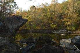
One of the newest additions to Bartow County's trails, the Pine Log Creek Trail is a short hike that passes over and around several hills in the vicinity of Pine Log Creek, before visiting an old water-filled CCC quarry. The Pine Log Creek Trail is also located conveniently close to metro Atlanta, and even though the trail does not have the outstanding features of many mountain trails, it could still serve as a great after-work outing for people from the northwest metro. This hike occurred on Saturday, October 29th, 2016. My plan was to hike the West Loop of the Pine Log Creek Trail clockwise and the East Loop of the Pine Log Creek Trail counter-clockwise. Along the way, I would take the side trail to the old CCC Quarry.
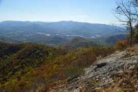
The Southern Nantahala Wilderness is a large wilderness area that stretches across portions of far northeast Georgia and southwest North Carolina. The Georgia side of the wilderness has a distinct lack of trails (other than a short section of the Appalachian Trail), which is unusual for Georgia wilderness areas. However, the lack of official trails does not mean that there are less points of interest. The Georgia side of the Southern Nantahala Wilderness is home to a number of tall peaks, including Hightower Bald and Eagle Mountain. On this hike, you will follow various old logging roads to the summit of Eagle Mountain, a 4000-foot mountain where a fantastic vista awaits. In my opinion, the view from the top of Eagle Mountain is one of the best - if not the best - vista in Georgia. This hike occurred on Saturday, October 22nd, 2016. My plan was to use several old logging roads, which appear to receive horse use and ATV use, to hike out and back to the summit of Eagle Mountain from the gate at the end of the drivable portion of Bell Gap Road.
|
About MeMark Oleg Ozboyd Dear readers: I have invested a tremendous amount of time and effort in this website and the Georgia Waterfalls Database the past five years. All of the work that has gone in keeping these websites updated with my latest trip reports has almost been like a full-time job. This has not allowed me to pick up a paid job to save up money for college, and therefore, I I've had to take out loans. If you find the information on this website interesting, helpful, or time-saving, you can say "thanks" and help me out by clicking the button above and making a contribution. I will be very grateful for any amount of support you give, as all of it will apply toward my college tuition. Thank you!
Coming in 2022-2023?
Other Hiking WebsitesMiles HikedYear 1: 540.0 Miles
Year 2: 552.3 Miles Year 3: 518.4 Miles Year 4: 482.4 Miles Year 5: 259.9 Miles Archives
March 2021
Categories
All
|

 RSS Feed