
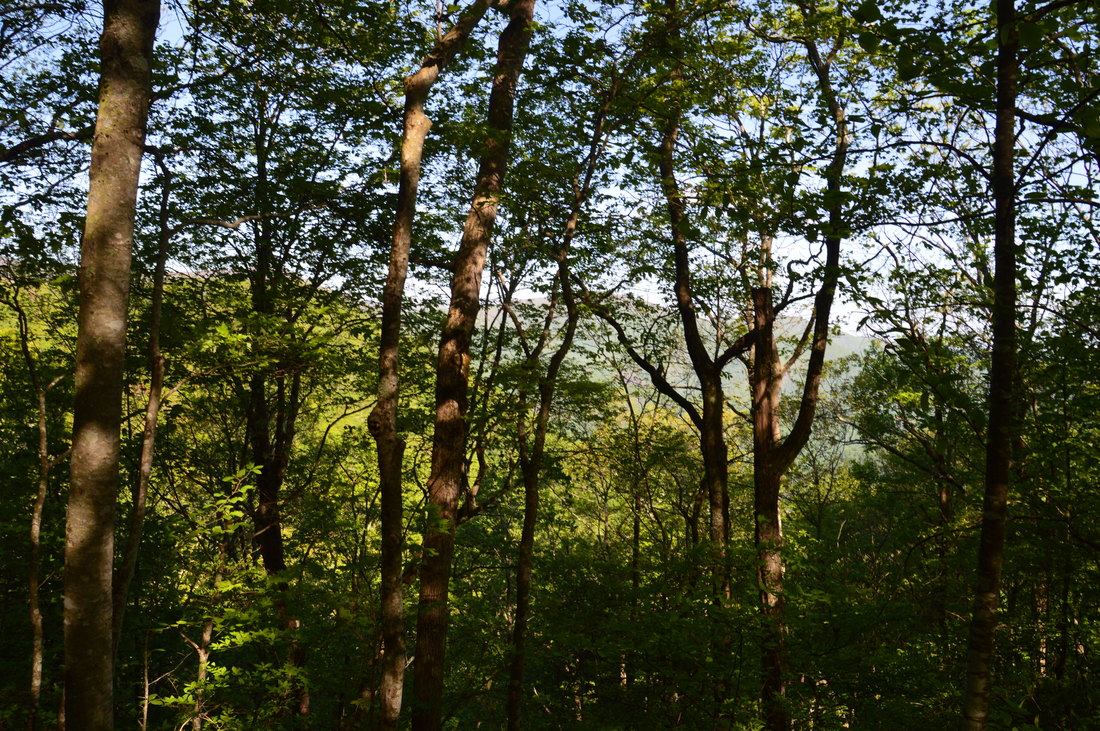
The Upper Tallulah River splits the Southern Nantahala Wilderness's lower region into two nearly separate parts. To the east of the Tallulah River, some of the wilderness's most famous landmarks are situated, such as Standing Indian Mountain, High Falls, and Denton Creek Falls, each of which is reached by well-used trails. The rugged terrain to the west of the Tallulah River tells a whole different story, however. Few official trails traverse this remote area, but a pair of unofficial footpaths provide access from the bottom of the valley all the way to the ridgetops. A beautiful waterfall called Oversoul Falls is found along the unmaintained Holden Cove Trail, and a difficult trek away from the Bly Gap Trail will lead an experienced hiker to Fall Branch Falls, a long series of steep cascades and slides. Even the Appalachian Trail in this area is used lightly compared to many other sections of the AT, and you're not likely to meet any people along the way to the breathtaking Ravenrock Cliff Overlook. This hike was occurred on Saturday, May 20th, 2017. My plan was to begin the day with a surprisingly difficult bushwhack from the Bly Gap Trailhead to Fall Branch Falls. Then, I would move on the main hike of the day, placing a second car at the Holden Cove Trailhead and hiking the Holden Cove Trail past Oversoul Falls to the Appalachian Trail and to Ravenrock Cliff Overlook. I would finish the hike by following the AT to Bly Gap and then hiking the Bly Gap Trail back to the first car. Folks without the option of taking two cars for the hike would have to make a final 2-mile roadwalk to complete the loop.
Summary
Note: The difficult trek to Fall Branch Falls, an optional side trip/add-on to the main hike, is mapped and described at the bottom of this page separately from the main hike.
Length of Trail: 11.1 Miles (13.3 Miles if only one car is available)
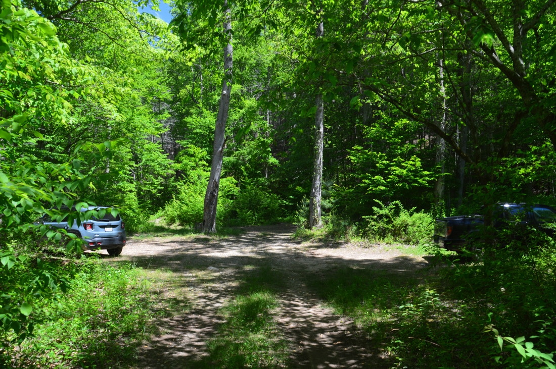
Duration of Hike: 9:10 Type of Hike: Point-to-Point (Longer Loop Option available for people without two cars) Difficulty Rating: 10 out of 10 Total Elevation Gain: 3220 Feet Pros: Solitude and wilderness throughout most of the hike Cons: Much of the hike is on faint trails that should not be attempted by novice hikers Points of Interest: Oversoul Falls - 3 stars; Ravenrock Ridge Overlook - 8 stars; 1973 plane crash remains; Courthouse Bald Vista - 3 stars Trail Blaze Colors: Holden Cove Trail - None; Appalachian Trail - White; Raven Rock Trail - Blue; Bly Gap Trail - None Best Seasons to Hike: Early Spring Fees: None Beginning Point: Holden Cove Trailhead (Note: If using one car, it may be better to park at Bly Gap Trailhead, because there is more parking space) Directions from Clayton, GA to Bly Gap Trailhead: From the intersection of Rickman Drive, Savannah Street, and US Route 23/441 in downtown Clayton, follow Savannah Street (US 76) West for 8.0 miles. Then, turn right onto Persimmon Road. In another 4.2 miles, turn left onto Tallulah River Road, and continue for exactly 6.6 miles, passing through Tate City. The road will turn into unpaved Forest Service Road 56. 0.2 miles after a bridge across Denton Creek, bear left onto a narrow unnamed forest road that descends down to the Tallulah River. 300 feet after leaving Tallulah River Road, the road turns acutely left at a camping area near the river. While the narrow road continues farther, this is the best place to park your car, as the Bly Gap Trail begins (or ends) here,and there is space for several cars. Directions from Bly Gap Trailhead to Holden Cove Trailhead: Return to Tallulah River Road from the Bly Gap parking area and continue driving along the road northward for about 2.2 miles. 0.3 miles after a shallow crossing of a stream (Waterspout Branch) on the road, there will be a camping area on the left side of the road down by the Tallulah River. There is space for one or possibly two cars to the right of the campsite, which also serves as the Holden Cove Trailhead. Map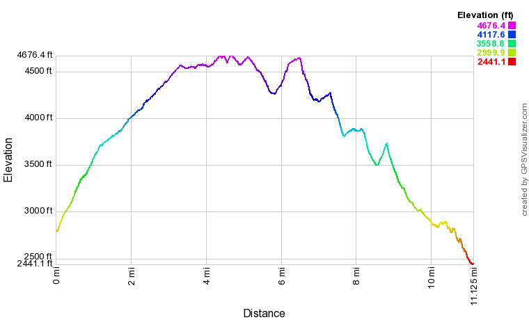
Click here to download a track of this hike.
Details
To begin with, a serious disclaimer is necessary for this hike. Around 2/3 of this hike is on trails that are not maintained or marked officially, namely the Holden Cove Trail and Bly Gap Trail. Both of these trails can be faint or even nearly non-existent in places, and hikers on these trails will have to navigate through blowdowns, overgrown sections, and confusing intersections. Coupled with the fact that this hike has over 3200 feet of elevation gain and some periods of extremely steep downhill, these details have led me to assign a difficulty rating of 10 to this hike. I do not recommend for inexperienced hikers without navigational skills to embark on this demanding trek.
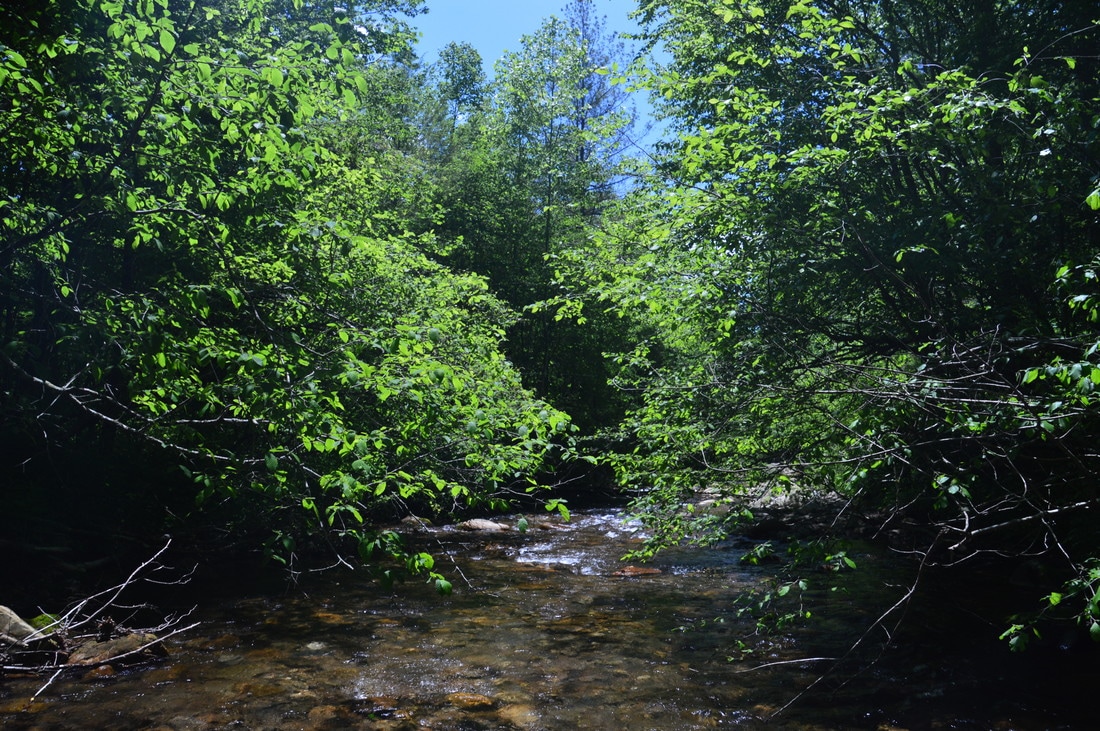
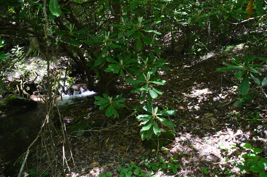
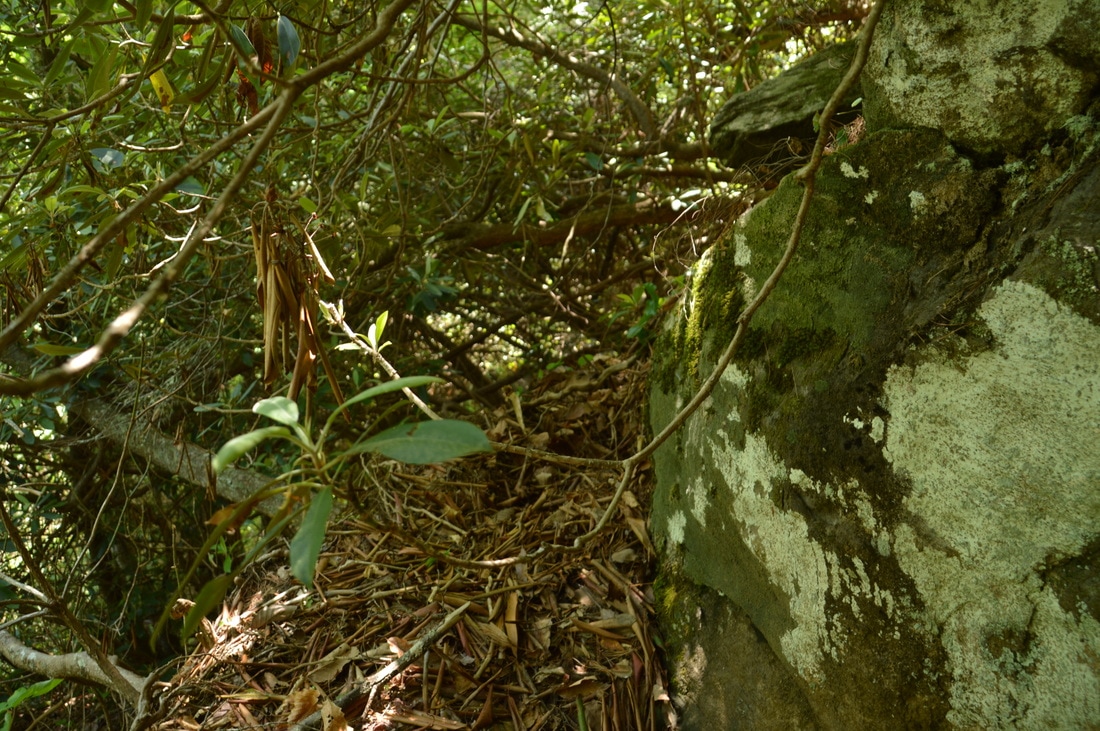
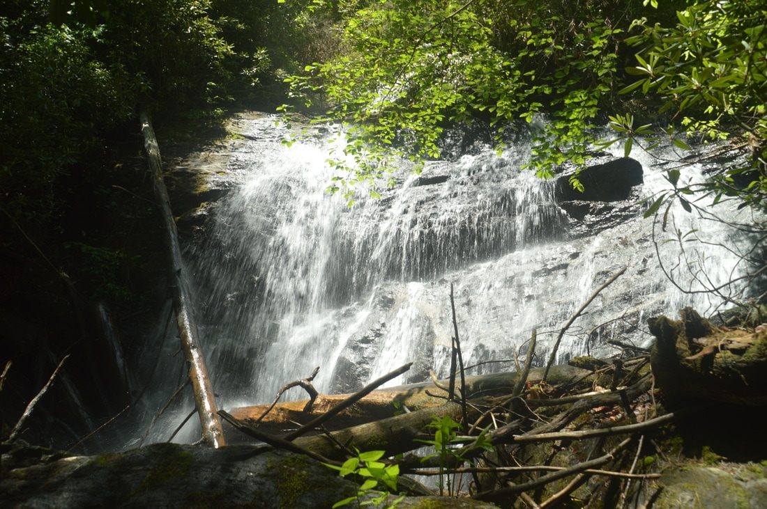
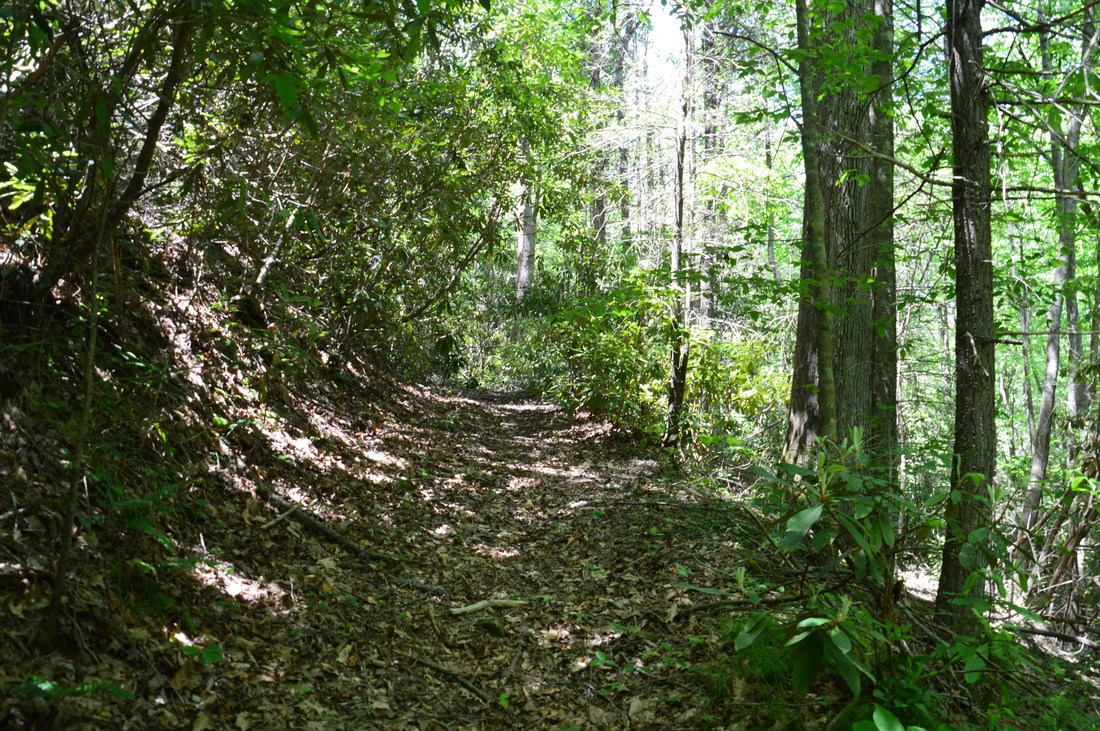
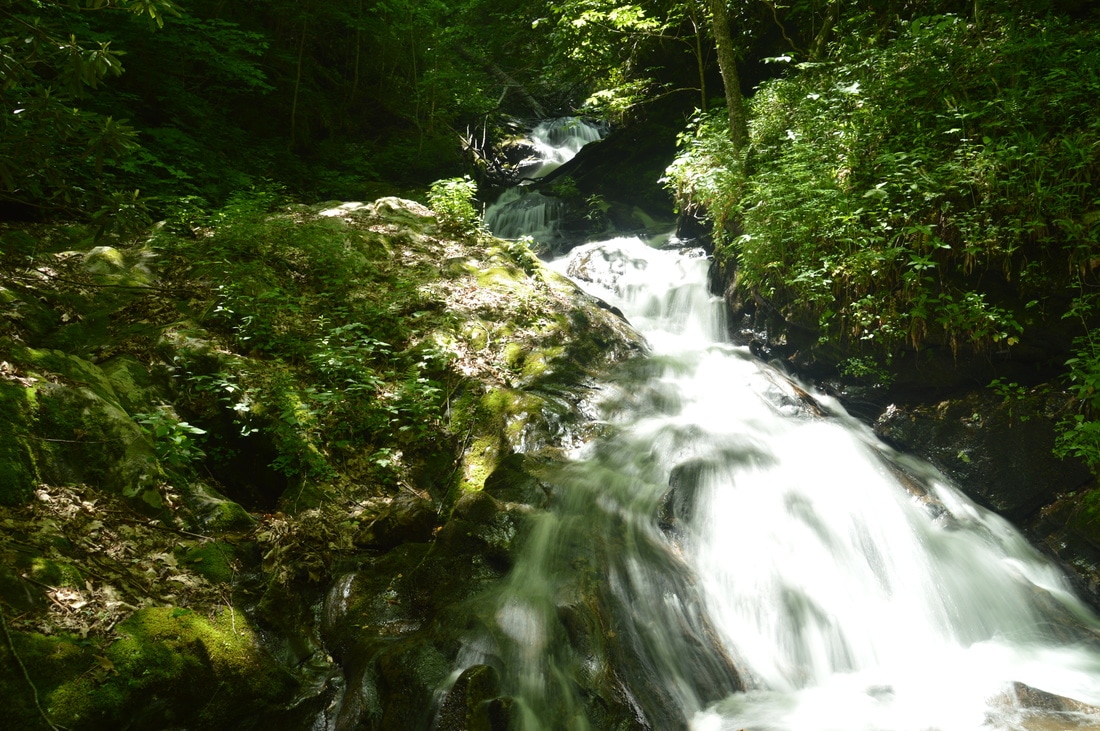
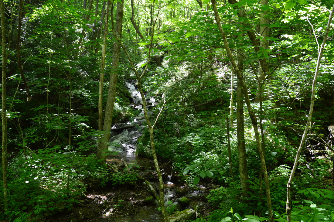
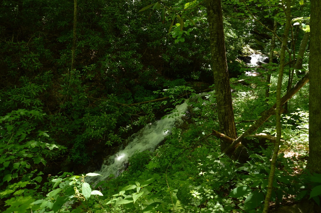
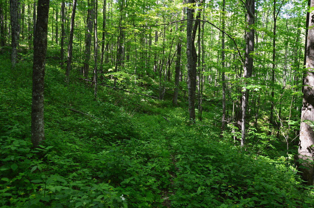
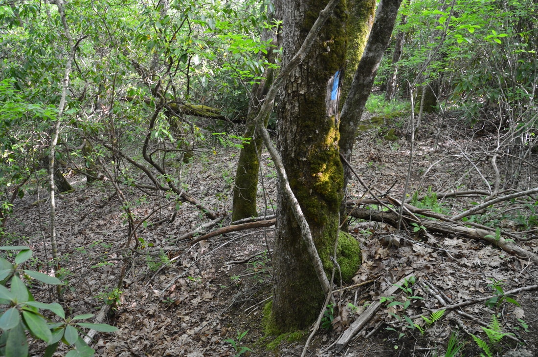
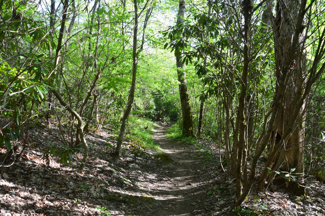
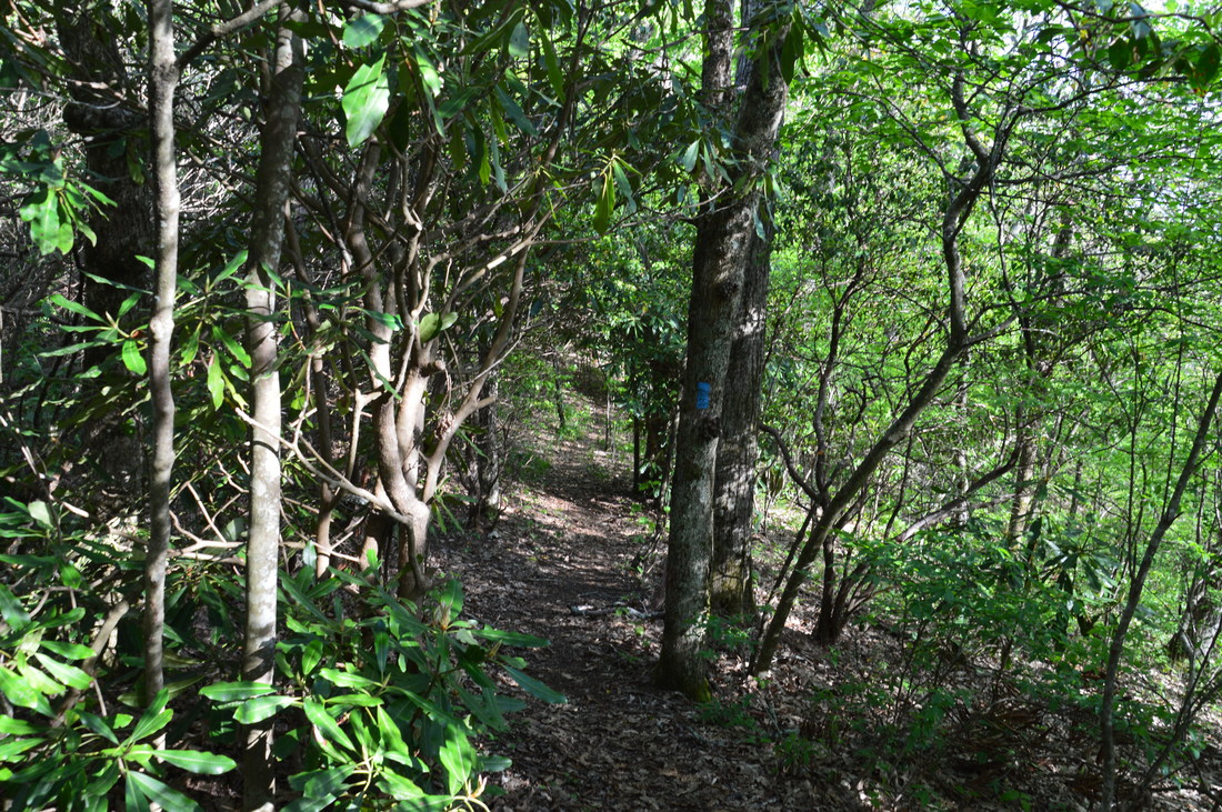
With the disclaimer behind, I do have to admit that this is a gorgeous hike, if the difficulty is manageable. Much of the hike is actually in North Carolina, with the exception of the Bly Gap Trail, which is primarily in Georgia. Even though a segment of this hike follows the popular Appalachian Trail, you will still get a true wilderness experience from hiking these trails, and there are multiple rewards in terms of waterfalls and views. I used two cars for this hike to cut down the mileage due to time constraints, although it's easy to turn the hike into a loop simply by walking along Tallulah River Road, a peaceful forest road, for 2.2 miles. Since the Bly Gap Trailhead has a lot more parking space, it is best to start the loop there, but however, it is important to hike the loop counter-clockwise for two reasons. The first reason is that the Holden Cove Trail is fainter than the Bly Gap Trail, so leaving it for the end is not a good idea. The second reason is that there are several extremely steep stretches on the Bly Gap Trail, and hiking up that trail would be very grueling. This trail report describes the hike in the counter-clockwise direction from Holden Cove Trailhead to Bly Gap Trailhead, and while the roadwalk in between is not described in detail, I will mention that it is quite easy and will only increase the difficulty of the hike in terms of mileage. From the Holden Cove Trailhead, begin the hike along an obvious path that leads northwest from the parking and right away down to a ford of the Tallulah River. The water was below my knees on this day. The distinct trail continues on the other side of the river, initially paralleling the Tallulah River but rising above it on an old roadbed. At 0.1 miles, the Holden Cove Trail begins to curve west into Holden Cove, and soon, Holden Cove Creek comes into view with a surprising amount of water in it. The trail quickly narrows but remains as a visible footpath for the time being, ascending moderately. The first 1.3 miles of the trail have the steepest part of the ascent, as the trail ascends over 900 feet during this time. At 0.25 miles, the Holden Cove Trail crosses a small tributary, and soon after, there is a long set of cascades on the main creek. At 0.5 miles, flagging tape marks the trail as it crosses Holden Cove Creek in an unclear spot just below a large cascade. You may be able to keep your feet dry at this crossing. Then, the trail ascends a steep slope, and Oversoul Falls - which looks like a set of slides/cascades from the trail - will be down on the creek to the left only about 100 feet after the crossing. To reach the falls, leave the trail and scramble down the slope to the base of the falls, and try to avoid provoking erosion along the way by descending down a more level area. 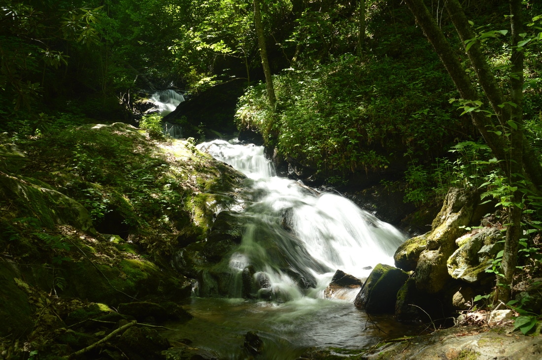
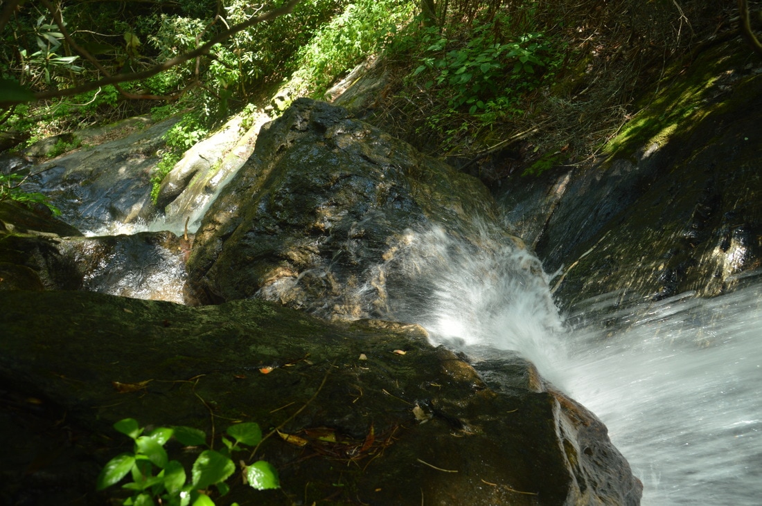
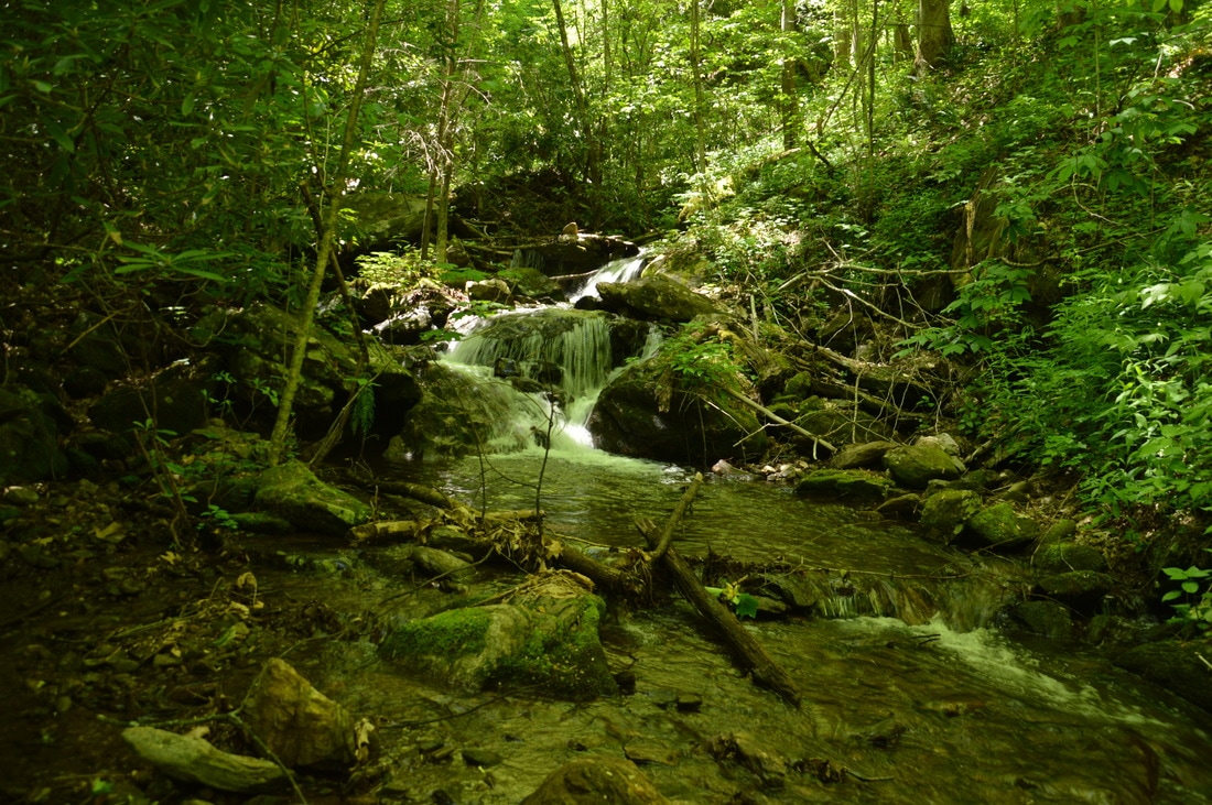
Oversoul Falls is a 40-foot run of cascades and slides in a narrow part of Holden Cove Creek. Under the right conditions, this can be a photogenic waterfall.
Oversoul Falls is not exactly a waterfall in the true sense, but it is a beautiful location anyway. Altogether, the creek drops about 40 feet at Oversoul Falls, and this elevation change consists of three sizable sliding cascades. A route on the left side of the biggest lower cascade provides access to a closer view of the upper cascades. A small pool marks the base of the lower cascade. Oversoul Falls was documented and christened by fellow hiker Andy Kunkle in April 2016.
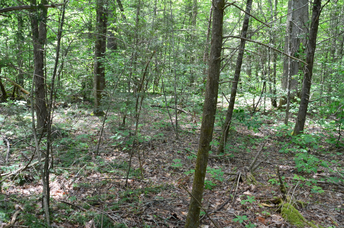
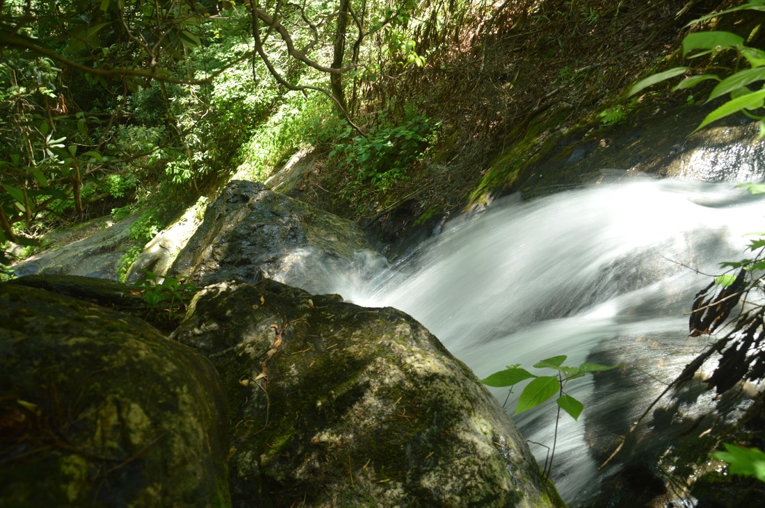
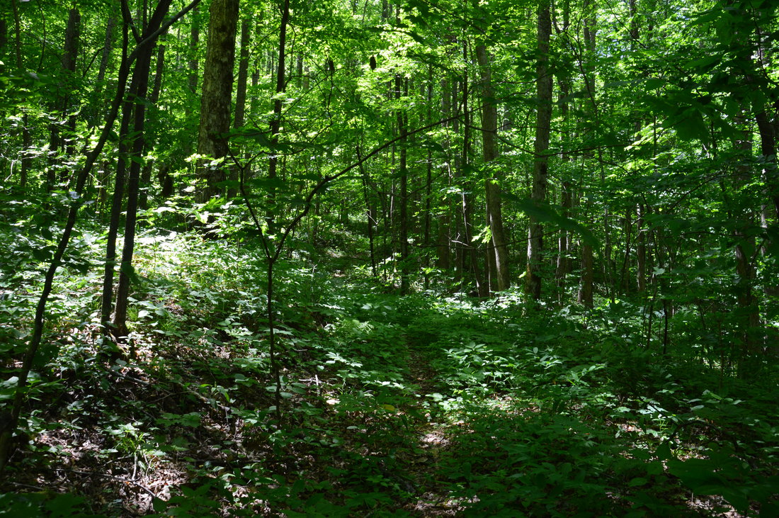
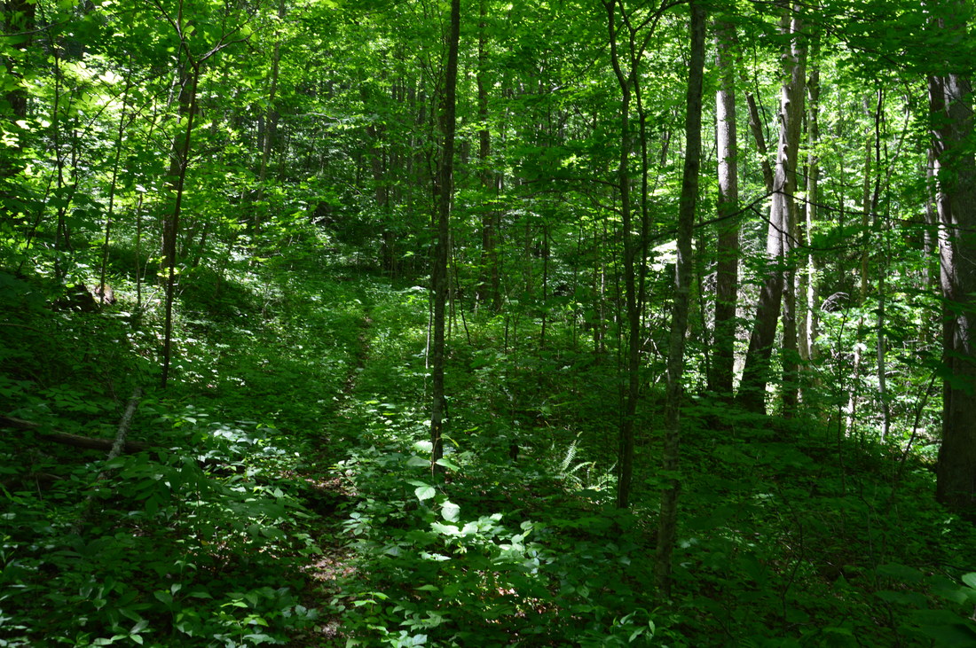
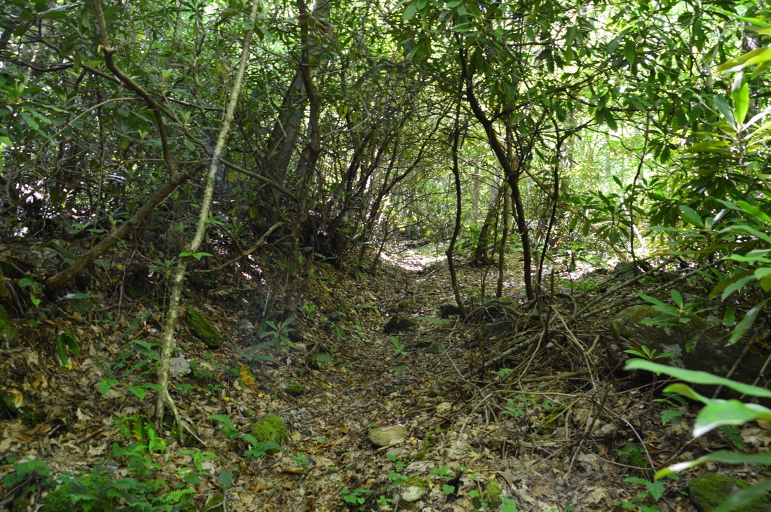
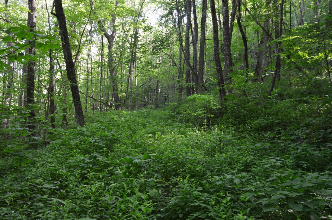
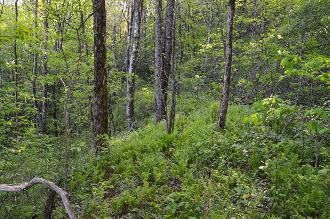
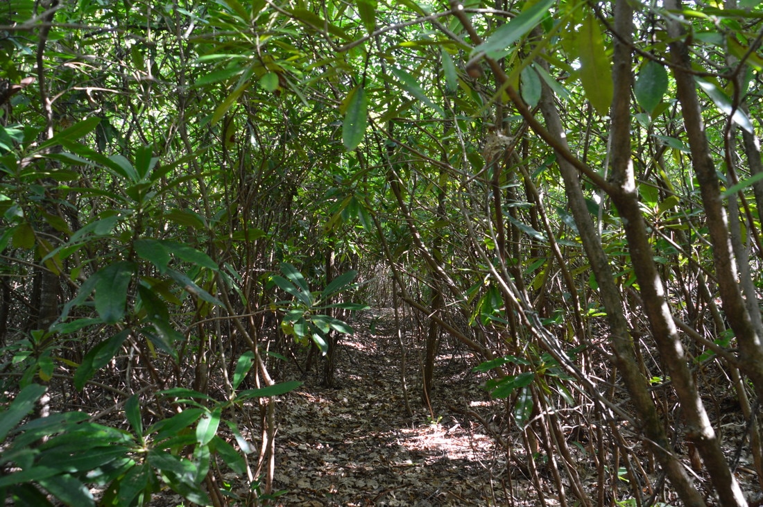
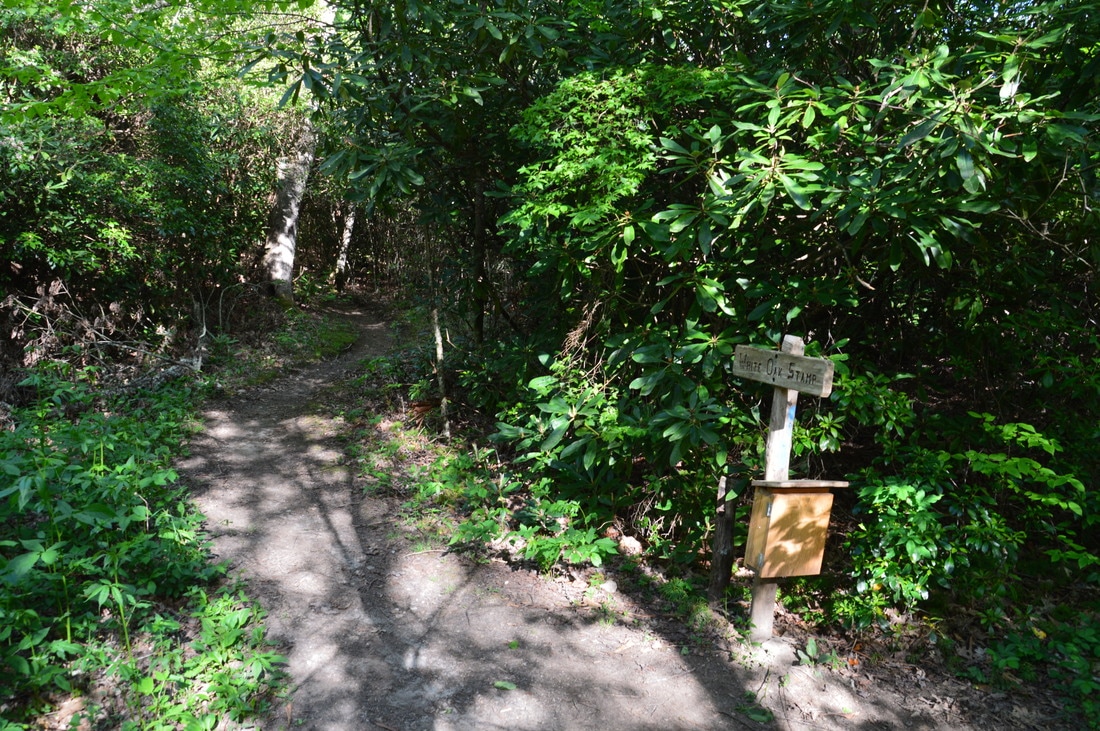
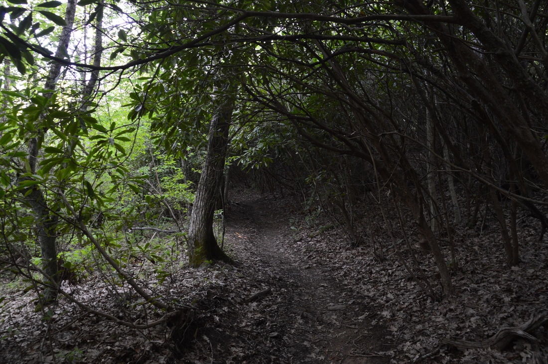
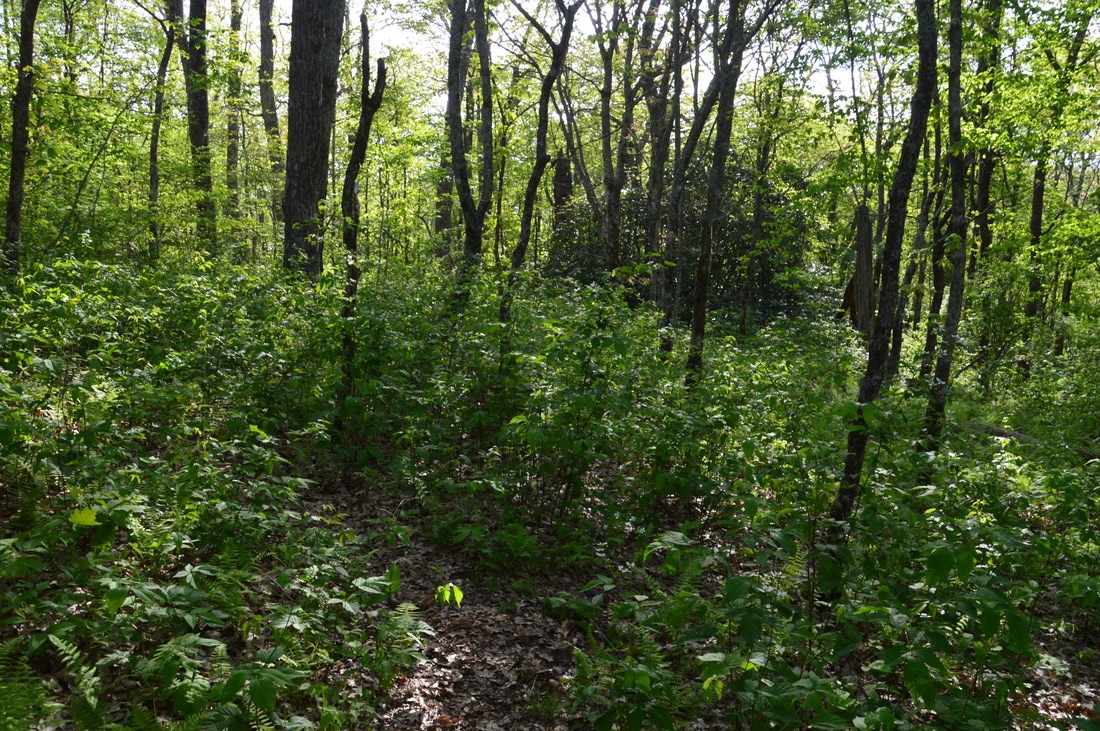
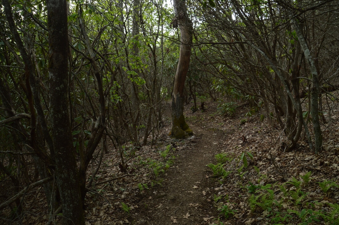
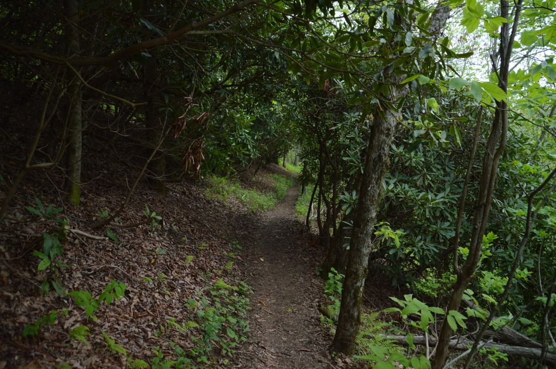
From Oversoul Falls, return to the trail and follow it upstream along Holden Cove Creek. At 0.6 miles, bear left to follow the trail across a tributary. A series of scenic cascades lies on the main creek to the left over the next tenth of a mile. The trail grows steadily fainter after Oversoul Falls, however, so you must stay vigilant. At 0.75 miles, the trail crosses Holden Cove Creek again. Immediately afterwards, Holden Cove Creek appears to split into two branches. A narrow strip of land separates the two branches. While it is not obvious, the very faint trail actually crosses over onto this "peninsula" and follows the area between the two branches. Then, the trail briefly takes the form of a more distinct path, but as it ascends moderately approaching a junction with a logging road, the path nearly disappears, and in the summer, it may difficult to discern the route. The last 400 feet or so of trail before the logging road were not visible at all in summer, so I had to guess my way along a route of least resistance in a straight line. At 1.3 miles, reach the junction with the logging road that heads left and right. Flagging tape marks the junction. Don't turn right, as that is a dead end. Instead, turn left onto the logging road. The road is rather overgrown, especially in summer, but it is quite easy to follow, and most of the time, a path is seen. The rest of the ascent along the Holden Cove Trail is gentle and easy. At 1.5 miles, there is another intersection, where an even more overgrown logging road bears left, while the main road/Holden Cove Trail switchbacks acutely to the right at an amusing "Road Closed to Vehicles" sign nailed to a tree. Over the next 1.1 miles, the Holden Cove Trail makes five pairs of long switchbacks, steadily gaining elevation in the hardwood forest. Simply keep following the obvious wide roadbed, even if it is more than a bit overgrown in a few places. At 2.6 miles, around the 4250-foot elevation, make the 11th and final switchback (to the right) since you joined the road. After this, the Holden Cove Trail contours along slopes in the upper reaches of Holden Cove, crossing one of the headwaters of Holden Cove Creek at 2.75 miles. Around 3.0 miles, there are great winter views eastward toward Big Scaly Mountain. The trail enters a rhododendron tunnel at 3.2 miles after passing through a beautiful field of ferns. Finally, at 3.3 miles, the Holden Cove Trail reaches a well-used blue-blazed trail that acts as a side trail for water from the Appalachian Trail. The water source is down to the right, but to continue the hike, turn left onto the broad path, reaching the Appalachian Trail in about 150 feet at a sign that reads "Whiteoak Stamp". 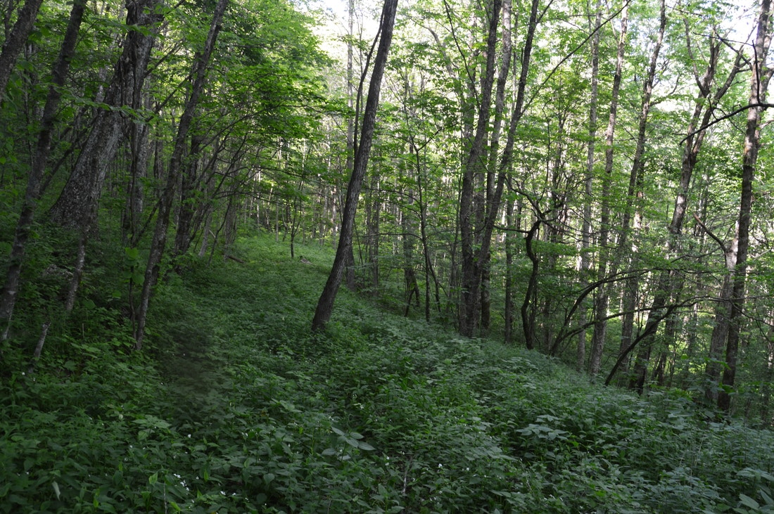
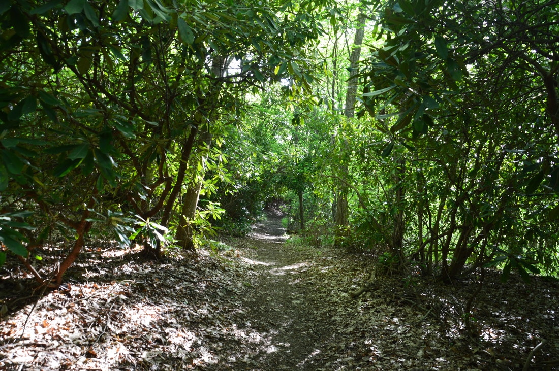
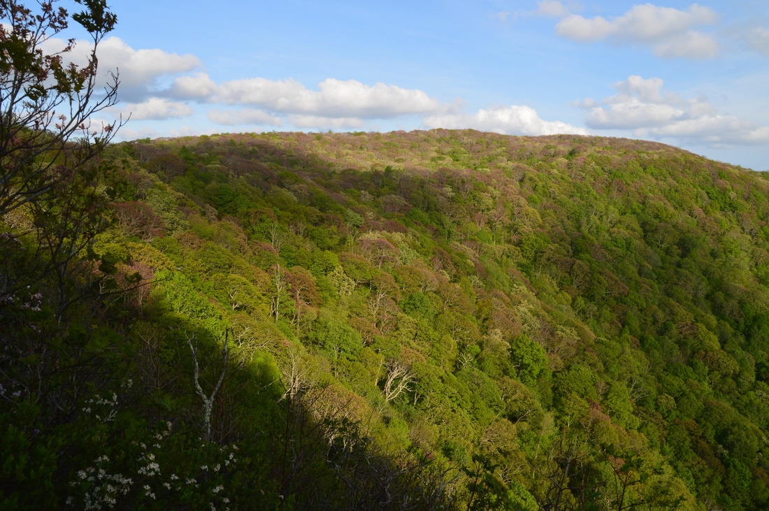
The upper section of the Holden Cove Trail follows an overgrown old logging road that steadily rises into the high country of the Southern Nantahala Wilderness.
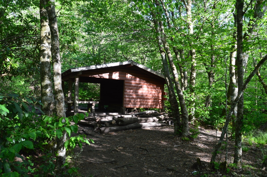
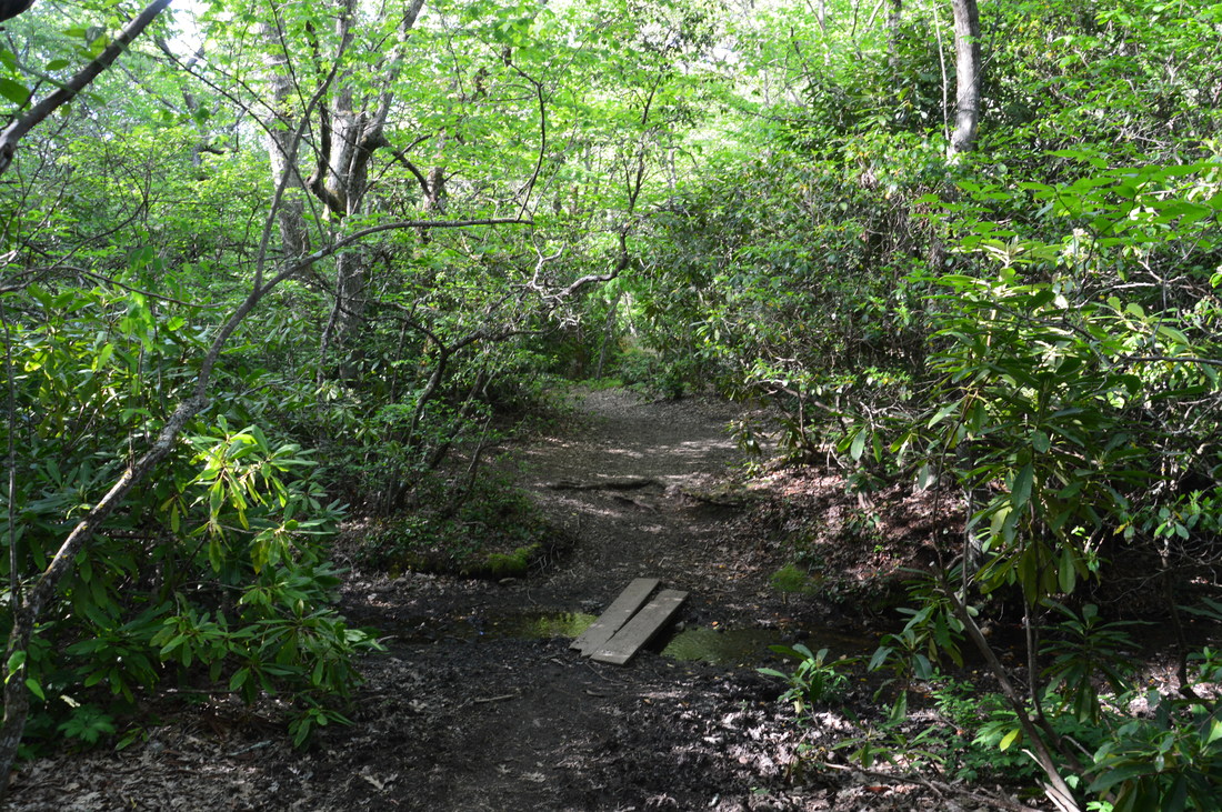
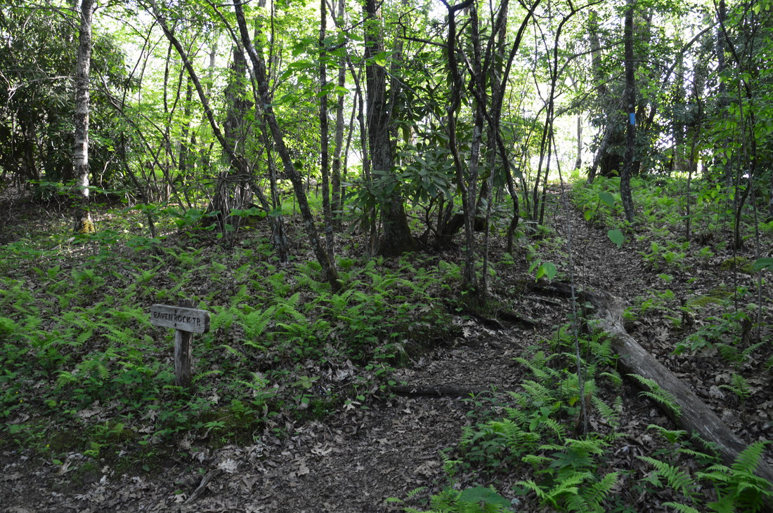
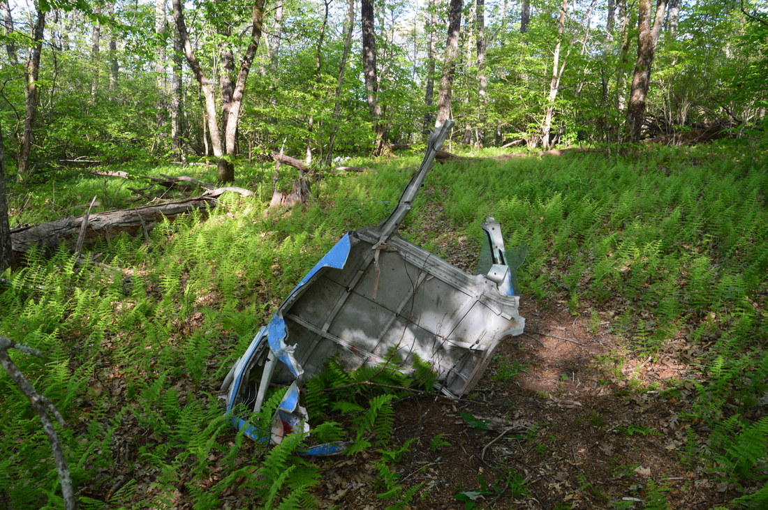
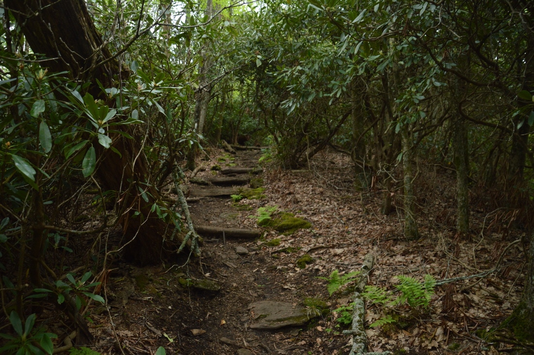
A "stamp" is typically a large high-elevation flat area. Whiteoak Stamp is home to a sizable tract of virgin forest and to a unique heath bog near the headwaters of a Muskrat Branch tributary. From the intersection with the AT, the distinct path that continues straight leads to the edge of thickets that cover the heath bog. To continue the main hike, turn left onto the white-blazed Appalachian Trail. The next 0.8 miles of trail are very easy and a welcome change, as all uphill and downhill grades are gentle and the topography is relatively flat. As you hike south along the AT, there are winter views of Ravenrock Ridge to the west. At 4.1 miles, the Appalachian Trail passes Muskrat Creek Shelter on the left - a great place for hikers to spend the night at - and crosses Muskrat Branch via a plank bridge. Just ahead, the AT reaches a usually signed intersection with the Raven Rock Trail. This blue-blazed side trail leaves to the right and serves as the approach trail to a breathtaking overlook from Ravenrock Cliffs. Begin following the Raven Rock Trail northwest along or near the spine of Ravenrock Ridge, circling around a 4700-foot wooded top at the hike's highest point. At 4.4 miles, there is an unmarked fork in the trail. The right fork is a 250-foot spur trail to remains from a 1973 plane crash. Take this spur trail to the remains, which are scattered all about the area. A small Cessna plane crashed into the mountain here during foggy conditions in 1973, killing the pilot, who was the only person in the plane.
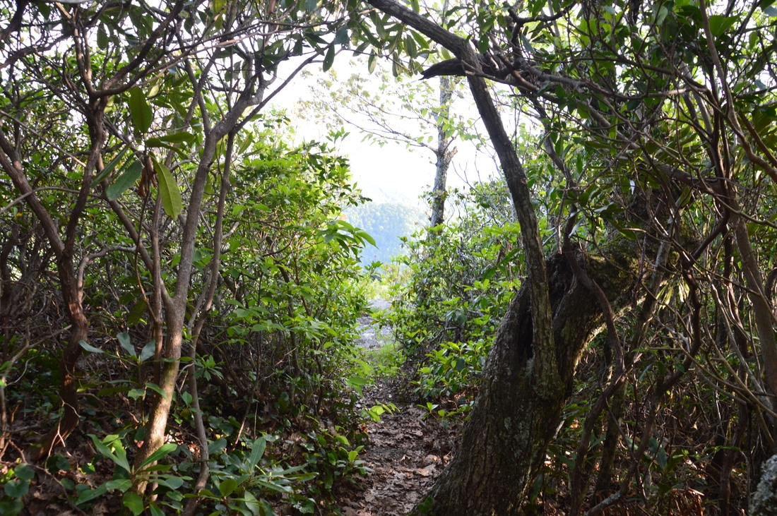
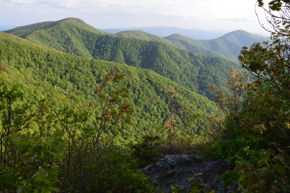
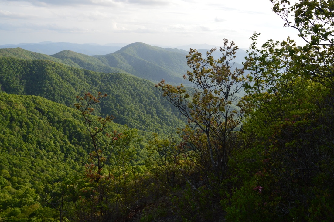
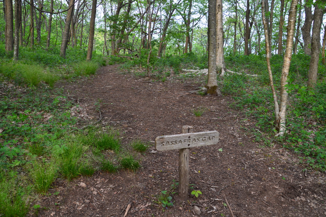
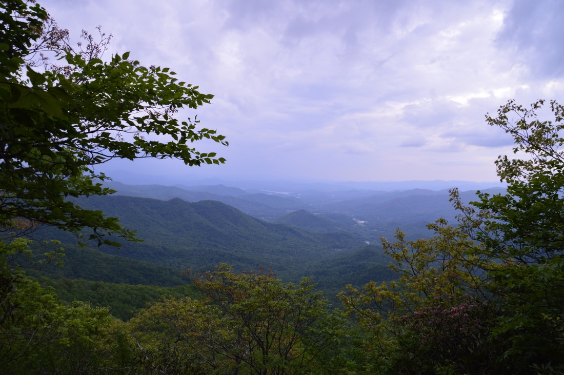
After viewing the plane remnants, return to the fork and continue following the main trail. The trail begins descending off the ridge and toward the cliffs, terminating at Ravenrock Cliffs at 4.6 miles. The cliffs provide a stunning 180-degree view to the south. The peaks on the ridge in foreground are (in order from left to right or northeast to southwest) Courthouse Bald, Sharp Top, Rich Knob, and Hightower Bald. On a clear day, many Georgia landmarks are visible in the distance, including Blue Mountain, Unicoi Gap, and Tray Mountain. On the far left towers Kitchens Knob, which is actually slightly taller than the overlook itself. Surprisingly, many people who hike the Appalachian Trail in this area simply skip the Raven Rock Trail due to the lengthy nature of the side trip, which is a shame as the view is one of the best in the region and rivals the more popular overlooks on Standing Indian Mountain and Pickens Nose. From Ravenrock Cliffs, return to the Appalachian Trail and continue following it southbound along the Tennesee Valley Divide. To the left of the ridge that the trail follows, all streams flow into the Tallulah River and eventually into the Savannah River and out to the Atlantic Ocean. To the right of the ridge, all streams flow into the Tennessee River by way of the Ocoee River and eventually into the Mississippi River and Gulf of Mexico. At 5.05 miles, pass a campsite to the right, complete with a small but nice view westward toward lines of ridges surrounding Lake Chatuge. After this, the trail begins an easy to moderate descent through rhododendron tunnels toward Sassafras Gap. Near the gap, winter views provide an ominous look at Courthouse Bald looming ahead. The trail passes through the signed gap at 5.85 miles and begins an unpleasant 400-foot climb to Courthouse Bald. Most of the ascent is straight up the nose of a ridge, and at 6.45 miles, the AT crosses the summit of Courthouse Bald, elevation 4600 feet. The descent that follows is considerably steeper than the ascent, even with the switchbacks. At the first switchback (around 6.6 miles), a short path continues ahead to a beautiful tree-framed view of the Shooting Creek valley and Lake Chatuge. The main trail passes through another gap at 6.9 miles and then makes a slight climb to Sharp Top, which it skirts at 7.3 miles. Another steep descent follows as the Appalachian Trail approaches Bly Gap. 
The tree-framed view of Lake Chatuge from Courthouse Bald is very pretty.
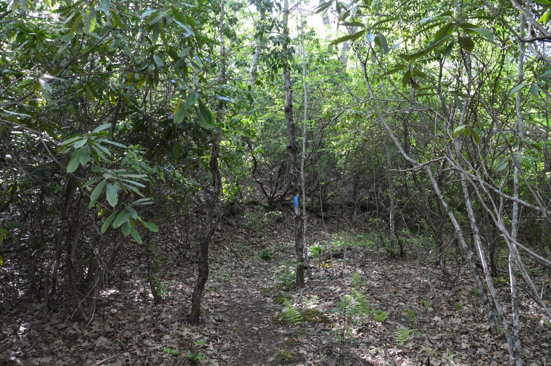
Bly Gap is a very important spot on the Appalachian Trail. To start with, it is a popular camping area at the Georgia/North Carolina state line. A grassy clearing in the gap provides limited views to the northwest but is steadily becoming more overgrown. Several different trails branch off from Bly Gap. The Bly Gap Trail diagonally crosses the gap. The Bly Gap Trail westward from the gap is officially maintained as it drops down into Sugar Cove. However, the Bly Gap Trail eastward from the gap is not officially maintained, although it is still a discernible trail that leads back into the Tallulah River valley. Farther in the gap, a steep signed trail leaves eastward to a water source at the head of the West Fork Charlie's Creek valley. The trail that this hike continues on is the east extent of the Bly Gap Trail, and you will reach it around 7.7 miles. It is very easy to miss this trail, and I actually did that myself at first. The Bly Gap Trail East leaves very acutely to the left just before (maybe 50 feet before) the Appalachian Trail reaches the grassy clearing in Bly Gap. Take this trail, which starts out very broad and well-used along an old roadbed that contours along the slope past two campsites and approaches a gap in a north-south ridge at 8.1 miles. Just before the gap is a split where the more obvious trail bears right into the gap but then disappears as best as I could tell. To continue the hike, take the trail that bears left at the split, past a downed tree and onto a more overgrown extension of the old roadbed.
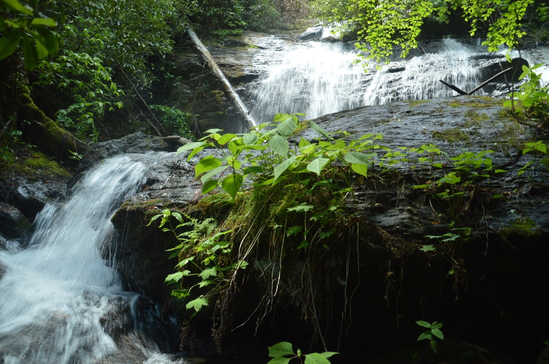
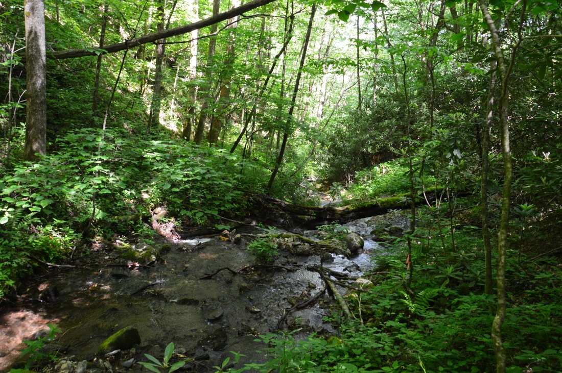
The old roadbed begins curving around the head of the Charlie's Creek valley, but at 8.25 miles, the Bly Gap Trail gradually turns right and begins descending into the valley. At first, the descent is moderate, but it steadily turns steeper and steeper. In fact, at one point, the grade was among the steepest I'd seen on a trail as the trail plunged straight into the valley. The Tate City area sure is notorious for its steep trails! I was surprised to meet up with a more-used path at 8.45 miles, which came in from the right seemingly from the direction of the gap with the split. Turn left onto the trail and follow it first across a small stream and then across Charlie's Creek at 8.6 miles. Throughout most of the year, this will be a dry crossing. After the crossing, the trail continues east, making a very steep and tiring 200-foot climb to another north-south ridge. Reach the top at 8.85 miles, where there is an old campsite to the left. After this, the Bly Gap Trail begins another extremely steep downhill pitch, this time heading into the Fall Branch valley. Hiking up these steep segments would likely be very tiring. The good thing is that the trail remains obvious as it joins an old roadbed. At 9.65 miles, the Bly Gap Trail crosses Fall Branch, which depending on recent rainfall could present a challenge for those who wish to stay dry. After the crossing, the Bly Gap Trail curves south and parallels Fall Branch along the broad old road. There are numerous large cascades down on Fall Branch. The trail itself continues descending a lot more gradually than it was earlier, and although there are a few blowdowns, there are no major obstacles. At 10.6 miles, the Bly Gap Trail begins curving away from Fall Branch in order to bypass the extremely rugged area around Fall Branch Falls. Soon after, there are some tall cliffs on the left side of the trail. At 10.8 miles, there is a very important intersection. The broad roadbed continues northward, descending gently. However, the roadbed does not lead to the Bly Gap Trailhead. A steep but distinct trail leaves to the right at the aforementioned intersection. The trail, which was marked by flagging tape when I did this hike, begins descending steeply directly toward the Tallulah River and the Bly Gap Trailhead. You must take this trail. The trail actually turns into another old roadbed with numerous heavy blowdowns. In fact, the blowdowns and steepness make this part of the Bly Gap Trail its worst. Getting around the blowdowns is time consuming, but eventually, the trail begins to level out near the river at 11.0 miles. As another path joins from the left, the trail turns right, passes over more blowdowns, and reaches a ford of the Tallulah River. A steep scramble path leads down to the river. The ford is around knee-deep. On the other side, the trail becomes a lot wider and clearer, crossing a muddy area on a set of planks and ending at the Bly Gap Trailhead parking area at 11.1 miles. If you have a second car here, then the hike concludes at the parking, but otherwise, you will have to walk up to Tallulah River Road, turn left onto it, and follow it for 2.2 miles to the Holden Cove Trailhead. Mileage
0.0 - Holden Cove Trailhead
0.5 - Oversoul Falls 3.35 - Whiteoak Stamp 4.1 - Muskrat Creek Shelter 4.45 - 1973 Plane Crash Remnants 4.6 - Ravenrock Cliffs Overlook 5.85 - Sassafras Gap 6.45 - Courthouse Bald 6.6 - Courthouse Bald Vista 7.3 - Sharp Top 7.7 - Bly Gap 8.6 - Charlie's Creek 9.65 - Fall Branch 10.6 - Top of Fall Branch Falls 11.1 - Bly Gap Trailhead Variations
Hike out and back to Oversoul Falls from Holden Cove Trailhead - 1.0 Miles
Hike out and back to Ravenrock Cliff Overlook from Holden Cove Trailhead - 9.1 Miles Hike out and back to Ravenrock Cliff Overlook from Bly Gap Trailhead - 13.1 Miles Optional Add-on: Fall Branch Falls from Bly Gap Trailhead
Click here to download a track of this hike.
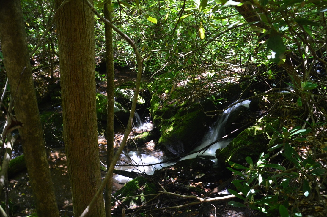
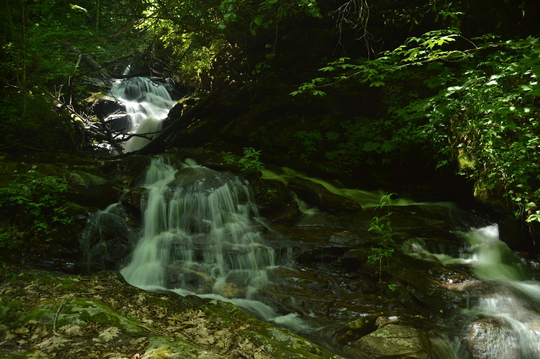
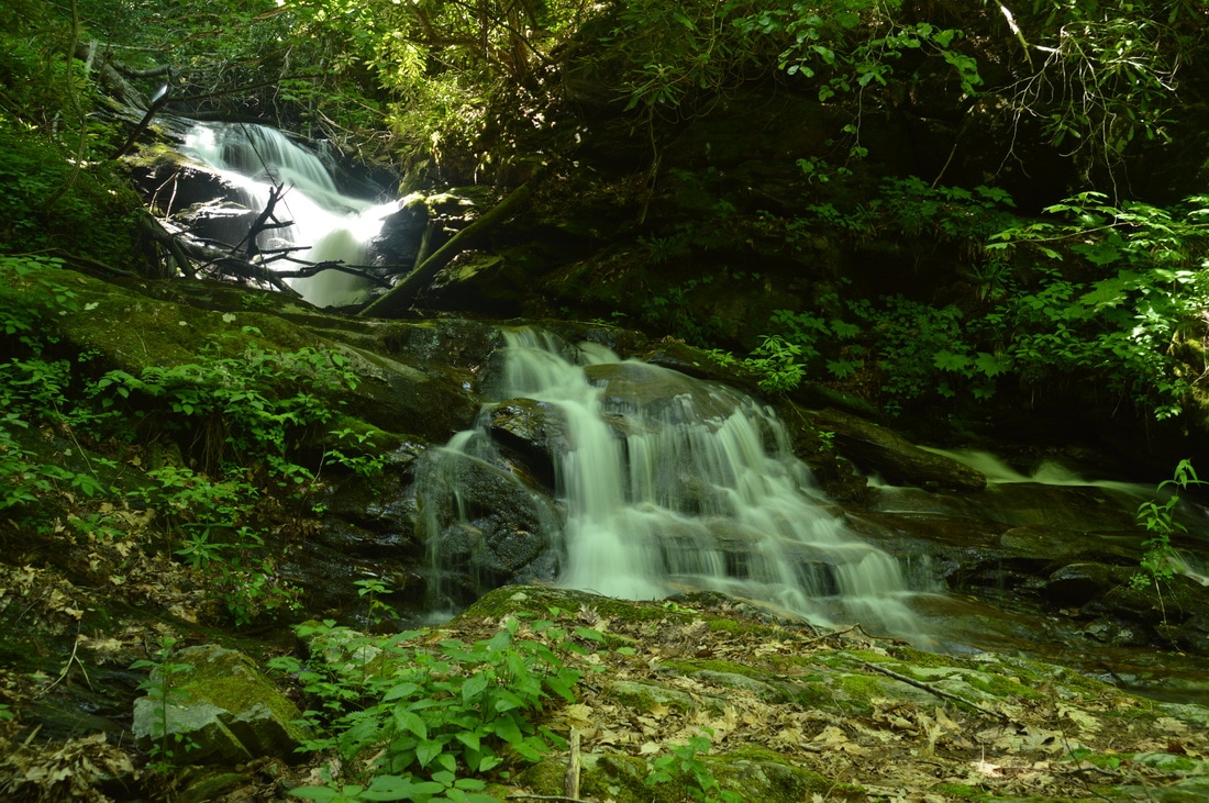
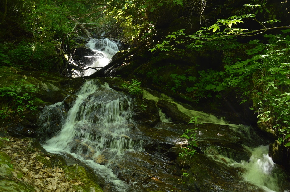
Fall Branch Falls is a large waterfall that is over 100 feet high. It would be an attractive destination, but unfortunately, the waterfall consists of multiple drops and slides that are hard to view. The best view of the waterfall is only mediocre and is still very hard to get to. For me, the difficult hike and bushwhack to Fall Branch Falls was not fully worth it, but for hardcore waterfall enthusiasts, it could be worth it, and there could even be better viewpoints further up that would just be even harder to reach.
The hike to Fall Branch Falls begins fairly easy. From the Bly Gap Trailhead parking area described near the top of this post, keep following the drivable forest road downstream along the east side of the Tallulah River. About 400 feet from the trailhead, the road ends at another camping area. From here, continue following the river along a fishing path. In another 300 feet or so (about 0.13 miles from the trailhead) is a good place to ford the Tallulah River just upstream from the point where Fall Branch ties into the river. The ford is fairly easy during normal water levels. On the other side of the river, walk through open woods in flats near the confluence and head toward Falls Branch. Once you reach Falls Branch, you will see a faint path that follows the same side of Fall Branch upstream. For now, this trail of sorts is the easiest route along the creek. About 0.3 miles from the trailhead, the path effectively ends in a rhododendron thicket as the terrain steepens up ahead. Fall Branch Falls is just around the corner, but getting to it from this point is challenging. It is not possible to continue straight, because a small cliff stretches perpendicular to the creek here. The best thing to do is to turn right and walk past the end of the cliff. Next, scramble up the steep slope to the top of the cliff, where you'll learn that a much taller cliff is situated. A narrow shelf between the two cliffs provides a sketchy route back to the creek; proceed very carefully here. At the far end of the shelf, some difficult scrambling up and down through the dense rhododendron thickets is needed. Eventually, by following the route of least resistance, you will reach a viewpoint of Fall Branch Falls at 0.35 miles, located at the base of what I refer to as the second drop of the falls, between the two cliffs. From this narrow vantage point, what you can see of Fall Branch Falls is fairly impressive but hard to photograph. Directly above from the rock outcrops, there are two steeply sliding drops that total 50 to 60 feet of vertical height, although the upper drop is shrouded in rhododendron. Directly below the rock outcrops where you are standing is a chasm: Fall Branch drops at least 30 feet in free-falls and cascades out of sight. It is possible that there is a good view of the full waterfall from down there, but I could not find a way to get to the base of those drops without spending significantly more effort. Since I did the bushwhack to Fall Branch Falls before the main hike, I did not want to spend more time on it. Also, there are probably more drops of Fall Branch Falls above what is visible from this perch, but I will leave it to someone else to get up there. From Fall Branch Falls, simply retrace your steps, returning to the car at 0.7 miles. Expect the roundtrip hike to Fall Branch Falls to take anywhere from 1 hour and 15 minutes to 2 hours, and expect to spend more time, if you will try to get to one of the other drops. 
Fall Branch Falls is a waterfall that consists of many tiers, any single one of which is hard to reach or photograph.
Bonus Stops
There are many bonus hikes available in the Tate City area. A particularly noteworthy bonus stop would be the 2-mile hike to three waterfalls on Denton Creek.
Pictures
Note: The first part of this picture album is from the optional hike to Fall Branch Falls from the same Bly Gap Trailhead.
Videos
2 Comments
Chris Dover
4/28/2020 10:49:45 am
Good morning, when I hit download the track it takes me to the garmin website? Hoping to get the track or at least at the waypoints on Gaia app.
Vidalia
12/4/2020 07:00:53 pm
Read your Holden Cove / Fall Branch trail report with interest. Just FYI, The Fall Branch and Holden Cove trails have received a significant amount of trail maintenance from various trail angels, Check them out when you have a chance... Leave a Reply. |
About MeMark Oleg Ozboyd Dear readers: I have invested a tremendous amount of time and effort in this website and the Georgia Waterfalls Database the past five years. All of the work that has gone in keeping these websites updated with my latest trip reports has almost been like a full-time job. This has not allowed me to pick up a paid job to save up money for college, and therefore, I I've had to take out loans. If you find the information on this website interesting, helpful, or time-saving, you can say "thanks" and help me out by clicking the button above and making a contribution. I will be very grateful for any amount of support you give, as all of it will apply toward my college tuition. Thank you!

Coming in 2022-2023?
Other Hiking WebsitesMiles HikedYear 1: 540.0 Miles
Year 2: 552.3 Miles Year 3: 518.4 Miles Year 4: 482.4 Miles Year 5: 259.9 Miles Archives
March 2021
Categories
All
|


 RSS Feed