HIKING THE APPALACHIANS AND BEYOND
  • Home
  • Trail Reports
    • Best Hikes
    • Hikes with Scenic Views
    • Hikes with Water Features
    • Alabama
    • Georgia
    • Florida
    • North Carolina
    • South Carolina
    • Tennessee
    • Vermont
    • Virginia
  • Map
  • Hike List
  • Testimonials
  • Resources
  • Contact Us
  • Southeast Nature Society
    • Our Team
  • Georgia Waterfalls Database

Chattahoochee National Forest: Flat Branch Falls Trail, Tate City, Georgia

6/12/2017

0 Comments

 
Picture
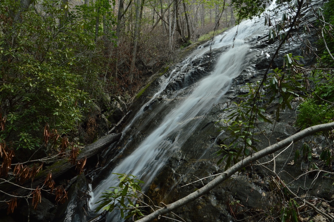
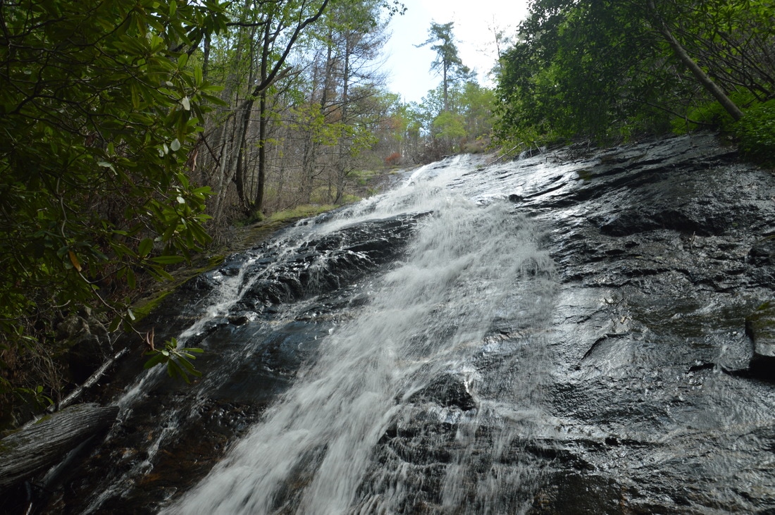
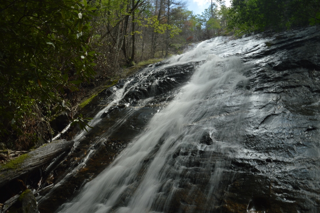
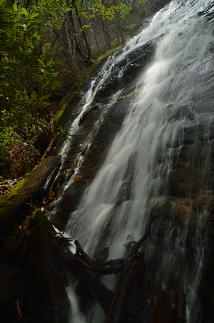
Most of the streams that drain the Upper Tallulah River form waterfalls. Many of these waterfalls are significant, such as Flat Branch Falls: a multi-tier sliding waterfall that is over 200 feet high. Even though not all of it is visible from the base, the view is still impressive. Unfortunately, the trail to Flat Branch Falls had been damaged severely by the Rock Mountain Fire in November 2016. In fact, the once-easy trail to Flat Branch Falls has turned into an obstacle course complicated by numerous dead and fallen rhododendron branches. In addition, the trail to Flat Branch Falls begins with a steep scramble up a nearly vertical 20-foot slope. With a bit of common sense and navigational skills, however, the more seasoned hiker will get to Flat Branch Falls without much trouble. This hike occurred on Saturday, June 10th, 2017. My plan was to hike out and back to the base of Flat Branch Falls via the trail that begins at Bridge 4 on Tallulah River Road. 

Summary

R/T Length of Trail: 0.4 Miles
Duration of Hike: 1:00 
Type of Hike: Out and Back 
Difficulty Rating: 4 out of 10 
Total Elevation Gain: 244 Feet
Pros: Flat Branch Falls is very remote for being accessed by a such short trail 
Cons: The Flat Branch Falls Trail was heavily damaged by the Rock Mountain Fire 
Points of Interest: Flat Branch Falls - 6 stars 
Trail Blaze Colors: None 
Best Seasons to Hike: Winter or Spring 
Fees: None 
Beginning Point: Bridge 4 on Tallulah River Road
Directions from Clayton, GA: From the intersection of Rickman Drive, Savannah Street, and US Route 23/441 in downtown Clayton, follow Savannah Street (US 76) West for 8.0 miles. Then, turn right onto Persimmon Road. In another 4.2 miles, turn left onto Tallulah River Road, and continue for exactly 3.2 miles to Bridge 4, which is the fourth large bridge that you will cross on Tallulah River Road coming from Persimmon Road. For confirmation, a small number "4" is painted on the first reflector at the bridge. The trail begins on the near (south) side of the bridge. There is a pullout on the right-hand side of the road just after the bridge. The pullout has space for only two to three cars, and it is frequently full in the warmer months thanks to fishermen, so if the pullout is full, continue on Tallulah River Road for 0.15 miles to the next pullout, which will be a larger pullout on the left with space for at least four to five cars. 

Map

Picture
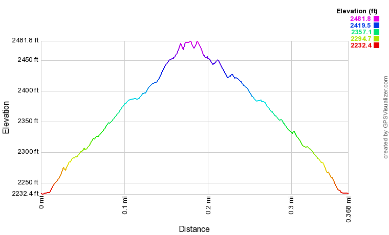
Click here to download a track of this hike. 

Details

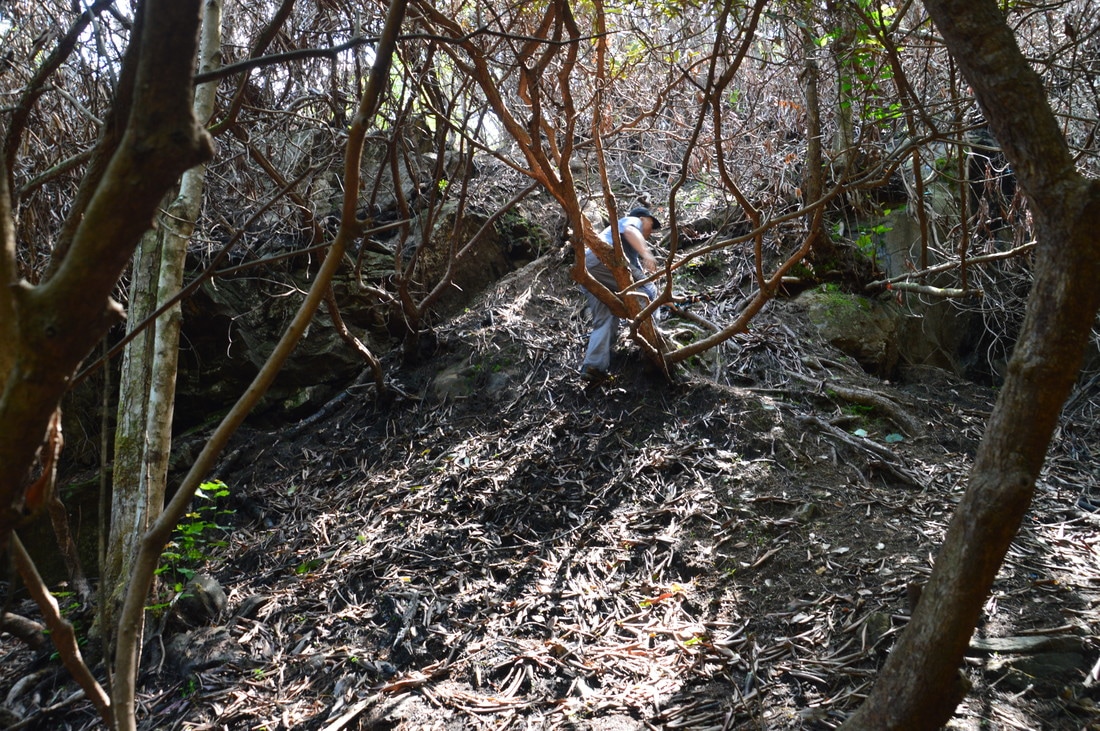
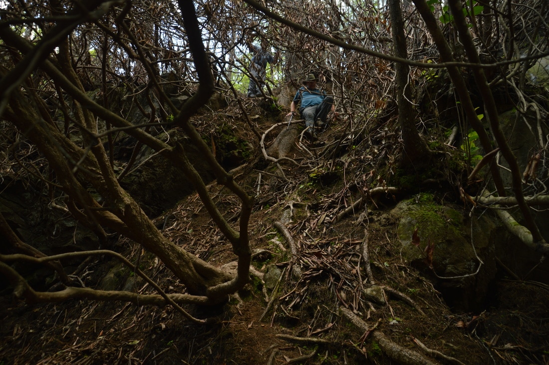
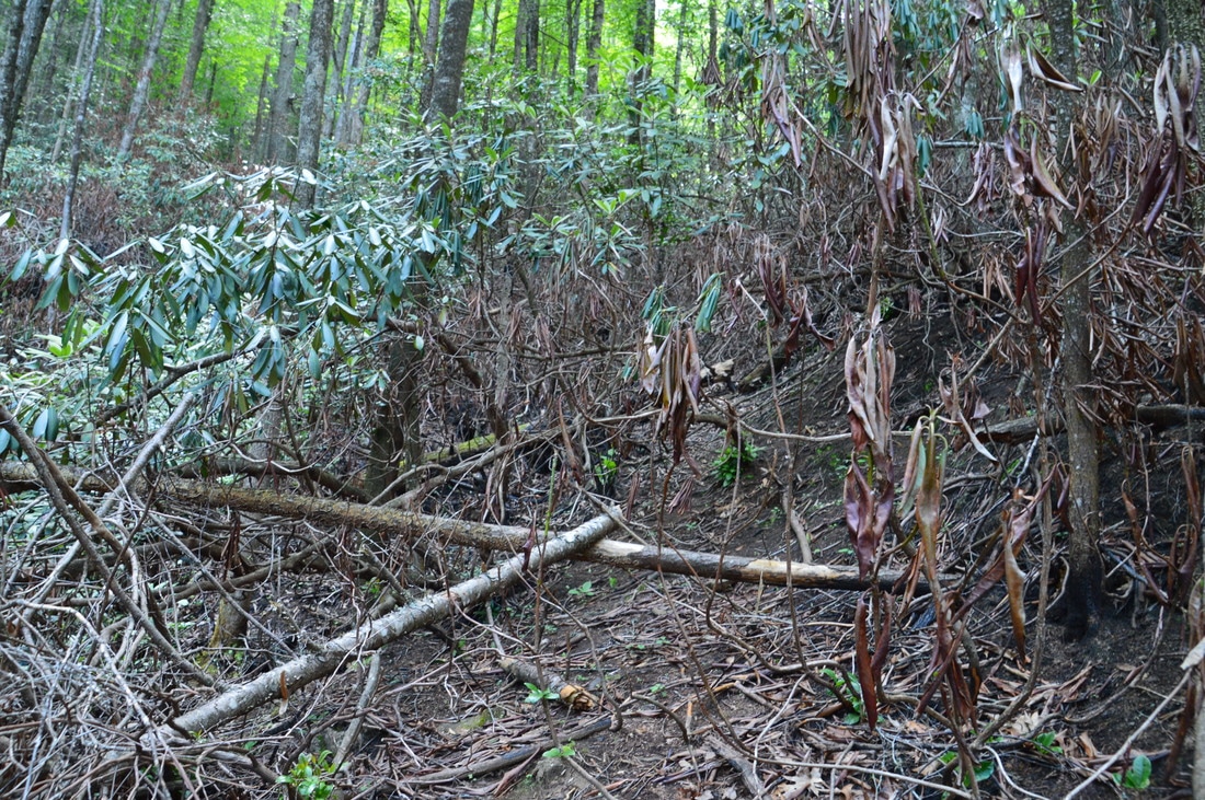
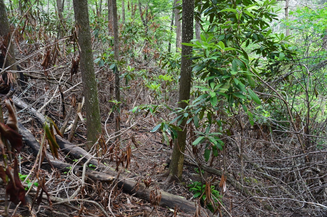
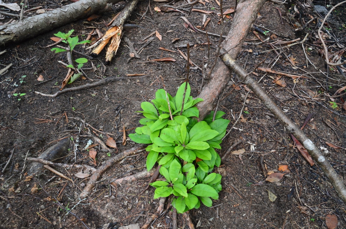
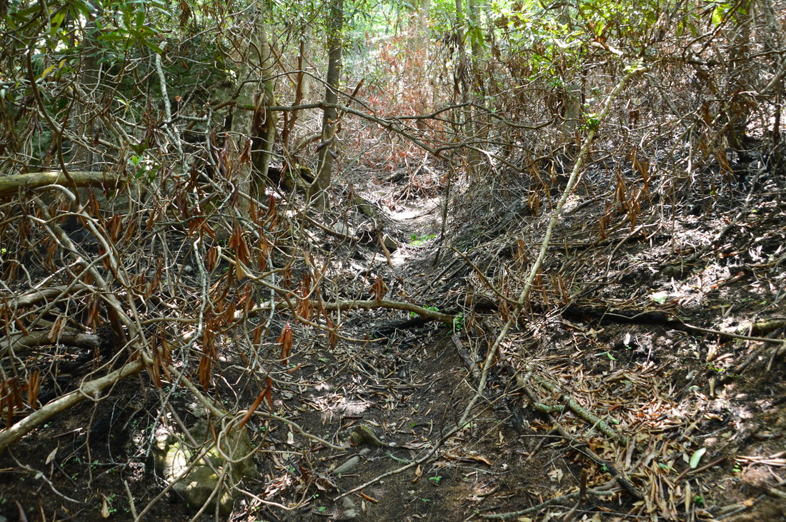
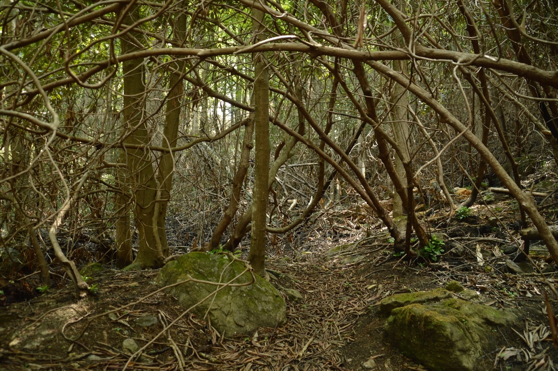
The hike to Flat Branch Falls is short but complicated. It was the first hike of a series of hikes that I did in the Tate City area on this day. The main reason that the hike to Flat Branch Falls is complicated and harder than one might expect is that the unofficial trail to the falls suffered considerable damage during the Rock Mountain Fire in November 2016. Even though the fire was not strong, it was widespread and it was strong enough to kill much of the rhododendron in the area. A lot of the dead rhododendrons then collapsed, and since the entire Flat Branch drainage is surrounded by rhododendron, the fallen rhododendrons have greatly obscured the trail and turned it into an obstacle course. An attentive hiker with some experience will make it to the falls using this description without any trouble, but until the trail gets cleared up, I would not suggest this trail to novice hikers. 

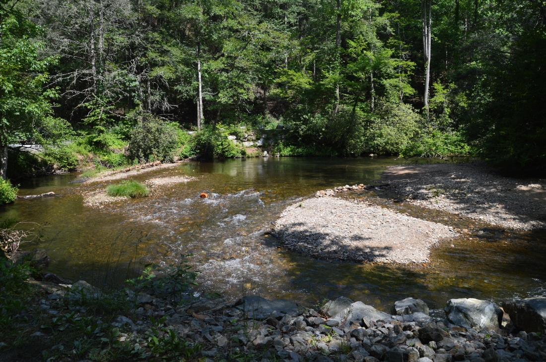
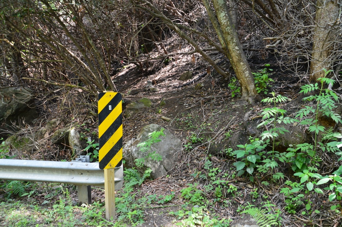
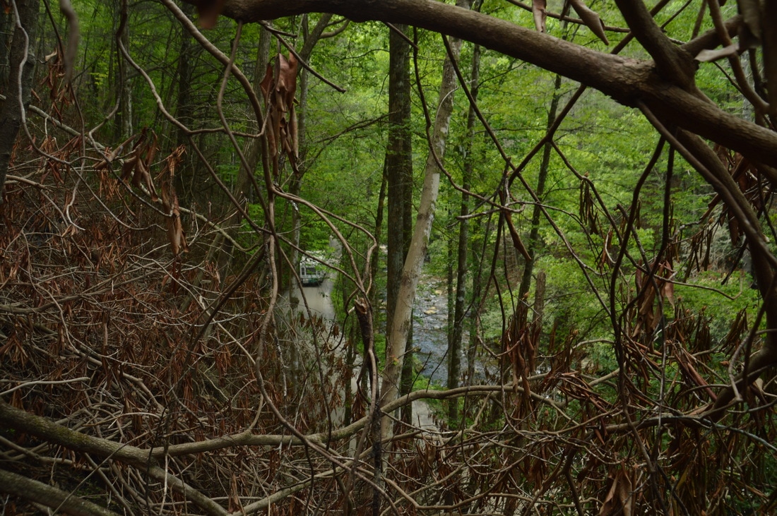
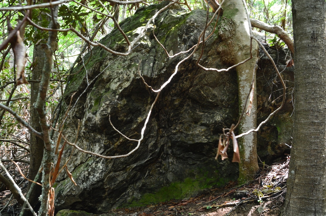
The entrance to the Flat Branch Falls Trail is on the south side of Bridge 4 on Tallulah River Road. To clarify, this bridge crosses the Tallulah River from southeast to northwest, or from right to left if coming from Persimmon Road. The trail begins by heading along the Tallulah River in the upstream direction from the bridge. As of this writing, the word "Falls" was inscribed in smaller letters into a reflector at the bridge - the same reflector that bears the number "4". Don't count on the writing still being there by the time you do this hike though. After about 50 feet, the trail turns right and steeply scrambles up a nearly vertical 20-foot slope. Other than the blowdowns, this exceedingly steep stretch is the toughest part of the hike. Even though handholds along the scramble are not plentiful, there are just enough to allow a safe passage. Once you reach the top of the steep slope, take a moment to look back at Tallulah River Road and the Tallulah River down below as you catch your breath. As the trail curves into the Flat Branch drainage, there will be a fork about 150 feet from the road. The right fork seems to be the more distinct trail, but it is a dead-end; stay left on the true trail, which is obscure. The going is not easy, as the largest amount of rhododendron blowdowns is concentrated here. About 400 feet from the road, the trail becomes easier to follow. At 0.1 miles, pass to the right of a large boulder and then bear left to stay on the trail. Flat Branch Falls comes into view through the trees ahead. 

The Flat Branch Falls Trail remains somewhat more passable than it was earlier. Keep the falls in the distance as your target and try to follow what looks like the easiest route - a path that others have taken. At about 900 feet (0.17 miles) from the road, the trail seems to disappear in a boulder field just below Flat Branch Falls. Bear left, scramble along the base of the boulder field to Flat Branch, and then scramble upstream as best as you can (without the benefit of a well-defined trail) to the area near the base of the falls. To reach the base of Flat Branch Falls, where there is a clear view of the falls, it is necessary at the end to scramble over a set of downed trees. Depending on the water level, getting to the least obstructed view may require wading into the small pool at the base of the falls. Reach the base of Flat Branch Falls at 0.2 miles. 

Flat Branch Falls is a very tall waterfall. In fact, the full waterfall is more than 200 feet high. I don't think that all of it is visible from the base, but at least the lower 120 feet are visible. Being a long and steep slide on a rather small stream, Flat Branch Falls is best to visit after the heavy rains of winter or spring, when the falls turns into a powerful torrent of whitewater. Even during lower flow, however, Flat Branch Falls is still very nice and scenic due to its height. The lowermost part of the slide can be photogenic under the right conditions, but cloudy skies are a necessity for quality photographs at this waterfall. 

From the base of Flat Branch Falls, return to the trailhead the same way, concluding the hike at 0.4 miles. Since this is a short hike, consider hiking in the same day to one of the numerous other waterfalls that are accessed from Tallulah River Road. 

Mileage

0.0 - Bridge 4 on Tallulah River Road 
0.2 - Flat Branch Falls 
0.4 - Bridge 4 on Tallulah River Road 

Variations

None, but keep in mind that the hike will be 0.3 miles longer if the pullout at Bridge 4 is full. 

Bonus Stops

There are several short waterfall hikes along Tallulah River Road that are great to combine with the hike to Flat Branch Falls. One hike that I highly recommend is the 1-mile unofficial but well-used trail to three waterfalls on Denton Creek. Another possible add-on is the Coleman River Trail, which follows the Coleman River for a mile, passing many scenic cascades and small waterfalls. 

Pictures

Videos

0 Comments


Leave a Reply.

    About Me

    Mark Oleg Ozboyd
    I'm an avid outdoor explorer and a hobbyist landscape photographer. I'm 21 years old and have been hiking since 2011. Originally based out of Atlanta, Georgia, I started out by occasionally hiking short trails throughout well-known Georgia State Parks. During 2012 and 2013, I began to expand my trips into adjacent states, as well as into the wilder National Forest areas rather than just State Parks. Throughout the years that followed, as I slowly ran out of popular hiking trails in my area, I began to search for and hike in more seldom-visited areas. Today, you can find me out in the woods every weekend, whether it's on an official trail or bushwhacking through cross-country terrain without any paths. I now attend Washington & Lee University and am exploring Virginia and West Virginia. My other hobbies include chess, science, old music, and meteorology. I have 3 years of amateur weather forecasting experience, having studied a lot of meteorology basics over the years. I am also a student at European School of Music where I learned that music and nature have a lot in common. Listening to good music inspires me to capture nature's beauty on the camera in different aspects that also make me recall many beautiful music pieces that I've heard.​


    Dear readers: I have invested a tremendous amount of time and effort in this website and the Georgia Waterfalls Database the past five years. All of the work that has gone in keeping these websites updated with my latest trip reports has almost been like a full-time job. This has not allowed me to pick up a paid job to save up money for college, and therefore, I I've had to take out loans. If you find the information on this website interesting, helpful, or time-saving, you can say "thanks" and help me out by clicking the button above and making a contribution. I will be very grateful for any amount of support you give, as all of it will apply toward my college tuition. Thank you! 

    Enter your email address to subscribe for trail reports:

    Delivered by FeedBurner


    Picture
    Coming in 2022-2023?

    Other Hiking Websites

    DWHike's Adventures
    Florida's Natural Wonders
    Florida Trailblazer
    Meanderthals
    Mountain Images
    by Bernie Boyer

    North Carolina Waterfalls with
    ​Kevin Adams
    Take-a-Hike!
    Tennessee Landforms
    Waterfall Page
    Waterfall Adventurer
    Zach's Mild Adventures

    Miles Hiked

    Year 1: 540.0 Miles
    Year 2: 552.3 Miles
    ​Year 3: 518.4 Miles
    Year 4: 482.4 Miles
    Year 5: 259.9 Miles

    Archives

    March 2021
    February 2021
    January 2021
    November 2019
    October 2019
    September 2019
    August 2019
    July 2019
    June 2019
    February 2019
    January 2019
    December 2018
    November 2018
    October 2018
    August 2018
    July 2018
    June 2018
    May 2018
    April 2018
    March 2018
    February 2018
    January 2018
    December 2017
    November 2017
    October 2017
    September 2017
    August 2017
    July 2017
    June 2017
    May 2017
    April 2017
    March 2017
    February 2017
    January 2017
    December 2016
    November 2016
    October 2016
    September 2016
    August 2016
    June 2016
    May 2016
    April 2016
    March 2016
    January 2016
    December 2015
    November 2015
    October 2015
    September 2015
    August 2015
    July 2015
    June 2015
    May 2015
    April 2015
    March 2015
    February 2015
    January 2015
    December 2014
    November 2014
    October 2014
    September 2014
    August 2014
    July 2014
    June 2014
    May 2014
    April 2014
    March 2014
    February 2014

    Categories

    All
    Adel
    Adirondack Park
    Alabama
    Alfred A. Ring Park
    Allegheny Trail
    Amicalola Falls State Park
    Anniston Area
    Apalachicola Bluffs And Ravines Preserve
    Apalachicola National Forest
    Apalachicola/Port St. Joe Area
    Apopka
    Appalachian Trail
    Appling
    Art Loeb Trail
    Aska Trail System
    Bakersville
    Balm-Boyette Scrub Preserve
    Balsam Lake Recreation Area
    Bankhead National Forest
    Bartow County Parks
    Bartram Trail
    Basinger
    Beersheba Springs
    Benton
    Benton Mackaye Trail
    Berry College Trail System
    Best Hike
    Big South Fork National Recreation Area
    Black Bear Wilderness
    Black Rock Mountain State Park
    Blairsville
    Blakely
    Blood Mountain Wilderness
    Blowing Rock
    Blue Ridge
    Blue Ridge Parkway
    Boone
    Bradenton
    Bradenton Beach
    Brasstown Bald
    Brasstown Wilderness
    Brevard
    Bryson City
    Buchanan
    Bucks Pocket State Park
    Bulow Creek State Park
    Bulow Plantation Ruins State Park
    Caesars Head State Park
    Caladesi Island State Park
    Calhoun
    Camel's Hump State Park
    Cashiers
    Caspersen Beach Park
    Catfish Creek State Park
    Caves
    CC Putnam State Forest
    Cedar Point Environmental Park
    Chatsworth
    Chattahoochee National Forest
    Chattanooga
    Chattanooga Valley
    Chattooga National Wild And Scenic River
    Cheaha Wilderness
    Cherohala Skyway
    Cherokee
    Cherokee National Forest
    Chiefland Area
    Chillhowee Recreation Area
    Chipley
    Chunky Gal Trail
    Circle B Bar Reserve
    Citico Creek Wilderness
    Citrus Wildlife Management Area
    Clarkesville
    Clayton
    Cleevland
    Cleveland
    Cloudland Canyon State Park
    Cohutta Wilderness
    Collier-Seminole State Park
    Cordele
    Cornelia
    Covington
    Crestview Area
    Crew-land-and-water-trust
    Cullowhee
    Cumberland Trail
    Dahlonega
    Dalton
    Dawson Forest Wildlife Management Area
    Dawsonville
    Dayton
    De Soto National Memorial
    DeSoto State Park
    Dillard
    Double Springs
    Ducktown
    Duncan Ridge Trail
    Dunlap
    Eagle's Rest Park
    Eastpoint
    Econfina Creek Wildife Management Area
    Eglin Air Force Base
    Elizabethton
    Elkins
    Elk Knob Game Lands
    Elk Park
    Ellicott Rock Wilderness
    Ellijay
    Emerson Point Preserve
    Englewood Area
    Enota Retreat
    Erwin
    Falling Waters State Park
    Fayetteville
    Fires Creek Recreation Area
    Fire Tower
    Flint River
    Florence Area
    Florida
    Florida Caverns State Park
    Florida Trail
    Foothills Trail
    Fort Mountain State Park
    Fort Myers Area
    Fort Payne
    Fort Payne Area
    Fort Yargo State Park
    Franklin
    Franklin Delano Roosevelt State Park
    Franklin-Marion State Forest
    Frozen Head State Park
    Gainesville
    Gainesville Area
    Gatlinburg
    George Washington National Forest
    Georgia
    Georgia Veterans Memorial State Park
    Glasgow
    Gorges State Park
    Grandfather Mountain State Park
    Great Smoky Mountains National Park
    Greeneville
    Green River Game Lands
    Gruetli-Laager
    Grundy Forest State Natural Area
    GTM Reserve
    Guana River Wildlife Management Area
    Hayesville
    Helen
    Hiawassee
    High Falls State Park
    Highlands
    Highlands Scenic Highway
    Hillsborough River State Park
    Hinson Conservation & Recreation Area
    Historic Sites
    Honeymoon Island State Park
    Hot Springs
    Huntington
    Inverness Area
    Jackson
    Jasper
    Jefferson National Forest
    Joan M. Durante Park
    Jonathan Dickinson State Park
    Jones Gap State Park
    Joyce Kilmer Slickrock Wilderness
    Joyce Kilmer - Slickrock Wilderness
    Juniper Prairie Wilderness
    Kelly Park
    Keown Falls Recreation Area
    Kolomoki Mounds State Park
    LaFayette
    Lake City Area
    Lake George Wild Forest
    Lake June-in-Winter State Park
    Lakeland Area
    Lake Placid
    Lake Russell Wildlife Management Area
    Lake Wales Ridge State Forest
    Laurel Fork North Wilderness
    Leffis Key Preserve
    Leon Sinks Geological Area
    Lexington
    Lineville
    Linville
    Linville Gorge Wilderness
    Lithia Springs
    Little Frog Wilderness
    Little Manatee River State Park
    Little River Canyon National Preserve
    Longboat Key
    Long Trail
    Lookout Mountain
    Lookout Mountain Battlefield
    Lovingston
    Lula Lake Land Trust
    Lumpkin
    Maggie Valley
    Manatee Springs State Park
    Marianna Area
    Mark Trail Wilderness
    Marlinton
    Mccaysville
    McMinville
    Mentone
    Middlesex
    Mistletoe State Park
    Monongahela National Forest
    Montreat
    Mountain Bridge Wilderness Area
    Mountain City
    Mountains To Sea Trail
    Mountains-to-Sea Trail
    Mount Rogers National Recreation Area
    Myakka River State Park
    Myron B. Hodge City Park
    Nantahala National Forest
    Naples
    Naples Area
    Natural Bridge State Park
    Neal Preserve
    New Castle
    Newport
    New River Gorge National Park
    New York
    North Carolina
    Ocala Area
    Ocala National Forest
    Ocean-to-Lake Trail
    Oconee State Park
    Oconee Station Historic Site
    Okaloacoochee Slough State Forest
    Oldsmar
    Oneida
    Orlando Area
    Ormond Beach
    Oscar Scherer State Park
    Oxford
    Palatka
    Palmetto Trail
    Panama City Area
    Panthertown Valley
    Parrish
    Paynes Creek Historic State Park
    Peaks Of Otter Recreation Area
    Pigeon Crockford Mountain Wildlife Management Area
    Pigeon-Crockford Mountain Wildlife Management Area
    Pigeon-Crockford Wildlife Management Area
    Pine Mountain
    Pinhoti Trail
    Pinnacle Park
    Pisgah Civitan Park
    Pisgah National Forest
    Pittman Center
    Pond Mountain Wilderness
    Ponds/Lakes
    Prentice Cooper State Forest
    Providence Canyon State Park
    Pumpkintown
    Quick Point Nature Preserve
    Raven Cliffs Wilderness
    Reed Bingham State Park
    Reliance
    Rice Creek Conservation Area
    Riverview Pointe Preserve
    Robbinsville
    Robinson Preserve
    Rock Creek Gorge Scenic Area
    Rock Island State Park
    Rome
    Rosman
    Sale Creek
    Salem
    Salt Springs
    Saluda
    Santa Rosa Beach
    Sarasota
    Sarasota Area
    Savage Gulf State Natural Area
    Scenic Views
    Scottsboro Area
    Sebring Area
    Sewanee
    Sheltowee Trace Trail
    Shining Rock Wilderness
    Signal Mountain
    Sipsey Wilderness
    Sky Valley
    Smithgall Woods State Park
    Snowbird Backcountry Area
    Soddy Daisy
    Soddy-Daisy
    Sopchoppy
    South Carolina
    South Cumberland State Park
    Southeastern Cave Conservancy
    Southern Nantahala Wilderness
    Sparta
    Sprewell Bluff Park
    Spring City
    Spring Hill
    Springs
    Spruce Pine
    Standing Indian Backcountry Area
    St. Augustine
    St. George Island State Park
    St. Joseph Bay State Buffer Preserve
    St. Marks Area
    St. Marks National Wildlife Refuge
    Stone Mountain
    Stone Mountain Park
    Suches
    Sumatra
    Sumter National Forest
    Suwannee River
    Swallow Creek Wildlife Management Area
    Sweetwater Creek State Park
    Sylva
    Talladega National Forest
    Tallahassee Area
    Tallulah Falls
    Tallulah Gorge State Park
    Tampa Bay Area
    Tate City
    Tate's Hell State Forest
    Tea Creek Wildlife Management Area
    Tellico Plains
    Tennessee
    Thomaston
    Toccoa
    Topsail Hill State Park
    Torreya State Park
    Townsend
    Tracy City
    Tray Mountain Wilderness
    Trenton
    Triple Creek Preserve
    Troutdale
    Unaka Mountain Wilderness
    Upper Tampa Bay County Park
    Venice
    Vermont
    Virgin Falls State Natural Area
    Virginia
    Virginia Outdoors Foundation
    Vogel State Park
    Wakulla Springs State Park
    Waleska
    Walhalla
    Wartburg
    Water Features
    Waynesville
    Weedon Island Preserve
    Weeki Wachee Preserve
    Wekiwa Springs State Park
    West Palm Beach Area
    West Virginia
    Whitehall
    White Springs
    Winder
    Withlacoochee State Forest
    Young Harris

    RSS Feed

TRAIL REPORTS

Hikes in Alabama
​Hikes in Florida
Hikes in Georgia
Hikes in North Carolina
Hikes in South Carolina
Hikes in Tennessee
Hikes in Virginia

Hiking Resources

Alabama Resources
​
Florida Resources
Georgia Resources
North Carolina Resources
​South Carolina Resources
​
Tennessee Resources

Other

Contact
Map of Hikes
Alphabetical List of Hikes
Southeast Nature Society
© COPYRIGHT 2014-2018
​ALL RIGHTS RESERVED.
Important: I disclaim any responsibility for any damage or personal injury that may occur as a result of the activities and information found on this website. All outdoor activities, especially off-trail hiking, are done at your own risk. Never hike or head into that area that may be above your fitness or experience level.
  • Home
  • Trail Reports
    • Best Hikes
    • Hikes with Scenic Views
    • Hikes with Water Features
    • Alabama
    • Georgia
    • Florida
    • North Carolina
    • South Carolina
    • Tennessee
    • Vermont
    • Virginia
  • Map
  • Hike List
  • Testimonials
  • Resources
  • Contact Us
  • Southeast Nature Society
    • Our Team
  • Georgia Waterfalls Database