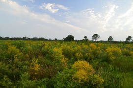
Nestled near the west Florida coastline between Sarasota and Venice, the underrated Oscar Scherer State Park is a haven for folks looking for a peaceful day hike in this part of southwest Florida. The park is known best as the home of the last remaining scrub jay habitat in southwest Florida, but it also has a superb color-coded trail system that introduces hikers to South Creek and its hammocks as well as the scrub and flatwoods nearby. In particular, the diverse Yellow Trail - part of the park's North Trail System - passes through a large range of ecosystems, crossing South Creek twice, passing a beautiful lake known as Big Lake, and travelling through a large section of the scrub. Hikers will even be able to see an old railroad trestle across South Creek. Thanks to its range of scenery and points of interest, the Yellow Trail at Oscar Scherer State Park has quickly turned into one of my favorite hikes in Southwest Florida. This hike occurred on Wednesday, August 2nd, 2017. My plan was to hike the Yellow Loop Trail counter-clockwise with a short detour to the Big Lake observation platform.
0 Comments
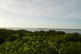
Emerson Point Preserve is one of several beautiful Manatee County coastline preserves. This preserve on Snead Island is rich with history, as there are several historic Indian mounds scattered throughout the park. The preserve's diverse trail system traverses both the Tampa Bay and Manatee River sides of the island, with several views of both, as well as an observation tower that provides a bird's-eye panorama of the preserve and Tampa Bay, with the Sunshine Skyway Bridge in the distance. Also, the park's primary trail system provides access to the Portavant Temple Mound - the biggest mound of all in the preserve. This hike occurred on Wednesday, July 26th, 2017. My plan was to hike the Portavant Mound Trail from the Ranger Station, making a side trip to the Manatee River view. Then, I would make a clockwise loop with the South Restoration Trail, Terra Ceia Trail, Tower Trail, and North Restoration Trail, making side trips to each of the three Tampa Bay views as well as the observation tower. I would conclude the hike by following a connector back to the Ranger Station.
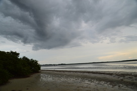
Cedar Point Environmental Park is one of two preserves that are operated by the Charlotte Harbor Environmental Center, with the other one being the Charlotte Harbor Environmental Park south of Punta Gorda. Cedar Point Environmental Park protects 130 acres of land along Lemon Bay. The park's namesake is Cedar Point, a small promontory that stretches out into Lemon Bay, separating the bay from Oyster Creek. On this hike, you will first be treated to a couple views of Oyster Creek just east of its mouth, before seeing Lemon Bay itself from Cedar Point. Much of the hike is in pine flatwoods or palm hammocks, but for the tiny size of this parcel of land, the feeling of remoteness is greater than one would expect. This hike occurred on Wedneday, July 13th, 2016. My plan was to make an outer loop across the entire Cedar Point Environmental Park's extremely confusing trail system. I would make a side trip to Cedar Point along the way.
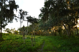
Located in a sprawling urban area along the southwest Florida coast, Oscar Scherer State Park protects a large swath of land that is considered as an urban getaway. South Creek flows through the center of the park, and large areas of prime scrub jay habitat lie on either side. Oscar Scherer State Park is considered as the only remaining haven for scrub jays in southwest Florida. There are several hiking trails in the park that you can explore, split into two trail general trail systems: the North Trail System and the South Trail System. On this day, I hiked the entire South Trail System, first along the shores of South Creek and then through scrub where scrub jays flew from tree to tree and an old bald eagle nest from the past spring was perched high up in a grand pine tree. This hike occurred on Wednesday, June 29th, 2016. My plan was to hike the South Creek Trail and Lester Finley Trail out and back. I would then hike the Green Trail loop clockwise, before finishing up with the short walk around Lake Osprey.
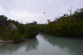 One of several small preserves on the shores of Sarasota Bay, Quick Point Nature Preserve is located at the southern tip of Longboat Key, protecting one of the last undeveloped places on this long barrier island. The preserve is an important step in helping to restore some of the habitats that used to be located all along Sarasota Bay. In addition to protecting a few natural lagoons near the coastline, there is a man-made lagoon that was created to help support marine life in the area. Nearly the entire shore of Sarasota Bay is developed, both from the Longboat Key side and from the mainland side. Preserves such as this one, while small, are always very beneficial, because a lot of the ecosystems native to the area have been erased by development. This hike occurred on Saturday, February 6th, 2016. My plan was to hike the short nature trail in Quick Point Preserve. De Soto National Memorial: De Soto Expedition Trail and Riverview Pointe Trail, Bradenton, Florida4/11/2016 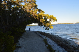 In 1539, Hernando de Soto reached the US and landed approximately 5 miles west of Bradenton. It was the start of the first major, organized exploration by the Europeans of the southern United States. Today, a small tract of public land called the Fort De Soto National Memorial marks the location of the landing. This small national preserve has a lot to offer on its nature trail, including a mangrove swamp, a homestead, and views of the Manatee River. Additionally, you can extend your hike into nearby Riverview Pointe Preserve for some hiking in the uplands farther from the shoreline. This hike occurred on Friday, February 5th, 2016. My plan was to start my hike at Riverview Pointe Preserve. I would hike down the nature trail to Fort De Soto National Memorial, from where I would hike the Memorial Trail. to Desoto Point and then to De Soto Monument. I would retrace my steps back to Riverview Pointe Preserve the same way, but I would use a connector to shortcut some of the trail on the return trip. 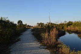 Neal Preserve is one of a number of lands that were acquired by Manatee County in the Sarasota Bay area. This small park features a nature trail that leads out to a view of Sarasota Bay, followed by an observation tower with a panorama of upper Sarasota Bay, Palma Sola Bay, and Holmes Beach. This hike occurred on Tuesday, February 2nd, 2016. Since I had no map of the trail system at Neal Preserve, my plan was to hike the outermost loop of trails at Neal Preserve, in addition to doing all spur trails. 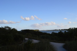 At the southern tip of Anna Maria Island lies the small island known as Leffis Key. This location is one of the few undeveloped areas on Anna Maria Island. Leffis Key has been the center of restoration efforts to restore the area's natural habitats, such as the mangroves and salt marshes. On this hike, you'll see some of the results of the restoration efforts, and you'll walk to a number of vistas of Sarasota Bay. This hike occurred on Friday, November 27th, 2015. My plan was to hike the largest loop in the preserve with a side trip to the top of the hill on Leffis Key. 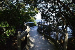 The barrier island of Longboat Key is home to a series of upscale development along the Longboat Key beach, generally referred to as the town of Longboat Key. By now, nearly the entire island is developed with very few of the native salt marshes and mangrove jungles left. Joan M. Durante Park preserves one of the last wild spots on Longboat Key, a place where you can hike on easy nature trails through salt marshes to the mangrove-lined shores of Sarasota Bay. This hike occurred on Monday, November 23rd, 2015. My plan was to hike the largest loop of the nature trails in Joan M. Durante Park. 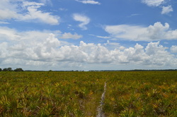
Once upon a time, the prairie was the key component of the nature of central Florida. Nowadays, not much of the prairie land is left, but fortunately, the majority of it is protected by tracts such as Myakka River State Park and Kissimmee Prairie State Park. On this long, strenuous (by Florida standards, of course) hike, you'll get to see the Florida prairie and the type of flora and fauna it is home to. However, you'll have to be sure that you bring sufficient water to enjoy this hike to its fullest. This hike occurred on Sunday, July 19th, 2015. My plan was to hike Fox's Low Road to the Myakka Hiking Trailhead. From here, I would do a large clockwise loop on the Myakka Hiking Trail. I would use Bobcat Crosstrail to shortcut the full 39-mile loop. I would end up back at the Myakka Hiking Trailhead at Fox's Low Road, and I would take Fox's Low Road back to the parking area.
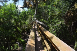
Myakka River State Park is one of the largest state parks in Florida. Protecting a large section of the Myakka River watershed, including two lakes, this massive park has all kinds of outdoor recreational opportunities. Most importantly for us hikers is a 39-mile hiking only loop trail that is located in the center of the park. The park also has many miles of dirt roads suitable for both hiking and biking, and even a few nature trails, like this one. This hike occurred on July 19th, 2015. My plan was to hike the short nature trail clockwise. I would then move on to hiking half of the park's main hiking loop, although that hike will be described in a separate post.
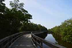
The salt marshes that dot the regions near the ocean can be some of the most scenic environments for hiking in Florida. On this hike, you can escape the urban feelings of the city of Bradenton for an afternoon walk in a relatively little-known preserve just outside of the city limits. On this hike, you'll traverse many miles of salt marshes, travel to the shoreline of Tampa Bay, and climb up an observation tower to a sweeping vista of Tampa Bay and the surrounding salt marshes. This hike occurred on Wednesday, July 1st, 2015. My plan was to hike the Osprey Loop counter-clockwise. Along the way, I would take the spur trail to the Manatee Overlook observation tower, as well as Tern Trail and Gull Trail. If I would have any leftover time, I would also take the Spoonbill Trail to the Ibis Trail and take the short Ibis Trail to a view of Perico Bayou.
|
About MeMark Oleg Ozboyd Dear readers: I have invested a tremendous amount of time and effort in this website and the Georgia Waterfalls Database the past five years. All of the work that has gone in keeping these websites updated with my latest trip reports has almost been like a full-time job. This has not allowed me to pick up a paid job to save up money for college, and therefore, I I've had to take out loans. If you find the information on this website interesting, helpful, or time-saving, you can say "thanks" and help me out by clicking the button above and making a contribution. I will be very grateful for any amount of support you give, as all of it will apply toward my college tuition. Thank you!
Coming in 2022-2023?
Other Hiking WebsitesMiles HikedYear 1: 540.0 Miles
Year 2: 552.3 Miles Year 3: 518.4 Miles Year 4: 482.4 Miles Year 5: 259.9 Miles Archives
March 2021
Categories
All
|

 RSS Feed