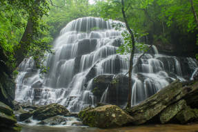
Yellow Branch Falls is an absolutely phenomenal waterfall in Oconee County, South Carolina (although it needs a lot of water to look its best). Over 50 feet high, Yellow Branch Falls features a stunning clamshell-shaped drop that spreads out in countless mini-trickles across a jagged rock face. From the Yellow Branch Recreation Area off Highway 28, an easy-to-moderate hiking trail leads 1.65 miles down the Yellow Branch valley past several smaller cascades to the falls. In addition, an unnamed tributary of Yellow Branch features a 35-foot cascading waterfall called Lohr's Falls. Lohr's Falls is only for experienced waterfallers, as there's no trail whatsoever to it. This hike occurred on Saturday, May 19th, 2018. My plan was to hike the trail out and back to Yellow Branch Falls. Along the way back, I would bushwhack to Lohr's Falls.
0 Comments
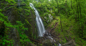
Lee Falls is often cited as one of Upstate South Carolina's top ten most beautiful waterfalls. Over 80 feet high, Lee Falls is an absolutely stunning free-falling drop in a 'tropical paradise' setting, surrounded by lush greenery on all sides. Although the moderate trail to Lee Falls isn't official, it's easily followed for 1.5 miles all the way to the falls. Along the way, you'll pass through several overgrown wildlife clearings and make six creek crossings as you scramble up the Tamassee Creek valley to Lee Falls. The best time of year to visit Lee Falls is during late spring after a good rain, when all the lush green growth around Lee Falls is particularly eye-popping and beautiful. Just be sure to go when the water levels are high. This hike occurred on Saturday, May 19th, 2018. My plan was to hike out and back to Lee Falls.
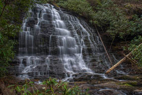
The Ellicott Rock Wilderness Area covers over 8000 acres across Georgia, South Carolina, and North Carolina. The wilderness's namesake is Ellicott Rock, located in the very heart of the wilderness at the point where all three states come together. From Burrells Ford, one can follow the Chattooga River Trail north into the wilderness all the way to Ellicott Rock and beyond. Besides passing Spoonauger Falls, the Chattooga River Trail affords numerous views of the river that it closely follows all the time. The other waterfall in the vicinity of Burrells Ford, King Creek Falls, is also easily-accessed and is among the most breathtaking waterfalls of the region. Intrepid waterfall chasers can also pick up the Bad Creek Trail from Ellicott Rock and make a challenging bushwhack to a secluded and pristine waterfall on Fowler Creek. This hike occurred on Saturday, January 27th, 2018. My plan was to first hike the Foothills Trail from Burrells Ford Campground to King Creek Falls. Then, I'd take the King Creek Trail and connect to the Chattooga River Trail. I'd follow the Chattooga River Trail north into the Ellicott Rock Wilderness all the way to Ellicott Rock, making the side trip to Spoonauger Falls along the way. From Ellicott Rock, I would follow the Bad Creek Trail and bushwhack down to Fowler Creek Falls. I would retrace most of my steps from Fowler Creek Falls, but when I would return to the vicinity of Spoonauger Falls, I would take the Foothills Trail straight to Burrells Ford Campground.
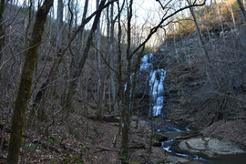 The Palmetto Trail is South Carolina's master trail, and when finished, it will extend across the entire state from the mountains to the coast. The trail starts off with a bang, and it's very first section is packed with interesting features, from a 60-foot waterfall to a historic site at Oconee Station to a breathtaking view from Tamassee Knob. Go in the winter, and you'll be treated to great views throughout the entire hike. This hike occurred on Saturday, December 19th, 2015. My plan was to first hike the Oconee Station Nature Trail, and then hike the Palmetto Trail's "Oconee Passage" from Oconee Station to Oconee State Park. Along the way, I would stop at Station Cove Falls. After reaching Oconee State Park, I would hike the Tamassee Knob Trail along a narrow ridge extending to a small summit with a fantastic vista. 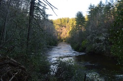
Big Bend Falls is one of the most powerful waterfalls in Upstate South Carolina. Located on the Chattooga Wild and Scenic River, the falls is one big mass of rapid whitewater, tumbling around 30 feet. To the east of the river, the Chattooga Ridge separates the main waterway from Cheohee Valley, which is a large area that lies at the base of the Cherokee Foothills. Several streams tumble down the steep eastern slopes of Chattooga Ridge, and a couple of these streams create several wonderful waterfalls that can be reached from the Winding Stairs Trail. This hike occurred on Saturday, April 4th, 2015. My plan was to hike the Winding Stairs Trail, the Big Bend Trail, and the Foothills Trail from the end of the Big Bend Trail to Cheohee Road. Since this isn't a loop and I didn't have a shuttle vehicle, I would finish with several miles of roadwalk on Cheohee Road.
|
About MeMark Oleg Ozboyd Dear readers: I have invested a tremendous amount of time and effort in this website and the Georgia Waterfalls Database the past five years. All of the work that has gone in keeping these websites updated with my latest trip reports has almost been like a full-time job. This has not allowed me to pick up a paid job to save up money for college, and therefore, I I've had to take out loans. If you find the information on this website interesting, helpful, or time-saving, you can say "thanks" and help me out by clicking the button above and making a contribution. I will be very grateful for any amount of support you give, as all of it will apply toward my college tuition. Thank you!
Coming in 2022-2023?
Other Hiking WebsitesMiles HikedYear 1: 540.0 Miles
Year 2: 552.3 Miles Year 3: 518.4 Miles Year 4: 482.4 Miles Year 5: 259.9 Miles Archives
March 2021
Categories
All
|

 RSS Feed