Pisgah Civitan Park: Pisgah Gorge Trail and Little Bryant Creek Waterfalls, Pisgah, Alabama5/9/2018 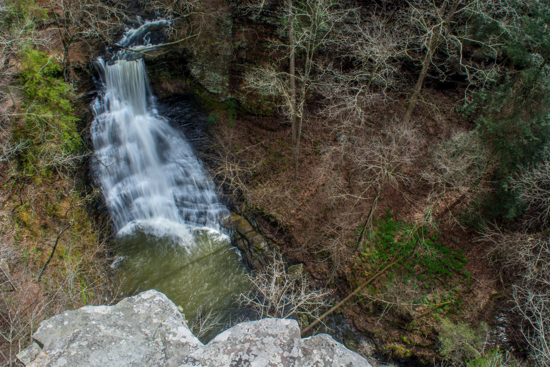
Inside the city limits of the quaint town of Pisgah in northeast Alabama is one of the area's most under-appreciated pieces of public land: the Pisgah Civitan Park. This small community park protects a section of the course of Little Bryant Creek through Pisgah Gorge that features three notable waterfalls - two of which are significant - and an extraordinary natural bridge. An easy trail follows the rim of the gorge, accessing several clifftop perches with sweeping birds-eye views of the gorge and its waterfalls. More adventurous hikers will find a faint, rugged pathway that drops into the gorge, accessing the base of Middle Little Bryant Creek Falls and the natural bridge. Pisgah Gorge features a sampling of some of Northeast Alabama's finest natural scenery and must not be missed! This hike occurred on Saturday, March 17th, 2018. My plan was to first hike the rim trail out and back to views of Upper Little Bryant Creek Falls, Middle Little Bryant Creek Falls, and the Pisgah Gorge downstream. I would then descend the trail into the gorge to get up-close and personal with the middle falls and the arch. In addition, I would check out a side trail leading to an old mill site at the top of the upper falls.
Summary
R/T Length of Trail: 1.2 Miles
Duration of Hike: 1:15 plus 1 hour and 45 minutes of stopping and photography Type of Hike: Out and Back with spur paths Difficulty Rating: 7 out of 10 (2 out of 10 if just the rim trail is hiked) Total Elevation Gain: 200 Feet Pros: Spectacular little-known waterfalls and views Cons: The trail into the gorge to the base of the middle falls and the arch is rugged, faint, and even a bit risky in a couple spots Points of Interest: Upper Bryant Creek Falls - 6 stars; Middle Bryant Creek Falls - 8 stars (based on both cliff view and base view); Lower Bryant Creek Falls - N/A (see details); Pisgah Gorge Arch; Pisgah Gorge View - 8 stars Trail Blaze Colors: None Best Seasons to Hike: Winter Fees: None Beginning Point: Pisgah Civitan Park Trailhead Directions: AL 40 intersects AL 71 east of Scottsboro and south of Pisgah. Follow AL 71 North for 2.4 miles. Then, turn left onto County Road 58. In another 2.2 miles, after entering the Pisgah city limits, turn left onto dead-end County Road 374. The entrance to Pisgah Civitan Park is 0.6 miles down the road on the left. If the gate is open, drive 0.1 mile down the road to the parking area. Park at the gate if it's closed. Map
Click the link below to download a .GPX file with a track of this hike.
Details
It amazes me that a place as outstanding and easy-to-access as Pisgah Gorge can remain hidden so well. It seems that primarily locals have any knowledge about the waterfalls of Little Bryant Creek and the area's other natural features. Pisgah Gorge is not featured in any hiking guidebooks, and you won't find much info online about it either. I am pretty sure that Pisgah Gorge is the most beautiful scenic area that I've come across in Alabama so far. Many thanks to the town of Pisgah for facilitating access to the area and maintaining it in the form of Pisgah Civitan Park, such a wonderful little park. I highly encourage Alabama waterfall hunters and hikers, and even those from neighboring areas of Georgia and Tennessee, to put Pisgah Gorge on your list. If you want an extraordinary hike duo, try visiting Stephens Gap Cave the same day as Pisgah Gorge. Trust me when I say that you won't be disappointed!
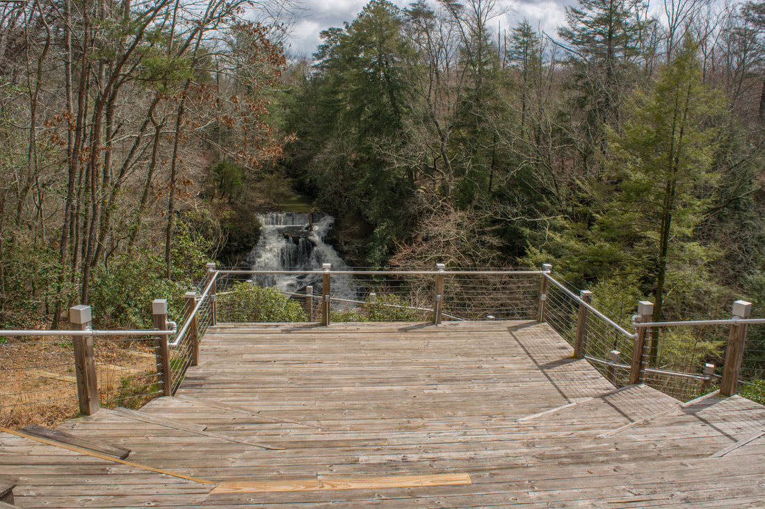
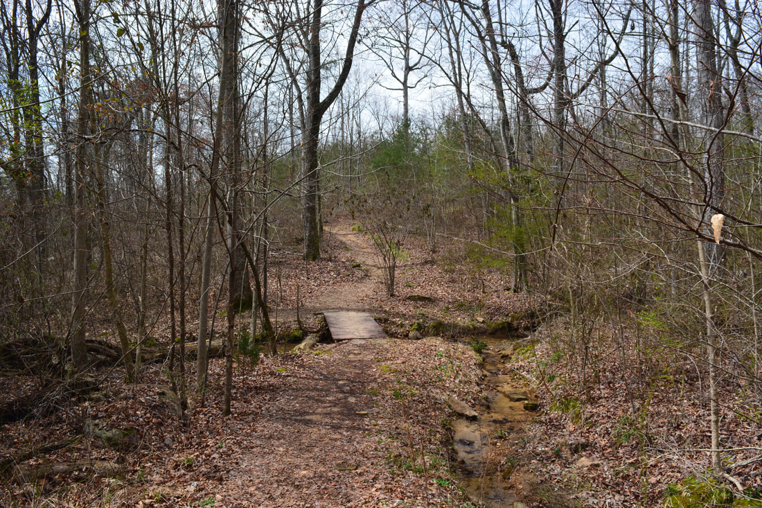
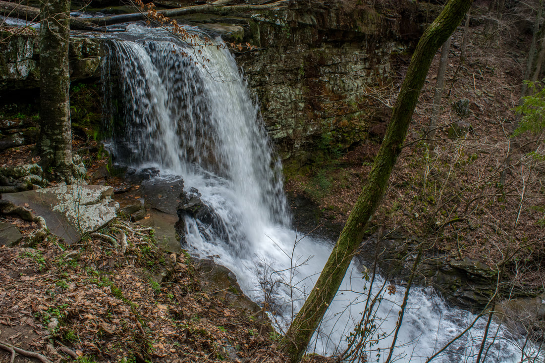
The Pisgah Gorge hike begins along the obvious pathway to the left of the picnic shelter at the end of the park road. In only 250 feet, the path arrives at a newly-built wooden observation deck with a view of Upper Little Bryant Creek Falls. As far as access to waterfalls goes, this one is about as easy as it gets - and it's a good one too! The observation deck provides a slightly distant frontal view of the falls from across the gorge, but this view actually appears to be more impressive than the one from the base. The double-tier falls is about 50 feet high and consists of two separate sliding sections in a rock amphitheater. The falls is especially scenic at high flow, when the creek spreads out across the entire rock face. A very steep and slick scramble path leads to the base of the falls, but I recommend sticking to the view from the observation deck. Just before the observation deck, a trail leaves left and right. First, take the trail on the left, which leads to the site of an old mill at the top of Upper Little Bryant Creek Falls. The trail meanders along the rim before ending at the top of the falls at 0.15 miles. Here, you have a close-up view of the old mill dam stretching across the creek. Even though the dam is right at the top of the falls, the falls itself is natural. You can see the old mill dam from the observation deck too, if you look closely. The area above the mill dam is quite scenic, as Little Bryant Creek Falls through an emerald pool lined by a cliff on one side. 
Upper Little Bryant Creek Falls in Pisgah Gorge is less than a hundred yards from the road.
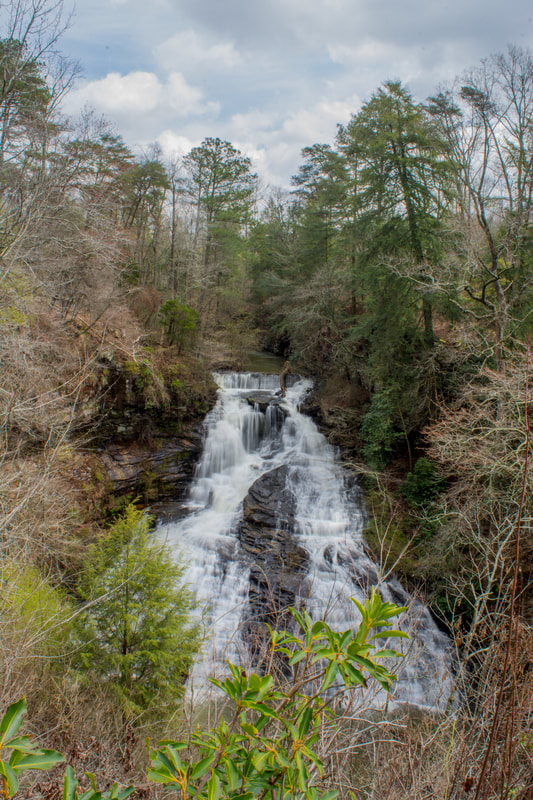
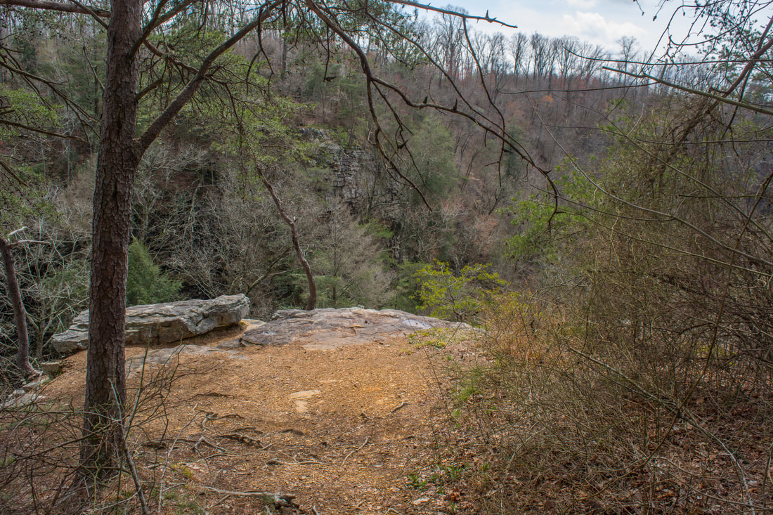
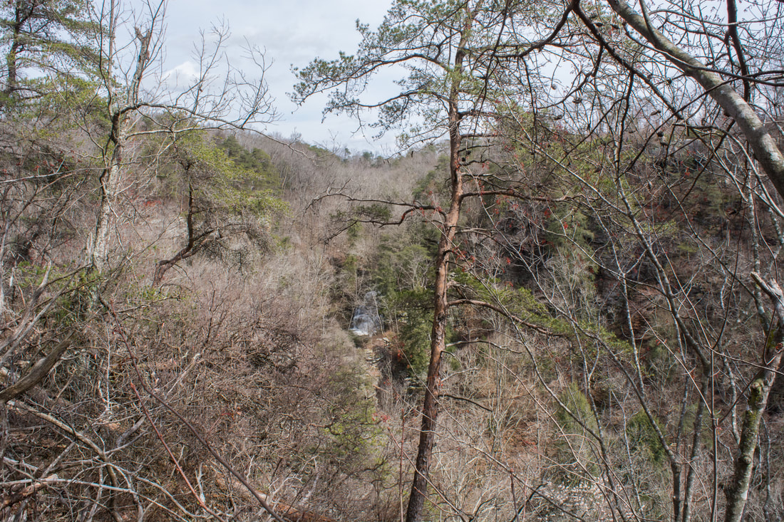
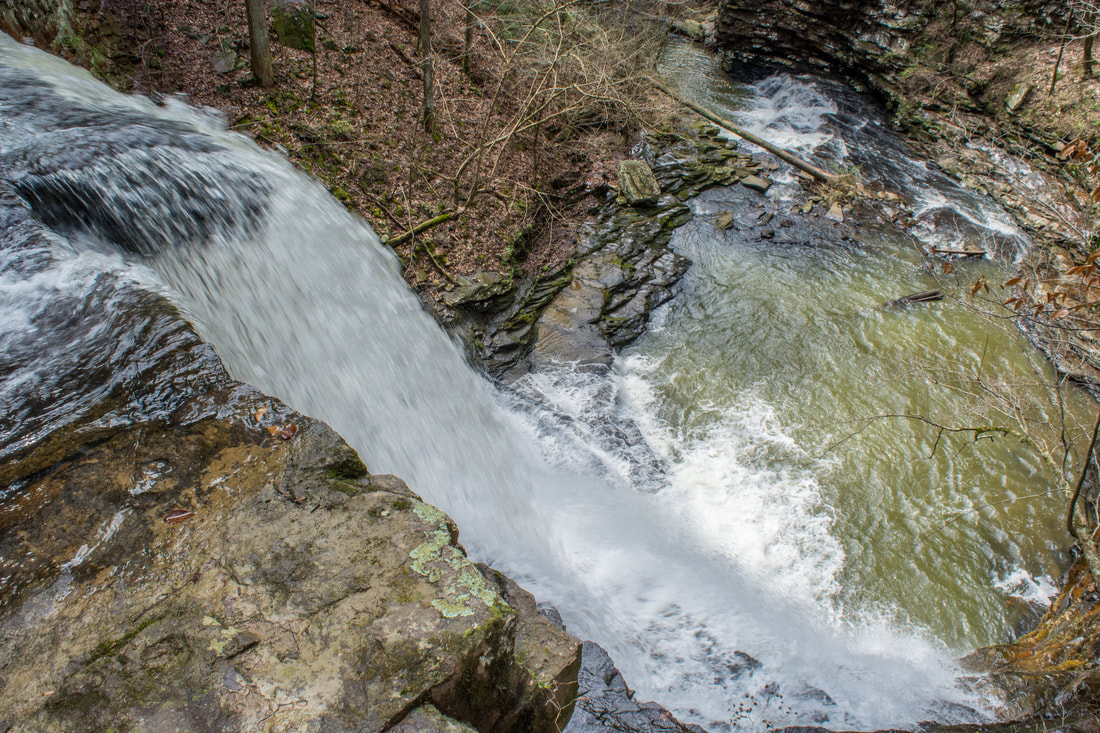
Return to the observation deck and follow the rim trail in the downstream direction. This is a very easy, level path all the way. At 0.35 miles (about 0.1 miles past the observation deck), the trail crosses a minor footbridge across a tiny rivulet. On the far side, a slim but distinct path leaves left. This is the trail that leads into the gorge to the base of Middle Little Bryant Creek Falls and the Pisgah Gorge Arch. If you plan on travelling into the gorge, make a mental note of this location; its coordinates are N34° 40.322' W85° 51.524'. For now, continue straight on the main trail. After a gentle rise, a 50-foot side trail leads left to the Middle Little Bryant Creek Falls Overlook at 0.45 miles. The overlook is spectacular, but be extremely careful around its edges - you're standing on a vertical cliff that drops over 100 feet down to the gorge floor! From this birds-eye vantage point, Middle Little Bryant Creek Falls looks tiny, although it's actually around 50 feet high as well. If the leaves are off, you can also see the Pisgah Gorge Arch a bit down the gorge to the right. Lower Little Bryant Creek Falls is just around the corner and out of sight (there will be more about it farther down this page).
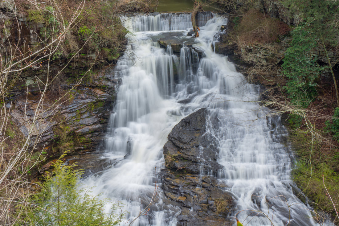
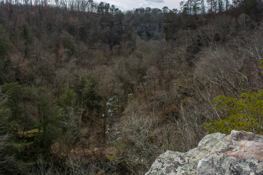
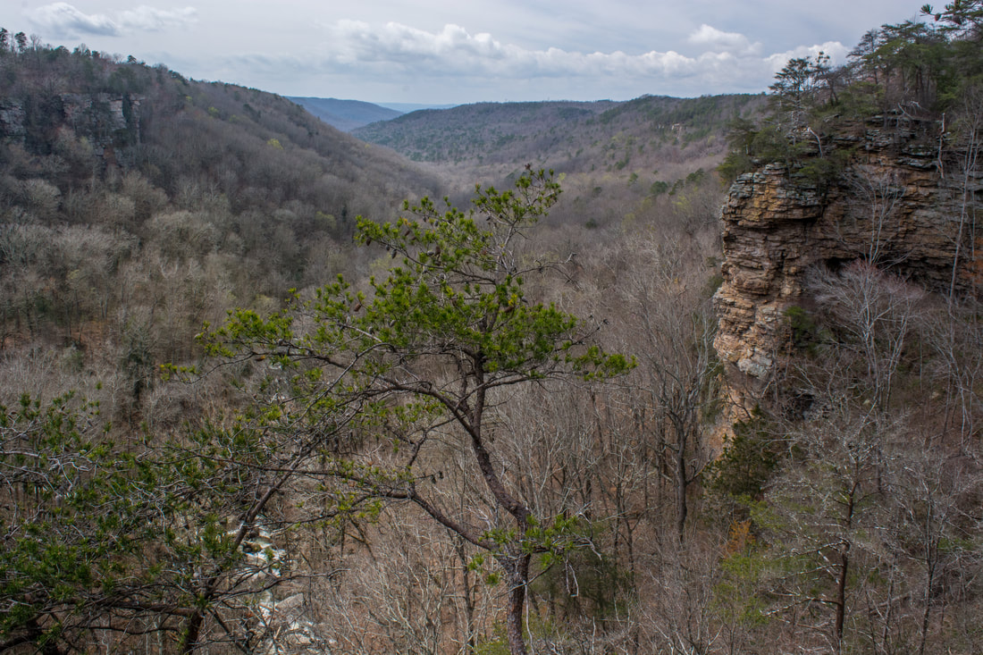
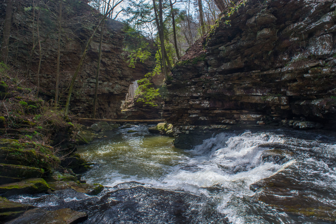
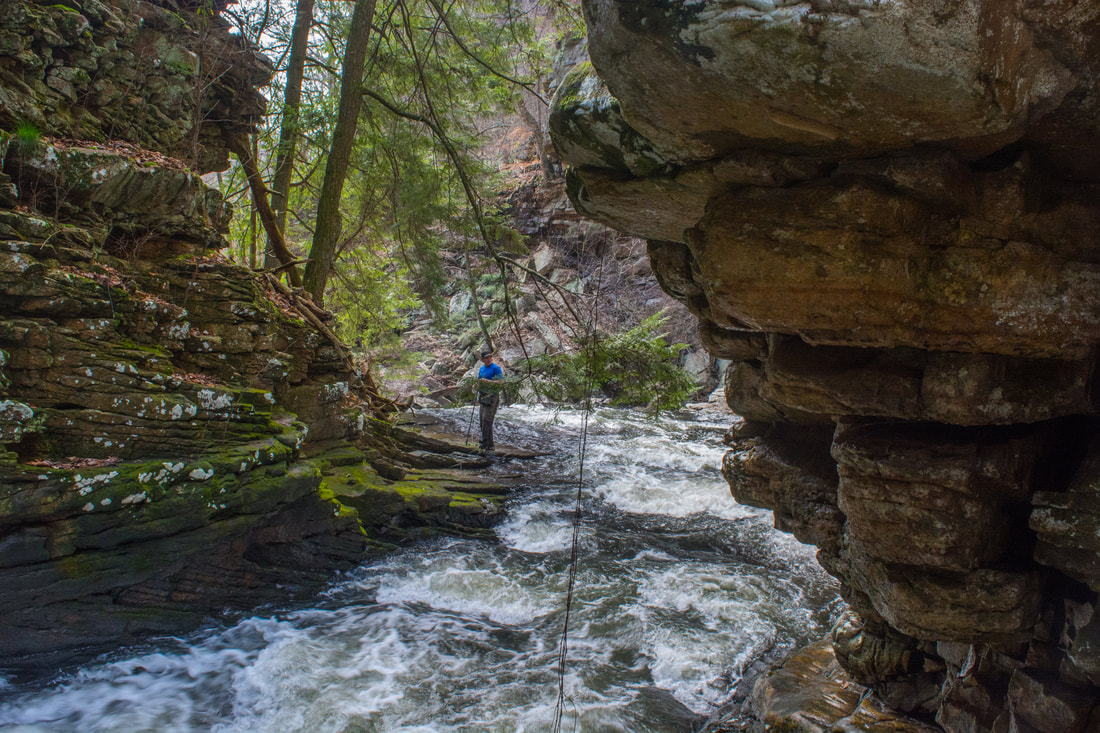
Return to the rim trail and keep following it westward. At 0.5 miles, the trail skirts a field - stay left. The trail passes a couple rock outcrops and reaches a split at 0.6 miles. Stay left toward the Pisgah Gorge downstream view. In 100 feet, the trail passes a limited distant view back toward Middle Little Bryant Creek Falls on the left. Meanwhile, while the path rounds a corner, the land suddenly opens up as you find yourself at the tops of cliffs over a hundred feet high. At 0.65 miles, the path reaches the main downstream view of Pisgah Gorge. This is the best view in the park and is well worth seeing. The clifftop perch affords a panoramic view of the confluence of Little Bryant Creek with Bryant Creek, forming Jones Creek, as well as the many bends in the gorge farther downstream along Jones Creek's route to the Tennessee River. Note the massive cliff just to the right of the view - this is pretty impressive for Alabama! Retrace your steps back to the junction with the path into the gorge by the little footbridge at 0.9 miles. Assuming that you're planning to hike to the base of the middle falls and see the arch, turn right onto the gorge path. The path quickly turns into a steep boulder field. Although there isn't much of a path visible through the rocks, it's not too hard to pick out the easiest route. Watch out for snakes here in the warmer months! You'll reach Little Bryant Creek and the gorge floor at 0.95 miles at the top of the middle falls. This is where the route gets sketchy. I hope I don't have to warn you to stay away from the brink of the falls. The route to the base begins with a drop down an 8-foot ledge just to the right of the falls. From there, a makeshift path follows the hillside for about 100 feet. There are several slick, muddy spots, so be very careful. When the path appears to dead-end at a tall bluff (this is the same bluff that is home to the elevated view of the falls high above), turn left and scramble down to the pool at the falls. The route is obvious, but the scramble can be fairly tough for folks who don't do this kind of 'hiking' often. You'll use your hands and your agility to scramble back up. If you think you can safely access the base of the falls though, it's well worth the effort. 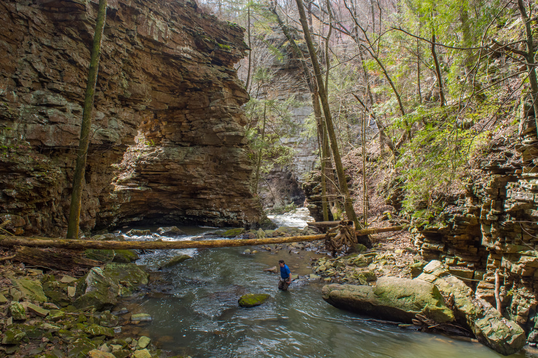
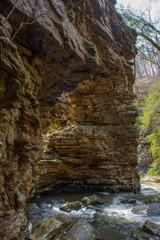
Just downstream from the middle falls on Little Bryant Creek in Pisgah Gorge is an extraordinary natural bridge!
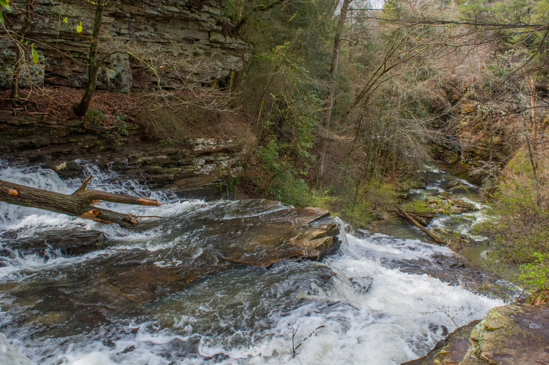
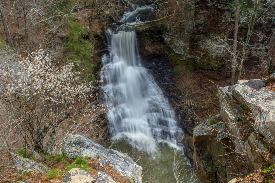
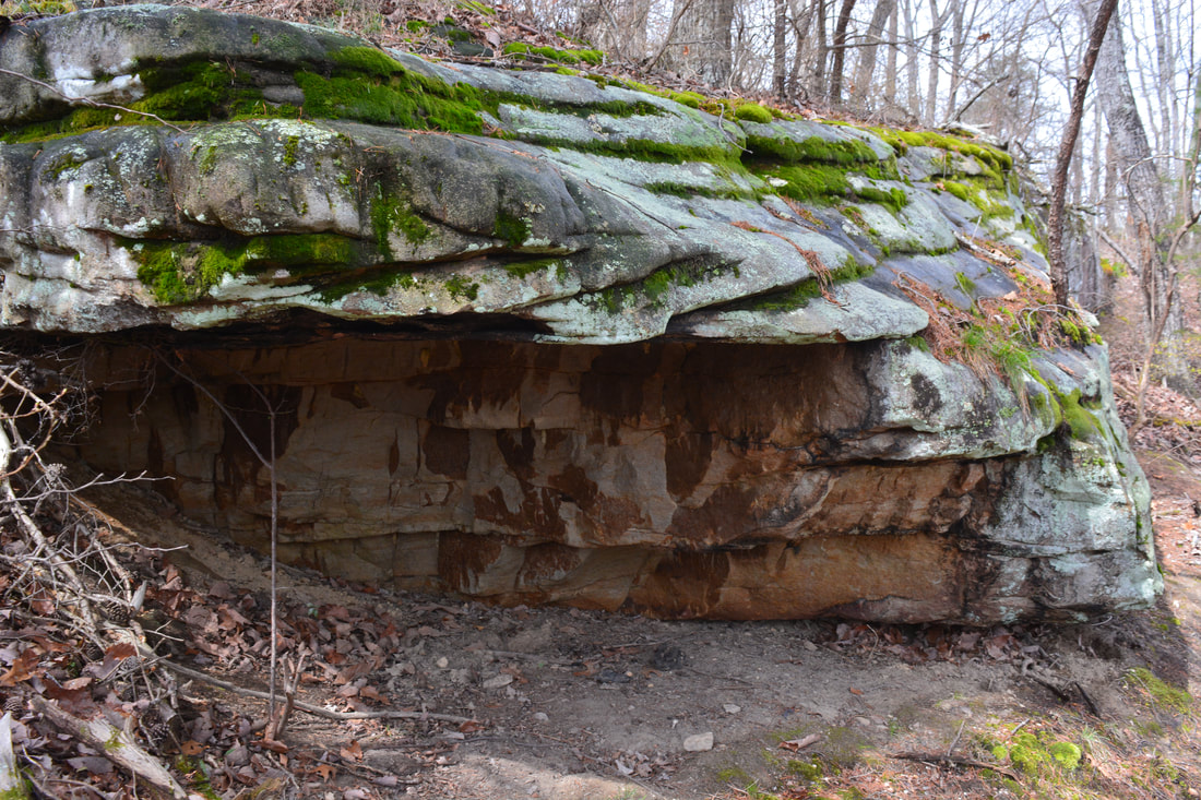
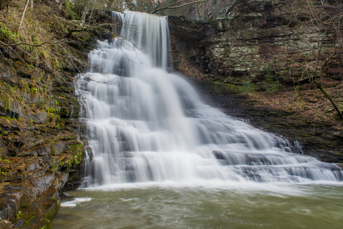
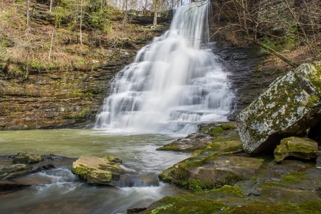
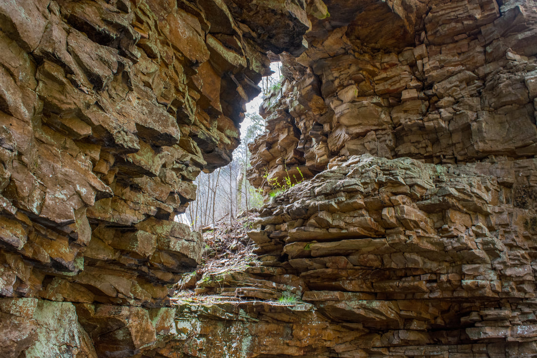
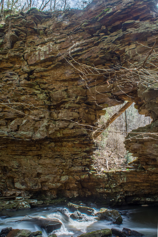
50-foot Middle Little Bryant Creek Falls begins with a free-fall that is followed by a very scenic stairstep cascade. Unlike the upper falls, this waterfall actually looks the best in lower flow. Like the upper falls, the middle falls is also in a scenic rock amphitheater. The setting feels much more secluded without the presence of any observation decks or picnic shelters. The view in other direction, downstream from the falls, is even more remarkable. There, you will see an extraordinary natural bridge that is known as the Pisgah Gorge Arch. The massive rock formation towers 80 feet into the air. The middle of the 'bluff' features a spectacular, undercut window-like opening with sunlight streaming through. If you want to explore the arch up close, you'll need to cross the creek below the middle falls - keep in mind that this can be a tough crossing due to slippery rocks and a swift current. And, if you visit this area (including the natural bridge), please practice LNT principles - this is a very unique, sensitive place that must be preserved and explored with care.
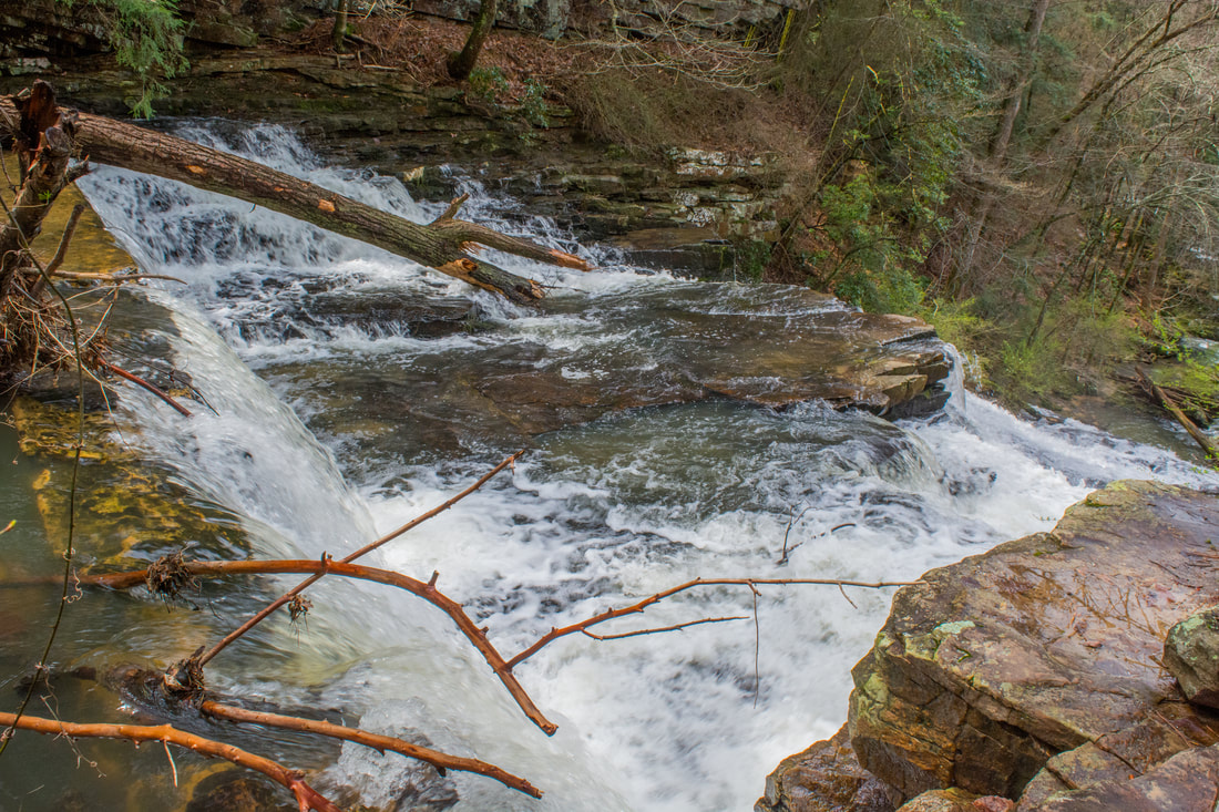
Just below the arch is Lower Little Bryant Creek Falls. If you move closer to the arch, you will actually see the brink of the falls at the next corner. The lower falls is only 15 feet high, but it's powerful and scenic. Had there been an easy way to the base, it would've definitely been worthwhile. However, there is no easy route to the base. Even getting to the top of the falls is problematic, because you would need to cross the creek twice at the far end of the arch. This is a tight spot with deep, fast water. The crossings will not be safe in high water! I did not go farther than the arch on my visit due to the high flow. I imagine that it will be tricky even in lower flows. Even if you manage to reach the top of the falls, you'll need to find a way scramble down the ledge alongside the falls. This is a technical scramble. I strongly discourage anyone but the most experienced off-trail hikers and climbers to attempt accessing the base of the lower falls. In any case, even though it's a scenic drop, the lower falls is far less impressive than the first two waterfalls. In this photo by Frank Emory, the lower falls (aka the third falls) on Little Bryant Creek is in the foreground, the Pisgah Gorge Arch is on the top right side, and the middle falls is a streak of white in the background. From the arch and the middle falls, simply retrace your steps back to the gorge rim. Then, turn right and follow the trail back to the parking area. At the split just before the picnic shelter and upper falls view, stay left on the shortest path to the trailhead. You'll conclude the hike upon your return to your vehicle at 1.2 miles. Due to the outstanding, little-known scenery found along this short hike, I have decided to rate it a "Best Hike!". In Alabama, it's seriously tough to beat the sights along this hike, given its short distance (much of it easy). Mileage
0.0 - Pisgah Civitan Park
0.05 - Upper Little Bryant Creek Falls 0.15 - Old Mill Dam 0.45 - Middle Little Bryant Creek Falls Overlook 0.65 - Pisgah Gorge View 1.0 - Middle Little Bryant Creek Falls Base; Pisgah Gorge Arch 1.2 - Pisgah Civitan Park Variations
Skip the side trip into the gorge - 1.0 Miles
Bonus Stops
Stephens Gap Cave, one of the most amazing natural sights in Alabama and even the Southeast, is west of Scottsboro. You can combine the cave with Pisgah Gorge for a great 1/2 day or 2/3 day outing.
Pictures
2 Comments
Heather Whitley
8/1/2021 10:25:02 am
There are no trespassing signs on the trail to the fall/dam now. Very disappointing!
Tom Leach
7/21/2023 09:58:23 am
This is a great job of covering the Pisgah Gorge! The best info on the web for gaining practical knowledge before visiting. Leave a Reply. |
About MeMark Oleg Ozboyd Dear readers: I have invested a tremendous amount of time and effort in this website and the Georgia Waterfalls Database the past five years. All of the work that has gone in keeping these websites updated with my latest trip reports has almost been like a full-time job. This has not allowed me to pick up a paid job to save up money for college, and therefore, I I've had to take out loans. If you find the information on this website interesting, helpful, or time-saving, you can say "thanks" and help me out by clicking the button above and making a contribution. I will be very grateful for any amount of support you give, as all of it will apply toward my college tuition. Thank you!

Coming in 2022-2023?
Other Hiking WebsitesMiles HikedYear 1: 540.0 Miles
Year 2: 552.3 Miles Year 3: 518.4 Miles Year 4: 482.4 Miles Year 5: 259.9 Miles Archives
March 2021
Categories
All
|
||


 RSS Feed