The trails at the west end of Panthertown Valley feature several popular waterfalls: Wilderness Falls, Frolictown Falls, and Granny Burrell Falls, as well as a spectacular well-known cliff line on the south side of Big Green Mountain called the Great Wall. This hike visits all of these destinations, in addition to lesser-known views atop Big Green Mountain itself. This hike also follows the Deep Gap Trail out of Panthertown Valley onto the seldom-hiked Laurel Knob Trail, a climbers' access trail that leads to the base of the 1200-foot cliffs of Laurel Knob. Laurel Knob boasts of the tallest uninterrupted cliff face in the entire Eastern United States! This hike occurred on Saturday, March 31st, 2018. My plan was to start out at the Salt Rock Gap Trailhead, where I'd take the Wilderness Falls Trail past Wilderness Falls to the Deep Gap Trail at Frolictown Falls. I'd then hike the Deep Gap Trail and Laurel Knob Trail out and back to the base of the Laurel Knob cliffs. Next, I'd return to Frolictown Falls, and I'd take the Great Wall Trail toward the top of Big Green Mountain, making a side trip to Granny Burrell Falls along the way. I would then follow the Big Green Trail past several views and continue down an unofficial connector to Macs Gap Trail. Finally, I'd follow the Macs Gap Trail and Panthertown Valley Trail back out to Salt Rock Gap.
Summary
R/T Length of Trail: 11.0 Miles
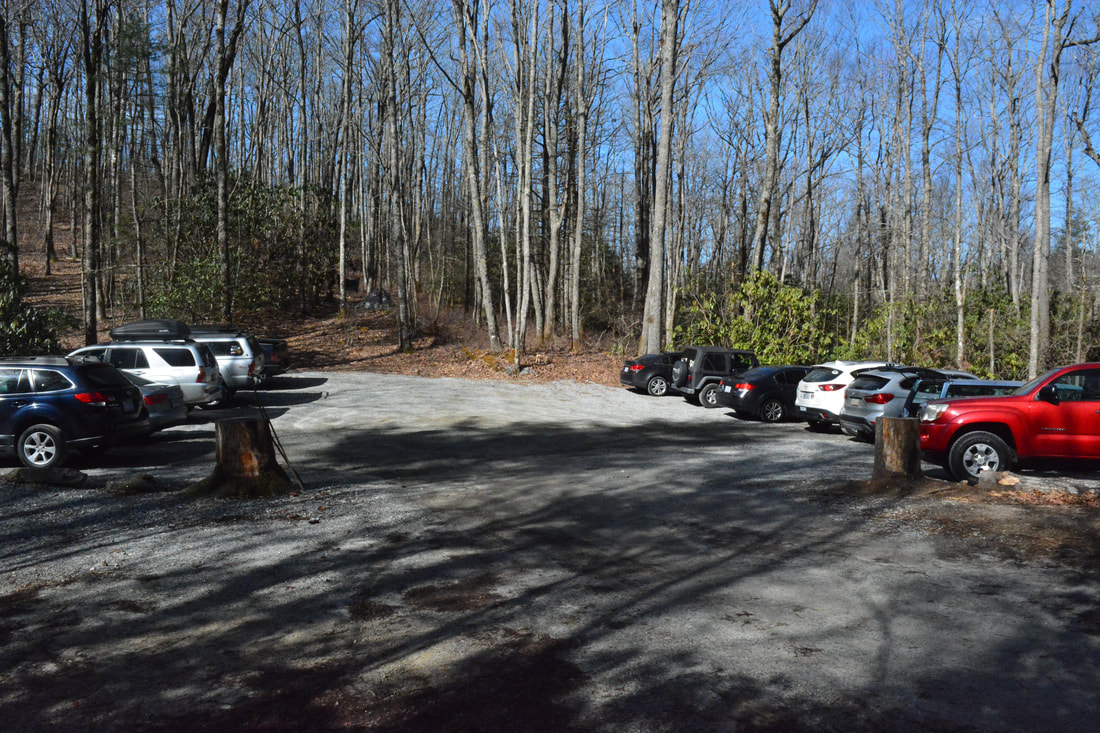
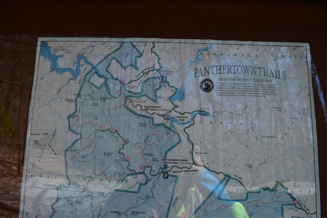
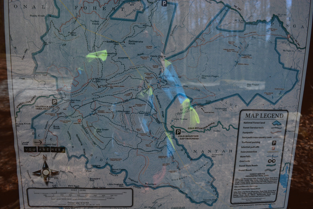
Duration of Hike: 6:00 plus 3 hours of stopping and photography Type of Hike: Loop with Spurs Difficulty Rating: 7 out of 10 Total Elevation Gain: 2833 Feet Pros: Secluded views atop Big Green Mountain Cons: Very steep climb back up from the base of the Laurel Knob cliffs Points of Interest: Wilderness Falls - 6 stars; Frolictown Falls - 4 stars; Granny Burrell Falls - 3 stars; Cliffs of Laurel Knob; The Great Wall; Views from Big Green Mountain - 6 stars collectively; View from Salt Rock Gap - 5 stars Trail Blaze Colors: Most trails are blazed either green or red. The Laurel Knob Trail and the unofficial connector trail between Big Green Mountain and Macs Gap Trail are unblazed. Most trails are well-signed and easy to follow, with the exception of the unofficial connector. Best Seasons to Hike: Summer Fees: None Beginning Point: Salt Rock Gap Trailhead Directions from Cashiers, NC: From the intersection of US 64 and NC 107 in downtown Cashiers, follow US 64 East for 1.9 miles. Then, turn left on Cedar Creek Road. In 2.3 miles, turn right on Breedlove Road. Follow Breedlove Road 3.6 miles to the dead-end parking area in Salt Rock Gap. The last 0.3 miles are unpaved but should be passable for most passenger vehicles. Map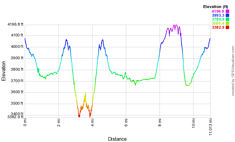
Click the link below to download a .GPX file with a track of this hike.
Details
Naturally, as soon as I'd heard that new public access had been secured to the massive rock face of Laurel Knob, touted to be the tallest uninterrupted cliff in the Eastern US - a place that I had never even heard about - I knew I had to visit. I found that the access to Laurel Knob was conveniently placed at the west end of Panthertown Valley, allowing me to combine a hike to Laurel Knob with a short loop that visited most of the typical destinations across the valley's western sector.
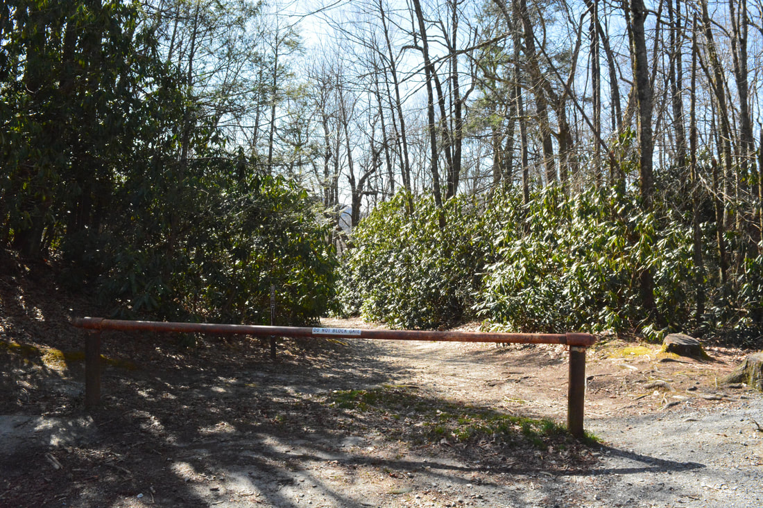
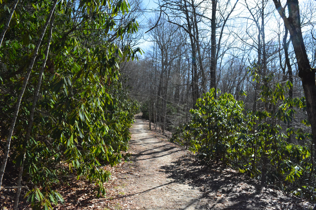
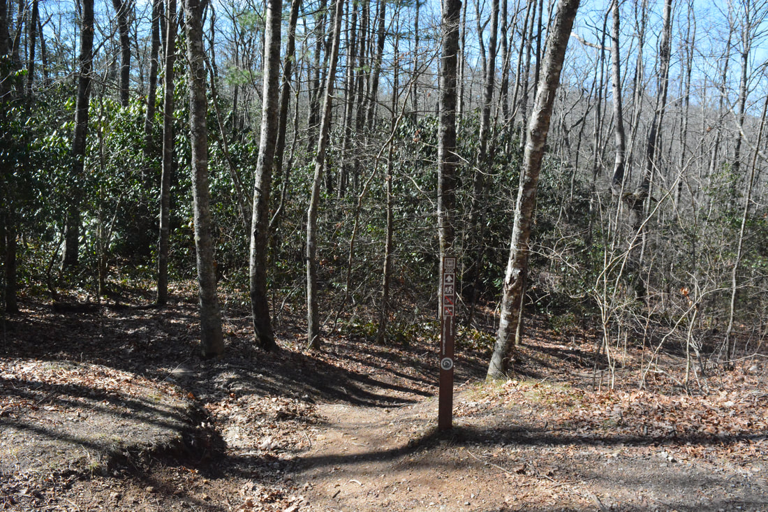
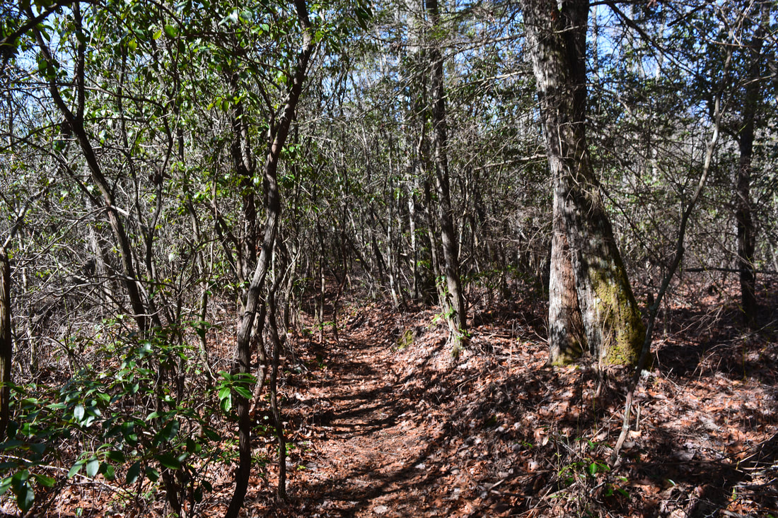
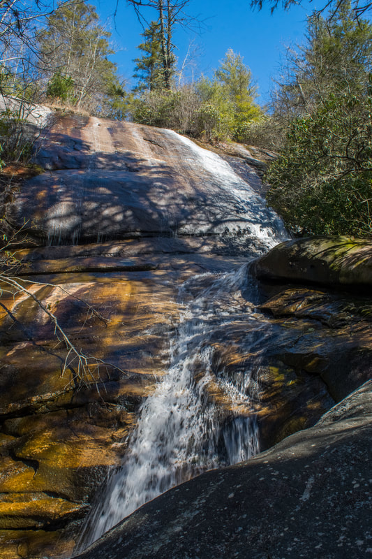
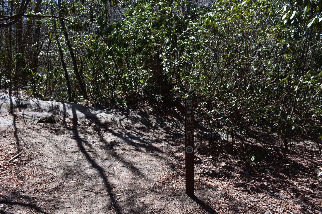
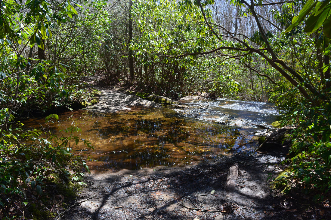
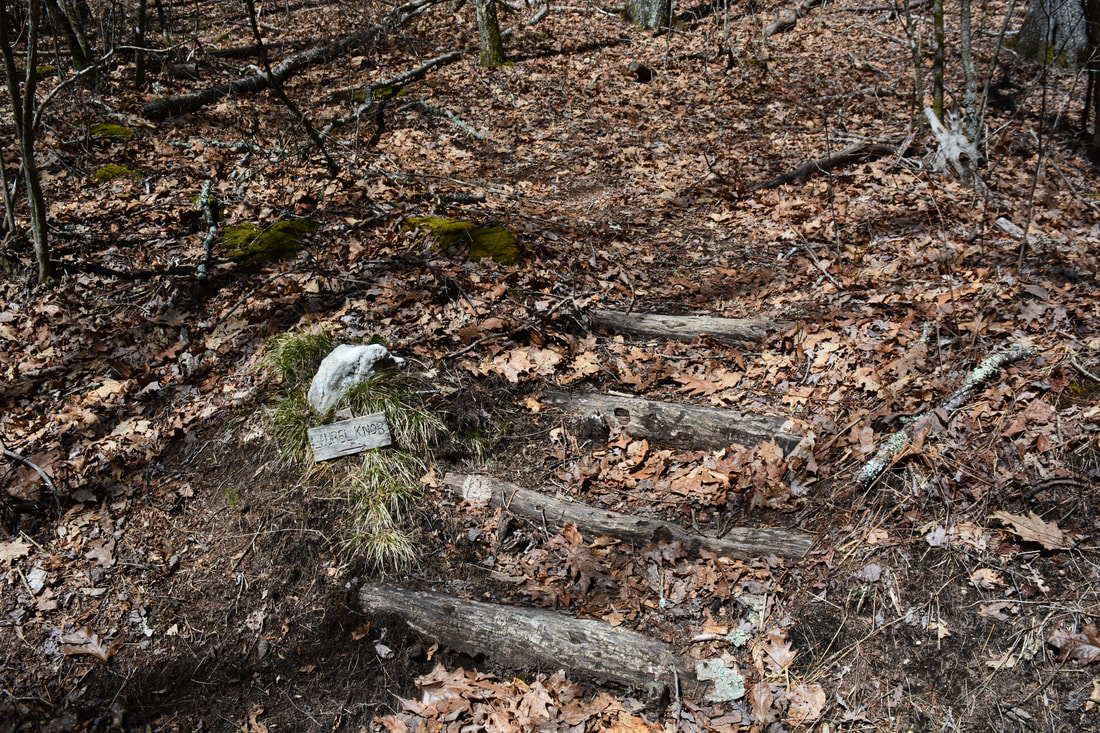
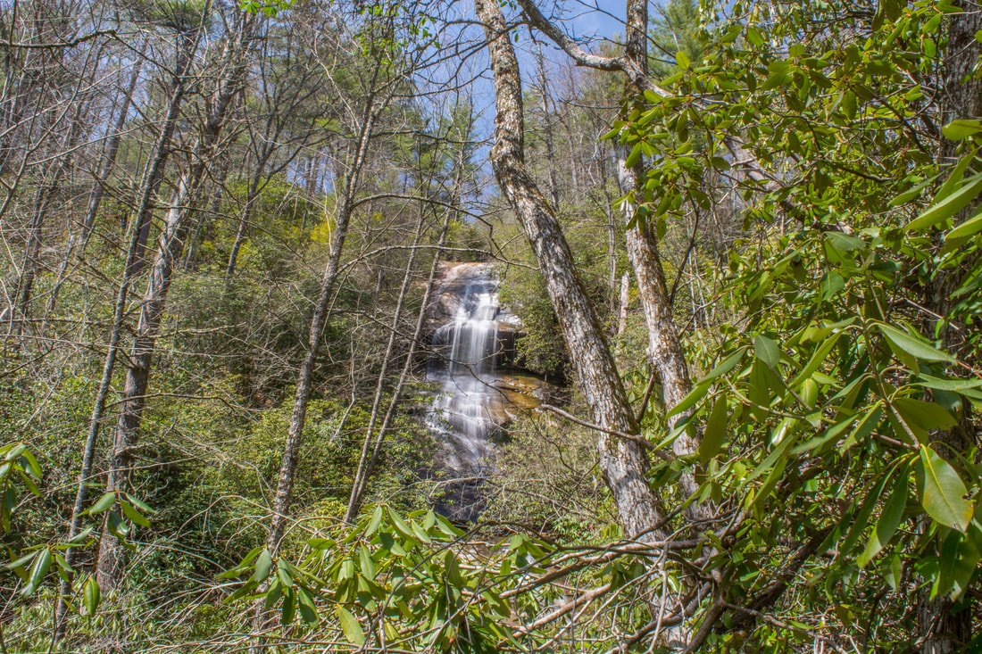
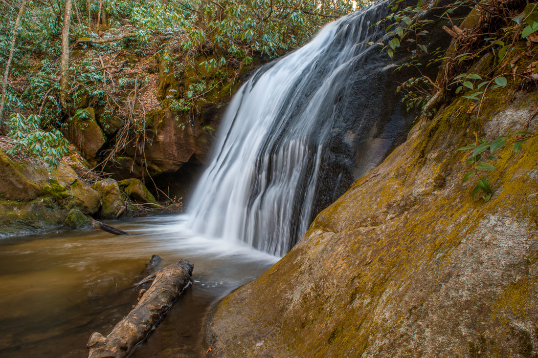
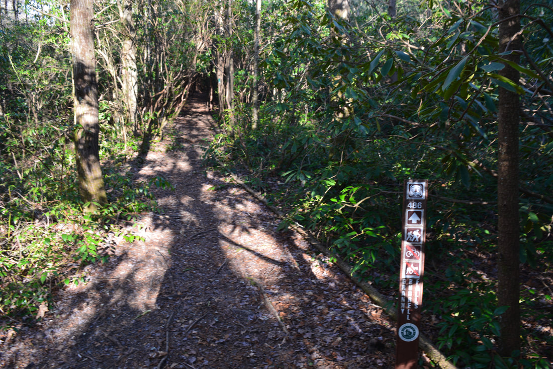
Begin the hike along the Panthertown Valley Trail along the broad forest road behind the gate at the Salt Rock Gap parking area. After a quarter-mile moderate descent, reach a junction with Wilderness Falls Trail on the right. This is where the loop begins; turn right on the single-track pathway. The trail shortly begins descending into the Frolictown Creek valley through tunnels of mountain laurel along a galax-lined path. After a pair of switchbacks at 0.6 miles, the trail reaches Wilderness Falls at 0.8 miles. A 50-foot side path straight ahead leads to a distant view of the falls, and a 150-foot side path on the right leads to a rock slab with close-up views of the falls. Wilderness Falls is close to 120 feet high, but it's on a very small tributary of Frolictown Creek, so it needs a lot of water to look good. The tributary is unnamed on topo maps, but it's occasionally referred to as Double Knob Gap Branch. The waterfall consists of a steep upper slide down a big rock face, followed by a lower slide and a cascade at the end. Keep following the Wilderness Falls Trail past Wilderness Falls. The trail meanders through lowlands near the stream, passing through several mucky areas before arriving at a junction with the Deep Gap Trail at 1.25 miles. The side pat to Frolictown Falls is just to the left, but if you plan on hiking to Laurel Knob before continuing the loop, I suggest turning right on the Deep Gap Trail and leaving Frolictown Falls for later. In just a few feet, the Deep Gap Trail makes an ankle-deep ford of Frolictown Creek just above Frolictown Falls. The trail then begins an easy ascent toward Deep Gap. Stay straight at 1.8 miles as an old logging road bears left. The grade steepens just a little toward the end. At 2.15 miles, 200 feet before the trail's end at the private property boundary in Deep Gap, a discreet wooden 'Laurel Knob' sign marks the start of the Laurel Knob Trail on the right. Take the Laurel Knob Trail. 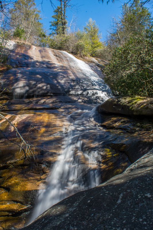
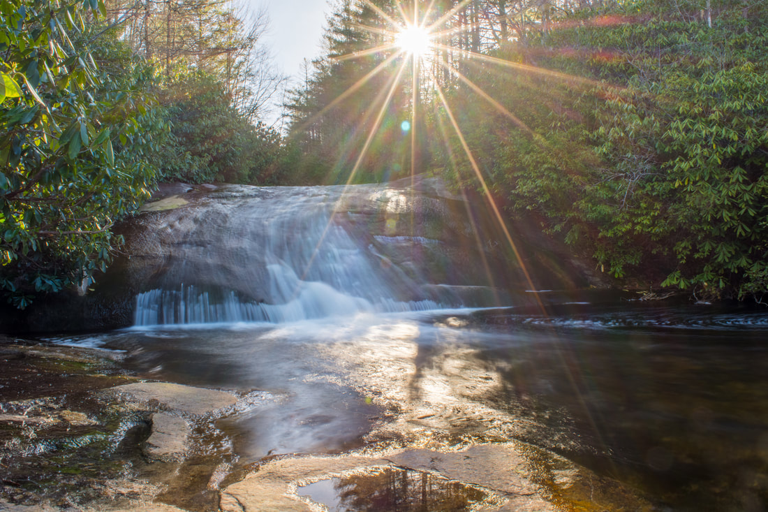
Wilderness Falls is a steeply-siding waterfall over 100 feet high on an unnamed tributary of Frolictown Creek.
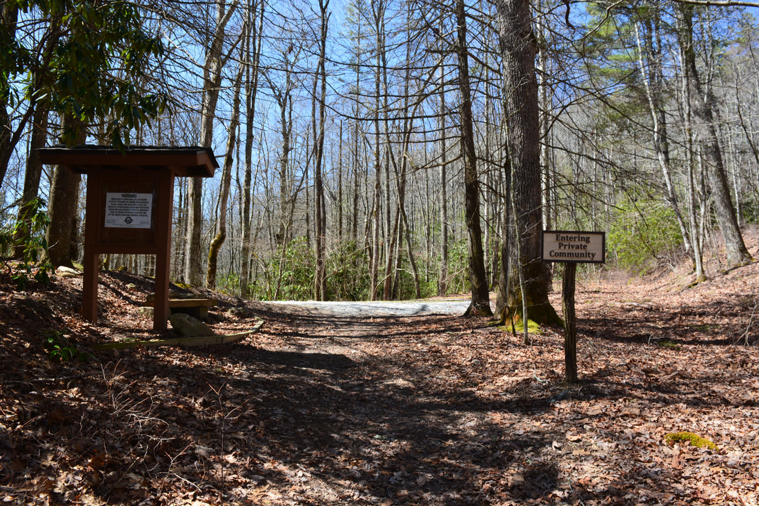
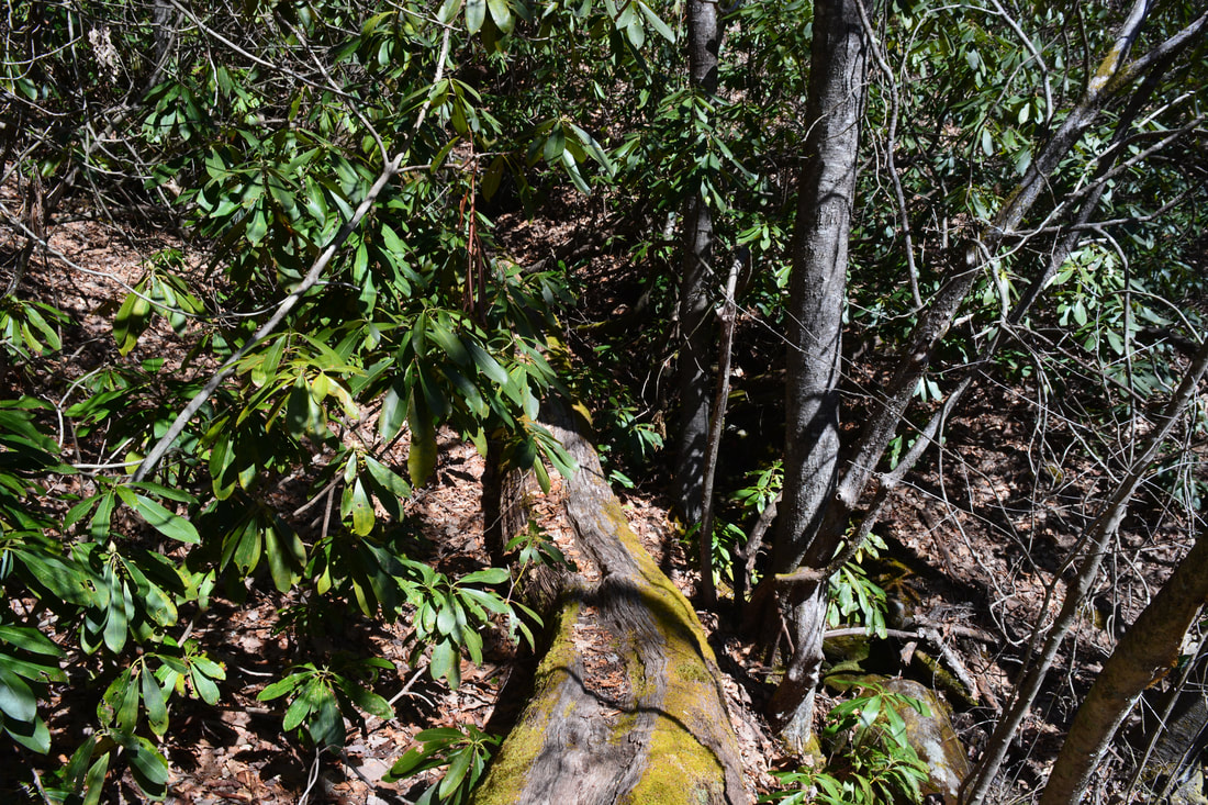
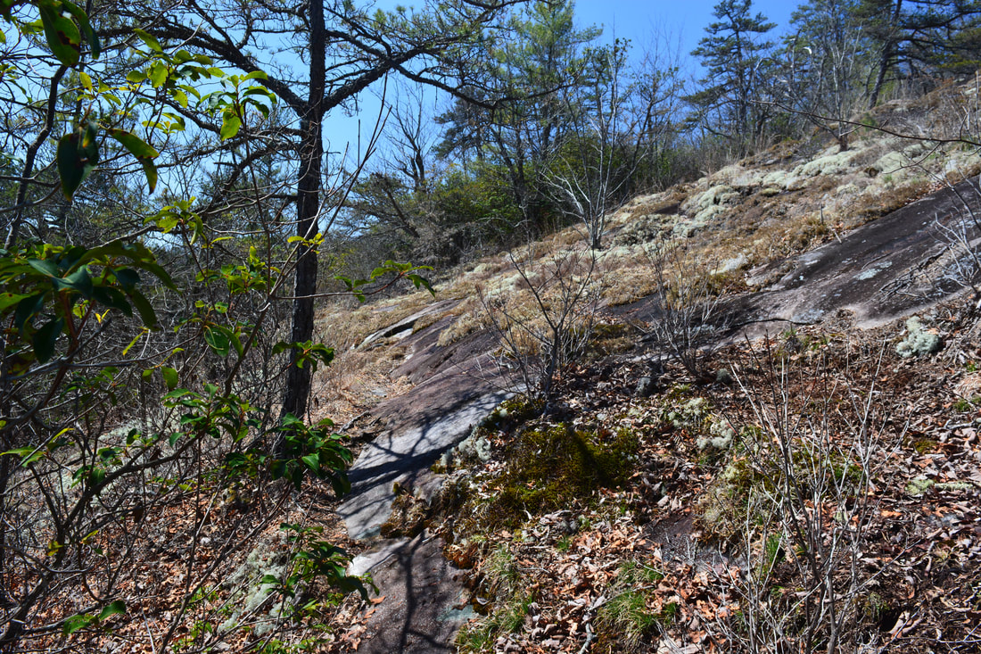
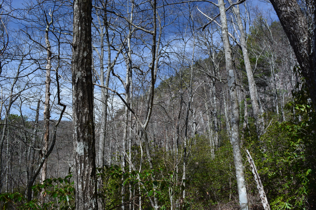
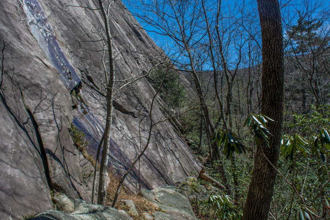
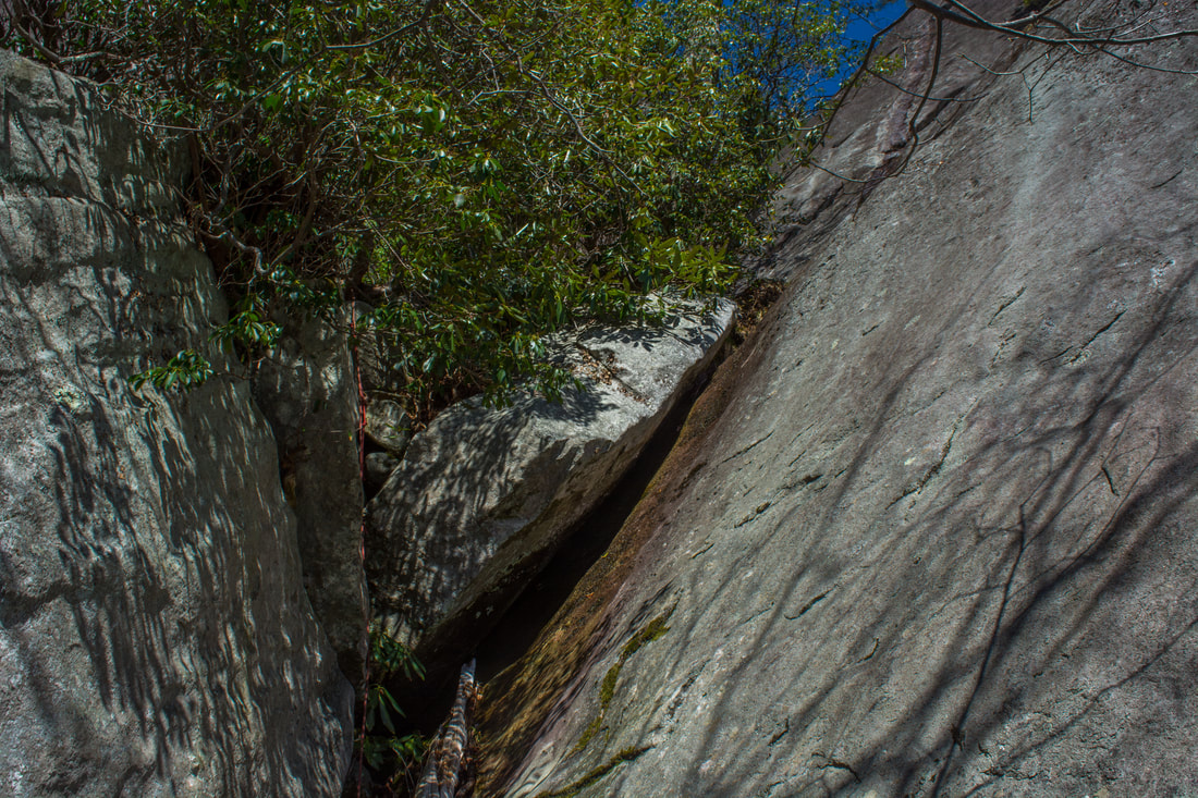
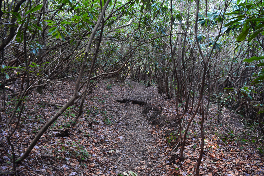
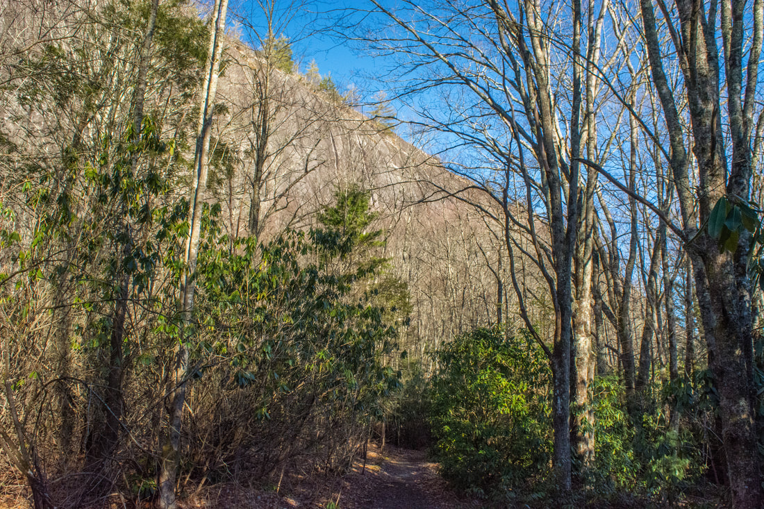
It instantly becomes evident that the maintenance of the Laurel Knob Trail, a Carolina Climbers Coalition access trail not managed by the US Forest Service, is vastly different from the main trails in Panthertown Valley. The narrow pathway starts out crossing several fallen trees before crossing a ravine via a log at 2.25 miles. After this, the trail slowly ascends along the south side of Laurel Knob, crossing a series of small rock outcrops with limited southward views near the highest point at 2.5 miles. At 2.6 miles, the trail turns abruptly right (west) and passes almost through the backyard of a house. At 2.7 miles, the trail reaches a Carolina Climbers' Association kiosk that details various rock climbing routes at Laurel Knob. After this, the trail begins a very steep descent into Lonesome Valley toward the base of the Laurel Knob cliffs. Although the descent features a number of switchbacks, they don't help much. You'll get some wintertime views of the massive rock face on Laurel Knob soon. After descending 400 feet, the trail meets up with the broader Laurel Knob Trail that comes out of the Lonesome Valley development. Turn right to stay on public land and to see the cliffs.
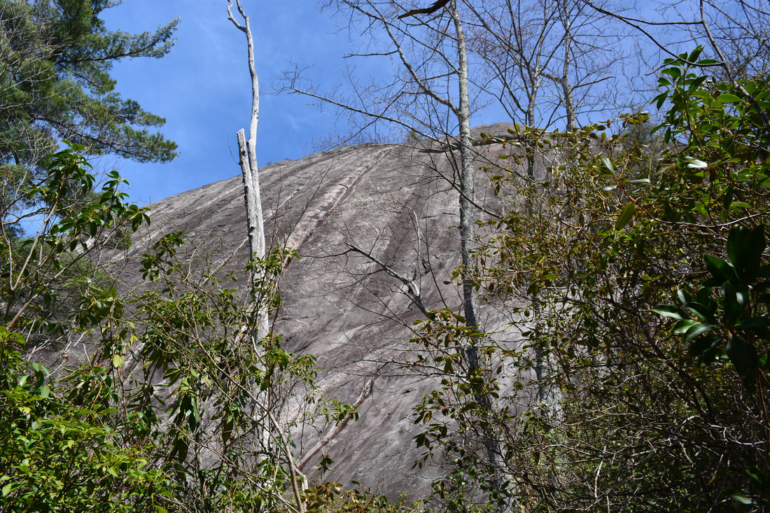
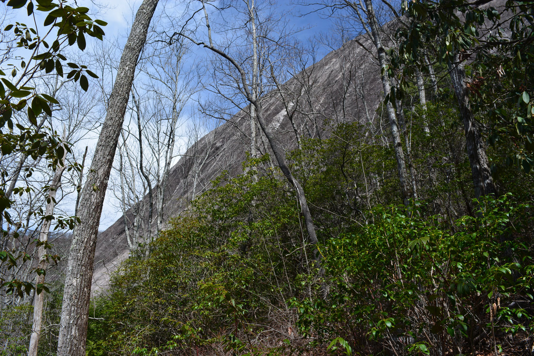
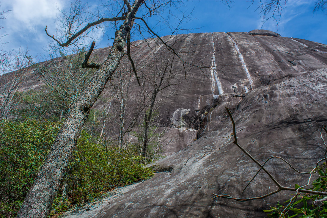
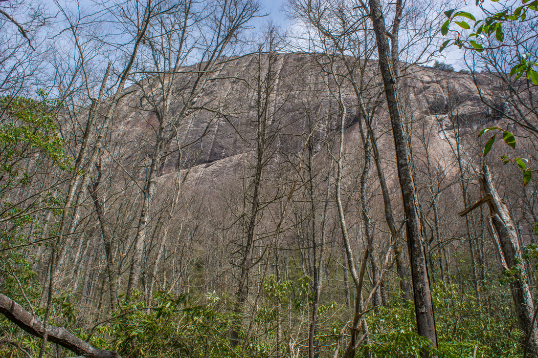
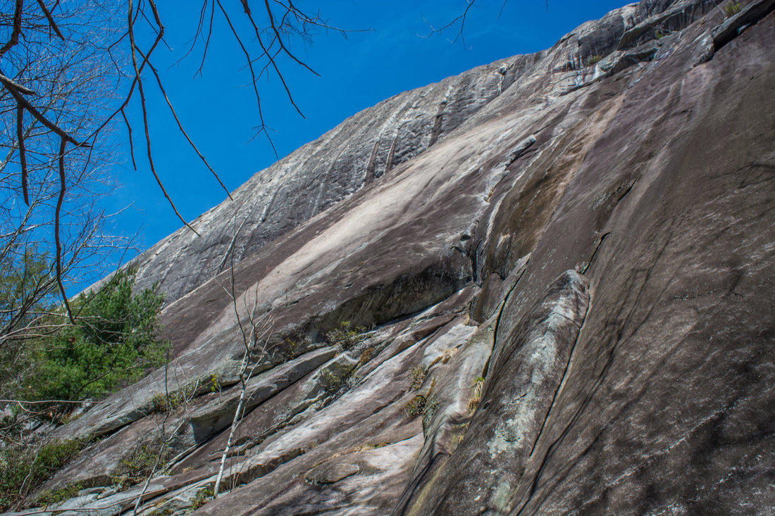
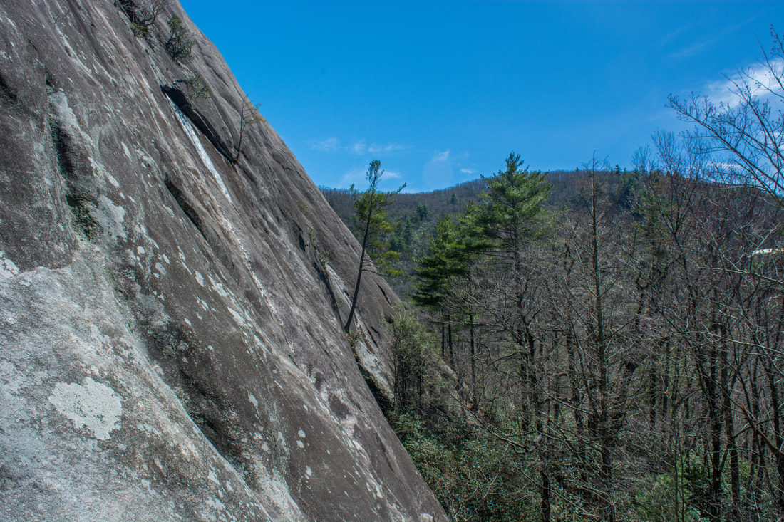
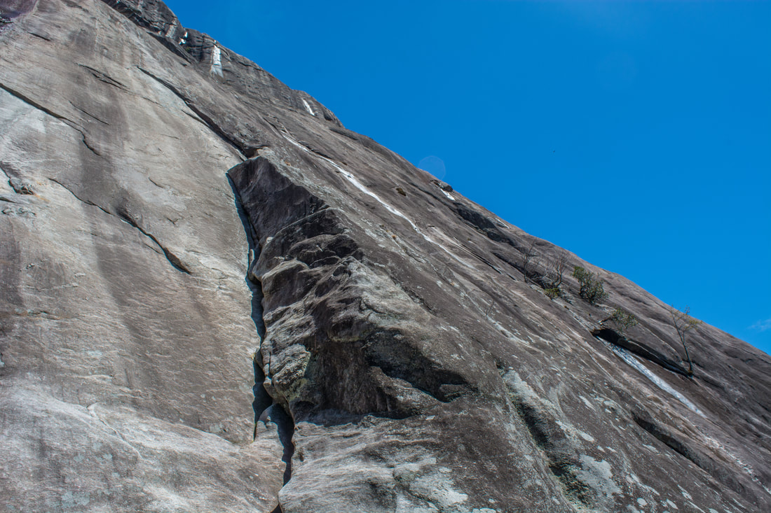
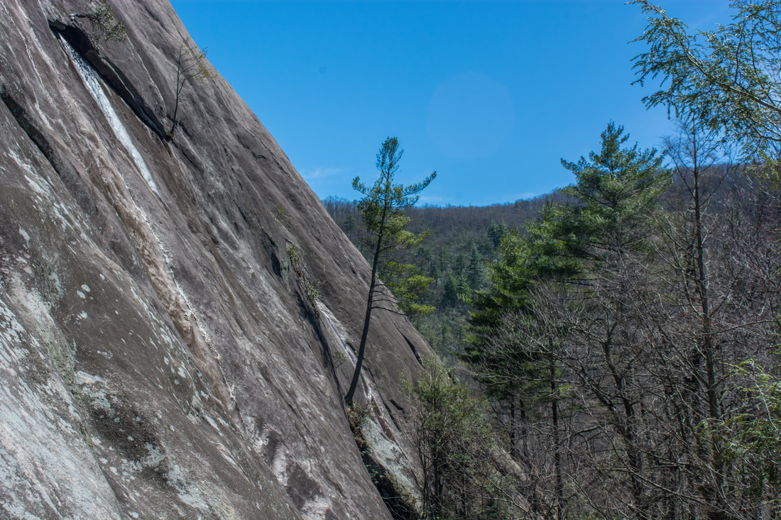
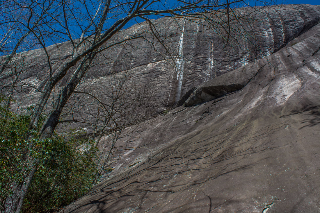
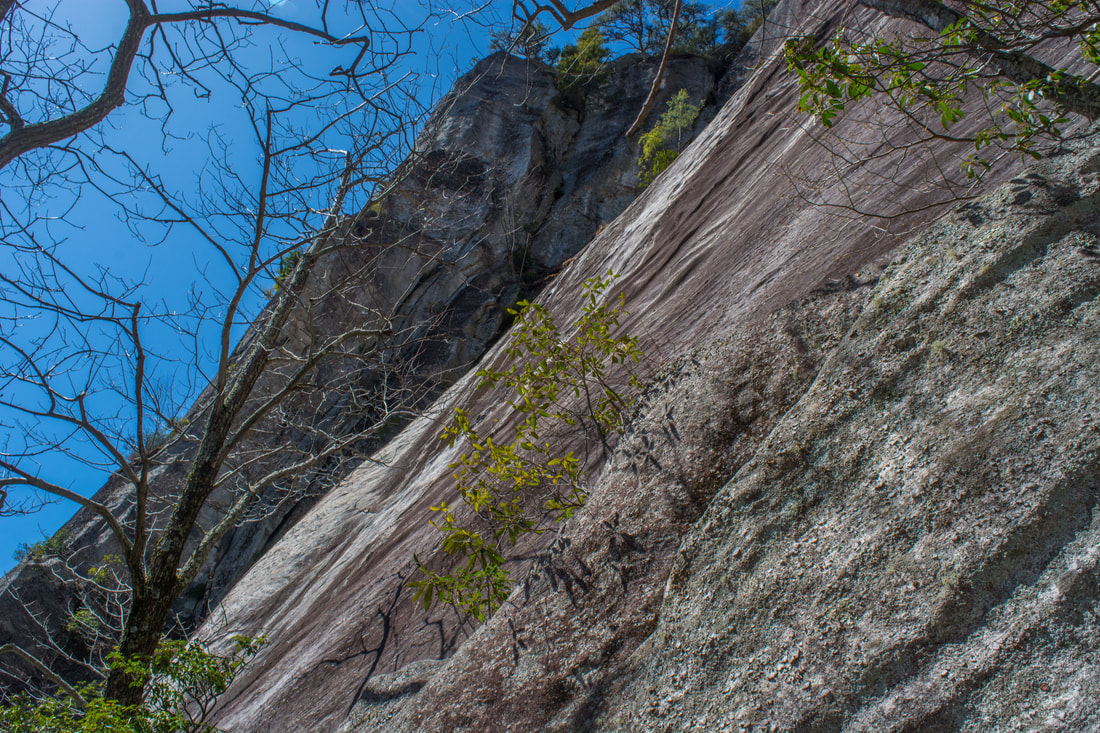
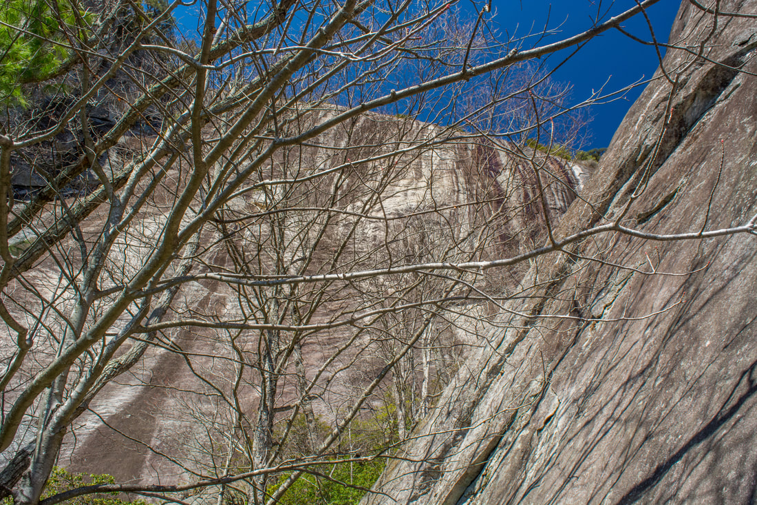
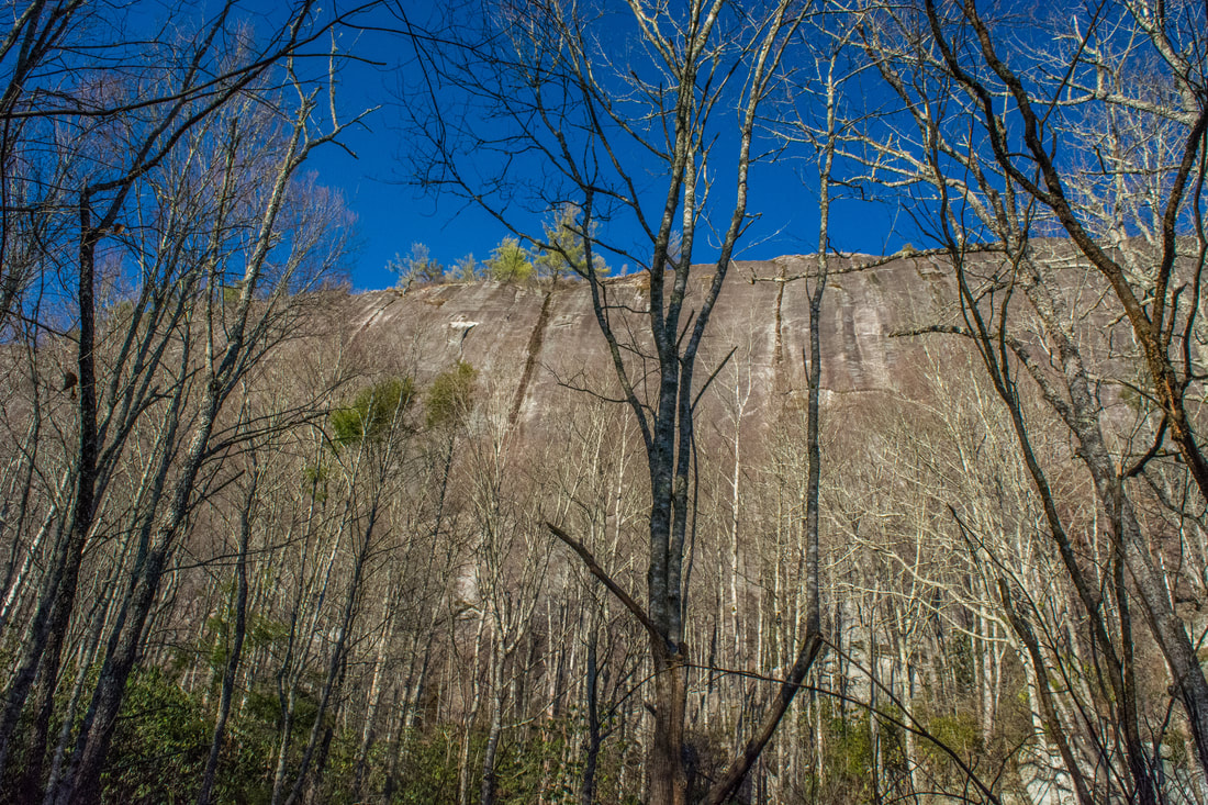
At 3.25 miles, there's a rather confusing intersection just as the trail reaches the base of the cliffs. The main pathway bears left and shortly enters surprisingly-unmarked private property that belongs to the Lonesome Valley development. The private pathway eventually leads to an unimpressive sliding waterfall called East Canyon Falls on a tributary of Logan Creek. Hikers and climbers must bear right on the narrower path that steeply climbs up some rocks. A CCC climbing rules sign is attached to a tree at the start of this path. The path shortly begins the traverse along the base of the Laurel Knob cliffs - the best route is among the immediate foot of the cliffs. The Laurel Knob cliffs are an incredible place, where nature will make you feel tiny! Although you can't see the full 1200-foot extent of the cliffs from the base due to the slant of the rock face, you can still see several hundred feet of it. Occasionally, you'll see stunted pines growing out of the most amazing spots right on the cliffs! After paralleling the massive cliffs for 0.35 miles, the path reaches an overgrown gully called Dillard Canyon at 3.6 miles. This is a good place to turn around. Although a path of sorts continues up into Dillard Canyon, it's not really worth the effort for anyone but climbers. The 'path' is insanely steep and features few views until near the top of the canyon. If Dillard Canyon had been open, it would be much more scenic, but it's so choked by vegetation that you can barely see anything. Towards the top, where tall cliffs close in on the canyon on both sides, there are a couple of places where you can tiptoe out on the edge of the rock face and get open views into Lonesome Valley and beyond. I've included photos of those views in the gallery below. However, I scrambled on my hands and feet all the way to the point in the canyon where it's not possible to proceed without climbing gear, and I can assure you that absolutely none of the views are worth the insane effort to get there. It's best for you to remain by the base of the cliffs and not venture up into Dillard Canyon. 
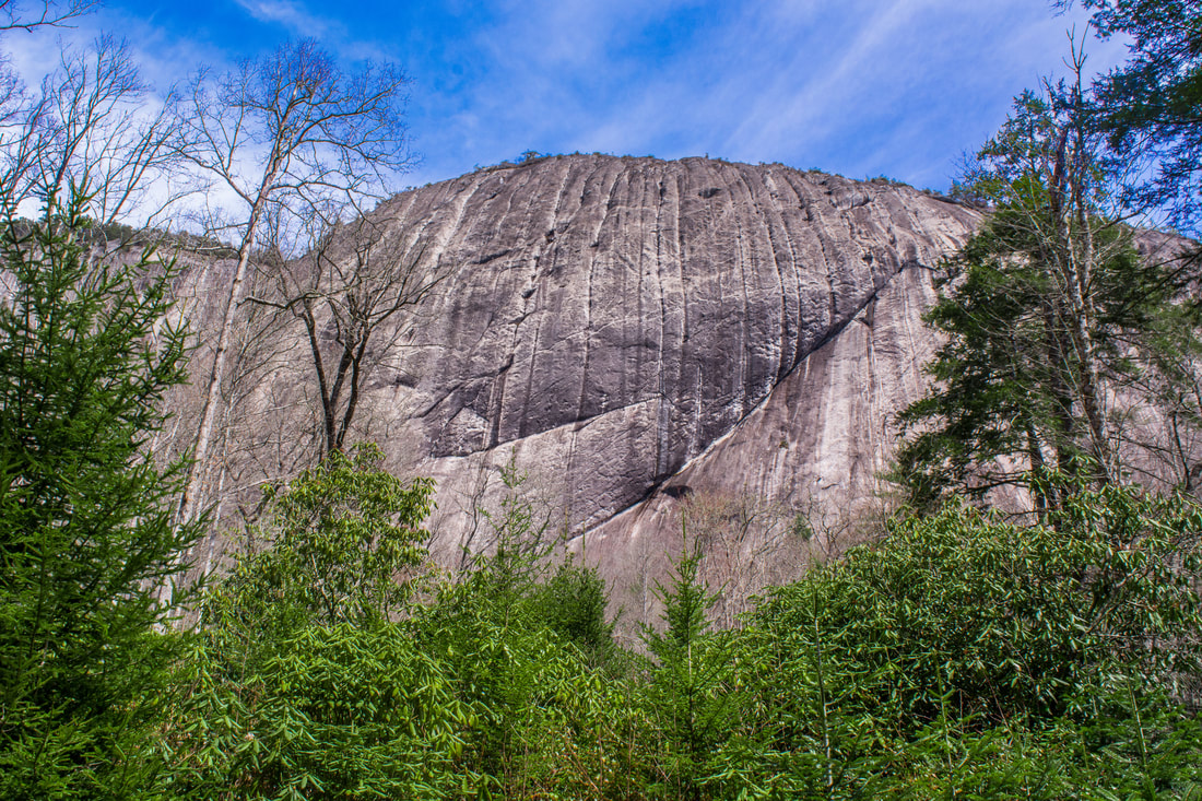
The sheer cliffs on the south side of Laurel Knob are the highest uninterrupted cliffs in the Eastern US, reaching heights up to 1200 feet!
Retrace your steps from Laurel Knob along the Laurel Knob Trail and Deep Gap Trail all the way to Frolictown Creek. That climb back out from Lonesome Valley will be a leg-burner! You'll return to the Wilderness Falls Trail junction at 5.85 miles. Now is a good time to take the short side path to Frolictown Falls, even if you plan on returning straight back to the parking area. The easy and obvious 100-foot side path leaves right 50 feet past the Wilderness Falls Trail. Frolictown Falls is a sheer 15-foot drop on Frolictown Creek. Although it's not a spectacular waterfall, it's still a pretty little drop with a nice pool, and it has good photographic potential too. Frolictown Falls is definitely worth seeing as part of a hike in the western sector of Panthertown Valley. Back on the main trail, reach a junction with the Great Wall Trail at 6.0 miles. If you wish to return to the parking area the shortest way, then follow the Deep Gap Trail straight to the Panthertown Valley Trail. However, if you've got time and energy, I recommend extending the loop to include Granny Burrell Falls and Big Green Mountain. To do so, bear right on the Great Wall Trail. The trail meanders through lowlands before coming to a crossing of Frolictown Creek at 6.3 miles. In typical summer flow, you can probably rock hop across, but in higher flows, this will be a shallow wade.
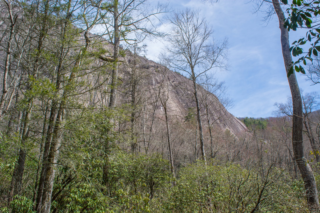
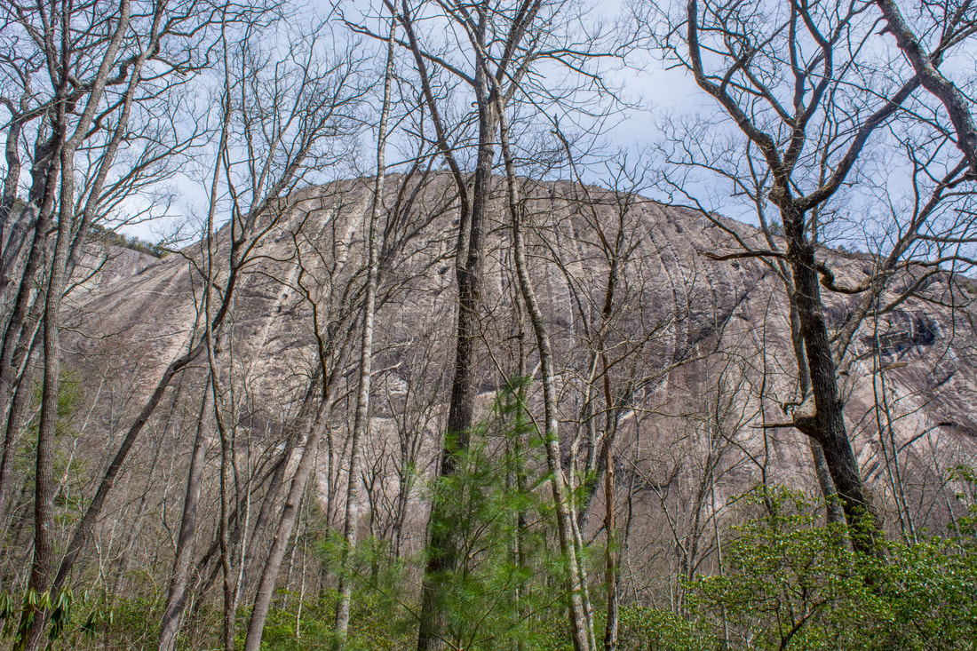
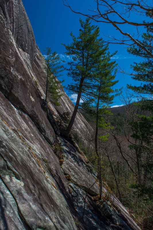
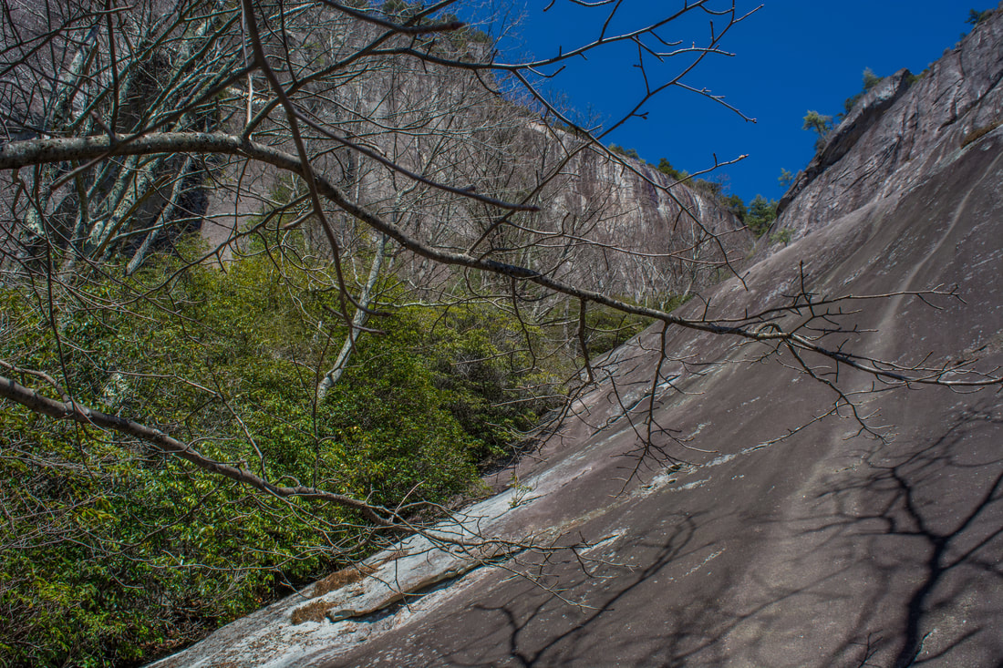
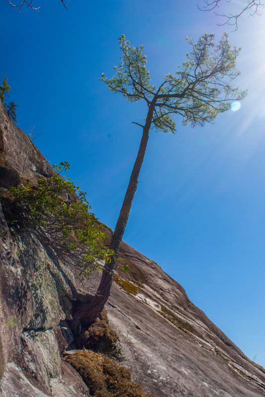
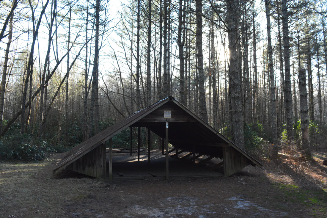
On the other side of the crossing, the signed Granny Burrell Falls Trail leaves left. Although Granny Burrell Falls is hardly a waterfall, it's still worth the very short side trip. The Granny Burrell Falls Trail is essentially level as it closely parallels Panthertown Creek downstream. Near the falls, the trail becomes muddy and rooty. First, a side path leads to the top of the falls; then, two side paths lead to the base at 6.55 miles. Granny Burrell Falls is just a pretty sliding cascade about 10 feet high, enclosed by rhododendron. The primary attraction is the enormous pool below the falls, as well as the sandy beach area and flat bedrock surrounding it. In the summer months, this is a popular spot for wading and swimming. Nice campsites surround Granny Burrell Falls. After viewing this small waterfall, return to the Great Wall Trail and continue to follow it. The trail passes a camping shelter in a stand of pines at 6.9 miles. The next 0.8 miles of the Great Wall Trail are essentially flat as it meanders through the Panthertown Creek valley. In the winter, there are excellent views of The Great Wall - a sheer 300-foot cliff that runs along the west side of Big Green Mountain. Although it's not quite as impressive as the Laurel Knob cliff, The Great Wall is still a majestic sight. During summertime, you can't see much of the cliff from the trail, but a side path leads to its base at 7.15 miles. Meanwhile, the main trail reaches a sudden left turn at 7.7 miles. A 350-foot ascent to the Big Green Mountain ridge begins here. The Great Wall Trail climbs moderately through a hollow, bridging a small stream and then climbing up via wooden and stone steps. At 8.15 miles, the Great Wall Trail terminates at a junction with the Big Green Trail in a gap to the east of the Big Green Mountain summit. A right on the Big Green Trail would take you to the vicinity of Greenland Creek Falls and Little Green Mountain. However, this hike turns left toward the Big Green summit, where several nice views await. The Big Green Trail continues a gradual ascent along a little-used path, reaching the south summit of Big Green Mountain at 8.5 miles. Just past this high point, the side path to the first of the three Big Green views bears left at a fork. The side path reaches the view at 8.6 miles. In my opinion, this is the least beautiful of the three views on Big Green Mountain. It's quite limited and is a good one to skip. 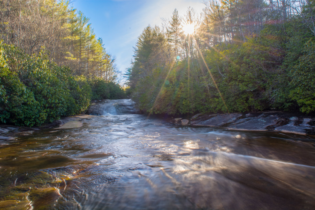
Granny Burrell Falls is a small sliding cascade on Panthertown Creek.
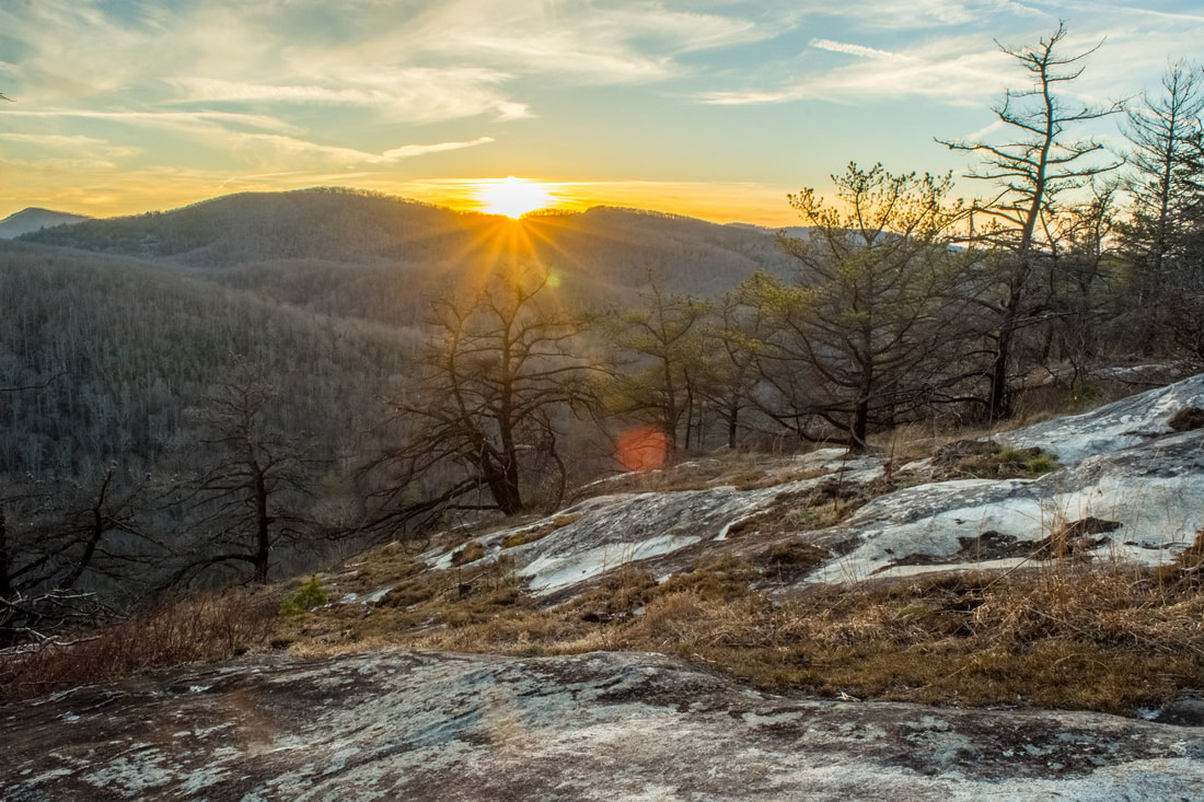
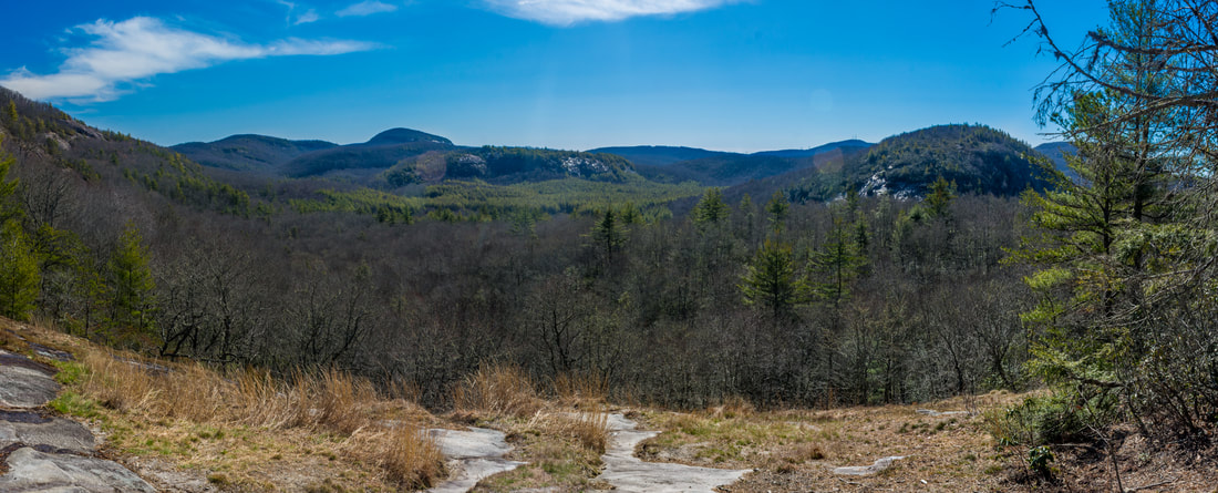
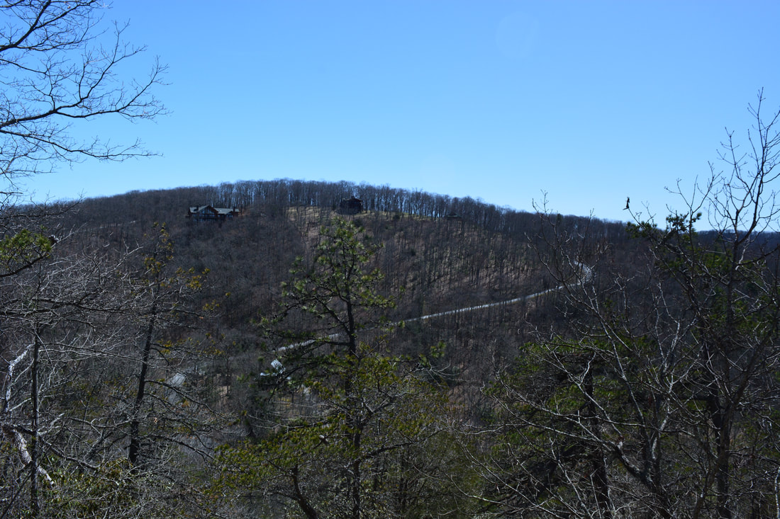
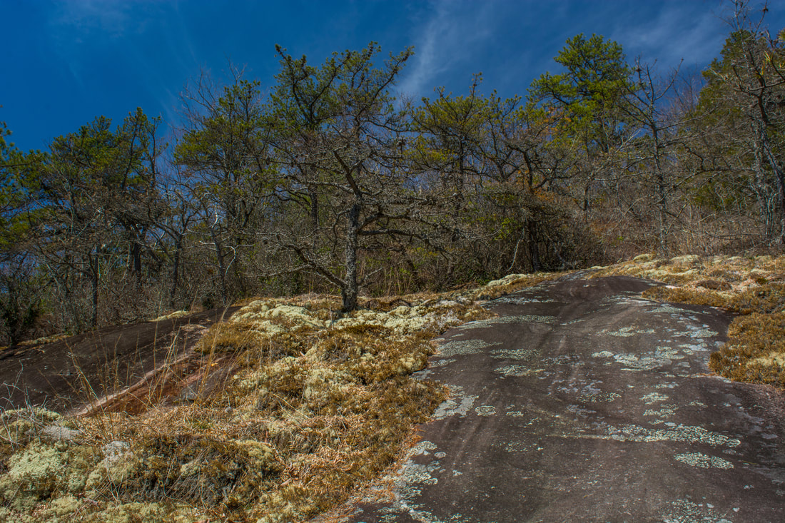
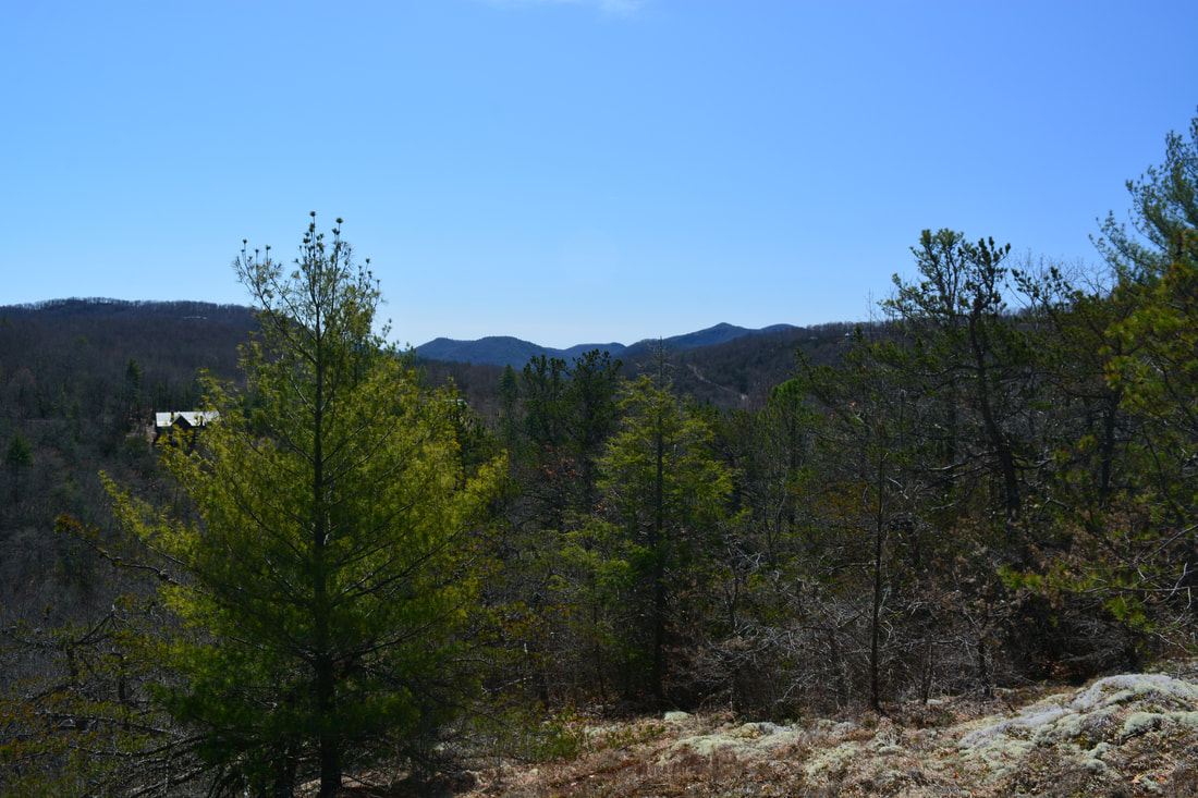
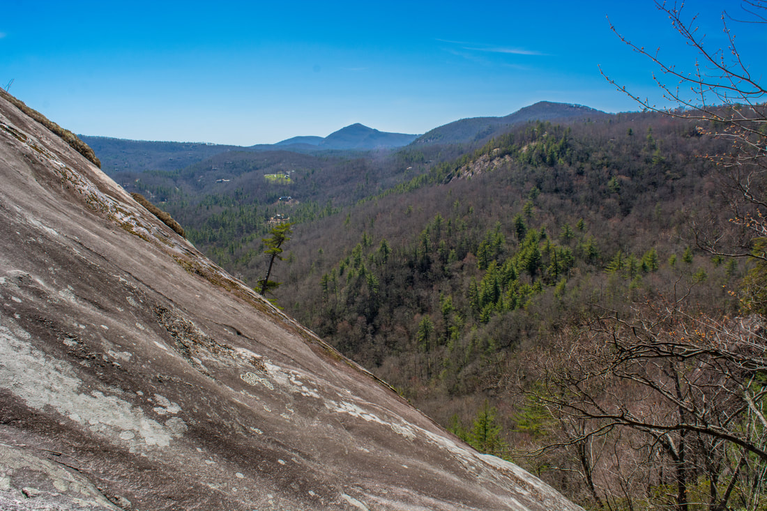
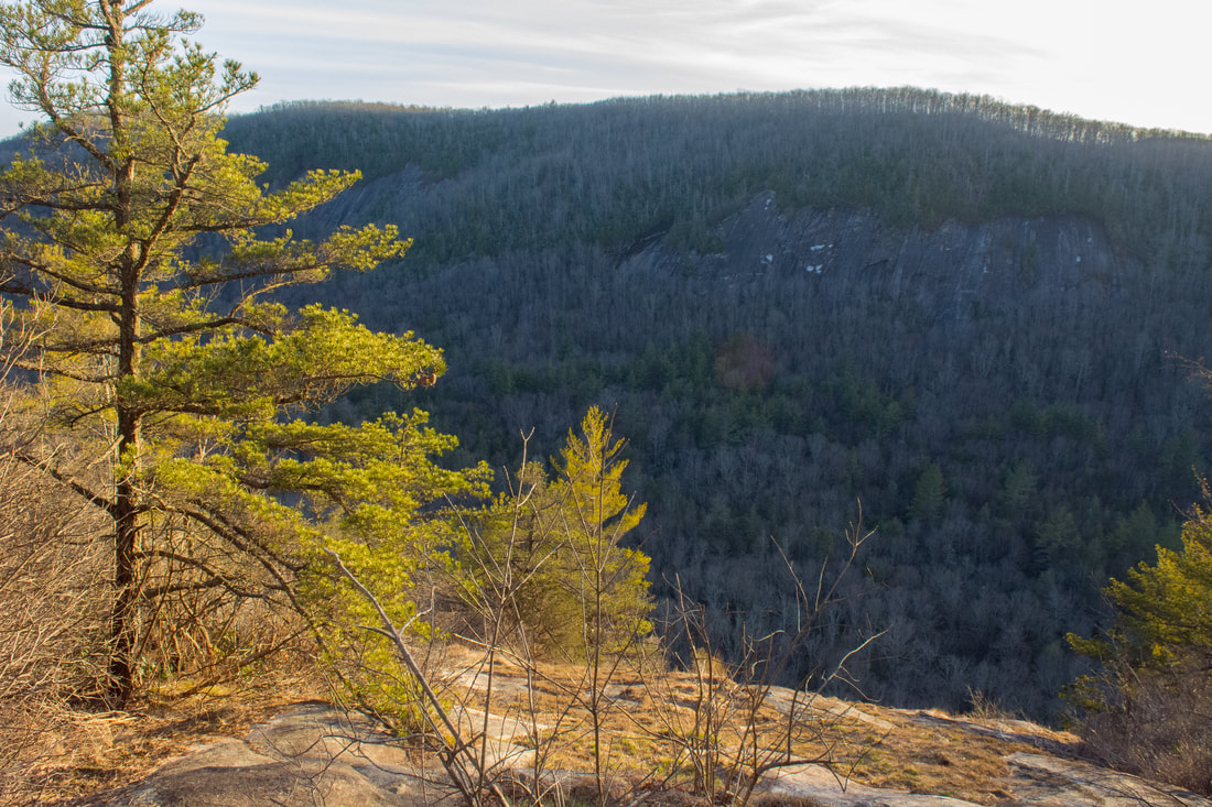
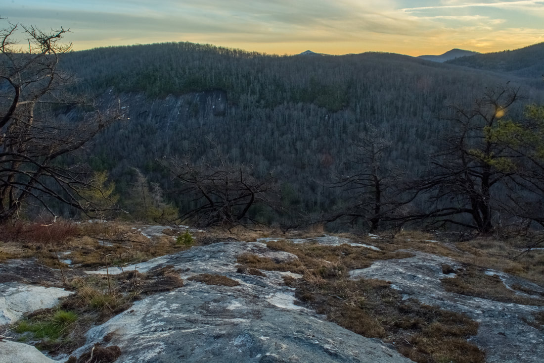
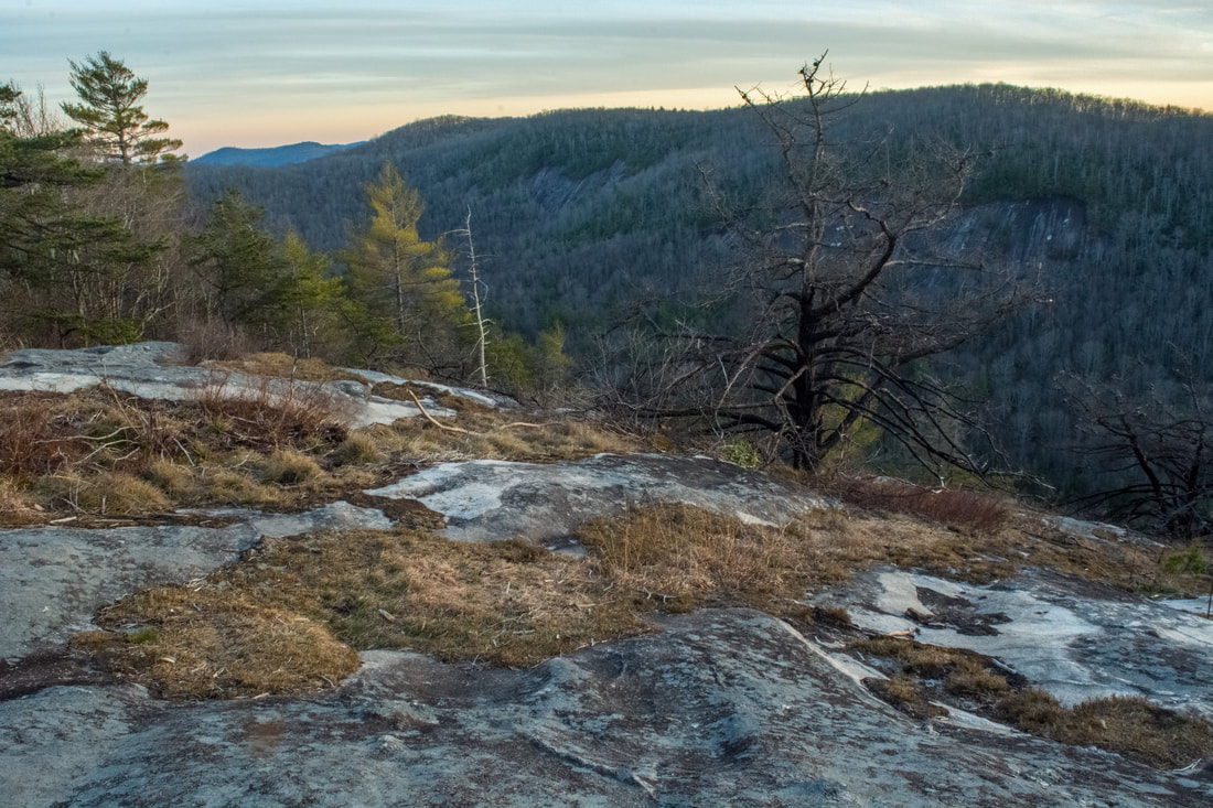
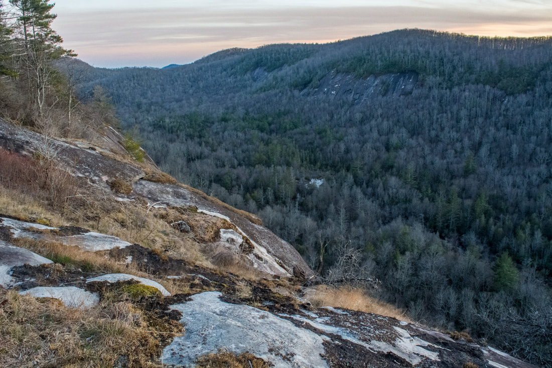
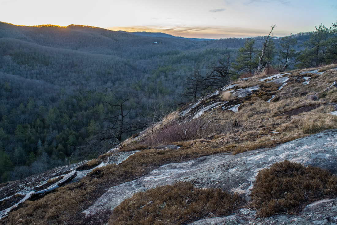
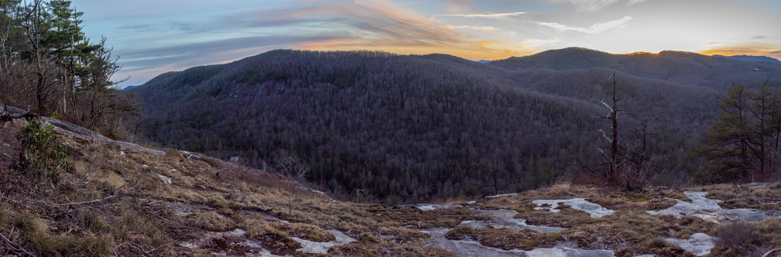
Meanwhile, the Big Green Trail drops into a shallow gap before climbing to the north summit of Big Green Mountain. At 8.9 miles, right around the north summit, the side path to the second view leaves left. This one is definitely worth taking. The path reaches a broad rock face with views at 8.95 miles. Although the view isn't long-range, it's impressive. You're standing at the top of the 300-foot Great Wall and gazing across the Panthertown Creek valley to the cliffs of Goldspring Ridge. On the left, far to the southeast, the peak of Hogback Mountain is visible. This is a great sunset-viewing spot; in fact, this is the view where I snapped the cover photo for this trail report. From the view, return to the main trail and keep following it along the ridge. You've still got one more view to see. You'll shortly reach a fork - stay left on the main trail. At 9.05 miles, reach a second fork. The unofficial connector trail to Macs Gap Trail bears right here. You'll take it later, but for now, stay left on the side path to the third view from Big Green Mountain. This side path is fainter and steeper than the first two, but it's definitely worth the effort. The path fades away toward the end - just keep heading in the same direction. Reach the broad rock face with views at 9.15 miles. Although the view is somewhat similar to the previous view, it faces more to the northwest. The top of Laurel Knob is just visible straight ahead. To the right, you can see Salt Rock Gap in the distance. This view is at the north end of the Great Wall, so you can also see a small section of the Great Wall at this vista.
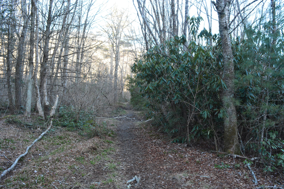
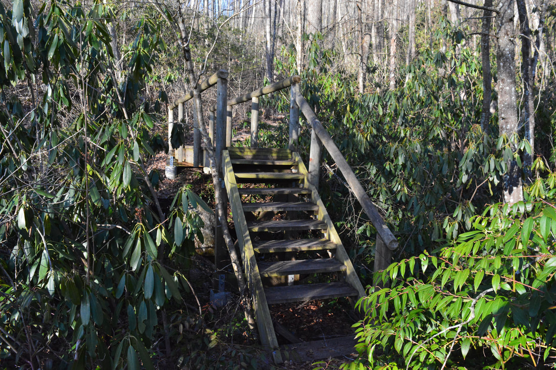
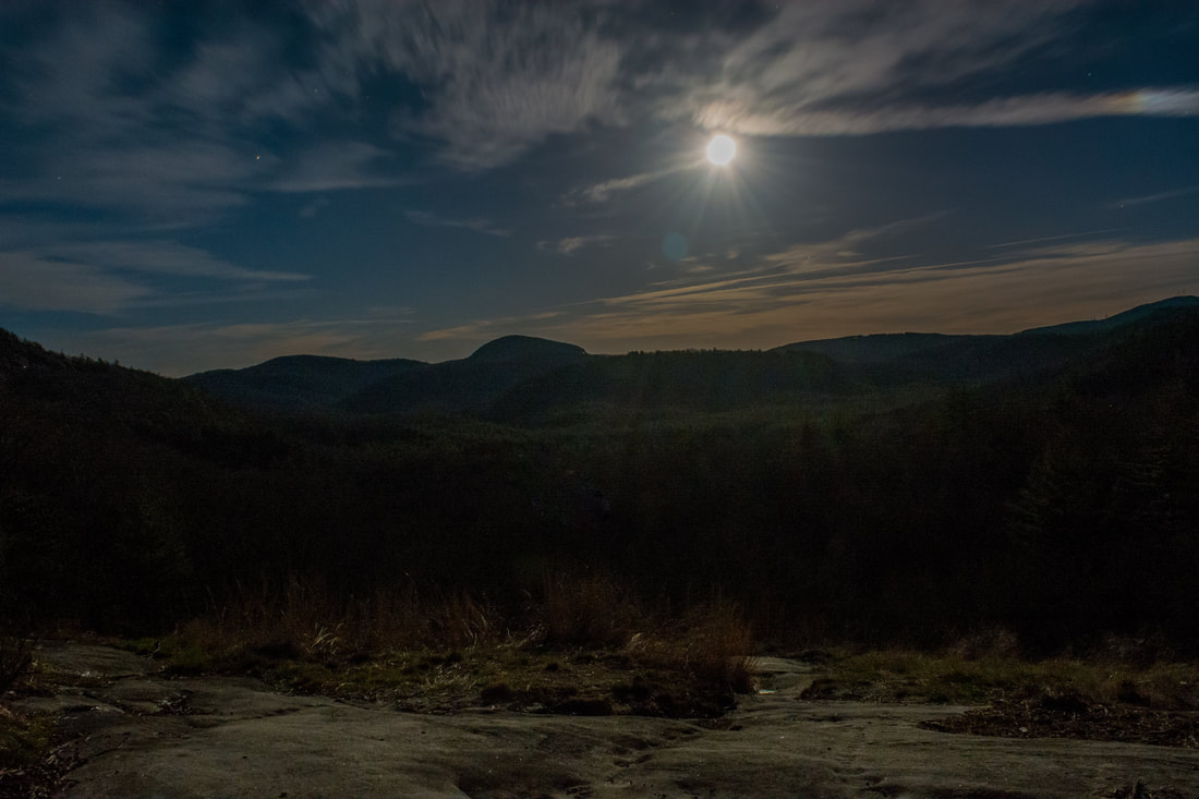
Return to the junction with the unofficial connector trail to Macs Gap Trail and begin following it down. This is one of the many paths built by Carlton McNeil in Panthertown Valley back in the 1990s. It never became an official, maintained trail due to its extremely steep grade and susceptibility to erosion. Still, this is a useful connector that remains reasonably easy to follow. The path descends 500 feet in 0.4 miles! For the most part, the path is obvious. As the path levels out near the foot of Big Green Mountain, go straight across another faint path and into an area of campsites. The well-defined Macs Gap Trail is found just past the campsites. You'll make no mistake when you see it, as it looks like a freeway compared to the Big Green connecting trail! Turn left on the Macs Gap Trail at 9.65 miles. Only 250 feet farther, the other end of the Granny Burrell Falls Trail leaves left. Stay on the Macs Gap Trail, which shortly crosses Panthertown Creek via a broad wooden bridge. On the other side, the trail meanders through a large area of campsites in a patch of white pines. At 10.0 miles, the Macs Gap Trail ends at a junction with the Panthertown Valley Trail (left and right) and North Road Trail (straight). To conclude the hike, turn left onto the Panthertown Valley Trail and begin the final climb out of the valley back to Salt Rock Gap. The Panthertown Valley Trail follows an old, rocky, eroded road as it ascends. Stay right as the Deep Gap Trail ties in at 10.6 miles. At 10.7 miles, a rock outcrop on the right affords a parting view of Panthertown Valley. From this great vantage point, much of Panthertown Valley is laid out in front of you: the cliffs of Blackrock Mountain on the left, the cliffs of Little Green Mountain in the middle, and the cliffs of Big Green Mountain on the right. Shelton-Pisgah Mountain and Cold Mountain guard the horizon. After this final view, you'll close the loop as you pass the Wilderness Falls Trail again at 10.75 miles. Continue following the Panthertown Valley Trail on the final uphill push, returning to your car in Salt Rock Gap at 11.0 miles. 
A rock outcrop along the Panthertown Valley Trail near Salt Rock Gap features panoramic views that include Blackrock Mountain, Cold Mountain, Little Green Mountain, and Big Green Mountain.
Mileage
0.0 - Salt Rock Gap
0.8 - Wilderness Falls 2.15 - Deep Gap 3.25-3.6 - Laurel Knob Cliffs 5.9 - Frolictown Falls 6.55 - Granny Burrell Falls 8.6 - First View on Big Green Mountain 8.95 - Second View on Big Green Mountain 9.15 - Third View on Big Green Mountain 10.7 - Salt Rock Gap View 11.0 - Salt Rock Gap Variations
Hike just out and back to Laurel Knob via Wilderness Falls Trail - 7.2 Miles
Bonus Stops
If you're in the area and would like to add on a short hike at the end of the day, consider visiting Silver Run Falls off NC 107 south of Cashiers.
Pictures & Videos
1 Comment
Dev Moring
7/25/2019 06:19:01 pm
Thanks for the only accurate, readable description of a Panthertown hike (or any other hike in the Cashiers/ Highlands area). Did the Big Green Loop today from Salt Rock, came down the connector, could not have done it without your precise directions. Beautiful Day! Leave a Reply. |
About MeMark Oleg Ozboyd Dear readers: I have invested a tremendous amount of time and effort in this website and the Georgia Waterfalls Database the past five years. All of the work that has gone in keeping these websites updated with my latest trip reports has almost been like a full-time job. This has not allowed me to pick up a paid job to save up money for college, and therefore, I I've had to take out loans. If you find the information on this website interesting, helpful, or time-saving, you can say "thanks" and help me out by clicking the button above and making a contribution. I will be very grateful for any amount of support you give, as all of it will apply toward my college tuition. Thank you!

Coming in 2022-2023?
Other Hiking WebsitesMiles HikedYear 1: 540.0 Miles
Year 2: 552.3 Miles Year 3: 518.4 Miles Year 4: 482.4 Miles Year 5: 259.9 Miles Archives
March 2021
Categories
All
|
||


 RSS Feed