
Protecting a small gulch on the east side of Lake Guntersville, Bucks Pocket State Park is one of Alabama's most underrated state parks. Bucks Pocket features a small slice of beautiful, wild scenery typical to the Cumberland Plateau. Two scenic, cliff-lined gorges are found in the park: those of Little Sauty Creek and South Sauty Creek. The park's best-known trail, the Point Rock Trail, follows Little Sauty Creek through numerous mossy boulder fields and woods that feature an abundance of wildflowers in spring, passing a small but very scenic waterfall on the stream. The Point Rock Trail then ascends to the rim of the gorge and ends at its namesake rock outcrop, which features panoramic views from a point on the rim high above the confluence of Little Sauty Creek and South Sauty Creek. This hike occurred on Saturday, March 17th, 2018. My plan was to hike the Point Rock Trail out and back to Point Rock from the Bucks Pocket Campground.
Summary
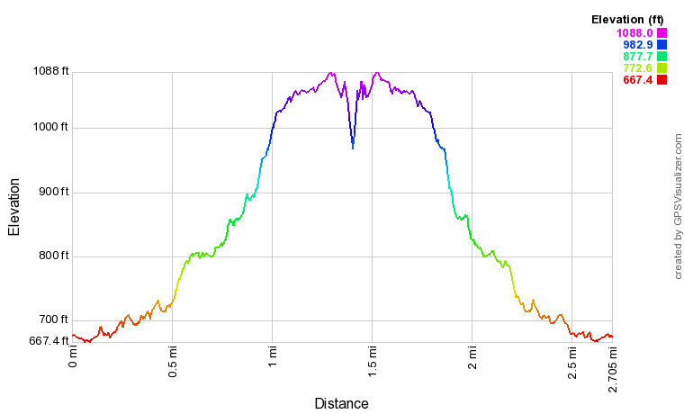
R/T Length of Trail: 2.7 Miles
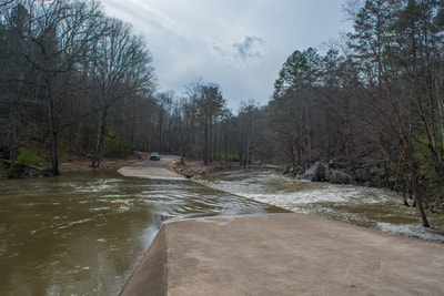
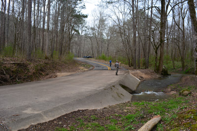
Duration of Hike: 1:30 plus 35 minutes of stopping Type of Hike: Out and Back Difficulty Rating: 4 out of 10 Total Elevation Gain: 550 Feet Pros: Beautiful spring wildflowers Cons: Point Rock Overlook is essentially accessible by vehicle Points of Interest: Little Sauty Creek Falls - 6 stars; Point Rock Overlook - 6 stars Trail Blaze Colors: Point Rock Trail - Blue and Orange Best Seasons to Hike: Spring Fees: None Beginning Point: Bucks Pocket Campground Directions from Section, AL: From the intersection of AL 35 and CR 43 (Main Street) in Section, follow CR 43 South for 4.7 miles. Then, turn right on CR 38. In another 1.6 miles, turn left onto CR 41. After 1.1 miles, turn right onto CR 44. In 400 feet, bear left on CR 44. In 1.3 miles, turn left onto CR 152. In another 0.6 miles, stay left on CR 452 at a dilapidated entrance sign for Bucks Pocket State Park. After 1 mile along CR 452, you will cross a low-water bridge across South Sauty Creek. If water levels are very high, the bridge could be inundated and unsafe to cross - you will need to enter the park from the south side from the community of Grove Oak then. The road turns into CR 173 past the bridge. In 0.2 miles, turn left on the campground road. In another 0.2 miles, cross a low water bridge across Little Sauty Creek. The Point Rock Trail begins on the right just before the bridge. The broad parking area is 300 feet past the bridge on the left, just before the campground entrance. Park here regardless of whether the campground is open or closed. Map
Click the link below to download a .GPX file with a track of this hike.
Details
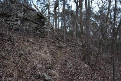
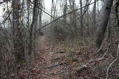
When severe funding cuts were cast upon the Alabama State Parks system in 2015, Bucks Pocket State Park was one of several parks to come under the ax. Originally, plans were to entirely shut down the park, but after an outpouring of support for this beautiful piece of conserved land to remain open to the public, Bucks Pocket began to operate at a very limited basis. As of this writing, it is still a day-use only area, although the campground is slated to reopen in late 2018. In addition, the park trails are maintained poorly. In fact, the park ranger is not even aware that the South Sauty Creek Trail - one of the park's most scenic trails - exists! Hopefully this situation will improve in the future. The good news is that the Point Rock Trail is distinct enough to follow easily the entire way.
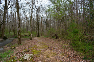
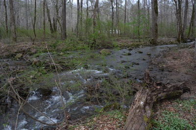
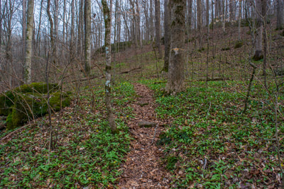
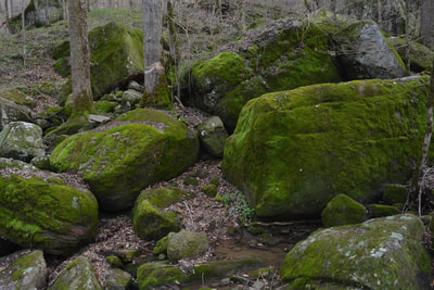
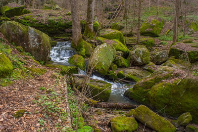
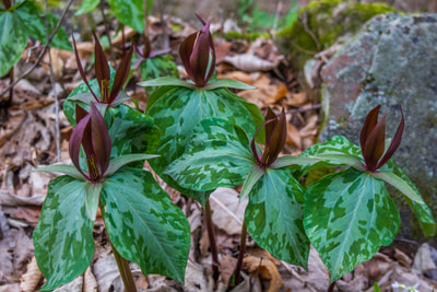
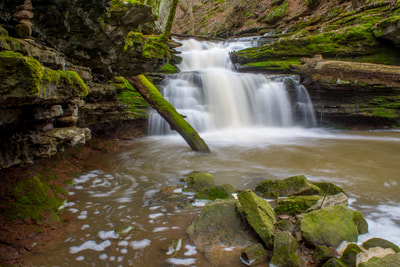
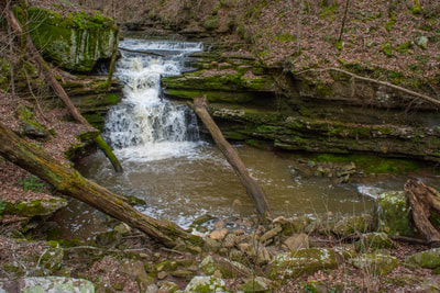
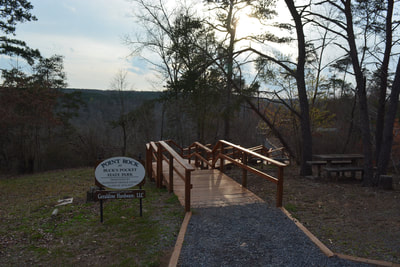
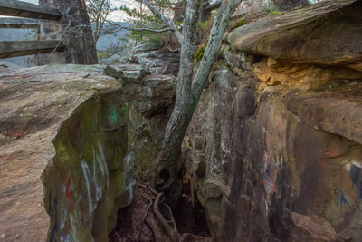
Begin following the Point Rock Trail along an old roadbed on the south side of Little Sauty Creek from the low-water bridge. There is one spot near the beginning where the trail may be a bit hard to locate. At 0.25 miles, the trail passes an old ranger's residence and then begins a slow ascent up the Little Sauty Creek valley. In this area, Little Sauty Creek is often totally underground, but during high flow, it features many scenic cascades. On my visit, I found many early spring wildflowers in this area (primarily vast amounts of trout lilies and little sweet betsy's trillium). At 0.4 miles, the trail crosses a small, rocky tributary of Little Sauty Creek. The tributary normally doesn't have much water, but the area around it is strewn with large mossy boulders. The trail then parallels the creek, climbing a set of old wooden steps near a large cascade. At 0.7 miles, the trail crosses Little Sauty Creek. Most of the time, this is a rock hop across a dry creekbed. However, if water flow is very high (which makes the hike more scenic), this will likely be a wade. On the other side, the trail soon climbs up a steep slope, at the top of which a short side path leaves left to a sinkhole at 0.85 miles. 150 feet farther, a distinct side path on the right leads to Little Sauty Creek Falls at 0.9 miles. Little Sauty Creek Falls is a very scenic 15-foot cascade. The creek spills over a series of ledges and into a small pool. Jagged mossy rock outcrops surround the small waterfall, and a mossy log complements the scene. I've seen photos of the falls covered in deadfall, so it was a pleasant surprise to find it mostly open. The round pool at the base of the falls is nearly encircled by small bluffs. Past the falls, the Point Rock Trail begins ascending out of the gorge. At 1.0 miles, the trail passes a small bluff and makes a sharp left turn. After this, the trail follows the rim of the gorge toward Point Rock. The ecosystem here is vastly different and much drier than that in the gorge. At 1.25 miles, the trail reaches the Point Rock parking area. A recently-renovated boardwalk on the left leads to Point Rock. Follow the boardwalk across a narrow, rocky ridge. At 1.35 miles, reach the end of the path at Point Rock. Point Rock is a rocky promontory at the end of a ridge a separating the valleys of South Sauty Creek and Little Sauty Creek. Although this is not a high view, it's still very open and scenic. Several stunted pines grow out of the rocks, adding beauty to the scene. Point Rock is a great sunset-viewing location. In addition, the view from Point Rock features vibrant fall colors. From Point Rock, simply retrace your steps back to Bucks Pocket Campground, concluding the hike at 2.7 miles. Mileage
0.0 - Point Rock Trailhead
0.9 - Little Sauty Creek Falls 1.25 - Point Rock Parking Area 1.35 - Point Rock 2.7 - Point Rock Trailhead Variations
Hike out and back to Little Sauty Creek Falls - 1.8 Miles
Bonus Stops
Just south of Bucks Pocket and the community of Grove Oak is a county park called High Falls Park, featuring the spectacular High Falls on Town Creek. The walk to the falls is very easy and short. The Point Rock Trail and High Falls would make for a great half-day combination.
Pictures & Videos
0 Comments
Leave a Reply. |
About MeMark Oleg Ozboyd Dear readers: I have invested a tremendous amount of time and effort in this website and the Georgia Waterfalls Database the past five years. All of the work that has gone in keeping these websites updated with my latest trip reports has almost been like a full-time job. This has not allowed me to pick up a paid job to save up money for college, and therefore, I I've had to take out loans. If you find the information on this website interesting, helpful, or time-saving, you can say "thanks" and help me out by clicking the button above and making a contribution. I will be very grateful for any amount of support you give, as all of it will apply toward my college tuition. Thank you!
Coming in 2022-2023?
Other Hiking WebsitesMiles HikedYear 1: 540.0 Miles
Year 2: 552.3 Miles Year 3: 518.4 Miles Year 4: 482.4 Miles Year 5: 259.9 Miles Archives
March 2021
Categories
All
|
||||||














 RSS Feed