Caesars Head State Park/Mountain Bridge Wilderness: Naturaland Trust Loop, Cleveland, South Carolina1/25/2018 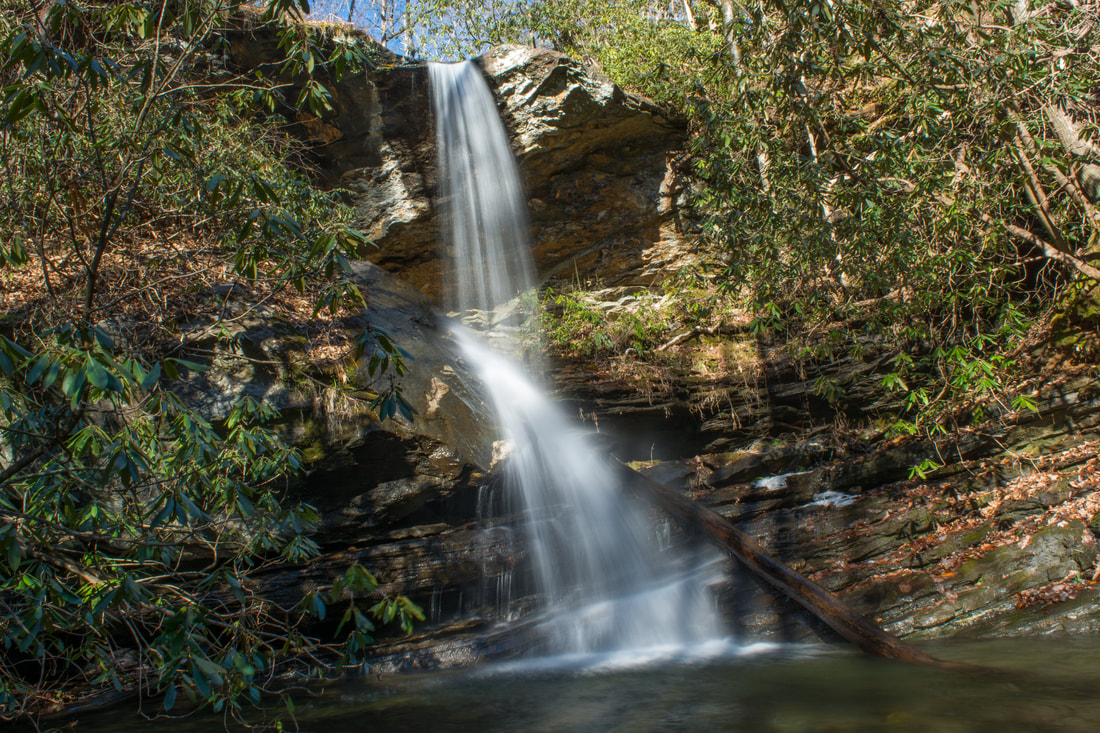
The west half of the Mountain Bridge Wilderness is encompassed by Caesars Head State Park, named for a prominent rock outcrop with striking views of the South Carolina Upstate. One of the area's main highlights is Raven Cliff Falls, a majestic waterfall on Matthews Creek that is cited to be 420 feet high. Among the wilderness's most scenic trails, the Naturaland Trust Trail provides direct access into the Matthew Creek gorge, passing views of Raven Cliff Falls after crossing an elegant suspension bridge at the waterfall's top. Several other trails in the park can be used to create the 12-mile loop Naturaland Trust Loop, which is not only among South Carolina's top hikes but also a very strenuous one. An added bonus for hiking the full loop, however, is optional access to two more gorgeous waterfalls on the property of Asbury Hills Camp: Moonshine Falls and Confusion Falls. This hike occurred on Saturday, January 20th, 2018. My plan was to hike the Naturaland Trust Loop clockwise from the Raven Cliff Falls parking area, although I came away with the feeling that hiking the loop counter-clockwise is better.
Summary
R/T Length of Trail: 12.0 Miles
Duration of Hike: 8:00 plus 1 hour of stopping and photography Type of Hike: Loop Difficulty Rating: 9 out of 10 Total Elevation Gain: 3770 Feet Pros: Mostly well-marked trails and intersections Cons: The view of Raven Cliff Falls isn't the best (it would be better if access to the base was allowed); access to Moonshine Falls and Confusion Falls is unofficial Points of Interest: Rock Cliff Falls - 2 stars; Moonshine Falls - 6 stars; Confusion Falls - 5 stars; Raven Cliff Falls - 8 stars; Cliffs on the south side of Caesars Head; The Cathedral; Raven Cliff Falls Suspension Bridge Trail Blaze Colors: Coldspring Branch Trail - Orange; Coldspring Branch Connector - Blue; Frank Coggins Trail - Indigo/Dark Blue; Naturaland Trust Trail - Pink; Moonshine Falls Side Trail - None; Gum Gap Trail - Blue; Raven Cliff Falls Trail - Red Best Seasons to Hike: Winter; Fall Fees: There's a $2 trail fee per adult for Caesars Head State Park and Jones Gap State Park. The fee is $1.25 for South Carolina Seniors, and children can hike for free. Beginning Point: Raven Cliff Falls Parking Area Directions from Cleveland, SC: From the intersection of SC 11 and US 276 in the community of Cleveland, follow US 276 North for 5.4 miles. Then, turn right to stay on US 276, and continue for 8.5 miles to the Raven Cliff Falls parking area on the right. Map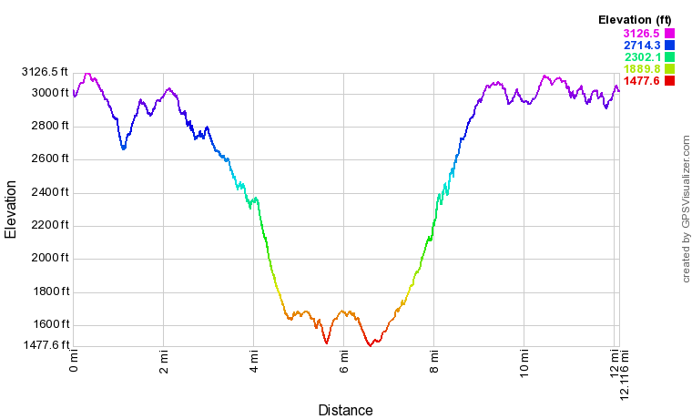
Click the link below to download a .GPX file with a track of this hike.
Details
There's a particular thing that seems to go wrong more often than anything else on my hikes. I frequently finish my hikes after dark, and sometimes, I've had to unfortunately miss points of interest because of it. This time, I missed Raven Cliff Falls - the best waterfall along the Naturaland Trust Loop. Well, I didn't miss it. Just I had to illuminate it with my flashlight so that I didn't miss it, and I can assure you that the light from my headlamp wasn't strong enough for a good night picture of a waterfall as far away as this one. It's exclusively my fault for being inattentive on what I treated as an easy-to-follow hike on well-groomed trails. The reason I spent considerably more time in the dark than I would've liked on this hike is that my inattentiveness got me disoriented at a trail junction. The result? 1.5 hours of extra bushwhacking time. Although I didn't get to see in daylight one of this hike biggest attractions, at least I came away with a lesson learned. I know I'm now always going to pay attention to signs, blazes, and other trail markers, even if I'm using my GPS and even if I'm hiking a broad official trail! Don't get me wrong - the Naturaland Trust Loop is an outstanding hike, likely one of the best the state has to offer, and it would've even better for me had I done more of it in daylight. Despite my mishap, I'm rating this a "Best Hike", and please read on to see why!
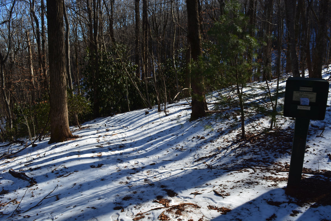
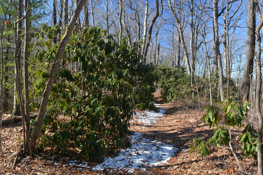
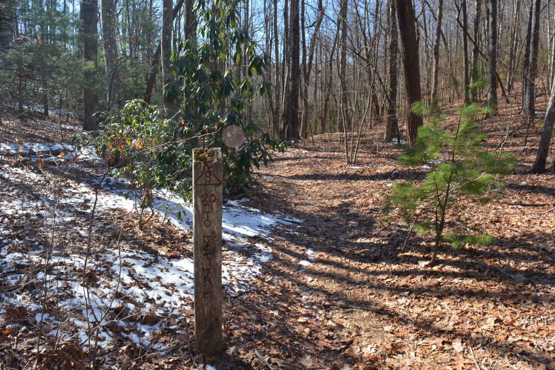
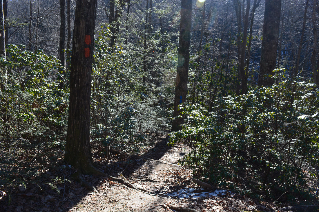
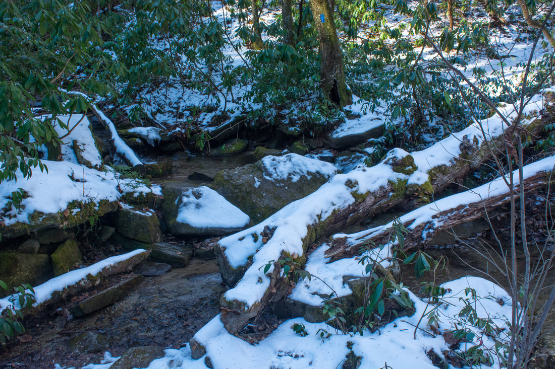
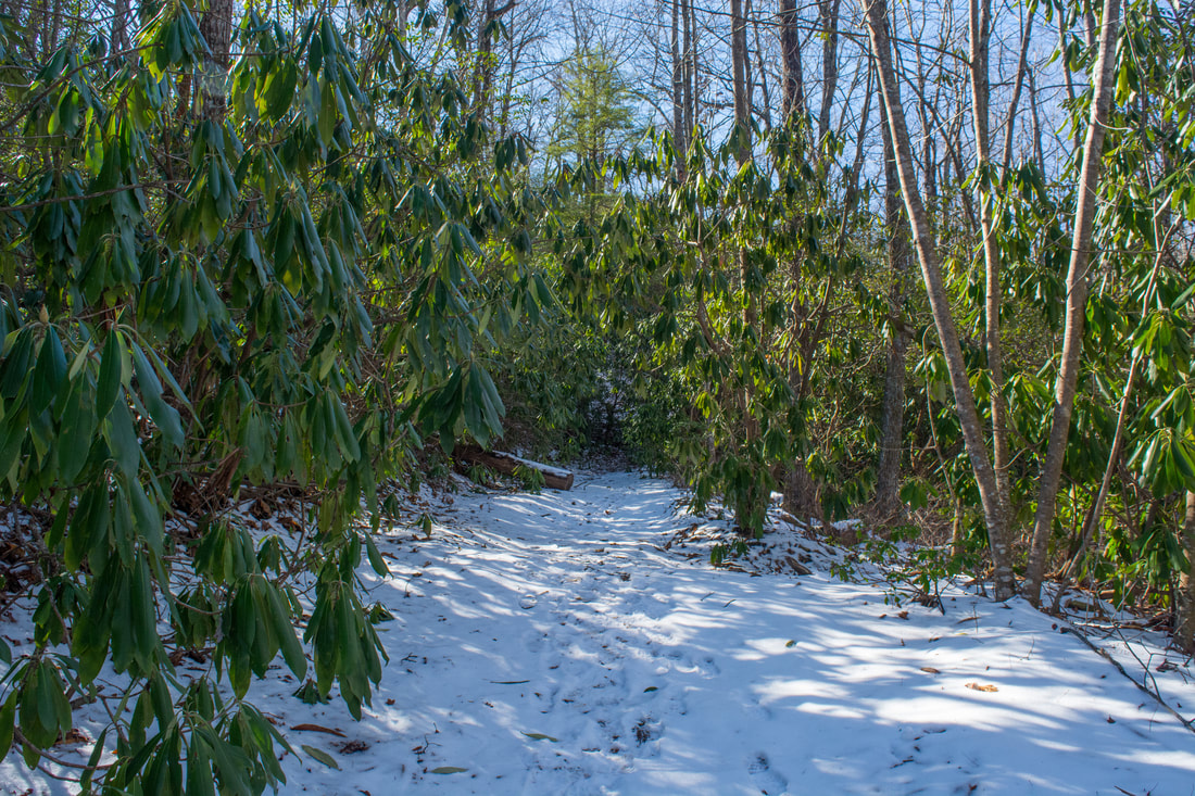
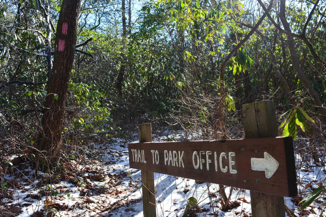
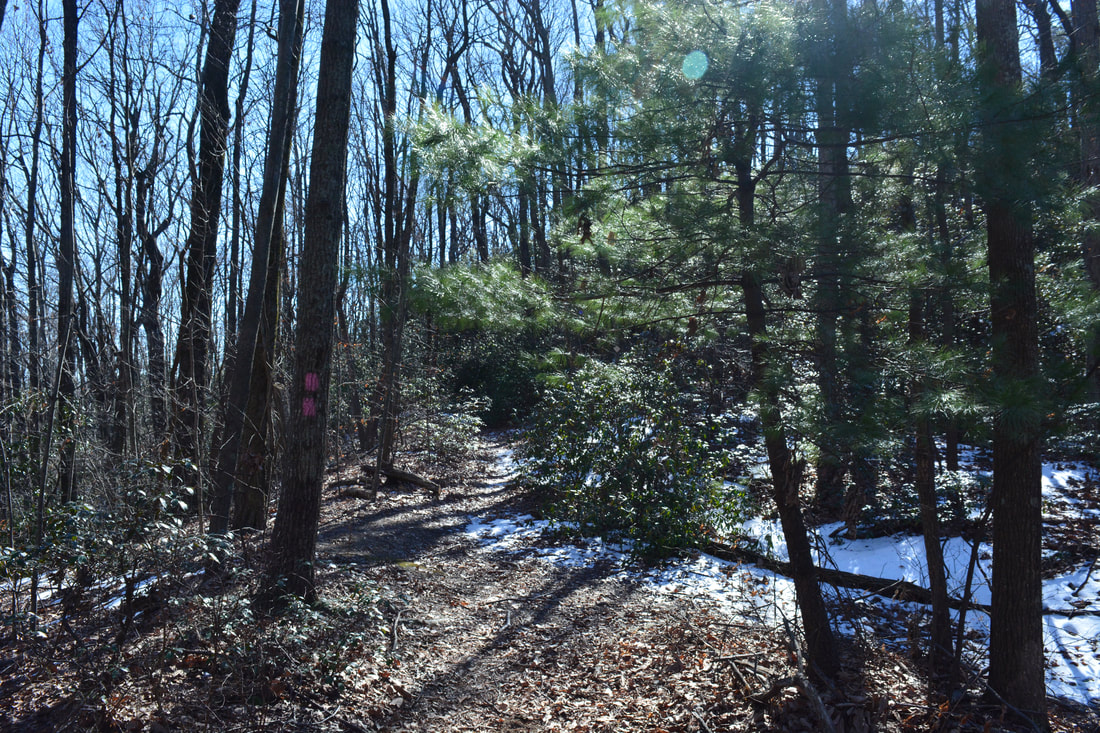
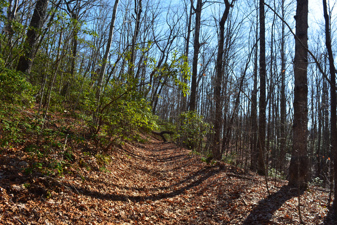
The Naturaland Trust Loop hike begins at the Raven Cliff Falls parking area. To be honest, I feel like it may be better to hike the loop counter-clockwise since you get to see Raven Cliff Falls first (unlike the way I hiked it). Either direction has its pros and cons though. Since I hiked the loop clockwise, that's the way this trail report describes it. Begin the hike by taking the orange-blazed Coldspring Branch Trail (#3) from the kiosk at the parking area's far end (the exit side). The trail starts out with a short but steep descent into a ravine. A similar climb out of the ravine brings the trail to an intersection with an old forest road from US 276 at 0.2 miles. Turn left to stay on the Coldspring Branch Trail. The trail climbs to the ridge and follows it along a very easy grade with nice winter views. In a gap at 0.75 miles is a junction with the pink-blazed Bill Kimball Trail (#5) leaving ahead. The Bill Kimball Trail passes the El Lieutenant cliff and eventually reaches the Middle Saluda River. This hike turns right and descends moderately into the Coldspring Branch valley along the Coldspring Branch Trail. At 1.1 miles, reach a crucial easy-to-miss intersection. The Coldspring Branch Trail continues straight along an old forest road through the valley (eventually reaching the Middle Saluda River after several crossings of Coldspring Branch), but this hike turns right onto the inconspicuous blue-blazed Coldspring Branch Connector (#7). The connector trail drops down a steep series of wooden steps before crossing Coldspring Branch on stepping stones. This will normally be a dry crossing. On the other side, the trail ascends the slope by a series of short, steep switchbacks and continues climbing out of the valley for some time. The connector ends at a junction with the Frank Coggins Trail (#15) at 1.5 miles. To the right, the Frank Coggins Trail leads to an alternate trailhead by the Caesars Head State Park Visitor Center. Stay straight on the Frank Coggins Trail along a gentle descent. At 1.7 miles, reach the start of the Frank Coggins Trail's loop. Straight, it connects to the Rim of the Gap Trail and to the Jones Gap State Park Visitor Center. This hike turns right and crosses an unnamed tributary of Coldspring Branch via a tight footlog. Stay left at 1.8 miles as the trail joins a narrower galax-lined path through a mountain laurel tunnel. At 1.95 miles, the pink-blazed Naturaland Trust Trail (#14) leaves right. The hike turns onto the Naturaland Trust Trail and remains on it for much of the hike. 
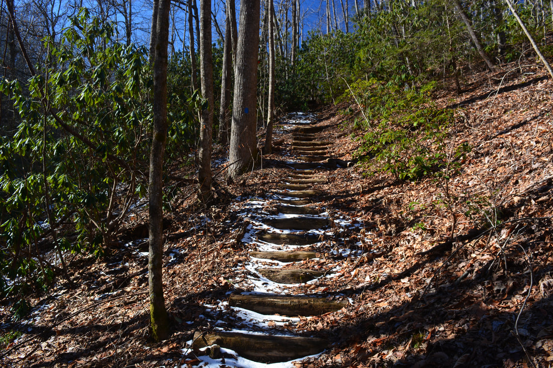
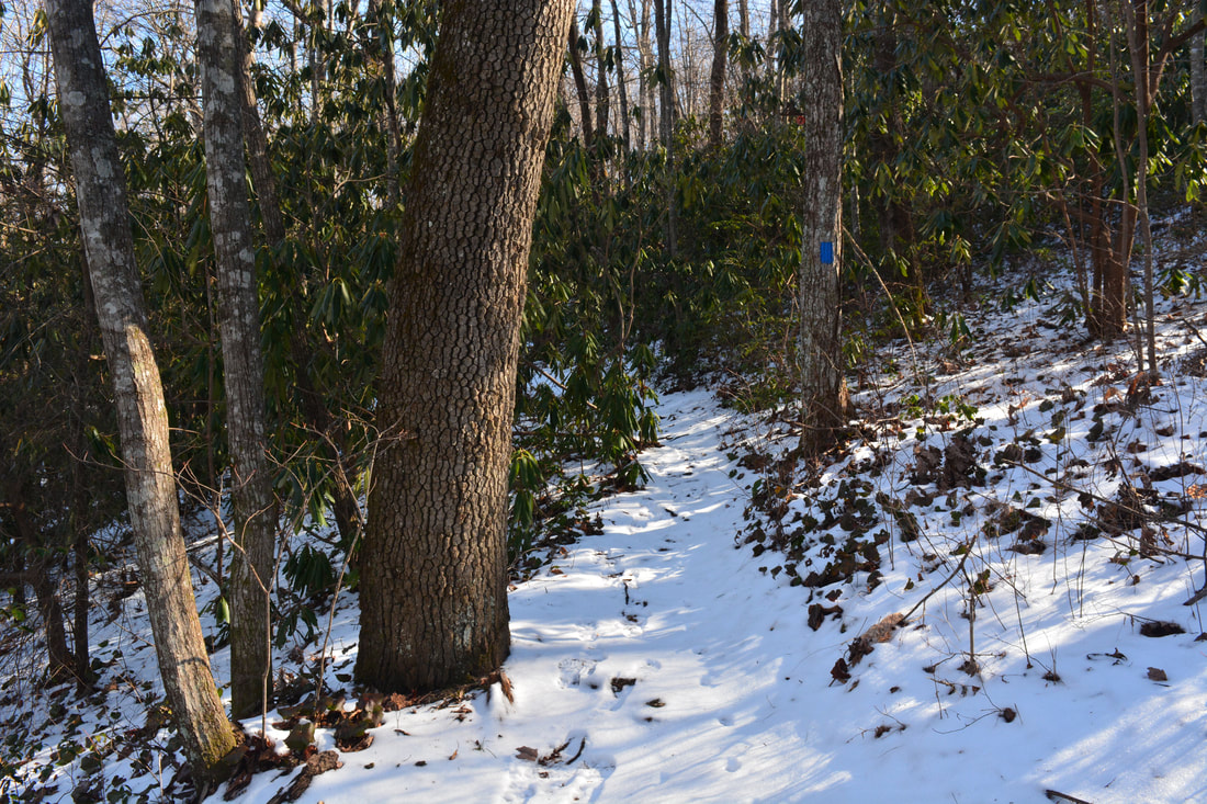
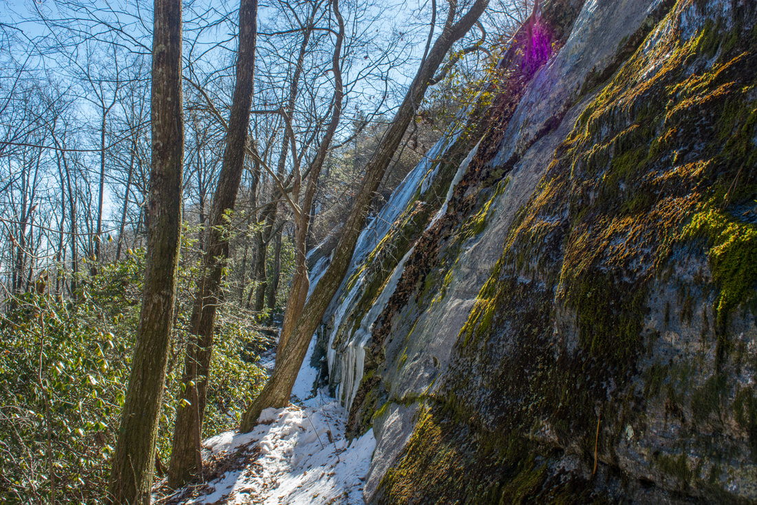
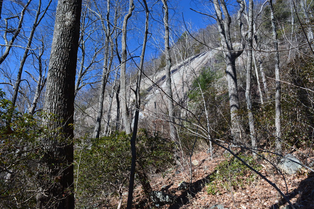
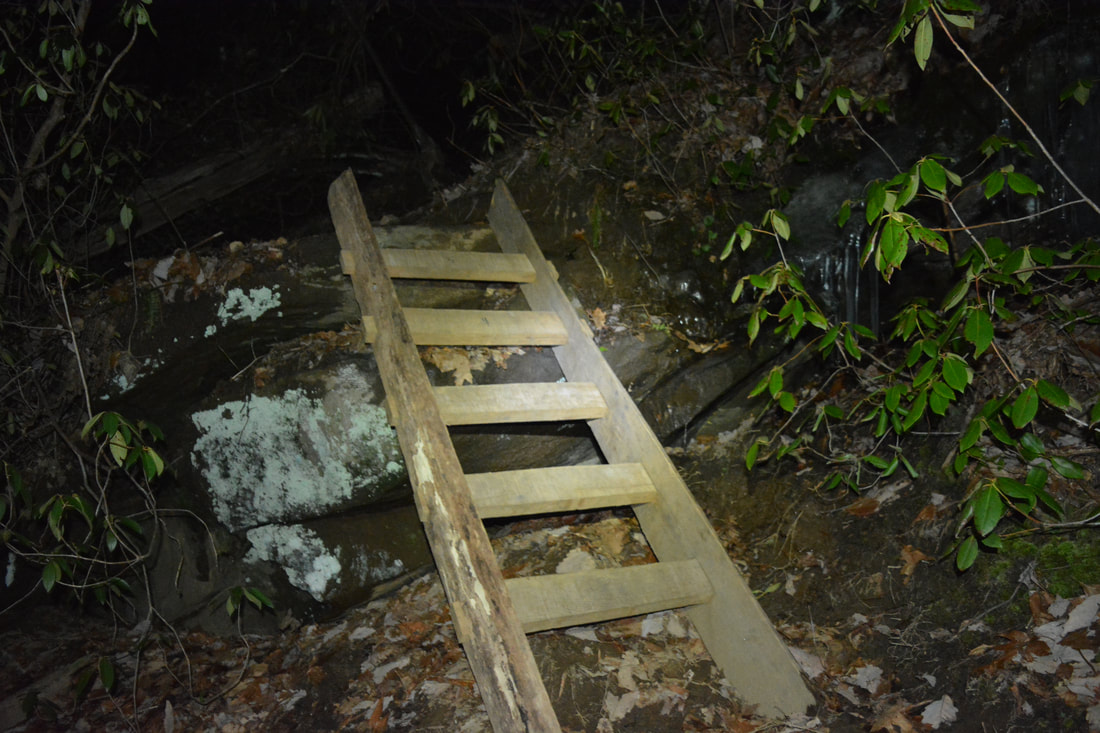
The blue-blazed Coldspring Branch Connector descends down a steep series of wooden steps.
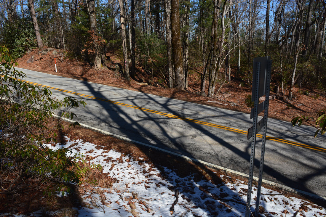
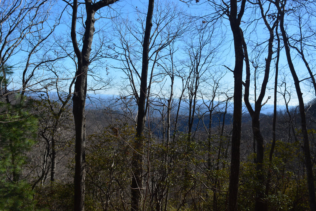
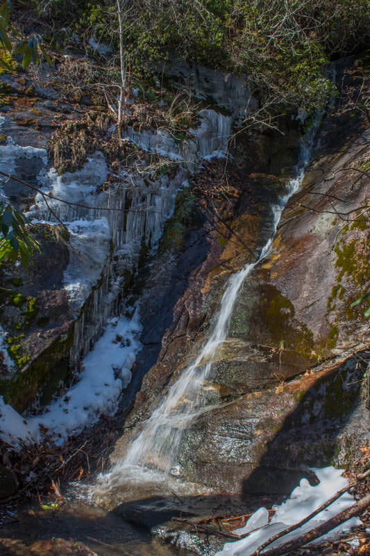
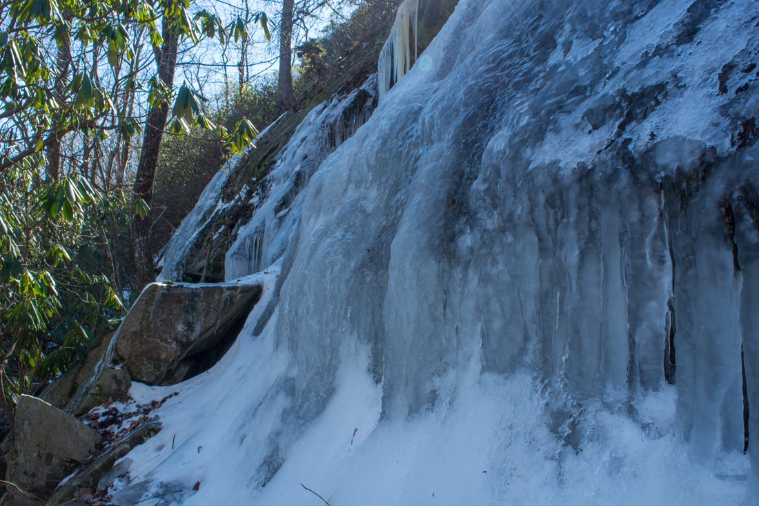
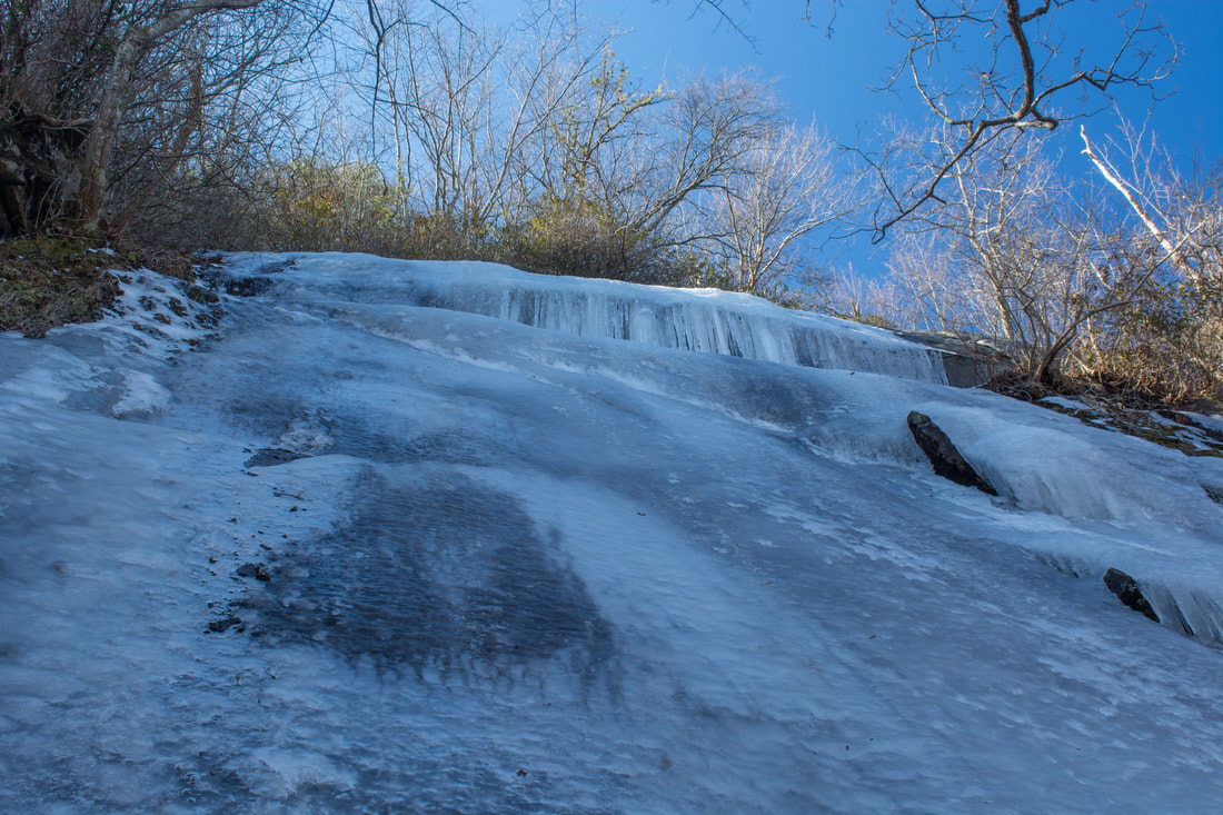
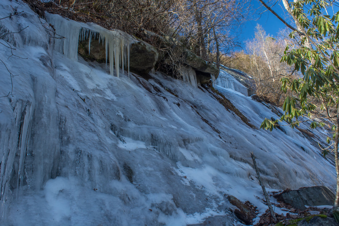
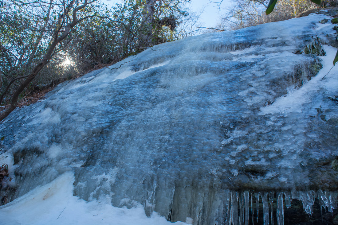
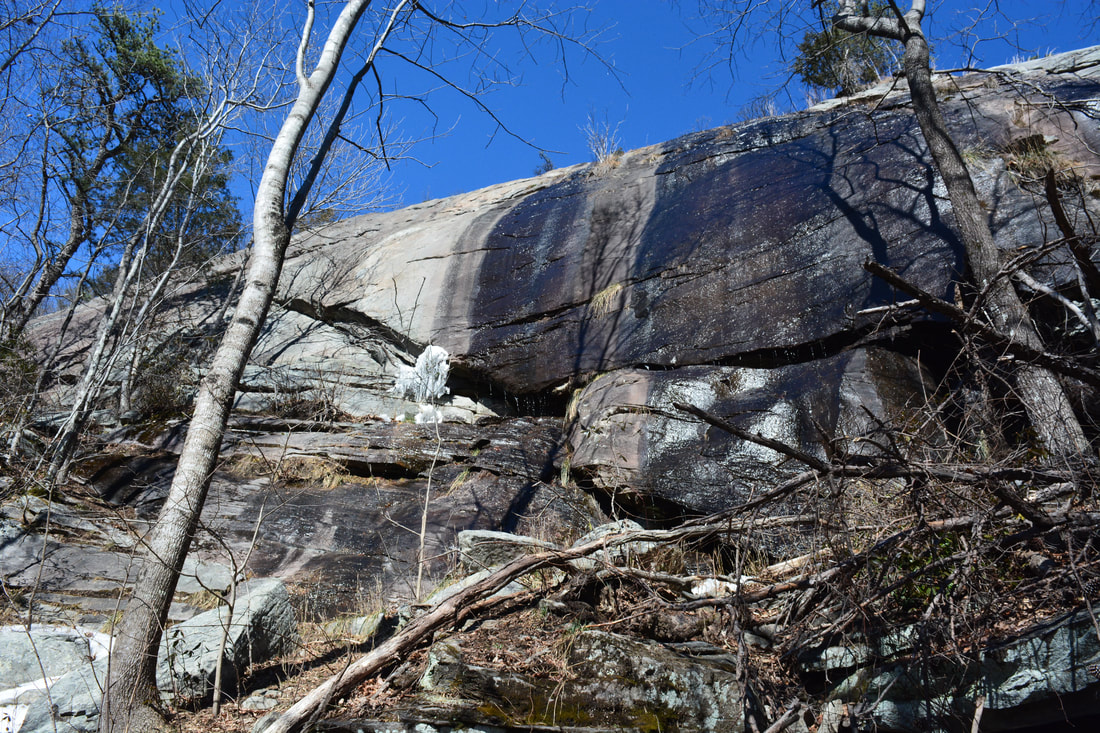
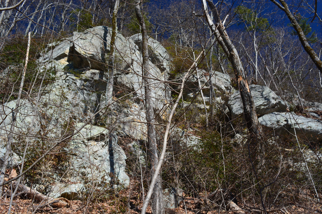
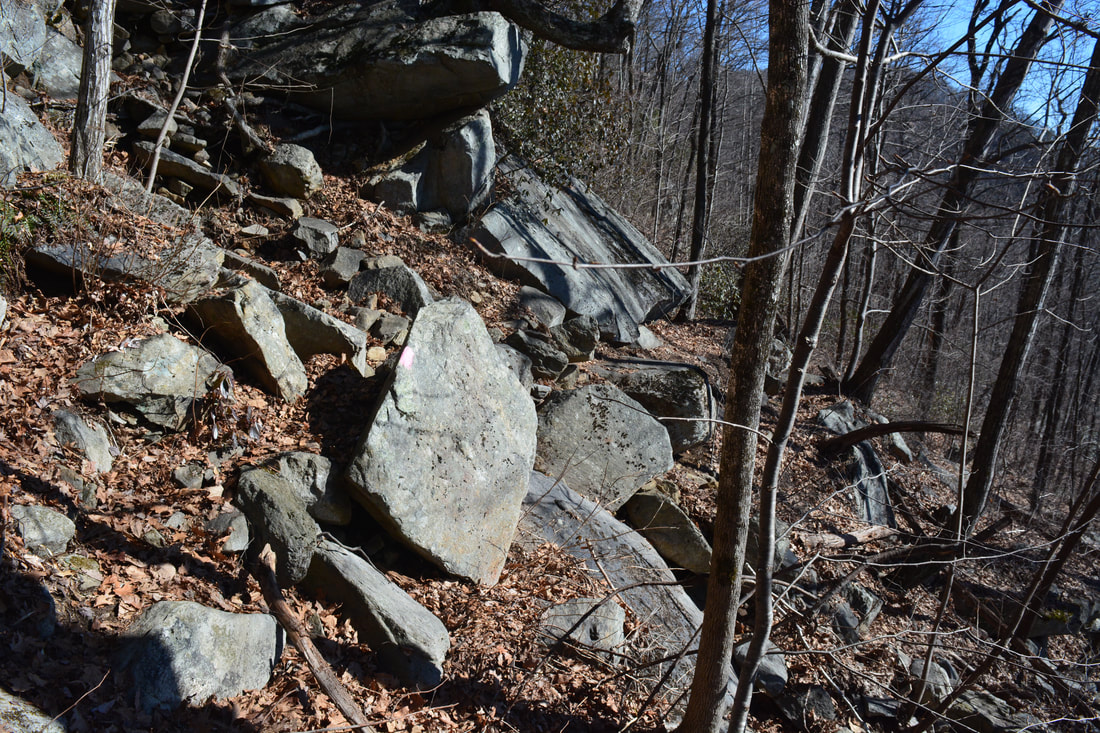
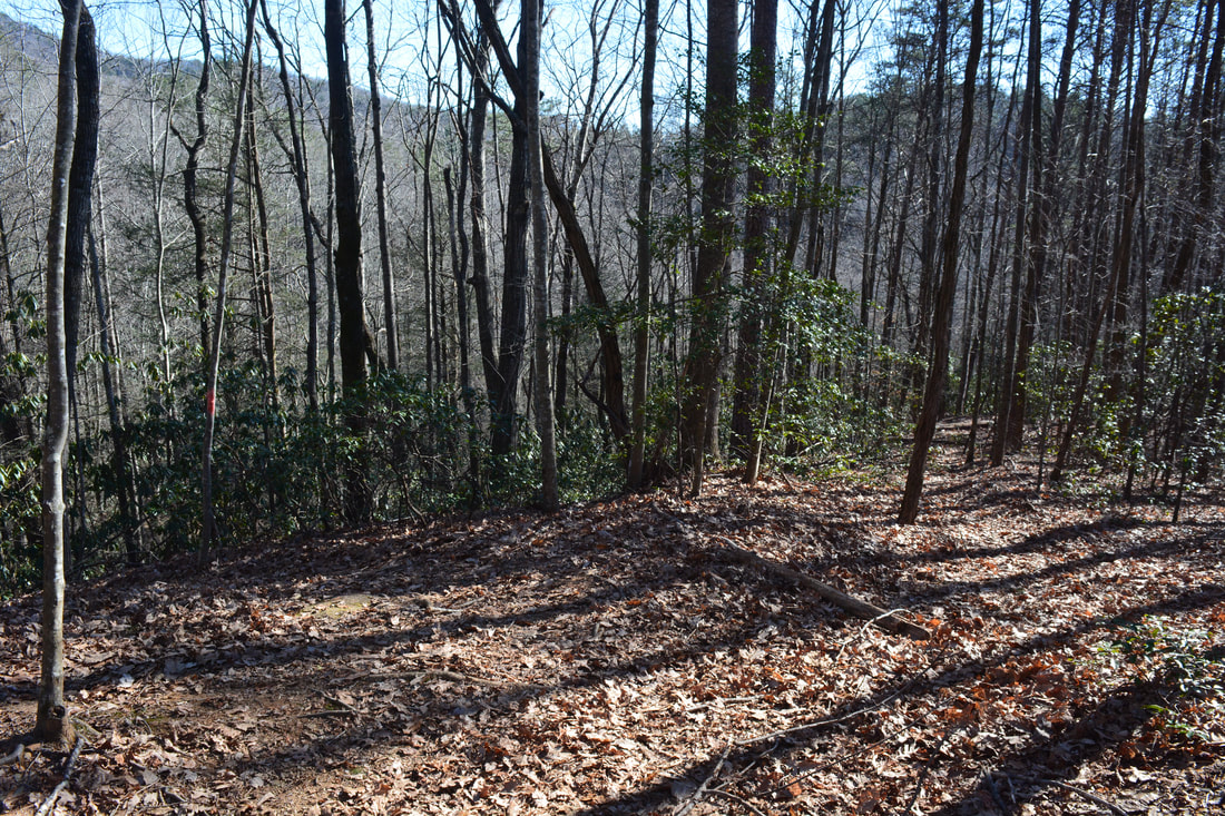
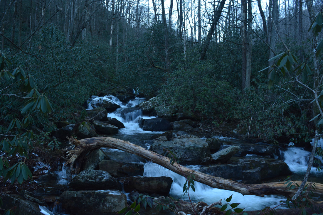
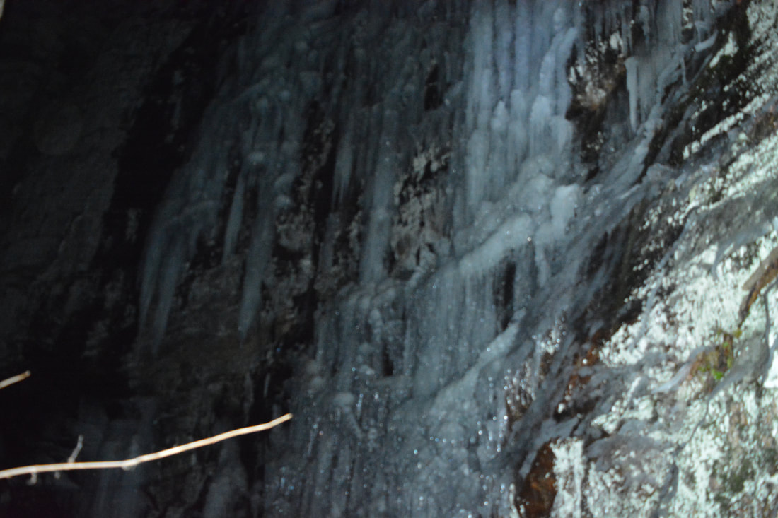
The Naturaland Trust Trail diagonally crosses Highway 276 at 2.15 miles. Watch for traffic as you cross the road. After this, the trail parallels the road for 0.2 miles, crossing a small boulder field along the way. At 2.3 miles, the trail crosses a private drive - several private structures stand to the right. After this, the trail begins to drop off the escarpment. Reach Rock Cliff Falls at 2.5 miles. This 30-foot cascading waterfall is normally unimpressive due to its low flow. What comes afterward is more impressive though. The trail crosses the unnamed stream at the foot of the falls and proceeds to follow the base of a tall bluff line. At the time of my hike, the entire cliff was covered with beautiful sheets of ice. After a rugged and slow 0.2 miles along the cliffs, the trail starts descending more steeply, curving west with time. Great winter views to the south and east begin. At 3.2 miles, the trail reaches a junction with the white-blazed Pinnacle Pass Trail (#20). The Pinnacle Pass Trail, the park's longest trail, continues ahead, soon crosses US 276, and eventually reaches the Jones Gap State Park Visitor Center after 10 miles. This hike turns acutely right and stays on the Naturaland Trust Trail. After an initial descent, passing Campsite D1, the trail begins to contour along the slope below a grand cliff line on the south side of Caesars Head. The trail is very rocky and slow in this section, but it's also scenic, affording great close-up views of the boulders and bluffs as well as panoramic wintertime views of Table Rock and Table Rock Reservoir to the west. Finally, at 4.05 miles, the trail turns left and begins a steep descent into the Matthews Creek valley. Over the next 0.7 miles, the Naturaland Trust Trail loses 700 feet in elevation! You'll pass Campsites D2 and D3 along the way.
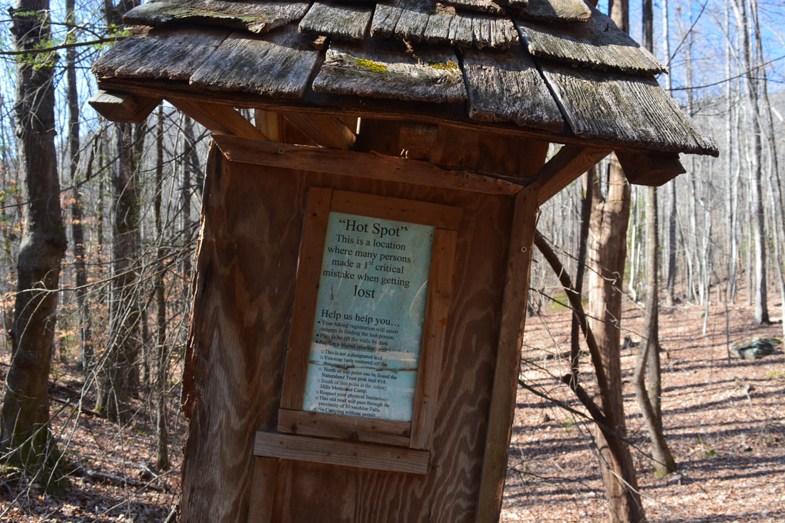
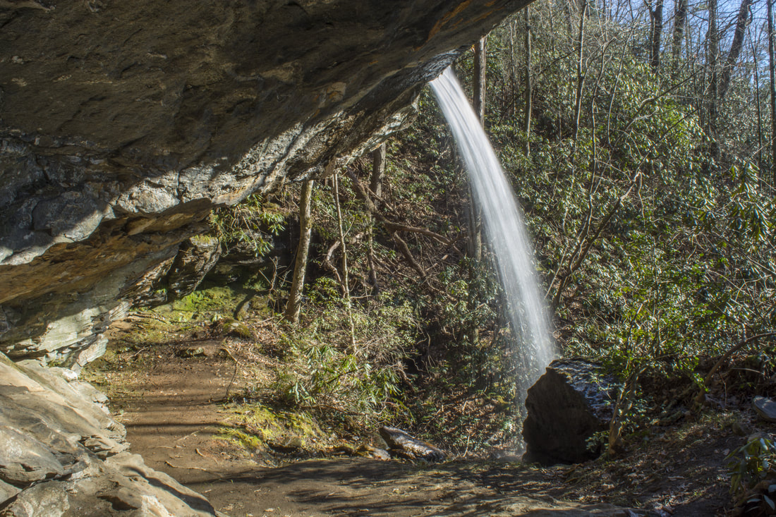
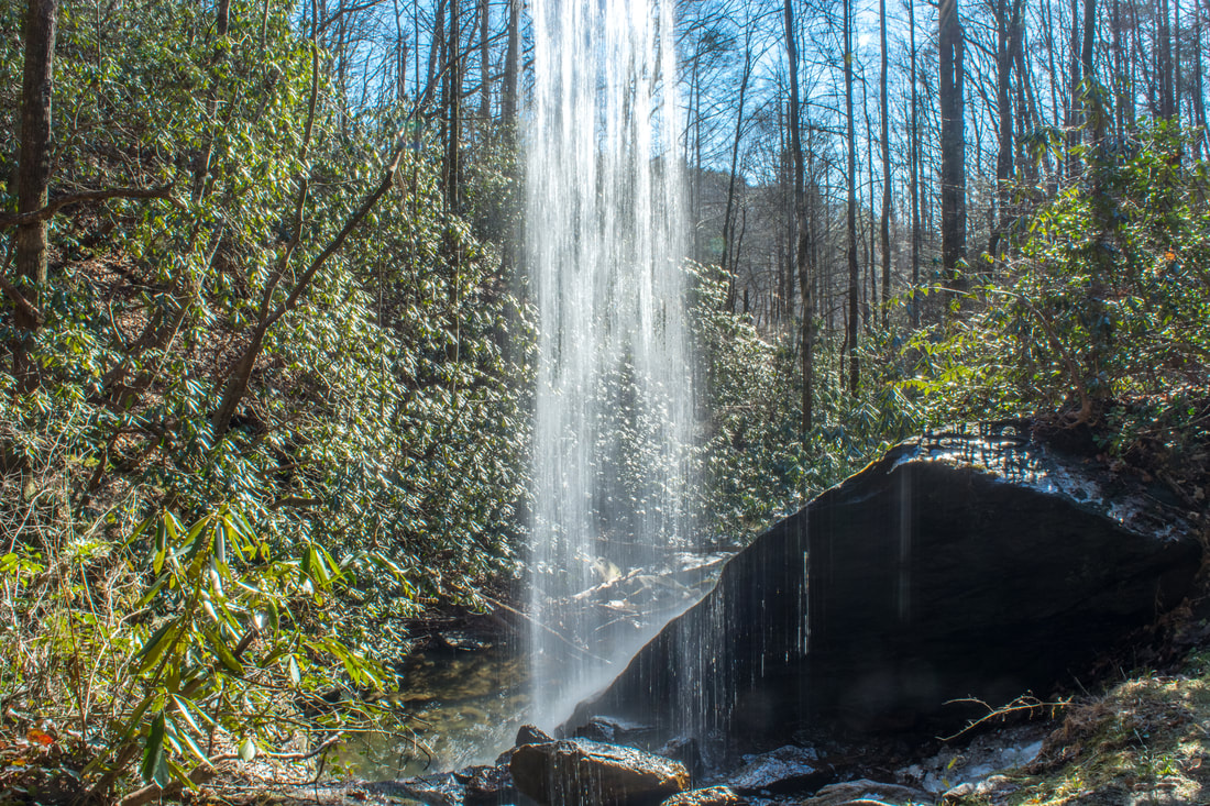
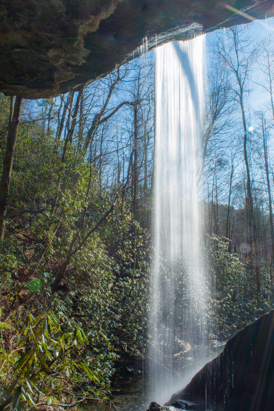
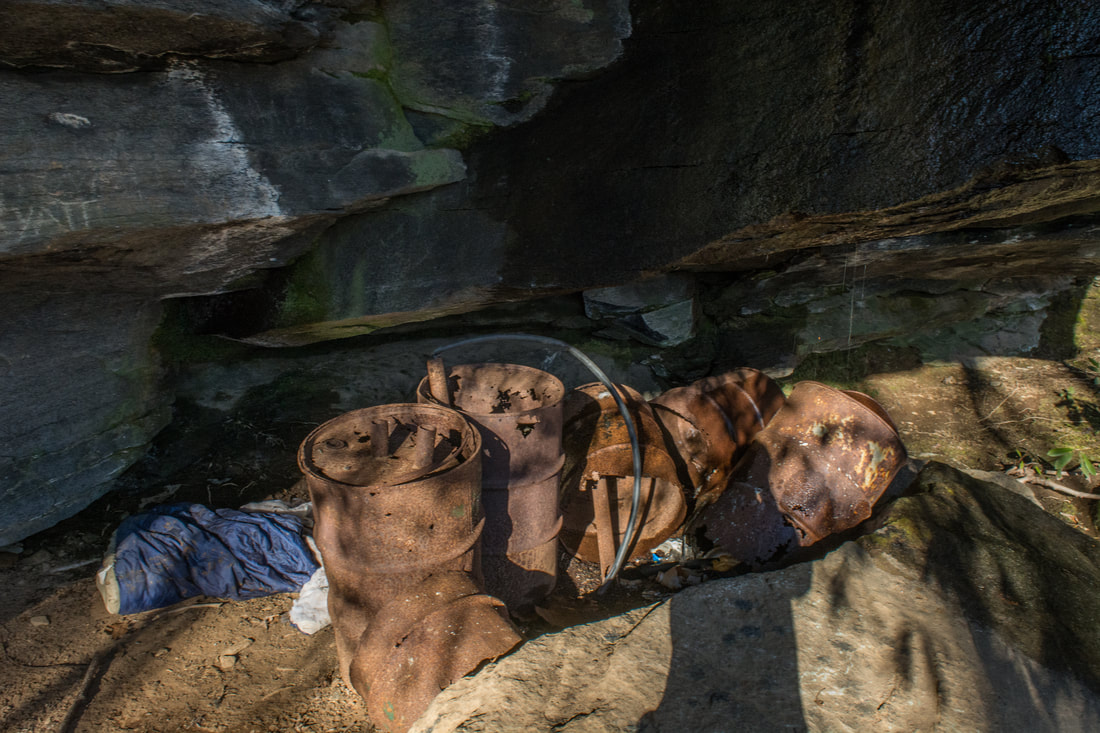
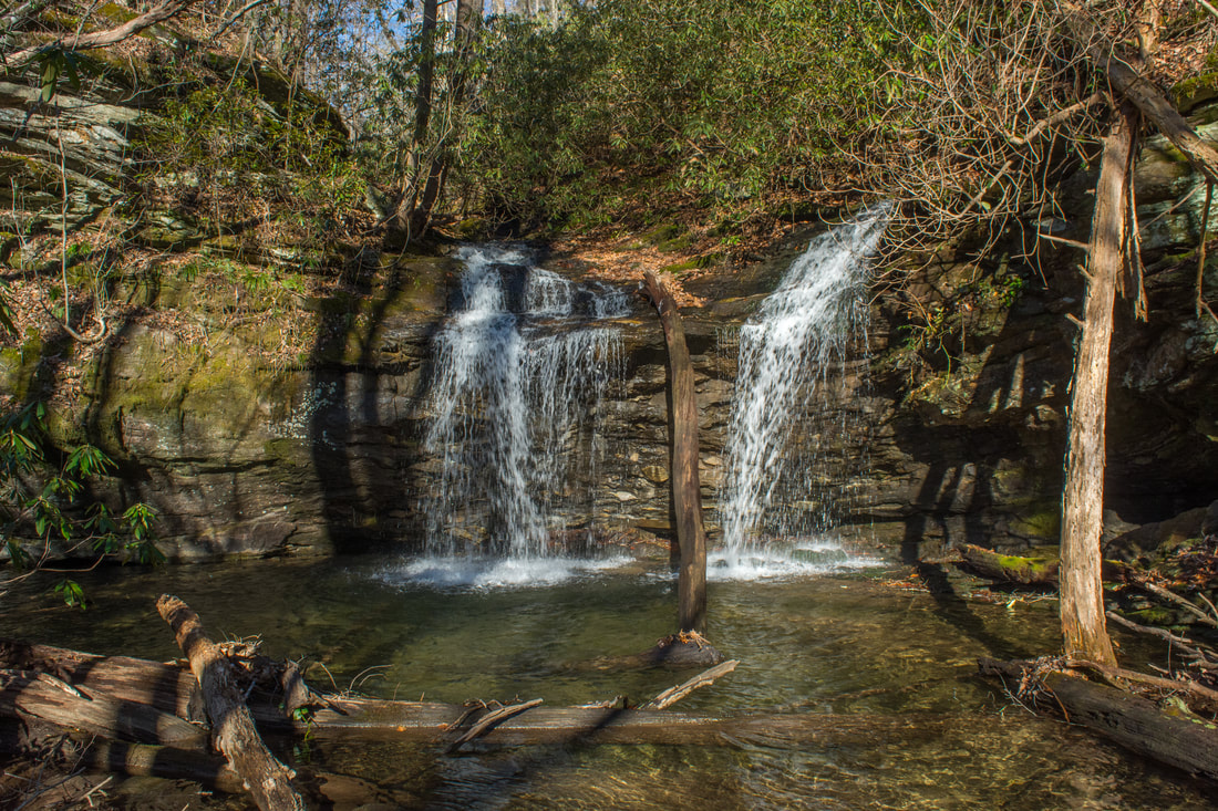
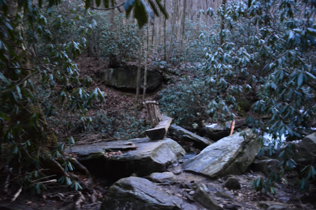
At 4.5 miles, the trail comes alongside a small stream. A short distance farther is a neat small landslide area between the trail and the creek. At 4.75 miles, the trail comes to a junction with the Moonshine Falls side trail. While the main trail bears right (where you'll head later), the spur trail to Moonshine Falls bears left along an old forest road. At the time of my hike, a cairn marked the intersection. It's about 0.5 miles one way to Moonshine Falls and another 0.2 miles to Confusion Falls. Shortly after you begin travelling down the unmarked side trail, you'll pass a "Hot Spot" kiosk that suggests that you may be hiking in the wrong direction. This is partly true, because the spur trail to Moonshine Falls isn't official. However, if your destination is Moonshine Falls, then you're on the right track - the sign applies to hikers who should be following the Naturaland Trust Trail. The forest road travels south, bends around a low ridge, turns into the watershed of the unnamed stream on which Moonshine Falls is located, and comes to a split at 5.2 miles. While the main forest road bears left, that's the wrong route (and at the time of my hike, it was blocked off). To see Moonshine Falls and Confusion Falls, stay right on a narrower path along another low ridge above the falls. In 300 feet, you will hear and perhaps even see Moonshine Falls down to the left. A faint path continues straight to Confusion Falls, but for now, turn left on the steep scramble path to Moonshine Falls. The scramble path ends at the huge cave-like overhang over which the upper part of 40-foot Moonshine Falls crashes. The overhang is so broad that it's easy to walk behind the falls without getting wet! As you explore the zone behind the falls, you'll undoubtedly spot the waterfall's namesake: an assortment of old moonshine stills and other equipment. Another scramble path leads to the base of the falls, though you'll have to rock-hop a little for the best view. Moonshine Falls is structured beautifully. The falls begins with an elegant free-fall, which is followed by a short slide at the landing point. The lower tier of the falls is another free-fall that culminates with a small pool. This is a great waterfall for photographers! For those who don't wish to make the difficult trek from Caesars Head State Park, there's an easier way to reach the falls from Asbury Hills Camp as well. Regardless, return to the ridge-top path just above the falls. Turn left on it to see Confusion Falls, which is well worth a trip in my opinion. The path narrows and even almost fades away, but just stay on the ridge. There may be flagging tape along the way. When you reach the end of the ridge, pick out the faint path as it descends straight down and then curves left when the waterfall comes within hearing distance. The final leg of the path is very steep as it drops down the side of the small gorge. The path ends at Confusion Falls at 5.55 miles. If by any reason you don't reach the creek at the waterfall (as some folks have done before), the falls should be just upstream from you. 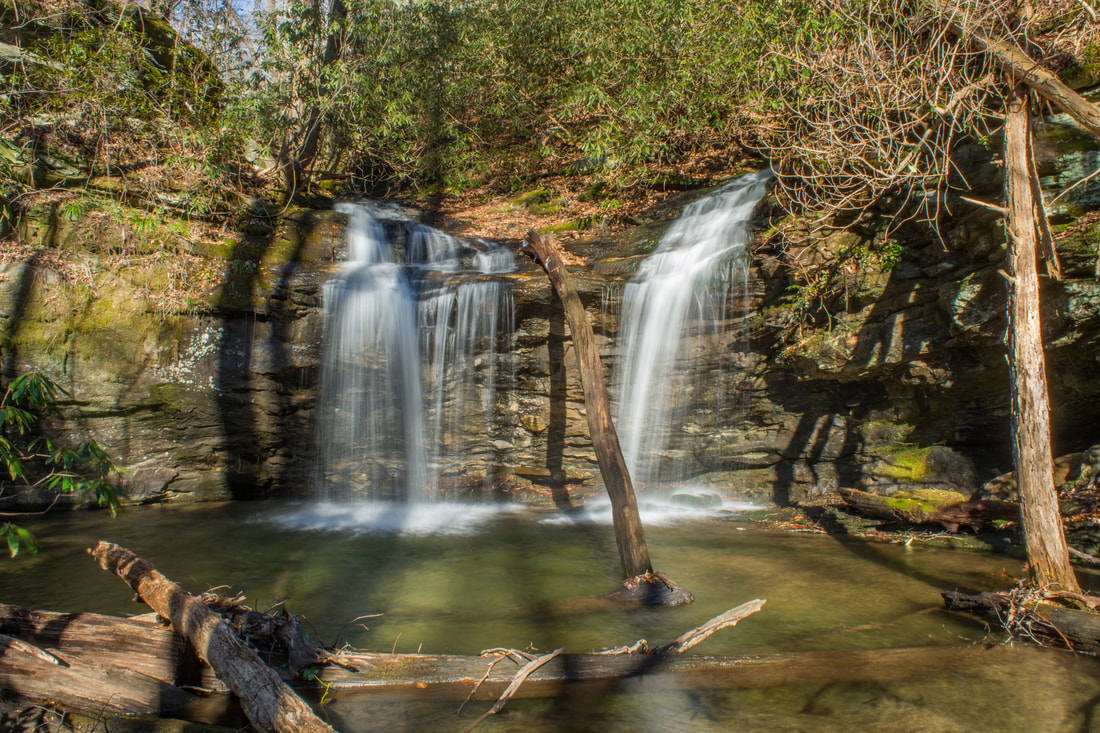
Confusion Falls is one of two beautiful waterfalls on an unnamed tributary of Matthews Creek.
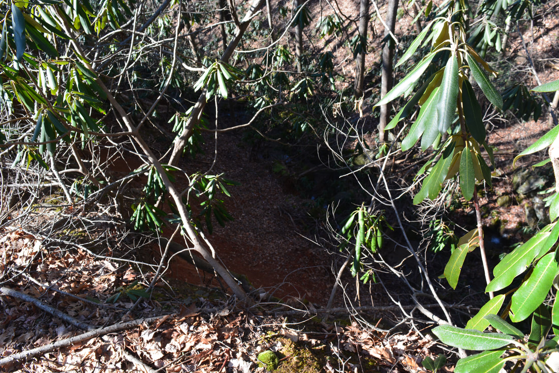
While much smaller than Moonshine Falls, Confusion Falls is nearly as beautiful. This 15-foot drop has charm thanks to the twin nature of the waterfall. The falls is at the confluence of two unnamed streams, both of which fall over a ledge before converging in the pool. Enhancing the scene's beauty are jagged rock outcrops around the falls. The name of Confusion Falls originated when folks looking for Moonshine Falls stumbled upon this waterfall and were "confused" upon whether they were at Moonshine Falls or not (when Moonshine Falls is actually a short distance upstream). Retrace your steps back to the Naturaland Trust Trail from Confusion Falls, rejoining the trail at 6.25 miles. The trail briefly continues to descend before it bottoms out near Matthews Creek at 6.45 miles. This is where the trail begins following Matthews Creek upstream into the narrowing gorge. At 6.7 miles, reach an important split. The Naturaland Trust Trail turns right at a sign, and that's the trail that this hike stays on. Meanwhile, the red-blazed trail to Asbury Hills Camp continues straight, crossing Matthews Creek by a cable bridge and reaching the camp in a couple miles. The Asbury Hills Camp Trail is the easiest way to get to Moonshine Falls and Confusion Falls, but for the purpose of this hike, you should ignore it.
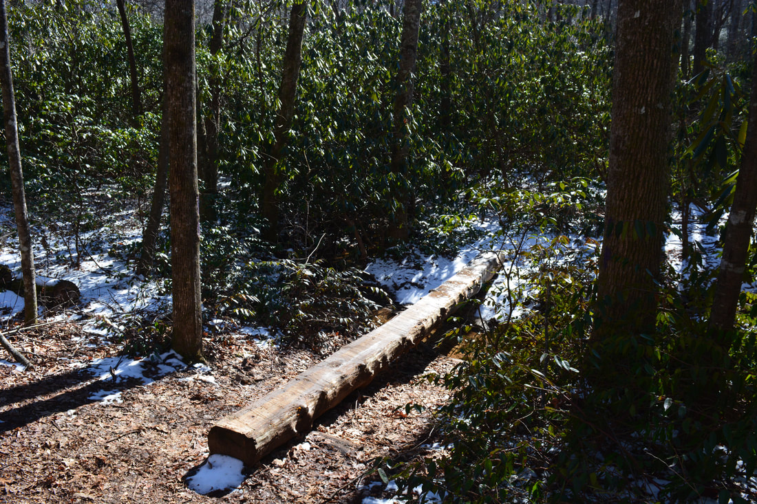
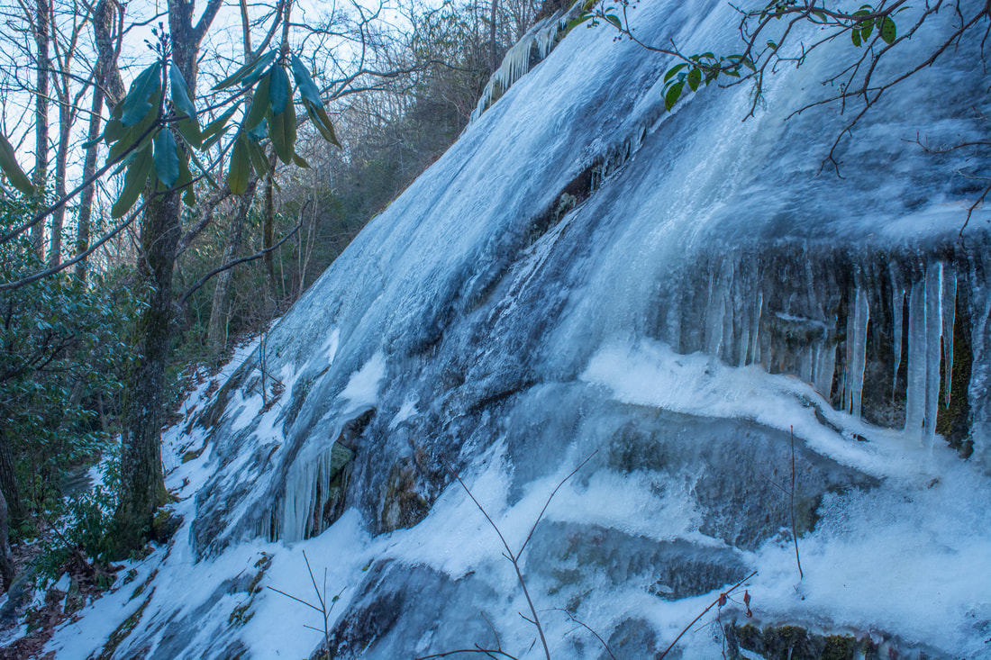
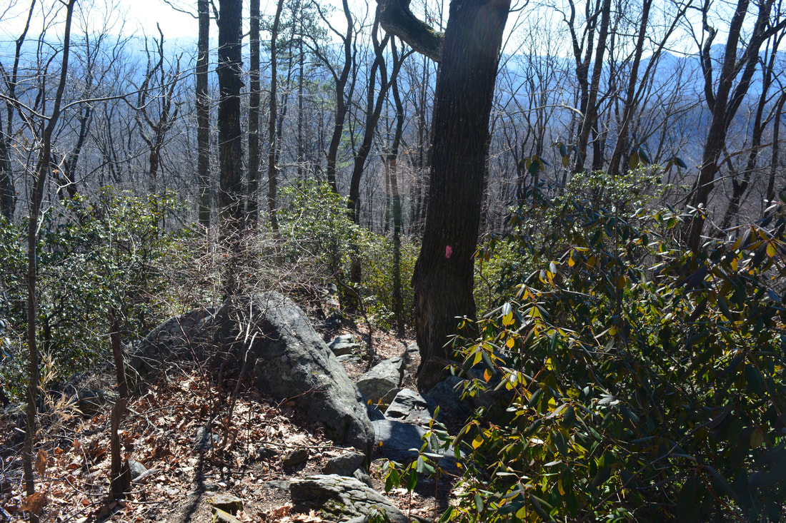
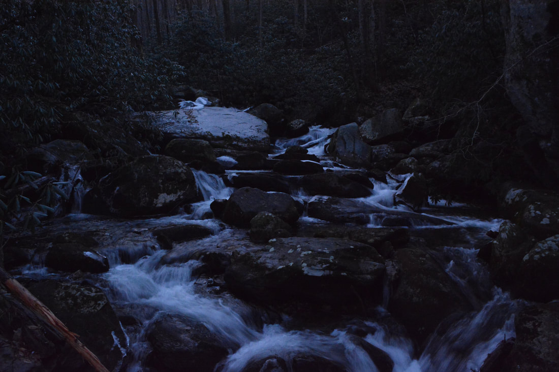
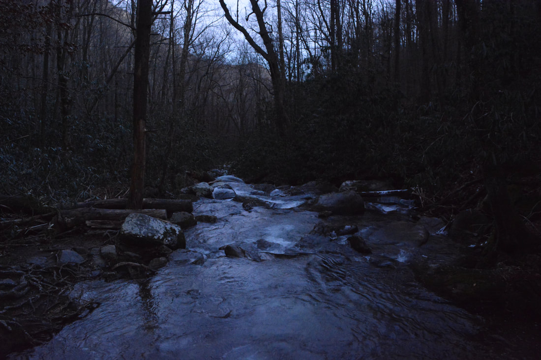
The Naturaland Trust Trail stays near Matthews Creek, providing close-up views of the creek's many cascades and rapids. After passing campsites D4 and D5 by the creek, the Naturaland Trust Trail reaches an intersection with the purple-blazed Dismal Trail (#12) leaving right at 7.15 miles. The Dismal Trail is a steep shortcut that reaches the Raven Cliff Falls Trail in 1.5 miles. Although the section of the Naturaland Trust Trail you're about to hike is more challenging in some ways, it's a much more scenic route. The trail reaches a footlog crossing of Matthews Creek by a house-sized boulder at 7.45 miles. There used to be a cable bridge in place here, but it became unsafe to use after the trees it'd been attached to died, so it was replaced with the footbridge. The footbridge provides great views of Matthews Creek's powerful rapids. Following the crossing, the trail begins a moderate to strenuous ascent into the gorge's upper reaches. Your excitement level should ramp up at 8.05 miles upon your arrival at The Cathedral, a massive rock amphitheater. If you'll visit The Cathedral in the same conditions as I did, you might even get an adrenaline rush - as on this relatively warm winter day, the cliff was covered by an enormous sheet of ice that appeared to be disintegrating by the minute! Add in an occasional sound of falling ice and you have an alarming scenario. The trail segment after The Cathedral may be the most difficult along the hike. The trail begins an exceedingly steep and rugged ascent out of the Matthews Creek Gorge. Pay special attention when at 8.2 miles the trail reaches the third switchback following The Cathedral. This is where the short side trail to the must-see profile view of Raven Cliff Falls continues straight. Another good way to identify the spur trail is the two downed trees near its start. The 250-foot side trail scrambles up a small rock outcrop and reaches the profile view of Raven Cliff Falls at 8.25 miles. Raven Cliff Falls is a breathtaking waterfall - one of South Carolina's best - though unfortunately, the existing trails don't take advantage of the best viewing opportunities for this waterfall. From this clifftop perch, you can only see the waterfall's tallest free-falling tier that I would estimate to be about 100 feet high. Although the view isn't totally open, it's still a fantastic view of a majestic waterfall and the cliffs around it. Sadly, access to the base of Raven Cliff Falls is very difficult. 
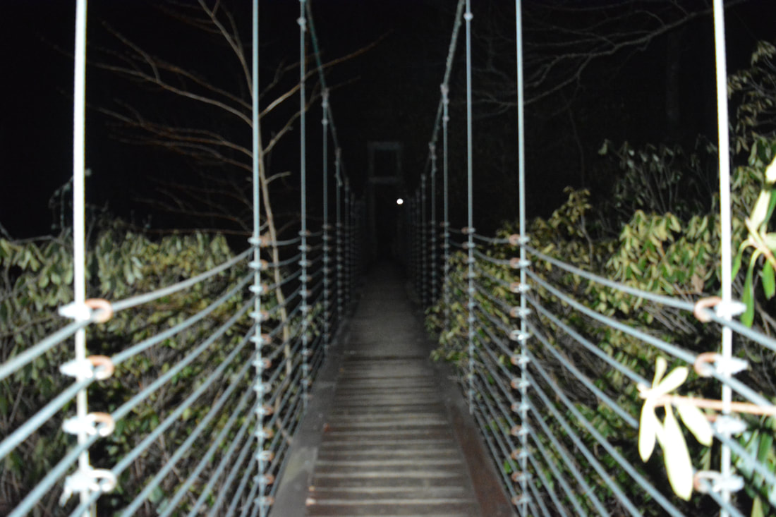
The Naturaland Trust Trail crosses Matthews Creek at the top of Raven Cliff Falls using an elaborate suspension bridge.
After the Raven Cliff Falls side trail, the trail begins scrambling up the same slope that Matthews Creek crashes over - and what a slope it is! Over the next 0.2 miles, the trail takes advantage of three wooden ladders to navigate the rugged terrain in the vicinity of Raven Cliff Falls. There are also a couple of places where you'll be scrambling among rock outcrops using your hands as well as your feet. After what seems like an eternity, at 8.5 miles the trail reaches a suspension bridge across Matthews Creek at the top of Raven Cliff Falls. As you cross this elaborate construction, you get the chance to observe cascading Matthews Creek picking up speed as it prepares for the plunge over Raven Cliff Falls. The bridge also affords a view across the gorge to an observation area at the terminus of the Raven Cliff Falls Trail with a great birds-eye overview of Raven Cliff Falls.
Meanwhile, after the trail, the Naturaland Trust Trail briefly follows Matthews Creek upstream before resuming the climb on a series of wooden steps. Thankfully, the ascent never gets as steep or rugged as it had been in the vicinity of Raven Cliff Falls. At 9.1 miles, the Naturaland Trust Trail reaches its terminus at a junction with the Gum Gap Trail (#13). This hike bears right on the Gum Gap Trail. The Gum Gap Trail follows a well-graded old forest road, and the section of the hike that follows it is pretty easy. A brief descent brings the trail to a culverted crossing of a Matthews Creek tributary at 9.6 miles. Make sure to turn right at 10.15 miles to stay on the Gum Gap Trail, which leaves the distinct forest road and begins ascending to a ridge. After a rather steep 150-foot ascent, the Gum Gap Trail ends at a junction with the Raven Cliff Falls Trail (#11) at 10.5 miles. You can make an optional 0.4-mile side trip to the birds-eye view of Raven Cliff Falls by turning right onto the red-blazed Raven Cliff Falls Trail. It's a pretty nice and unique view, especially during fall or winter. This hike instead turns left onto the Raven Cliff Falls Trail. Don't be surprised to encounter a lot more people on this trail. The Raven Cliff Falls Trail is one of the area's most popular trails due to the relative ease of access to the Raven Cliff Falls view. The trail mostly contours along the ridge and the edge of the escarpment without any grades of even moderate difficulty. At 11.1 miles, the trail climbs up a series of rock steps and then passes a short side trail to a limited southward view. This section has nice views of the South Carolina Piedmont when the leaves are off the trees. At 11.75 miles, the trail passes a kiosk with information about the Palmetto Trail and joins a gravel service road that makes the final climb to US 276. Finally, at 12.0 miles, the Raven Cliff Falls Trail passes around a metal gate and ends at US 276 directly across from the parking area. Walk a few feet to the right and to your vehicle down the parking lot's exit road, concluding the hike. The Naturaland Trust Loop is a superb hike! By the end of the day, you'll have seen three waterfalls, countless bluffs of all shapes and sizes, and acres of pristine forest. Not only does the hike have a variety of points of interest spread throughout it, but the loop includes many scenic trail miles full of solitude. That's why I decided to rate this hike a "Best Hike". To date, it's the best hike that I've done in South Carolina. Mileage
0.0 - Raven Cliff Falls Parking Area
1.1 - Coldspring Branch Connector Junction 1.95 - Naturaland Trust Trail Junction 2.15 - US 276 Crossing 2.5 - Rock Cliff Falls 3.2 - Pinnacle Pass Trail Junction 4.75 - Moonshine Falls Side Trail Junction 5.3 - Moonshine Falls 5.55 - Confusion Falls 6.7 - Asbury Hills Trail Junction 7.15 - Dismal Trail Junction 7.45 - Matthews Creek Footbridge 8.05 - The Cathedral 8.25 - Raven Cliff Falls 8.5 - Matthews Creek Suspension Bridge 9.1 - Gum Gap Trail Junction 10.5 - Raven Cliff Falls Trail Junction 12.0 - Raven Cliff Falls Parking Area Variations
Skip the side trip to Moonshine Falls and Confusion Falls - 10.5 Miles
Add the side trip to Raven Cliff Falls Overlook - 12.8 Miles Hike the shorter Dismal/Naturaland Loop - 8.1 Miles Bonus Stops
Make sure to stop by the Caesars Head State Park Visitor Center before or after the hike and take in the beautiful panoramic view to the south and west. If the weather has been rainy, another good bonus stop could be the Wildcat Wayside Trail off US 276. It features three wet-weather waterfalls, one of which is right by the road.
Pictures & Videos
Note: Due to an unprecedented navigational mishap on my end, I was forced to hike the last 4.5 miles of the hike in darkness. Sadly, this included Raven Cliff Falls. Thus, most photos in the gallery below are from the first 2/3 of the hike. I have included a few decent-quality night photos from the vicinity of Raven Cliff Falls.
1 Comment
1/30/2018 08:09:32 pm
Thanks for this comprehensive hike outline, detailed information, and photos/videos! I'm looking forward to reading more of your posts, and I've subscribed to your feed. Leave a Reply. |
About MeMark Oleg Ozboyd Dear readers: I have invested a tremendous amount of time and effort in this website and the Georgia Waterfalls Database the past five years. All of the work that has gone in keeping these websites updated with my latest trip reports has almost been like a full-time job. This has not allowed me to pick up a paid job to save up money for college, and therefore, I I've had to take out loans. If you find the information on this website interesting, helpful, or time-saving, you can say "thanks" and help me out by clicking the button above and making a contribution. I will be very grateful for any amount of support you give, as all of it will apply toward my college tuition. Thank you!

Coming in 2022-2023?
Other Hiking WebsitesMiles HikedYear 1: 540.0 Miles
Year 2: 552.3 Miles Year 3: 518.4 Miles Year 4: 482.4 Miles Year 5: 259.9 Miles Archives
March 2021
Categories
All
|
||


 RSS Feed