HIKING THE APPALACHIANS AND BEYOND
  • Home
  • Trail Reports
    • Best Hikes
    • Hikes with Scenic Views
    • Hikes with Water Features
    • Alabama
    • Georgia
    • Florida
    • North Carolina
    • South Carolina
    • Tennessee
    • Vermont
    • Virginia
  • Map
  • Hike List
  • Testimonials
  • Resources
  • Contact Us
  • Southeast Nature Society
    • Our Team
  • Georgia Waterfalls Database

Pigeon-Crockford Mountain Wildlife Management Area: Chamberlain Trail to Nash Pit Falls and High Point, LaFayette, Georgia

1/17/2018

2 Comments

 
Picture
Chamberlain Trail is one of only two trails that ascends the east side of Pigeon Mountain from base to top. This lesser-known trail climbs at an easy to moderate pace through Atwood Gulf before meeting up with the Atwood Trail atop the mountain. While there aren't any notable attractions along the trail itself, a fantastic natural sight lies off-trail in Atwood Gulf: Nash Pit Falls. Have you ever heard the words pit and waterfall in one sentence? At Nash Pit Falls, a small stream flows out of a cave and instantly drops over 70 feet into the Nash Pit, a small but deep hole in the ground. In addition to the stunning Nash Pit Falls, this hike also visits a pair of McLemore Cove vistas on High Point - the highest point on Pigeon Mountain. This hike occurred on Saturday, January 13th, 2018. My plan was to hike the Chamberlain Trail from Chamberlain Road to Atwood Trail, making the bushwhack to Nash Pit Falls along the way. Next, I would follow the Atwood Trail to the Pocket/Bluff Trail. I would then follow the Pocket Trail and Bluff Trail in conjunction to the views on High Point. I would retrace my steps the same way. 

Summary

R/T Length of Trail: 9.6 Miles
Duration of Hike: 4:40 plus 50 minutes of stopping and photography 
Type of Hike: Out and Back 
Difficulty Rating: 6 out of 10 
Total Elevation Gain: 2023 Feet
Pros: Easy-to-follow trails 
Cons: One of the main attractions, Nash Pit Falls, is off-trail 
Points of Interest: Nash Pit Falls - 8 stars with good flow; High Point Views - 4 stars
Trail Blaze Colors: Chamberlain Trail - Red (very few blazes); Atwood Trail - Orange; Bluff Trail - White; Pocket Trail - Blue
Best Seasons to Hike: Winter 
Fees: A WMA Hunting or Fishing License is required for this hike. The license costs $15 annually and can only be obtained online at www.gooutdoorsgeorgia.com or at certain retailers.
Beginning Point: Chamberlain Trailhead
Directions from LaFayette, GA: From the intersection of US 27 Business (South Main Street) and GA 193 (West Main Street) in downtown LaFayette, follow GA 193 North for 2.8 miles. Then, turn left onto Chamberlain Road. In 2.6 miles, turn right onto the unnamed and unpaved road that leads to the Chamberlain Trailhead. Reach the dead-end parking area in 0.2 miles. 

Map

Picture
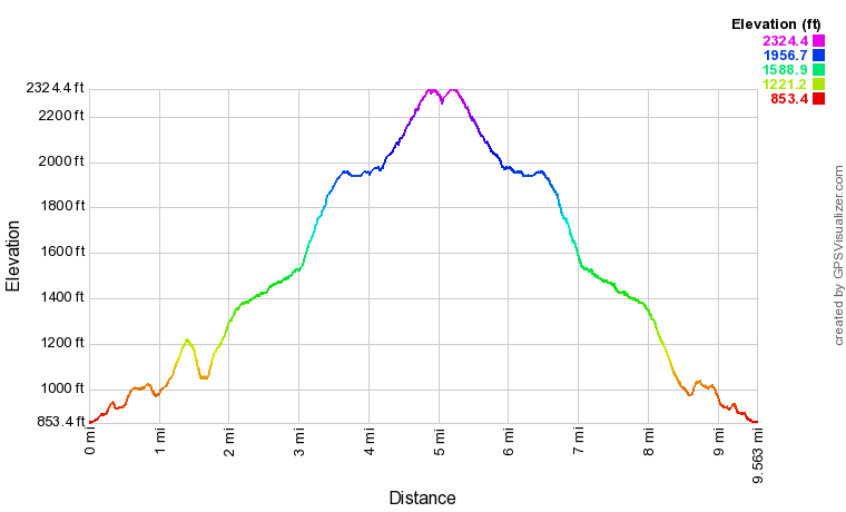
Click the link below to download a .GPX file with a track of this hike. 
chamberlain_trail_to_nash_pit_falls_and_high_point.gpx
File Size: 401 kb
File Type: gpx
Download File

Details

That mysterious waterfall dropping into a cave had been on my list for years ever since I first saw a photo on Flickr. Discovering the location of Nash Pit Falls turned out to be a daunting task due to the lack of online information. I was surprised to learn about relatively easy access to Nash Pit Falls. It didn't seem like the bushwhack to it would be formidable, so I quickly put it on my list to visit this most unique falls. Even though it took me over a year to get there since I learned about the location, I'm excited to have finally crossed Nash Pit Falls off my list. 

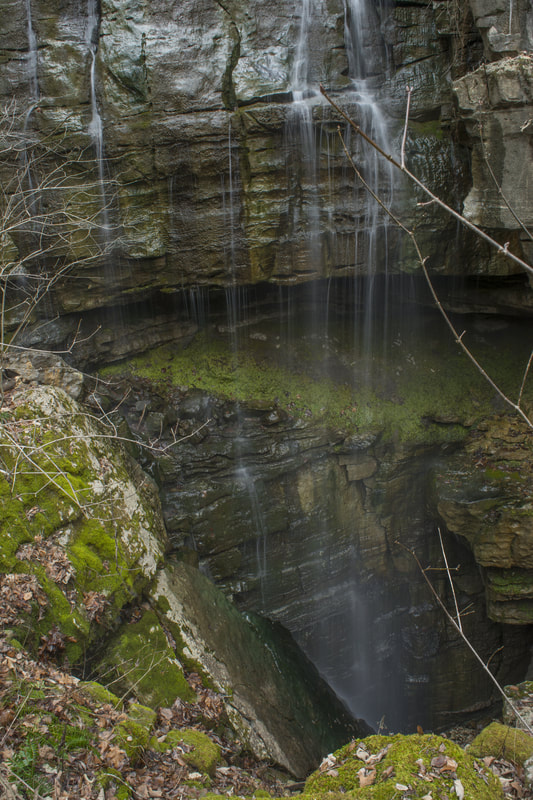
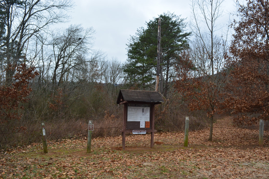
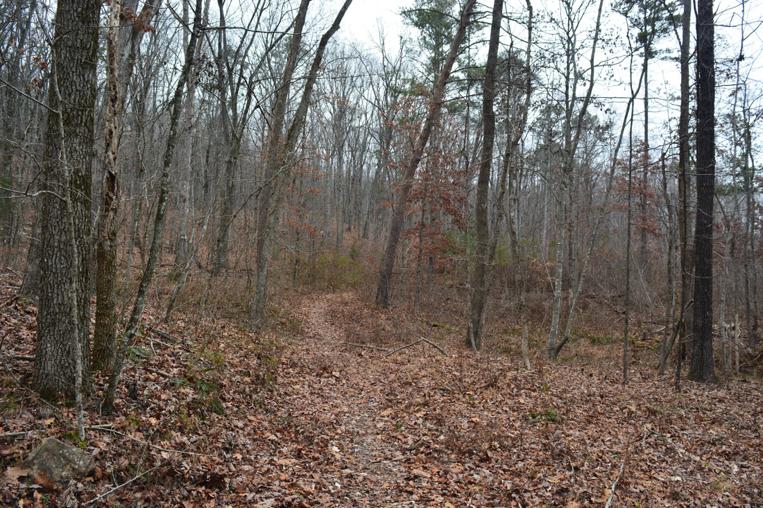
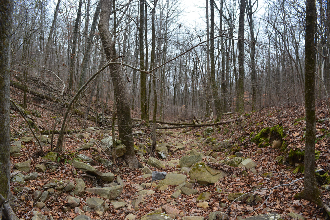
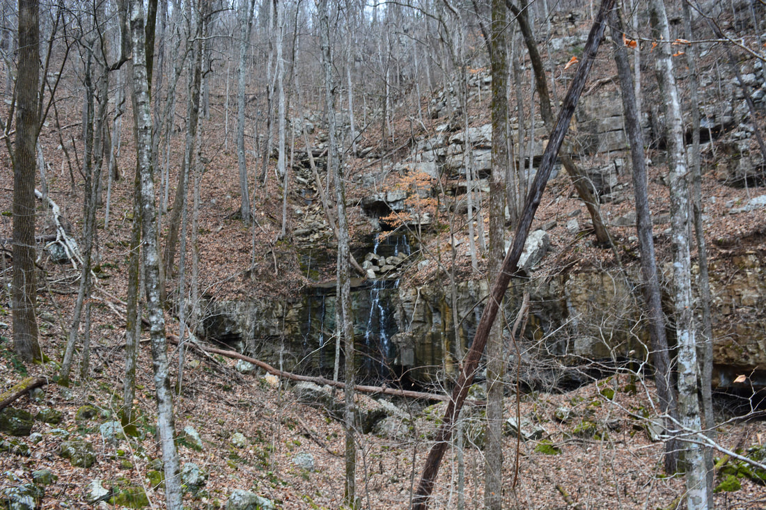
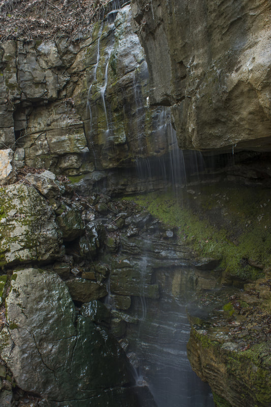
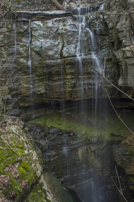
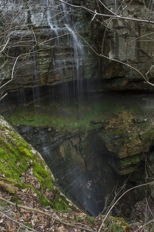
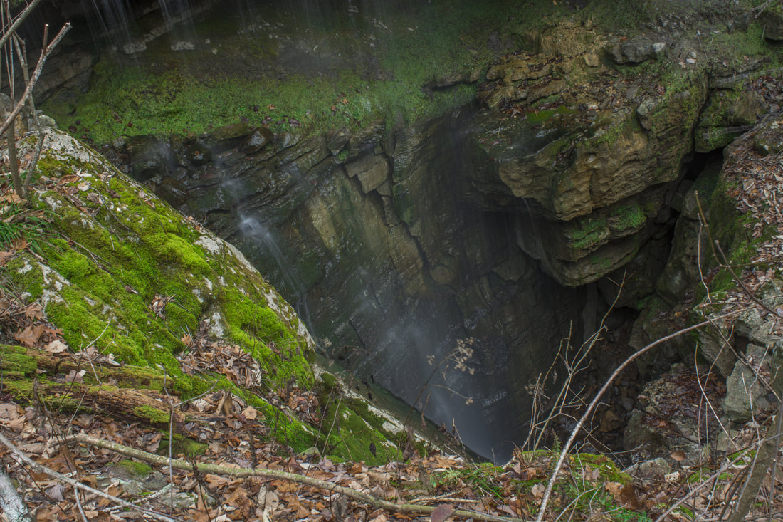
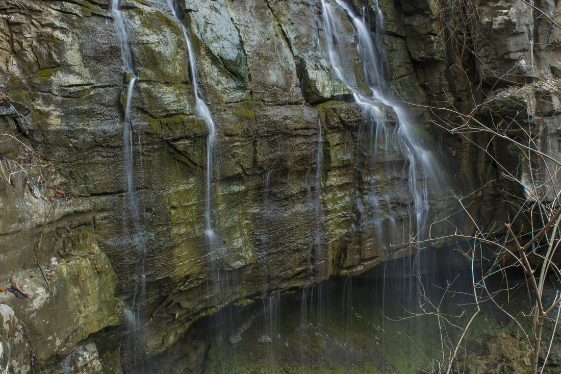
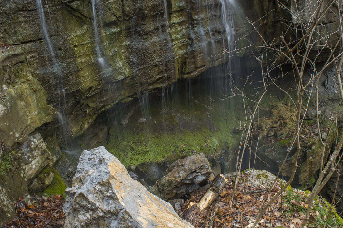
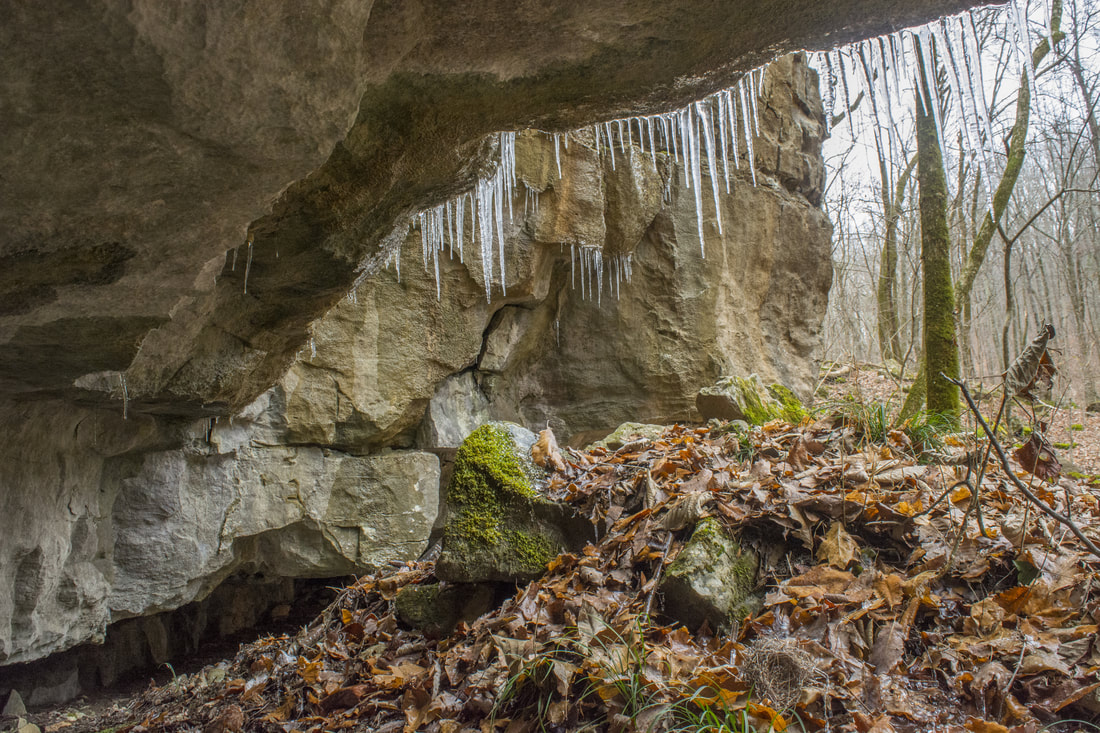
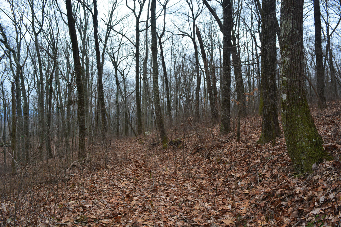
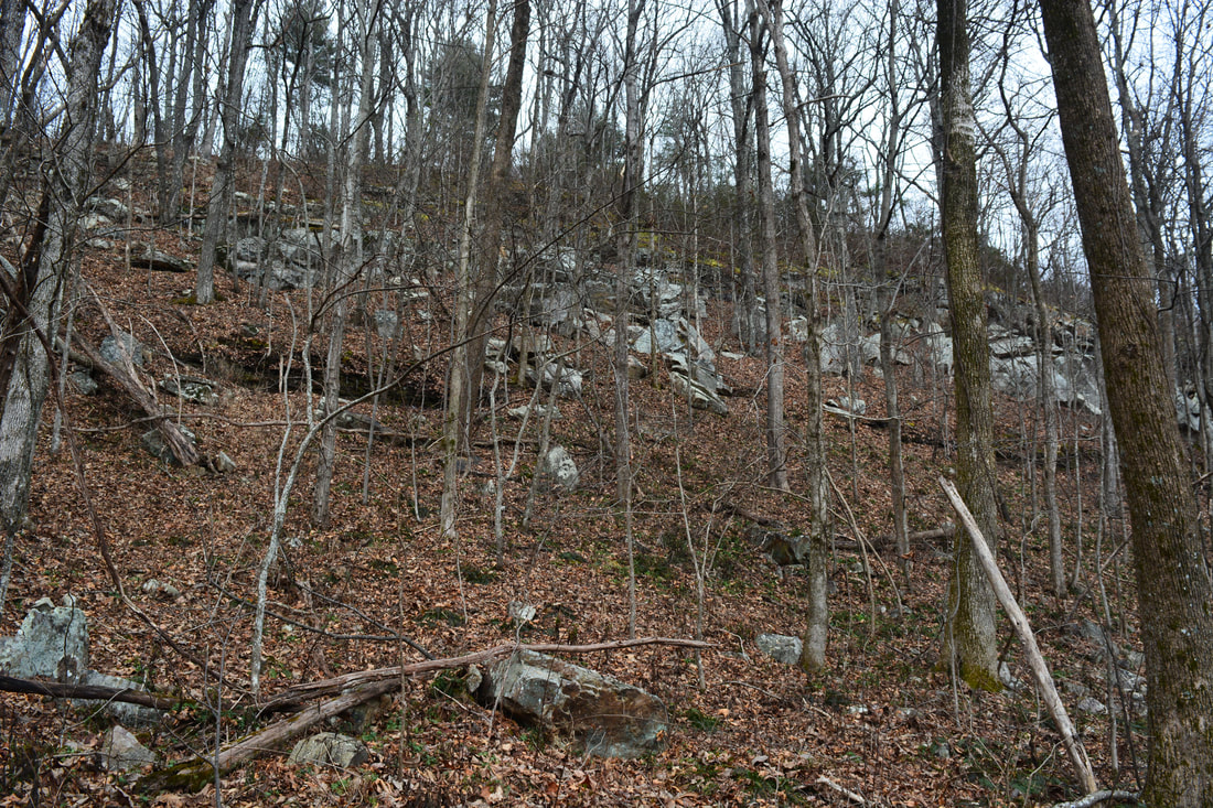
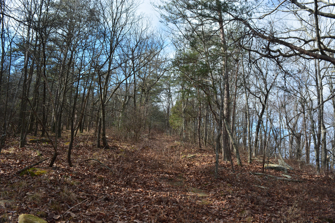
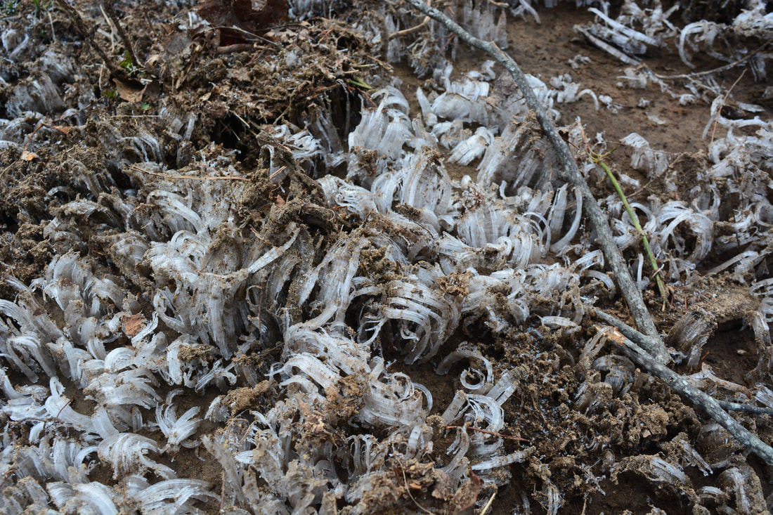
The Chamberlain Trail begins by the kiosk at the far end of the huge parking area. Near its beginning, the trail crosses a minor powerline cut and a service road leading to a private field. Then, the trail makes an easy ascent on the lower slopes of Pigeon Mountain well below Atwood Point. At 1.05 miles, after circling a small hollow, the Chamberlain Trail enters a valley-like area known as Atwood Gulf. Shortly thereafter, as the trail joins an old roadbed, the ascent becomes steeper. At 1.4 miles, a very faint old roadbed angles to the right. If you look right, you can see a notable tall peak (part of Pigeon Mountain) across the valley. This is the place where you should leave the trail to see Nash Pit Falls. The off-trail section is about 0.25 miles one way. It's okay to initially follow the faint old roadbed, but the roadbed dissipates in less than 0.1 mile. From there, turn right and walk through the open woods in the direction of the prominent peak. There's a couple of spots where you have to descend steeply before you reach a normally dry gully at the bottom of Atwood Gulf. Cross the rocky gully and continue straight 250 feet to Nash Pit Falls, reaching it at 1.65 miles. In the winter and if the flow is good, you should be able to glimpse the falls before you descend all the way to the gully. 

Nash Pit Falls may not be a powerful waterfall but it's about as unique as a natural sight can get. The falls is located on a tiny unnamed stream that's mostly underground. Just above the waterfall, the stream exits a cave, cascades down a series of ledges, and drops over 70 feet into the Nash Pit - much of it a free-fall! The small overhang near the top of the pit features a beautifully lush spray plant community. Usually, the flow is low and spread out, but the falls is truly special when its setting and uniqueness is factored in. Nevertheless, a disclaimer for Nash Pit Falls is needed. The area around the pit is extremely dangerous. If you slip into the pit, you would likely die, and even if you didn't, you wouldn't be able to get out without a rope. For your own safety, please stay away from the edge of the pit. 
Picture
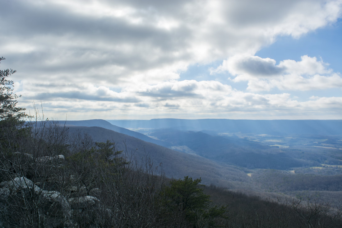
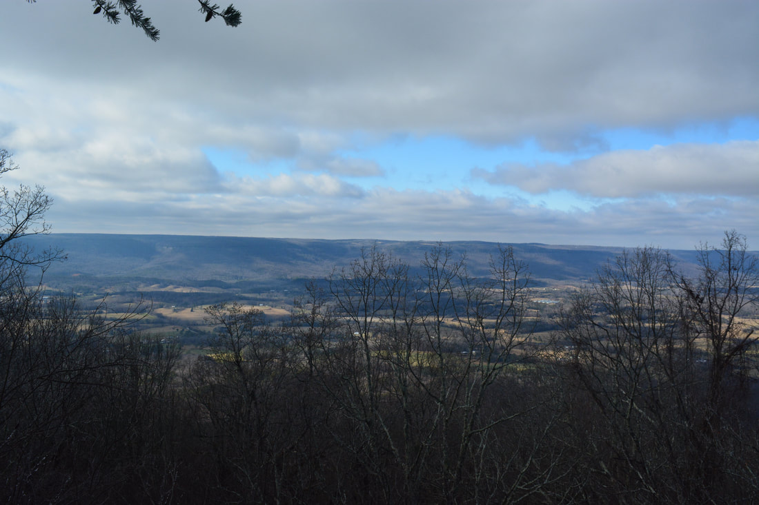
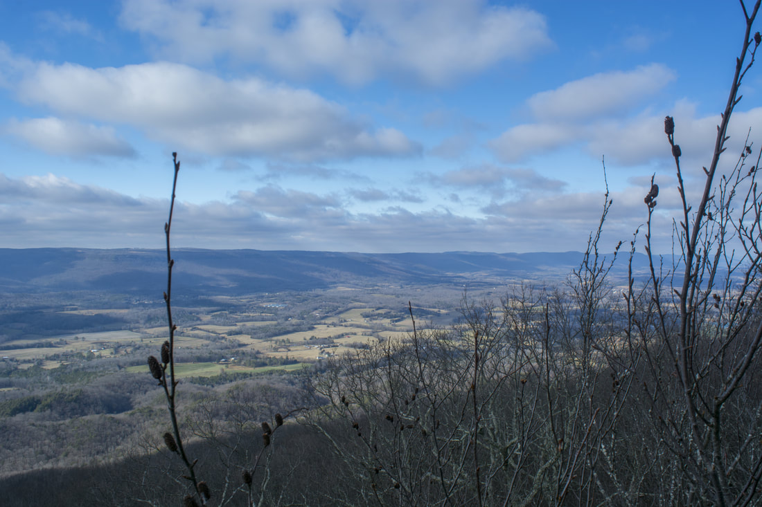
The turnaround point for this hike, High Point, features great views of McLemore Cove
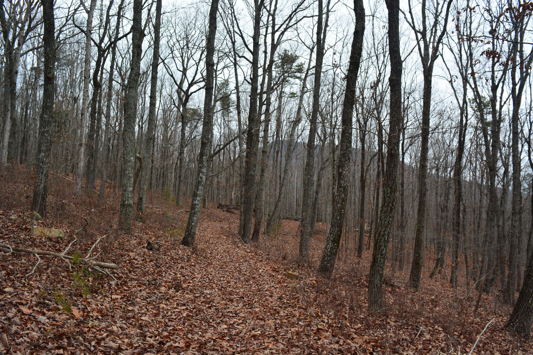
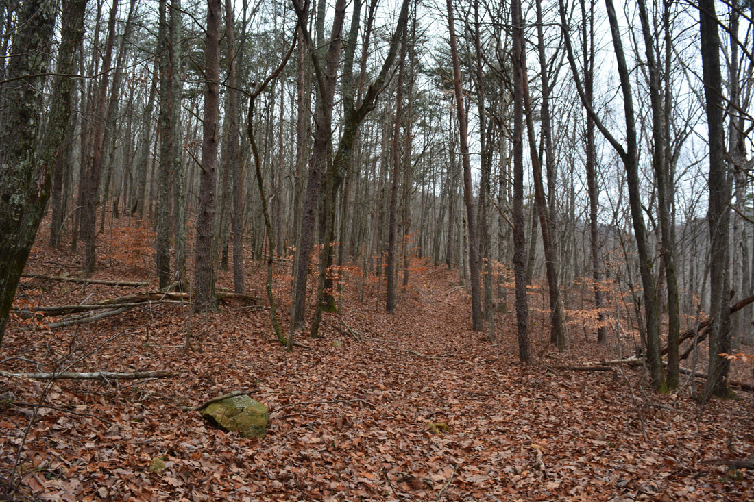
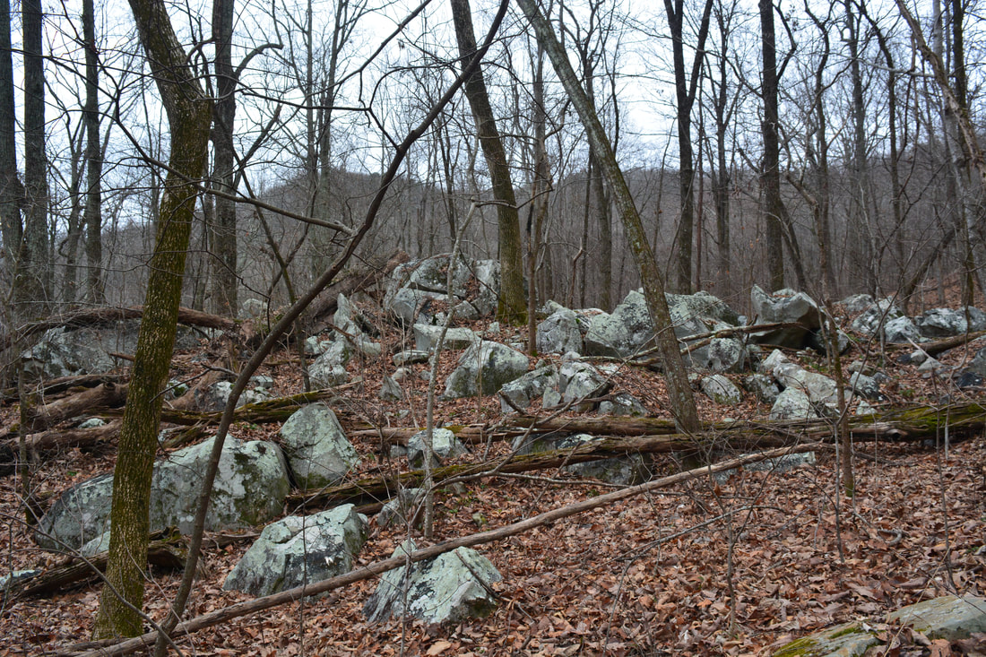
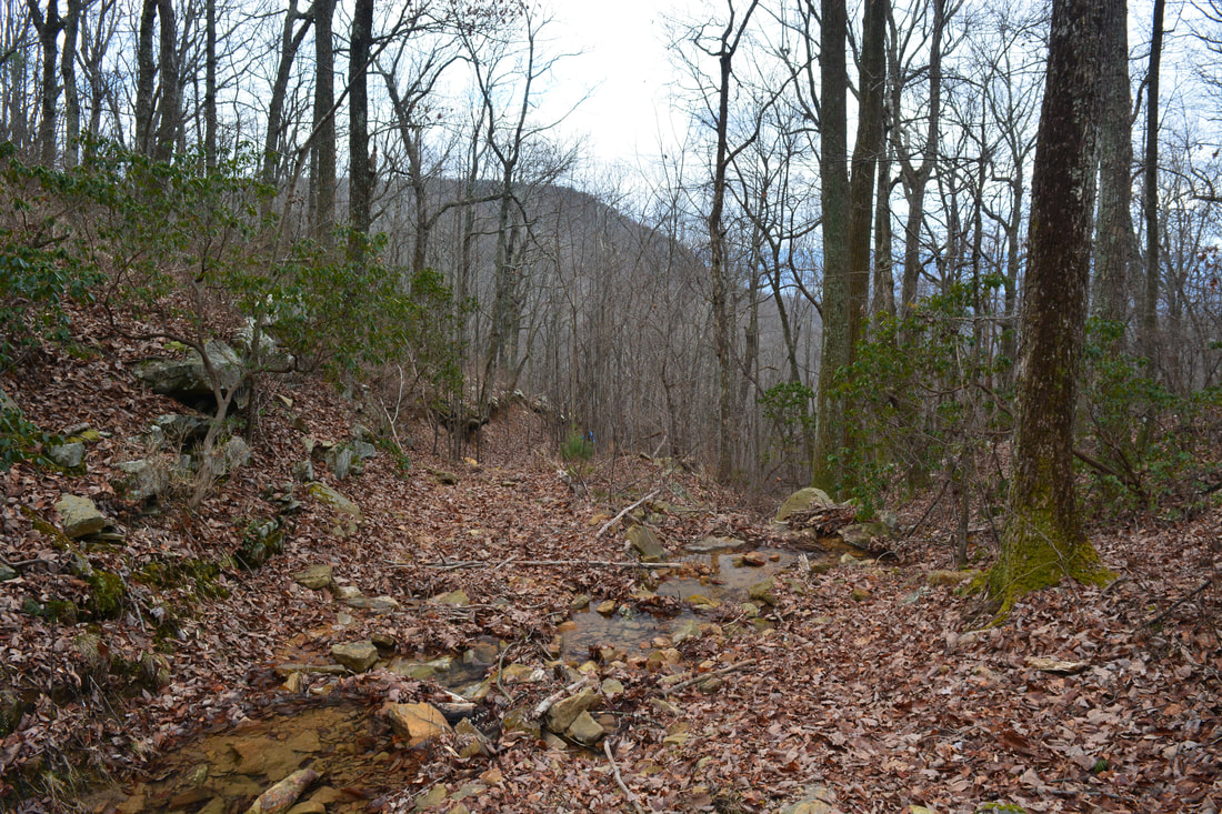
From Nash Pit Falls, return to the Chamberlain Trail. The trail soon levels out and travels northward into the upper reaches of Atwood Gulf at a very easy grade. At 2.95 miles, the trail crosses an intermittent stream shown on topographic maps. There are two waterfalls on this stream: Lower and Upper Atwood Gulf Falls. The waterfalls are close to each other and are about 0.1 mile above the trail crossing. Although Upper Atwood Gulf Falls is fairly tall, it's worth it only after extended periods of heavy rain. The stream normally has very low volume, so the falls look good only during excessively wet periods. A rather steep ascent with a couple switchbacks to the plateau begins after the stream crossing. Pretty boulder fields surround the trail near the top. As the trail reaches the top, it crosses a small stream twice at 3.4 miles. The Chamberlain Trail then reaches its upper end at 3.7 miles, where there's a junction with the Atwood Trail. 

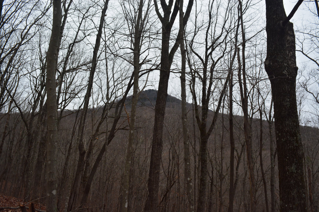
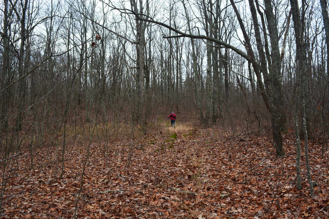
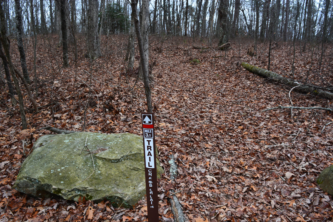
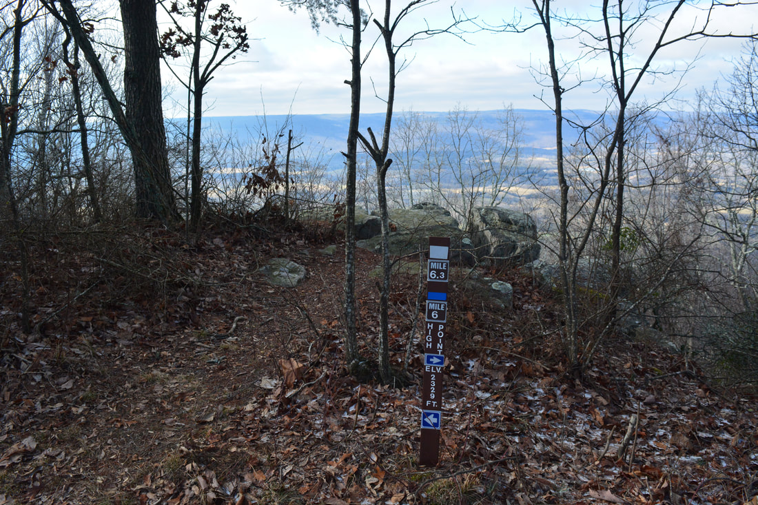
The northernmost part of the Atwood Trail that the Chamberlain Trail meets up with follows a seasonal forest road that leads to Atwood Point. As far as I know, there's no good views at Atwood Point, so it's probably not worth the side trip. While the trail to Atwood Point continues straight, this hike turns right onto the Atwood Trail toward High Point. At 3.9 miles, the Atwood Trail ends at a junction with the Bluff Trail and Pocket Trail (they run in conjunction). Turn left onto a narrower footpath, blazed blue and white, to hike to High Point. This is where the final easy-to-moderate 400-foot ascent to High Point starts. Winter views north into McLemore Cove abound along the trail. At 4.9 miles, the trail reaches the summit of High Point - the highest point on Pigeon Mountain. A rock outcrop provides a nice view of McLemore Cove and Lookout Mountain, but the best view lies ahead along the trail. 0.15 miles later, at 5.05 miles, the Bluff/Pocket Trail passes a campsite by some rock outcrops to the right. This is where the best view atop High Point is at. Walk to the campsite and onto the far rock outcrop. From here, there is an unimpeded 180-degree panoramic view of McLemore Cove's patchwork fields. The long flat ridge of Lookout Mountain is on the far side of the cove. To the left, you can see Dougherty Gap in the distance at the head of the cove. 

Simply retrace your steps from High Point back to the Chamberlain Trailhead, concluding the hike at 9.6 miles.

Mileage

0.0 - Chamberlain Trailhead
1.65 - Nash Pit Falls 
3.7 - Upper end of Chamberlain Trail 
4.9 - High Point
5.05 - Main View from High Point
9.6 - Chamberlain Trailhead

Variations

Hike out and back to Nash Pit Falls - 3.3 Miles

Bonus Stops

A nice bonus stop for this hike is the short trail to 70-foot Dickson Falls off Rocky Lane. 

Pictures & Videos

2 Comments
Leo link
2/25/2018 03:28:36 pm

Thank you for introducing me to this hike. Two of my buddies and I did this route recently. The Nash pit was spectacular! Your trail description was spot on and the directions were flawless. This hike is a hidden gem: we were the only hikers there on a near-perfect Saturday. I am grateful for your excellent website: what a wealth of information it is.

Reply
Amber Hall
7/18/2018 11:47:43 pm

Where is this at from Uncle Jed's store can you give me route directions from the Crawford Pigeon Mountain we wrestle cases or is it located around there I'll be coming from Town Square in Lafayette

Reply


Leave a Reply.

    About Me

    Mark Oleg Ozboyd
    I'm an avid outdoor explorer and a hobbyist landscape photographer. I'm 21 years old and have been hiking since 2011. Originally based out of Atlanta, Georgia, I started out by occasionally hiking short trails throughout well-known Georgia State Parks. During 2012 and 2013, I began to expand my trips into adjacent states, as well as into the wilder National Forest areas rather than just State Parks. Throughout the years that followed, as I slowly ran out of popular hiking trails in my area, I began to search for and hike in more seldom-visited areas. Today, you can find me out in the woods every weekend, whether it's on an official trail or bushwhacking through cross-country terrain without any paths. I now attend Washington & Lee University and am exploring Virginia and West Virginia. My other hobbies include chess, science, old music, and meteorology. I have 3 years of amateur weather forecasting experience, having studied a lot of meteorology basics over the years. I am also a student at European School of Music where I learned that music and nature have a lot in common. Listening to good music inspires me to capture nature's beauty on the camera in different aspects that also make me recall many beautiful music pieces that I've heard.​


    Dear readers: I have invested a tremendous amount of time and effort in this website and the Georgia Waterfalls Database the past five years. All of the work that has gone in keeping these websites updated with my latest trip reports has almost been like a full-time job. This has not allowed me to pick up a paid job to save up money for college, and therefore, I I've had to take out loans. If you find the information on this website interesting, helpful, or time-saving, you can say "thanks" and help me out by clicking the button above and making a contribution. I will be very grateful for any amount of support you give, as all of it will apply toward my college tuition. Thank you! 

    Enter your email address to subscribe for trail reports:

    Delivered by FeedBurner


    Picture
    Coming in 2022-2023?

    Other Hiking Websites

    DWHike's Adventures
    Florida's Natural Wonders
    Florida Trailblazer
    Meanderthals
    Mountain Images
    by Bernie Boyer

    North Carolina Waterfalls with
    ​Kevin Adams
    Take-a-Hike!
    Tennessee Landforms
    Waterfall Page
    Waterfall Adventurer
    Zach's Mild Adventures

    Miles Hiked

    Year 1: 540.0 Miles
    Year 2: 552.3 Miles
    ​Year 3: 518.4 Miles
    Year 4: 482.4 Miles
    Year 5: 259.9 Miles

    Archives

    March 2021
    February 2021
    January 2021
    November 2019
    October 2019
    September 2019
    August 2019
    July 2019
    June 2019
    February 2019
    January 2019
    December 2018
    November 2018
    October 2018
    August 2018
    July 2018
    June 2018
    May 2018
    April 2018
    March 2018
    February 2018
    January 2018
    December 2017
    November 2017
    October 2017
    September 2017
    August 2017
    July 2017
    June 2017
    May 2017
    April 2017
    March 2017
    February 2017
    January 2017
    December 2016
    November 2016
    October 2016
    September 2016
    August 2016
    June 2016
    May 2016
    April 2016
    March 2016
    January 2016
    December 2015
    November 2015
    October 2015
    September 2015
    August 2015
    July 2015
    June 2015
    May 2015
    April 2015
    March 2015
    February 2015
    January 2015
    December 2014
    November 2014
    October 2014
    September 2014
    August 2014
    July 2014
    June 2014
    May 2014
    April 2014
    March 2014
    February 2014

    Categories

    All
    Adel
    Adirondack Park
    Alabama
    Alfred A. Ring Park
    Allegheny Trail
    Amicalola Falls State Park
    Anniston Area
    Apalachicola Bluffs And Ravines Preserve
    Apalachicola National Forest
    Apalachicola/Port St. Joe Area
    Apopka
    Appalachian Trail
    Appling
    Art Loeb Trail
    Aska Trail System
    Bakersville
    Balm-Boyette Scrub Preserve
    Balsam Lake Recreation Area
    Bankhead National Forest
    Bartow County Parks
    Bartram Trail
    Basinger
    Beersheba Springs
    Benton
    Benton Mackaye Trail
    Berry College Trail System
    Best Hike
    Big South Fork National Recreation Area
    Black Bear Wilderness
    Black Rock Mountain State Park
    Blairsville
    Blakely
    Blood Mountain Wilderness
    Blowing Rock
    Blue Ridge
    Blue Ridge Parkway
    Boone
    Bradenton
    Bradenton Beach
    Brasstown Bald
    Brasstown Wilderness
    Brevard
    Bryson City
    Buchanan
    Bucks Pocket State Park
    Bulow Creek State Park
    Bulow Plantation Ruins State Park
    Caesars Head State Park
    Caladesi Island State Park
    Calhoun
    Camel's Hump State Park
    Cashiers
    Caspersen Beach Park
    Catfish Creek State Park
    Caves
    CC Putnam State Forest
    Cedar Point Environmental Park
    Chatsworth
    Chattahoochee National Forest
    Chattanooga
    Chattanooga Valley
    Chattooga National Wild And Scenic River
    Cheaha Wilderness
    Cherohala Skyway
    Cherokee
    Cherokee National Forest
    Chiefland Area
    Chillhowee Recreation Area
    Chipley
    Chunky Gal Trail
    Circle B Bar Reserve
    Citico Creek Wilderness
    Citrus Wildlife Management Area
    Clarkesville
    Clayton
    Cleevland
    Cleveland
    Cloudland Canyon State Park
    Cohutta Wilderness
    Collier-Seminole State Park
    Cordele
    Cornelia
    Covington
    Crestview Area
    Crew-land-and-water-trust
    Cullowhee
    Cumberland Trail
    Dahlonega
    Dalton
    Dawson Forest Wildlife Management Area
    Dawsonville
    Dayton
    De Soto National Memorial
    DeSoto State Park
    Dillard
    Double Springs
    Ducktown
    Duncan Ridge Trail
    Dunlap
    Eagle's Rest Park
    Eastpoint
    Econfina Creek Wildife Management Area
    Eglin Air Force Base
    Elizabethton
    Elkins
    Elk Knob Game Lands
    Elk Park
    Ellicott Rock Wilderness
    Ellijay
    Emerson Point Preserve
    Englewood Area
    Enota Retreat
    Erwin
    Falling Waters State Park
    Fayetteville
    Fires Creek Recreation Area
    Fire Tower
    Flint River
    Florence Area
    Florida
    Florida Caverns State Park
    Florida Trail
    Foothills Trail
    Fort Mountain State Park
    Fort Myers Area
    Fort Payne
    Fort Payne Area
    Fort Yargo State Park
    Franklin
    Franklin Delano Roosevelt State Park
    Franklin-Marion State Forest
    Frozen Head State Park
    Gainesville
    Gainesville Area
    Gatlinburg
    George Washington National Forest
    Georgia
    Georgia Veterans Memorial State Park
    Glasgow
    Gorges State Park
    Grandfather Mountain State Park
    Great Smoky Mountains National Park
    Greeneville
    Green River Game Lands
    Gruetli-Laager
    Grundy Forest State Natural Area
    GTM Reserve
    Guana River Wildlife Management Area
    Hayesville
    Helen
    Hiawassee
    High Falls State Park
    Highlands
    Highlands Scenic Highway
    Hillsborough River State Park
    Hinson Conservation & Recreation Area
    Historic Sites
    Honeymoon Island State Park
    Hot Springs
    Huntington
    Inverness Area
    Jackson
    Jasper
    Jefferson National Forest
    Joan M. Durante Park
    Jonathan Dickinson State Park
    Jones Gap State Park
    Joyce Kilmer Slickrock Wilderness
    Joyce Kilmer - Slickrock Wilderness
    Juniper Prairie Wilderness
    Kelly Park
    Keown Falls Recreation Area
    Kolomoki Mounds State Park
    LaFayette
    Lake City Area
    Lake George Wild Forest
    Lake June-in-Winter State Park
    Lakeland Area
    Lake Placid
    Lake Russell Wildlife Management Area
    Lake Wales Ridge State Forest
    Laurel Fork North Wilderness
    Leffis Key Preserve
    Leon Sinks Geological Area
    Lexington
    Lineville
    Linville
    Linville Gorge Wilderness
    Lithia Springs
    Little Frog Wilderness
    Little Manatee River State Park
    Little River Canyon National Preserve
    Longboat Key
    Long Trail
    Lookout Mountain
    Lookout Mountain Battlefield
    Lovingston
    Lula Lake Land Trust
    Lumpkin
    Maggie Valley
    Manatee Springs State Park
    Marianna Area
    Mark Trail Wilderness
    Marlinton
    Mccaysville
    McMinville
    Mentone
    Middlesex
    Mistletoe State Park
    Monongahela National Forest
    Montreat
    Mountain Bridge Wilderness Area
    Mountain City
    Mountains To Sea Trail
    Mountains-to-Sea Trail
    Mount Rogers National Recreation Area
    Myakka River State Park
    Myron B. Hodge City Park
    Nantahala National Forest
    Naples
    Naples Area
    Natural Bridge State Park
    Neal Preserve
    New Castle
    Newport
    New River Gorge National Park
    New York
    North Carolina
    Ocala Area
    Ocala National Forest
    Ocean-to-Lake Trail
    Oconee State Park
    Oconee Station Historic Site
    Okaloacoochee Slough State Forest
    Oldsmar
    Oneida
    Orlando Area
    Ormond Beach
    Oscar Scherer State Park
    Oxford
    Palatka
    Palmetto Trail
    Panama City Area
    Panthertown Valley
    Parrish
    Paynes Creek Historic State Park
    Peaks Of Otter Recreation Area
    Pigeon Crockford Mountain Wildlife Management Area
    Pigeon-Crockford Mountain Wildlife Management Area
    Pigeon-Crockford Wildlife Management Area
    Pine Mountain
    Pinhoti Trail
    Pinnacle Park
    Pisgah Civitan Park
    Pisgah National Forest
    Pittman Center
    Pond Mountain Wilderness
    Ponds/Lakes
    Prentice Cooper State Forest
    Providence Canyon State Park
    Pumpkintown
    Quick Point Nature Preserve
    Raven Cliffs Wilderness
    Reed Bingham State Park
    Reliance
    Rice Creek Conservation Area
    Riverview Pointe Preserve
    Robbinsville
    Robinson Preserve
    Rock Creek Gorge Scenic Area
    Rock Island State Park
    Rome
    Rosman
    Sale Creek
    Salem
    Salt Springs
    Saluda
    Santa Rosa Beach
    Sarasota
    Sarasota Area
    Savage Gulf State Natural Area
    Scenic Views
    Scottsboro Area
    Sebring Area
    Sewanee
    Sheltowee Trace Trail
    Shining Rock Wilderness
    Signal Mountain
    Sipsey Wilderness
    Sky Valley
    Smithgall Woods State Park
    Snowbird Backcountry Area
    Soddy Daisy
    Soddy-Daisy
    Sopchoppy
    South Carolina
    South Cumberland State Park
    Southeastern Cave Conservancy
    Southern Nantahala Wilderness
    Sparta
    Sprewell Bluff Park
    Spring City
    Spring Hill
    Springs
    Spruce Pine
    Standing Indian Backcountry Area
    St. Augustine
    St. George Island State Park
    St. Joseph Bay State Buffer Preserve
    St. Marks Area
    St. Marks National Wildlife Refuge
    Stone Mountain
    Stone Mountain Park
    Suches
    Sumatra
    Sumter National Forest
    Suwannee River
    Swallow Creek Wildlife Management Area
    Sweetwater Creek State Park
    Sylva
    Talladega National Forest
    Tallahassee Area
    Tallulah Falls
    Tallulah Gorge State Park
    Tampa Bay Area
    Tate City
    Tate's Hell State Forest
    Tea Creek Wildlife Management Area
    Tellico Plains
    Tennessee
    Thomaston
    Toccoa
    Topsail Hill State Park
    Torreya State Park
    Townsend
    Tracy City
    Tray Mountain Wilderness
    Trenton
    Triple Creek Preserve
    Troutdale
    Unaka Mountain Wilderness
    Upper Tampa Bay County Park
    Venice
    Vermont
    Virgin Falls State Natural Area
    Virginia
    Virginia Outdoors Foundation
    Vogel State Park
    Wakulla Springs State Park
    Waleska
    Walhalla
    Wartburg
    Water Features
    Waynesville
    Weedon Island Preserve
    Weeki Wachee Preserve
    Wekiwa Springs State Park
    West Palm Beach Area
    West Virginia
    Whitehall
    White Springs
    Winder
    Withlacoochee State Forest
    Young Harris

    RSS Feed

TRAIL REPORTS

Hikes in Alabama
​Hikes in Florida
Hikes in Georgia
Hikes in North Carolina
Hikes in South Carolina
Hikes in Tennessee
Hikes in Virginia

Hiking Resources

Alabama Resources
​
Florida Resources
Georgia Resources
North Carolina Resources
​South Carolina Resources
​
Tennessee Resources

Other

Contact
Map of Hikes
Alphabetical List of Hikes
Southeast Nature Society
© COPYRIGHT 2014-2018
​ALL RIGHTS RESERVED.
Important: I disclaim any responsibility for any damage or personal injury that may occur as a result of the activities and information found on this website. All outdoor activities, especially off-trail hiking, are done at your own risk. Never hike or head into that area that may be above your fitness or experience level.
  • Home
  • Trail Reports
    • Best Hikes
    • Hikes with Scenic Views
    • Hikes with Water Features
    • Alabama
    • Georgia
    • Florida
    • North Carolina
    • South Carolina
    • Tennessee
    • Vermont
    • Virginia
  • Map
  • Hike List
  • Testimonials
  • Resources
  • Contact Us
  • Southeast Nature Society
    • Our Team
  • Georgia Waterfalls Database