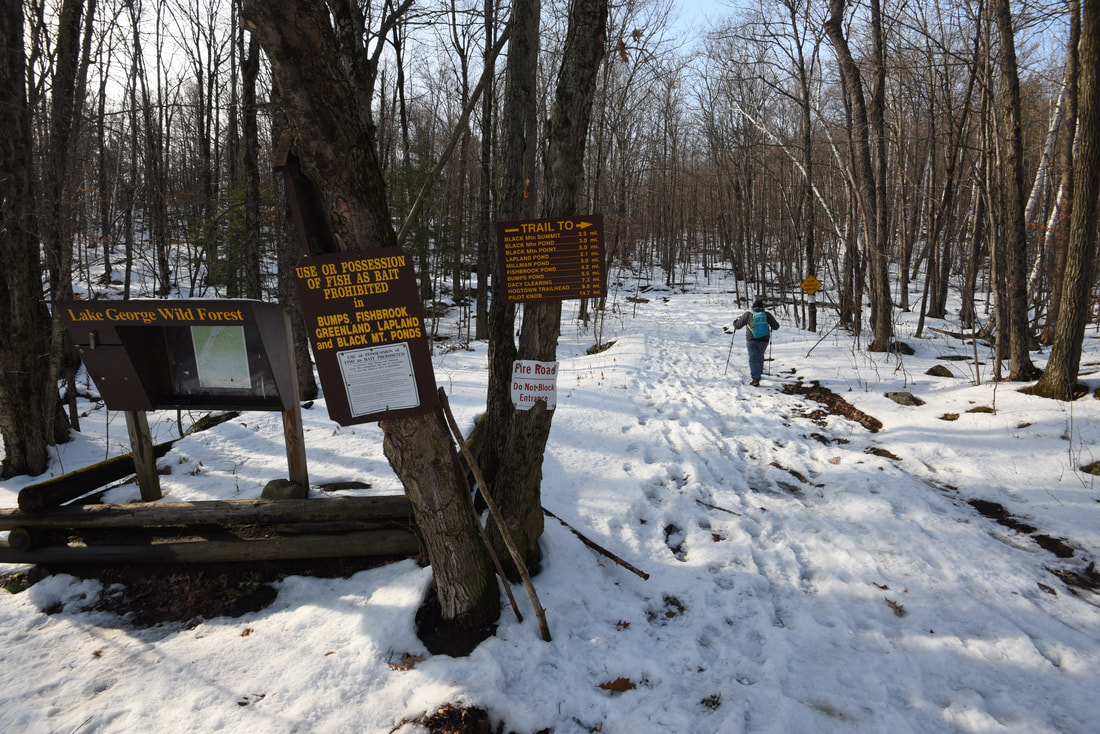
Towering over 2,000 feet above the east shore of Lake George is the little-known summit of Black Mountain. Given the fantastic views of Lake George and vicinity that Black Mountain provides both northward and southward, it is a wonder that this hike tends to stay so under-represented in the hiking community. Pike Brook Road serves as the starting point of the Black Mountain Trail, which reaches the summit in 2.5 miles with a remarkably well-graded climb. What's more, the full 7-mile loop drops down the back side of Black Mountain past multiple additional vistas before an exceptionally scenic traverse past Black Mountain Pond, Round Pond, and Lapland Pond. The Black Mountain Loop is definitely one of the highlight hikes of the Lake George area. Furthermore, this hike is a great winter pick for less experienced snowshoers, thanks to the trail's moderate grades and lack of the rock scrambling so typical to other parts of the Adirondack Park. This hike occurred on Tuesday, November 26th, 2019. My plan was to hike the Black Mountain Loop in a counter-clockwise direction from Pike Brook Road.
Summary
R/T Length of Trail: 7.1 Miles
Duration of Hike: 4:15 plus about one hour of stopping Type of Hike: Lasso Total Elevation Gain: 1646 Feet Difficulty Rating: 6 out of 10 Pros: Lots of panoramic views with a relatively easy ascent; great winter hike for those with less experience; diversity of scenery throughout the loop Cons: The first 0.6 miles of the trail (out and back) follow a double-track forest road that is slightly monotonous Points of Interest: Black Mountain views - 8 stars; Black Mountain Pond; Round Pond; Lapland Pond Trail Blaze Colors: Pike Brook Road to Loop Start - Red; Loop Start to Black Mountain Summit - Red; Black Mountain Summit to Black Mountain Point Trail Junction - Red; Black Mountain Point Trail Junction to Millman Pond/Fishbrook Pond Trail Junction - Blue; Millman Pond/Fishbrook Pond Trail Junction to Loop End - Yellow Best Seasons to Hike: Fall; Summer Fees: None Beginning Point: Pike Brook Road Trailhead Directions from Whitehall, New York: From the junction of Broadway (NY 22) and Poultney Street (US 4 East) in downtown Whitehall, follow NY 22 North for 7.2 miles. Then, turn left onto County Road 6. In another 2.6 miles, turn left onto Pike Brook Road. Continue for 0.8 miles to the Black Mountain trailhead parking area on the right. Map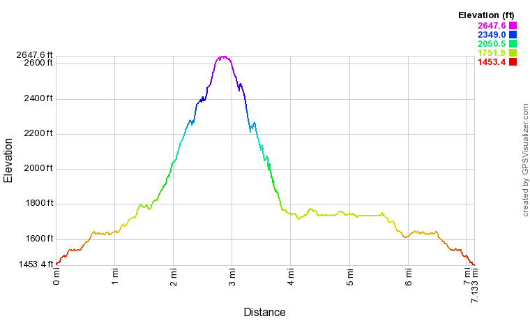
Click the link below to download a .GPX file with a track of this hike.
Details
The obscure summit of Black Mountain came up as I was searching for a relatively easy half-day hike within an hour of Middlebury that I could do without having to get up early. I wasn't necessarily looking for anything spectacular - just a pleasant outing in the woods with some varied scenery. So to say I was surprised by the scenery of the Black Mountain Loop would be an understatement. This is easily one of my favorite hikes I've done since moving to Vermont in September. Considering that the well-graded trails hardly required any effort to hike, the reward-to-effort ratio of this hike is immensely high.
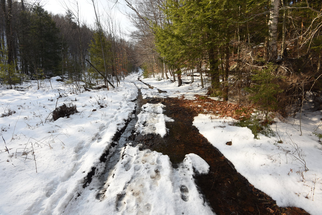
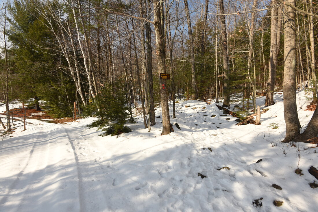
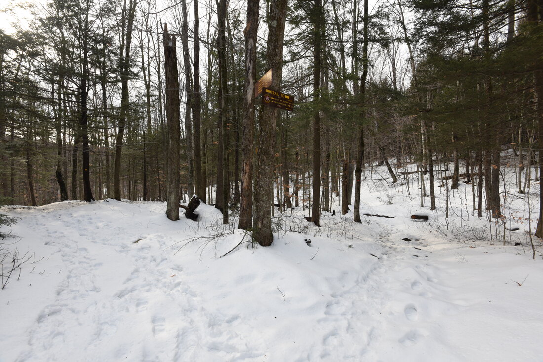
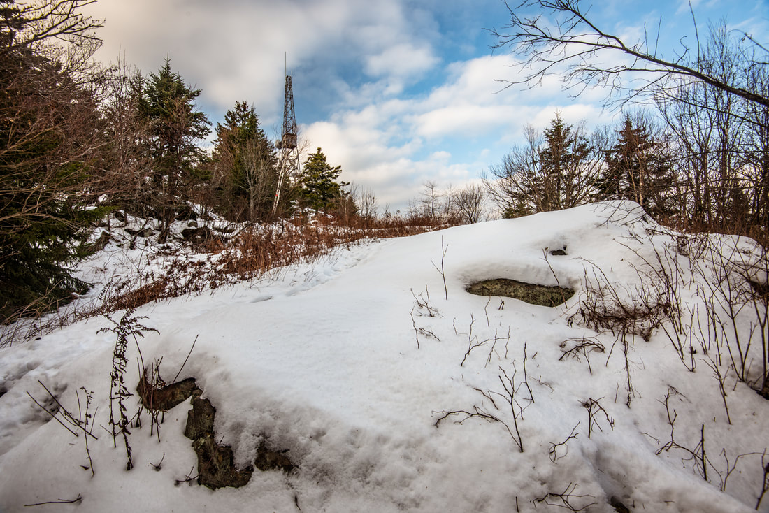
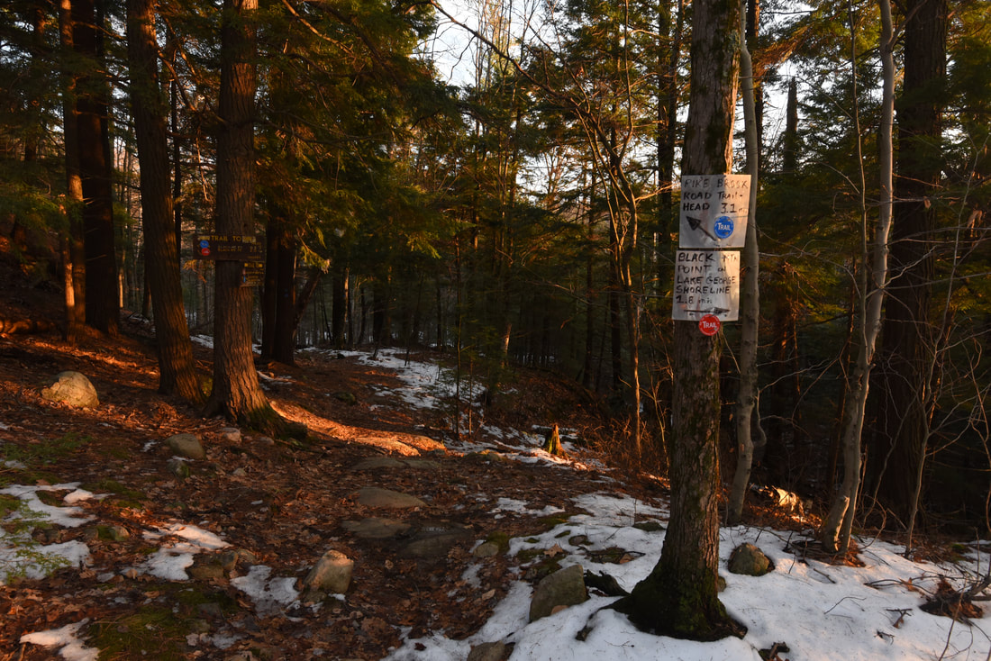
You can't miss the start of the trail, heading straight up a steep hill along a double-track forest road beside the trailhead kiosk. Around the first corner is a gate that is typically closed. It was open this day, likely due to it still being hunting season, but even if you find it open, I don't recommend attempting to drive the forest road as it is quite rough in places and not that long. The trail turns west after 0.15 miles and becomes a very pleasant walkway as it levels out alongside a small rivulet. At 0.6 miles, the trail bumps up along a private inholding. The road leads past another gate and into a clearing with multiple structures within the private inholding. Be sure to follow the red blazes and bear right off the road and onto a narrower trail toward Black Mountain. At 1.05 miles (the sign reads 1.2 miles), reach a Y-fork that indicates the start of the Black Mountain Loop. To the left is the yellow-blazed trail to Lapland Pond, while to the right is the more direct trail to Black Mountain. I recommend bearing right, like I did, to get done with the main ascent sooner and leave the more undulating trail that interconnects the ponds for the latter half of the hike. The trail gains 1,000 feet in elevation over the next 1.8 miles - a very tame grade for Adirondack Park trails. The ascent remains on a relatively broad trail and steepens at a very gradual pace. You will cross a few seeps and climb up a couple minor rock outcrops, but nothing particularly worth nothing. As you gain elevation in the winter, you might notice through the trees the fire tower and wind turbine adorning Black Mountain's summit. The tower is again visible at 2.5 miles, now straight ahead and much closer. The trail doesn't take the most direct track to get there, circling around the cliffs that adorn Black Mountain's north slopes. The woods are a rather dense mix of high-elevation deciduous forest and some spruce, mostly precluding seasonal views of your surroundings. The woods finally start opening up at 2.8 miles as the trail emerges into a grassy clearing immediately below the summit. The old stone footings in the clearing are all that remains of another, older fire tower that used to occupy this spot. The clearing has fine views northeast toward Lake George, but wait until the summit rock with its similar but more expansive view. 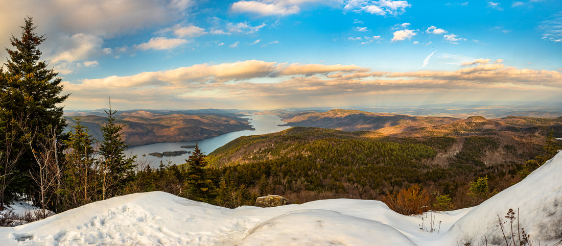
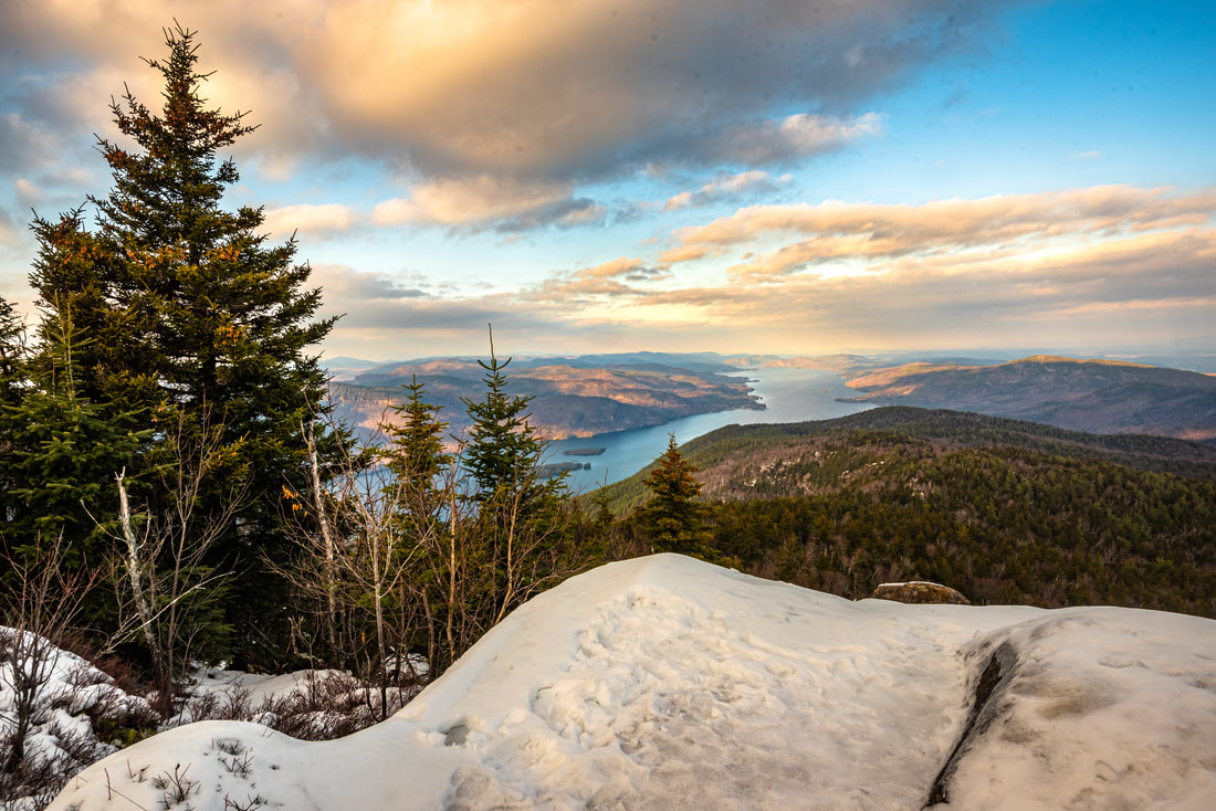
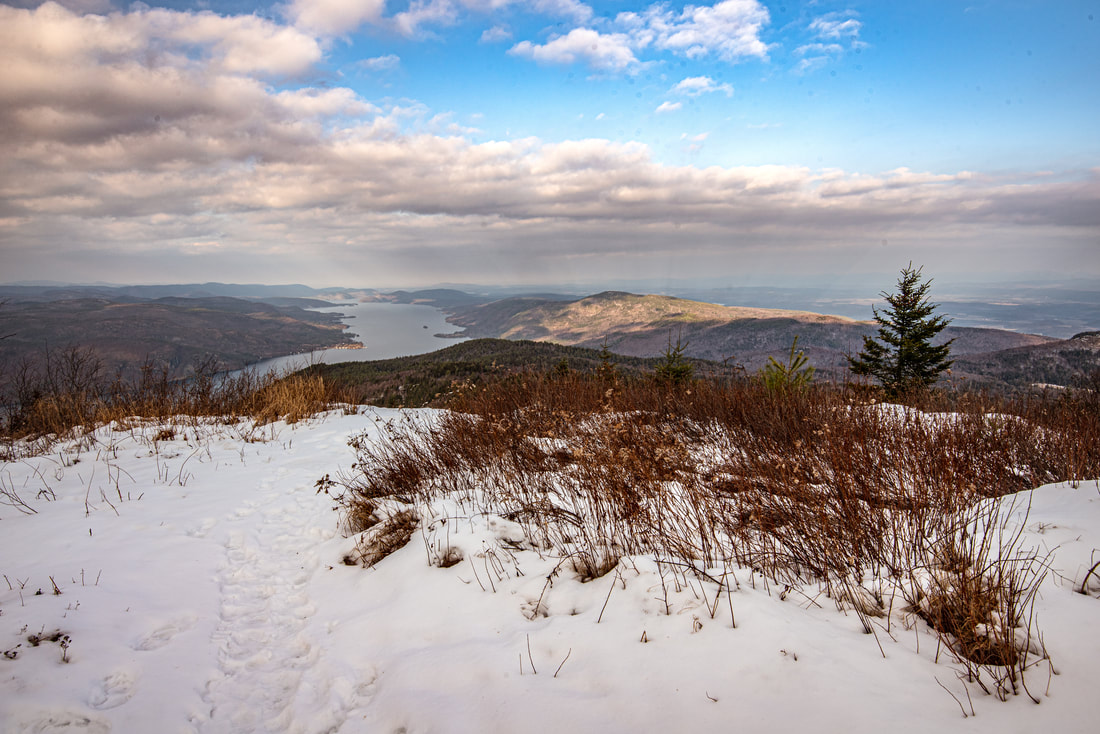
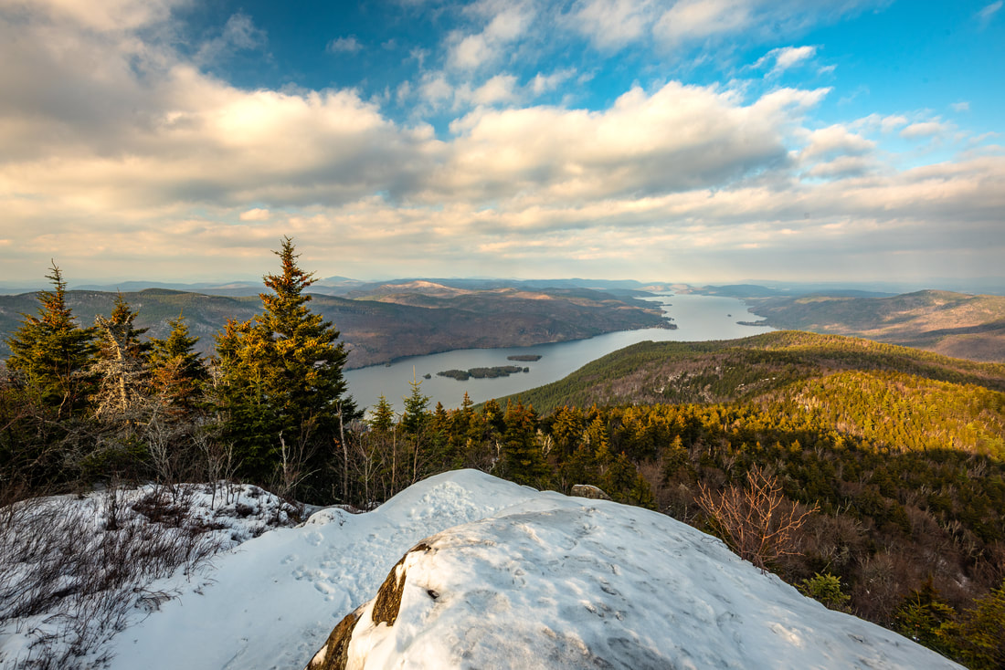
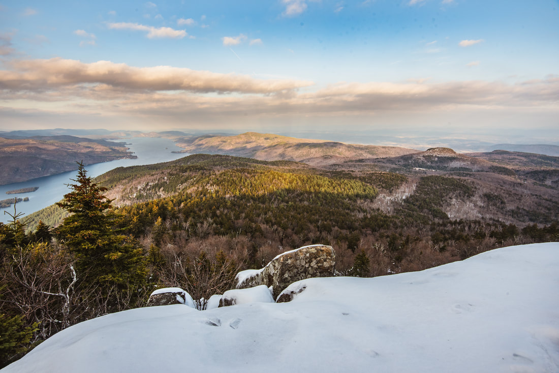
The north-facing rock outcrop crowning Black Mountain's summit features a splendid view of the Lake George basin and even the hazy Green Mountains across the state line in Vermont.
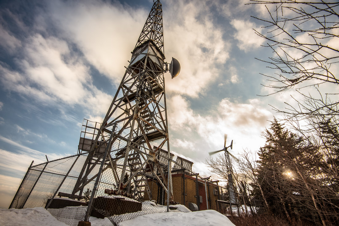
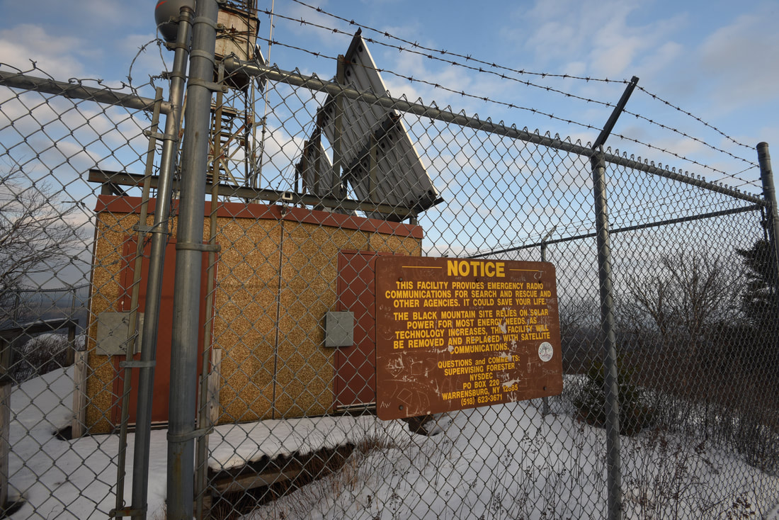
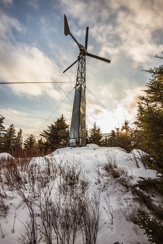
The main trail turns left at the clearing, reaching the Black Mountain summit at 2.85 miles. At an elevation of 2,640 feet, Black Mountain possesses the honor of being the highest peak on the Lake George 12'er list. On the right is the old fire tower, positioned within a heavily-fenced enclosure. The fire tower now doubles as a facility that relies on solar energy to provide emergency radio communications for search and rescue agencies, so the tower is closed to the public. A sign states that the radio communications equipment will be removed in the future and replaced by satellite communications - I wonder if the fire tower will then be opened to hikers. To the left of the trail stands a small wind turbine that I assume is somehow related to the radio communications tower. If you're here on a day with a breeze, you will have heard the noise of the turbine's rotating blades well before reaching the summit.
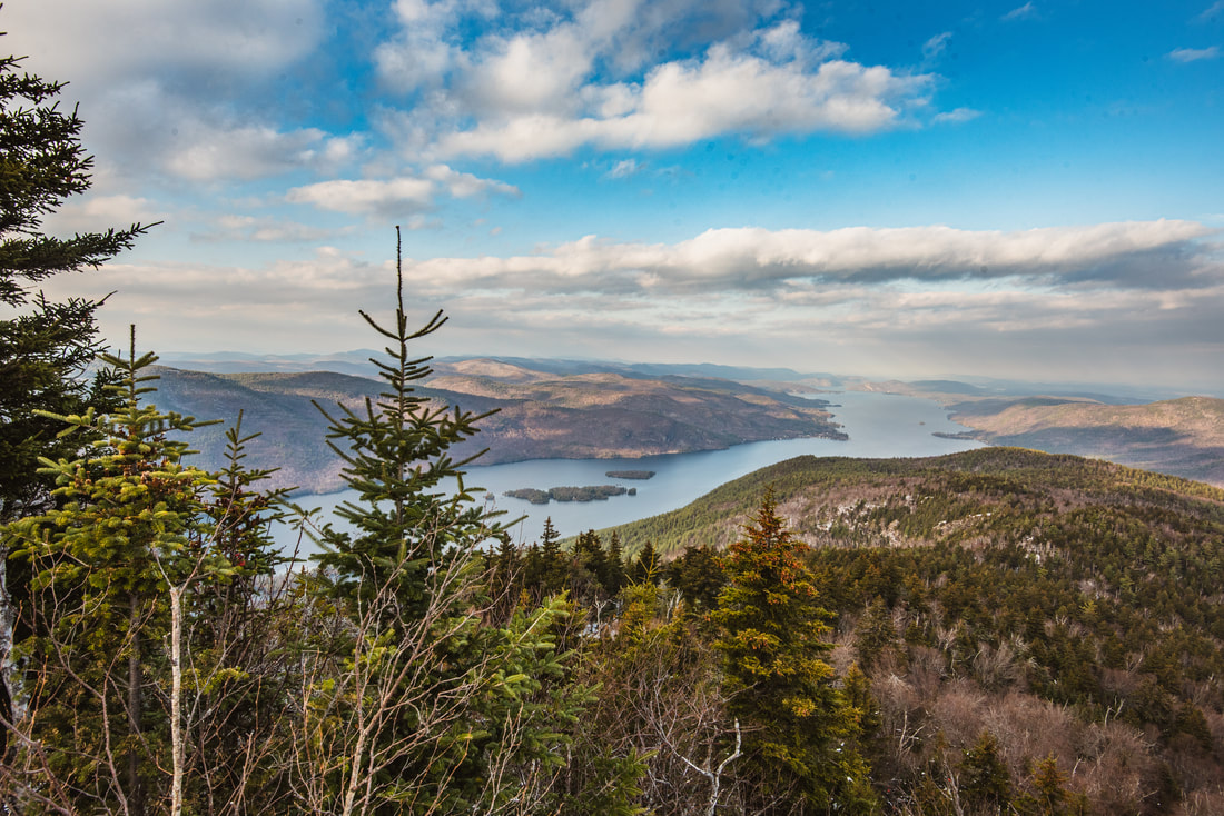
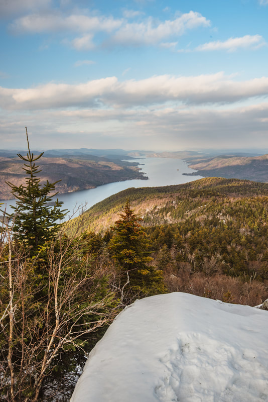
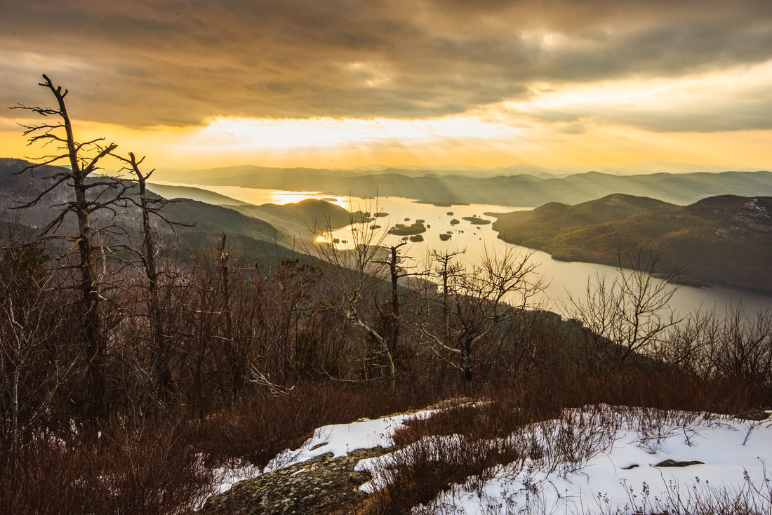
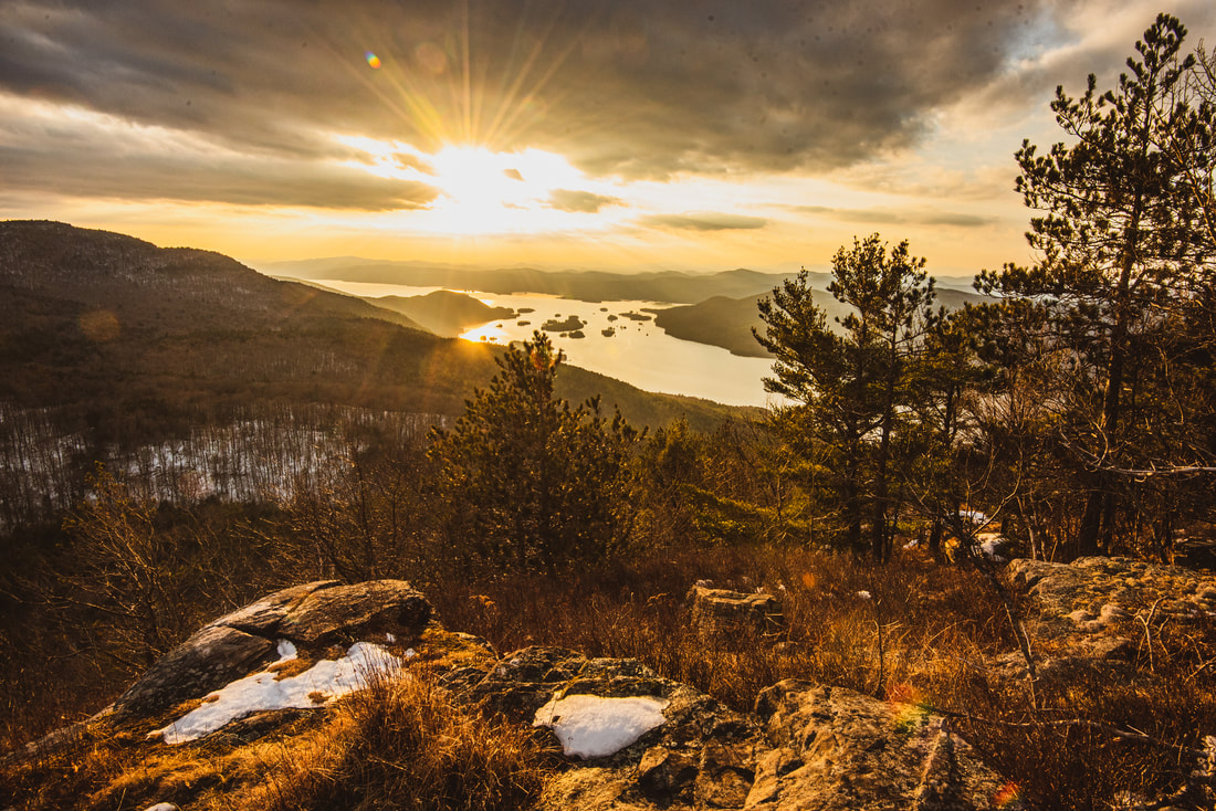
A few feet past the summit, the red-blazed Black Mountain Trail turns left, marked by a sign that informs it is one mile to the junction with the trail to Black Mountain Pond. But hold up! Be sure to turn right here first onto the well-traveled path that emerges in just a few dozen feet atop the rock outcrop that features Black Mountain's best north-facing view (and is the cover photo for this trip report). Spread out in front of you is the picture-perfect north sector of Lake George, socked into a gentle valley that runs due north toward the town of Ticonderoga. Looking right in a more northeast/east direction, the rolling Taconic hills gradually fade into the southern extent of the Lake Champlain Valley, framed by Vermont's Green Mountains on the horizon. As you return to the main trail junction, I highly encourage you to keep hiking the Black Mountain Loop instead of just returning the same way along the shortest route. Not only will you see several more views of Lake George, but the trail section that traverses the shorelines of the multiple ponds just southeast of Black Mountain is a large part of what makes this hike so scenic. As you start following the Black Mountain Trail south along the summit ridge, you will instantly notice that this part of the trail is significantly narrower and lesser-traveled. After a moderate period of descent, the trail passes through a semi-open shrubby area at 3.1 miles with nice seasonal views - watch out for an obscure side path bearing right across a small rock slab. The path leads 150 feet to a stunning southwest view down the heart of Lake George. In the very center of the scene are the Lake George Narrows, punctuated by its nearly two dozen tiny islands that look as if someone had scattered a bunch of crackers. The rugged slopes of the Tongue Mountain Range on the west shore and Shelving Rock Mountain on the east shore run toward each other to squeeze the islands into Lake George's most dramatic section. I was fortunate enough to reach this vista about an hour of sunset, when the sun was about to emerge beneath a grouping of stormy clouds hovering above the narrows. Crepuscular rays streamed down right over the narrows and the unseen sun painted the threatening clouds in a surreal orange glow. 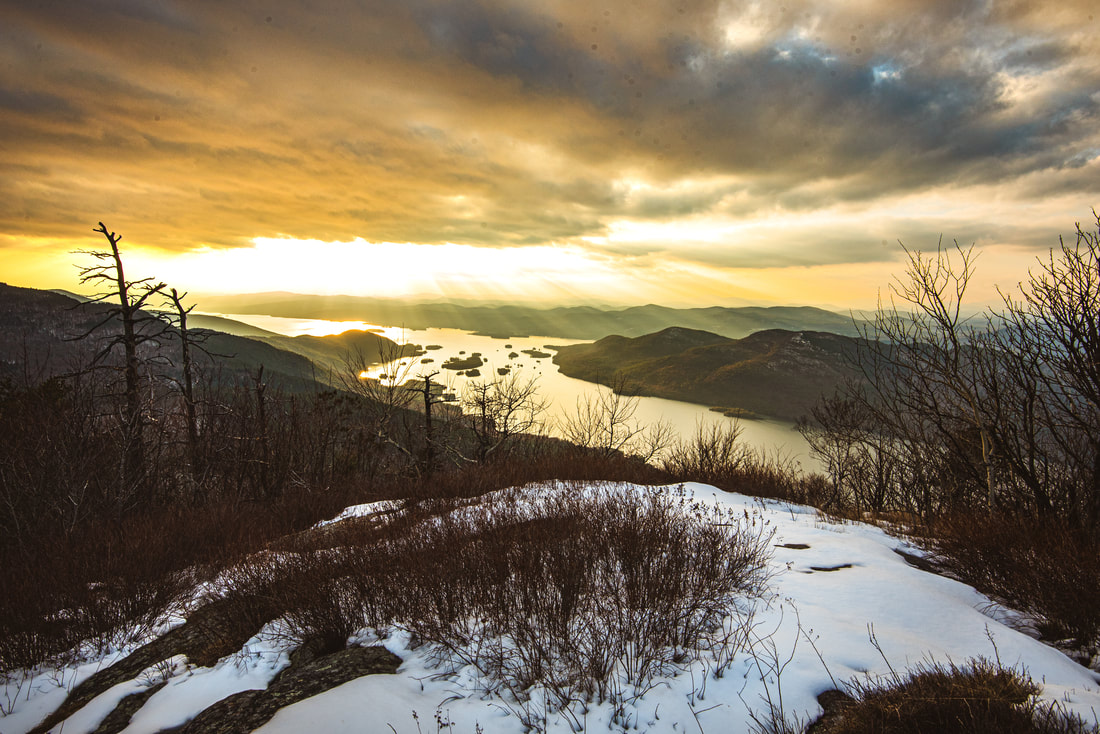
In addition to the obvious summit view facing the north end of Lake George, Black Mountain also has superb southwest views over the island-filled Lake George Narrows.
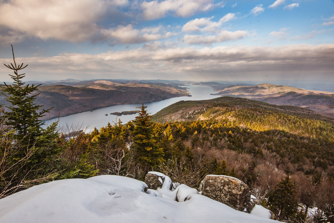
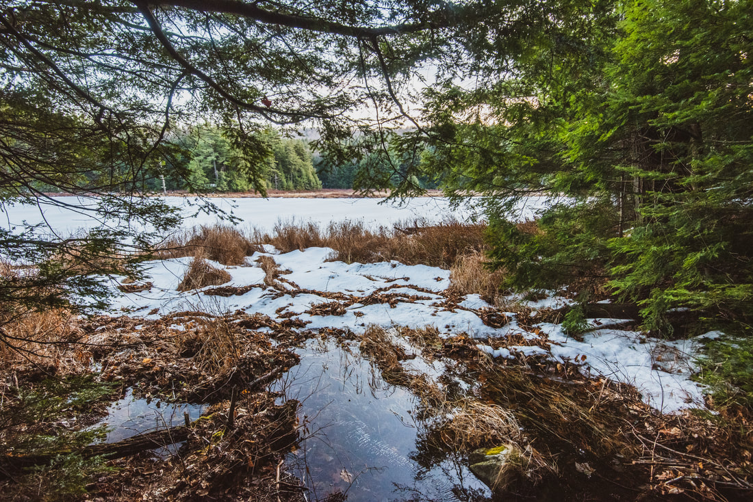
Returning to the main trail, you'll begin a steeper descent toward Black Mountain Pond. The trail passes below a set of scenic cliffs around 3.3 miles - in the winter when the leaves are off the trees, there are nearly continuous views of the Lake George Narrows here. This is a very well-constructed trail that utilizes ample switchbacks as it loses elevation - an innovation I have not spotted frequently on Adirondack Park Trails. Watch for a well-used side trail on the left at 3.5 miles that leads to another rock outcrop with open southward views. The Lake George Narrows are once again in the view; Erebus Mountain dominates the view in front of you. To the left is a chain of ponds and wetlands - frozen on this day - that includes Black Mountain Pond and Round Pond. The main trail continues a fairly steep descent with switchbacks, passing a path to one more similar view of Black Mountain Pond and Erebus Mountain at 3.65 miles. At 3.9 miles, the trail finally bottoms out at an important trail junction.
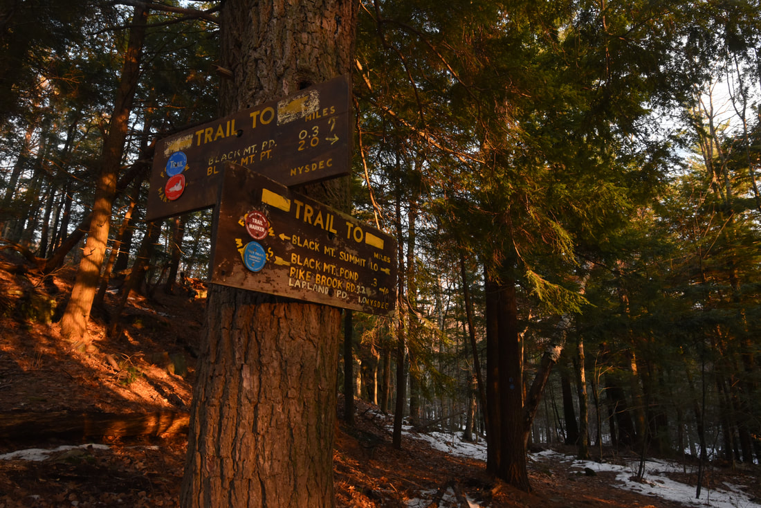
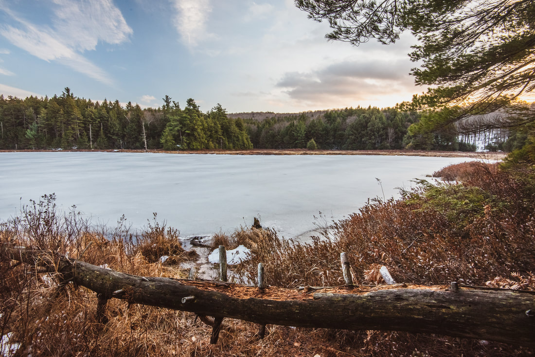
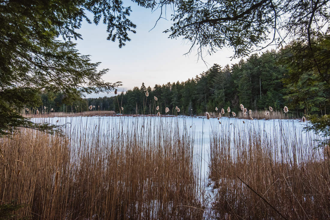
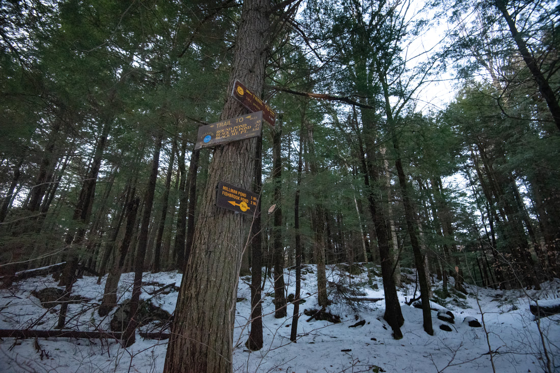
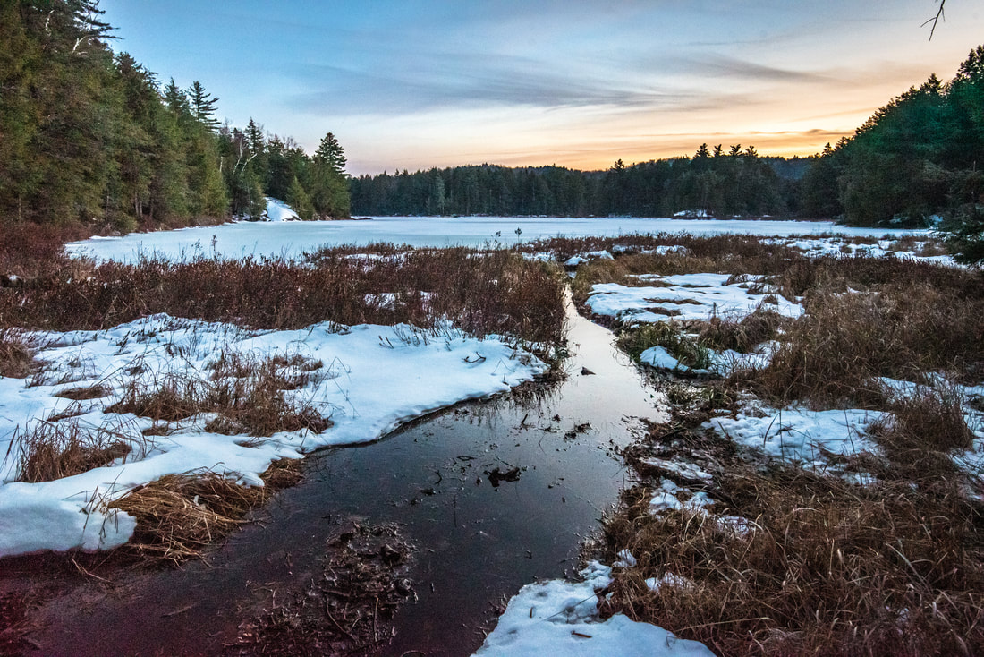
The red-blazed trail to Black Mountain Point on Lake George leaves right. This trail continues descending quite steeply, dropping 1400 feet in 2.0 miles before reaching the lake shoreline. From Black Mountain Point, you could then follow a trail that traces the Lake George shoreline for several miles before eventually reaching the Shelving Rock area, but that is well beyond the scope of this trip report. Our hike continues straight ahead on the blue-blazed trail toward Black Mountain Pond and Lapland Pond. The trail passes through a relatively flat but rocky gap of sorts before arriving by the edge of Black Mountain Pond at 4.15 miles. A few yards farther, the trail crosses a slanted rock outcrop with a nice panoramic view of this evergreen-lined pond. Above the rock on the left stands a room with a view - a classic Adirondack lean-to looking out over the serene, wilderness pond. The trail crosses a couple small streams draining the slopes of Black Mountain before abruptly rising away from the pond and meandering through cross-country terrain. I must say I was a little surprised by the amount of elevation change found on the trail section between Black Mountain Pond and Lapland Pond. There's no extended climbs, of course, but the trail isn't really ever flat either. The trail drops to the shore of Round Pond at 4.6 miles, lined by a wall of cottongrass so dense that the pond's waters were hardly visible. The trail circumnavigates this pond, passes through another faint gap, and reaches a T-junction with a yellow-blazed trail at 4.95 miles. If it sounds like I'm hesitant to apply names to these trails, it's because I am - Adirondack Park trails are unique in that they often aren't assigned specific names. Instead, the term "Trail to" is used, followed by a list of destinations along the route. But I digress. To the right, the trail leads a mile to Millman Pond and then another mile to Fishbrook Pond. Eventually, this trail can be used to access Sleeping Beauty Mountain, another one of the Lake George area's prominent peaks and also on the Lake George 12'er list. However, our loop hike turns left back in the direction of the Pike Brook Road Trailhead. 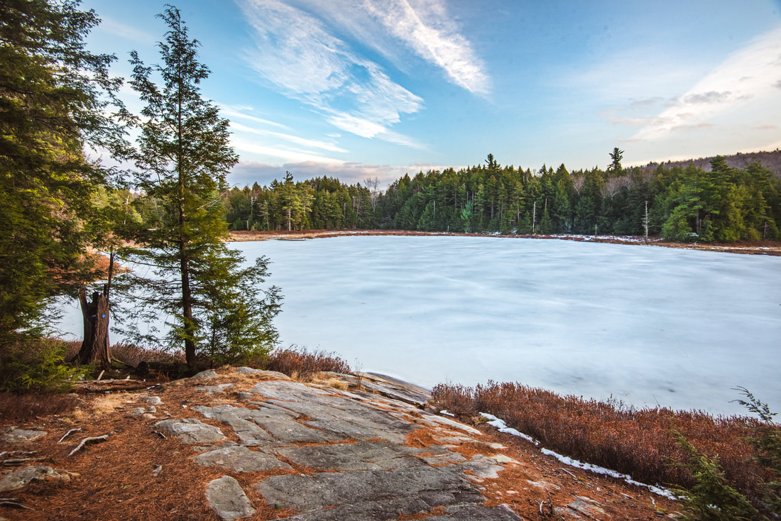
An elevated rocky trailside perch provides a serene, wilderness view of Black Mountain Pond.
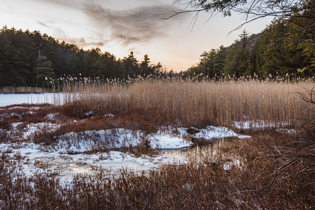
As you follow the yellow-blazed trail north, Lapland Pond soon comes into view through the trees on your right. An opportunity for a more open view presents itself at 5.1 miles, where a side trail leaves right to the shore and to another lean-to overlooking the pond on a dry, rocky perch. Lapland Pond is the largest pond of the day, though similar to the others by character. As I photographed the pond under the pale pink colors of sunset, a disturbed beaver plunged into the water, easily cracking the thin November ice.
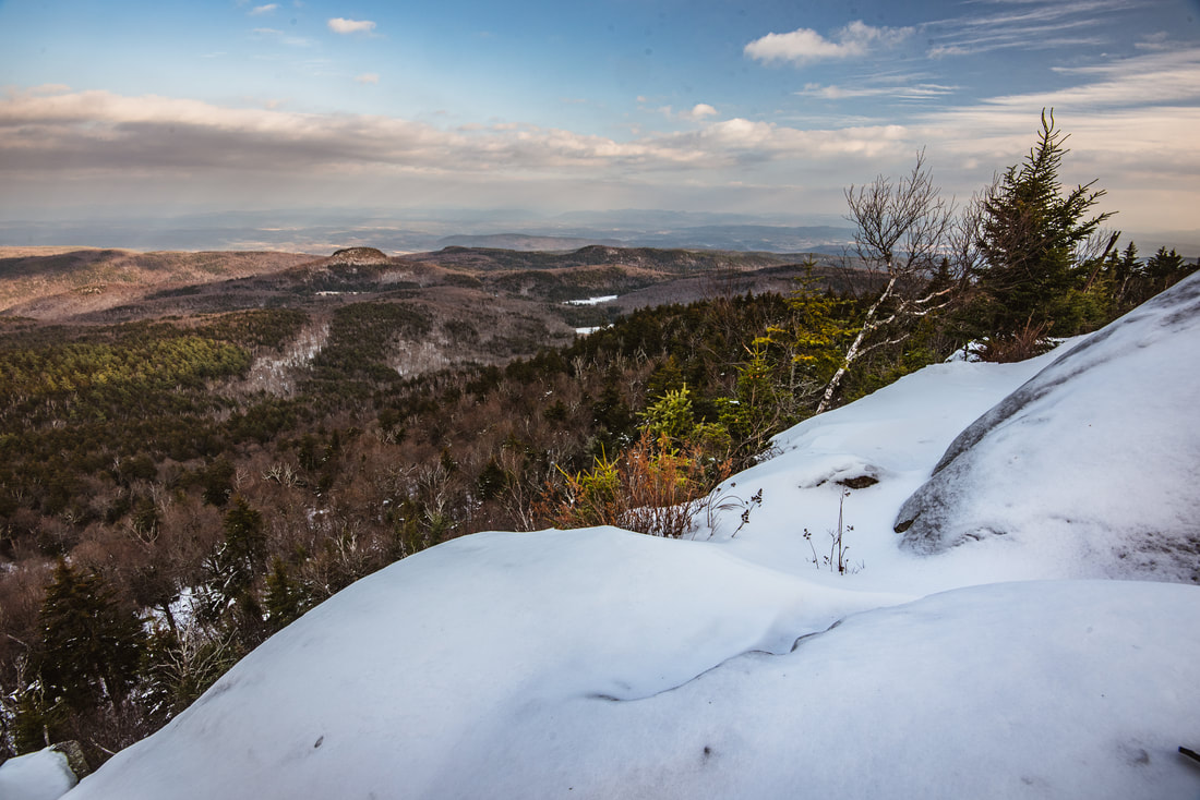
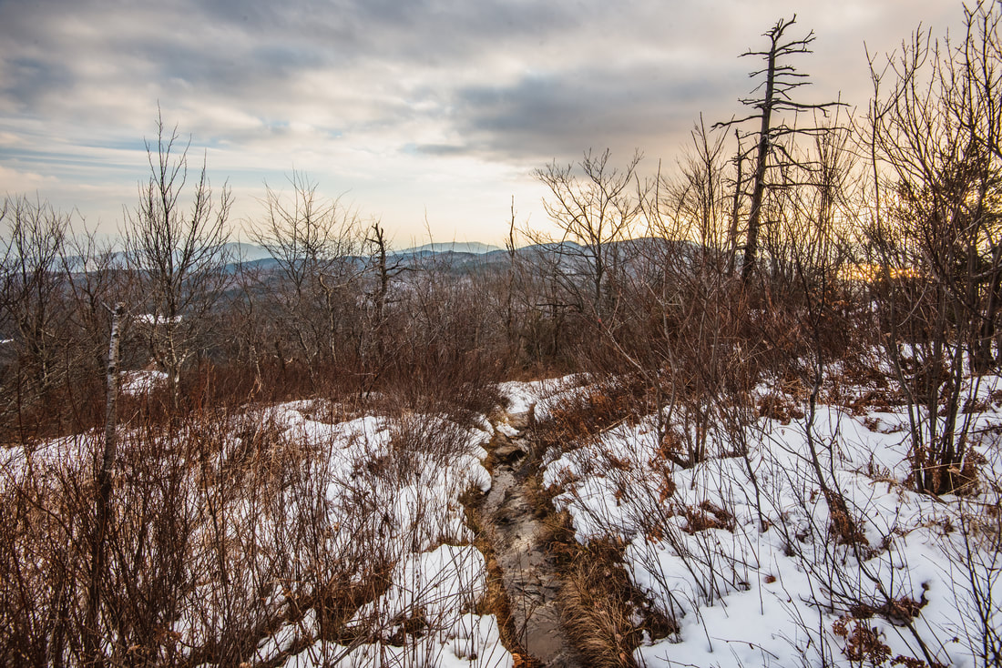
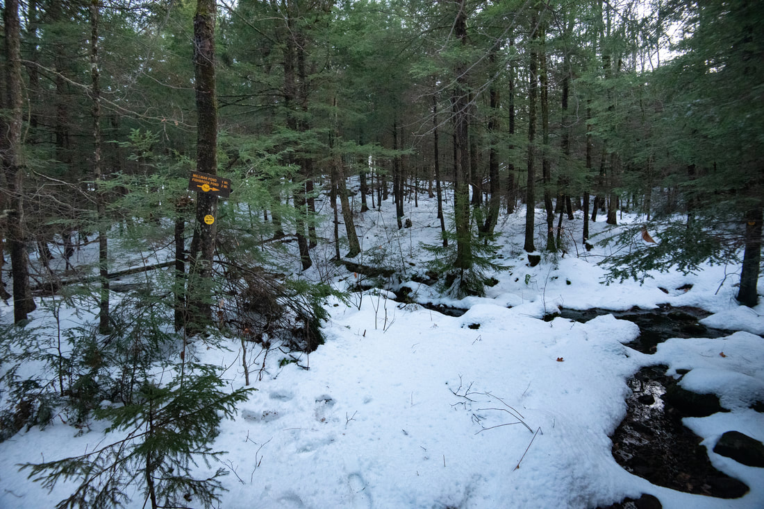
Back on the main trail, you'll make a gentle ascent before leveling out in a rather boggy region. The fragile snow cover concealed what seemed to be a tremendous amount of mud, but I have no doubt this part of the trail can get quite messy, especially in the spring. Between 5.5 and 5.6 miles, the trail skirts the right side of a small wetland with an impressive collection of beaver signs - I counted over a dozen trees that were definitely felled by beavers, including a couple across the trail. Then, a brief descent brings the trail to a stump-punctuated wetland that looks like a pond but is not shown on the topo map. A wooden boardwalk crosses the pond's outflow stream at 5.9 miles. Finally, at 6.05 miles, reach a familiar junction - you have now rejoined the Black Mountain summit trail and closed the loop. Bear right and now trace the day's earlier steps, past the private residence and down the old forest road. You will conclude the hike on your return to the Pike Brook Trailhead at 7.1 miles. To summarize, I highly recommend for everyone in the area to consider this spectacular, underrated hike. Black Mountain is hard proof that you don't have to be in the alpine zone or on a high peak to get an outstanding hiking experience. And be sure to do the full loop rather than just go out and back to the summit. Loop hikes like this one that feature a variety of scenery all throughout - from different vistas to scenic paths along ponds and bogs - are among my favorites. Pictures & Videos
1 Comment
Chuck Wilcox
8/20/2020 10:43:03 am
Great description of the hike..very informative and helpful...Thanks, C Leave a Reply. |
About MeMark Oleg Ozboyd Dear readers: I have invested a tremendous amount of time and effort in this website and the Georgia Waterfalls Database the past five years. All of the work that has gone in keeping these websites updated with my latest trip reports has almost been like a full-time job. This has not allowed me to pick up a paid job to save up money for college, and therefore, I I've had to take out loans. If you find the information on this website interesting, helpful, or time-saving, you can say "thanks" and help me out by clicking the button above and making a contribution. I will be very grateful for any amount of support you give, as all of it will apply toward my college tuition. Thank you!

Coming in 2022-2023?
Other Hiking WebsitesMiles HikedYear 1: 540.0 Miles
Year 2: 552.3 Miles Year 3: 518.4 Miles Year 4: 482.4 Miles Year 5: 259.9 Miles Archives
March 2021
Categories
All
|
||


 RSS Feed