
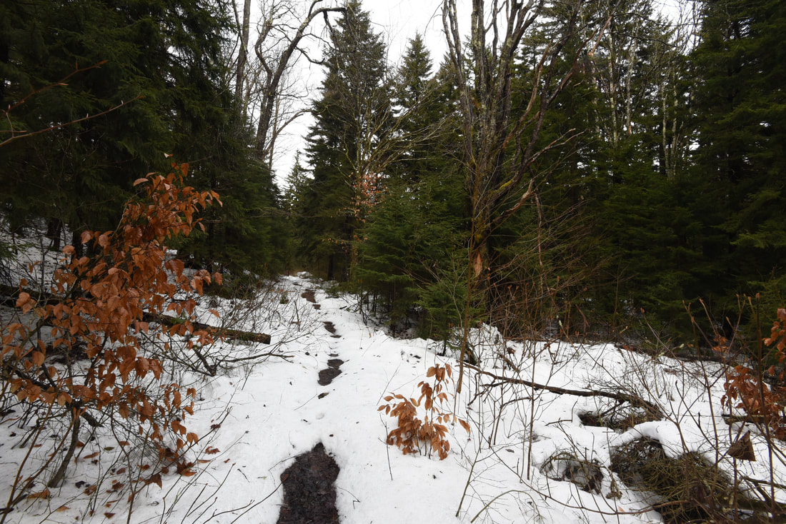
Just off NC 281 is a lesser-known entrance to the backcountry of Panthertown Valley: the West Fork Way trailhead. The unofficial West Fork Way ascends through the West Fork French Broad River watershed for several miles, passing the extremely steep access trail to three spectacular waterfalls: Rhapsodie Falls, Dismal Falls, and Lower Dismal Falls. West Fork Way then connects to another unofficial trail on the fringes of Panthertown Valley called the Shelton-Pisgah Trail, which follows a seldom-hiked pathway along the ridge of Shelton-Pisgah Mountain to Cold Mountain. A cliff on the west side of Cold Mountain, nicknamed the High Bethel View features an outstanding vista of Panthertown Valley spread out to the west - arguably the best of the valley's five views. This hike occurred on Saturday, May 12th, 2018. My plan was to hike West Fork Way and Shelton-Pisgah Trail out and back to Cold Mountain. Along the way, I would take the side trails to Rhapsodie Falls, Dismal Falls, and Lower Dismal Falls. I would also stop by two other small falls - Aunt Sally's Falls and Lower Rhapsodie Falls.
Summary
R/T Length of Trail: 13.5 Miles
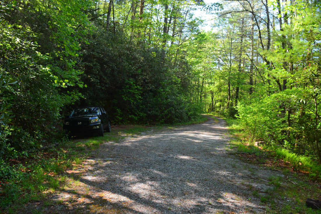
Duration of Hike: 9:00 plus 3.5 hours of stopping and photography Type of Hike: Out and Back Difficulty Rating: 10 out of 10 Total Elevation Gain: 4514 Feet Pros: Spectacular, little-known views and waterfalls Cons: Portions of the side trail to Dismal Falls are extremely steep and not suitable for average hikers Points of Interest: Aunt Sally's Falls - 2 stars; Lower Rhapsodie Falls - 3 stars; Rhapsodie Falls - 8 stars; Lower Dismal Falls - 6 stars; Dismal Falls - 10 stars; Shelton-Pisgah Mountain View - 6 stars; Cold Mountain View (High Bethel View) - 9 stars Trail Blaze Colors: None, not official trails Best Seasons to Hike: Spring Fees: None Beginning Point: Old NC 281 terminus Directions from Rosman, NC: From the intersection of US 178 and US 64 near Rosman, follow US 64 West for 8.3 miles. Then, turn right onto NC 281. In another 6.2 miles, turn left on Winding Gap Road. In 0.1 mile, stay right on an unmarked gravel road with grass in the middle - this is Old NC 281. Follow the gravel road for 0.1 mile to the turnaround and parking area. West Fork Way Trail begins behind the gate. Map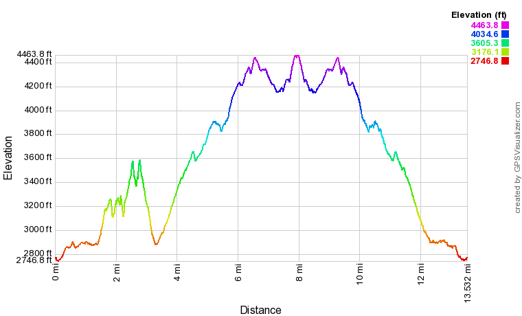
Click the link below to download a .GPX file with a track of this hike.
Details
Dismal Falls & Rhapsodie Falls
Most people who hike to Dismal Falls do not hike anywhere else that day. The same goes for people who visit the views atop Cold Mountain. The trails are vastly different; one is a long, moderately-ascending pathway, while the other is an extremely steep goat path. With that said, combining Dismal Falls and Cold Mountain into one day or overnight hike is an excellent choice. Unlike the central sections of Panthertown Valley with Greenland Creek Falls, Little Green Mountain, etc., you're not likely to meet another person in the Dismal Falls/West Fork Way/Cold Mountain area.
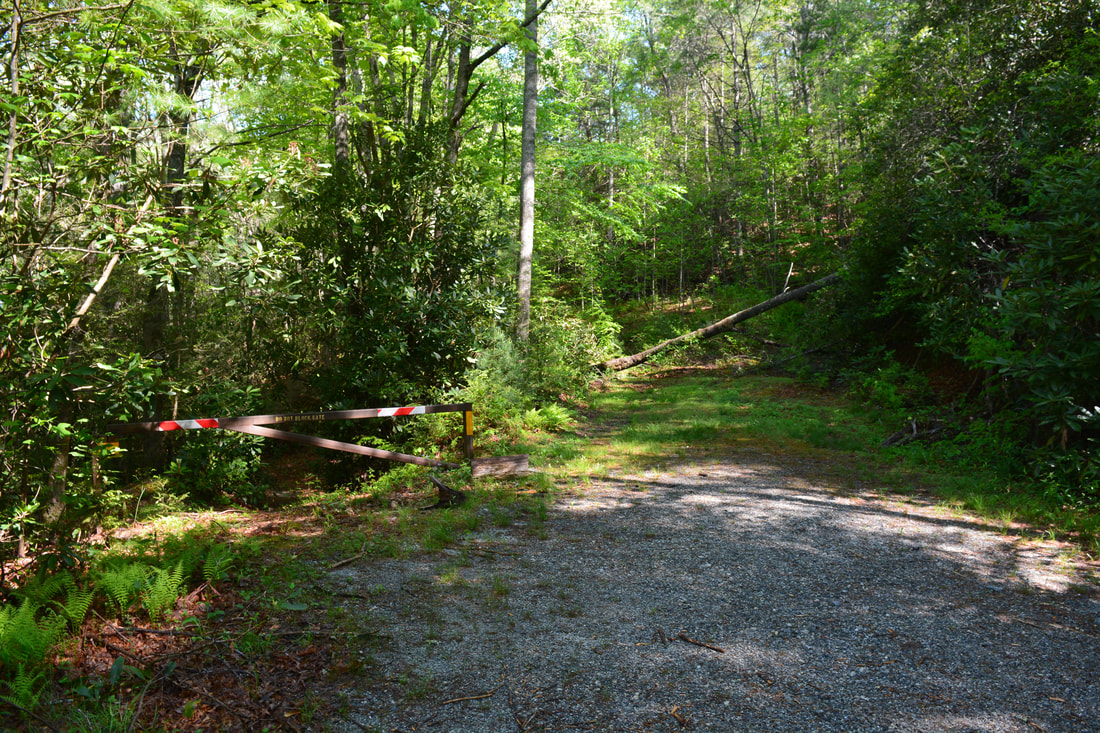
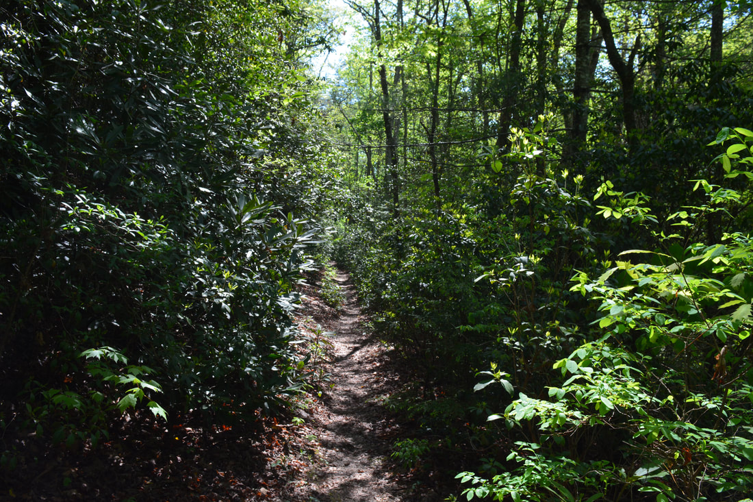
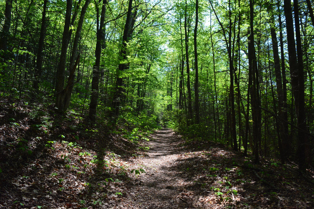
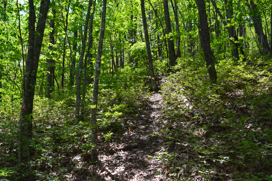
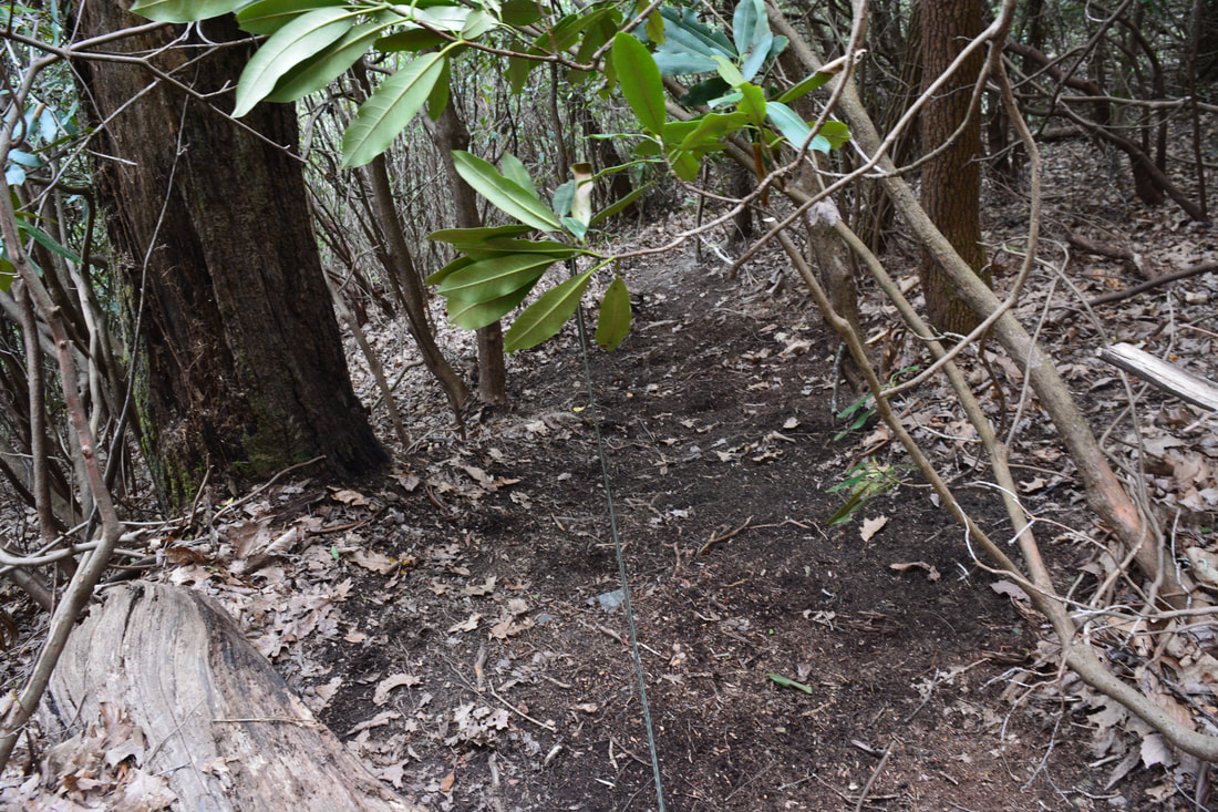
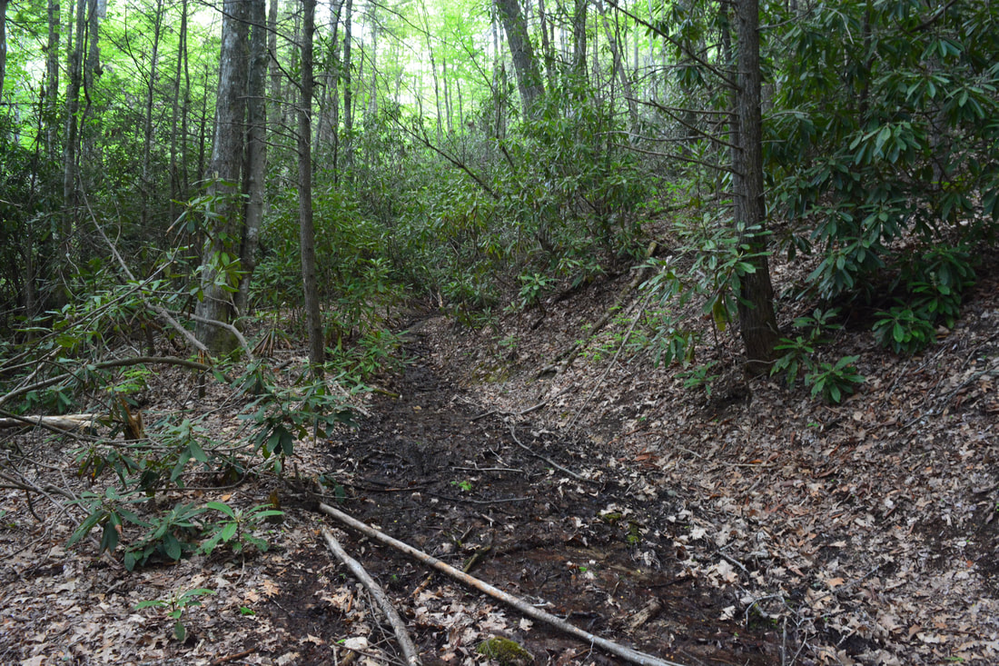
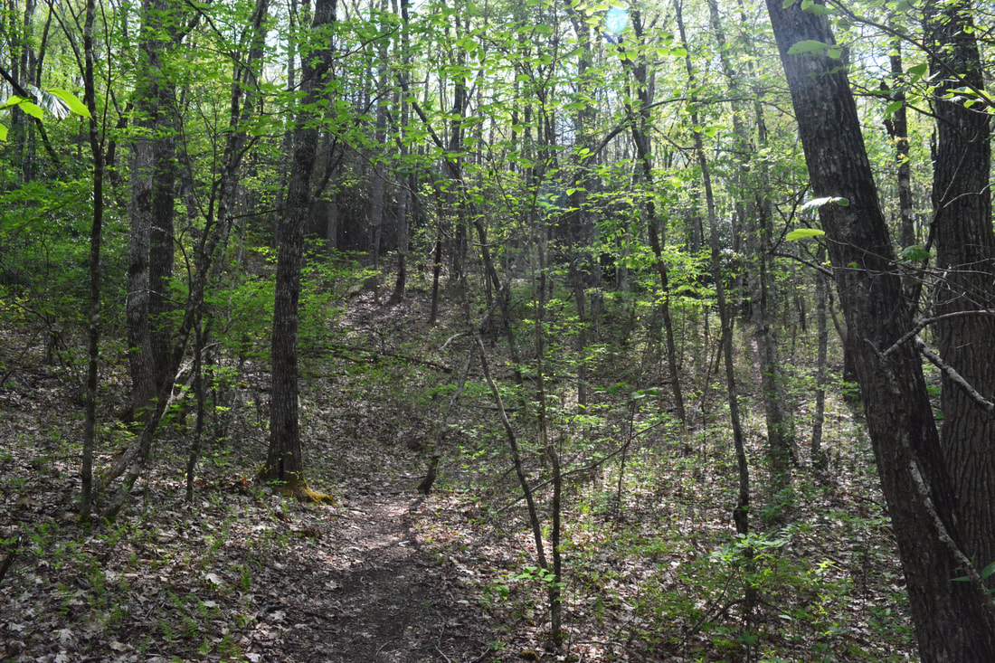
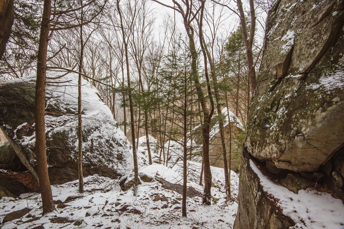
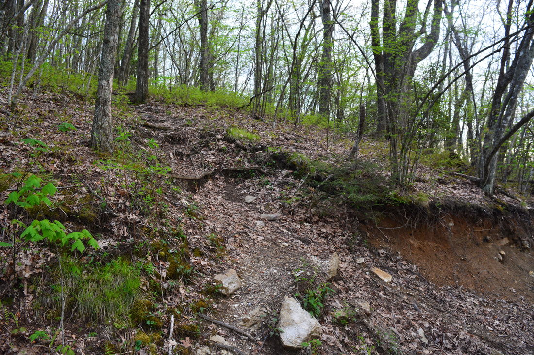
The hike begins along West Fork Way behind the gate at the end of Old NC 281. In the first 0.2 miles, the distinct trail crisscrosses a small stream three times. Crossing a set of downed trees, the trail then contours along the slope on the north side of the West Fork French Broad River. At 0.5 miles, the trail reaches another small stream. Immediately before the stream, a side path turns right and leads 0.1 mile through a camping area to Aunt Sally's Falls. Aunt Sally's Falls is a low-flow 30-foot waterfall, mostly a free-fall. It's not really impressive in normal conditions, but it's probably worth a quick stop. Back on the main trail, you'll reach a fork a few feet past the Aunt Sally's Falls side path - stay right. You're following West Fork Way along an old logging road. At 1.35 miles, reach an inconspicuous yet important junction at N35° 11.261' W82° 58.327'. Straight ahead, West Fork Way continues to Devils Elbow and ultimately Cold Mountain. If you'd like to skip to that part of the hike, keep reading on to its own section farther below. The following part of the trail report describes the trail to Dismal Falls and Rhapsodie Falls, which leaves left at the junction and descends to a campsite by the West Fork French Broad River. Cross the river - this is typically a rock hop or very easy wade, as the 'river' is a small stream at this point. On the other side, go 50 feet and enter another camping area - stay right here. The trail begins to ascend steeply (though not quite as steep as it will get past Rhapsodie Falls). Reach a 30-foot cascading waterfall at 1.5 miles, at a point where the main trail switchbacks left. This is Lower Rhapsodie Falls. Even though it's not overly impressive, it can make a nice picture and is a good bonus stop on the way to more impressive waterfalls. Lower Rhapsodie Falls is on an unnamed stream just west of Dismal Creek - the same stream that Rhapsodie Falls is on. 
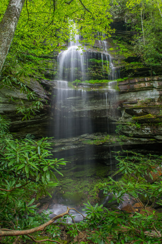
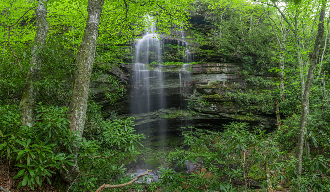
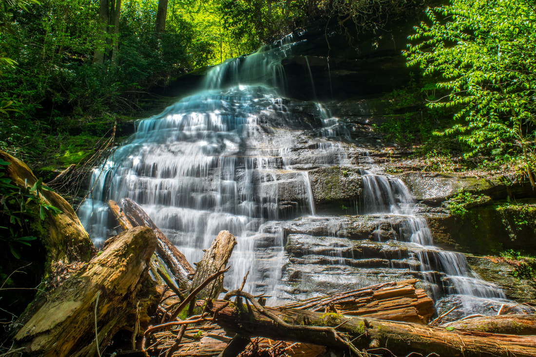
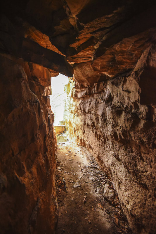
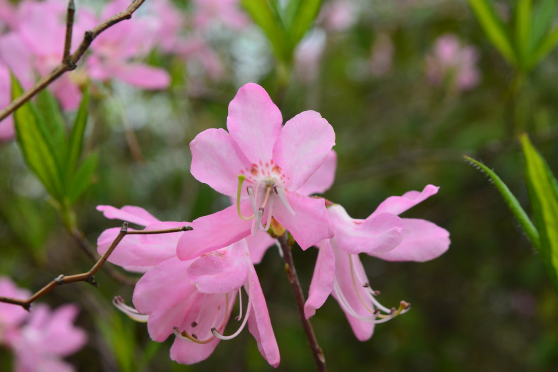
The back of Rhapsodie Falls features a massive, cave-like grotto!
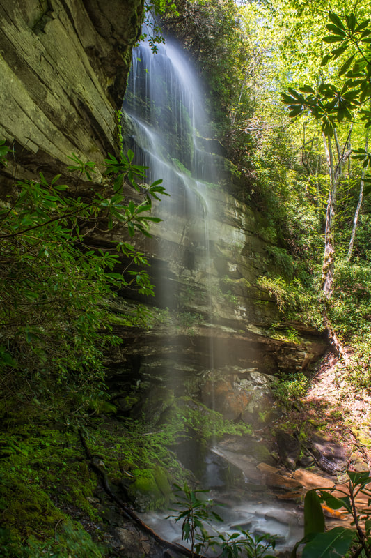
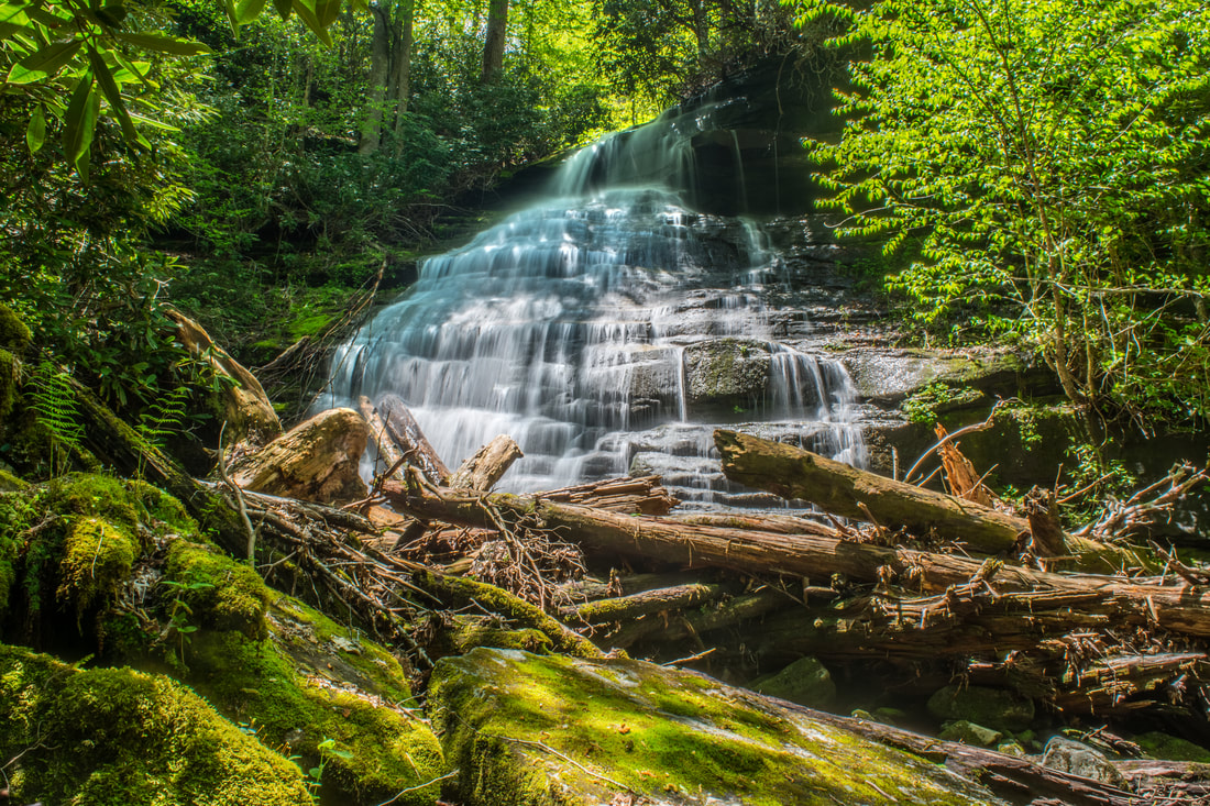
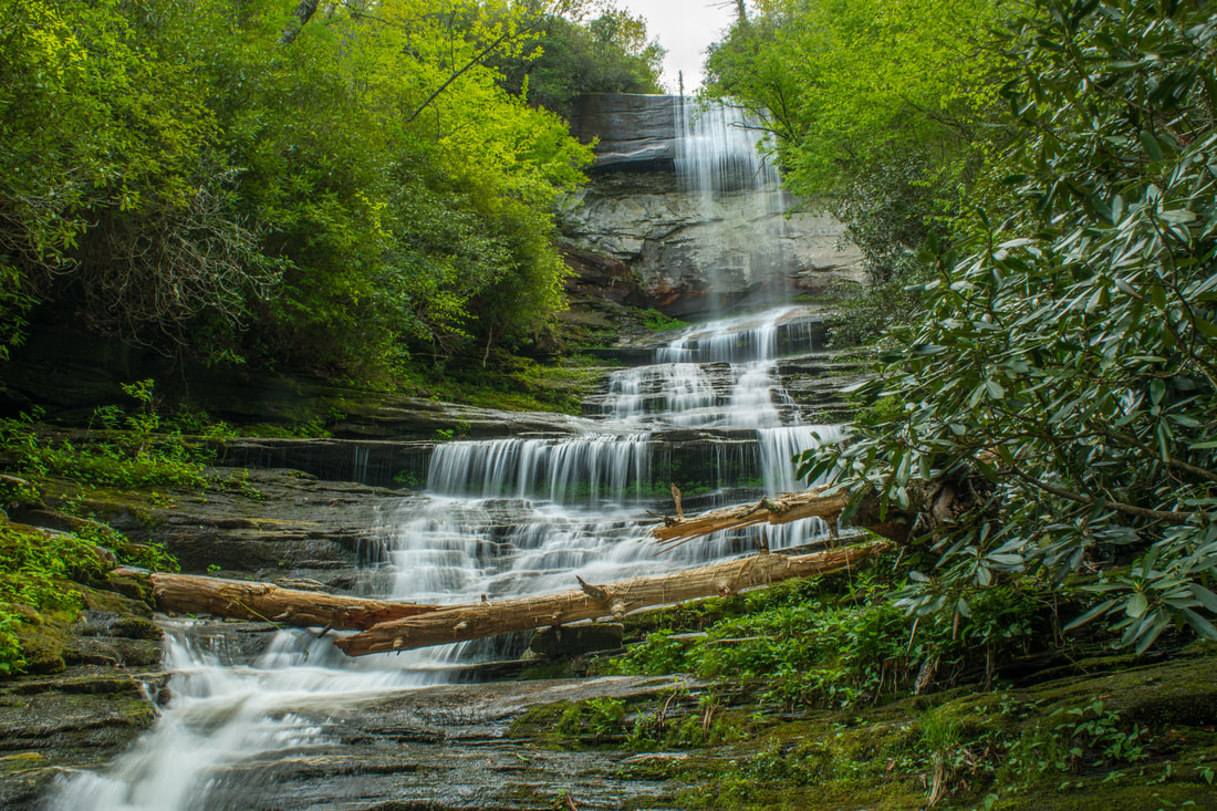
The main trail continues to ascend steeply past several rock outcrops above the stream. At 1.65 miles, having now ascended 300 feet, the main trail bears left, whereas the side trail to Rhapsodie Falls bears right. Be sure to not skip this easy 150-foot side path, as Rhapsodie Falls is nearly as breathtaking as Dismal Falls itself! At least 80 feet high, Rhapsodie Falls is a thin free-falling waterfall that comes over a large cliff. Behind the falls is a unique grotto-like space - a high rock overhang resembling a cave. Even though the grotto features a neat view of the falls, I would caution against entering the grotto, as it is home to numerous sensitive spray-community plants. Please exercise the utmost care if you do enter it. A second name for Rhapsodie Falls is Grotto Falls (this is the name used on Burt Kornegay's Panthertown Valley Trail Map). At the front of Rhapsodie Falls is a perfect, elevated vantage point about 15 feet above the waterfall's base. It showcases the waterfall and the surrounding green, tropical setting the best. Rhapsodie Falls is best viewed and photographed in the spring, when the forest has just come alive with bright greenery. The coordinates for Rhapsodie Falls are N35° 11.082' W82° 58.470'.
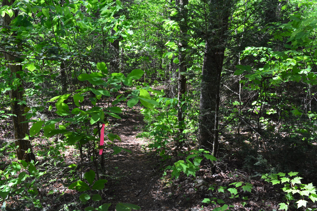
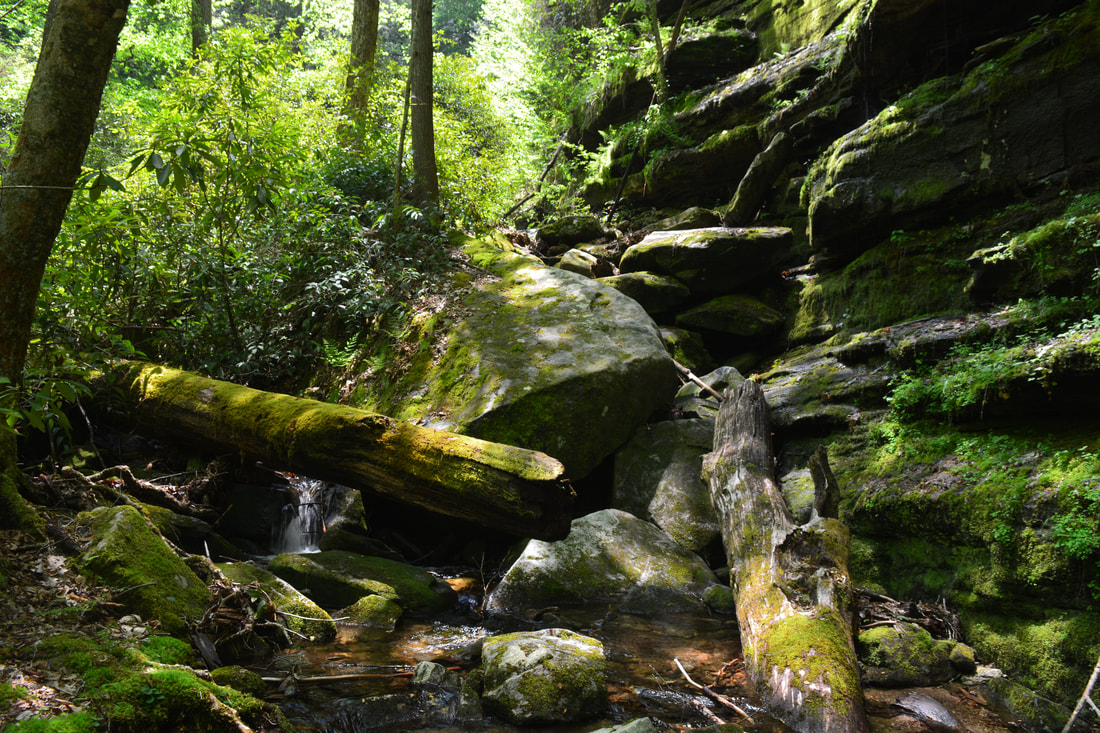
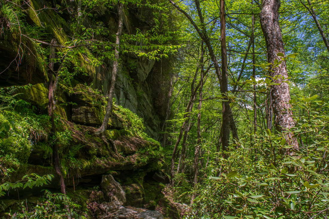
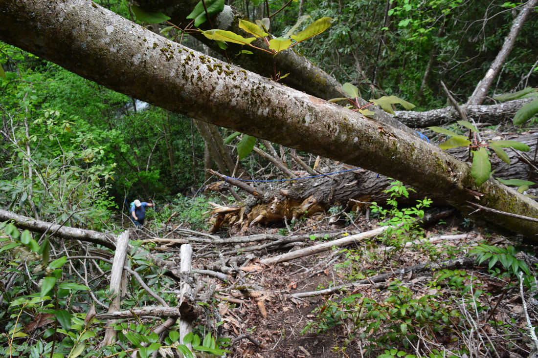
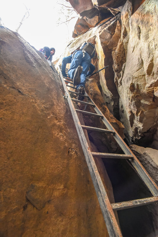
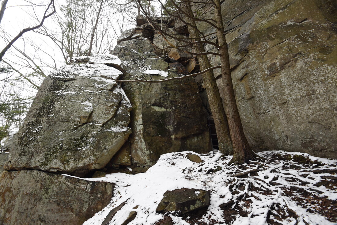
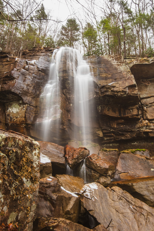
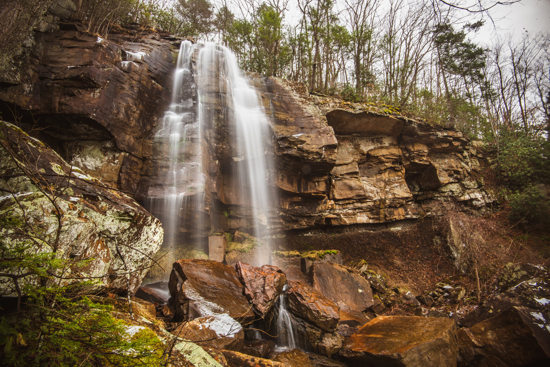
After Rhapsodie Falls, keep following the main trail to Dismal Falls, which becomes a little more overgrown. At 1.8 miles, the side trail to Lower Dismal Falls leaves left. Lower Dismal Falls, while not quite as spectacular as Dismal Falls, is worth seeing for sure while you're here. However, keep in mind that the side trip will add an extra hour to the hike. If you're short on time, it's definitely better to head straight to Dismal Falls. This trail report first describes the Lower Dismal Falls side trip, which begins along a gentle pathway that approaches the Dismal Creek gorge. At the edge of the gorge, however, the path loses all of its sanity, as it drops 100 feet down a near-vertical slope. Thankfully, tree handholds and ropes (if they are still there) will help the experienced hiker down. At the bottom, the trail turns right and begins to follow Dismal Creek upstream along the base of a breathtaking bluff line known as the Great Dismal Wall. The trail travels along the cliff for over one tenth of a mile, and the cliff steadily gets taller and grander! The Great Dismal Wall is part of the reason that the Lower Dismal Falls side trip is worthwhile. At the end of the wall, at 2.05 miles, the trail reaches Dismal Creek - scramble the final 250 feet to the falls upstream along the creek-bed. There are enough rocks that you'll probably stay dry, unless the water flow is well above average. Near the end is a tricky spot where you'll need to rock hop across the creek and find a route around a big boulder. You'll arrive at Lower Dismal Falls at 2.1 miles. The coordinates for Lower Dismal Falls are N35° 10.886' W82° 58.391'. Surrounded by mossy rocks, Lower Dismal Falls is a 30-foot stairstep waterfall. It's quite pretty, although the massive pile of deadfall at the base decreases the waterfall's appeal. You won't want to make a special trip to this waterfall, but complemented by the Great Dismal Wall, it's an excellent bonus to Dismal Falls. Unfortunately, to get to Dismal Falls from Lower Dismal Falls, you'll need to return to the main trail and then make another trip into the gorge (there is no reasonable route in the gorge between the two waterfalls). Thus, keep following the main trail as it ascends very steeply along the ridge above the Dismal Creek gorge. After over 300 feet of elevation gain in just 0.2 miles, the trail finally reaches its high point at 2.6 miles. Bear left here and begin descending into the gorge toward the falls. Believe it or not, this section is even steeper! It's similar to the Lower Dismal Falls descent, but it's longer. Although there aren't any technical spots, I would recommend only seasoned hikers to hike here. Ropes may be present to assist you with the hardest spots. Finally, reach the base of Dismal Falls at 2.7 miles. The coordinates for Dismal Falls are N35° 10.847' W82° 58.436'. 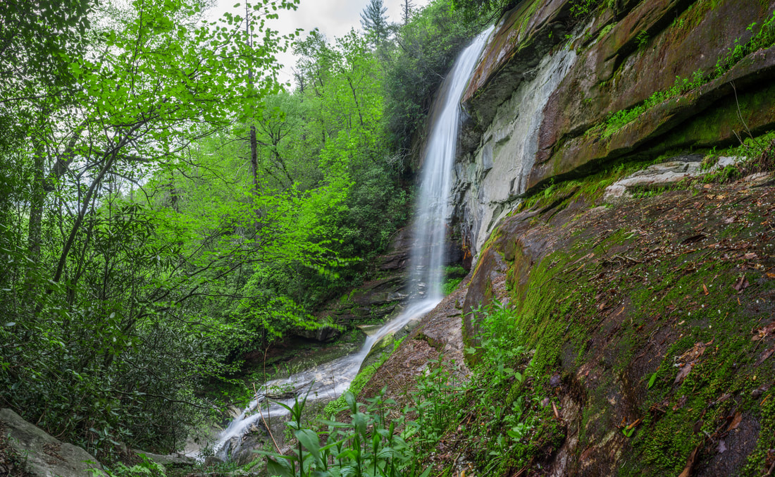
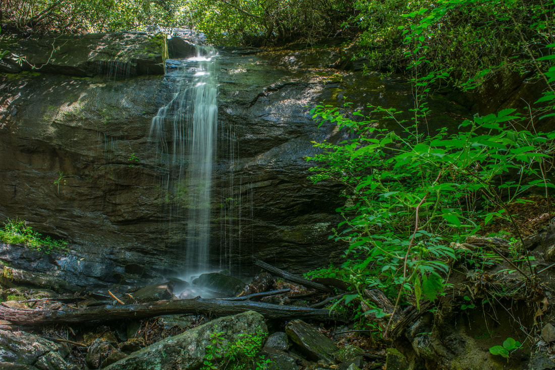
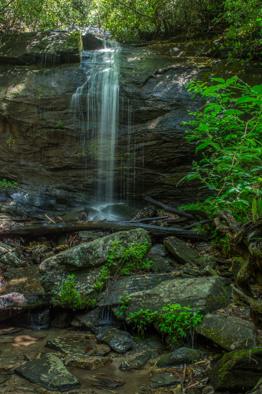
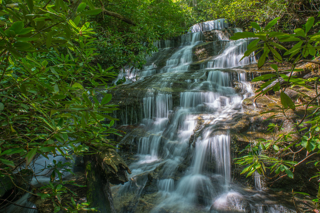
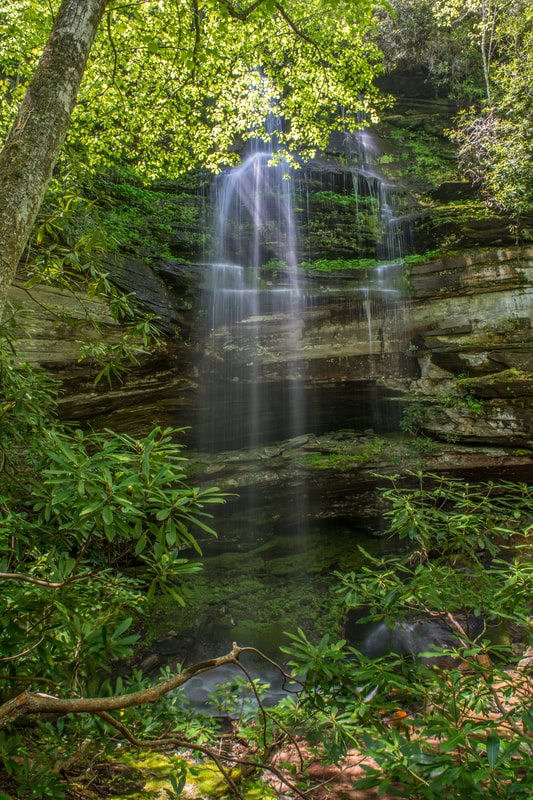
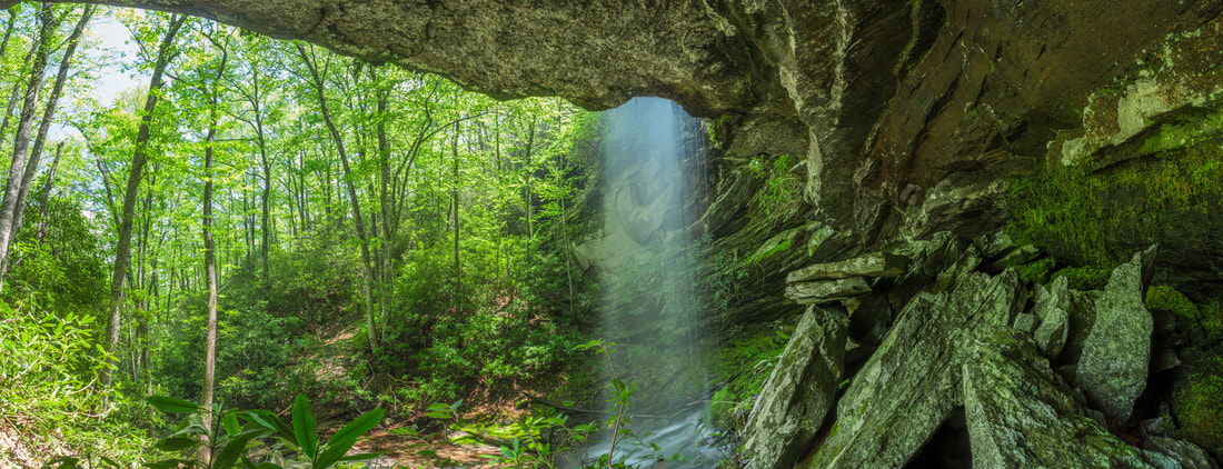
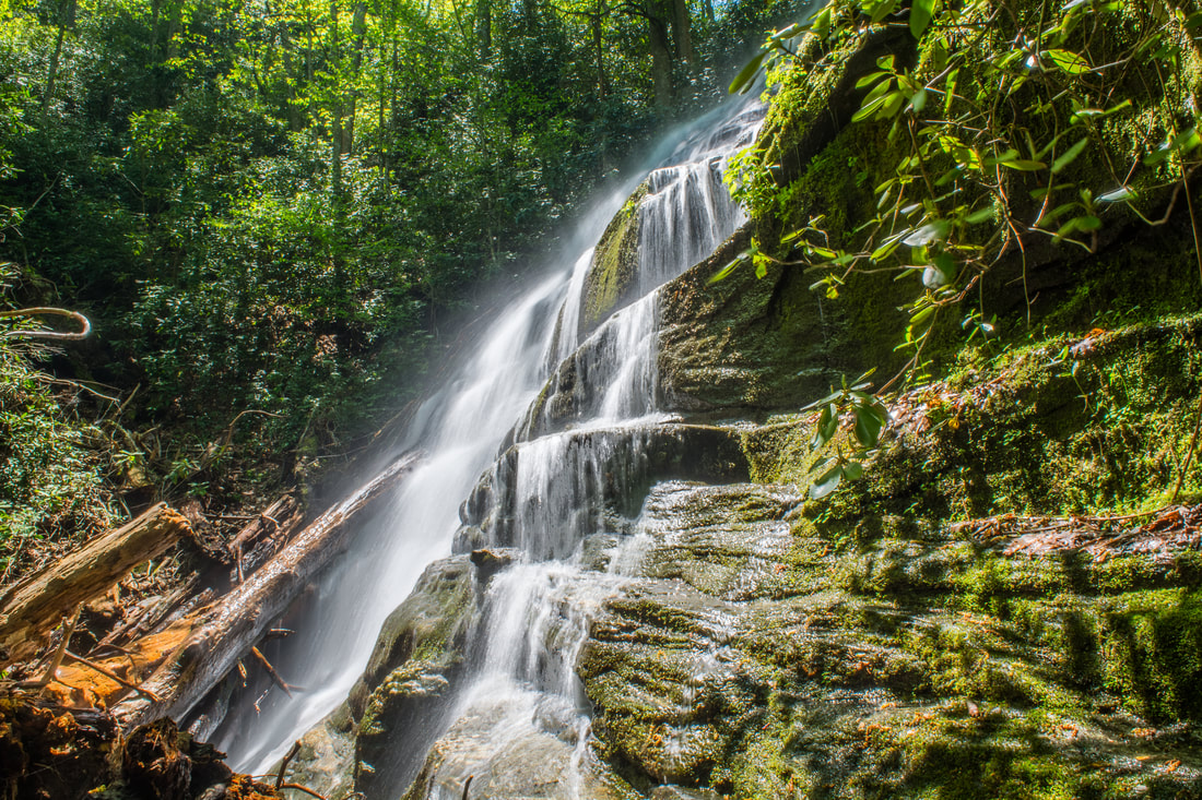
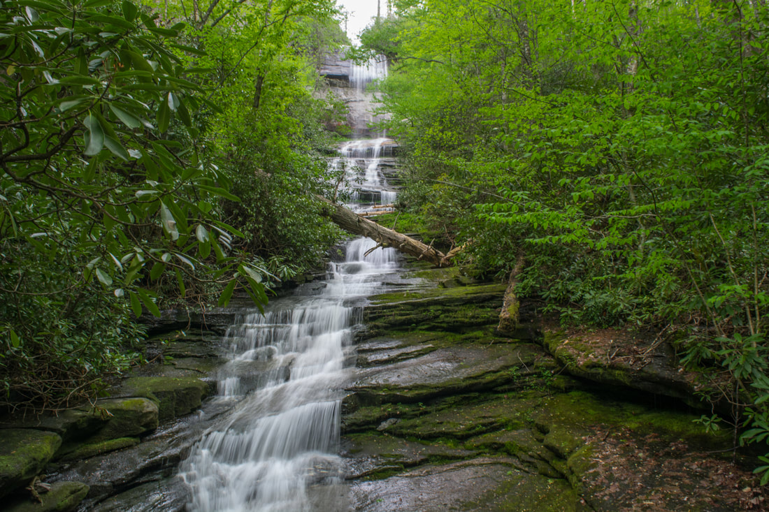
120-foot Dismal Falls is a stunning waterfall in the remote upper reaches of the Dismal Creek gorge.
Dismal Falls is one of those North Carolina waterfalls that is considered to be so breathtaking, yet hard to reach, that it's a a must-do on every seasoned waterfaller's list. The full height of the waterfall is 120 feet. The upper tier is a 60-foot free-fall, and the lower tier is a very picturesque stairstep cascading run. From the trail's end at the base of the stairstep cascade, the upper tier is pretty far up, even though it's clearly visible. Those who would like to get a closer view of the upper part (as in the photo above) can scramble/bushwhack up the west side of Dismal Creek (River Left side) to the base of the free-fall. There isn't any path, but it's not too difficult. The vantage point near the base of the free-fall not only lets you appreciate the waterfall's most impressive section, but it also lets you view the mossy cliffs by the falls up close.
From Dismal Falls, simply retrace your steps back to West Fork Way. You'll first have to do an incredibly steep climb out of the gorge, but after that, it's all smooth sailing make down to the junction! You'll reach West Fork Way at 3.35 miles. Here, you've got a decision to make. You could turn right and return to Old NC 281, concluding the hike at 4.7 miles. This is a good choice for people who don't have the full day to hike, or for people who want to see other area waterfalls. Those who want to embark on a full-blown, difficult day hike can turn left on West Fork Way and continue on to Cold Mountain. Read on to learn more! High Bethel View on Cold Mountain
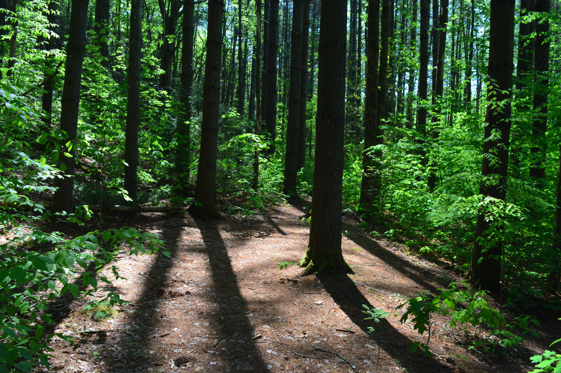
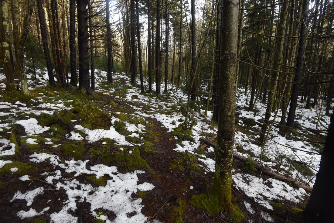
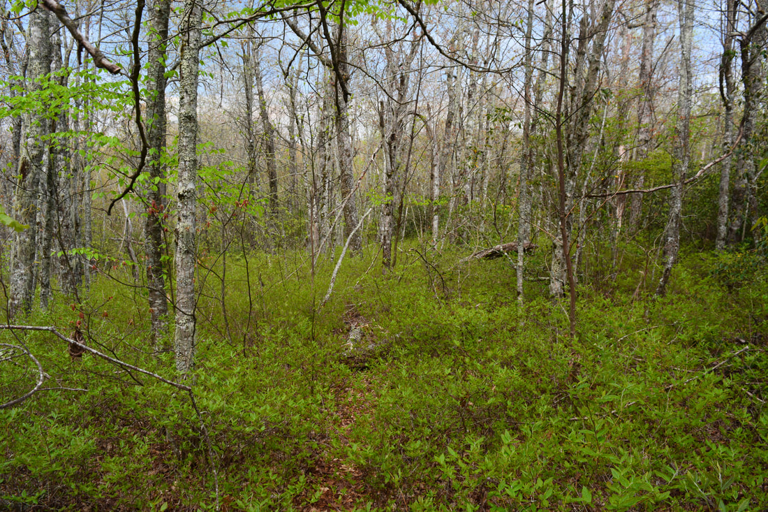
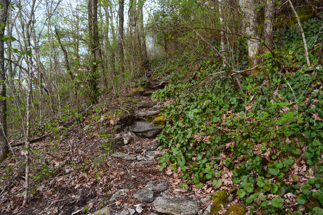
From the 3.35-mile point at the Dismal Falls junction on West Fork Way (or 1.35-mile point if you skipped the Dismal Falls side trip), continue to follow West Fork Way up the valley along the old logging road. An easy to moderate ascent ensues. You will pass through several muddy stretches just past the junction. At 3.85 miles, West Fork Way makes a double switchback. It eventually crosses the West Fork French Broad River headwaters at 4.3 miles. Then, it makes one final steep push to a gap north of Shelton-Pisgah Mountain at 4.55 miles. You've ascended 800 feet from the Dismal Falls turn-off. Continue straight through the gap, ignoring the old logging road that crosses from left to right (to the left it can be used as a shortcut to Cold Mountain, but it would involve bushwhacking off-trail). West Fork Way drops steeply down to a junction with another forest road at 4.65 miles. West Fork Way turns left onto the old road - this turn is very easy to miss on your return! The trail then enters the bed of a shallow, unnamed stream for 100 feet before gradually ascending to another gap at 4.9 miles. Here, West Fork Way makes a hairpin left turn and begins contouring along the slope high above the Tuckasegee River.
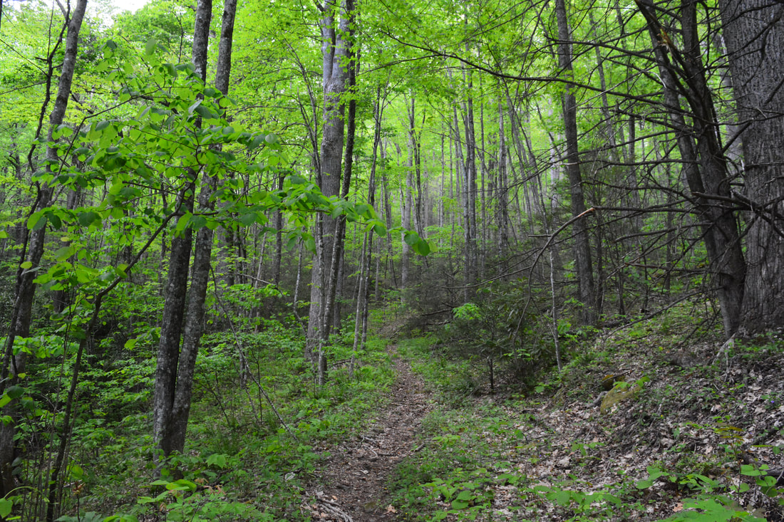
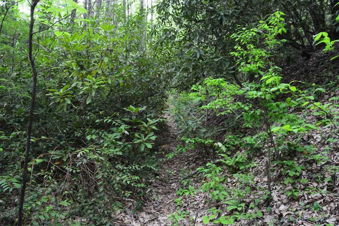
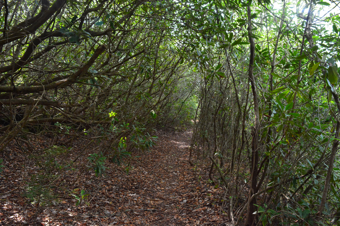
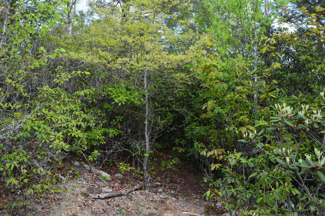
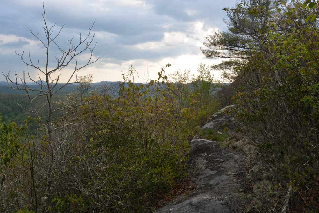
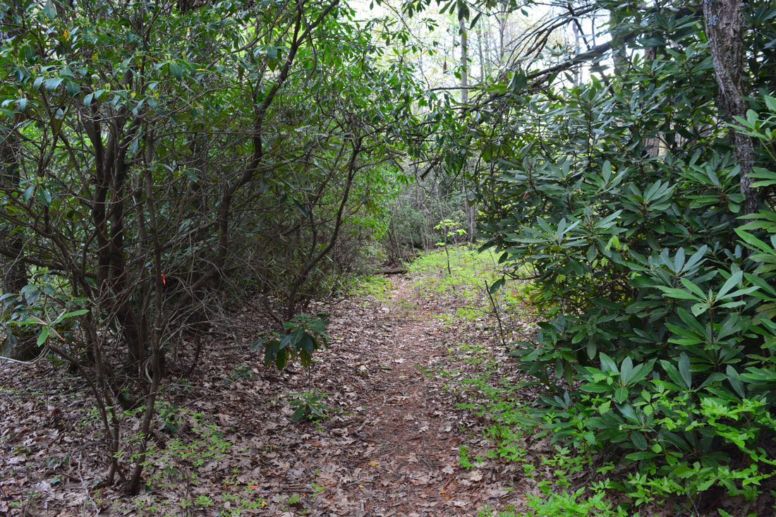
The rest of West Fork Way is a gradual but steady ascent toward Devil's Elbow along a well-defined double-track trail with seasonal views of the Tuckasegee RIver Gorge. At 5.6 miles, West Fork Way pops out of a rhododendron tunnel onto the open, rocky area that is known as Devil's Elbow. This spot doesn't have any real views, but it's a significant junction. To the right, the official Devil's Elbow Trail descends into the Tuckasegee River Gorge toward the heart of Panthertown Valley. The trail passes side paths to a number of waterfalls: Elbow Falls, Red Butt Falls, Riding Ford Falls, Jawbone Falls, and Wardens Falls. It also passes the bushwhack access to Lichen Falls. A good way to extend the Cold Mountain hike is to loop it with the Little Green Creek Trail and Devil's Elbow Trail, which could allow you to see several more waterfalls. For the purposes of this hike, however, you'll need to look for the much more obscure Shelton-Pisgah Trail. The barely-perceptible start of this slim pathway is in a rhododendron tunnel to the left of the rocky clearing where West Fork Way terminates. In other words, it enters the woods on the other side of the clearing and begins ascending the ridge moderately southeastward toward Shelton-Pisgah Mountain. 
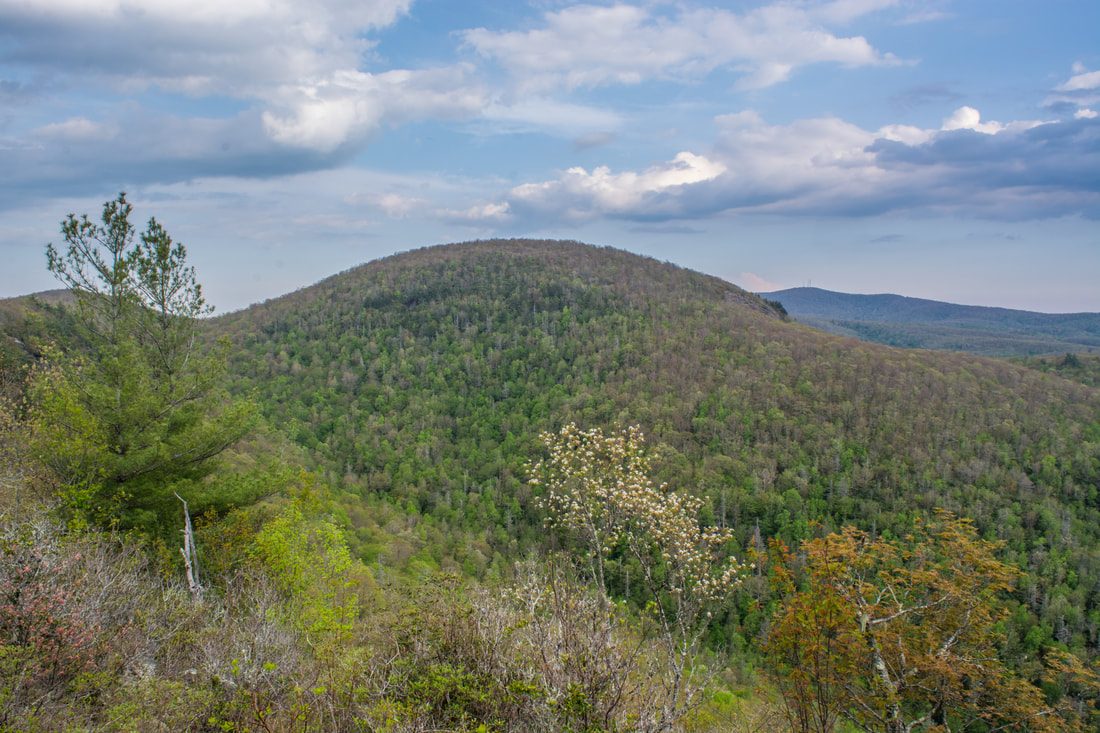
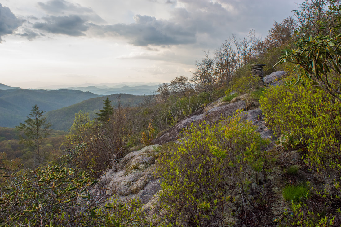
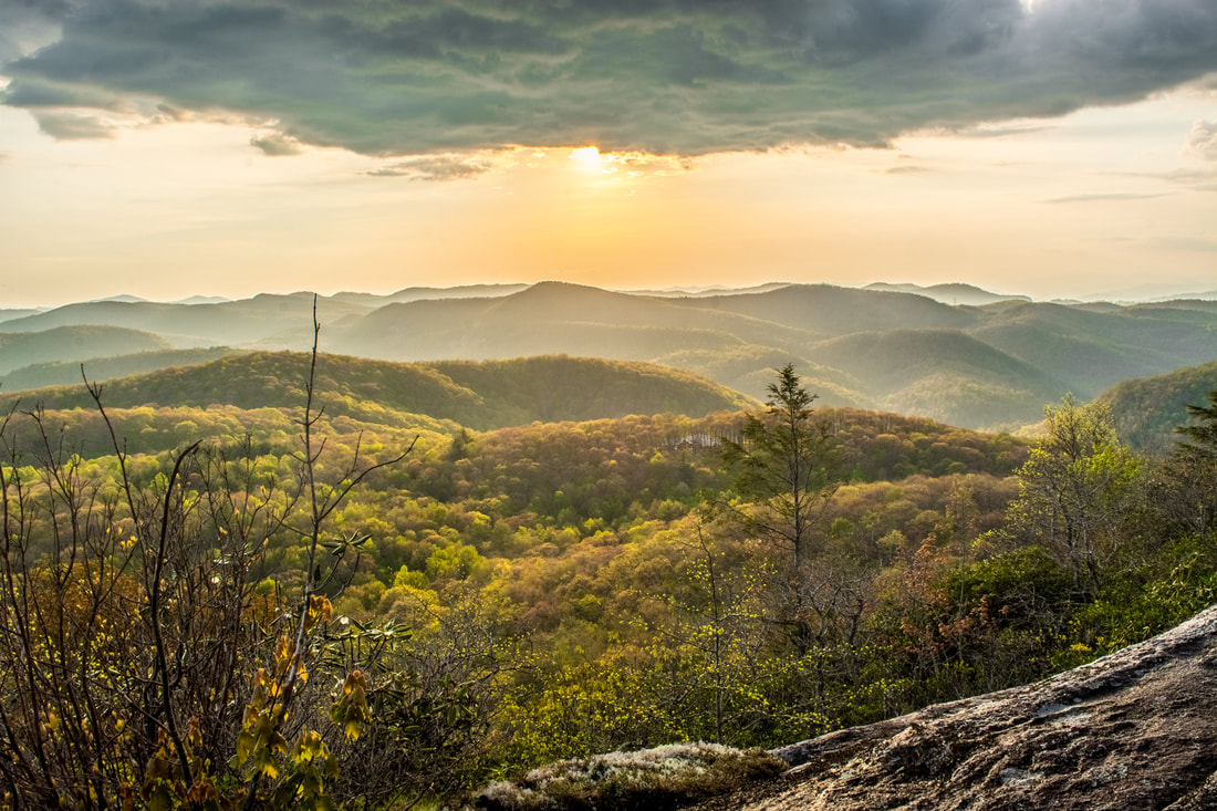
Shelton-Pisgah Mountain has its own Panthertown Valley view, a bonus to the Cold Mountain hike.
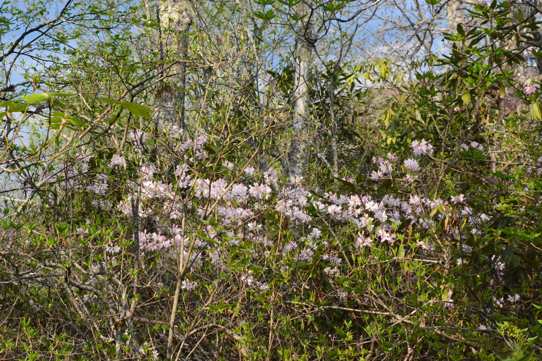
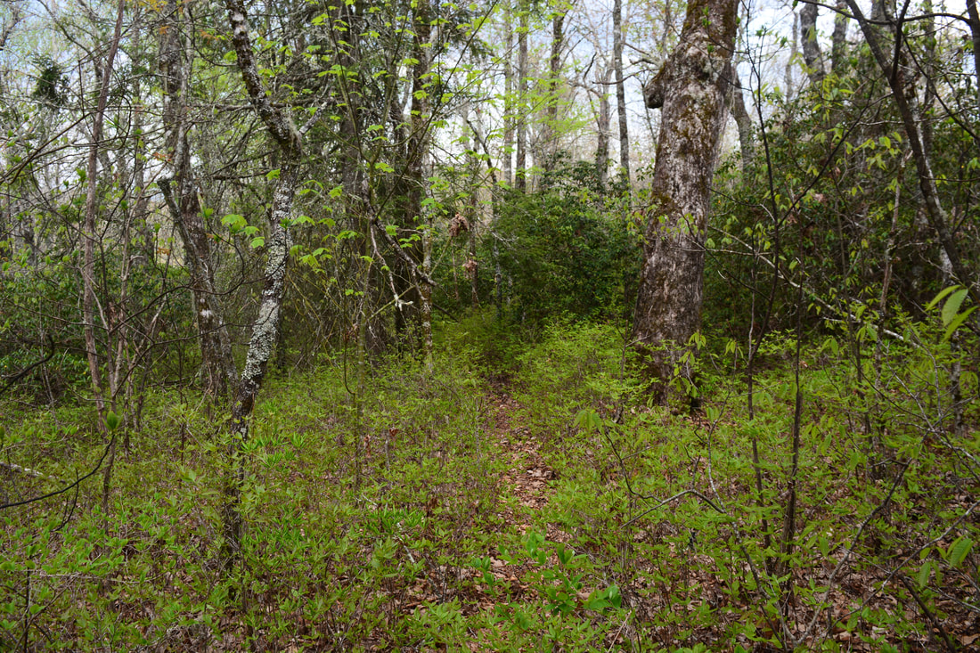
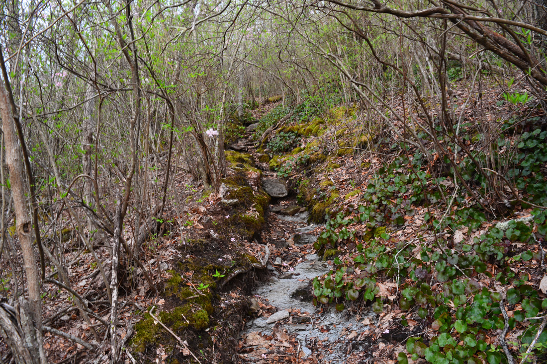
Although the Shelton-Pisgah Trail is unmaintained and rather faint in places, I think that most hikers should be able to follow it without much trouble. As it approaches a knob just west of Shelton-Pisgah Mountain, the trail gets a little overgrown. At 6.4 miles, the trail dumps you out onto a broad rock outcrop - the Shelton-Pisgah Mountain view. Cold Mountain is the large rounded summit close by on the front. Shelton-Pisgah Mountain barely peeks out from above the trees to the left. In the distance is Panthertail Mountain, which has its own views on private property. This view also encompasses the eastern sections of Panthertown Valley. Meanwhile, keep following the trail into a small gap and up the final steep ascent to the Shelton-Pisgah Mountain summit at 6.6 miles. Then trail then descends moderately through its most overgrown section. At 7.2 miles, reach a gap before Panthertail Mountain with a junction. While the private trail to Panthertail Mountain bears left, you'll want to stay on the main trail to Cold Mountain, which curves sharply right. After a short downhill stretch, the unofficial Little Green Creek Trail leaves right at 7.3 miles. Connecting to the Devil's Elbow Trail near the Riding Ford Trail junction, the Little Green Creek Trail can be a great shortcut for backpackers. It's also the shortest access trail to Cold Mountain from the popular Cold Mountain Gap trailhead.
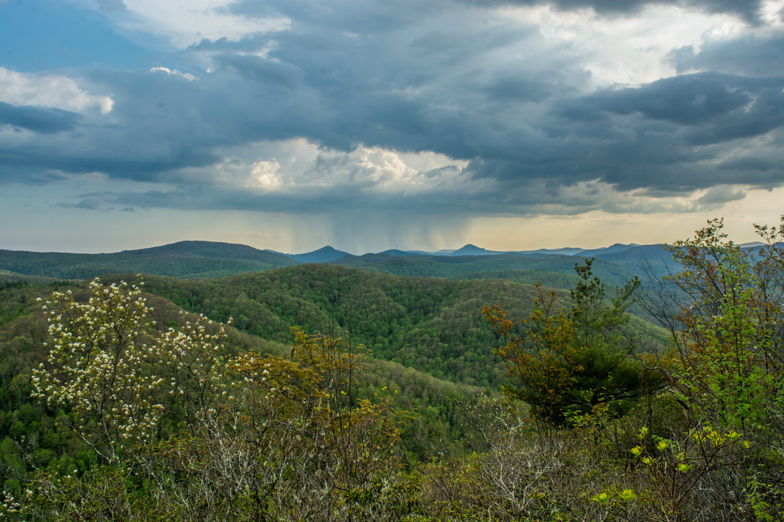
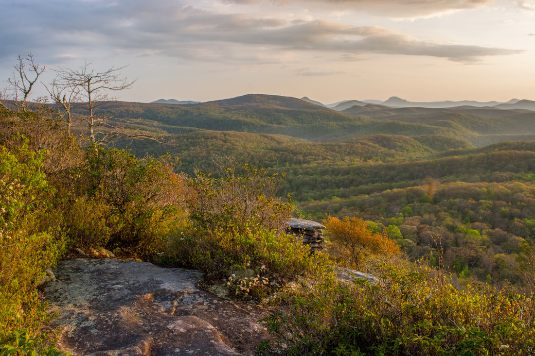
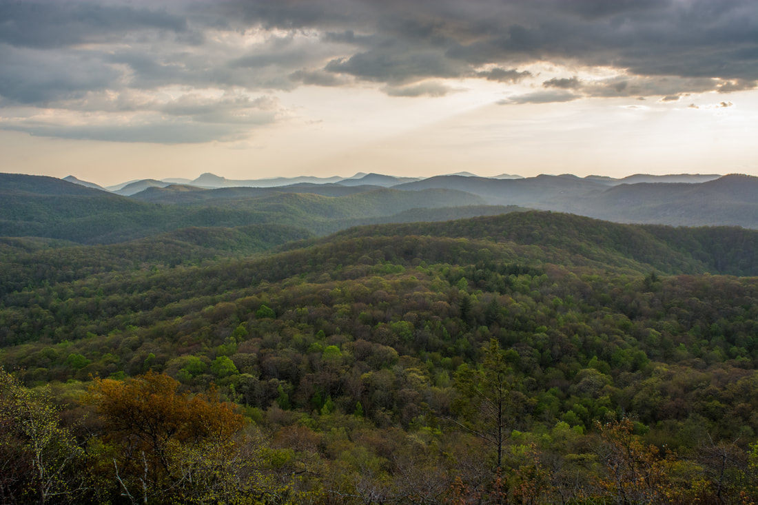
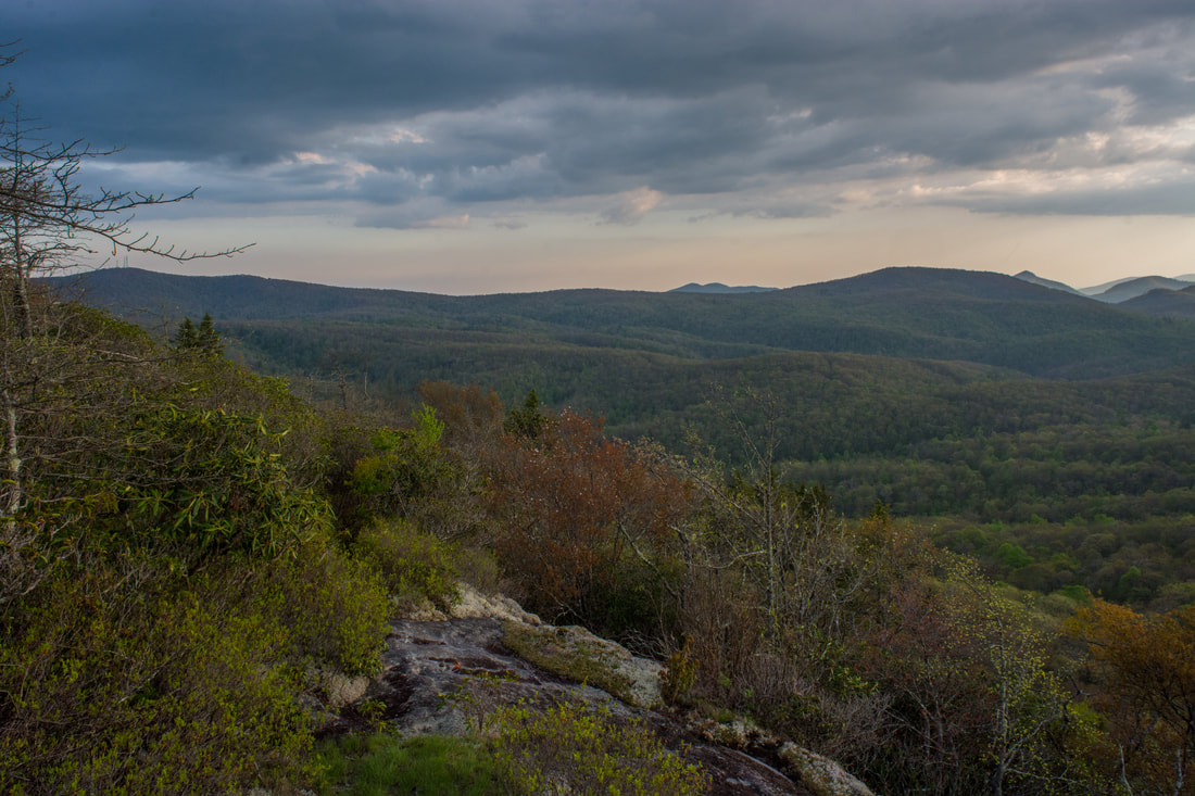
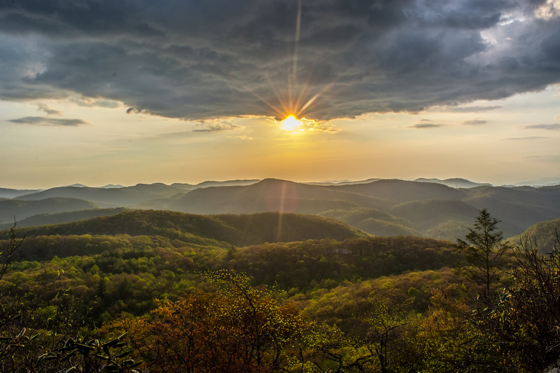
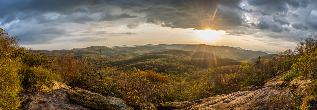
Stay straight on the trail to Cold Mountain, which begins a gentle ascent along an old logging grade along the north slopes of Cold Mountain. At 7.7 miles, just as the trail begins to descend, the obvious side trail to High Bethel view on Cold Mountain leaves left. Be sure to not miss this junction - not only is this the only access to the view atop Cold Mountain, but the trail that continues straight ahead shortly enters the private property of the Canaan Land Christian Retreat, where only guests are allowed. Meanwhile, the vista side trail begins the final 200-foot ascent along a rocky, galax-lined pathway. Finally, just as the trail levels out, reach a small cliff on the west side of Cold Mountain at 7.95 miles. This is the hike's destination - the High Bethel view. The view is located at the coordinates N35° 09.940' W82° 59.356'. The Cold Mountain view isn't at a high elevation, but nevertheless, the panorama is jaw-dropping. The whole expanse of Panthertown Valley is spread out before you, and all of the valley's major peaks are visible: Blackrock Mountain, Little Green Mountain, Big Green Mountain, Hogback Mountain, and Toxaway Mountain. On a clear day, the Great Smoky Mountains over 40 miles away can be seen on the far right. Whiteside Mountain - one of southwest North Carolina's most iconic peaks - is easily identified in the distance as well. So why is this vista known as the "High Bethel view"? This cliff on Cold Mountain is home to the High Bethel Altar, constructed by Canaan Land visitors from 1956 to 1974. All of the stones were brought by hand. The altar features the following inscription:
"Near the endless sky above us
up in Canaan Land lies the beauty of High Bethel made by God's own hand. Here we watch the sunset his love we understand in the majesty of mountains here we join God's hand." 
Not only does Cold Mountain have an outstanding view of the expanse of Panthertown Valley to the west, but it's also a great place to watch the sunset.
As the inscription implies, the High Bethel view is a great sunset-viewing spot. For day hikers, the drawback is that the hike out in darkness would be rather lengthy (I managed it though). But for backpackers, sunset at Cold Mountain is about as good as it gets. Once you finally manage to pull yourself away from the vista, begin retracing your steps back to the trailhead. You'll simply want to return along the Shelton-Pisgah Trail and West Fork Way all the way to Old NC 281. Thankfully, beside the 0.7-mile ascent of Shelton-Pisgah Mountain and a short uphill stretch along West Fork Way, essentially of the return trip is downhill. You'll return to the trailhead parking area at 13.5 miles, concluding the hike (it would've been 11.5 miles if you skipped Dismal Falls).
This outstanding hike has it all, from a number of breathtaking, remote waterfalls, to astounding panoramic views. Furthermore, this is a great backcountry hike where you're likely to encounter few - if any - people. I have decided to rate it a "Best Hike". Mileage
0.0 - Old NC 281 Trailhead
0.5 - Aunt Sally's Falls 1.35 - Dismal Falls Trail Junction 1.5 - Lower Rhapsodie Falls 1.65 - Rhapsodie Falls 2.1 - Lower Dismal Falls 2.7 - Dismal Falls 5.6 - Devil's Elbow 6.4 - Shelton-Pisgah Mountain View 7.2 - Panthertail Mountain Trail Junction 7.3 - Little Green Creek Trail Junction 7.95 - High Bethel View on Cold Mountain 13.5 - Old NC 281 Trailhead Variations
Hike out and back to Rhapsodie Falls, Lower Dismal Falls, and Dismal Falls - 4.7 Miles
Hike out and back to Cold Mountain (High Bethel View) - 11.5 Miles Bonus Stops
One nearby waterfall is the spectacular Raven Rock Falls. It's accessible by a pathway from Cold Mountain Road (the access road to the Panthertown Valley trailhead at Cold Mountain Gap). If you do just the Dismal Falls hike without Cold Mountain, Raven Rock Falls could be a good way to round out your day.
Pictures & Videos
1 Comment
Dev Moring
8/22/2019 06:45:29 pm
Thanks for a description that enabled two 70 something hikers to get to Rhapsodie Falls! We would never have made it without your great directions. We did note that at the West Fork Trail was blocked off (downed tree with three large logs propped against it) at the intersection leading to the Falls. We were not interested in going on.so did not explore the reason for the blockage. Leave a Reply. |
About MeMark Oleg Ozboyd Dear readers: I have invested a tremendous amount of time and effort in this website and the Georgia Waterfalls Database the past five years. All of the work that has gone in keeping these websites updated with my latest trip reports has almost been like a full-time job. This has not allowed me to pick up a paid job to save up money for college, and therefore, I I've had to take out loans. If you find the information on this website interesting, helpful, or time-saving, you can say "thanks" and help me out by clicking the button above and making a contribution. I will be very grateful for any amount of support you give, as all of it will apply toward my college tuition. Thank you!

Coming in 2022-2023?
Other Hiking WebsitesMiles HikedYear 1: 540.0 Miles
Year 2: 552.3 Miles Year 3: 518.4 Miles Year 4: 482.4 Miles Year 5: 259.9 Miles Archives
March 2021
Categories
All
|
||


 RSS Feed