One of three rocky gorges in the Savage Gulf State Natural Area sector of South Cumberland State Park, Collins Gulf features some of the most spectacular, wild scenery on the Cumberland Plateau in Tennessee. The true star of the Collins Gulf hike is Suter Falls, a majestic 40-foot waterfall on Rocky Mountain Creek (a tributary of the Collins River) surrounded by cliffs in an awe-inspiring setting. Beside Suter Falls, the hike features as many as four other waterfalls (two are largely ephemeral). As the Collins Gulf Trail treks through the rugged gorge carved out by the Collins River, it passes a small but powerful block-type waterfall on the river called Horsepound Falls, as well as set of remarkable sinks on Collins River and Fall Creek. The second part of the hike follows the Collins Rim Trail, where the trail provides nice seasonal views into the gorge as it crosses countless tumbling streams before re-entering the gorge and crossing the Collins River on a mighty suspension bridge at a particularly gorgeous boulder-strewn section of the river. This hike occurred on Sunday, February 18th, 2018. My plan was to hike the Collins Gulf Loop clockwise from the 55th Avenue Trailhead.
Summary
R/T Length of Trail: 13.7 Miles
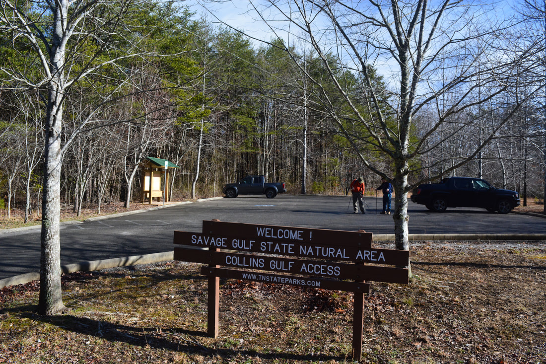
Duration of Hike: 7:45 plus about two hours of stopping and photography Type of Hike: Lasso Difficulty Rating: 9 out of 10 Pros: Numerous spectacular water features Cons: Collins Rim Trail section is a bit boring in places Points of Interest: Collins Gulf Overlook - 5 stars; Suter Falls - 10 stars; Horsepound Falls - 8 stars; Schwoon Spring & Falls - 7 stars; Skinny Falls - 5 stars; Unnamed Falls along Stagecoach Road Historic Trail - 4 stars; Collins Rim Trail Views - 2 stars collectively; Collins River Boulder Crossing scenic area Trail Blaze Color(s): Collins Gulf Trail - White; Connector Trail - White; Stagecoach Road Historic Trail - White; Collins Rim Trail - White; Side trails to Collins Gulf Overlook, Horsepound Falls, Schwoon Spring, Sawmill Campsite, and Collins Rim views - Blue Best Seasons to Hike: Winter; Spring Fees: None Beginning Point: 55th Avenue Trailhead in Savage Gulf State Natural Area Directions from Gruetli-Laager, TN: 55th Avenue leaves northward from TN 108 within the city limits of Gruetli-Laager, about 5.2 miles east of the TN 108/TN 56 junction. Follow 55th Avenue north for 2.7 miles to the Collins Gulf parking area. Map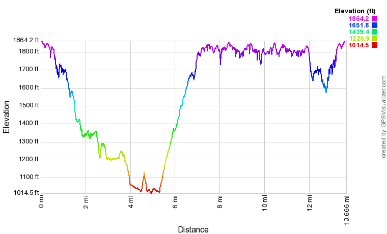
Click the link below to download a .GPX file with a track of this hike.
Details
Over the past few years, I'd completed many of the well-known hikes in the southern section of the Cumberland Plateau in Tennessee that were within reasonable driving distance for me. Savage Gulf State Natural Area was one section of the Cumberland Plateau that I had largely ignored due to the longer drive. I'd only hiked once in this area previously when I visited Greeter Falls and the Stone Door. I was thus excited to begin the Collins Gulf Loop, a spectacular hike that I had read a lot about over the past months.
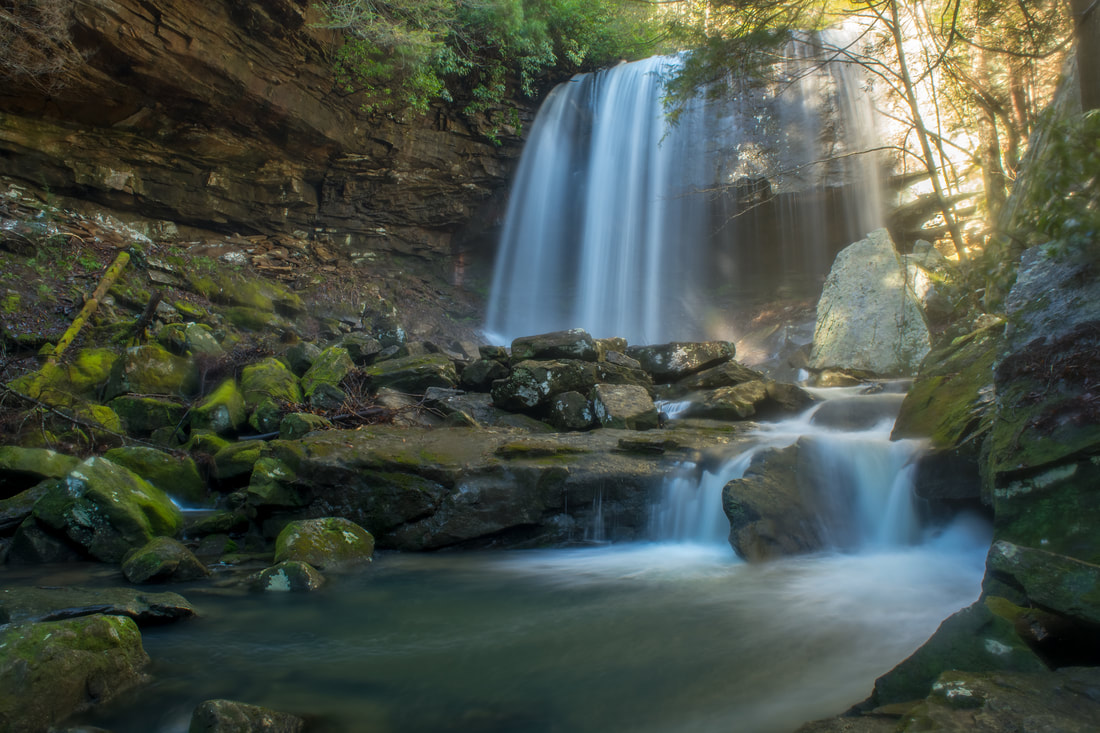
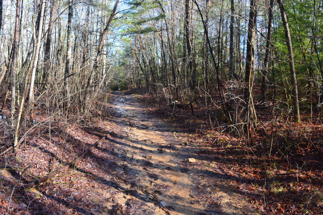
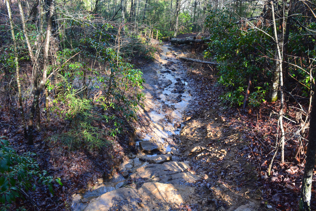
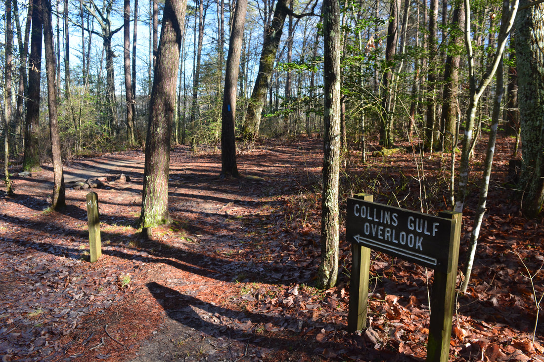
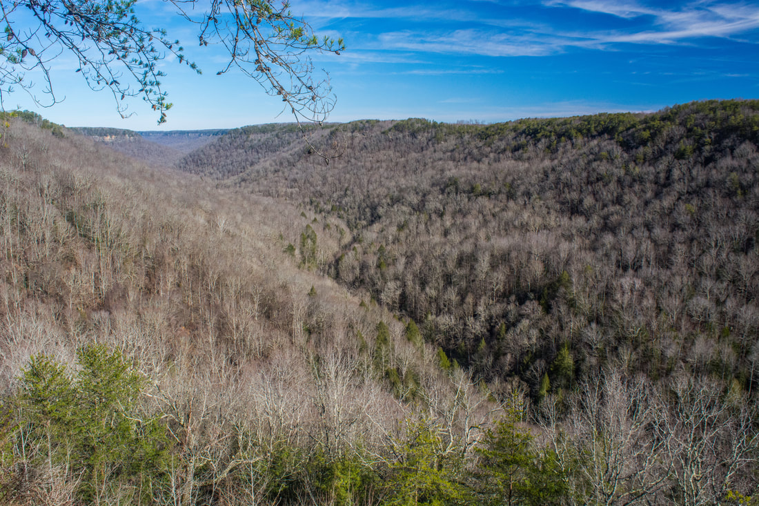
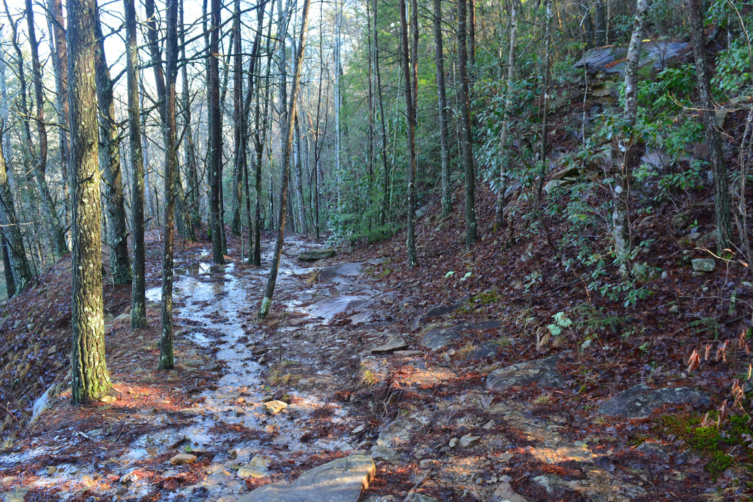
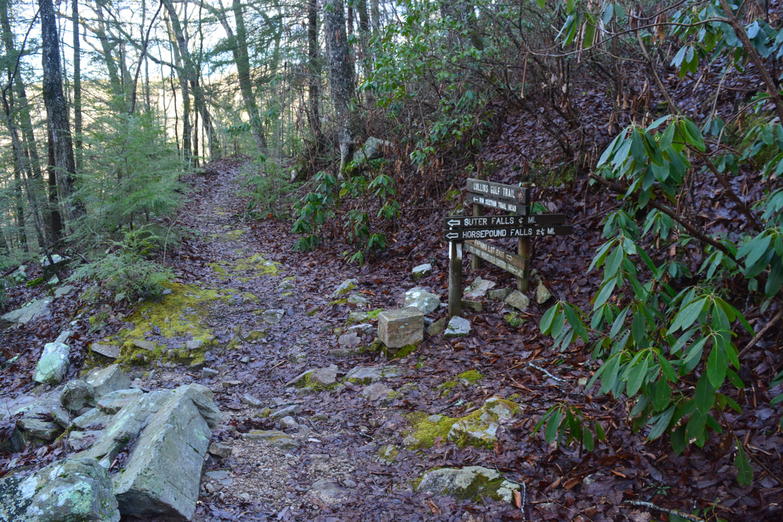
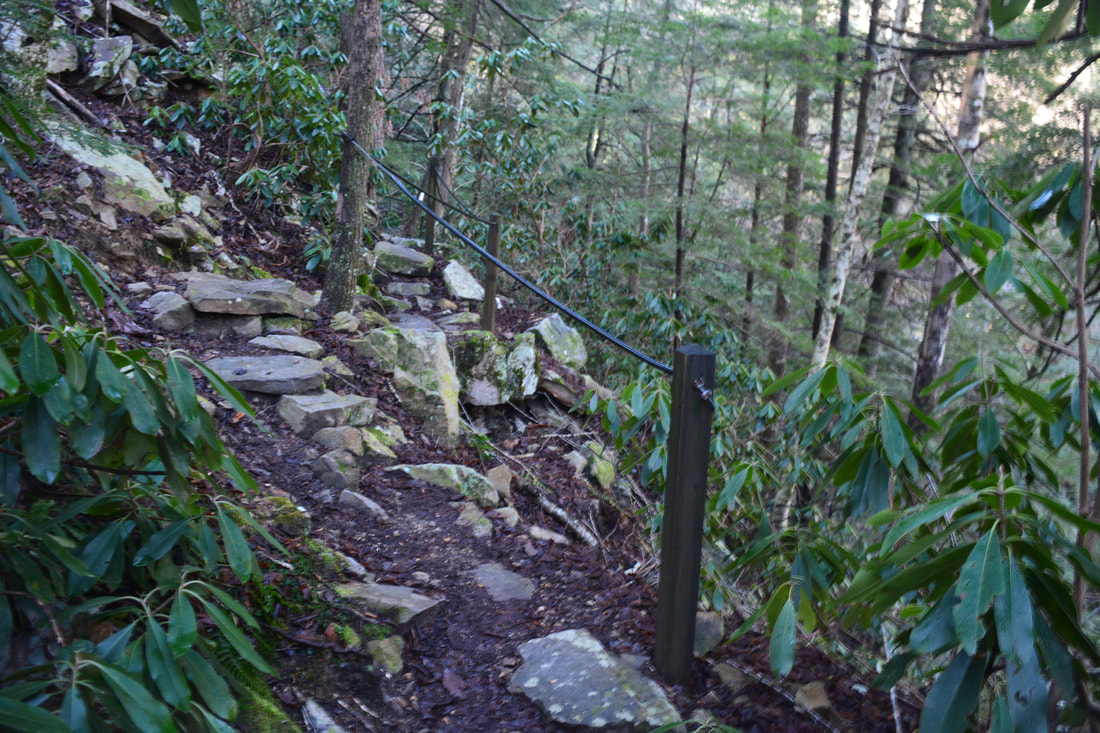
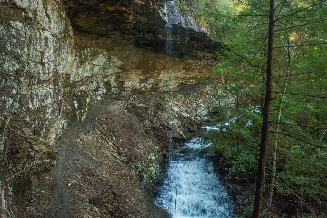
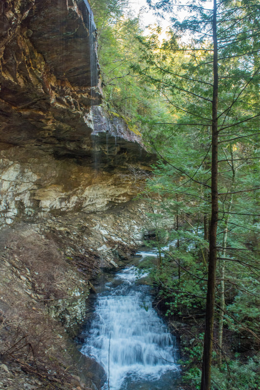
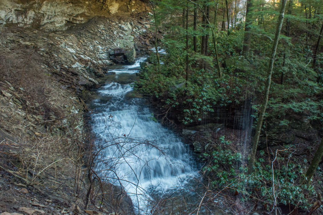
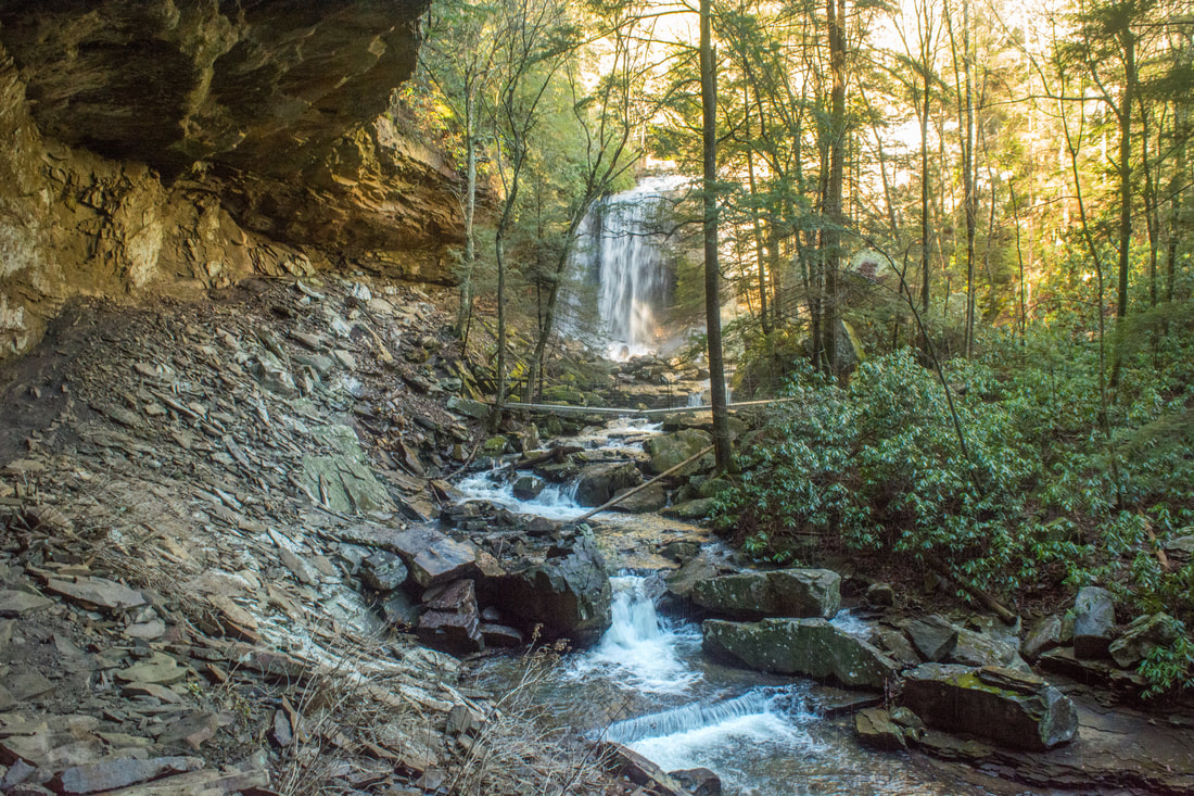
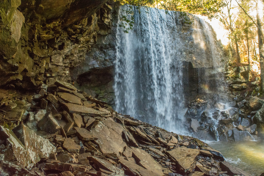
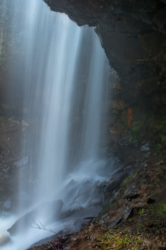
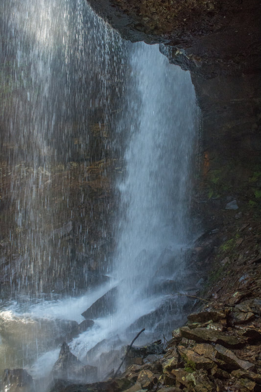
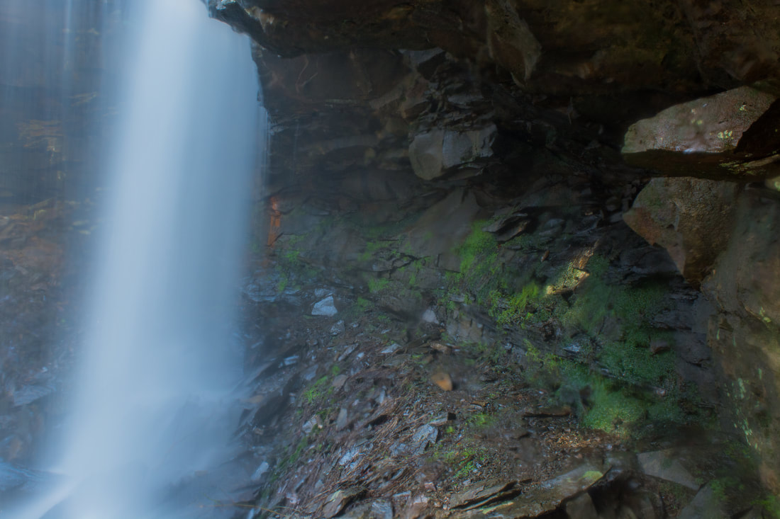
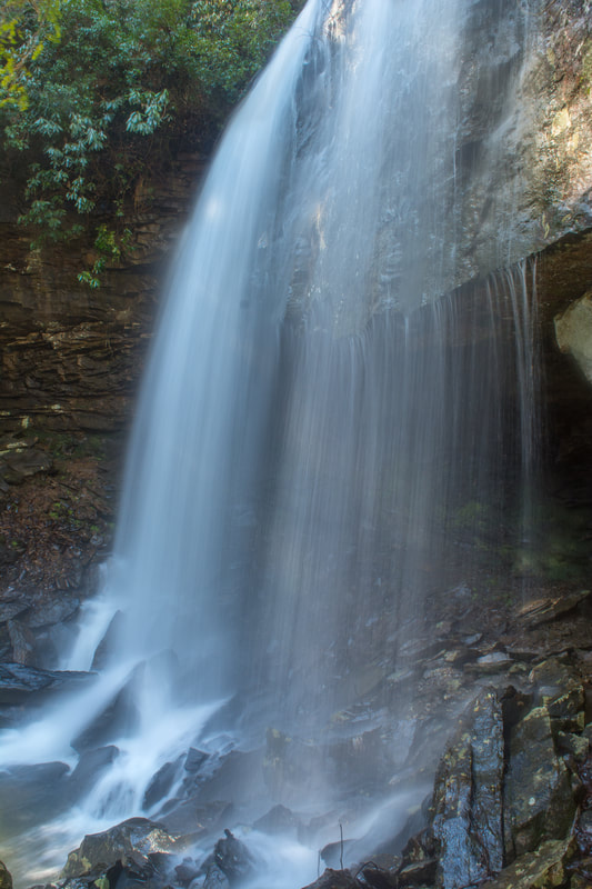
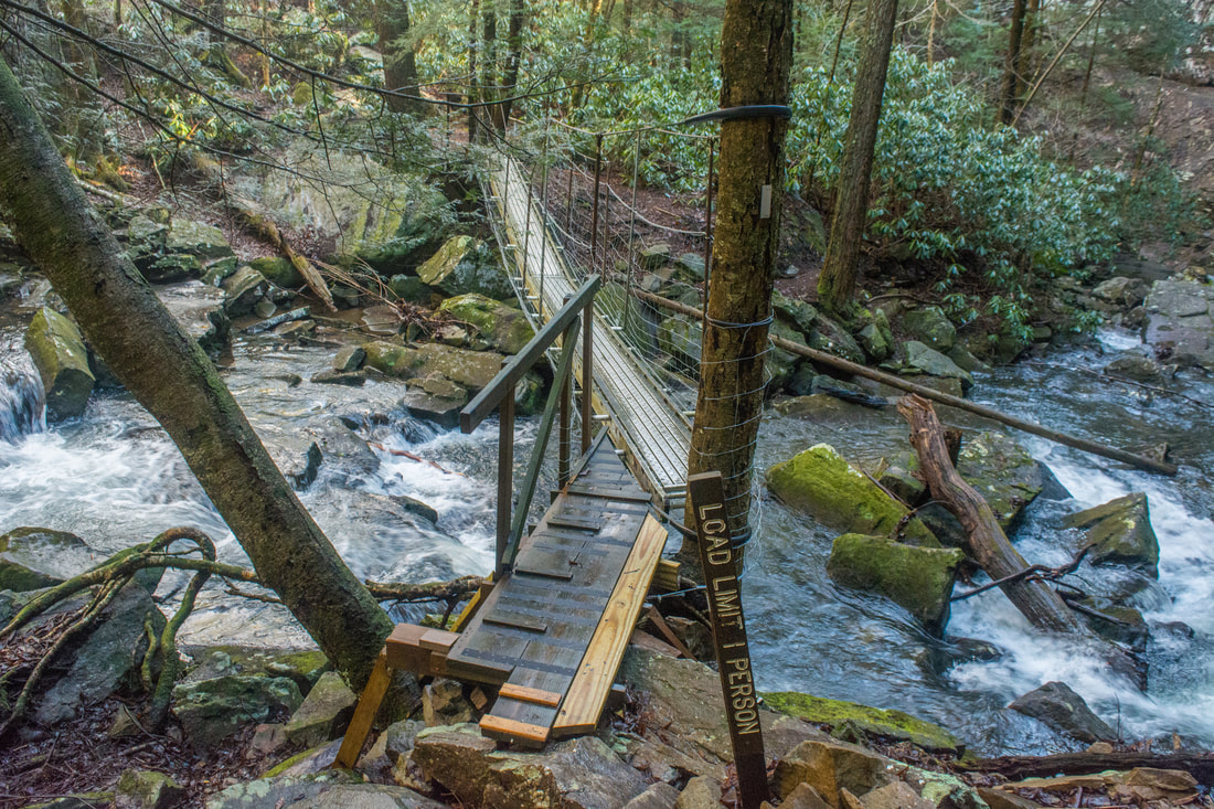
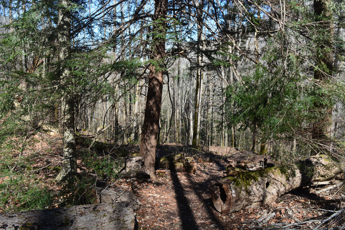
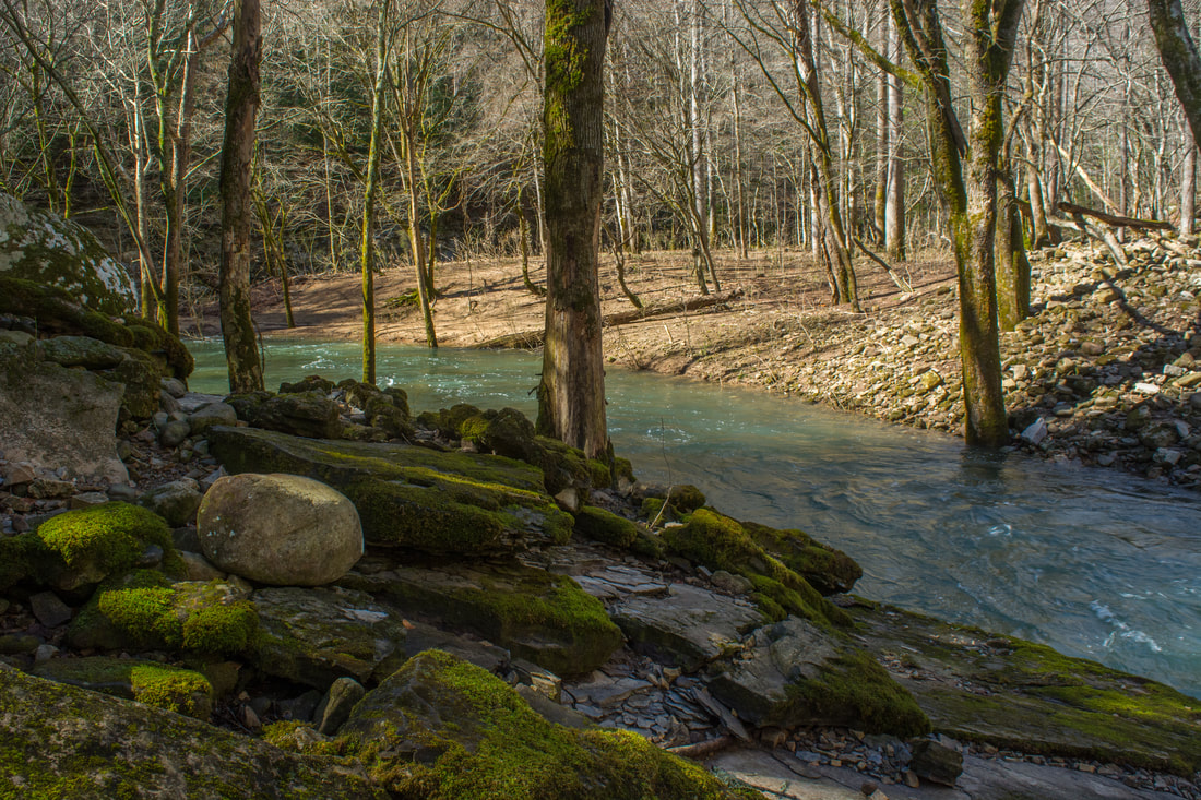
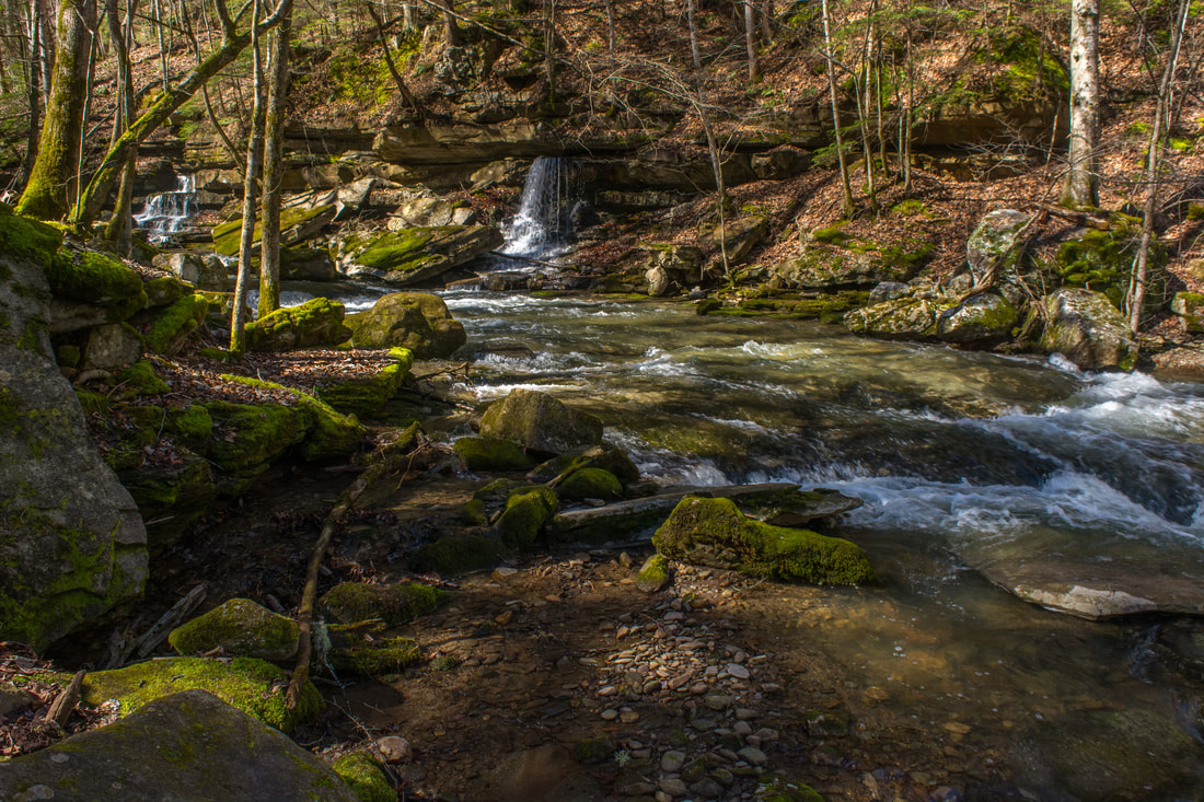
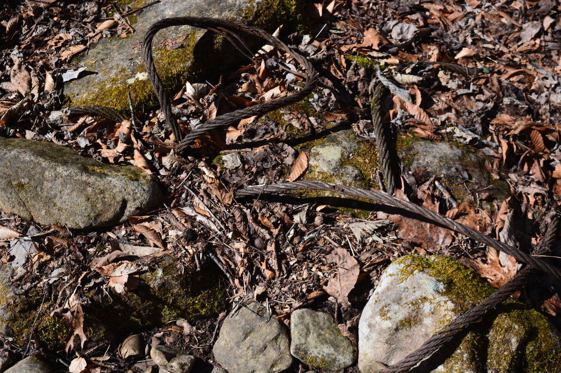
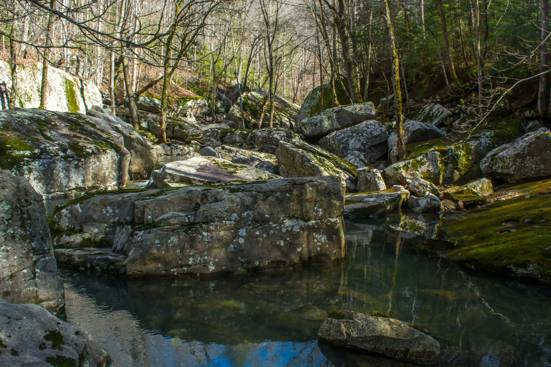
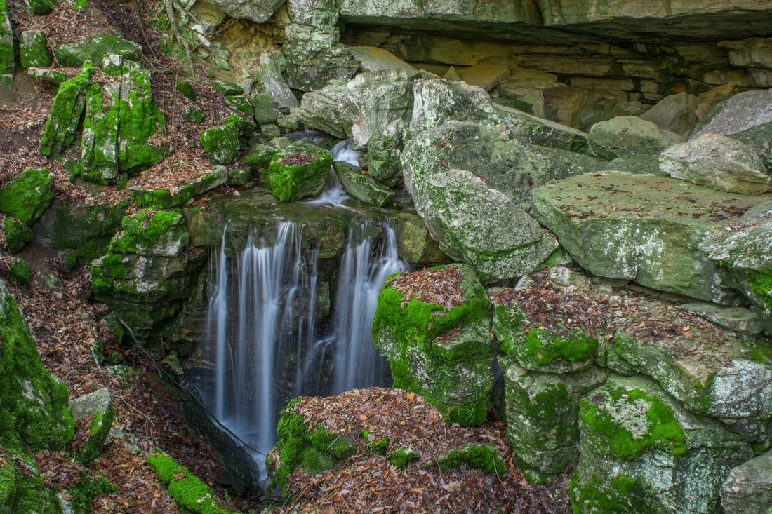
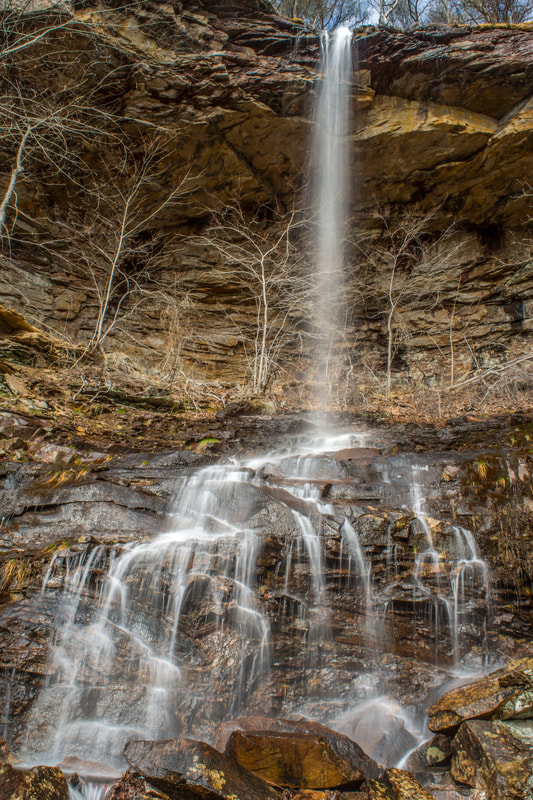
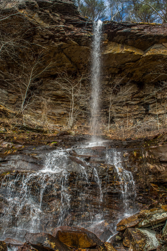
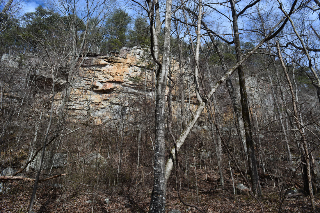
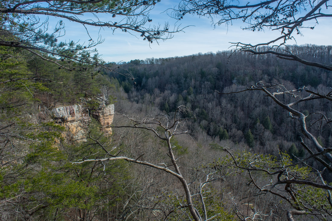
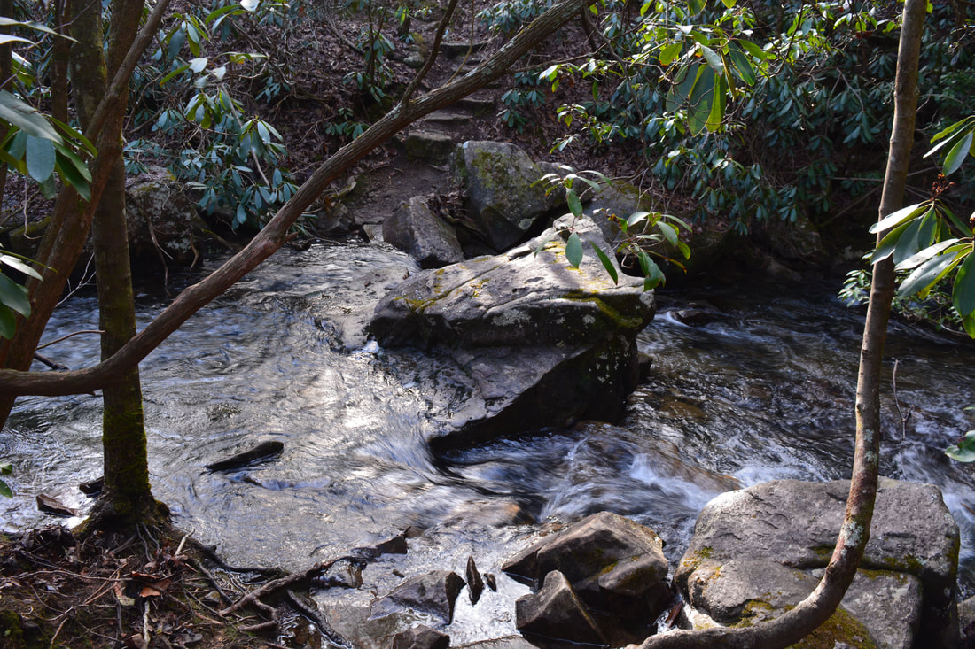
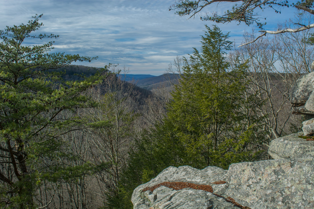
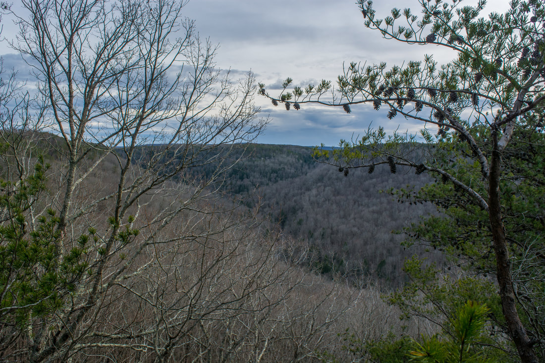
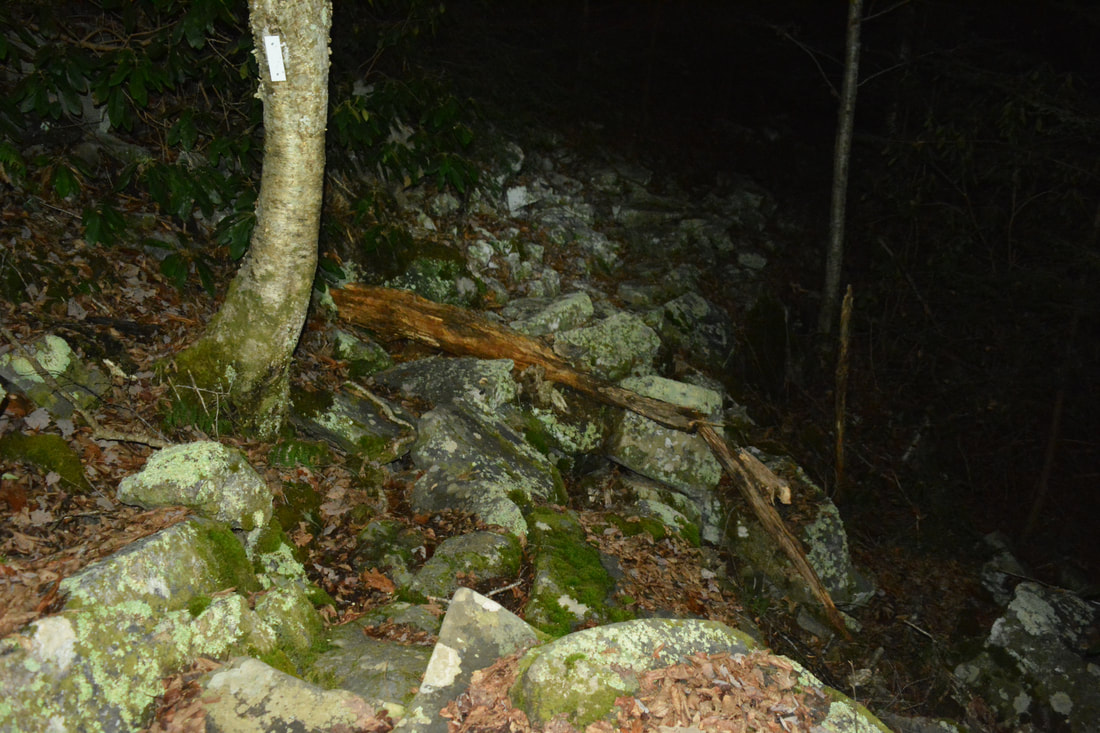
The hike begins at the trailhead kiosk by the parking area off 55th Avenue. Initially, the trail joins an extremely muddy old roadbed. My hike took place following a day of heavy rain, and this stretch of the trail was very wet and messy. At 0.2 miles, the trail passes a small, signed spring on the left that serves to be the water source for the Collins West Campsite. After this, the trail crosses a footbridge across a perennial stream and turns drier. At 0.3 miles, a sign points out the blue-blazed side trail to Collins West Campsite and Collins Gulf Overlook on the right. Make sure to not miss this side trail - the view from Collins Gulf Overlook is the best on the hike. As you pass through a series of campsites, another blue-blazed path leads left back to the trail at 0.4 miles. Turn right and reach Collins Gulf Overlook on an open rock outcrop at 0.45 miles. This viewpoint has nice views downstream along Collins Gulf. The Collins River is audible far below in the gorge. This is also a great viewpoint for observing vibrant fall colors. Retrace your steps and take the other blue-blazed trail back to the main white-blazed trail. The main trail begins a steep descent into the Rocky Mountain Creek gorge along a long set of rock steps. At 0.7 miles, reach the start of the Collins Gulf Loop. The Collins Gulf Trail turns left while the Collins Rim Trail continues straight ahead. If you hike the loop clockwise as I did, turn left onto the Collins Gulf Trail. The rocky descent toward Suter Falls continues. Cables line a piece of the trail. At 0.75 miles, Rocky Mountain Creek comes into view. An astounding cliff curves out along the left side of the creek, forming a tall rockhouse with wet-weather waterfalls spilling over the lip. The trail actually passes directly under one such shower! After this, as Suter Falls slowly appears through the trees, the trail travels along the very base of the cliff just above the creek. A small stairstep waterfall about 10 feet high on Rocky Mountain Creek near the cliff is sometimes called Middle Suter Falls. It is easily seen from the trail. Suter Falls, the amazing rockhouse, and the view of Rocky Mountain Creek all help to make this one of the most scenic spots along the hike - and not even a mile from the parking area! At 0.8 miles, the Collins Gulf Trail arrives at the spectacular Suter Falls. Here, the trail turns right and crosses Rocky Mountain Creek via a rickety suspension bridge that comes complete with a warning sign reading "Load Limit: 1 Person". The 'bridge' is literally just two ladder-type constructions tied together! Since it's part of the official trail though, it must have still been deemed safe to use. Several great spots to view Suter Falls are around the bridge (as well as on the bridge itself). You can also scramble through the boulder field below the rockhouse and get close to the falls. 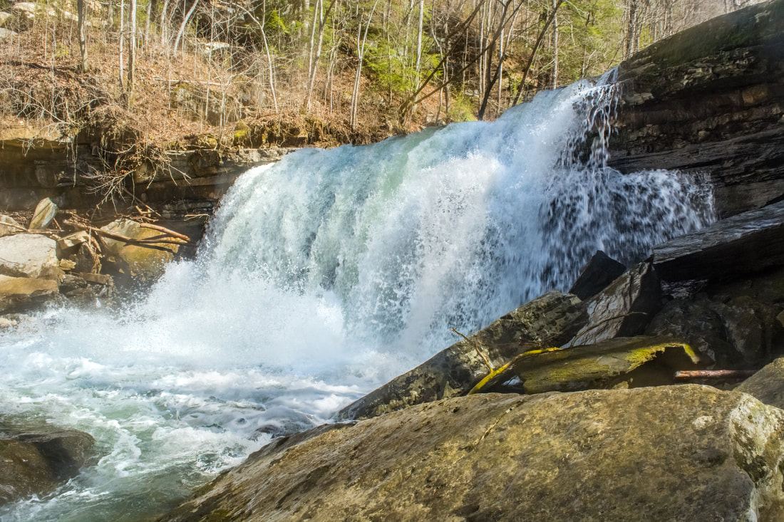
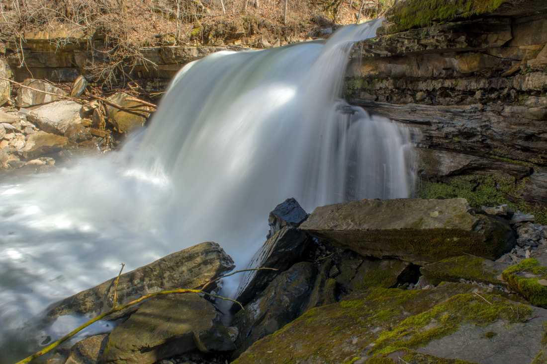
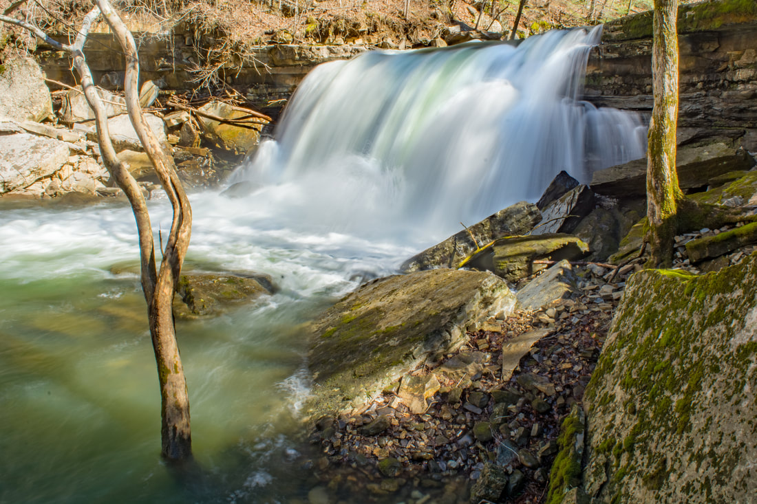
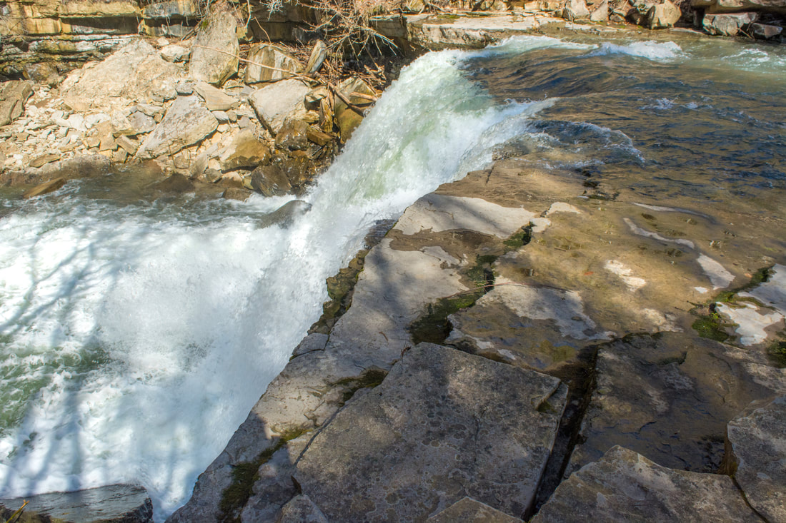
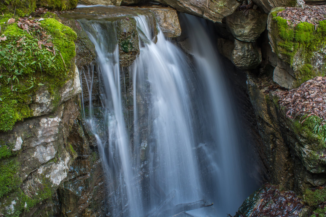
Horsepound Falls is a spectacular block-type waterfall on the Collins River.
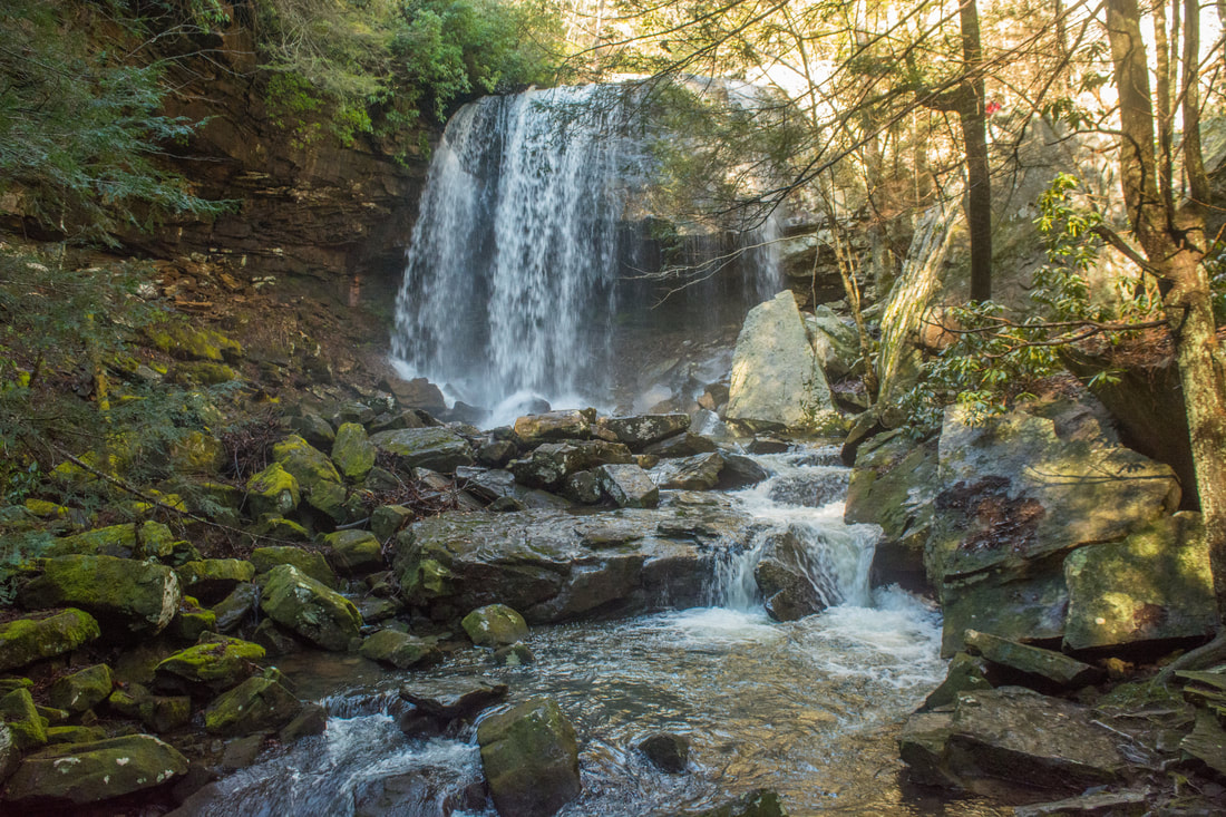
Suter Falls is a 40-foot free-falling waterfall on Rocky Mountain Creek. The creek spills over the lip of the same massive rockhouse and continues to cascade among beautiful mossy boulders. In summer, the boulder field to the left of the falls is peppered with ferns. Words and pictures don't do justice to the incredibly scenic setting of Suter Falls, responsible for the high beauty rating for more than anything else. Suter Falls is stunning during any flow level, although it's at its best when the water is high enough that it spreads out over the entire cliff. In low water, Suter Falls narrows to one slim spout of falling water.
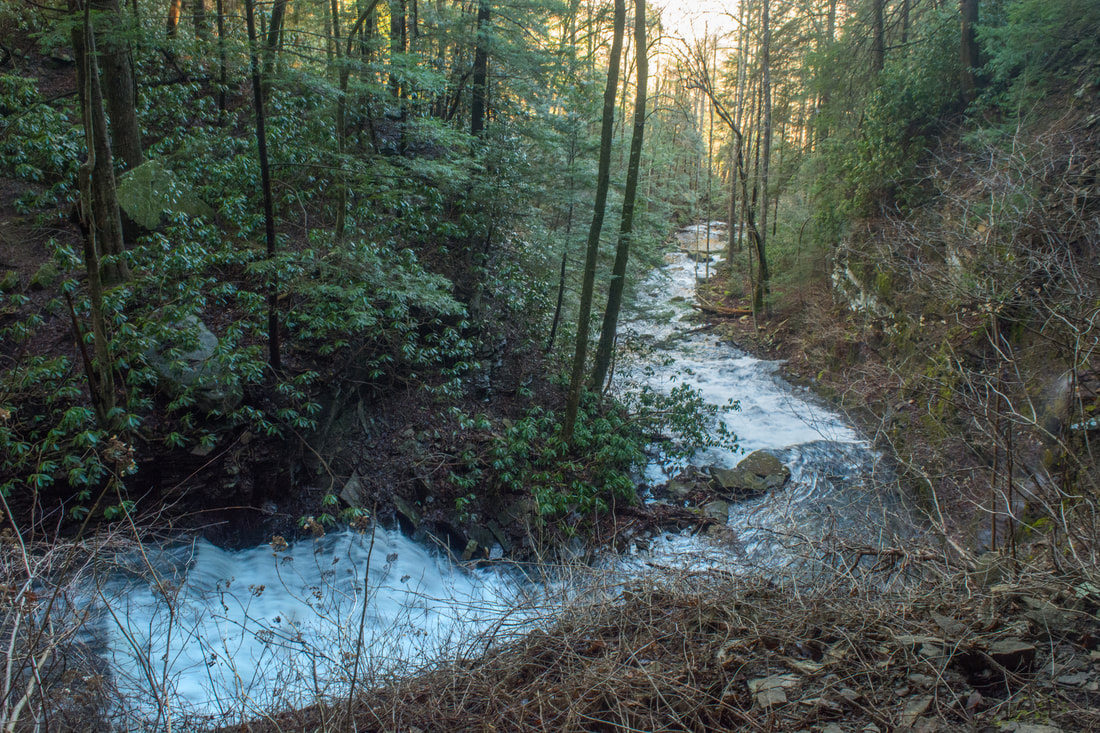
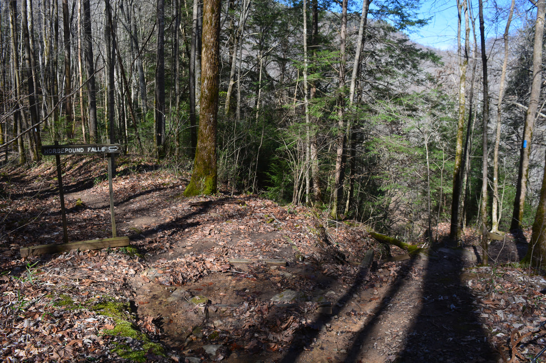
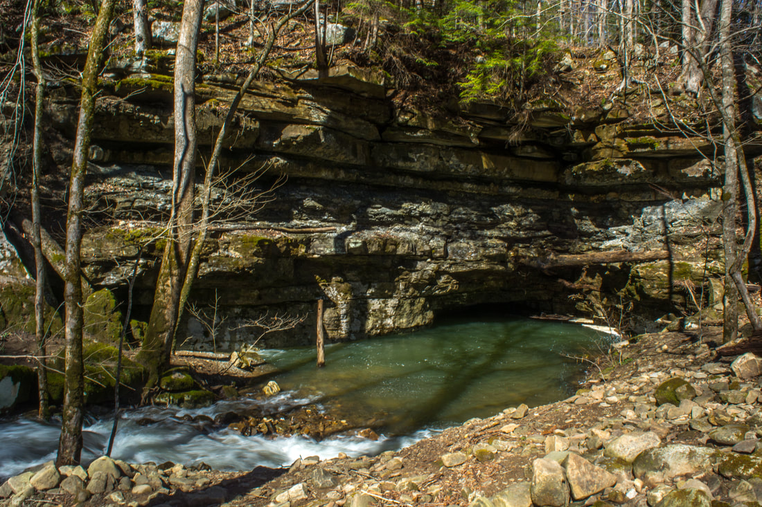
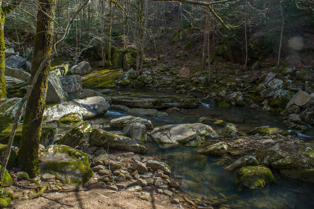
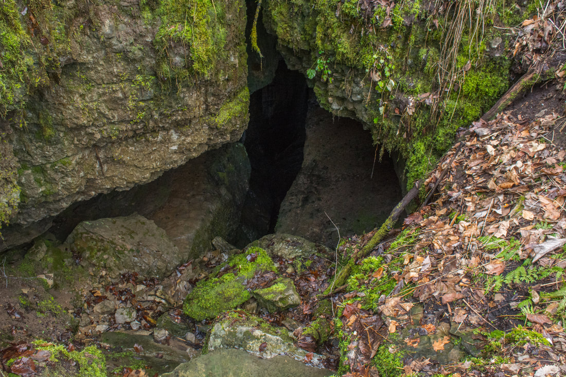
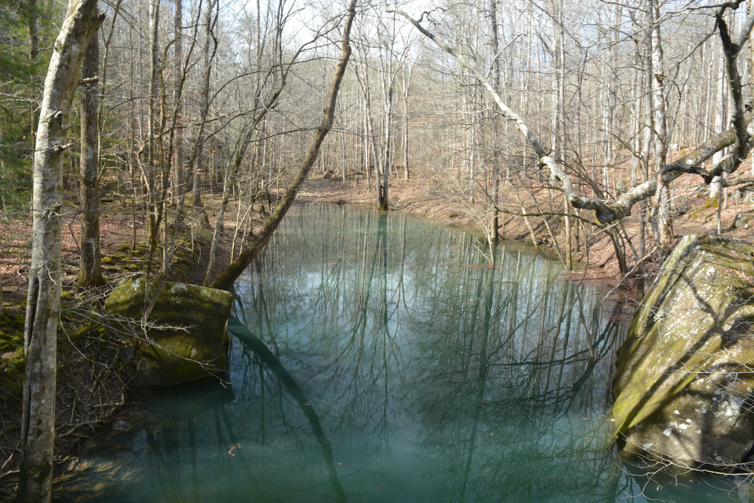
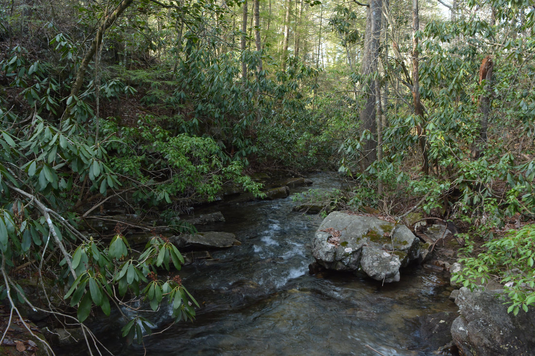
After you've gotten your fill at Suter Falls, resume following the Collins Gulf Trail. The trail initially follows the rugged cliff line, passing a small waterfall cascading off the cliffs at 1.0 miles. You will also see Lower Suter Falls through the trees to the right, a 20-foot ledge-type waterfall. Getting to the base of Lower Suter Falls requires a steep bushwhack, as no trail leads to it, so I skipped it. At 1.25 miles, the trail begins a moderate descent with switchbacks toward the Collins River, passing several mossy boulder fields near the trail along the way. The trail finally comes alongside the river at 1.8 miles. At 2.6 miles, a signed spur trail leaves right and comes to Horsepound Falls in one tenth of a mile. Horsepound Falls on the Collins River is only 20 feet high, but what it lacks in height it more than makes up for power. During high flow, the power of the river here is overwhelming as it thunders over the small cliff and into a turbulent pool. Below the falls, the river suddenly turns tranquil as it approaches the Collins River Sink, where much or even all of the water goes underground!! Meanwhile, the Collins Gulf Trail comes alongside Fall Creek - a major tributary of Collins River - and reaches the Fall Creek Sink at 2.95 miles. Here, the cascading waters of Fall Creek (a large stream in its own right) disappear into the shadowy confines of a cavern. A beautiful blue-green pool is found at the entrance to the cave. If the water level is high enough, you'll see water cascading out of openings in the hillside and into Fall Creek just above the cave. The waterworks here are fascinating! Also, if the water level is as high as it was on this day, some of the water in Fall Creek will overflow into a side channel that dumps into the Collins River to the right near its own sink. When this happens, you'll probably get your feet wet crossing this channel of Fall Creek, although it will be only a shallow wade. On my hike, I was able to utilize a log to the left just fine for crossing the creek, but there's no telling how long it'll remain there. After you cross the channel, take a look to the right and note the large overflow area for the Collins River. This is the Collins River Sink, and although it's not as striking as the Fall Creek Sink, it's still amazing that such a powerful river goes completely underground! In high water, some water continues to flow down the riverbed past the sink, but at that point, the river resembles a small creek more than the large river at Horsepound Falls. 
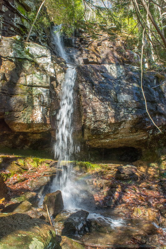
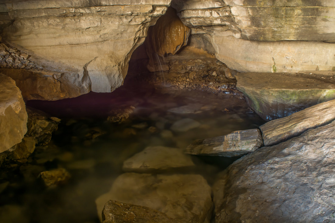
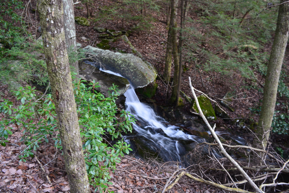
One of Collins Gulf's numerous fascinating water features is this partly-underground waterfall at Schwoon Spring, formed by the water of a stream that exits a cave only to drop back underground in a few dozen feet.
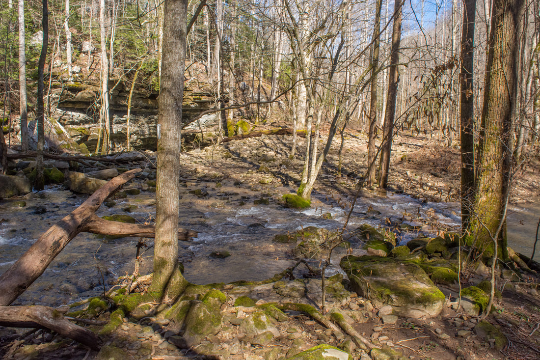
After passing through a short boulder field in the floodplain area, the Collins Gulf Trail continues its journey downstream along the much-smaller Collins River. At 4.05 miles, the trail arrives at a crossing of the Collins River known as the Trumpet Creeper Ford. In normal flow, this is a dry crossing as the riverbed will not have any water. In very high water, particularly after a stretch of heavy rain, this ford could become impassable. On this day, even though the riverbed had a substantial amount of water in it, the crossing was still easily passable, so it really takes a LOT of rain for the crossing to become dangerous. In fact, on this day, I was able to hop across via the large boulders. My companion waded through and the water didn't get far above his ankles. As you cross the riverbed, be sure to take a look at the beautiful mossy boulders in the river, as well as the huge rock garden in the floodplain. Thankfully, the trail aims for slightly higher ground and bypasses the rock garden. At 4.5 miles, a signed spur trail leaves left to Schwoon Spring, another must-see sight along this hike (particularly if the water's up). The spur trail crosses the riverbed again, but unless the water is extremely high, you should be able to rock hop. On the other side, the trail passes through a very rocky stretch and makes a steep ascent to Schwoon Spring, reaching it at 4.65 miles.
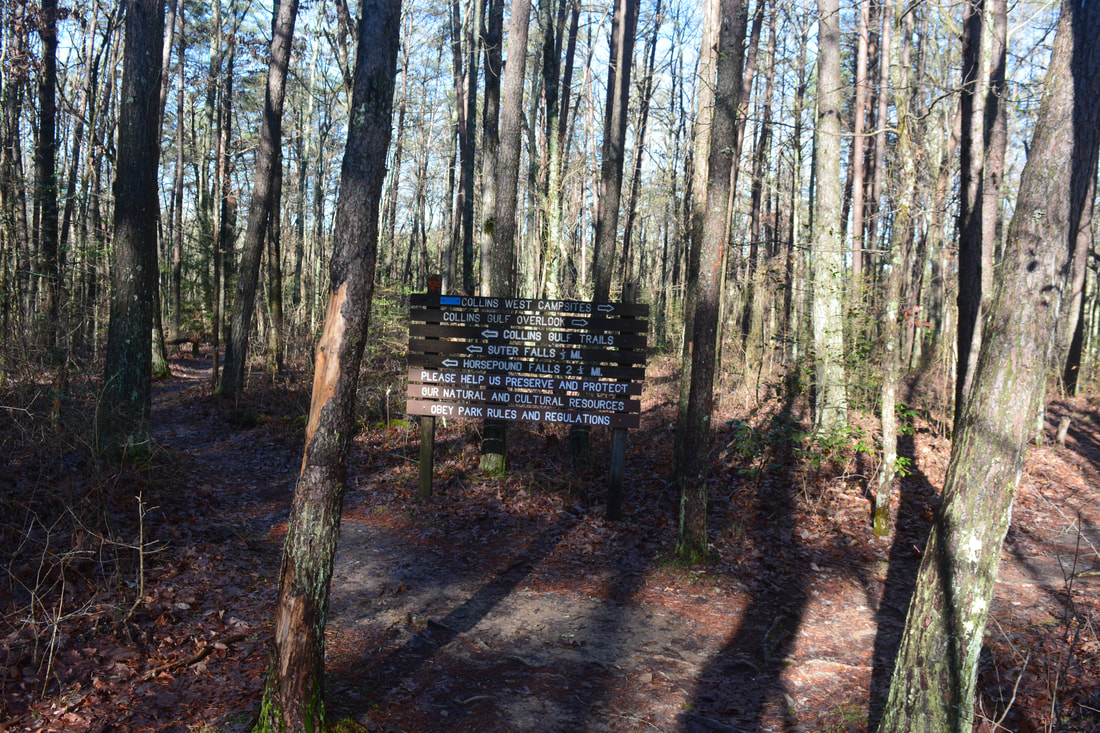
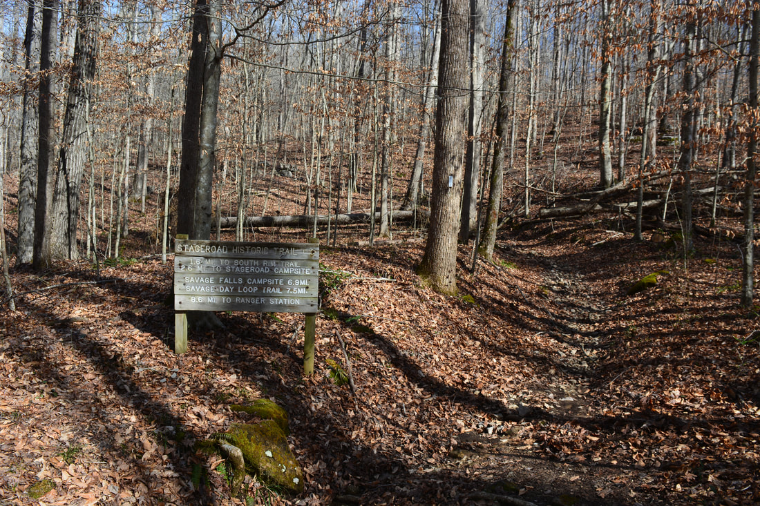
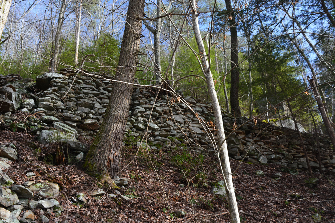
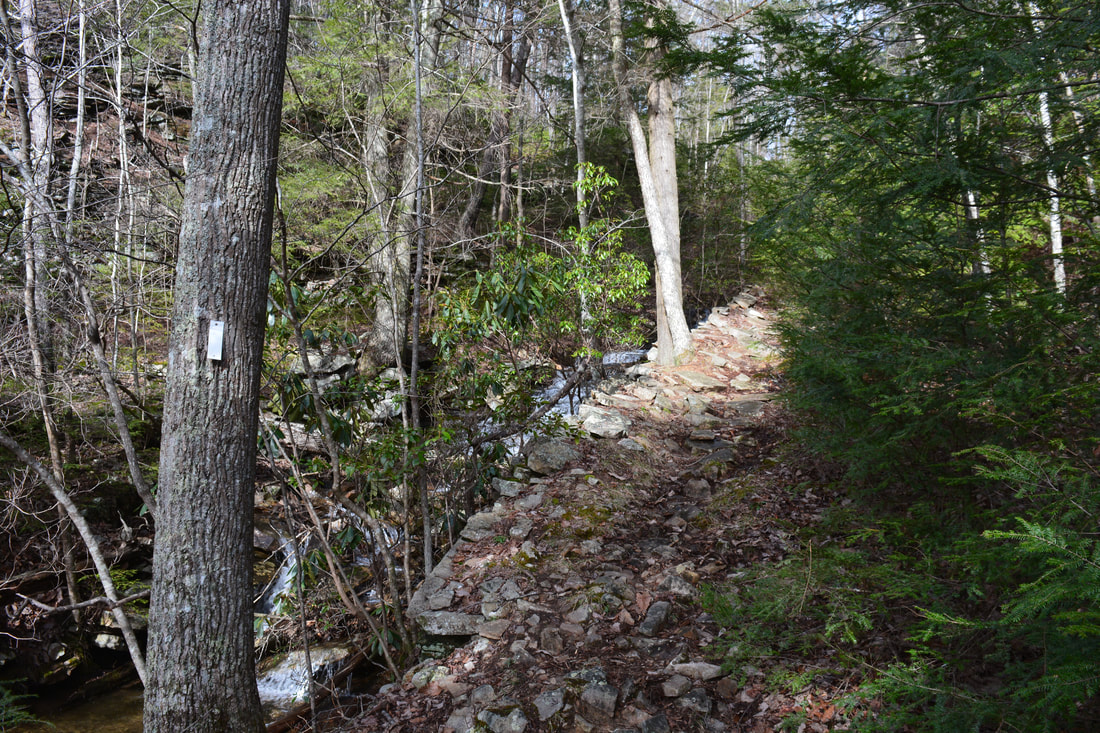
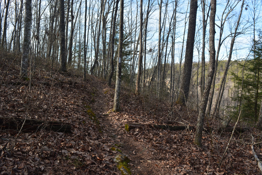
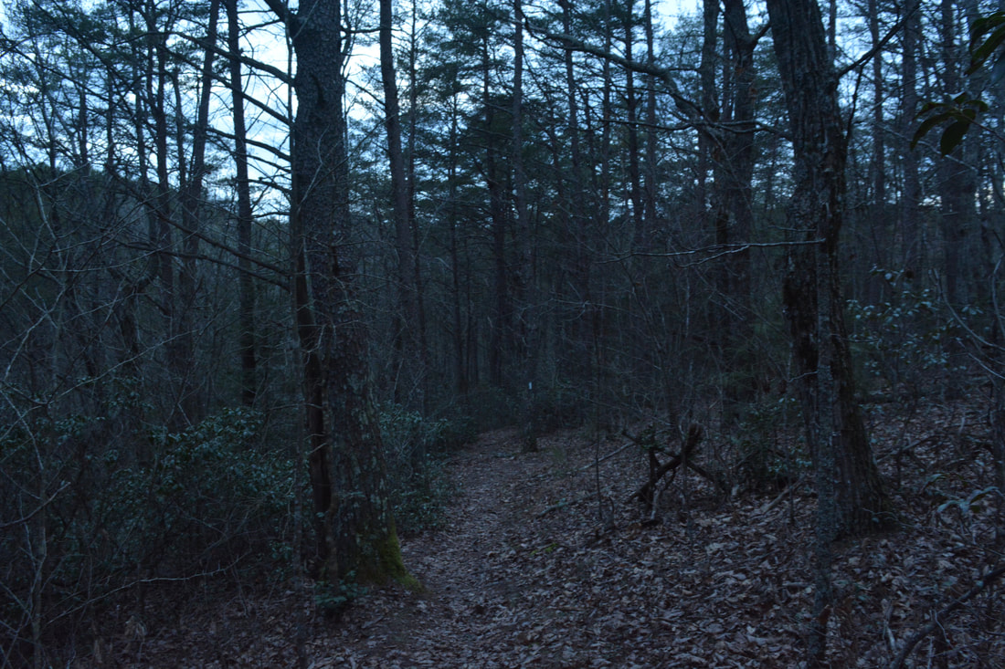
Schwoon Spring is a unique spot. The spring itself is actually a small stream flowing out of a cave under a massive bluff. The stream cascades among big boulders and then drops into a hole in the ground, disappearing from sight for good. As the stream drops back underground, it forms a scenic and interesting waterfall. The height of the falls above ground is maybe 15 feet, but there is probably a lot more of it under the surface that we simply can't see! Just below the spring and falls is another cave entrance too. The Schwoon Spring side trip is quite underrated. Even during normal flow, it has to be a beautiful spot. Returning to the main trail, you'll reach a junction with the Connector Trail at 4.95 miles. To the left, the Connector Trail crosses Collins River on a high suspension bridge and soon reaches the Stone Door area. This hike bears right on the Connector Trail. At 5.0 miles, turn right to stay on the Connector Trail (a side trail to Sawmill Campsite continues straight). The 750-foot ascent out of the Collins River Gorge begins here. At 5.4 miles is the intersection with the Stagecoach Road Historic Trail. The Connector Trail continues straight into the Savage Gulf area, but this hike turns right onto the Stagecoach Road Historic Trail. The next 1.6 miles consist of a gradual but extremely rocky ascent. I wouldn't want to hike the loop in the other direction, as dropping down such a rocky trail is no fun! But why is the trail called a historic trail? The trail follows the route of the historic Stagecoach Road, once a toll road that connected McMinville to Chattanooga. 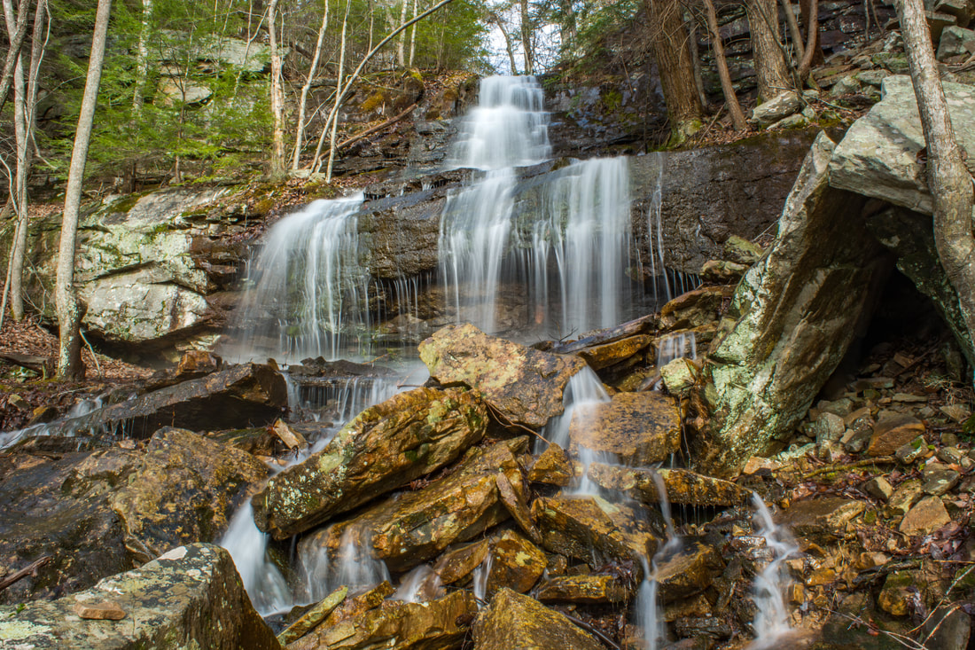
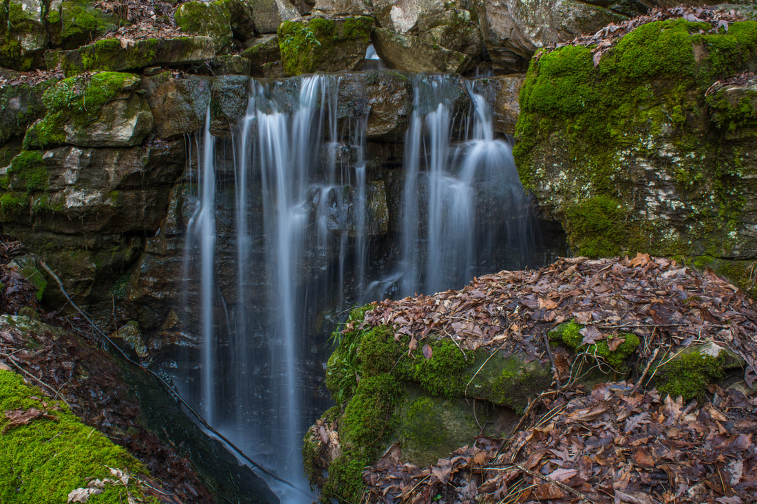
An unnamed waterfall tumbles over the gorge rim along the Stagecoach Road Historic Trail
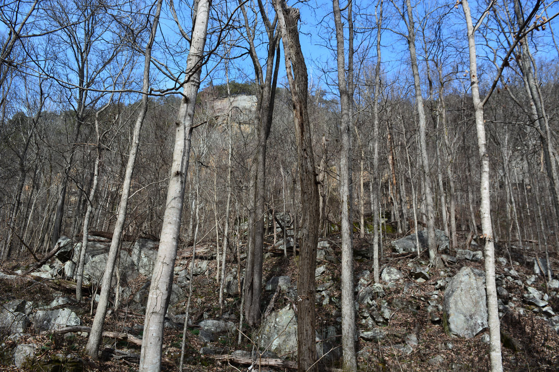
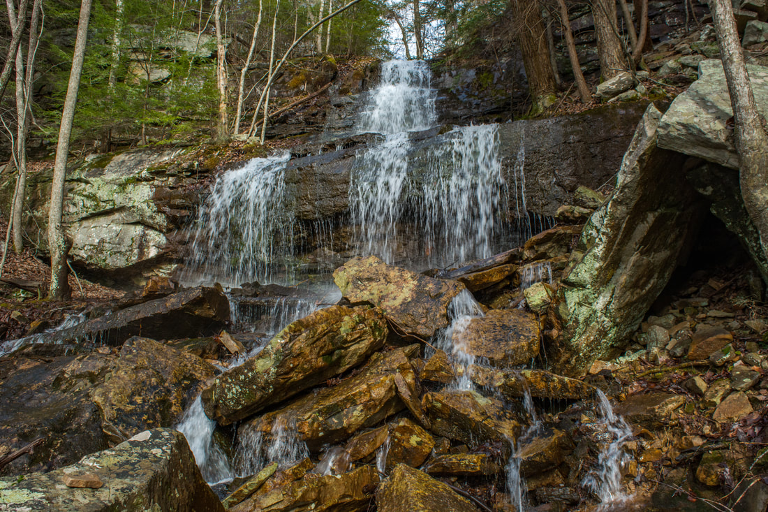
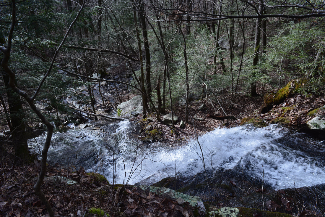
At 6.55 miles, the trail passes just below Skinny Falls. Its height is 100 feet, but the flow rarely is strong. Still, if the water level is up, this is a pretty scenic free-falling waterfall. The free-fall ends with a picturesque cascade. The best way to get to the base is by scrambling up the right side of the unnamed stream. Past Skinny Falls, the trail continues its ascent, getting steadily closer to the rim bluffs. At 6.9 miles, the trail passes the fifth and final waterfall of the hike: an unnamed waterfall cascading off the gorge rim on another small stream. This is a picturesque multi-tier cascading drop about 40 feet high. After hopping across the stream, the trail makes a sharp switchback. Note the rock wall along the trail, which is still following the historic road here. The rock wall was hand-built when the road was being constructed. The trail passes the top of the falls and accesses the top of the plateau through a gap in the cliffs formed by the stream. As the trail approaches the Collins Rim Trail junction, it passes a scenic chute on the stream.
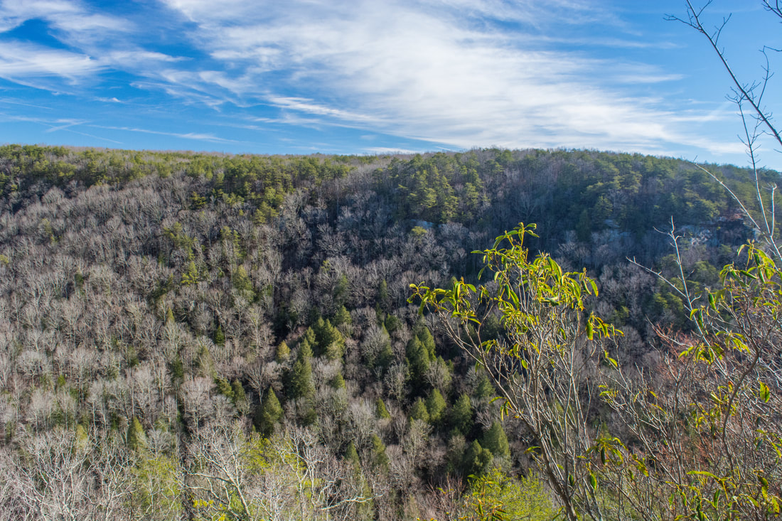
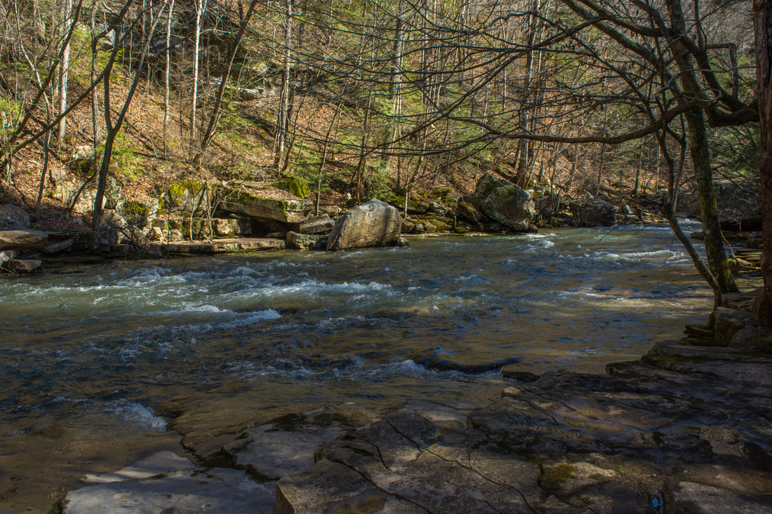
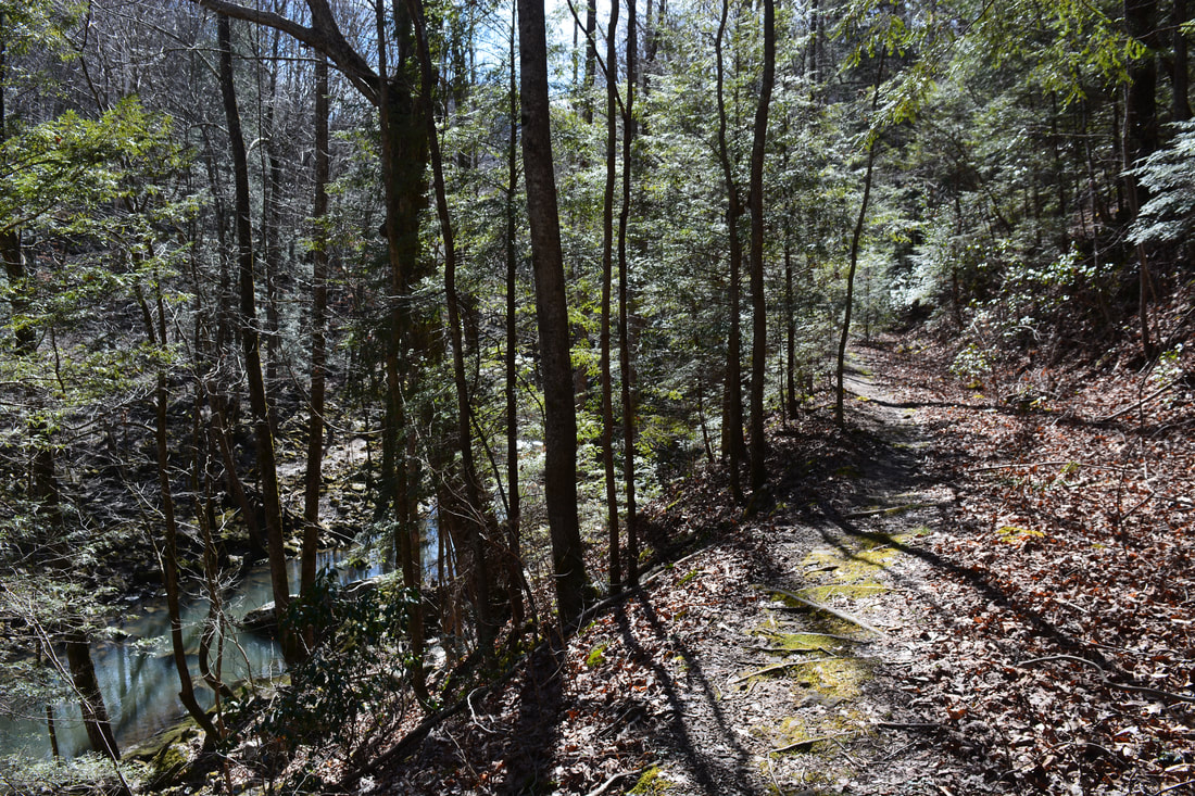
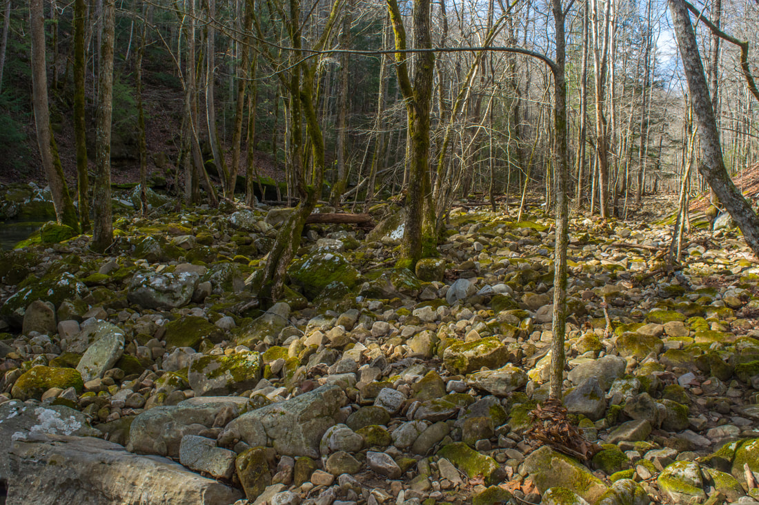
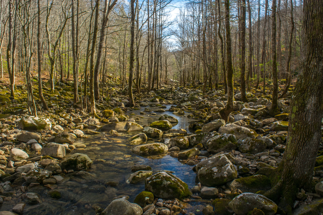
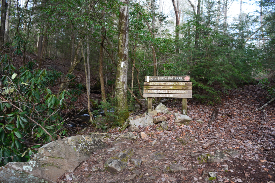
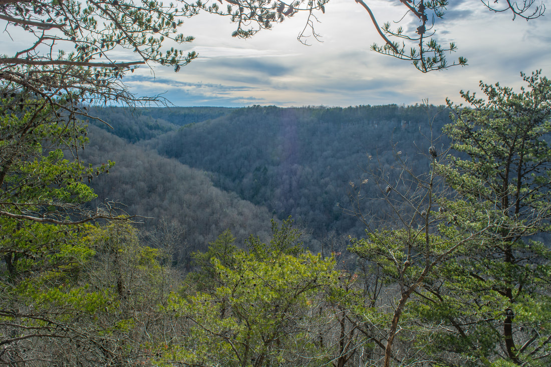
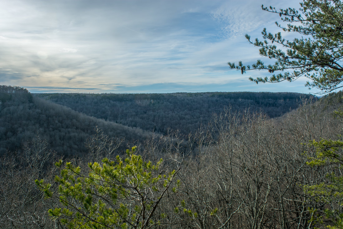
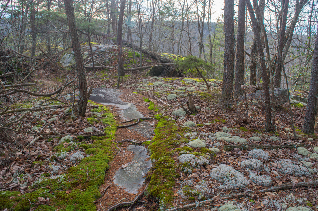
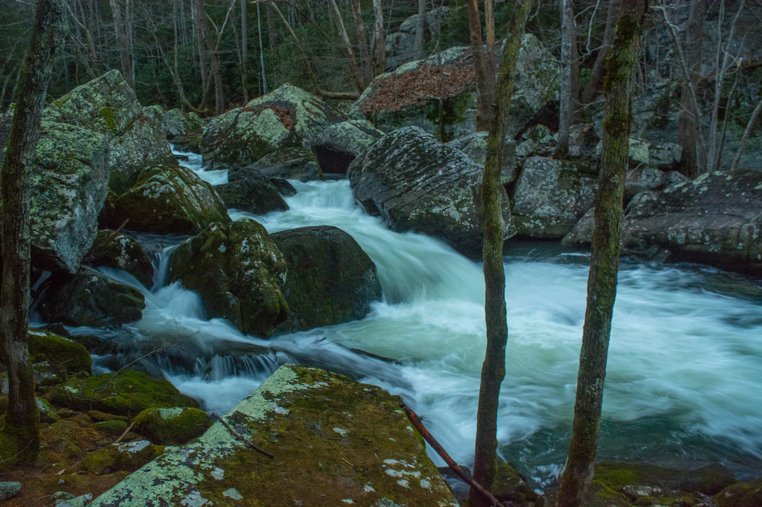
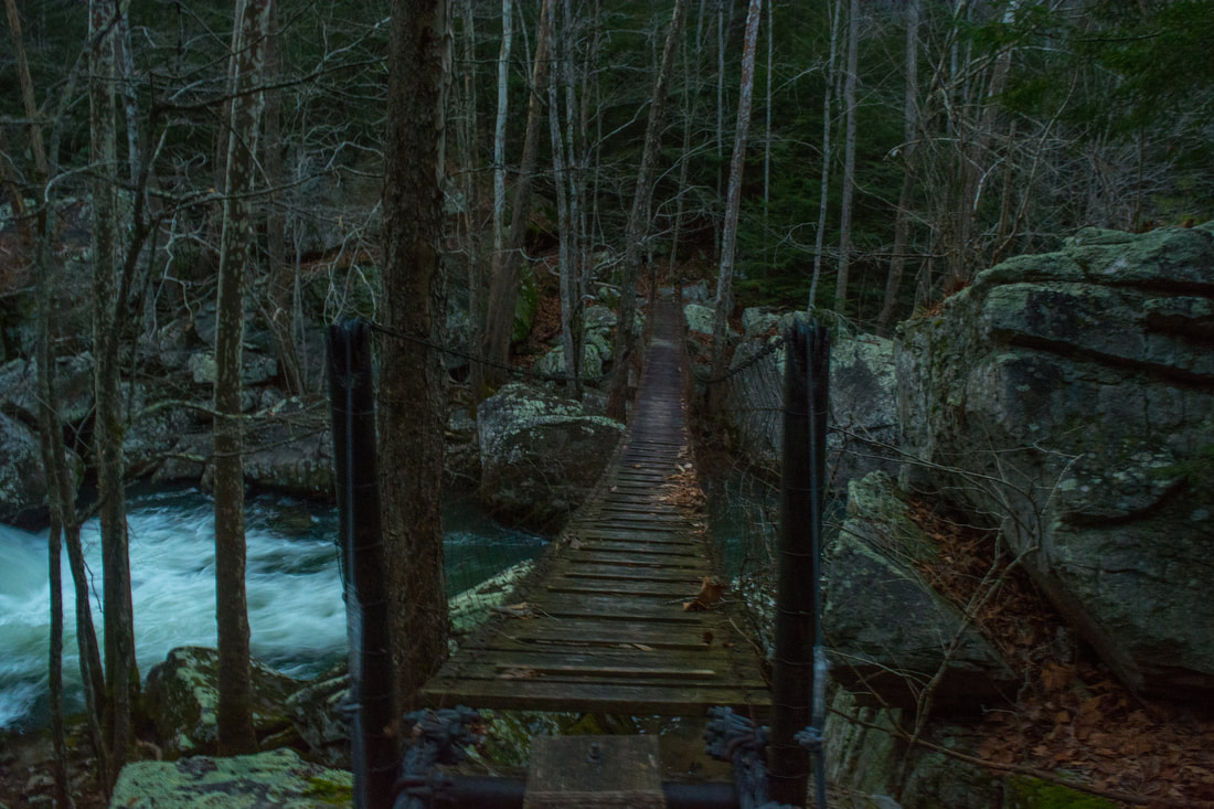
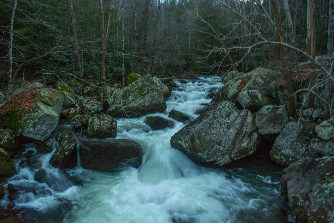
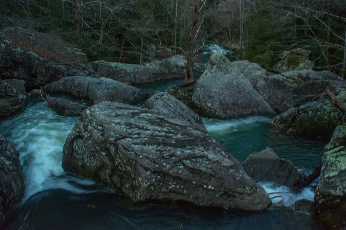
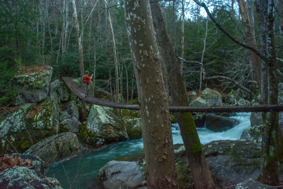
Reach a junction with the Collins Rim Trail at 7.0 miles. To the left is the South Rim Trail, which leads to Savage Falls in about five miles. Meanwhile, the Collins Rim Trail turns right, and that's where this hike turns. The Collins Rim section of the hike isn't as exciting as the Collins Gulf section - it's more of a peaceful woods walk through easy terrain with occasional small cascades and views into the gulf. The first of the four views along the trail is accessed by a short spur trail to the right at 7.45 miles. It leads to Blue Branch Overlook. As with all views along the Collins Rim Trail, it is heavily obstructed by trees. At 8.1 miles, the trail crosses Blue Branch. You should be able to rock hop this rhododendron-lined stream. Side paths lead right to Horsepound Point Overlook at 8.75 miles, Standing Rock Overlook at 9.35 miles, and Collins River Overlook at 9.7 miles. The mileage includes the side paths, each of which is about 250 feet one way. At 9.85 miles, the trail crosses a small stream just above a nice cascade. It crosses two more notable streams at 11.25 miles and 11.7 miles. You should be able to rock hop across both, but it'll be a bit tricky if the water's up. At 11.9 miles, the Collins Rim Trail begins descending back into the Collins River Gorge. The descent is moderately steep with a bit of scrambling towards the end. The trail comes alongside Collins River at 12.1 miles and follows it downstream to a high suspension bridge across the river at 12.2 miles. This spot is known as Boulder Crossing. Boulder Crossing is a very scenic spot. Collins River tumbles over powerful rapids through huge boulders right below the suspension bridge at this spot. The bridge provides a beautiful elevated view of the river. Folks who would like to do only a short hike out and back to Suter Falls and then to Boulder Crossing. Beyond the suspension bridge, the trail enters its most rugged section of the entire hike. For three quarters of a mile, it traverses a huge boulder field where the path consists entirely of stone. Some of the rocks are large, and some move with every step. This section of the trail will make for a slow and tiresome walk toward the hike's end. However, it's still better than doing the loop the other direction, which would involve coming down Stagecoach Road and making the endless gradual ascent along the Collins Gulf Trail. Finally, at 12.95 miles, the trail bears left and joins an old roadbed, leaving the boulder field. At 13.2 miles, the trail reaches the end of the loop. Bear left on the access trail to 55th Avenue, retracing your earlier steps. The steep ascent out of the gorge will also be tiring after such a long day of hiking rugged trails. You'll return to the parking area at 55th venue at 13.7 miles, concluding the hike. Mileage
0.0 - 55th Avenue Trailhead
0.45 - Collins Gulf Overlook 0.7 - Begin Collins Gulf Loop 0.8 - Suter Falls 2.7 - Horsepound Falls 2.95 - Fall Creek Sink 4.65 - Schwoon Spring 6.55 - Skinny Falls 6.9 - Unnamed Falls (along Stagecoach Road Historic Trail) 7.45 - Blue Branch Overlook 8.75 - Horsepound Point Overlook 9.35 - Standing Rock Overlook 9.7 - Collins River Overlook 12.2 - Boulder Crossing 13.2 - End Collins Gulf Loop 13.7 - 55th Avenue Trailhead Variations
Hike out and back to Collins Gulf Overlook and Suter Falls - 1.4 Miles
Hike out and back to Collins Gulf Overlook, Suter Falls, and Boulder Crossing - 3.4 Miles Hike out and back to Collins Gulf Overlook, Suter Falls, and Horsepound Falls - 5.2 Miles Bonus Stops
On the north side of Savage Gulf Natural Area is Laurel Falls near the Stone Door Ranger Station. Laurel Falls is a beautiful waterfall when the flow is good, and it can make for a nice add-on to the Collins Gulf Loop, given that the hike to it is short and easy.
Pictures & Videos
0 Comments
Leave a Reply. |
About MeMark Oleg Ozboyd Dear readers: I have invested a tremendous amount of time and effort in this website and the Georgia Waterfalls Database the past five years. All of the work that has gone in keeping these websites updated with my latest trip reports has almost been like a full-time job. This has not allowed me to pick up a paid job to save up money for college, and therefore, I I've had to take out loans. If you find the information on this website interesting, helpful, or time-saving, you can say "thanks" and help me out by clicking the button above and making a contribution. I will be very grateful for any amount of support you give, as all of it will apply toward my college tuition. Thank you!

Coming in 2022-2023?
Other Hiking WebsitesMiles HikedYear 1: 540.0 Miles
Year 2: 552.3 Miles Year 3: 518.4 Miles Year 4: 482.4 Miles Year 5: 259.9 Miles Archives
March 2021
Categories
All
|
||


 RSS Feed