One of the most distinctive landmarks in Vermont and the third-tallest peak in the state, the rocky, alpine dome of 4,085-foot Camel's Hump is known well for its incredible 360-degree views overlooking a lengthy swath of the Green Mountains, with Lake Champlain, the Adirondacks, and the Whites all in view. Although Long Trail - Vermont's own long-distance trail - directly crosses the summit, getting there is still a steep, strenuous ascent from any direction. What some people fail to realize though is that Camel's Hump is just one highlight of the Long Trail as it runs south to Highway 17. The 11.7-mile section of the Long Trail between Camel's Hump and Appalachian Gap is never dull, featuring a variety of overlooks, spectacular bluffs, intricate rock mazes, bogs, and the signature viewpoint atop Burntrock Mountain. Expect this to be a difficult and slow hike that will take all day and test your physical shape. This hike occurred on Saturday, October 5th, 2019. My plan was to leave two cars - one at Appalachian Gap on Hwy 17 and one at the Burrows Trailhead - and start ascending the Burrows Trail to Camel's Hump. I would join the Long Trail near the summit, and I'd follow the Long Trail the rest of the day to Appalachian Gap.
Summary
R/T Length of Trail: 13.8 Miles
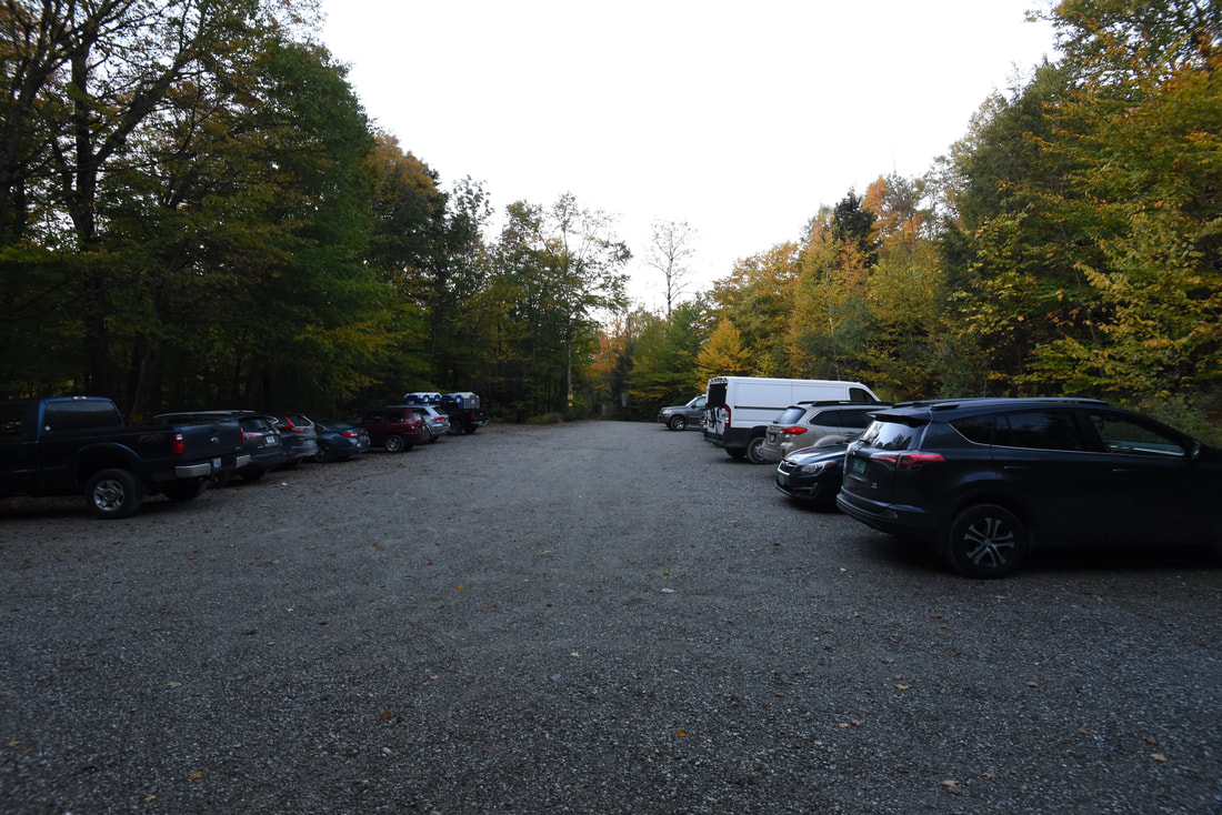
Duration of Hike: 9:45 plus 2 hours and 15 minutes of stopped time Type of Hike: Point-to-Point (two cars required) Total Elevation Gain: 5,352 feet Difficulty Rating: 9 out of 10 Pros: Numerous viewpoints throughout the hike; very scenic rock features often present along the Long Trail; section between Hedgehollow Brook Trail Junction and Birch Glen Shelter is easy and a welcome relaxation compared to the rest of the hike Cons: Every single main ascent and descent on the hike is extremely steep, rocky, and rugged, making for very slow hiking Points of Interest: Camel's Hump Views - 10+ stars; Views along the ridge between Camel's Hump and Wind Gap - 8 stars; Views from Mount Ethan Allen - 7 stars; Views from Burntrock Mountain - 10 stars; View from Molly Stark Balcony - 7 stars Trail Blaze Colors: Burrows Trail - Blue; Long Trail - White Best Seasons to Hike: Summer, Fall Fees: None Beginning Point: Burrows Trailhead for Camel's Hump Directions to Appalachian Gap Trailhead: If coming from Bristol, follow VT 17 East from the VT 116 junction for 9.6 miles to Appalachian Gap. The parking area will be on the left in the gap. If the lot is full, there is extra space to park along the road shoulders. If coming from Waitsfield, follow VT 17 West from the VT 100 junction for 6.2 miles to the Appalachian Gap parking area. Directions from Appalachian Gap Trailhead to Burrows Trailhead: Follow VT 17 West for 2.7 miles. Then, turn right on Gore Road (which later becomes Main Road) and continue 6.2 miles to Camels Hump Road on the right in the town of Huntington. Turn onto Camels Hump Road, and stay right at the Y-split in 0.6 miles. After the Y-split, continue another 2.8 miles to the end of Camels Hump Road at the Burrows Trailhead. The road becomes unpaved but is easily drivable for all passenger vehicles. The last 0.4 miles of Camels Hump Road are steeper and narrower, and are not maintained during winter. Thus, winter hikers must park in the lower winter lot, adding 0.4 miles to their hiking distance (0.8 miles roundtrip if doing and out and back hike to Camels Hump). Map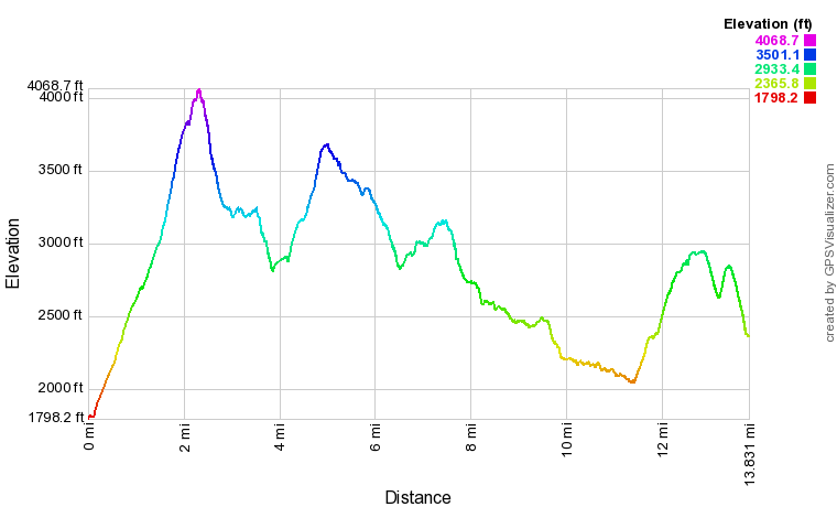
Click the link below to download a .GPX file with a track of this hike.
Details
Camel's Hump is a peak that consistently hovers near the top of New England peakbaggers' lists. With such a distinct profile and unique name, it's not hard to imagine why - the peak is the third tallest in Vermont and one of the best views in the state. However, my hike on the Long Trail all the way to Highway 17 illustrated that Camel's Hump is far from being the only highlight of this trail. While tough, this is one spectacular hike, with numerous vistas scattered all throughout and complemented by many fun rock scrambles and intricate cliff outcrops. Just be sure to take ample of time to complete this section of the Long Trail - we started our hike at 7 AM and still finished after sunset, hiking at a moderately fast pace. One more note of interest - you may notice that hiking the Long Trail in the direction I did, from north to south, from Burrows to Appalachian Gap, actually involves about 600 feet more ascent than descent. It may thus be counter-intuitive hiking the trail in this direction. I thought the same thing, but trust me, this is definitely the direction you want to hike it in! You'll get the most rugged sections of the trail out of the way in the first half of the day, and the walking will become increasingly easier after Burnt Rock Mountain. You'll unfortunately still have a 1,000-foot climb up Molly Stark Mountain not far from the end, but that's better than the brutal climb you'd have coming up Camel's Hump the opposite direction at the end of a long day! If you were to hike from Appalachian Gap to Camel's Hump, the walking would just become increasingly slower/more difficult, and I feel confident that it would appear as if there's more ascent than descent. Furthermore, I feel like descending the insanely steep and rocky Burrows Trail would be an extremely unpleasant experience.
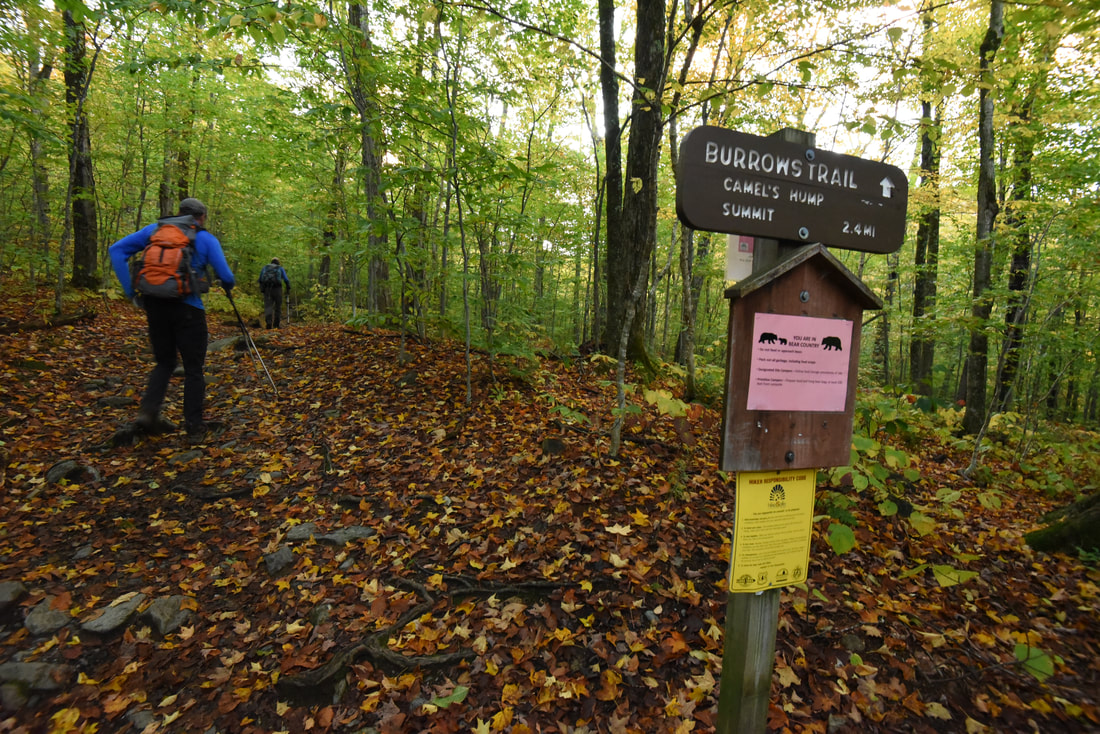
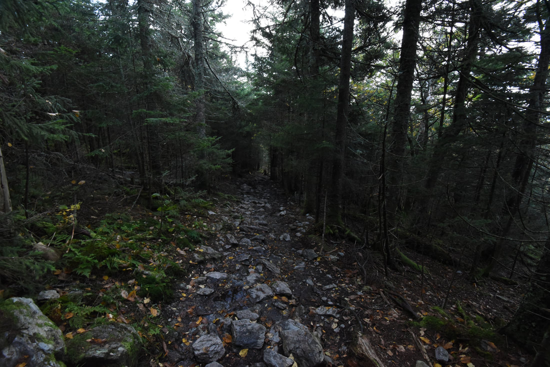
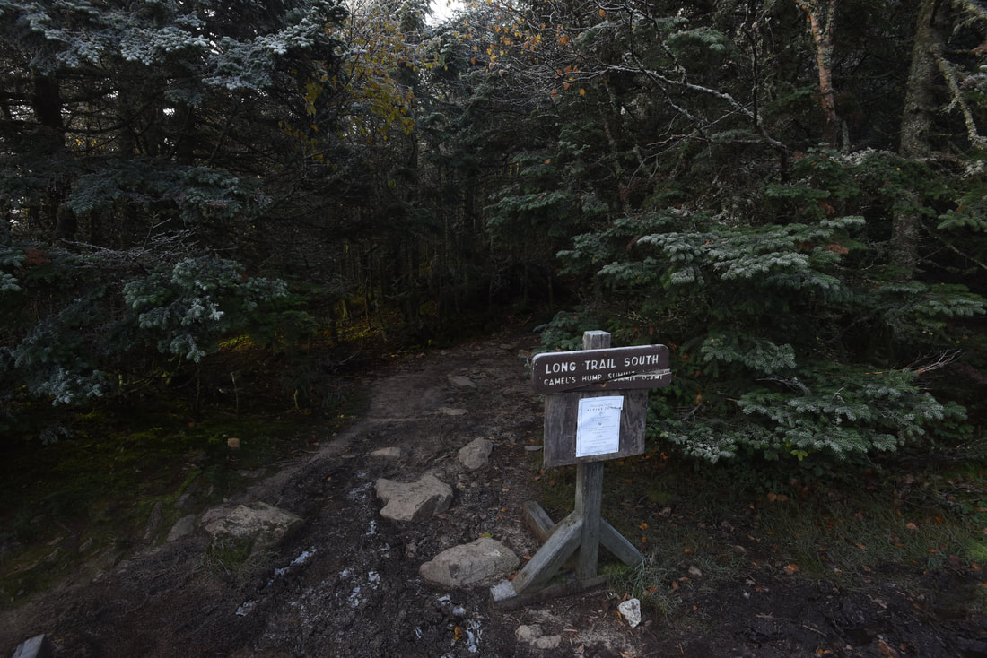
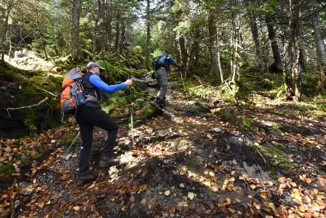
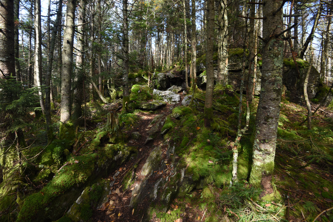
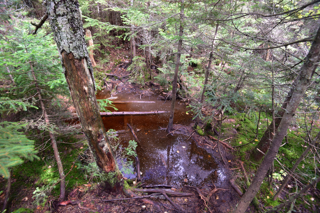
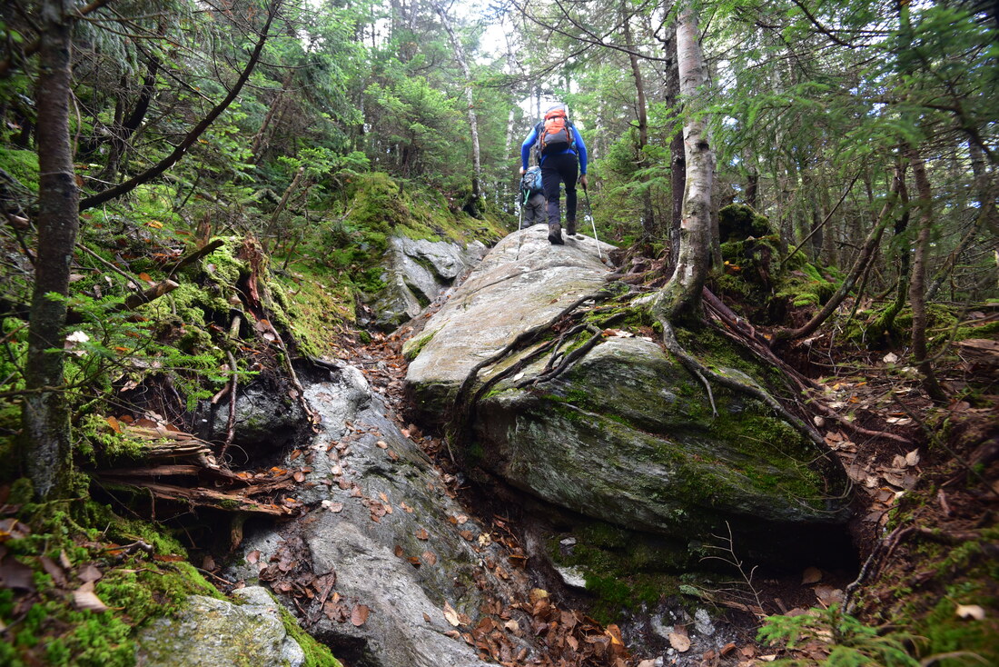
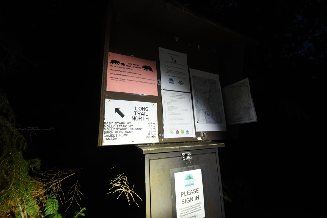
The hike begins at the Burrows Trailhead, one of two trailheads commonly used to access Camel's Hump (the other being Monroe Trailhead on the east side). Burrows Trail is the shorter of the two, but it's also noticeably steeper. The trail is 2.1 miles long and ascends 2,000 feet in this distance. Initially, the trail is just a relentless moderately steep climb through a scenic hardwood forest on the west side of Brush Brook. Around the 0.7-mile mark, the trail steadily turns steeper and more rugged. The forest starts transforming into more of a spruce-fir forest, and obstacles in the form of large rock outcrops become increasingly common. These obstacles often form welcome breathers for the ascent, though they would make the descent very annoying. The steepest stretch is from roughly 1.6 to 1.9 miles, when the trail climbs over 500 feet! After cresting the ridge, the trail drops down a few feet and reaches a junction with the Long Trail and Monroe Trail in the Hut Clearing at 2.1 miles. The grassy clearing in front of you, encircled by dense spruce, is the site of the Green Mountain House - a hotel built for travelers in 1859. It burned down in 1875. Later, in the early 20th century, the Camel's Hump Club - a local hiking group - used the clearing for three tin huts, but they were also removed in the 1950s, and no relics remain today. The Long Trail crosses the clearing perpendicularly. Straight ahead, the Monroe Trail leads 3.1 miles to the Duxbury parking area. To the left, the Long Trail leads 4.9 miles north to the lesser-used Banforth Ridge parking area along Duxbury Road in the Winooski River Valley - and eventually all the way to Canada. This hike turns right on the southbound Long Trail, in the direction of the Camel's Hump summit, which is only about 200 feet higher. 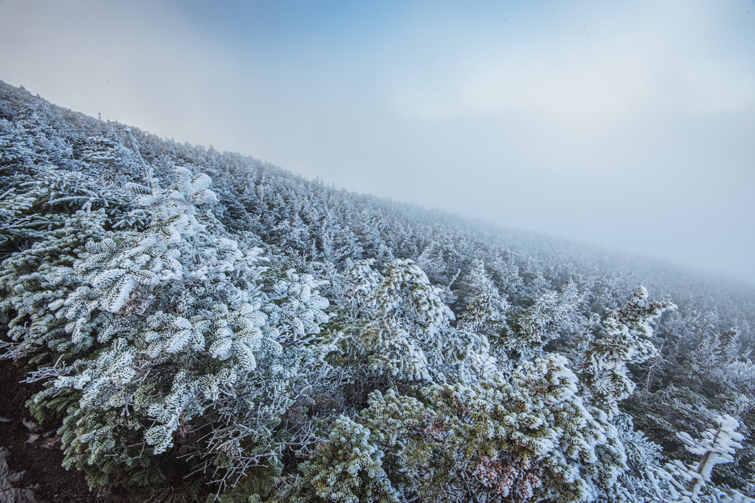
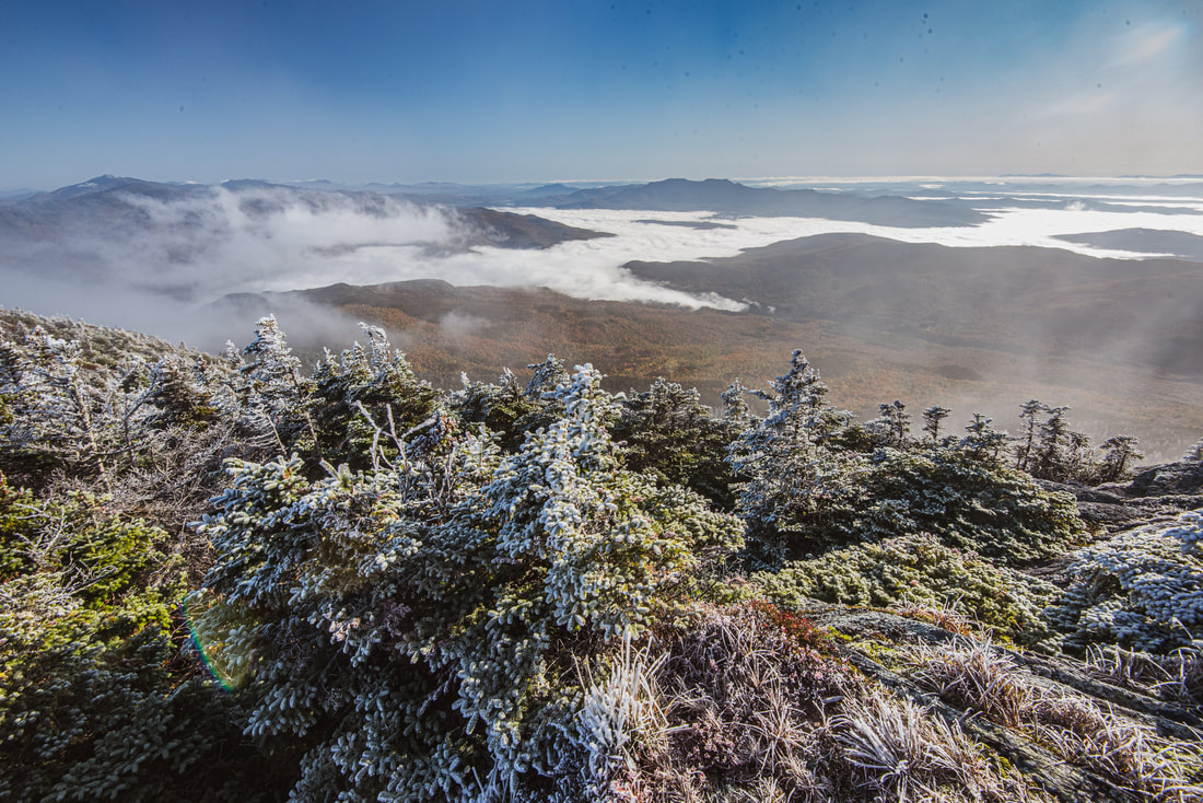
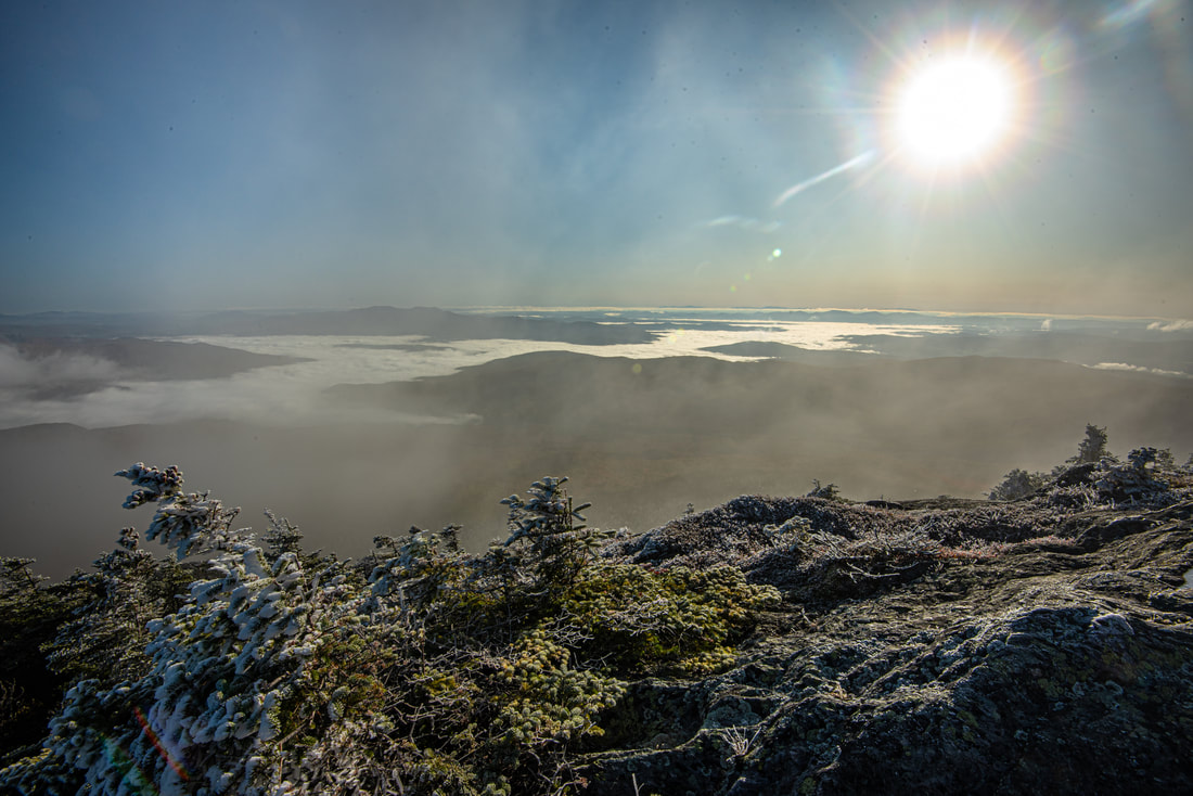
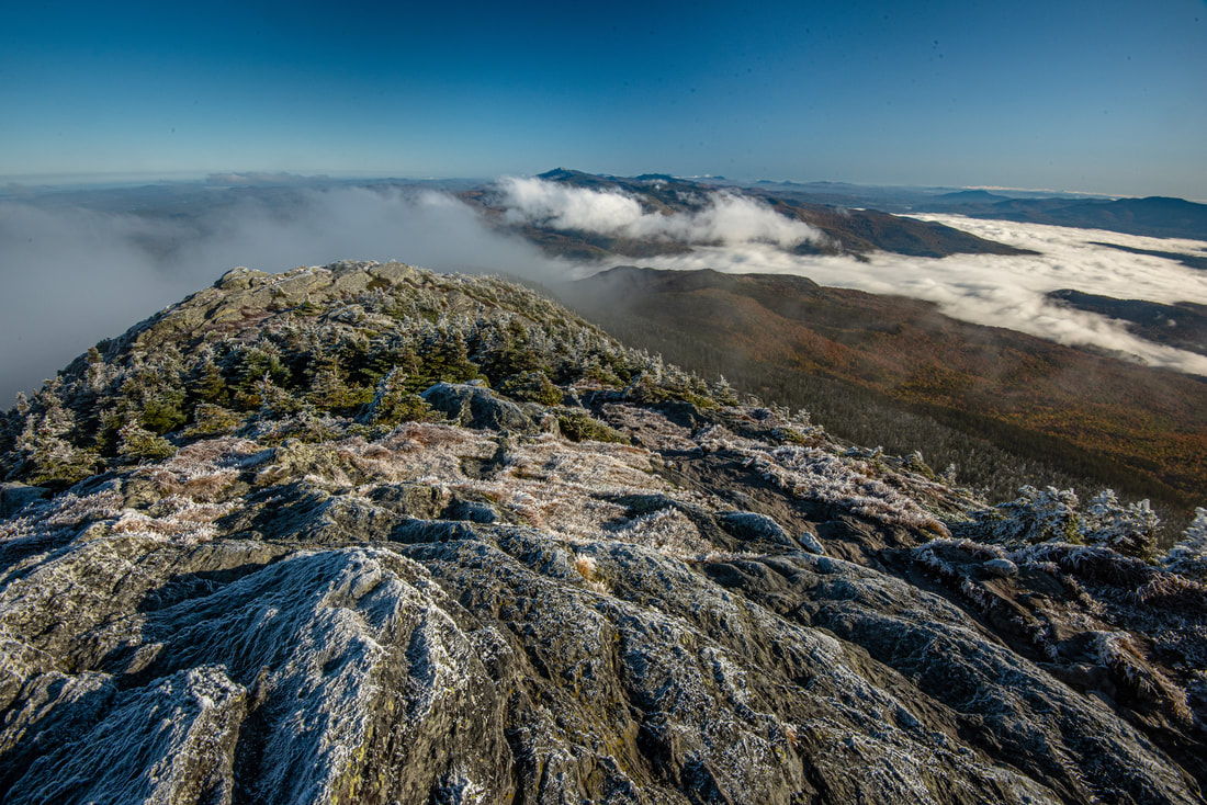
The early morning rime ice on the mist-shrouded slopes of Camel's Hump was absolutely stunning.
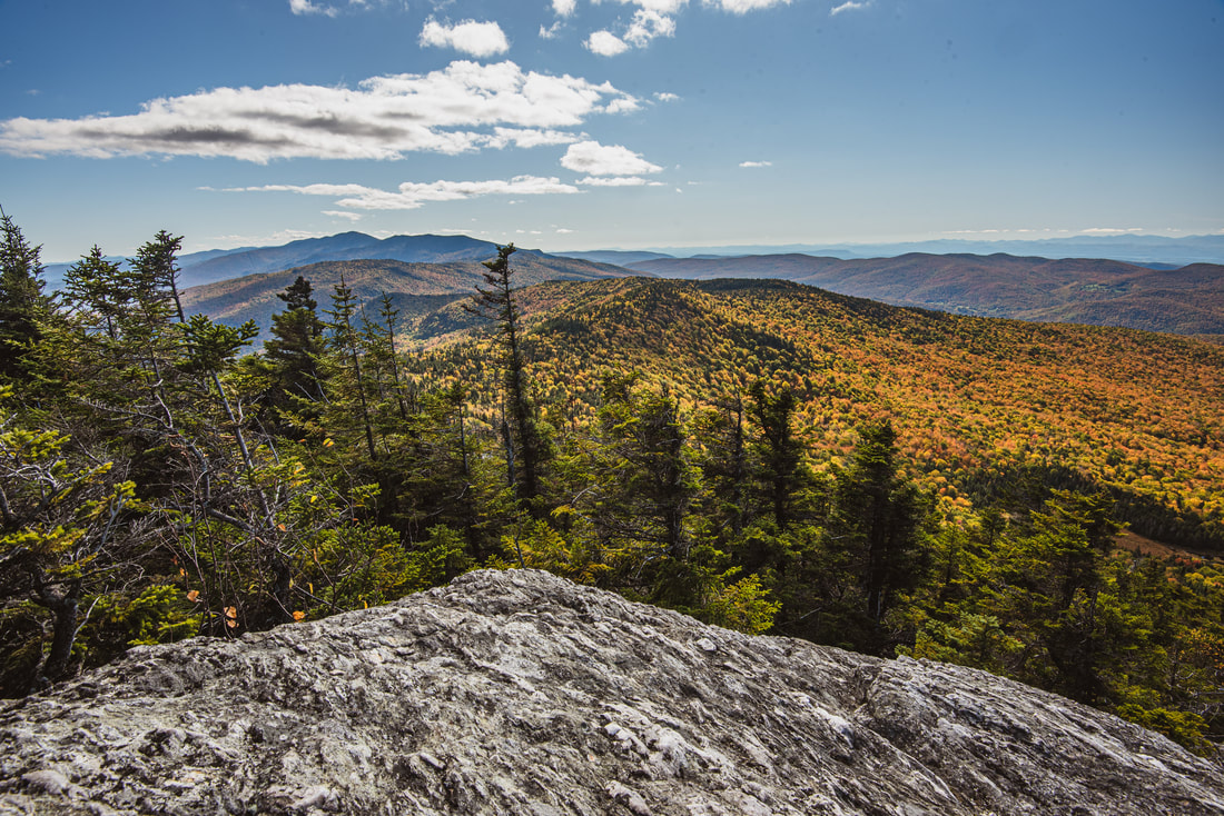
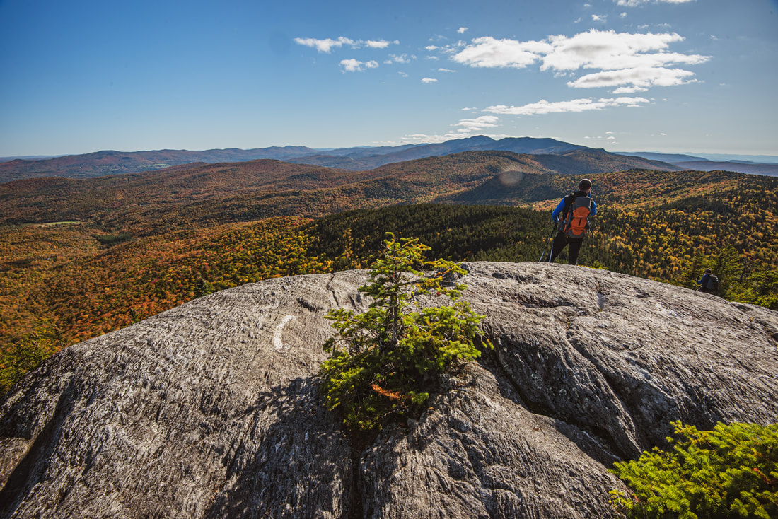
The Long Trail continues the Burrows Trail's steep ascent up jagged rock slabs - but you know you're getting close to the summit as the spruce-fir forest starts to thin and the trees turn into stunted krummholz. Suddenly, at 2.25 miles, stunning views open up westward into the Lake Champlain valley and toward the High Peaks of the Adirondacks. The trail continues twisting through the krummholz, passing signs warning you to stay on the trail and vegetation-free rocks to help protect the fragile vegetation of the alpine area. The trail passes through a small gap, where the rocky pinnacle on the left is off limits. The trail then makes the final push to the top, reaching the rocky summit dome of Camel's Hump at 2.35 miles.
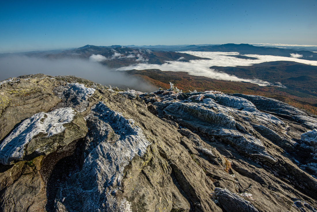
Camel's Hump offers essentially unparalleled 360-degree panoramic views. The view is incredible in every direction you look. The spine of the Green Mountains extends north and south; to the north is the distinct, towering profile of Mount Mansfield, while to the south are Mount Ethan Allen (in the foreground) and Mount Ellen (farther back). To the northeast, there is a separate ridge to the right of Mount Mansfield called the Worcester Range, which includes prominent peaks like Mount Hunger and Mount Worcester. Further to the east, the White Mountains crown the horizon, with Mount Washington, Mount LaFayette, and Mount Moosilauke as prominent landmarks on a clear day. Meanwhile, the elongated, shimmering blue strip of Lake Champlain encompasses the view to the west. The numerous High Peaks of the Adirondacks such as Giant Mountain, Dix Mountain, Mount Marcy, and Whiteface Mountain beautifully frame the background of the lake. Camel's Hump is one of Vermont's most renowned landmarks for several reasons. At 4,085 feet, it is the third tallest peak in the state, but to many, it might as well be the tallest, because the other two - Mount Mansfield and Mount Killington - have both been scarred by development like communication towers and ski resorts. The vertical 200-foot bluff that forms the south side of Camel's Hump summit presents such a distinct profile that the peak is recognizable from dozens of miles away in essentially any direction. In fact, Camel's Hump is so famous that it was carved into Vermont's state quarter-dollar coin as a very prominent feature! As you explore the summit, be sure to remember that you must always stay on the open rocks and not trample on any alpine vegetation in between. 
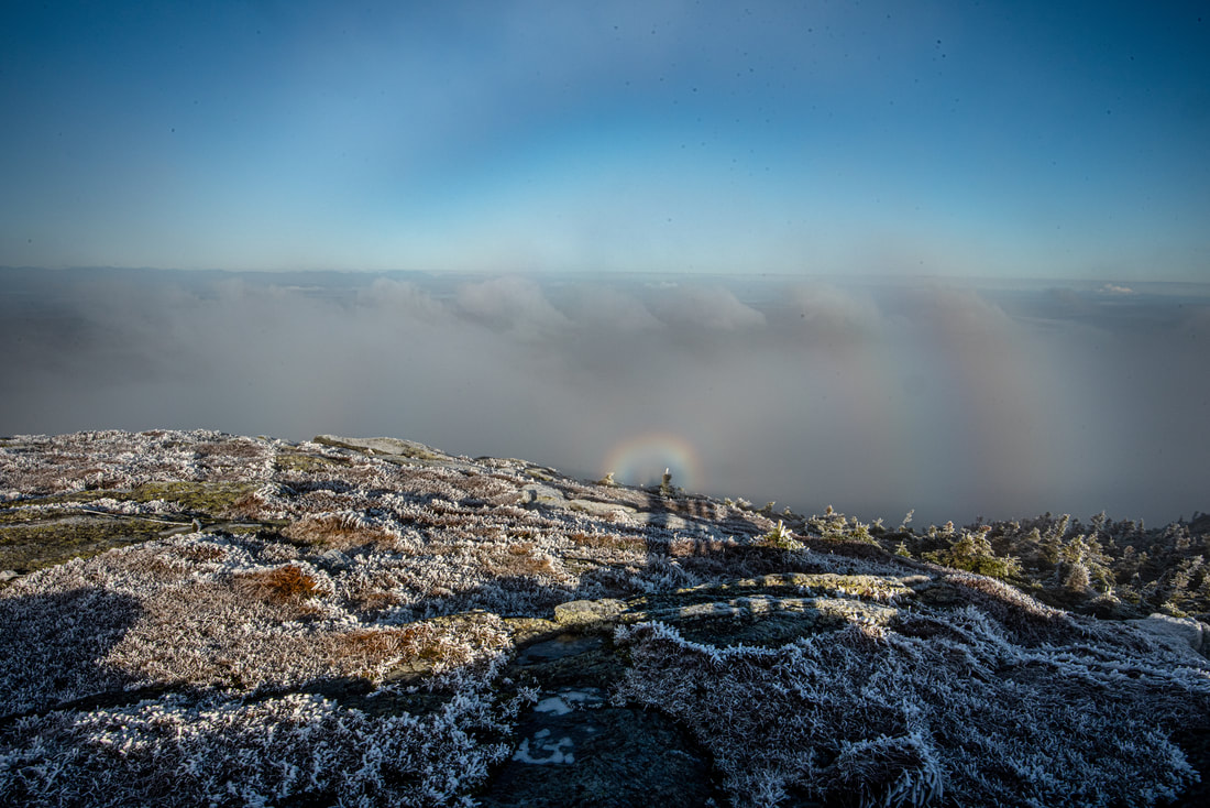
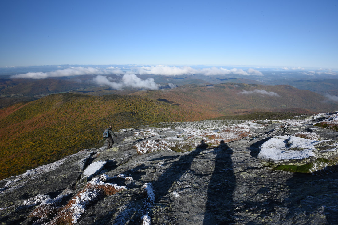
The early morning sunshine reflected my shadow across the Camel's Hump summit, creating the incredible Brocken Spectre phenomenon upon the scattering fog.
The conditions that greeted me upon my arrival to the summit of Camel's Hump were nothing short of extraordinary. As I approached the top, I walked into a cloud of early morning fog that enshrouded slopes covered in a thick coating of rime ice. Not only were the krummholz all white with rime ice, but every single patch of alpine grass and exposed rock outcrop at the summit was white too. But as I stood on the frigid, windy summit, the fog suddenly began to disperse, and a blinding sun broke through, illuminating a puffy white undercast in the Mad River Valley and Winooski River Valley. At the same time, the sun reflected my shadow upon the thicker clouds on the west side of the summit, leading to the incredibly unique and rare Brocken Spectre phenomenon - a set of literally circular rainbows! The Brocken Spectre was such an amazing sight - I'd never seen one before.
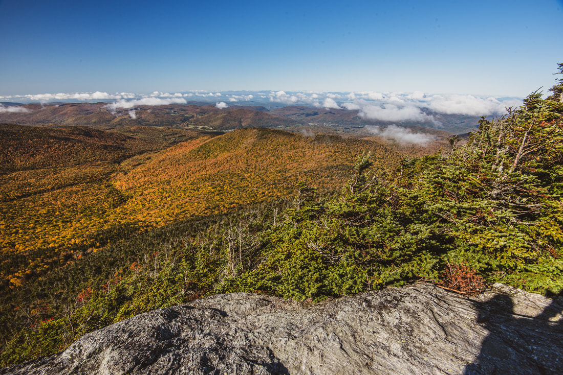
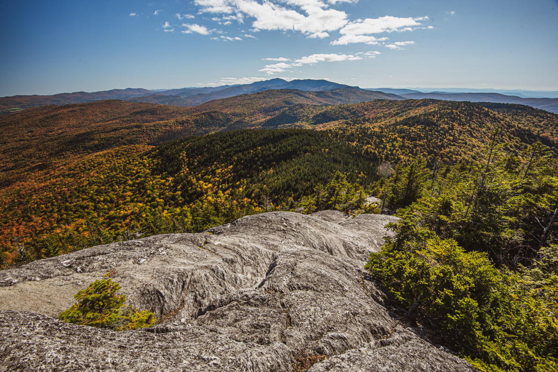
As spectacular as Camel's Hump is, it's only the start of this exciting hike! The Long Trail crosses the rocky summit and then bends to the right, descending the shaded west side of the rock face. Even though it was only the first weekend of October, we encountered a fair amount of ice that made this part of the descent sketchy, with the temp hardly being above freezing and the sun's energy still hidden behind the summit. At 2.45 miles, the trail briefly enters a patch of fir before exiting onto another broad rock outcrop on Camel's Hump southwest side, affording broad views of the day's route ahead and of the Lake Champlain valley. As the trail circles across large boulders to the south side of Camel's Hump, you'll be passing below the massive cliff mentioned above whose form will be easily discernible even at the end of the day when you reach the view from Molly Stark Mountain's Balcony. Just past 2.5 miles, the trail finally drops back below tree line and reaches a junction with the orange-blazed Alpine Trail. The Alpine Trail serves as a rugged bad-weather bypass of Camel's Hump exposed summit. The trail reaches the Monroe Trail in a half-mile and rejoins the Long Trail well north of Camel's Hump in another 1.2 miles. For the purposes of this hike, bear right to stay on the white-blazed Long Trail and begin an extremely steep descent. You'll be slowly clambering down near-vertical rock outcrops within the spruce-fir forest for the next 0.15 miles. The trail drops into a gap about 850 feet below the summit at 2.9 miles and becomes tamer after this as it strives to parallel the southbound ridgeline. 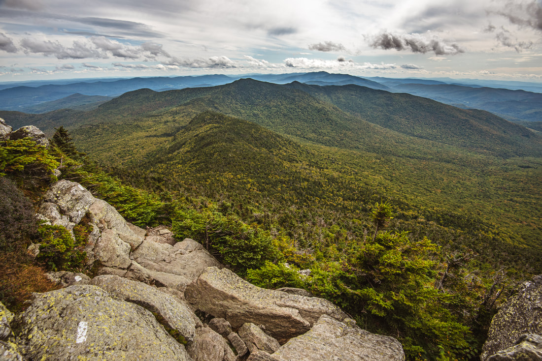
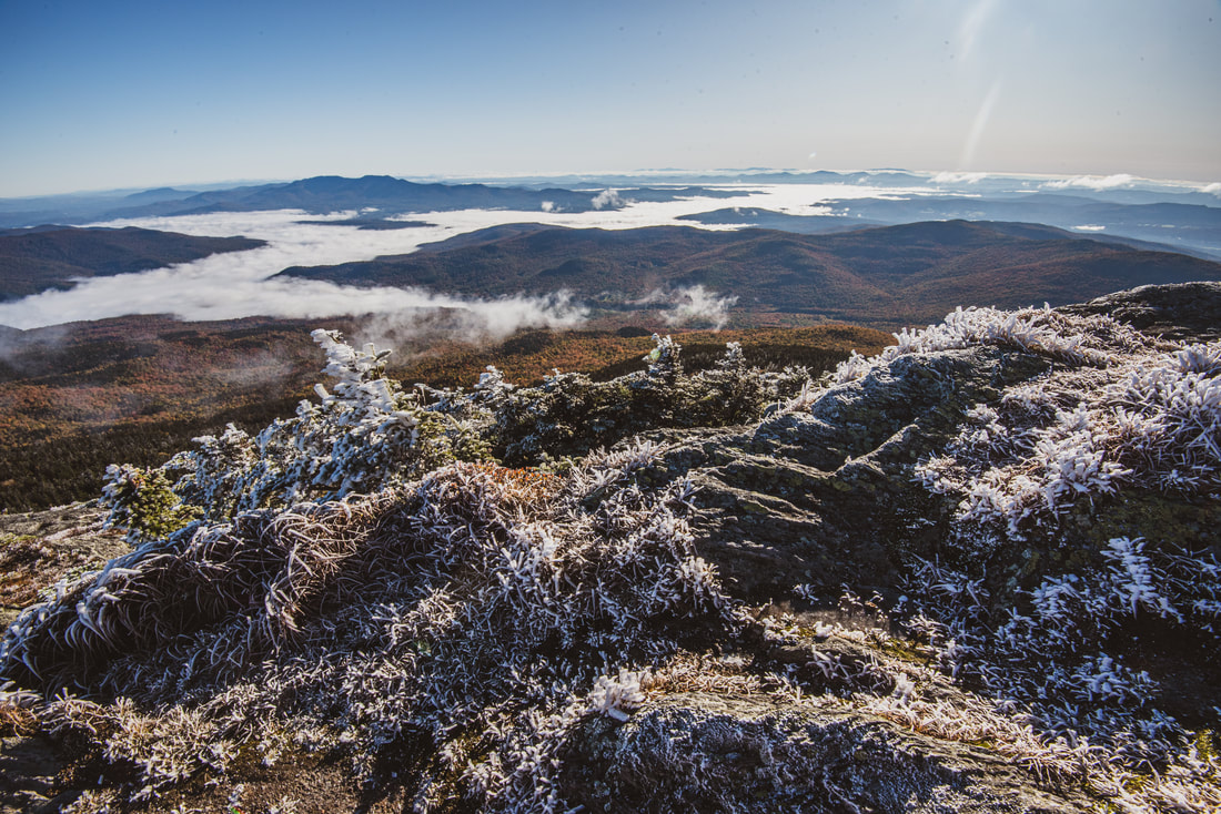
As the Long Trail skirts the south cliff of Camel's Hump, spectacular southward views of Mount Ethan Allen and Mount Ellen unfold.
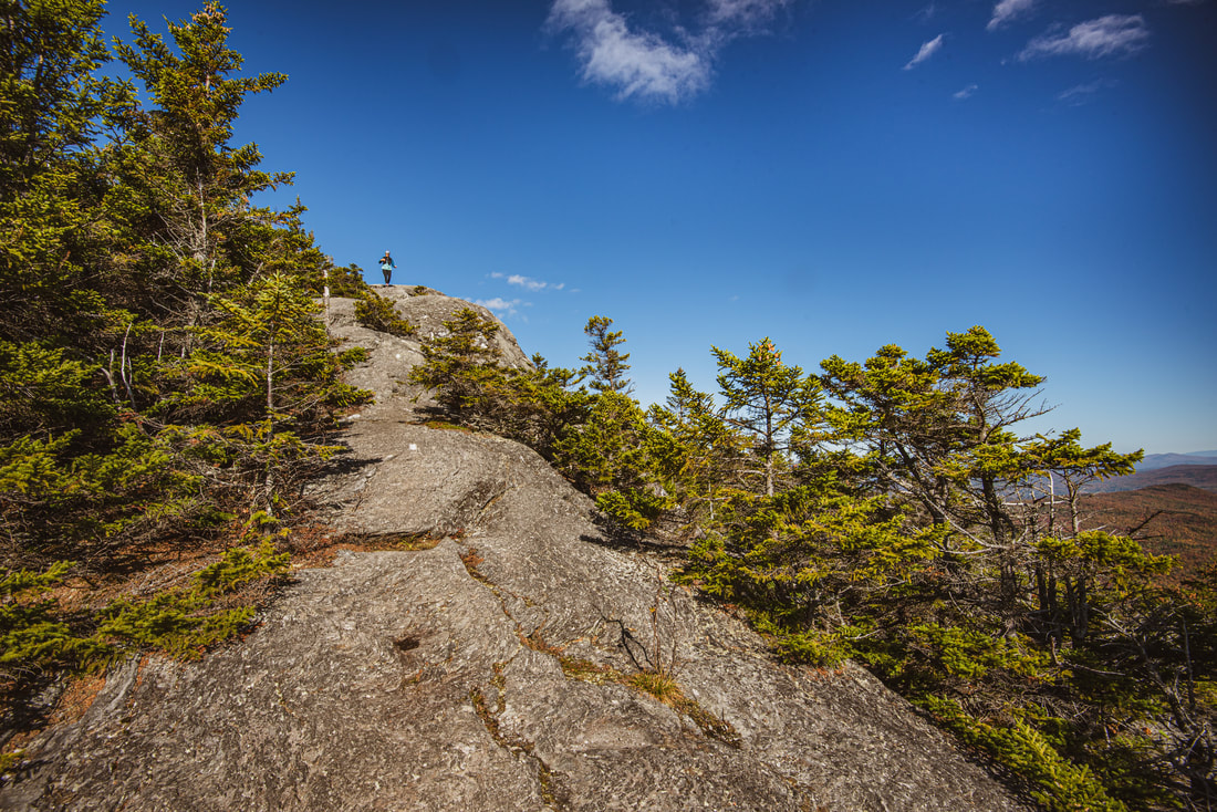
After dropping down a pair of steep, slick rock slabs at 3.0 miles and crossing the ridgeline, the trail gently rises to an elongated outcrop at 3.35 miles with great views looking back toward the pointed peak of Camel's Hump and east into the Winooski River Valley/Northeast Kingdom. Camel's Hump looks like an insurmountable obstacle from here, accessible only to advanced rock climbers! Between here and Wind Gap, the trail again turns decidedly slower and more "interesting" with all kinds of rock scrambles - a theme that will be repeated numerous times throughout the day. The trail steeply drops down a series of open rock slabs with great views at 3.55 miles, before entering a giant boulder jumble where the trail's ideal route actually takes you through a small cave-like underpass (you can also bypass it by a sketchy hop down from a rock). More southward views open up at 3.75 miles - note how close and imposing Mount Ethan Allen looks straight ahead, and that's precisely where the Long Trail is headed. One final very steep descent follows (200 feet in about 0.1 mile) before the trail reaches Wind Gap at 3.9 miles.
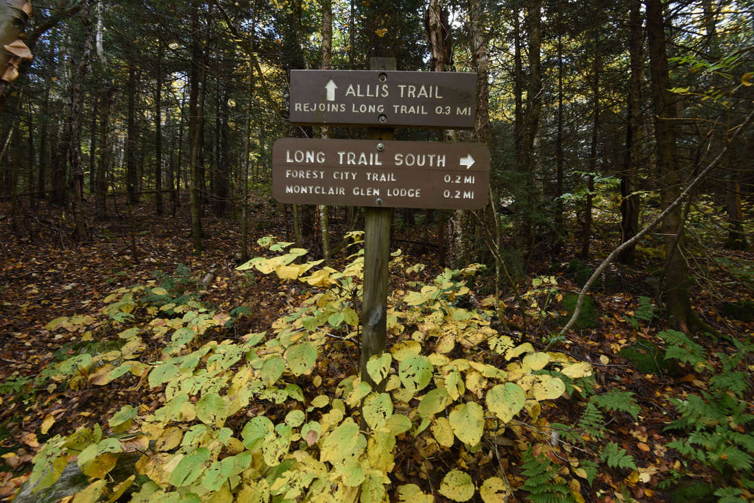
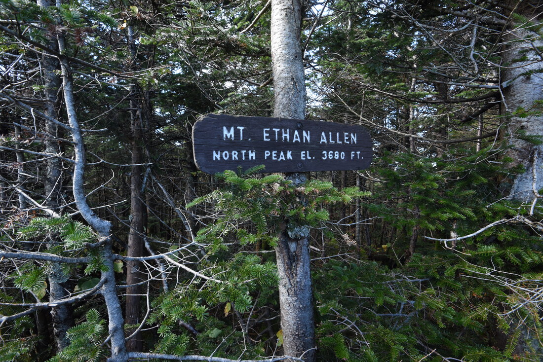
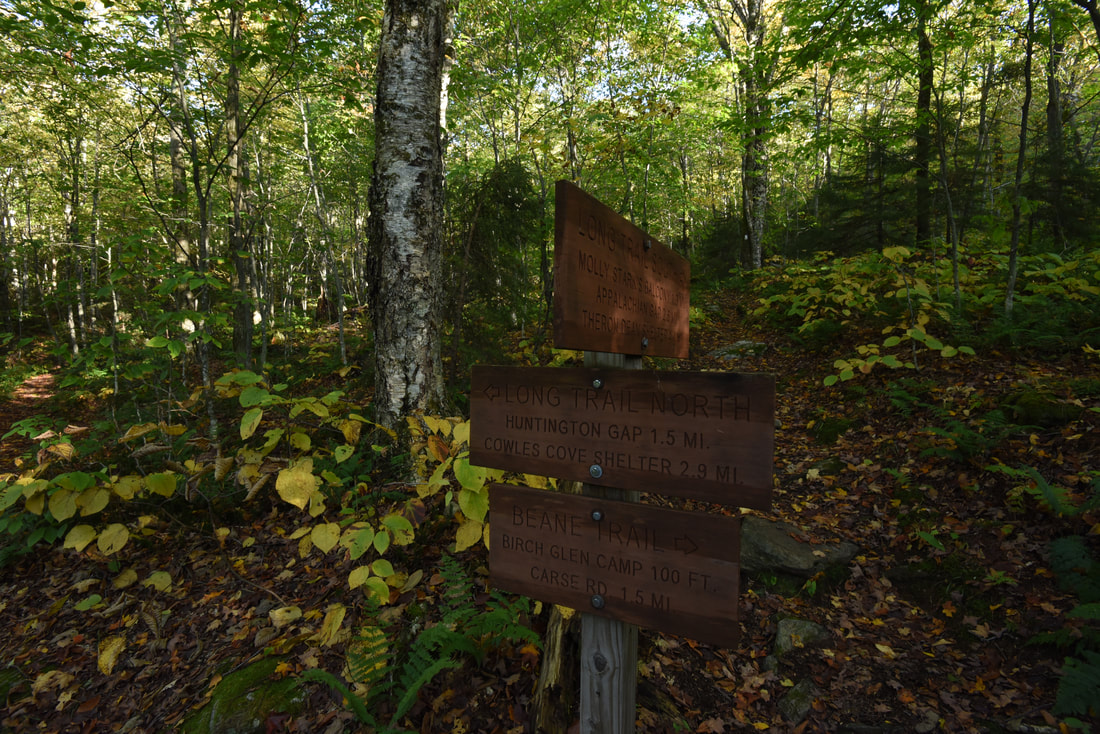
Wind Gap is where the Dean Trail meets the Long Trail. The Dean Trail turns left and reaches the Monroe Trail in 1.0 mile, helping to form the popular Monroe Loop to Camel's Hump that I hiked with my dad just a month earlier (and I am including some pics from that trip as well). The Dean Trail is quite moderate and passes a spur trail to an open wetland with spectacular views of Camel's Hump and the other cliffs along the Long Trail to the south. You can see part of these cliffs as you look back from Wind Gap. Another trail that ties in at Wind Gap is the Allis Trail. While the Long Trail turns right and heads toward Montclair Glen Lodge (shelter) and Forest City Trail junction (which is an alternate route back to Burrows Trailhead), the Allis Trail heads straight and takes a slight shortcut as it saves 0.1 mile and directly climbs a small knoll before Mount Ethan Allen. I recommend taking the Allis Trail, as it's shorter and actually saves some climbing coming up from Montclair Glen Lodge. The top of the knoll features a bench with a limited but imposing view back toward Camel's Hump. The Allis Trail rejoins the Long Trail at another gap at 4.2 miles. The ascent of Mount Ethan Allen proper begins here - there isn't much to say about it other than it's 800 feet in 0.7 miles and includes a fair amount of rock slab scrambling, though nothing as extreme as the south side of Camel's Hump. The forest becomes predominantly conifer near the top, but the mountain is actually mostly wooded. Reach the North Peak of Mount Ethan Allen (elevation 3,860 feet) at 4.9 miles. A small rock outcrop provides a nice vista east toward Groton State Forest (home to the Spruce Mountain fire tower) and the White Mountains. The mountain is named in honor of Ethan Allen, a Connecticut farmer, writer, and politician who is known as one of the founders of Vermont. Allen formed resistance to New York's efforts to claim the land and lobbied Congress to recognize Vermont as a separate state; he and his family were also the very first to purchase plots of land where the city of Burlington sits today. 
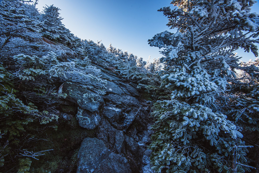
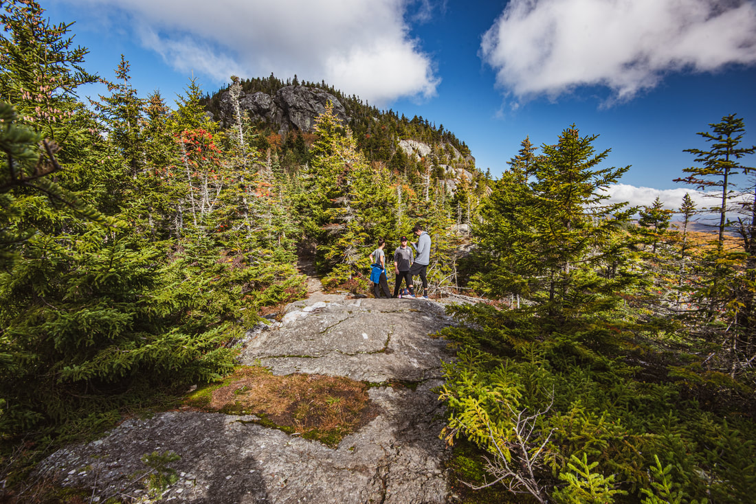
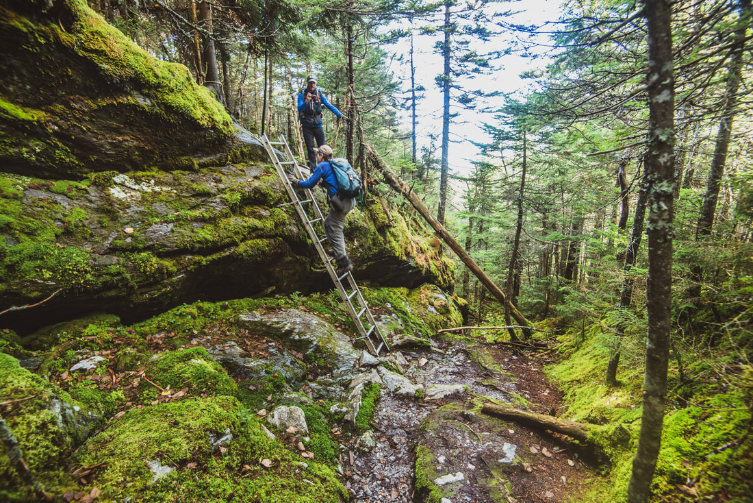
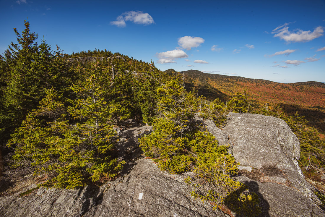
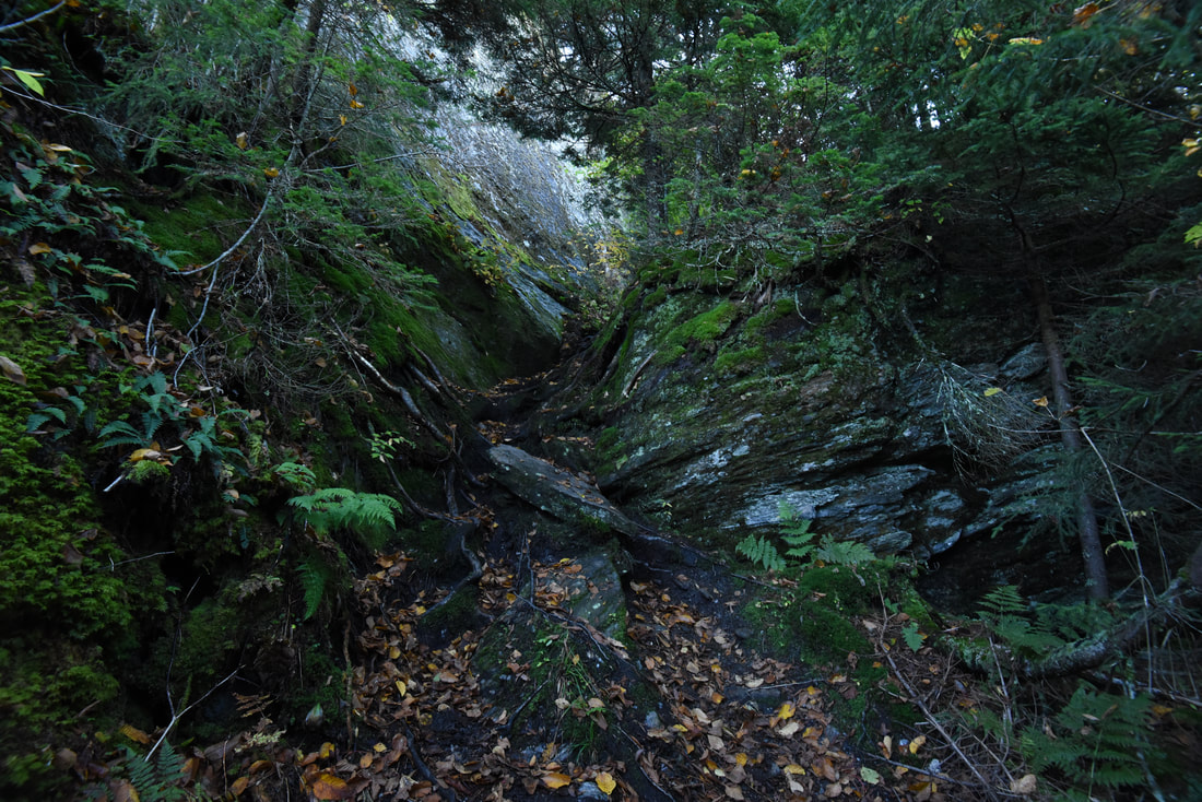
The Long Trail over Burnt Rock Mountain features one exciting scramble after another, including this memorable spot dubbed "Ladder Ravine".
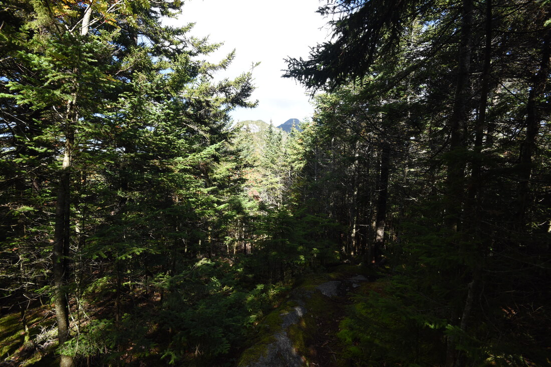
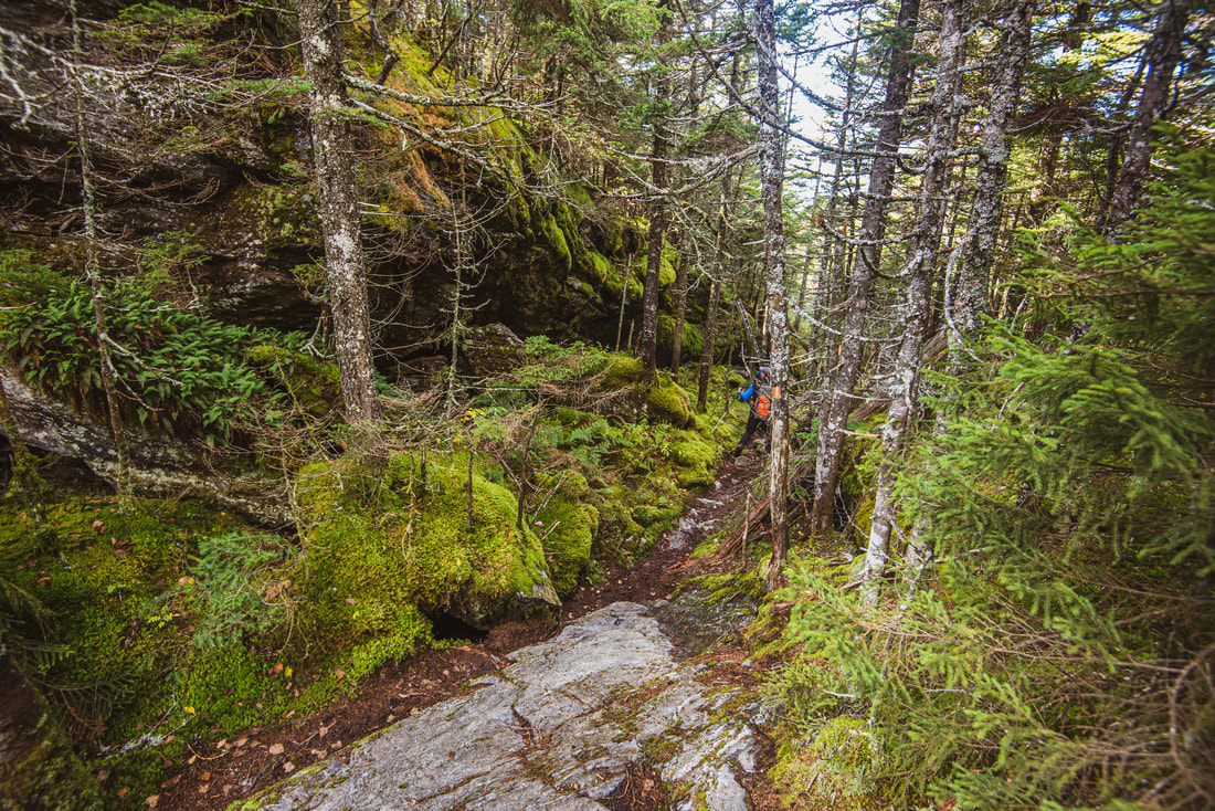
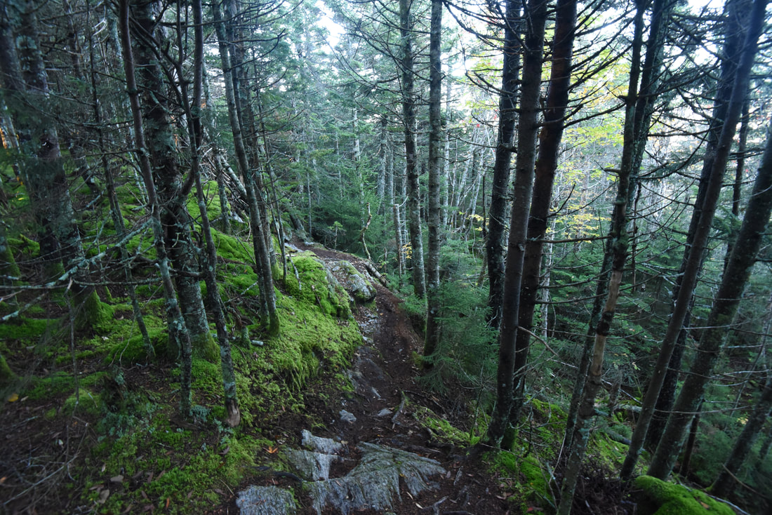
After crossing the slightly lower South Peak of Ethan Allen Mountain, reach a side path on the right at 5.25 miles that leads to a much more expansive vista looking southward. If you follow the path all the way to the bluff at its end, you'll find a 180-degree panorama that once again includes everything from Mount Moosilauke in the White Mountains on the far left to Lake Champlain and the ADK High Peaks on the right. The next imposing bump along the ridge ahead is Mount Ira Allen, but the Long Trail actually bypasses that summit (though the difficulty remains the same). Beyond that, you can now see the relatively low but rugged rocky crown of Burnt Rock Mountain, which contains some of the hike's best views outside of Camel's Hump. Returning to the main trail, you'll find a mercifully moderate descent the next half-mile, with a couple minor bumps along the way and some boggy stretches to circumnavigate. After 5.75 miles, the trail makes a lengthy move to the east side of the ridge to skirt the summit of Mount Ira Allen. This sidehilling section of the trail isn't any easier though - the slope is extremely steep and you're constantly scrambling 10 feet up or 10 feet down various rock outcrops and obstacles, so if you're expecting any relaxation or easier walking, you'll be disappointed.
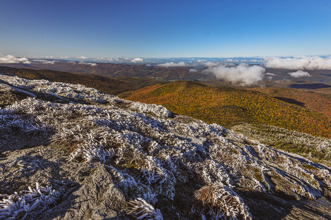
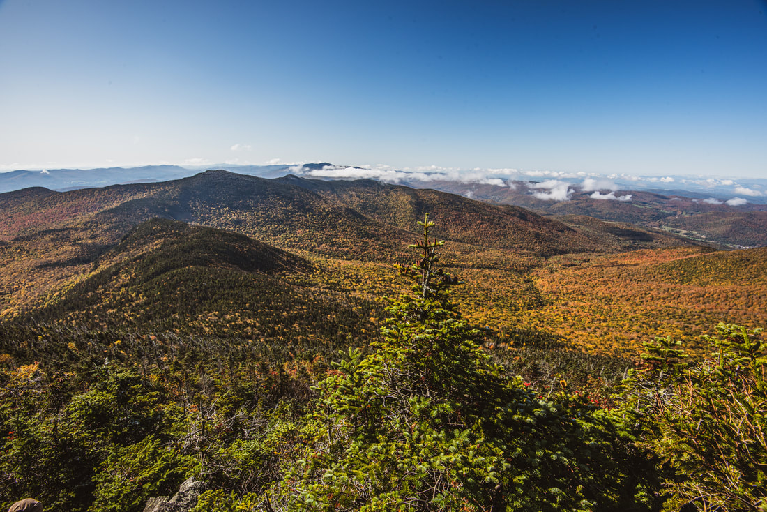
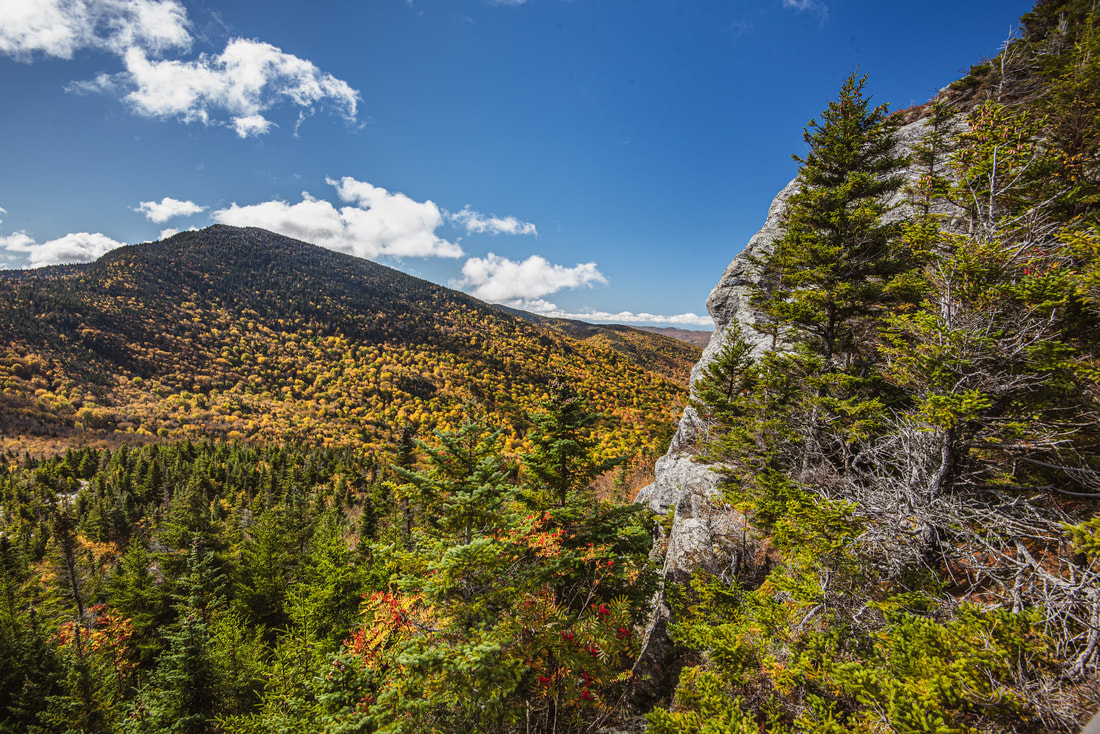
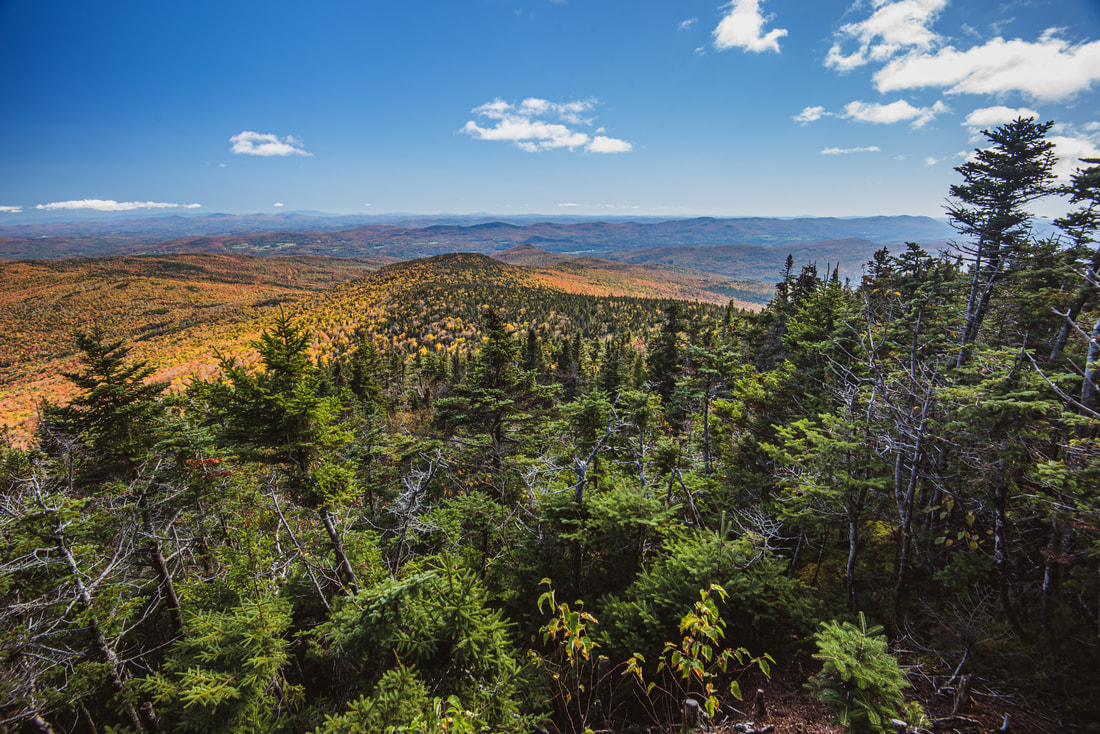
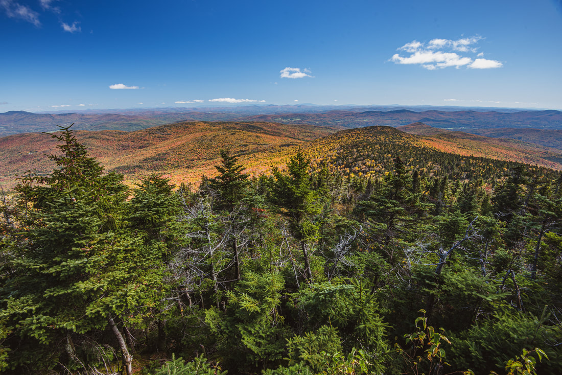
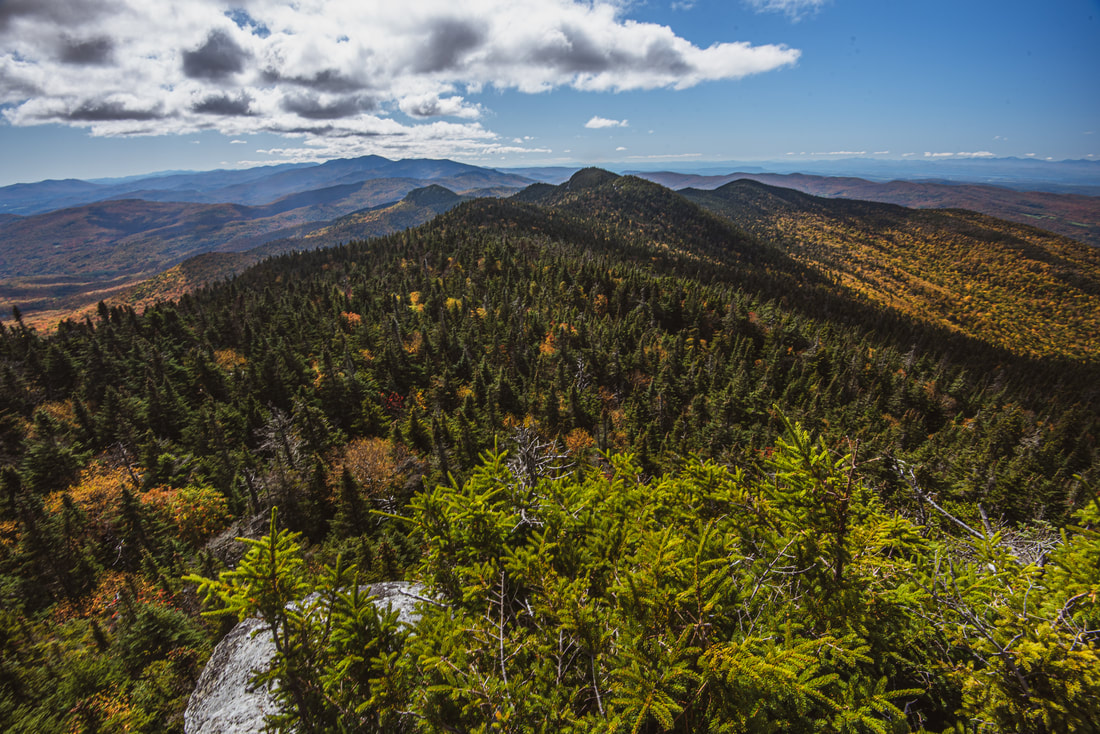
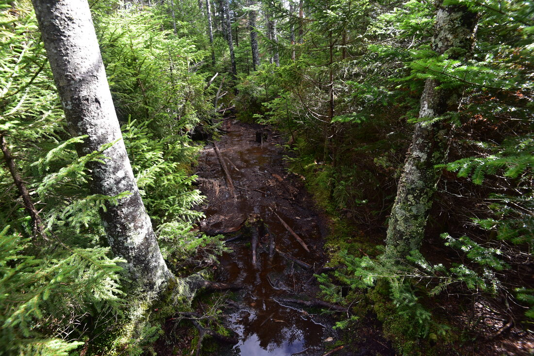
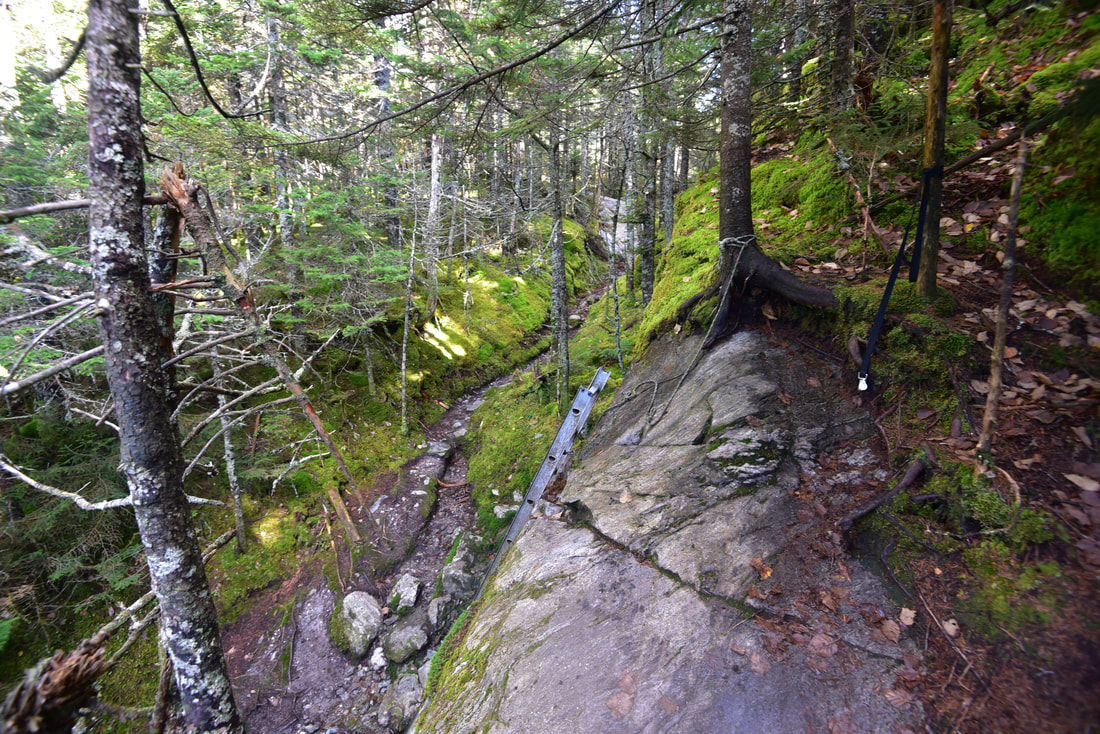
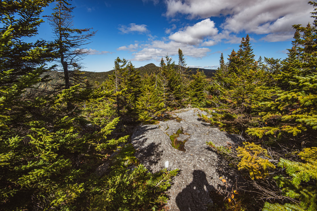
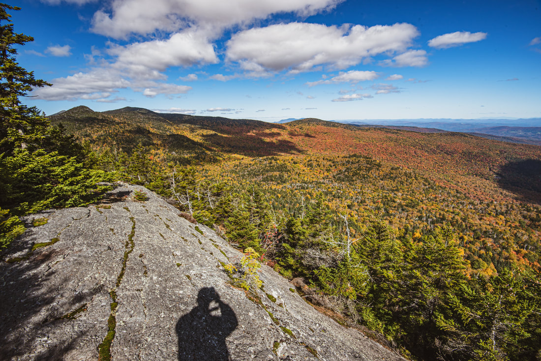
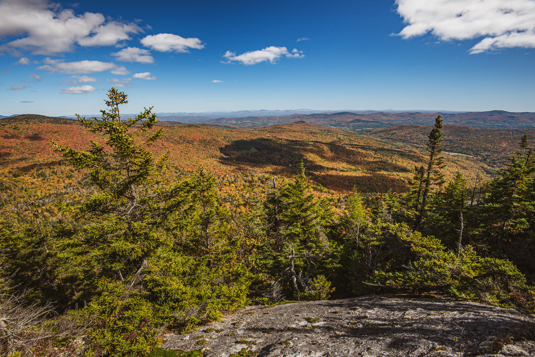
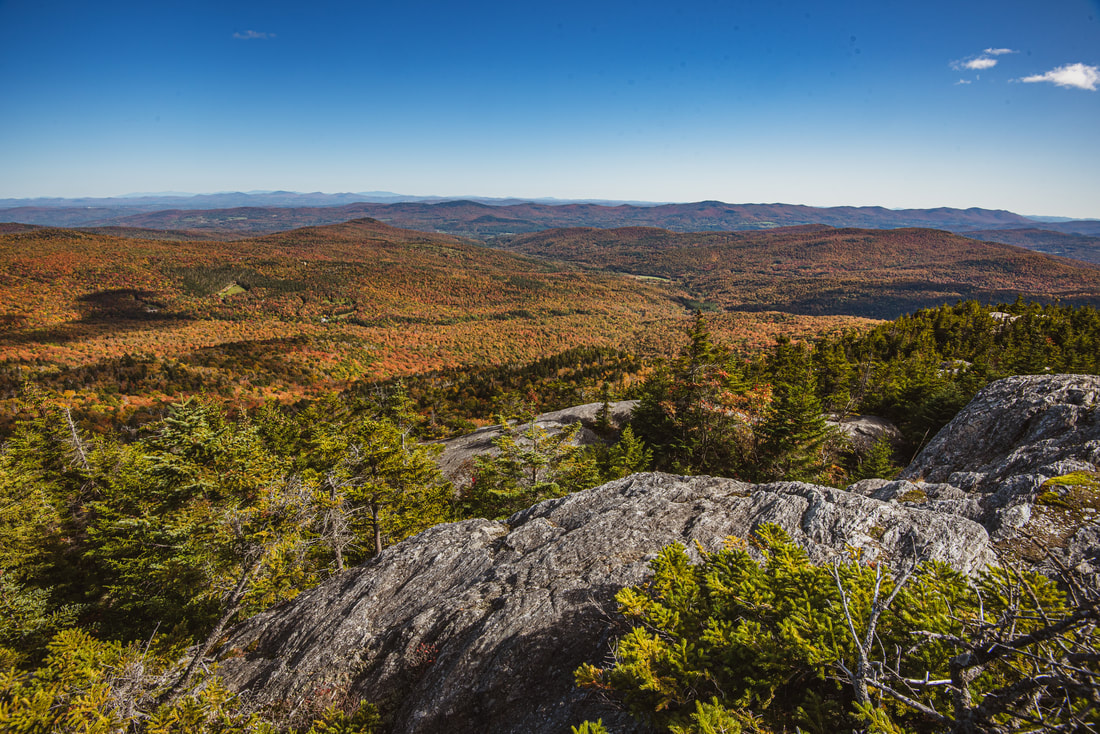
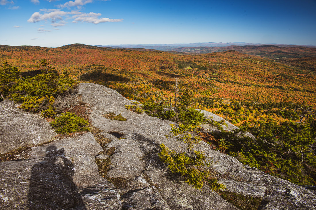
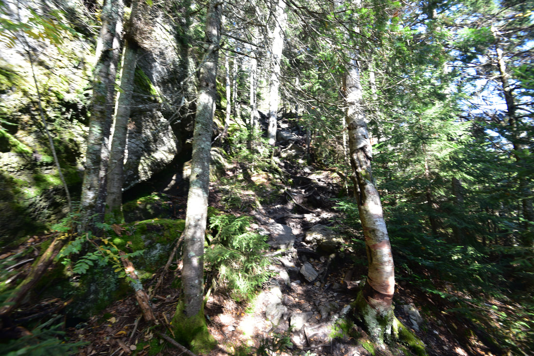
As the trail descends into the Shephard Brook headwaters around 6.5 miles, it actually joins a streambed for a short stretch before making a couple rock hops across the different branches of Shephard Brook. Around 6.7 miles, the ascent to Burnt Rock Mountain begins. Burnt Rock Mountain actually consists of a whole seven sub-peaks, which are quite annoying to traverse. The actual summit vista is at the sixth sub-peak, but there are a couple memorable spots before this. One is at 6.95 miles, where the trail descends a steep, slick rock slab that drops straight into an unattractive mudhole - you have to be very cautious here if you want to avoid getting your feet wet! Then, at 7.05 miles, the trail reaches a picturesque notch lined by lush, mossy cliffs, called "Ladder Ravine". The trail turns right, traces the ravine, and then climbs out of it via a rickety, steel ladder. The top is a bit awkward due to a slanted, moist slab that you must step out on - there is a rope for assistance. At 7.25 miles, the trail crests an open rock outcrop atop the "fifth peak" of Burnt Rock Mountain, with great views looking back toward Mount Ira Allen and Mount Ethan Allen. The pointed top of Camel's Hump peeks out in the far back, looking strangely distant. The trail then dips through another shallow gap and scrambles up steep, jagged rocks to finally reach the main summit of Burnt Rock Mountain at 7.5 miles. The expansive rock slabs that constitute the summit afford outstanding views to the north, east, and south. While you're at the summit, pay attention to a pair of goat paths that leave to the right and lead to another cliff on the summit's west side, with more views toward Lake Champlain. These westerly views are a bit unique compared to the ones you had earlier atop Camel's Hump, because you're now lower and have a close-up panorama of the rolling farmlands in the Huntington River valley. It is amazing how far Camel's Hump looks from here - it's hard to imagine to get there within a day even from here! And when you see this view of the terrain that you've traversed so far, you can understand why it'd be so demoralizing to do this hike in the opposite direction. 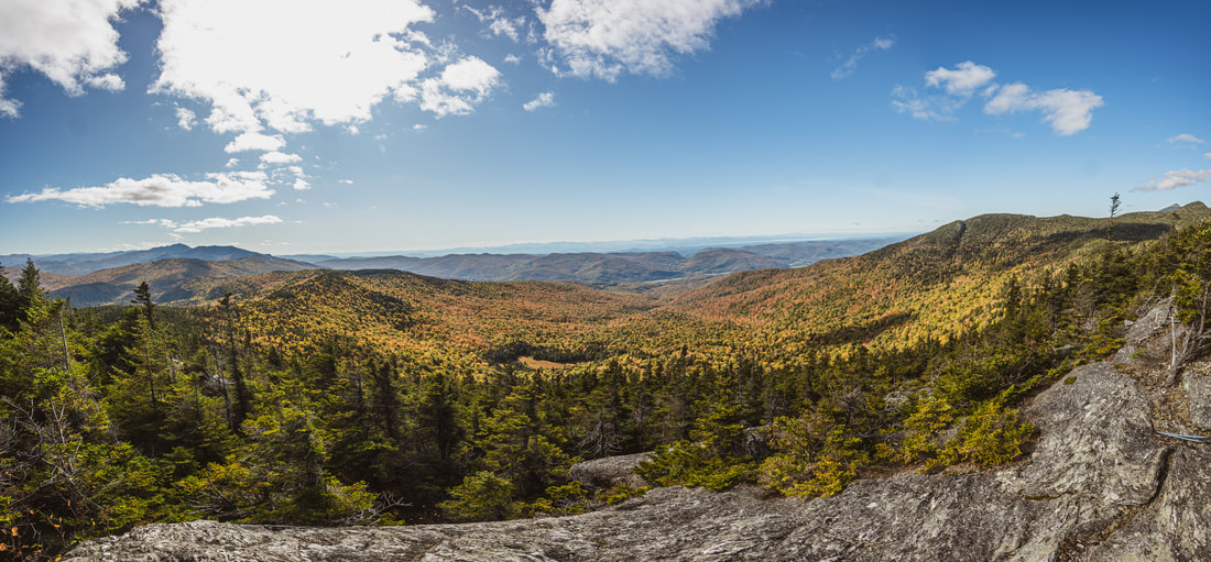
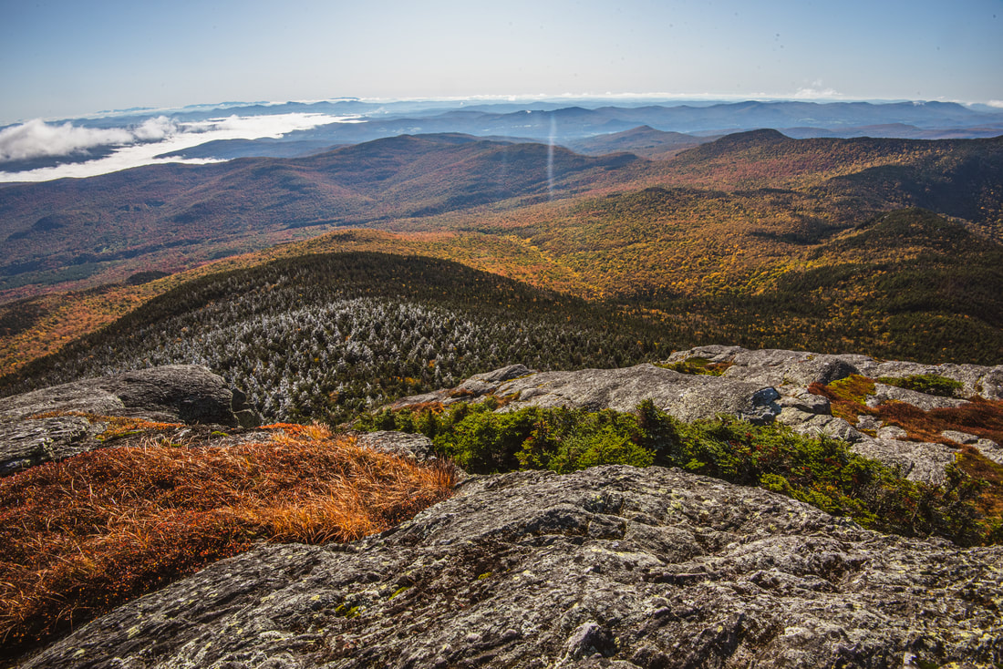
The westerly views from Burnt Rock Mountain encompass everything from Mount Ellen in the far left to Camel's Hump in the far right.
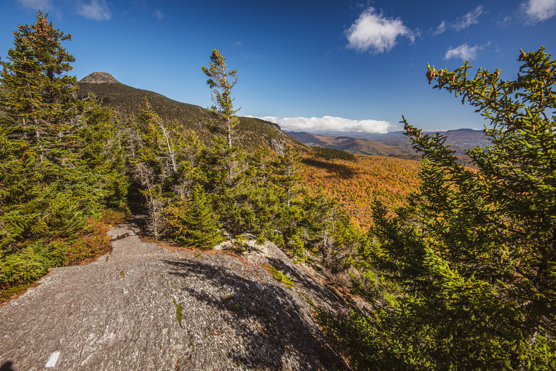
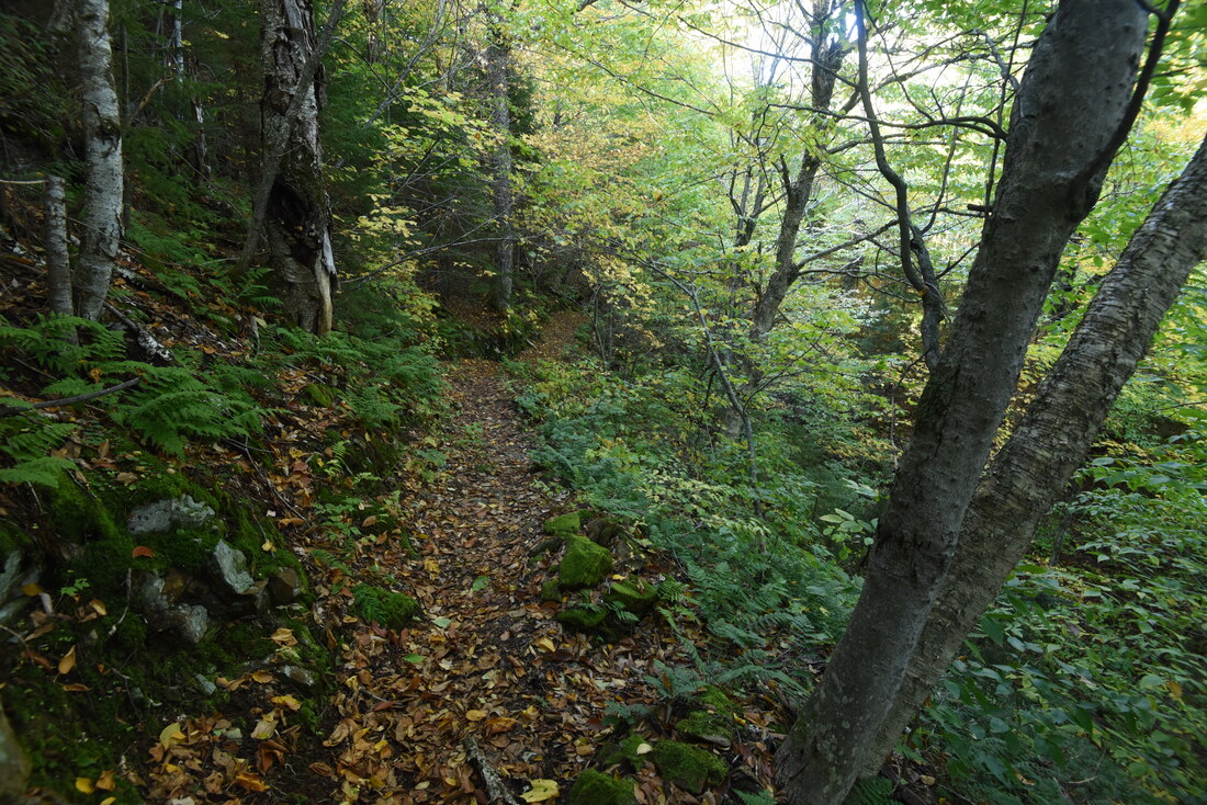
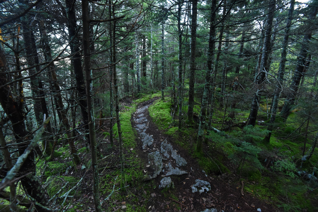
The descent from Burnt Rock Mountain is a particularly exciting set of rock scrambles. The trail stays on steep, open ledges for the next one-tenth of a mile as it rises to the seventh "sub-peak" of the mountain - pay close attention to the white blazes painted on the rocks. The final views are at 7.6 miles; after this, the trail makes a near-vertical descent down a rocky gully and joins a wooded ridge. Reach a junction with the Hedgehog Brook Trail at 7.95 miles. This trail turns left and traverses private land under conservation easement for two miles to a trailhead on Big Basin Road. The Hedgehog Brook Trail as a moderate and fairly popular route that folks use to access Burnt Rock Mountain without having to hike all day. This hike continues straight on the Long Trail, and there's some amazing news - after the arduous, rugged traverse most of the last eight miles have consisted of, the next 3.5 miles all the way to the foot of Molly Stark Mountain are an absolute joy to walk and will allow a much faster pace.
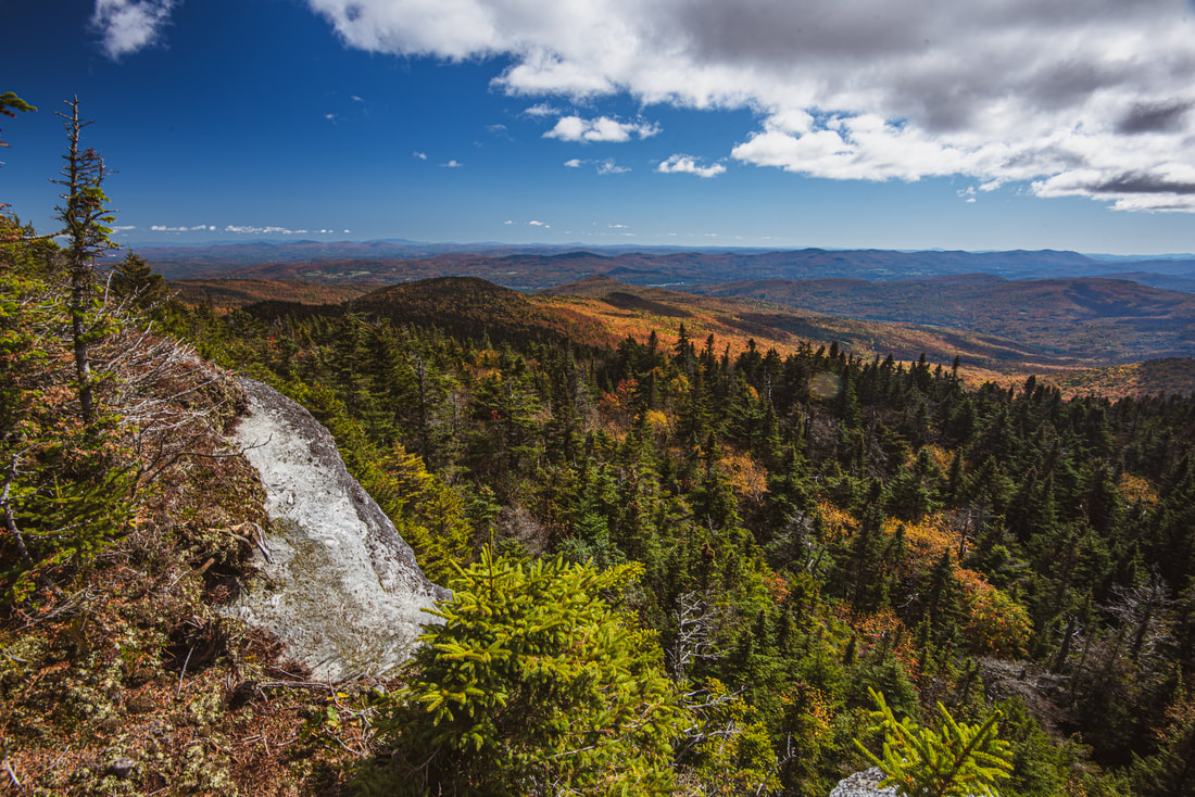
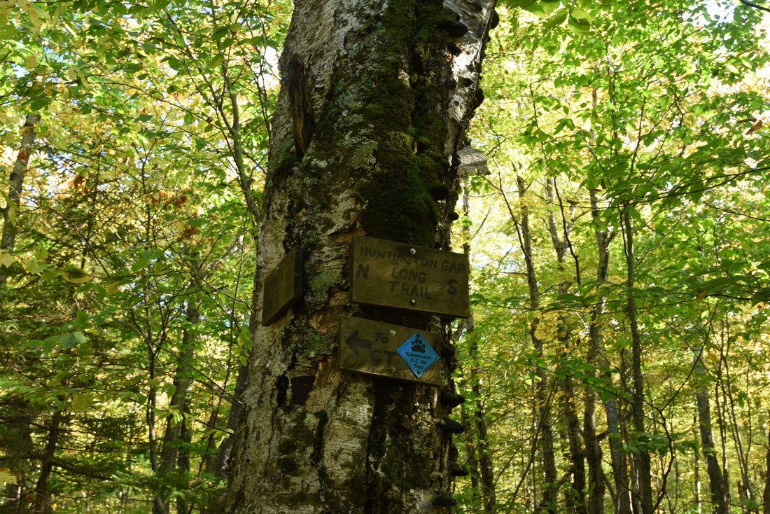
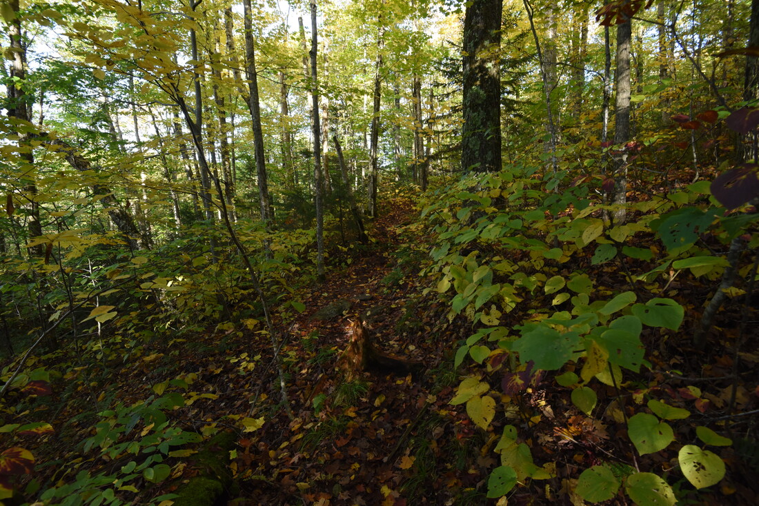
The Long Trail passes Cowles Cove Shelter on the left at 8.1 miles, perched on a sunny south-facing hillside. A small rivulet the trail crosses ahead serves as a water source. Between here and 9.5 miles, the trail sidehills along the east side of the ridge, but the sidehilling is significantly nicer than earlier. Note that as you have lost elevation and the forest has become mostly deciduous, the trail has also become mostly void of rock outcrops and general ruggedness. After crossing a low point on the ridge, the trail makes a moderate descent to Huntington Gap at 10.0 miles. Here, you will cross a broad forest road that serves as the route of the Catamount Trail, Vermont's own long-distance ski trail that stretches over 300 miles from Massachusetts to Canada! The pleasant walking continues on as the Long Trail contours along the lower north slopes of Beane Mountain without ever gaining or losing much elevation. At 11.4 miles, the trail reaches Birch Glen Shelter and a junction with the Beane Trail. The Beane Trail continues straight, past the shelter, and moderately descends 1.4 miles to another trailhead on Carse Road to the west. Leaving a second vehicle at Carse Road instead of Appalachian Gap would significantly ease the hike's ending, eliminating the 1000-foot climb up Molly Stark Mountain, but I personally think it's worth hiking all the way to Appalachian Gap for Long Trail section-hiking purposes, and for the rewarding view back toward Camel's Hump from Molly Stark Mountain's Balcony. Turn left on the Long Trail and start tackling the ascent of Molly Stark Mountain, its steepness a rude awakening after the last few miles. There's little doubt in my mind that this was the most unpleasant part of the day for me - such a strenuous climb on tired legs after over ten hours of hiking, with the latter part of the day having been increasingly easy and pleasant. At 12.4 miles, regain the ridge in a gap between Beane Mountain and Molly Stark Mountain. Straight ahead, the massive bluff of Molly Stark's Balcony towers above you. The steep rock scramble through a cleft near the base of the cliff will come as a surprise after the lack of rock outcrops along the rest of the ascent. The trail then curves around this marvelous set of cliffs before making a rock scramble to the top, reaching the view from Molly Stark's Balcony at 12.6 miles - the day's final vista. 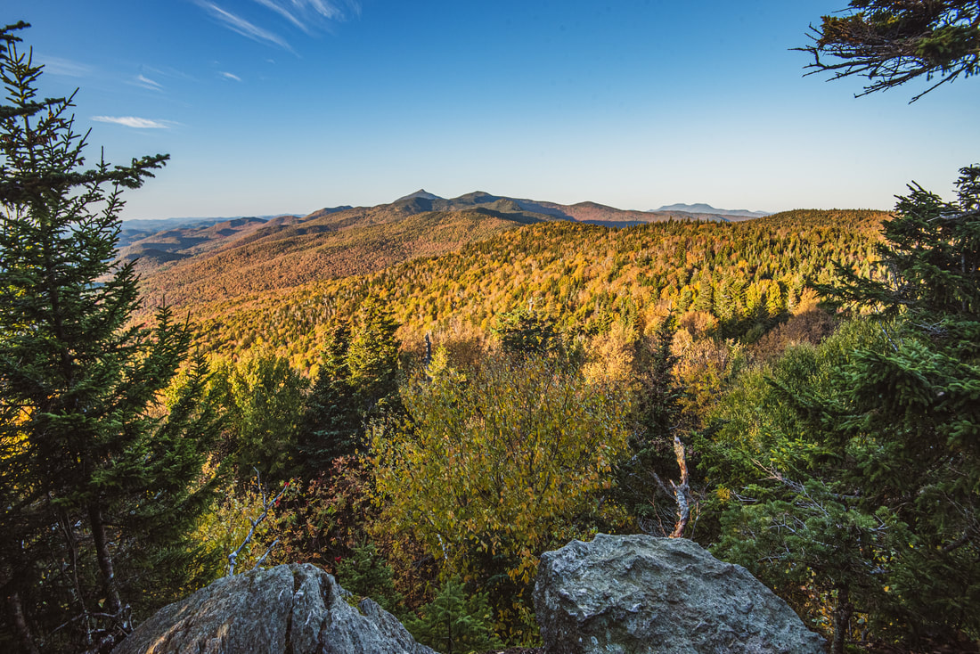
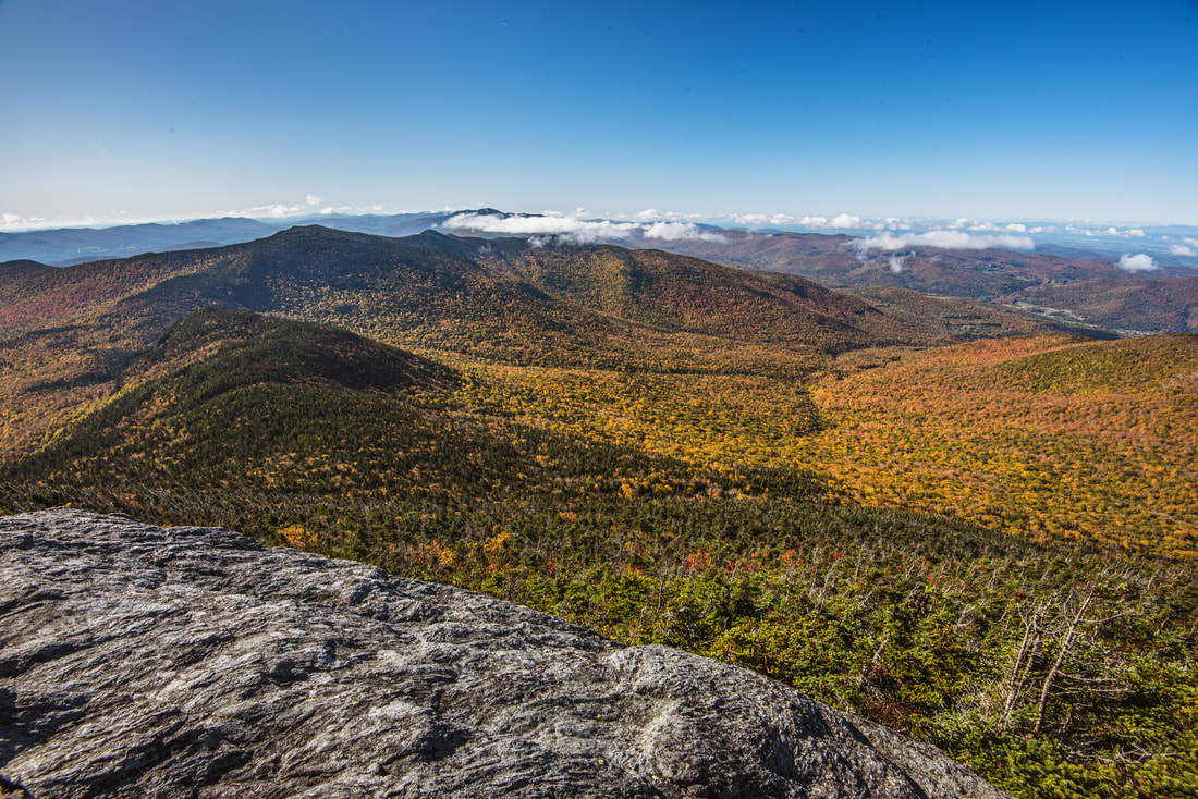
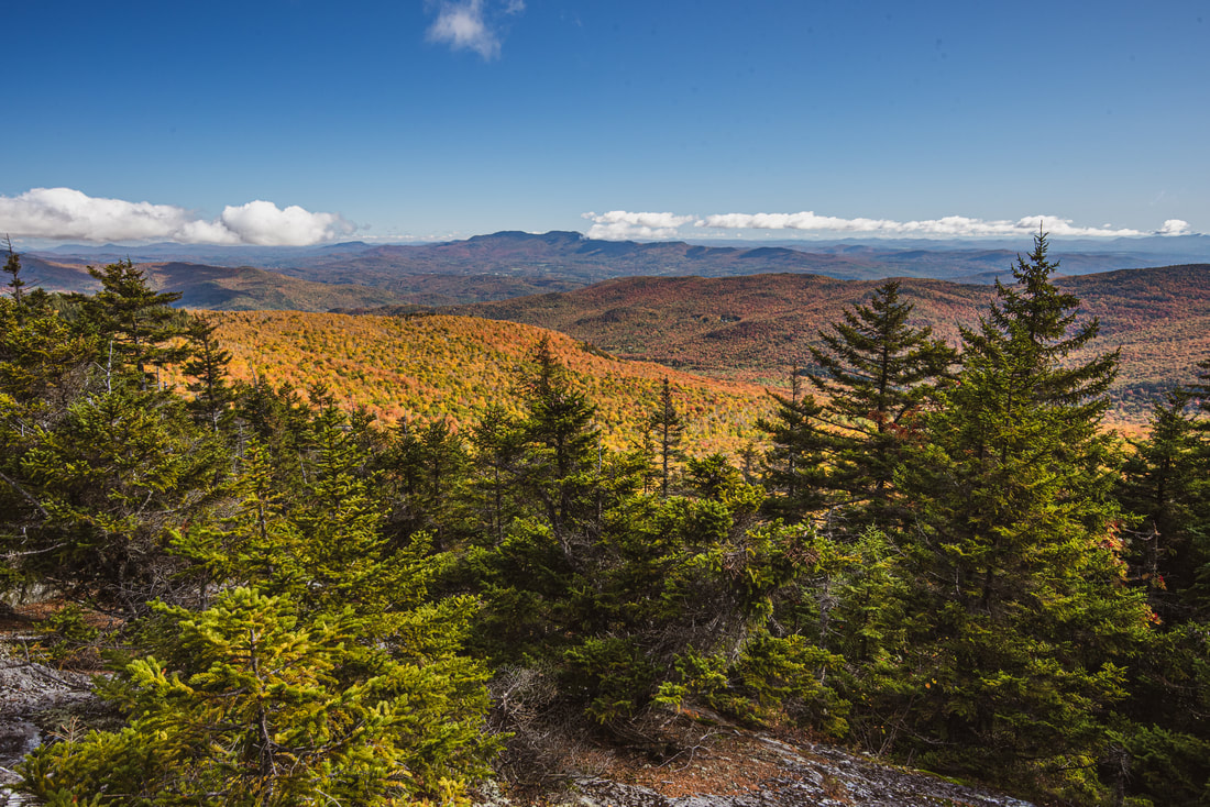
Molly Stark Mountain's Balcony affords a grand view north across the Green Mountains toward Camel's Hump and the Worcester Range in the distance.
The view from Molly Stark's Balcony isn't the grandest view of the day, but it might certainly feel like the most rewarding. You have hiked over a dozen miles to get to this point and have most of the day's route laid out in front of you like on a piece of cardboard. In order, the summits of Burnt Rock Mountain, Mount Ethan Allen, and Camel's Hump are all discernible, the latter appearing impossibly far away. And not only did you come from such a distance, but you even climbed over two miles up Camel's Hump from a distant, invisible valley first! From this vantage point, it almost appears as if Camel's Hump is just as distant as Mount Hunger & the Worcester range further to the right!
After the Balcony view, the trail continues ascending more gently, passing by the summit of Molly Stark Mountain (elevation 2,960 feet) at 12.85 miles. A moderate descent takes the trail to a small creek crossing at 13.25 miles. Just ahead of you is one final obstacle: the precipitous climb up Baby Stark Mountain. The trail climbs 200 feet in the next 0.15 miles, and along the way, it incorporates several tricky rocky scrambles involving some use of hands. At this point in the day, any bit of extra ascent - especially as steep as this - was just torturous, given that both my arms and legs were complete toast! The Long Trail crosses the top of Baby Stark Mountain at 13.4 miles and finally begins the last drop down to Appalachian Gap. As you might have anticipated, this is another extremely steep descent (the grade getting progressively worse), but at least it's the final one. There isn't anything technical on the descent, but there are plenty of steep and slippery rock slabs that will require extra caution to surpass, given your likely exhaustion at this point. Finally, at 13.8 miles, the Long Trail reaches Highway 17 at Appalachian Gap. Turn to the right - the parking area and your second vehicle are miraculously waiting just 200 feet away. You have at last concluded this spectacular and rewarding yet brutal hike along the Monroe Skyline, one of the most scenic sections of trail in Vermont! This hike has likely either made you hate or love the Long Trail - and hopefully it's the latter, and that it kindled the seed for the love of Long Trail section-hiking in you, like it certainly did for me. Mileage
0.0 - Burrows Trailhead
2.1 - Hut Clearing at Long Trail Junction 2.35 - Camel's Hump Summit 2.5 - Alpine Trail Junction 3.35 - Views back toward Camel's Hump 3.9 - Wind Gap 4.9 - North Peak of Mount Ethan Allen 5.25 - View below South Peak of Mount Ethan Allen 7.05 - Ladder Ravine 7.5 - Burnt Rock Mountain Summit Views 7.95 - Hedgehog Brook Trail Junction 8.1 - Cowles Cove Shelter 10.0 - Huntington Gap & Catamount Ski Trail Jct 11.4 - Birch Glen Shelter & Beane Trail Jct 12.6 - View from Molly Stark's Balcony 12.85 - Molly Stark Mountain 13.4 - Baby Stark Mountain 13.8 - Appalachian Gap at Highway 17 Pictures & Videos
2 Comments
Brian Aust
11/3/2019 11:56:59 pm
You got a Brocken Spectre!! I've seen it twice from Camel's Hump summit while caretaking there, in October 2000 and again in September 2004. Well done! That is a fantastic route you hiked. Leave a Reply. |
About MeMark Oleg Ozboyd Dear readers: I have invested a tremendous amount of time and effort in this website and the Georgia Waterfalls Database the past five years. All of the work that has gone in keeping these websites updated with my latest trip reports has almost been like a full-time job. This has not allowed me to pick up a paid job to save up money for college, and therefore, I I've had to take out loans. If you find the information on this website interesting, helpful, or time-saving, you can say "thanks" and help me out by clicking the button above and making a contribution. I will be very grateful for any amount of support you give, as all of it will apply toward my college tuition. Thank you!

Coming in 2022-2023?
Other Hiking WebsitesMiles HikedYear 1: 540.0 Miles
Year 2: 552.3 Miles Year 3: 518.4 Miles Year 4: 482.4 Miles Year 5: 259.9 Miles Archives
March 2021
Categories
All
|
||


 RSS Feed